Downloaded 370 times


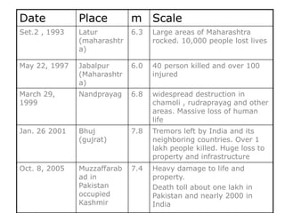
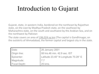


The document provides a comprehensive overview of the 2001 Bhuj earthquake in Gujarat, India, detailing its classification as a natural disaster, causes, effects, and response. It describes the extensive devastation, loss of life, and infrastructure damage, highlighting the response from both local and international communities. The reconstruction efforts involved public-private partnerships and NGOs, leading to the development of disaster-resistant housing for affected families.


