
Recommended
More Related Content
What's hot
What's hot (20)
Similar to Riverine fisheries of India By B.pptx
Similar to Riverine fisheries of India By B.pptx (20)
More from B. BHASKAR
More from B. BHASKAR (20)
Recently uploaded
Recently uploaded (20)
Riverine fisheries of India By B.pptx
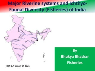
- 1. Major Riverine systems and Ichthyo- Faunal Diversity (Fisheries) of India By Bhukya Bhaskar Fisheries Ref: B.K DAS et al. 2021
- 2. Introduction • India is bestowed with 14 major, 44 medium, and numerous minor rivers that run through 2.52 lakh Kms contributes to current production of 1 Lakh ton. • For optimally harnessing the potential of riverine fisheries, the Department is focusing on conservation of indigenous fisheries resources and restoration of natural productivity by practice of river ranching and 41 Conservation and Awareness in Riverine Fisheries programme sanctioned under Blue Revolution in 9 States /UTs. • Production of native species in the rivers by seed ranching of native stock, upgradation of riverine landing centers and instruments to provide financial assistance for fishermen wellbeing are being targeted. • Planning is also ongoing for implementing river ranching, as a pilot-based activity under central sector scheme, in six states in two phases with total budget outlay of Rs. 2.81 crores to ranch 1.40 crores fingerling. • The first phase will be launched by end of September while the second phase will begin in October. • To support the fishermen, the Department has sanctioned the following with an investment of Rs 1,710 crores:
- 3. River System • All major rivers of India originate from one of the following main watersheds: 1. Aravalli range 2. Himalaya and Karakoram ranges 3. Sahyadri or Western Ghats in western India 4. Vindhya and Satpura ranges and Chotanagpur plateau in central India
- 4. Ganges River System • The major rivers in this system are (in order of merging, from west to east) 1. Ganges - 2,525 kilometres (1,569 mi)[8] Starting from Gangotri Glacier, Uttarakhand, India 2. Chambal - 1,024 kilometres (636 mi) Flows through Madhya Pradesh, Rajasthan and merges into Yamuna in Uttar Pradesh 3. Betwa - 676 kilometres (420 mi) Not Himalayan river, covers Madhya Pradesh and Uttar Pradesh before merging Yamuna 4. Yamuna - 1,376 kilometres (855 mi) Yamuna runs its most of the course parallel to Ganga before contributing its water to Ganga at Prayagraj. Largest of Ganga's southern tributaries 5. Gomti - 529 kilometres (329 mi) Starts near the junction of three borders viz. Nepal, Uttarakhand and UP 6. Ghaghra - 1,156 kilometres (718 mi) Starts in Nepal near Uttarakhand 7. Son - 784 kilometres (487 mi) Not Himalayan river, covers MP, UP, Jharkhand and Bihar. Second Largest of Ganga's southern tributaries 8. Gandak - 652 kilometres (405 mi) Starts from Nepal 9. Kosi - 725 kilometres (450 mi) Starts from Nepal 10. Brahmaputra - 3,969 kilometres (2,466 mi) Merges with Ganga in Bangladesh. By now, flow velocity of both rivers slow down to considerable extent as they are in plains now. Before entering Bangladesh, near Farakka in Malda District, Ganga leaves a distributary Hoogly, 450 kilometres (280 mi) which provides water for irrigation in West Bengal
- 5. Brahmaputra River System • Brahmaputra River basin across Northeast India • The Brahmaputra river originates / starts from Tibet. 1. Yarlung Tsangpo River - 2,809 kilometres (1,745 mi) originates and forms the upper stream of Brahmaputra in Tibet 2. Siang - 184 kilometres (114 mi) main river after it enters India in the state of Arunachal Pradesh 3. Dibang - major tributary flowing through Arunachal Pradesh before merging into the Brahmaputra River in Assam 4. Lohit - one of the three major tributaries of Brahmaputra flowing through Arunachal Pradesh from the easternmost India 5. Brahmaputra - 916 kilometres (569 mi) runs across the state of Assam from East to West, entering Bangladesh afterwards 6. Teesta - 324 kilometres (201 mi) one of the largest tributaries of Brahmaputra; originating in the borders of Sikkim and Tibet, flowing South it joins Brahmaputra in Bangladesh 7. Jamuna River (Bangladesh) - 196 kilometres (122 mi) the Brahmaputra is known as Jamuna in Bangladesh • Brahmaputra has Total length of 3,969 kilometres (2,466 mi) as per latest mapping.
- 6. Indus River System • The Indus River originates in the northern slopes of the Kailash range near Lake Manasarovar in Tibet. • Most of the river's course runs through neighbouring Pakistan, as per as regulation of Indus water treaty of 1960, India can use only 20 percent of the water in this river. • A portion of it does run through Indian territory, as do parts of the course. • The rivers forming Panjnad are Chenab, Satluj, Jhelum, Ravi and Beas These tributaries are the source of the name of the Punjab of South Asia; the name is derived from the panch ("five") and aab ("water"), hence the combination of the words (Punjab) means "land with the water of five rivers". The Indus is 3,610 kilometres (2,240 mi) long. • The major rivers in Indus river system are (in order of their length): 1. Indus - 3,610 kilometres (2,240 mi) 2. Sutlej - 1,372 kilometres (853 mi) 3. Chenab - 1,090 kilometres (680 mi) 4. Jhelum - 725 kilometres (450 mi) 5. Ravi - 729 kilometres (453 mi) 6. Beas - 484 kilometres (301 mi) 7. Shyok - 216 kilometres (134 mi) 8. Zanskar - 196 kilometres (122 mi) 9. Galwan - 138 kilometres (86 mi) tributary of Shyok
- 7. Length and catchment area of major River Basin
- 9. • Following rivers flow from the Aravalli range, both northwards to Yamuna as well as southwards to Arabian Sea. • North-to-south flowing rivers, originate from the western slopes of Aravalli range in Rajasthan, pass through the southeastern portion of the Thar Desert, and end into Gujarat. – Luni River, 495 kilometres (308 mi) originates in the Pushkar valley near Ajmer, ends in the marshy lands of Rann of Kutch. – Sakhi river, 265 kilometres (165 mi) ends in the marshy lands of Rann of Kutch. – Sabarmati River, 371 kilometres (231 mi) originates on the western slopes of Aravalli range of the Udaipur District, end into the Gulf of Cambay of Arabian Sea. • West to north-west flowing rivers, originate from the western slopes of Aravalli range in Rajasthan, flow through semi-arid historical Shekhawati region, drain into southern Haryana. Several Ochre Coloured Pottery culture sites, also identified as late Harappan phase of Indus Valley civilisation culture, has been found along the banks of these rivers. – Sahibi River, originates near Manoharpur in Sikar district flows through Haryana, along with its following tributaries: • Dohan river, tributary of Sahibi river, originates near Neem Ka Thana in Alwar district). • Sota River, tributary of Sahibi river, merges with Sahibi river at Behror in Alwar district. • Krishnavati river, former tributary of Sahibi river, originates near Dariba zinc and lead mines in Rajsamand district of Rajasthan, flows through Patan in Dausa district and Mothooka in Alwar district, then disappears in Mahendragarh district in Haryana much before reaching Sahibi river. • West to north-east flowing rivers, originating from the eastern slopes of Aravalli range in Rajasthan, flow northwards to Yamuna. – Chambal River,1,024 kilometres (636 mi) a southern-side tributary of Yamuna river. • Banas River, 529 kilometres (329 mi) a northern-side tributary of Chambal river. – Berach River, 236 kilometres (147 mi) a southern-side tributary of Banas River, originates in the hills of Udaipur District » Ahar River, 100 kilometres (62 mi) a right-side (or eastern side) tributary of the Berach river, originates in the hills of Udaipur District, flows through Udaipur city forming the famous Lake Pichola. » Wagli Wagon River a right-side tributary of the Berach River. » Gambhiri River a right-side tributary of the Berach river. » Orai River a right-side tributary of the Berach River.
- 10. The East Coast River System • It is a composite system of rivers, the main constituents of which are the Mahanadi, the Godavari, the Krishna and the Cauvery, having a combined length of about 6,437 km. • The total catchment area is 121 million ha. • This system drains the entire peninsular India, east of Western Ghats in the west and southern parts of central India including Chotta Nagpur hill ranges. • These East Coast rivers drain into the Bay of Bengal. • Mahanadi has all the Indian Major carps common with the Ganga system. • The other river of the East coast system, besides their own indigenous fish fauna of several carp species including Gangetic carp, catfishes, murrels, prawns. • Tributaries of the Cauvery from the Nilgiris have cold water fish like trout and tench.
- 11. The East Coast River System • i) The river Mahanadi • It is a river of eastern India. The Mahanadi rises in the Satpura Range of central India, and flows east to the Bay of Bengal. The Mahanadi drains most of the state of Chhattisgarh and much of Orissa and also Jharkhand and Maharashtra. It has a length of about 860 km. Near the city of Sambalpur, a large dam, the Hirakud Dam is on the river. • Fish and Fisheries • The river mainly harbours the hill stream fishes. The most common fishes are Chela untrahi, Erethistes conta and Arius gagora.
- 12. The East Coast River System • ii) The river Godavari • The river with second longest course within India, Godavari is often referred to as the Vriddh (Old) Ganga or the Dakshin (South) Ganga. It is about 1440 km long. It originates from Deolali hills near Nasik and Mumbai in Maharashtra around 380 km distance from the Arabian Sea, but flows southeast across south-central India through the states of Chhattisgarh, Karnataka, Orissa and Andhra Pradesh, and empties into the Bay of Bengal in the Northern Western Ghats. Its catchment area is 315,980 km2. It is a seasonal river, widened during the monsoons and dried during the summers. Its main tributaries are Manjira, Wainganga (secondary tributaries – Penuganga and Wardha) and Indravati. Its minor tributaries are Purna, Maner, Sabari etc. There is no major dam. However, several small dams have been built across the tributaries of Godavari and long irrigation canals form a network of water bodies. • Fish and Fisheries of Godavari • The most common fishes in this river include fishes such as carps (Labeo fimbriatus, Cirrhinus mrigala, Labeo calbasu, Catla catla ), c atfishes (Mystus seenghala, Mystus aor, Silonia childreni, Wallago attu, Pangasius pangasius, Bagarius bagarius) and Hilsa ilisha. Of the several carp species, L. fimbriatus is found to dominate and this is followed by C. mrigala. Macrobrachium malcolmsonii (Godavari prawn) is the prawn common in this river. Fishing gears that are commonly employed are gillnets (set gillnet, drift gillnet, drag gillnet, barrier gillnet), seines (shore seine, large seine and drag net) and cast net.
- 13. The East Coast River System • iii) The river Krishna • The Krishna is one of the longest rivers of India (1120 km in length). • Its c atchment area is 233,229 km2. • It originates at Mahabaleswar in Maharashtra, passes through Sangli and meets the sea in the Bay of Bengal at Hamasaladeevi in Andhra Pradesh. • The Krishna river flows through the states of Maharashtra, Karnataka and Andhra Pradesh. • Its most important tributary is the Tungabhadra River, which itself is formed by the Tunga and Bhadra rivers that originate in the Western Ghats. • Other tributaries include the Koyna, Bhima, Mallaprabha, Ghataprabha, Yerla, Warna, Dindi, Musi and Dudhganga rivers. • There are dams (anaicuts) or weirs and barrages. Several reservoirs have been built on the rivulets, and some major dams as the Lakkavali, Tungabhadra, Koina and Vanivilas Sagar have been constructed. • The conditions of flow, nature of river bed and other features of the Krishna river system are quite similar to Godavari system. • Fish and Fisheries of Krishna • The fish species composition is similar to the Godavrai system. The major fishes of the river include carps (Labeo fimbriatus, Cirrhinus mrigala, Labeo calbasu, Catla catla ), c atfishes (Mystus seenghala, Mystus aor, Silonia childreni, Wallago attu, Pangasius pangasius, Bagarius bagarius) and Hilsa ilisha. Fishing gears employed are similar to the Godavrai system.
- 14. The East Coast River System • iv) The river Cauvery • It is one of the great rivers of India. This river is also called Dakshin Ganga. It o riginates in the Brahamagiri hills in the Western Ghats range of Karnataka state, and from Karnataka through Tamil Nadu, it empties into the Bay of Bengal. The source of the river is Talakaveri located in the Western Ghats about 5,000 feet (1,500 m) above sea level. It flows generally south and east for around 765 km, emptying into the Bay of Bengal through two principal mouths. Its basin is estimated to be 27,700 square miles (71,700 km²), and it has many tributaries including Shimsha, Hemavati, Arkavathy, Kapila, Honnuhole, Lakshmana Tirtha, Kabini, Lokapavani, Bhavani, Noyyal and Amaravati. The large Mettur dam has been constructed across Cauvery in Tamil nadu. In Tamil nadu, i n the Thanjavur delta, the river divides into a northern branch, the Coleroon and a southern branch, the Cauvery proper. The Lower anaicut is across the river, Coleroon and the Upper anaicut and Grand anaicut are across Cauvery proper. • Fish and Fisheries of Cauvery • Eighty three species of fishes belonging to 23 families have been reported from the Cauvery river. They are: • Carps: Catla catla, Labeo rohita, Cirrhinus mrigala, Cyprinus carpio, Tor putitora, Barbu s carnaticus , B. dubius, Labeo kontius, Cirrhinus cirrhosa, Acrossocheilus hexagonolepis, Osteochilus hexagonolepis, Osteochilus brevidorsalis • Catfishes: Mystus seengala, M. aor, Wallago attu, Pangasius pangasius, Silonia silondia, Glyptothorax madraspatanum • Miscellaneous : Notopterus notopterus, Channa marulius, Osphronemus goramy • Fishing gears employed • They are similar to the Godavrai system. They include gillnets (set gillnet, drift gillnet, drag gillnet, barrier gillnet), seines (shore seine, large seine and drag net) and cast net.
- 15. The WEST Coast River System • The combined length of this system is 3,380 km. Its total catchment area is 69.6 million ha. It drains the west of Western Ghats. It includes the basins of the Narmada, Tapti and the drainage of Gujarat. The Narmada and the Tapti are the longest rivers of this system and have rich fish fauna. The fish fauna of this system mainly consists of carps, catfishes, mahseers, murrels, perches, prawns etc. • i) The river Narmada • The Narmada is a river in central India. It forms the traditional boundary between North India and South India, and is a total of 1,289 km (801 mi) long. Of the major rivers of peninsular India, only the Narmada, the Tapti and the Mahi run from east to west. It rises on the summit of Amarkantak Hill in Bilaspur district of Madhya Pradesh state, and for the first 320 km (200 miles) of its course winds among the Mandla Hills, which form the head of the Satpura Range; then at Jabalpur, passing through the 'Marble Rocks', it enters the Narmada Valley between the Vindhya and Satpura ranges, and pursues a direct westerly course to the Gulf of Cambay. Its total length through the states of Madhya Pradesh, Maharashtra, and Gujarat amounts to 1312 km (815 miles), and it empties into the Arabian Sea in the Bharuch district of Gujarat. Its total c atchment area is 94,235 km2 lying in Madhyapradesh and Gujarat with 18 tributaries with catchment area ranging from 1,350 to 6,330 km2. Of these, 16 are in Madhyapradesh and two are in Gujarat. • Fish and Fisheries of Narmada • The fisheries of the river Narmada consists of the following species. • Carps: Tor tor, Labeo fimbriatus, L. calbasu, L. bata, Labeo kontius, Cirrhinus mrigala, C. reba, Catla catla, Puntius sarana. • Catfishes: Mystus seengala, M. aor, M. cavasius, Wallago attu, Rita pavimentata, Ompok bimaculatus • Miscellaneous : Notopterus notopterus, Channa spp., Mastecembelus spp, minnows. • Fishing gears employed • They include cast net, gill net, long lines etc.
- 16. The West Coast River System • ii) The river Tapti • The Tapti is a river of central India. It is one of the major rivers of peninsular India with the length of 724 km. It rises in the eastern Satpura Range of southern Madhya Pradesh state and flows westward, draining Madhya Pradesh, Maharashtra and South Gujarat before emptying into the Gulf of Cambay of the Arabian Sea, in the State of Gujarat. The Western Ghats or Sahyadri range starts south of the Tapti River near the border of Gujarat and Maharashtra. The Tapti River basin lies mostly in northern and eastern districts of Maharashtra but also covers Betul, Burhanpur districts of Madhya Pradesh and Surat district in Gujarat as well. The principal tributaries of Tapti River are Purna River, Girna River, Panzara River, Waghur River, Bori River and Aner River. • Fish and Fisheries of Tapti • Fishing season commences from September to October and continues till the onset of monsoon. Fishing operations are extensive after Jan - Feb. Cheer fishing also takes place during Nov – Jan with scare line and a composite net made by towing two cast nets. Fishing gears employed are similar to the Narmada rivers sytem. • The fisheries of the river Narmada consists of the following species. • Carps: Tor tor, Labeo fimbriatus, L. calbasu, L. bata, L. kontius, L. boggut, Cirrhinus mrigala, Puntius sarana. • Catfishes: Mystus seengala, M. aor • Miscellaneous : Channa spp., Mastecembelus armatus, Clupisoma garua
- 17. Fish species diversity of the selected river systems Ref: Das et al.2021
- 18. Fish species diversity of the selected river systems
- 19. Tributaries of major riverine systems Ref: Das et al.2021
- 20. References • http://ecoursesonline.iasri.res.in/mod/page/view.php?id=146906 • Basanta K. Das . Dibakar Bhakta . Lohith Kumar . • Sangeetha M. Nair . Satish K. Koushlesh . Sajina A.M. Roshith, C.M. . S. Samanta.2021. Ichthyofaunal diversity of the major Indian rivers: A review. J. Inland Fish. Soc. India 2021 53 (1&2): 22-35. http://dx.doi.org/10.47780/jifsi.53.1&2.2021.115769 • Balasundaram, C., Dheepa, A. and Mariappan, P. 1999. Fish • diversity in Grand Anicut, River Cauvery (Tiruchirapalli, • Tamil Nadu). Zoos' Print, 14(8): 87-88. • Bhakta, D., Meetei, W. A., Vaisakh, G., Kamble, S., Das, S. K., • Das and B. K. 2018. Finfish Diversity of Narmada • Estuary in Gujarat of India. Proceedings of the • Zoological Society, 72(3): 257-262. • Bhakta, D., Solanki, S., Vadhel, N., Meetei, W. A., Kamble, S. • P., Chandra, G., Samanta, S. and Das, B. K. 2020. • Finfish Diversity of River Narmada and Its Tributaries. • Proceedings ofthe Zoological Society, doi.org/10.1007/ • s12595-020-00336-4. • Bhakta, J. N. and Bandyopadhyay, P. K. 2007. Exotic fish • biodiversity in Churni River of West Bengal, India. • Electronic Journal of Biology, 3(1): 13-17. • Bhattacharjya, B. K., Bhaumik, U. and Sharma, A. P. 2017. Fish • habitat and fisheries of Brahmaputra River in Assam, • India. Aquatic Ecosystem Health &Management, • 20(1-2): 102-115. • Bhattacharjya, B. K., Choudhury, M. and Sugunan V. V. 2004. • Icthyofaunistic resources of Assam with a note on their • sustainable utilization. In: P.C. Mahanta, L.K. Tyagi • (Eds.), Participatory approach for fish biodiversity • conservation in North East India, Workshop • Proceedings, NBFGR, Lucknow, pp. 87-105. • Bhattacharya, M., Chini, D. S., Kar, A., Patra, B. C., Malick, R. • C. and Das, B. K. 2020. Assessment and modeling of • fish diversity related to water bodies of Bankura • district, West Bengal, India, for sustainable • management of culture practices. Environment, • Development and Sustainability, 22(2): 971-984. • Chacko, P. I., Kuriyan, G. K. and Thyagarajan, S. 1954. A • survey of the Fisheries the Cauvery River. • Contributions of the Freshwater Fisheries Biological • Station, Madras, 12: 1-19. • Chaudhari, M. S. and Patil, Y. B. 2010. Diversity of fish fauna • in river Tapi, Bhusawal tehsil. International Referred • Research Journal, 1(15):73-74. • Choubey K. and Qureshi Y. 2013. Study of Ichthyofaunal • Biodiversity of Rajnandgaon town, CG, India. • International Research Journal of Biological Sciences, • 2: 21-24 • CIFRI 2020a Annual Report, January-December 2020. • ICAR-Central Inland Fisheries Research Institute, • Kolkata. • CIFRI, 2000b River Godavari- Environment and Fishery, • ICAR-CIFRI Bulletin No.102, 27 p. • CIFRI, 2015. Annual Report 2014-2015. ICAR-Central Inland • Fisheries Research Institute, Kolkata. 163 p. • CIFRI, 2017. Annual Report 2016-2017. ICAR-Central Inland • Fisheries Research Institute, Kolkata. 232 p. • CIFRI, 2018. Annual Report 2017-2018. ICAR-Central Inland • Fisheries Research Institute, Kolkata. 242 p. • CIFRI, 2019. Annual Report, April-December 2019. ICARCentral • Inland Fisheries Research Institute, Kolkata. • 376 p. • Das M. K.; Samanta, S., Mitra, K., Bandyopadhyay M. K. and • Bhowmick S. 2014. Assessment of fishery and • ecological integrity of the anthropogenically stressed