SlideShare a Scribd company logo
1 of 66
Download to read offline
NICE-SCEE-NUST-H-12,
ISLAMABAD
SECTION-B
11/15/2012
“Future Possibilities of Being the
One and Only Arc Measured from
Arctic Sea to Antarctic Ocean”
MEMBERS:-
 ASAD ULLAH MALIK
 MUHAMMAD AQIB USMAN
 MUHAMMAD AWAIS ARSHAD
 SAAD TARIQ
 AAKIF SAEED
 AMMAR MALIK
“Future Possibilities of Being the One and Only Arc Measured from Arctic Sea to
Antarctic Ocean” 2012
1 Nov. 15, 2012
TABLE OF CONTENTS
INTRODUCTION OF STRUVE: ___________________________________________________________ 3
STRUVE GEODETIC ARC:- ______________________________________________________________ 4
a) Introduction:__________________________________________________________________ 4
b) Measurement: ________________________________________________________________ 6
1) The Great French Revolution:_________________________________________________ 7
2) The Need For Such A Measurement: ___________________________________________ 8
3) First Moves In Russia: _______________________________________________________ 9
4) Struve And His Colleagues: __________________________________________________ 10
5) Selection Of The Route: ____________________________________________________ 10
c) The Field Work: _______________________________________________________________ 11
1) Details Of The Field Work: __________________________________________________ 14
i) FIRST PHASE: Central West Russia (1816-1831):- _____________________________ 14
1816: _____________________________________________________________ 14
1820-1821: ________________________________________________________ 14
1822 – 1827: _______________________________________________________ 15
1825-1827: ________________________________________________________ 15
1828: _____________________________________________________________ 15
ii) SECOND PHASE: Extension To The South And North (1830-1844):-_______________ 16
1831: _____________________________________________________________ 16
1833: _____________________________________________________________ 16
1835: _____________________________________________________________ 17
iii) THIRD PHASE: Sweden And Norway (1844-1851) And Bessarabia (1846-1851):-____ 17
1844: _____________________________________________________________ 18
1845: _____________________________________________________________ 18
1846-1850: ________________________________________________________ 18
1850 May: _________________________________________________________ 19
1851: _____________________________________________________________ 19
1852: _____________________________________________________________ 20
iv) FOURTH PHASE: Completion (1852-1855):-_________________________________ 20
1852-1855: ________________________________________________________ 20
d) Instrumentation:______________________________________________________________ 20
e) Monumentation:______________________________________________________________ 21
f) Units And Standards Of Length: __________________________________________________ 23
“Future Possibilities of Being the One and Only Arc Measured from Arctic Sea to
Antarctic Ocean” 2012
2 Nov. 15, 2012
g) Baselines: ___________________________________________________________________ 24
h) Reference Meridian:___________________________________________________________ 26
i) Coordinates On The Struve Arc:___________________________________________________ 26
j) Accuracy: ____________________________________________________________________ 29
k) Summary: ___________________________________________________________________ 30
l) Subsequent Comparison:________________________________________________________ 34
m) UNESCO World Heritage:_______________________________________________________ 34
The Arc of 30th Meridian: ____________________________________________________________ 38
a) Introduction:_________________________________________________________________ 39
b) Background: _________________________________________________________________ 39
c) Measurement:________________________________________________________________ 40
1) 1908-1909 (2º Arc In Uganda): _______________________________________________ 40
2) 1800-1930 (In Egypt): ______________________________________________________ 42
3) 1935-1950 (In Sudan):______________________________________________________ 44
4) 1952-1954 (Closing The Gap In The Arc In Uganda And Sudan): _____________________ 47
Possibilities Of Being The Only Arc Measured From The Arctic Sea To The Antarctic Ocean: _______ 53
a) Background: _________________________________________________________________ 53
1) Reconnaissance Of Otto Struve: ______________________________________________ 54
2) The Mediterranean Sea: ____________________________________________________ 55
b) Future: _______________________________________________ Error! Bookmark not defined.
1) Possible Routs For The Connection: _____________________ Error! Bookmark not defined.
i) Route Through Asia Minor: ________________________ Error! Bookmark not defined.
ii) Route From Poland To Crete: ______________________ Error! Bookmark not defined.
c) Crossing The Mediterranean Sea:___________________________ Error! Bookmark not defined.
D) One And The Only Arc Measured From Arctic Sea To The Antarctic Ocean:________________ 57
APPENDIX _________________________________________________________________________ 59
a) Tenner: _____________________________________________________________________ 59
b) Hansteen: ___________________________________________________________________ 60
c) Lindhagen:___________________________________________________________________ 60
d) Maupertuis: _________________________________________________________________ 61
e) Selander:____________________________________________________________________ 62
e) Svanberg: ___________________________________________________________________ 63
“Future Possibilities of Being the One and Only Arc Measured from Arctic Sea to
Antarctic Ocean” 2012
3 Nov. 15, 2012
INTRODUCTION OF STRUVE:
Friedrich Georg Wilhelm Struve
was a German born Russian
scientist. He was born at Altona,
Duchy of Holstein (then a part of
the Denmark–Norway kingdoms)
on 15 April 1793. He was the son
of Jacob Struve (1755–1841).
Struve's father moved the family
away from the French occupation
to Dorpat in Imperial Russia to
avoid military service, equipped
with Danish passports.
Struve came to Tartu University as
a refugee from Altona to study
Philology in 1808 as his father had
recommended. Indeed, he graduated from the university with a gold
medal at the end of 1810.Then he decided to continue his further studies
in mathematics and physics. In 1813 Struve passed the qualifying exam
for the master's and doctor's degree. In 1812 when during summer he
was practising land survey with a 10-inch Troughton sextant, he was
taken for a French spy and was arrested by a Russian patrol and was
released on the clearance of the confusion but Struve lost a week's work.
From 1813 to 1820, he taught at the university and collected data at the
Tartu Observatory (Dorpat). The Tartu Observatory was founded at the
Imperial University of Dorpat as it was reopened in 1802 and building
was completed in 1810 on the Toome hill in Dorpat.The Tartu
Observatory (Estonian: Tartu Observatoorium) is the largest
astronomical observatory in Estonia. The old Tartu Observatory is
known internationally for its connection to Friedrich Georg Wilhelm von
Struve and the Struve Geodetic Arc, of which it is the first reference
point. The instruments were installed in 1814 by von Struve who
Friedrich Georg Wilhelm Struve
“Future Possibilities of Being the One and Only Arc Measured from Arctic Sea to
Antarctic Ocean” 2012
4 Nov. 15, 2012
subsequently started observations. In 1820 became a full professor and
director of the observatory. In 1839, he founded and became director of
the new Pulkovo Observatory. The points of the triangulation chain
were protected and marked by cairns, commemorative plaques or
obelisks.
In 1827 he was
awarded their
Royal Medal
and was elected a
member of
the Royal Swedish
Academy of
Sciences in 1833.
He died on 23
November 1864 in
Pulkovo, Russia.
STRUVE GEODETIC ARC:-
a) Introduction:
It is a concept that started in the year 1816 and was
carried out by an astronomer by the name of
Friedrich Georg Wilhelm von Struve. During the
time of Struve’s existence, the distance between
two points was measured by measuring poles.
However in order to accomplish the goal that Friedrich von Struve had
envisioned - calculating the size of the earth - measuring poles would
not be sufficient. To do this a more sophisticated tool would be needed.
Before long the Struve Geodetic Arc was created to do just that.
The Struve Arc only ran through two counties, namely Russia and
Sweden-Norway. But his surveys, that took place between the years of
1816 and 1855, calculated the very first measurement of a part of the
Pulkovo Observatory, Russia
“Future Possibilities of Being the One and Only Arc Measured from Arctic Sea to
Antarctic Ocean” 2012
5 Nov. 15, 2012
meridian with staggering accuracy. It was the start of topographic
mapping and a growing interest in earth sciences. The Struve Arc is a
survey triangulation chain which has assisted scientists to map out
certain areas and regions of their countries. The Struve Geodetic Arc is
currently a joint venture between scientists of various countries who
work together in the name of science. Today the Struve Arc survey chain
runs through ten countries, namely Norway, Sweden, Lithuania,
Moldova, Russia, Latvia, Belarus, Ukraine, Finland and Estonia, and
stretches from Hammerfest (Norway) to the Ukrainian Black Sea.
The Struve Geodetic Arc is a chain of survey triangulations stretching
from Hammerfest in Norway to the Black Sea, through ten countries and
over 2,820 km, which yielded the first accurate measurement of a long
segment of a meridian, helping in the establishment of the exact size and
shape of the world, and it exhibits an important step in the development
of the earth science. The chain was established and used by Friedrich
Georg Wilhelm von Struve in the years 1816 to 1855 to establish the
exact size and shape of the earth. At that time, the chain passed merely
through two countries: Union of Sweden-Norway and the Russian
Empire. The Arc's first point is located in Tartu Observatory, where
Struve conducted much of his research. All ten countries have been
working together to maintain the chain’s station points and to protect the
Struve Geodetic Arc. In 2005, the chain was inscribed on the World
Heritage List as a memorable ensemble of the chain made up of 34
commemorative plaques or built obelisks out of the original 265 main
station points which are marked by drilled holes in rock, iron crosses,
cairns, others. Measurement of the triangulation chain comprises 258
main triangles and 265 geodetic vertices. The northernmost point is
located near Hammerfest in Norway and the southernmost point near the
Black Sea in Ukraine.
In 2005, the Struve Arc was inscribed on the UNESCO World Heritage
List. This inscription is located in ten countries, the most of any
UNESCO World Heritage.
“Future Possibilities of Being the One and Only Arc Measured from Arctic Sea to
Antarctic Ocean” 2012
6 Nov. 15, 2012
b) Measurement:
A long ongoing dispute in the French Academy of Science about the real
shape of the Earth ended in the 1730's with a victory of Newton's theory
which said that the Earth was not a perfect spheroid, but somewhat
flattened at the poles (ellipsoid). Scientists in the next 200 years tried to
get more accurate information about the size and the shape of the Earth
by meridian arc measurements. So did also the Russian scientist
Friedrich Georg Wilhelm Struve.
In 1812 when during summer he was practising land survey with a 10-
inch Troughton sextant, he was taken for a French spy and was arrested
by a Russian patrol and was released on the clearance of the confusion
but Struve lost a week's work. From 1813 to 1820, he taught at the
university and collected data at the Tartu Observatory (Dorpat). The
Tartu Observatory was founded at the Imperial University of Dorpat as it
was reopened in 1802 and building was completed in 1810 on the
Toome hill in Dorpat. The Tartu Observatory (Estonian: Tartu
Observatoorium) is the largest astronomical observatory in Estonia. The
old Tartu Observatory is known internationally for its connection to
Friedrich Georg Wilhelm von Struve and the Struve Geodetic Arc. The
instruments were installed in 1814 by von Struve who subsequently
started observations.
Around 1815 the Livonian Society of Public Utility and Economy
applied to the Tartu University for technical help in land survey. They
planned to issue a topographic map of Livonia (now the southern part of
Estonia and the northern part of Latvia. The university made a contract
with Struve who was then the extraordinary professor of mathematics
and astronomy. He was allowed to spend only three to four summer
months for this work. The contract foresaw that all the expenses would
be covered by the Society (approximately 3000 silver roubles) as
planned. Struve has been even given a horse and a wagon.
“Future Possibilities of Being the One and Only Arc Measured from Arctic Sea to
Antarctic Ocean” 2012
7 Nov. 15, 2012
The triangulation of Livonia – a big and exacting task for young and
inexperienced Struve - was carried out with flying colours. Struve
finished his triangulation in 1816. This was controlled by a baseline on
the ice of Lake Werz-Jerw, measured in 1819. The experience
accumulated during this work laid a solid basis for an enormous future
project (measurement of the big arc).
Struve intended to remeasure at least a part of the Livonian triangulation
network but instead of that he started a much bigger project
(measurement of the meridian arc of 25 degrees 20 minutes). The
observation were carried out in the years 1816 to 1855 and resulted in
establishing the exact size and shape of the Earth. Through the years
1816 to 1855 he managed the work on what previous was called The
Russian-Scandinavian Meridian Arc Measurements. It can be considered
as one part of his lifework. Until about 100 years ago it was the longest
meridian arc measured on the Earth.
When von Struve began assembling his Geodetic Arc in 1816, the
doorstep of the observatory became its first point. For the astronomical
source of the geodetic network Struve chose the university observatory
whose geographical coordinates he had measured for his doctoral thesis,
and the cathedral in Riga.
On the other hand work in the Vilnius district was initiated by Tenner in
1816(same year) for the purpose of mapping.
1) The Great French Revolution:
The seeds for the Struve Arc were sown by the Great French Revolution.
Many traditional habits were replaced by new systems. Especially old
measures were toppled by a new metric system.
A result from the French Revolution wars was raging all around Europe.
The Napoleonic wars stretched from the North Cape to Cairo and from
Moscow to Atlantic Ocean. The initial defeat of Napoleon resulted in the
Vienna Conference but in the middle of negotiations Napoleon made a
“Future Possibilities of Being the One and Only Arc Measured from Arctic Sea to
Antarctic Ocean” 2012
8 Nov. 15, 2012
"come back" and war broke out again. When Napoleon was finally
defeated by Russia, the Vienna Conference reconvened and agreed in
1815 on the international boundaries in Europe and on the steps to be
taken against the seeds of the revolution and against new uprisings.
At that time there was a general restlessness among the rulers in Europe.
They did not trust a lasting peace and tried to be prepared for new wars.
Mapping for such military purposes was a must and all steps to its
promotion were advanced.
2) The Need For Such A Measurement:
The lack of a proper framework for the topographic mapping was a
problem at that time. Such a framework could be likened to a human
skeleton upon which the flesh (or map information) is added. At the
lower order a method called framework traversing was available but the
higher order was more complicated. Astronomical observations were too
difficult at the density needed in traversing, especially for the
determinations of the longitude which was still a very difficult problem
to solve. In addition, the coordinate system required a resolution to the
uncertainty of earth ellipsoid dimensions. Especially in Russia both
needs were felt deeply; that of the fundamentals of geodetic surveys and
that for suitable map grids. Many professors in mathematics attempted to
foster new knowledge in these areas. Top military surveyors however
were interested only in better mapping. It was Colonel Carl Tenner who
managed to combine both needs in the triangulation work in Lithuania
started in 1816. Astronomer Wilhelm Struve's proposal to the Tzar of
Russia in 1819 also combined both elements.
Tzar Alexander the First, after defeating Napoleon and entering Paris
felt himself leader of European politics where science was fortunately
among the top priorities. Struve got all the resources he needed for his
project. The way was open for an arc measurement to develop the basis
of a geodetic framework and to start the topographic mapping.
“Future Possibilities of Being the One and Only Arc Measured from Arctic Sea to
Antarctic Ocean” 2012
9 Nov. 15, 2012
3) First Moves In Russia:
At about the same time that the Peru and Lapland arcs were being
measured Joseph Delisle published in 1737, a proposal for an arc to be
measured through the Russian empire and embracing some 22º of
meridian. He stated that "...this set of degrees when determined would
display in an incontestable manner, if their variations were uniform,
would show whether different meridians have different curvatures..."
Surprisingly the Empress Anne of Russia was not frightened by such a
vast proposal and gave it her backing to contribute to the progress of
science.
Unfortunately in 1739, after Delisle got as far in his triangulation as
measuring a base on the ice from Peterhof Castle in Kronstad to Doubni
Castle on the island of Retusri, and connecting the base to several points
by triangulation, a journey to Siberia in 1740-41 interrupted his work
and it was never restarted.
At that time the meter had yet to be developed and the base had actually
been measured at about 13.5 verstes (an old Russian unit of
approximately 1.067 km per verste or a base length of 14.4 km). The
measurement itself was by wooden bars of known length placed end to
end. Nothing was published on this work but in 1844 Otto Struve, son of
F.G.W. Struve, did come across Delisle's manuscript in the Paris
Observatory archives. For his angles Delisle talked of using a 30º sector
of 12-15 ft. radius and a quadrant of 2-3 ft. radius.
B.A. von Lindenau, Director of the Seeberg Observatory, proposed to
Prince Wolkonsky, the measure of an arc of meridian (or section of a
line of longitude) to follow the western provinces of Russia south from
the White Sea. He presented the proposal to the Russian authorities. This
did not progress because of a disagreement over which instruments -
German or Russian- should be used. Struve's opinion however was in
any case it was not a good site for well-conditioned triangulation.
“Future Possibilities of Being the One and Only Arc Measured from Arctic Sea to
Antarctic Ocean” 2012
10 Nov. 15, 2012
4) Struve And His Colleagues:
Around 1815 F.G.W. Struve, Professor of Mathematics and Astronomy
at the University of Dorpat was put in charge of a trigonometric survey
in Livonia. This was controlled by a baseline on the ice of Lake Werz-
Jerw, measured in 1819.
During 1820 Struve assisted Gauss in the base measure by Schumacher
made near Braack with his new Repsold equipment.
This work enabled Struve to interest officials in the idea of an arc of
about 3½º between Gögland, an island in the Gulf of Finland, and
Jacobstadt to the south. After getting the resources he was able to
observe the arc between 1821 and 1831.
During more or less the same period (1816-1828) Carl Tenner was doing
similar work further south in Lithuania but at that stage he was operating
quite independently from Struve.
Once he had completed his early surveys, Struve was keen to extend the
measurements further north and south so that a very long line would
result and could be the basis of a sound set of values for the earth
parameters as well as having other uses. He would have been aware of
the work at that time in India on the measurement of the Great Indian
Arc, and that it would be an ideal partner to anything he did through
Russia, to determine the earth’s parameters (As it is known that one arc
on its own is insufficient to determine the parameters of an oblate
spheroid).
5) Selection Of The Route:
It is little surprise, since Struve worked at Dorpat University, that he
decided any extensions of his surveys should follow, as nearly as
possible, the line of longitude (meridian) through Dorpat Observatory at
about 26º East of Greenwich. Looking at this line on a map it was clear
that some work had already been done in its vicinity in the far north (by
Maupertuis 1736-37; and by Svanberg 1802-03) from the northern end
“Future Possibilities of Being the One and Only Arc Measured from Arctic Sea to
Antarctic Ocean” 2012
11 Nov. 15, 2012
of the Gulf of Bothnia (north west of Finland) well into the Arctic
Circle. Here was an opportunity to connect to that work and further
extend the line. At the same time it became clear that Tenner was
working more or less along the same meridian towards the south. While
Struve could envisage the northward extension, Tenner similarly noticed
how there could be a southern extension as far as the Black Sea. Thus
the elements were present for an arc that stretched from Fuglenaes near
Hammerfest in the far north over some 2800 km (1750 miles) to Staro-
Nekrassowka near Ismail in the south over 25º of latitude. It was quite
natural that both Struve and Tenner assumed the astronomical positions
of Dorpat (Tartu) and Wilno (Vilnius) respectively, as zero meridians of
their independent surveys. Luckily these were close enough to enable a
trigonometric link. Then the observed latitudes and azimuths allowed
calculation of the longitudes to the other points in relation to the zero
meridians.
c) The Field Work:
F.G.W. Struve started his work on his ambitious project in 1816 at The
Tartu Observatory. His aim was to establish a long arc of a meridian to
measure the exact shape of the Earth.
As far as is known there is no other such feature as the Struve Geodetic
Arc represented on the UNESCO World Heritage List so no direct
comparisons are possible. Worldwide there are a finite number of such
features that might be similarly considered and probably only 5 that,
should this nomination be accepted, rank as of anywhere near similar
importance. These are in India, Eastern Africa (from Egypt to S. Africa),
Peru, N. France to N. Africa and across Central Europe from Southern
Ireland to the Urals in Russia.
Due to the large variety of natural and political circumstances involved,
each country from the Arctic to the Black Sea presented unique
peculiarities in the work, at first glance, of a purely technical kind.
“Future Possibilities of Being the One and Only Arc Measured from Arctic Sea to
Antarctic Ocean” 2012
12 Nov. 15, 2012
The work on the Scandinavian sector was carried out by Swedish and
Norwegian experts, with the assistance of from Poulkova Observatory
and astronomers Karl Tenner, F.G.W. Struve, N H Selander and Chr.
Hanste. They were the directors of the Poulkova Observatory.
Norway accomplished the most northerly arc measurement in history,
and the monument near Fuglenaes that marks this achievement is the
most beautiful on the Arc. Swedish surveyors attempted to make the
final judgment over the famous Tornea valley in Lapland being
measured for the third time! – Thus they measured their principal
baseline twice unlike the 9 other Struve arc baselines measured only in
one direction according to the usual practice of the time. The longest arc
segment in time and the second in length were measured through
Finland’s forests and swamps, where the large number of surviving
marks is in rock. The segment was also the best connection between the
monarchies of Russian Tsar and Swedish King who both contributed to
the work, thus have met at quite peaceful reason, though not in fact, on
the front page of the Struve final account, and acknowledged in solemn
texts on the extreme arc monuments as well. Estonia gave the origin of
the meridian to be measured for 40 years ahead, and famous Wilhelm
Struve started as astronomer and surveyor in this country. His Baltic arc
segment reached the Latvian river Daugava (Duna) and was connected
in the south with the arc segment of his friend general Carl Tenner, an
outstanding Russian surveyor, who worked in Latvia, Luthiania and
Belarus. Latvian fields presented the first connection of measurements
based on the Russian-English unit of the sajene (7-feet Tenner’s
standard) and the Russian-French unit of the toise (6-feet Struve’s
standard). The famous German astronomer Wilhelm Bessel judged on
this connection and later used the combined Struve-Tenner arc for
several derivations of the Earth’s reliable geometry. This laid the
foundation for the derivation of Bessel Ellipsoid (1841). In Lithuania
the longest baseline of 11.8 km was measured with an apparatus, which
was made by Tenner and some other observers, kneel down to read the
scales of the level, thermometer and contact sliding rule. Besides, a
“Future Possibilities of Being the One and Only Arc Measured from Arctic Sea to
Antarctic Ocean” 2012
13 Nov. 15, 2012
unique triangle side stretching exactly along the meridian line was built
in this country by Tenner to escape the complexity of orientation
(azimuth) observations.
In Belarus the first topographical works in Bessarabia were undertaken
by Russians in 1817-1819 and 1822-1827. Karl Tenner worked here
with F.G.W. Struve. Belarus presents a unique Struve-Tenner arc
survival with the authentic endpoints of the Ossownitza baseline.
Ukraine and Moldova present the longest arc segment, having entered
into the northern extremes of the Islamic world. However, unlike
Finland, the measurement took half of the time; it was due to the very
favorable topographical circumstances. F.G.W. Struve together with
Karl Tenner as geodesist headed triangulation explorations in Ukraine.
“Future Possibilities of Being the One and Only Arc Measured from Arctic Sea to
Antarctic Ocean” 2012
14 Nov. 15, 2012
Further research will possibly reveal the highest accuracy of
measurement achieved in this country. Additional search along this arc
segment, still little surveyed, may also provide other interesting finds.
Unfortunately, Struve’s suggestion of expanding the measurement
further to the south was not realized within the same century because of
political unrest in the region.
The work on the Russian part of the arc was carried out jointly by
Imperial staff officers, the Dorpat Observatory and the Central
Observatory of Poulkova. Karl Tenner’s and F.G.W. Struve’s work is of
high importance in this context.
1) Details Of The Field Work:
Struve reported the division of work on the arc in four phases
encompassing seven sections. The various phases of the arc
measurement are as follows:
i) FIRST PHASE: Central West Russia (1816-1831):-
1816-1820:
The early work by Struve had baselines
measured with wooden bars and angles by
Troughton sextant yet even so he got good
results. In 1817 Colonel Tenner who was the
previous year charged with the trigonometric
survey in western Russian Provinces obtained
the permission (without funds) to also carry out
an arc measurement along the Vilna meridian
and started it.
1820-1821:
Struve obtained a grant from Dorpat University
to fund further arc measurement including
development of his own form of base line
Northernmost Point
of The Struve Arc
“Future Possibilities of Being the One and Only Arc Measured from Arctic Sea to
Antarctic Ocean” 2012
15 Nov. 15, 2012
equipment. He consulted with Schumacher, Bessel and Gauss, and
decided to adopt the observing method used by Schumacher on the arc
between Denmark and Hannover. He took his reconnaissance
northwards from Gogland Island into Southern Finland together with H.
Walbeck, and investigated the country south from the Gulf of Finland.
1822 – 1827:
Struve fitted surveying observations in between his lecturing duties and
observing in Dorpat Observatory. Professor Paucker from Mitau
(Elgava, Latvia) helped with the astronomical observations at Jacobstadt
and Gögland. Struve has crossed the larger part of the Gulf of Finland
although the connection was difficult: the longest side of the arc
triangles he observed from Gögland to the southern shore of the Gulf. In
1827 the chain from Gögland to Jacobstadt (Jekabpils) was completed,
but whilst building substantial signals there were no rocks in which to
leave bolts to mark the positions. When measuring the Simonis base in
October 1827 the temperature fell to -13ºR = -16ºC.
ºR = Rankin degrees ºR = ºF (Fahrenheit) + 460º
1825-1827:
Tenner’s responsibilities extended into Belarus. He had completed a
chain along the meridian of Wilna from Belin to Bristen tied to baselines
at Ossownitza and Ponedeli. As a result Tenner’s most northerly point
was then only 32 km west of Struve's most southerly station.
1828:
The possibility of joining the two arcs brought Struve and Tenner
together in Dorpat possibly for the first time. They were to fight the
challenge of incomparability of their two very different units of length
before connecting both chains.
“Future Possibilities of Being the One and Only Arc Measured from Arctic Sea to
Antarctic Ocean” 2012
16 Nov. 15, 2012
Struve and Tenner managed to solve all the problems, and as a result by
1831 there was an arc of 8º 02.5' from Gogland to Belin equipped with
three base-lines and five astronomical stations with latitude and azimuth
observations. The results of the connecting of the two partial arcs were
published by the Academy of Sciences in its Memoirs of 1832 and also
in volumes VIII and X of the Annals of deposit topography in 1832. It
was soon used by Bessel who until 1841 was engaged in computations
of improved values of the earth dimensions.
ii) SECOND PHASE: Extension To The South And North
(1830-1844):-
This began with Struve requesting resources from the Tsar Nicholas I to
extend northwards to Tornea. The idea was to connect with the earlier
work of Maupertuis and the extension of that by Svanberg.
The military (not only Russian) also had the idea of connections, and
Tenner secured three (in 1832, 1843 and 1853) between his, the Prussian
and the Austrian geodetic networks, here from to France and the British
Islands. This was the first major in transcontinental European East-West
geodetic framework.
1831:
Struve obtained permission to extend northwards and connect with the
Lapland arc. Angular measurements were performed by three Finnish
officers who had been educated at Dorpat.
1833:
In 1833 Struve was commissioned by Nicholas I to build the best
Russian astronomical observatory at Pulkovo.
“Future Possibilities of Being the One and Only Arc Measured from Arctic Sea to
Antarctic Ocean” 2012
17 Nov. 15, 2012
1835:
The work was mostly led by a Finnish astronomer Woldstedt, as the
officers had been called off for other Russian surveys. Meanwhile
Tenner was continuing his geodetic work south of the River Pripyat
passing through parts of the Ukraine. His new baseline at Staro-
Konstantinow was among the longest in the whole arc. Astronomical
observations were made at Kremenetz (latitude 50º 06') and
Suprunkowzi (latitude 48º 45').
iii) THIRD PHASE: Sweden And Norway (1844-1851) And
Bessarabia (1846-1851):-
Struve had a more complicated task. The first leg across autonomous
Finland was not politically difficult. Moreover, he could leave the
practical implementation to Woldstedt. Later political steps were needed
and the necessary agreements made.
The chain was joined in the north to that part carried out by Sweden as
their share. In Sweden the responsibility for the work was given to the
astronomer N. H. Selander.
There the chain followed first the old Maupertuis arc of 1736, with
western points on the Swedish side and the eastern ones on the Finnish
side of the boundary.
Continuing further to the north there was a new political problem that
Norway belonged to the Swedish realm but had her own administration.
Consequently, the rest of the chain from Atjik to the Barents Sea was
measured under the responsibility of Christopher Hansteen (1784-1873)
Director of the Royal Norwegian Geographic Department, as far as the
northernmost point at Fuglenaes. This finished the fieldwork.
The northern part included 4 additional astronomical stations and 4 base
lines.
“Future Possibilities of Being the One and Only Arc Measured from Arctic Sea to
Antarctic Ocean” 2012
18 Nov. 15, 2012
1844:
Struve conferred with scientists from Norway, Sweden and Russia as
well as with Tenner, on the possible extension southwards to the Black
Sea and for a northern extension to the Arctic. Commissioners were
appointed to assess the feasibility by Sweden from Tornea to
Kautokeino and Norway and Norway from there to North Cape.
Later the same year Struve met with King Oscar I and proposed the
extension to the Barents Sea. This was quickly agreed and N.H. Selander
from Sweden was made responsible.
A baseline was measured near Elim (latitude 60º 50').
1845:
Norwegian participation was put in the hands of Christopher Hansteen.
Astronomical observations were made near Tornea (latitude 65º 51'). A
further base was measured at Oulu (lat. 65º 00').
This then allowed a readjustment of the chain from Tornea to
Ssuprunkowzi, an arc of 17º 05' 33''.
In 13 June an agreement was made between Sweden and Norway for the
arc to begin. Hansteen dispatched two young officers to reconnoiter(to
make a military observation) the area, build signals and determine
suitable sites for the baseline and astronomy.
1846-1850:
In Bessarabia Tenner continued the triangulation chain as far as the
fortress at Ismail, located near the mouth of the river Danube. Two more
baselines were measured and two astronomical stations completed. He
terminated in the village of Staro-Nekrassowka (latitude 45º 20').
Measurements of the Meridian Arc in the territory of Moldova started in
August 1846, within the general triangulation frame of “Bessarabia
“Future Possibilities of Being the One and Only Arc Measured from Arctic Sea to
Antarctic Ocean” 2012
19 Nov. 15, 2012
Region”. General management was provided by Lt. Gen. Tenner,
operational management by Lt. Col. Heldenbrand, and from August
1847 by First Lt. Napersnikov. Measurements of Moldovian points were
completed in 1848. The whole triangulation of this area, including the
surveying of the southern part of the meridian arc, is founded on two
baselines: Romankauti and Tashbunar, both are in Ukraine and were
surveyed by means of the Struve base equipment. The first of them was
adjacent to the border between Moldova and Ukraine and the Moldovian
line Gvozdauti-Briceni. Astronomy was provided by Pulkovo
astronomer Sabler at the point Vadul-lui Voda in September 1848.
1850 May:
The Alten base was measured by Klouman (1813-1885) and an
astronomer, Lindhagen, from Struve's staff at Pulkovo. The area was flat
but the base was only 1154.7 t. (2251.7 m). Each terminal was
monumented with a stone block, and small iron bolt at the center.
Bad weather severely delayed the astronomical observations at the
northern terminal of the whole arc, Fuglenaes near the town of
Hammerfest, and Lindhagen just managed to get the last boat south
before the permanent winter dark set in.
Unfortunately his assistant Lysander died on the long journey back to
Pulkovo.
There were 15 stations between Hammerfest and the Swedish border
near Kautokeino. The astronomy was at Fuglenaes because North Cape
itself was unsuitable for the final station because of the weather
conditions and persistent fog.
1851:
A baseline was measured near Tornea and the astronomy completed at
Stuor-oivi.
“Future Possibilities of Being the One and Only Arc Measured from Arctic Sea to
Antarctic Ocean” 2012
20 Nov. 15, 2012
There were 24 stations in the Swedish section which was mostly
observed by Selander, Lindhagen, Skogman and Wagner.
1852:
The base extension of the Öfver-Tornio (Ylitornio) was completed.
iv) FOURTH PHASE: Completion (1852-1855):-
1852-1855:
Some supplementary re-
observations of suspect values
were made during this period.
To honour the completion of
the arc, monuments were
erected at Staro-Nekrassowka
and Fuglenaes.
d) Instrumentation:
Struve used a universal instrument (theodolite) by Reichenbach of
Munich which had a 13 inch diameter horizontal circle and 11 inch
vertical circle. These were graduated to 5' (= minutes of arc) and read
directly by verniers to 4" (= seconds of arc).
Tenner used a variety of seven instruments by a range of different
makers. There were two repeating circles, one of 13 inches diameter by
Baumann, which read to 4" by vernier, and the other 14.3 inches by
Troughton reading by vernier to 10''. A 12 inch diameter terrestrial
repetition theodolite by Reichenbach read by vernier to 4'' an 8 inch
astronomical repetition theodolite by Ertel reading to 10"; a repeating
theodolite of 10 inches made in the Etat-major and reading to 5''; and
The Southernmost Point of The
Struve Arc
“Future Possibilities of Being the One and Only Arc Measured from Arctic Sea to
Antarctic Ocean” 2012
21 Nov. 15, 2012
two instruments by Ertel. The first two of these instruments gave
inclined angles whilst the other five used by Tenner and that by Struve
gave horizontal angles direct.
e) Monumentation:
Another remarkable item of the Struve arc is the monumentation of the
stations. In Finland many were marked on the solid rock by drilling a
hole. The hole was filled with lead and on the top of the lead was a plate
of brass. Veriö elaborated this point saying that nearly all stations
between Hogland and Tornio were marked with small copper plates,
which were soldered with lead into 5-7 cm deep holes drilled in the rock
or big stones. In the course of time most of the plates have disappeared.
In fact most of them were found missing already in the 1890s. Later the
lead has been dug out, maybe to be made into shot for the hunters.
However, nobody has been able to take along the holes in his pockets. In
the Swedish-Norwegian part many points were marked directly on the
solid rock or on big rocks by engraving a cross and are still unchanged.
Unfortunately, Struve did not leave ground markers to mark the
positions of his stations between Gögland and Jacobstadt (Ekabpils,
Latvia), except for the two terminals. Within this section the center
markers were mostly placed on timbers, which have not survived. The
monumentation south of Jacobstadt belongs exclusively to the merits of
Tenner.
There points were marked on stones or brickwork, which were placed
underground to depths of up to a meter.
In general the form of the marks can range from:-
- A small hole drilled in a permanent rock surface - sometimes filled
with lead but often such a filling has been poached for other uses
although the hole remains.
- Cross shaped center and/or witness marks engraved in the rock.
“Future Possibilities of Being the One and Only Arc Measured from Arctic Sea to
Antarctic Ocean” 2012
22 Nov. 15, 2012
- To a solid block with a marker set in it.
- Or a large solid structure of rocks possibly some decimeters below
ground level together with a center stone or brick in which there is a
drilled hole.
- A measuring block on top of which was a single brick on edge of
which the intersection of the diagonals designated the point. This was
used by Tenner on his baselines. Essentially the marks are similar to,
and serve the same purpose as, the triangulation pillars that one finds on
hill tops in the many countries where there is a central mark within some
larger, stable and reasonably secure structure. With the older marks
these are now sometimes found 25 cm or more below ground level but
on location, excavation and verification are still in their original
condition.
A special form of conservation is proposed for the selected Struve
Geodetic Arc stations: i.e. special plaques or similar notice boards in the
immediate vicinity. Existing linear cultural sites bear a description
distributed along the lines and this is also envisaged in the case of the
Arc points.
The lengths attainable between neighbouring triangulation points vary
according to several factors. These include the range of height of the
topography, the vegetation cover and the suitability of points to form
reasonably shaped triangles. For the full Struve Arc the longest line is
81.7 km in length (from Mäki-Päälys on Hogland Island to Halljall in
Estonia) and many lines are well over 60-70 km long. The shortest line
is only 479.6 m in length (from Porlom 1 to Porlom 11 in Finland). The
average length between points is 27.1 km.
None of the terrain over which the survey was observed could be termed
mountainous as in the Peru arc of 1735 (along the Andean peaks) or the
Arc of 30th
Meridian (the mountains of East Africa). However the terrain
varied from massive granite outcrops in the Northern latitudes, some tree
covered, through low lying areas in central Finland. To the simple island
“Future Possibilities of Being the One and Only Arc Measured from Arctic Sea to
Antarctic Ocean” 2012
23 Nov. 15, 2012
of Hogland that greatly assisted the crossing from Finland to Estonia but
presented poor geometry. Through thickly forested areas of Eastern
Europe and the marshlands to the delta of the river Danube where long
sight lines were difficult to obtain. Any hills were made use of as well as
high buildings available like the tower of Alatornio church and the
Observatory at Tartu.
Many chains were measured in different continents in subsequent years.
Some results of these activities can be seen in the development of the
computed dimensions of the earth.
f) Units And Standards Of Length:
Although at the time of the surveys, the metric system was well
established, the base measurements were recorded in two different units
of length. Struve used the old French "toise" (approx. 1.949 m) because
his basic standard had come from France.
Meanwhile Tenner used the Russian unit the "Sajen” (approx. 2.134 m)
because his basic standard had been built in St Petersburg based on
English "foot”, as in the 18th century 1 sajen was defined equal to 7
English feet. The two units first "met" or came together on the Struve
arc of the meridian. By 1830 Struve and Tenner had solved the problem
of converting sajens into toises through careful examinations of their
measuring bars and the respective standards, and Struve was able to
present further results in toises. His final table of the length of the arc
segments is computed in those units, probably for the last time in history
and probably also as a sign of the merits of Frenchmen in measuring the
earth.
Some complications later occurred when trying to determine the best
conversion factor for relating the toise to the modern metre. Various
factors will be found ranging from 1.949 to 1.949 087. Of course, with
the long distances that occured in this project the last digits can make a
significant difference.
“Future Possibilities of Being the One and Only Arc Measured from Arctic Sea to
Antarctic Ocean” 2012
24 Nov. 15, 2012
The standard unit used was the toise of Paris, which was the same as the
toise of Peru. Copies were specially commissioned by Struve and Bessel
and constructed by Fortin. From his copy Struve had two field standards
made each of about 2 toise or 1728 lignes long. (1 ligne = 1/12 inch).
Tenner on the other hand used a standard of 945 lignes, which equates to
the Russian sajène or 1.0946 toise. During 1850 to 1853 ninteen (19)
different standards were inter-compared at Pulkovo. Thus the
relationships become complicated.
That used on the baselines of Simonis, Elim and Oulu was of
1728.01249 lignes of the Fortin toise at l3ºR. For the bases at Alten,
over Torneå and Taschbunar the standard was of 1727.99440 lignes. For
the Romankautzi base the standard was of 1728.01991 lignes. The value
of Tenner’s standard, used for the bases at Ponedeli, Ossownitza and
Staro-Konstantinow was of 945.75779 lignes.
g) Baselines:
Sprinkled among the 258 principal triangles were 10 baselines, three of
which were measured with Tenner's apparatus and seven with that of
Struve. The Struve equipment consisted of four wrought iron bars each
of 2 toise in length. One end of each bar had a small cylinder with
slightly rounded end; the other end of each had a contact lever which
was pivoted to the bar. Two thermometers were set into holes in the bars
and the bars were each set in boxes from which their ends protruded.
Seven of the baselines were measured using this equipment and Struve
estimated the probable errors of each to be around 1 ppm.
The other three baselines were measured by equipment devised by
Tenner. Here the bars were of forged iron 2 sajènes long. One end of
each bar was fixed and the other free to move. At this latter end was a
sliding scale that could be used to determine the distance between
consecutive bars. Struve estimated the probable errors of Tenner's
apparatus to be around 3ppm. With a single exception, all the baselines
“Future Possibilities of Being the One and Only Arc Measured from Arctic Sea to
Antarctic Ocean” 2012
25 Nov. 15, 2012
were measured in one direction only, thus control over the lengths of
sides connecting successive arc segments was essential.
The last column of the following table gives the quoted accuracy when
computing from one baseline to the next which is not the same as the
accuracies of the individual baselines.
“Future Possibilities of Being the One and Only Arc Measured from Arctic Sea to
Antarctic Ocean” 2012
26 Nov. 15, 2012
h) Reference Meridian:
Struve was working in Dorpat (now Tartu)
Observatory and so it was logical to select
the meridian line through that place as a
reference line. It was taken as the start
(datum) point in both latitude and longitude.
Distances were calculated N and S of Dorpat
with Dorpat as 0, reaching 710 000 t to the
north and 740 000 t to the south.
Details are given in at the location of the
reference point under the center of the
Cupola of the observatory. The point was
relocated from Struve’s original measurements and is now marked with
a 12 mm bronze marker and a commemorative plaque unveiled in 2002.
i) Coordinates On The Struve Arc:
Due to his incurable illness diagnosed at the beginning of 1858, Struve
never managed to publish the 3rd volume of his Arc du meridien…. A
full account of the astronomic operations, final results, a critical
evaluation of the world arc measurements and derivation of a series of
related earth figure parameters would have been contained there.
Perhaps, a full list of geographic coordinates of all the arc stations was
also kept in mind for use by the Russian Army General Headquarters
that shared the arc field operations from the very beginning in 1816.
Such a full list was not computed until 1926.
Before that time some Russian regional nets did include Struve arc
stations, with subsequent derivation of their coordinates. For instance, in
1892 the Head of the Russian Survey of Finland Lieut. Gen. Järnefelt
published a list of geographic cords of 91 stations of the northern part of
the Struve arc from Gogland (Mäkipäällys) to the Norwegian border
(Stuoroivi). The values were computed on the 1819 Walbeck ellipsoid
with longitudes related to Dorpat meridian. In 1926 a vast list of
Tartu Observatory
“Future Possibilities of Being the One and Only Arc Measured from Arctic Sea to
Antarctic Ocean” 2012
27 Nov. 15, 2012
coordinates of the Russian 1st order triangulation points was published,
including Struve arc Russian stations south of Kakamavara (near
Tornea) to Izmail, that resulted from computation on the 1841 Bessel
ellipsoid, the longitudes being related to Pulkovo.
Both the Lists were in the Proceedings of the Russian Military
Topographers Corp (in Russian). Since then, due to the collapse of the
Russian Empire and subsequent political changes in Eastern Europe,
there have been no other computations for the entire arc although there
have been separate calculations within national borders (Latvia, Finland,
Norway, Poland, Romania).
Observations for latitude and azimuth were made at 13 selected stations
3 of these were in Scandinavia and the other 10 in the Russian Empire
states. This gave 12 arcs (see the Table in the topic Accuracy) varying
from 1º 22' to 2º 54' in length that could be computed separately.
From these the length of 1º (see the Table “Length of 1 º) was
determined for each of the 12 arcs and these varied from 57 252 t in the
far north to 57 068 t in the far south but there were some inconsistencies
in between. Using seven different divisions there was a more regular
decreasing pattern between similar extreme values. A decrease as one
moves from north to south indicated an oblate rather than a prolate shape
for the earth.
“Future Possibilities of Being the One and Only Arc Measured from Arctic Sea to
Antarctic Ocean” 2012
28 Nov. 15, 2012
The results of the 1816-1855 arc measurements were first published by
W. Struve in 1857 (unfortunately, without astronomy and the historical
preface), then in 1860 (in full) each edition in French. In 1861 an
identical Russian edition was issued and some selected chapters of this
were re published in 1957. Note that F.G.W. Struve tended to publish
under W. Struve.
In these Struve's definitive conclusion was that the overall length of the
meridian arc was 1 447 787 toise (= 2 821 833 m) for 25º 20' 08.29".
However, Struve became ill and could not complete the compilation of
astronomical results and derivation of the definitive values of the earth’s
“Future Possibilities of Being the One and Only Arc Measured from Arctic Sea to
Antarctic Ocean” 2012
29 Nov. 15, 2012
parameters “a” and “f” (Figure 6 and Table 8). He only derived
preliminary values of these combining his results with those of Bessel
and Everest, resulting in semi-major axis (a) = 3 272 539 toises and
flattening (f) of 1:294.73.
He did however make other calculations with varied results. Others
since, including Bessel (from 1834 to 1841) and Clarke (1858 and
1861), and many others afterwards all used Struve's latitudes and arc
section lengths to combine with other arcs around the world.
j) Accuracy:
Among the various figures Struve gave were those for a measure of the
accuracy achieved in the various sections were values for the probable
error of each of the 12 sections between successive astronomical
stations. This gave the following list and indicates the overall high
accuracy of around 1/200 000 (i.e. 5 mm per km) achieved.
“Future Possibilities of Being the One and Only Arc Measured from Arctic Sea to
Antarctic Ocean” 2012
30 Nov. 15, 2012
k) Summary:
1830: End of phase one, there was a complete meridian arc from
Gogland in the Gulf of Finland (latitude 60º 05') to Belin (latitude
52'02') = 8º 03' extent.
1844: End of phase two, there was a complete arc from Tornea to the
Dnestre river (latitude 48º 45’).
1851: End of phase three, there was a complete arc from Fuglenaes to
Staro-Nekrassowka except for the need to add some supplementary data
and re-observe various suspect stations- which took place during the last
phase.
A summary of the whole arc:
Northern terminal Hammerfest (Fuglenaes) latitude 70º 40'11.23" N
Southern terminal Ismail (Staro-Nekrassowka) 45 º20’02.94’’ N
Difference in geographic latitude 25º20’08.29’’
Difference in toises 1447786.783 ± 6.226
kms 2821.833711*
Origin of the meridian arc located in Dorpat latitude 58º 22' 47.56"±
0.05''
Time difference between Greenwich and Dorpat 1h 46m 53.536s ±
0.066s
Then longitude of Dorpat related to Greenwich = 26º 43' 23.04"
* Value in kms will vary slightly according to conversion factor used.
“Future Possibilities of Being the One and Only Arc Measured from Arctic Sea to
Antarctic Ocean” 2012
31 Nov. 15, 2012
The Struve chain brought
several benefits. The long and
accurate chain gave a fine
addition to the determination of
the spheroid but it also had
plenty of indirect influence.
The principles of the work were
published in all details and this
made the arc a good example
for others to adopt. Even the
personal contacts made over the
forty years were important. For
instance, Struve had an
influence on the measurement
of an arc along the line of
latitude 52º carried out in the
second half of the century. It
was Tenner who asked Bessel
to derive new dimensions of the
earth incorporating use of the
Russian arc.
Many chains were measured in
different continents in
subsequent years. Some results
of these activities can be seen
in the development of the
computed dimensions of the earth.
Very clearly the mutual agreement has become better since the
publishing of the Struve arc and succeeding measurements. This has
given a good start to uniform mapping, its framework and the map
projection systems.
Triangulation Chain from Arctic
Sea to Black Sea
“Future Possibilities of Being the One and Only Arc Measured from Arctic Sea to
Antarctic Ocean” 2012
32 Nov. 15, 2012
Toise values from Struve records:
Meter values by use of conversion factor K = 1.949 067
Note that Vassiljev in his paper of 1994 appears to have used K = 1.949
and hence all his meter values are less than those above.
“Future Possibilities of Being the One and Only Arc Measured from Arctic Sea to
Antarctic Ocean” 2012
33 Nov. 15, 2012
In all the toise-meter conversions the last three decimal places make
noticeable differences. These digits are found variously as 087, 081, 067
(0668) or 061. Foot values are from 34-35.
Indirectly it has also helped the spread of the metric system as it became
more generally accepted in principle at the international agreement in
the year 1875. It is true that the length of the basic unit no longer
depends on the determination of the earth dimensions but in the 19th
century it was the chosen way.
Because of the number of countries it passes through the Struve arc has
had a remarkable effect on the framework for mapping. Strong chains
with permanent marking and good documentation have ever since
belonged to the basic work in many countries. New base lines and
astronomical stations were distributed along the Struve arc triangulation
chain and made it an inseparable part of developing a traditional
framework for European geodesy and mapping. These principles have
then been followed for nearly 150 years until the Global Positioning
System (GPS) has now completely changed the methods.
“Future Possibilities of Being the One and Only Arc Measured from Arctic Sea to
Antarctic Ocean” 2012
34 Nov. 15, 2012
The Struve arc has not only served triangulations as an example. Its
points have been the starting points to many new triangulations and
traverses in the intervening period.
Up to the 1960s the Struve arc was the only connection of coordinates
between South and North Finland. An additional advantage has been the
careful trigonometric leveling along the points in the chain.
Data from this arc was used in 1942 by Izotov and Krassovsky in their
ellipsoid calculation and as recently as 1956 in the new determination of
the figure of the earth by Chovitz and Fische. Norwegian geodesists
repeated the astronomical observations at Fuglenaes in 1928 with Hans
Jelstrup and in 1950 with Yngvar Schiott. There was good agreement
with a variation in latitude of less than 6m.
l) Subsequent Comparison:
The amount of work is not the only merit. Taking the instrument and
observation techniques of that time into account the achieved accuracy
was amazing. Co-ordinate transformations between some Struve points
and coinciding new points measured applying the best methods over one
century later, have revealed an unexpected quality.
The discrepancies were of the order of some centimeters, maybe one or
two decimeters. One lost Struve point was found when measured from a
nearby new triangulation point. It was about one decimeter from the
computed site. Perhaps the accuracy of the methods of the time deserves
admiration.
m) UNESCO World Heritage:
In 2005, the Struve Arc was inscribed on the UNESCO World Heritage
List. This inscription is located in ten countries, the most of any
UNESCO World Heritage.
The Scientific Conference in Tartu took forward the idea and on August
28, 1993 agreed the following
“Future Possibilities of Being the One and Only Arc Measured from Arctic Sea to
Antarctic Ocean” 2012
35 Nov. 15, 2012
Resolution No 1:
“Considering the scientific, historical and practical importance of the
measurement of the arc of meridian through Tartu, made by F.G.W.
Struve, Urge the governments of those countries that still possess relics
of that enterprise to take all possible steps to preserve those relics,
including an approach to UNESCO to declare them to be World
Heritage sites.”
A corresponding resolution 1/2 1994 was then made at the FIG Congress
at Melbourne in 1994:
“Considering the great historical value of the measurement of the arc of
the meridian, and that an inventory exists of land monuments marking
the arc of the meridian, called Struve, which extends over 9 countries
and 25º of latitude from the Black Sea to Hammerfest situated on the
north coast of Norway, Commission 1 recommends that FIG should
present a request to the United Nations that the remains of this arc of
meridian be added to the World Heritage List of Historical
Monuments.”
A similar conference to that of 1993, held in Tallinn and Tartu from 25
to 28 September 2002 under the title “Struve Arc 150”, was an ideal
opportunity to discuss the arc in detail and to progress the efforts of the
International Institution for the History of Surveying & Measurement
(IIHSM) to have selected points in each country recognized by
UNESCO as a World Heritage Monument. 50 delegates from 10
countries attended- namely Norway, Sweden, Finland, Russia, Estonia,
Latvia, Lithuania, Belarus, Ukraine, Moldova, Belgium and UK.
Despite the setbacks a final document of 270 pages was produced in
time for presentation to the UNESCO in January 2004. The 18 month
period of scrutiny within UNESCO and ICOMOS (International Council
on Monuments and Sites) seemed endless but at last a decision was
made on 15 July 2005 at the UNESCO annual meeting in Durban, S
Africa. World Heritage status had been achieved. 34 points in Norway
“Future Possibilities of Being the One and Only Arc Measured from Arctic Sea to
Antarctic Ocean” 2012
36 Nov. 15, 2012
(4), Sweden (4), Finland (6), Russia (2), Estonia (3), Latvia (2),
Lithuania (3), Belarus (5), Moldova (1) and Ukraine (4), were registered.
1) Norway:-
1: Northing: (70°40'12'') Easting: (23°39'48'')
2: Northing: (69°56'19'') Easting: (23°21'37'')
3: Northing: (69°39'52'') Easting: (23°36'08'')
4: Northing: (69°01'43'') Easting: (23°18'19'')
2) Sweden:-
1: Northing: (68°15'18'') Easting: (22°58'59'')
2: Northing: (67°16'36'') Easting: (23°14'35'')
3: Northing: (66°38'47'') Easting: (23°46'55'')
4: Northing: (66°01'05'') Easting: (23°55'21'')
3) Finland:-
1: Northing: (68°40'57'') Easting: (22°44'45'')
2: Northing: (66°23'52'') Easting: (23°43'31'')
3: Northing: (65°49'48'') Easting: (24°09'26'')
4: Northing: (61°55'36'') Easting: (25°32'01'')
5: Northing: (60°42'17'') Easting: (26°00'12'')
6: Northing: (60°16'35'') Easting: (26°36'12'')
4) Russia:-
1: Northing: (60°04'27'') Easting: (26°58'11'')
2: Northing: (60°05'07'') Easting: (26°57'40'')
“Future Possibilities of Being the One and Only Arc Measured from Arctic Sea to
Antarctic Ocean” 2012
37 Nov. 15, 2012
5) Estonia:-
1: Northing: (59°03'28'') Easting: (26°20'16'')
2: Northing: (59°02'54'') Easting: (26°24'51'')
3: Northing: (58°22'44'') Easting: (26°43'12'')
6) Latvia:-
1: Northing: (56°50'24'') Easting: (25°38'12'')
2: Northing: (56°30'05'') Easting: (25°51'24'')
7) Lithuania:-
1: Northing: (55°54'09'') Easting: (25°26'12'')
2: Northing: (54°55'51'') Easting: (25°19'00'')
3: Northing: (54°38'04'') Easting: (25°25'45'')
8) Belarus:-
1: Northing: (54°17'30'') Easting: (26°02'43'')
2: Northing: (53°33'38'') Easting: (24°52'11'')
3: Northing: (52°17'22'') Easting: (25°38'58'')
4: Northing: (52°12'28'') Easting: (25°33'23'')
5: Northing: (52°09'39'') Easting: (25°34'17'')
9) Moldova:-
1: Northing: (48°19'08'') Easting: (27°52'36'')
10) Ukraine:-
1: Northing: (49°33'57'') Easting: (26°45'22'')
2: Northing: (49°19'48'') Easting: (26°40'55'')
“Future Possibilities of Being the One and Only Arc Measured from Arctic Sea to
Antarctic Ocean” 2012
38 Nov. 15, 2012
3: Northing: (49°08'55'') Easting: (26°59'30'')
4: Northing: (45°19'54'') Easting: (28°55'41'')
Map of The Struve Geodetic Arc
“Future Possibilities of Being the One and Only Arc Measured from Arctic Sea to
Antarctic Ocean” 2012
39 Nov. 15, 2012
The Arc of 30th Meridian:
a) Introduction:
Uganda, The Sudan and Egypt – which between them have more than
half of the 608 stations on the Arc of the 30th Meridian. Work on the
Arc here took place over a period of 50 years. The various parts of this
are summarized to illustrate to realize David Gill’s dream, who worked
in these countries in early 20th
century.
Four distinct periods are noted: 1908-1909, the 2º arc in Uganda; 1800-
1930 in Egypt; the Sudan before 1950 and 1952-1954 closing the gap in
the arc in Uganda and Sudan.
b) Background:
At the beginning of the 20th century there were three colonial powers in
the central part of Africa, namely Belgium, Germany and Great Britain.
There was controversy between them as to the sphere of influence in this
region. "Artificial" boundaries had been established a long time before,
and due to the newly discovered parts, it often led to disputes.
In 1894, agreement was signed between Congo and Great Britain, which
met with the protest from Germany because some points in this
agreement were contrary to the earlier, 1890 British and German
convention. To settle the continual boundary disputes, the Anglo
German Boundary
Commission was formed in 1902. This Commission, through the
Colonial Office, bore the greater part of the cost of camp equipment and
tools with donations from professional societies.
The fixing of the true position of the 30th meridian between Uganda and
the Belgian Congo led to a controversy as to the boundary, and in 1906 a
Commission was sent to survey the territory in dispute. This joint
Anglo-Belgian Boundary Commission under Lt Col Bright was
operating in the region near the 30th meridian lying between Lake
“Future Possibilities of Being the One and Only Arc Measured from Arctic Sea to
Antarctic Ocean” 2012
40 Nov. 15, 2012
Albert and the parallel 1º S, and this appeared to both Gill and to Sir
Herbert Read (an original member of the Colonial Survey Committee),
to be a good opportunity to utilize some of the personnel of the joint
Commission to measure that part of the arc of meridian which traversed
the area in which the Commission had been working. This was agreed
by the two Governments; Belgium appointed M Dehalu an astronomer
from Liege University to assist.
c) Measurement:
Four distinct periods are noted:
1: 1908-1909 (the 2º arc in Uganda)
2: 1800-1930 (in Egypt)
3: 1935-1950 (in Sudan)
4: 1952-1954 (closing the gap in the arc in Uganda and Sudan)
1) 1908-1909 (2º Arc In Uganda):
In August 1908 command of British party went to Capt. E M Jack who
was joined by G.T. McCaw as assistant observer. The party observed an
arc from 1º11' N to 1º11' S together with Belgians and a base was
selected at Semiliki (northern part of the Lake Albert flats).
Sixteen trigonometric stations were fixed and permanently marked. 35
triangles in five figures were observed with a 10-inch Repsold
theodolite, lent by the Transvaal Government using 5 inch helios and
acetylene lamps. Using Repsold theodolites and a zenith telescope M.
Dehalu observed over a period of nine months 14 latitudes using up to
49 distinct pairs of stars at a single station, and azimuths at Omunturok,
NKenda and Kikerere.
Climatic conditions were poor in the Ruwenzori Mountains, and each
station took an average of 36 days to complete.
“Future Possibilities of Being the One and Only Arc Measured from Arctic Sea to
Antarctic Ocean” 2012
41 Nov. 15, 2012
During the same period Dehalu and Wangermée took magnetic
declination observations at 58 main points of which 15 were geodetic
points. In the same reference is a comment:-
"The geodetic points are marked on the ground by piles of dry rocks, in
a conical shape, around 5m diameter at the base and about 2.50m high;
in the center, following the axis is fixed an iron tube 3m long
surmounted by two circular metal discs set at right angles to one
another."
The length of the Arc measured in Uganda was a little over 2º and
extended from the frontier of Uganda on the south to the southern shore
of Lake Albert, so that not all the meridional extent of Uganda was
traversed. Thus between Lake Albert and Aswan in Egypt there was a
big gap in 1929.
At a station at Kasunju (East of Lake Edward) small crater lakes are
visible. Not only would it have been practically impossible to occupy the
summit of Ruwenzori over 16 000 feet in height, but even on the higher
of the two spurs which had been occupied, on Karangora peak (Between
Lake Albert and Lake Edward) observations were secured with great
difficulty.
Observations for latitude were made at 14 out of the total of 16 stations,
and for azimuth at 3 stations.
At one of the latter points (Kkenda) the attraction from the west must be
very considerable, yet the effect on azimuth was very slight. In such a
greatly disturbed region it might be expected that the deviations of the
vertical would be marked, and they are. They rise to over 20 seconds. In
order to obtain a reasonably correct value of the latitude, the measures at
all stations north of the equator had to be rejected, and the latitude
finally selected as standard was derived as a mean of the seven stations
south of the equator.
“Future Possibilities of Being the One and Only Arc Measured from Arctic Sea to
Antarctic Ocean” 2012
42 Nov. 15, 2012
The attractions on both the western and eastern sides of the chain are
largely local and indeed, the greater deviations might have been
anticipated qualitatively, being conditioned by the central mass under
Margherita and the rift valley to the north, including Lake Albert. On the
western meridional line the geoid rises to the escarpment north of Lake
Victoria, on which stands Isura; on the eastern meridional line, on the
other hand, in the same latitudes, the geoid drops in the Lake Victoria.
On both the eastern and western lines the latitude of the summit of the
geoid is approximately 0º25' N.
The geoidal surface must vary considerably in an east-west direction; it
will be seen that in this sense also it rises towards Margherita and climbs
steeply from Lake Albert towards the Isura Escarpment.
The only baseline in Uganda, at Semliki, was observed August and
September 1908 by G T McCaw, Capt. Jack and Dr Chevallier and had a
reduced length of 16 532.37644 m. It was located in the Semliki valley
in Toro to the South of Lake Albert and was measured with 6 Jäderin
invar wires of 24m each standardized at Sèvres and the NPL.
2) 1800-1930 (In Egypt):
The project started in 1907 when Capt. H G Lyons became first
Director General of Survey in Egypt when it was founded in July 1898
and stayed until 1909. He began the geodetic triangulation of Egypt
along the NILE VALLEY in 1907.
The main triangulation of Egypt consists of a narrow belt of braced
quadrilaterals running north along the valley of the Nile from near the
frontier with the Anglo-Egyptian Sudan to Cairo.
The reconnaissance survey of somewhat less than 150 km was a long
strip from Cairo (lat. 30° N) to Beba (modern Biba) (lat. 29° N), carried
outby E Wande, under the charge of B Keeling, the superintendent of the
Helwan Observatory near Cairo. Two baselines were chosen at this time:
“Future Possibilities of Being the One and Only Arc Measured from Arctic Sea to
Antarctic Ocean” 2012
43 Nov. 15, 2012
one near the Helwan Observatory and the second one, called Beni
Suleiman (lat. 29° N), between Beba and Beni Suef.
It is reported that a second section joining Cairo to Suez has been
completely observed and computed. This is the first stage of a junction
of the Egyptian geodetic chain with the Palestine triangulation.
At the end of 1909, the reconnaissance was carried southwards to Assiut
(lat. 27° N), where the third baseline was selected. In the following years
as the work extended further south other baselines were measured at
Luxor (lat. 25°40' N) and Aswan (lat. 24° N). The angular observations
on the section, between these two latter baselines, and the determination
of astronomical latitudes, were carried out by J H Cole, and for the first
time since 1907, by an Egyptian, Ibrahim Azzam.
In the 1920s, a chain of triangulation was observed southwards along the
Nile Valley in Egypt as far as Luxor under the direction of Captain (later
Sir Harry) Lyons RE. This was soon extended to Aswan under the
direction of Hussein Sirry Bey and thence to Adindan (north of the
Sudan border, Aswan, Egypt), across the border from Wadi Halfa in the
Sudan. This triangulation followed the course of the Nile from Cairo
southwards.
The geodetic triangulation from Cairo to Aswan- some 550 miles- was
of a very high order. At the time of starting this work the latest available
figure of the earth was that by Helmert (a = 6 378 200 1/f = 298.3) of
1906, and the domestic geodesy of Egypt, including lower order
triangulation continued to be based on that figure.
This figure was used in preference to those of Clarke. When the Madrid
Conference of 1924 accepted the figure of Hayford 1910 it was too late
to change as the mapping was so far advanced although for scientific use
the triangulation was computed on both figures. The positions of the arc
have been recomputed on Hayford figure, but judging from the printed
report of 1927, the result may increase the A-G differences. The
“Future Possibilities of Being the One and Only Arc Measured from Arctic Sea to
Antarctic Ocean” 2012
44 Nov. 15, 2012
positions of all trignometric points were also given on the Transverse
Mercator.
When the geodetic triangulation started there was only one point of fixed
longitude in Egypt. This had been achieved at the time of the 1874
transit of Venus (connected, through subsidiary triangles, with The
Helwan Observatory) at Moqattam Hill near Cairo by the exchange of
telegraph signals with Greenwich Observatory and at the same time with
Suez (Northern Egypt) similarly determined by Sir David Gill in 1874.
For latitude, the mean discrepancy between the astronomical and
geodetic latitudes of the first eight stations south of Cairo was made
zero. The Egyptian chain, between Cairo and Adindan (north of the
Sudan border, Aswan, Egypt), was adjusted in blocks. Laplace azimuths
were used only for the southern section, between Aswan and Adindan. A
chain from Cairo to Suez was established with a view to a future
connection with the parallel Indian Arc.
3) 1935-1950 (In Sudan):
In 1893 Major M.G.Talbot went to Wadi Halfa (Southern Egypt) and
began a small triangulation after fixing his position by telegraphic
comparison with Cairo. Subsequently he went into the Nubian Desert
(North of Sudan) and determined the position of the oasis Murrat Wells
(Northern Sudan). During the winter of 1893-4 he commenced
triangulation from Suakin (west of Red Sea, Sudan), in 1896 completed
a triangulation survey from Halfa to Kerma (at bank of Nile in Sudan) ,
in 1898 he fixed Merowe telegraphically and began a small triangulation
between there and Abu Hamed. On January 1st 1900 Talbot was
appointed to the newly created post of Director of Surveys and then
resumed mapping the country.
Gwynn surveyed the Eritrean frontier from Kassala (Eastern border of
Sudan with Eritrea) to the Red Sea, closing on the Suakin (Cost of
Sudan in North of Eritrea) triangulation. He measured a base at Kassala
and began triangulating northwards in December 1901, completing it at
“Future Possibilities of Being the One and Only Arc Measured from Arctic Sea to
Antarctic Ocean” 2012
45 Nov. 15, 2012
Suakin in March 1902. In 1903 the Butter-Maud Expedition was to
survey the Kenya east of Lake Rudolph (now Lake Turkana) and to
carry triangulation to the north end of the lake in Ethiopia. They
measured a base of 3 ½ miles near Lake Rudolph.
Pearson succeeded Talbot as Director of Surveys, with Lieut. A.E.
Coningham as Assistant Director. During 1905 and 1906 Coningham
became proficient at triangulation covering 5000 sq. miles in one season
and in 1907 he started triangulation south from EI Obeid (South of
Northern Sudan).
In 1928 a detailed resolution was passed at the first Conference of
Empire Survey Officers and this led to the work by an imperial party in
Tanganyika Territory, who were to connect the existing parts of the Arc
in Northern Rhodesia (now Zimbabwe) and Uganda, from where the
chain was to be continued northward into the Sudan.
In 1929 discussions about the most economical way of dealing with the
Sudan gap made considerable headway. Better knowledge of the Sudd
region indicated the possibility of taking the triangulation across this
area on dry land with the help of portable steel towers. E. K. G.
Sweeting was able to confirm this and suggested a feasible route, east of
the Bahr ez Zeraf, linking up the hills north of Juba with the Nuba
Mountains.
World economic crisis delayed it further because Sudan was hit
severely. In 1933 the question was reopened by the International Union
of Geodesy and Geophysics. They were able to loan a Geodetic
Tavistock theodolite from Tanganyika and had the promise of base-
measuring apparatus as soon as it was free. The fact that a single
reconnaissance cum beacon building party was put in the field in
October, 1935, was largely due to the energetic efforts of S. L. Milligan.
“Future Possibilities of Being the One and Only Arc Measured from Arctic Sea to
Antarctic Ocean” 2012
46 Nov. 15, 2012
Egypt had completed its part of the Arc to the Sudan border in 1930 and,
as the gap south of the Sudan had not been closed by 1935; the obvious
decision was made to begin in the north.
The field party started from Wadi Halfa with few fixed ideas. A request
for the loan of the "Macca" base measuring apparatus from the
Department of Lands and Mines of Tanganyika met with a favorable
reply in December, 1935. It was used on the Amentego (central North
Sudan) baseline. Work lasted from March 18th to May 1st, 1936, a total
of 45 days. The Quleit base was 6.2 miles long in latitude 13º 50' N. in
the Northern Kordofan (North Sudan). The distance from Amentego is
600 km. measured along the meridian line of the chain. Every effort was
made during reconnaissance to get its direction as nearly at right angles
as possible to the prevailing winter winds from the north.
The chain would follow the valley from Amentego southwards as far as
Debba (central North Sudan). The natural route for triangulation was
astride (on both sides) the river. But the only two places at which any
facilities at all existed for ferrying the cars across the river on east side
were Wadi Halfa and Dongola, and those at Dongola were very
primitive. A third ferry was later organized at El Ghaba (South Sudan)
just north of Debba.
Due to the Second World War, there was a delay and the work resumed
in 1947. Then, most of the pillars for the third section of the Arc were
built. The observations at the 25 stations of this section were carried out
during the observing seasons, until April 1952. D. T. F. Munsey was in
charge of the field party in the first seasons of 1949 and 1950. The
average triangular misclosure of the chain was 0.60". The Abu Qarn
(Southmost of North Sudan) base site was selected in 1951-52 by
Munsey and Mason at the southern end of the chain (lat. 10° N).
Mason started its measurement from Abu Qarn base and that of the
expansion figure in November 1951 and completed it in January 1952.
Unfortunately it was to be the most inaccessible of the entire base lines
in Sudan. From clearing the line to its completion took 39 days. The
“Future Possibilities of Being the One and Only Arc Measured from Arctic Sea to
Antarctic Ocean” 2012
47 Nov. 15, 2012
difference in length between the outward and reverse readings for all the
336 x 100 ft. bays was but 0.002 ft. For this section of about 4º the
closure on the Abu Qarn base from a triangle near Quleit was:
1:150 000 in length and 2 seconds in azimuth
The Sudan portion of the Arc was computed on the Modified 1880
Clarke ellipsoid. It was the recommendation of the Colonial Survey
Committee to have all African surveys based on the same ellipsoid. One
of the Adindan (Egypt) base terminals was chosen as the origin of the
Sudan part of the Arc. Its geographical co-ordinates were computed on
the Hayford 1910 figure of the earth. The longitudes required a
correction of +3.45".
4) 1952-1954 (Closing The Gap In The Arc In Uganda
And Sudan):
With the completion in 1940, of that part of the 30th Arc between Wadi
Halfa and El Obeid in the Sudan, there remained only a gap of some 630
miles (1000 km) to make the Arc complete from near Port Elizabeth
(South Africa) northwards to Cairo. Half of this 630 mile (1000 km) gap
was probably the most difficult section of the whole Arc from the
surveying point of view, involving as it did the crossing of the vast Sudd
area of the Southern Sudan.
This gap extended from the Semliki flats, at the southern end of Lake
Albert (now Lake Mobutu Sese Seko) in Uganda and the Belgian
Congo, to the Nuba Mountains in Sudan.
There was a distance of about 315 miles (500 km) crossing the Sudd
region in Sudan, with no hills and floods occurred there during the rainy
season.
From Juba to Abu Qarn along the Nile valley the chain crossed such flat
country that 33 m towers were required throughout. This section of the
Arc was carried out mainly in the interest of the international geodesy.
“Future Possibilities of Being the One and Only Arc Measured from Arctic Sea to
Antarctic Ocean” 2012
48 Nov. 15, 2012
With the possibility of the “Cold War” the United States Government
decided that a more accurate figure of the earth was essential for the
calculation required for long range rocket warfare and decided to
measure most difficult gap extended from the Semliki flats to the Nuba
Mountains in Sudan.
At the Conference of Commonwealth Survey Officers in 1951
discussions led to a request that a resolution be passed to encourage the
execution of the necessary work.
The American observer, Mr Floyd Hough, indicated that he would be
making a proposal on these lines to his superiors and Conference duly
passed the resolution proposed by Martin Hotine and seconded by
Colonel Baumann of South Africa. Soon afterwards, a proposal by the
United States Army Map Service, which had available the required
equipment and the necessary skilled personnel, either of their own, or on
secondment from the Coast and Geodetic Survey, for the completion of
the work was submitted to the governments of the Sudan, Uganda and
the Belgian Congo. This was quickly accepted and, by mid-December
1952, a large United States team was in position in Juba in the southern
Sudan.
The party formed up in the Sudan in 1952 and by their first entry into
Uganda in April 1953, had observed a large part of the chain across the
extremely difficult Sudd region using Bilby towers as “stepping stones”
and bulldozing some of the taller parts of the scrub, to get as long lines
as feasible. Even then, assuming level ground between them, the stations
could only be sited a maximum of 18 miles apart. With 18 mile
diagonals on braced quadrilaterals, this meant that side lengths could
only be some 12 miles long at their maximum if forward movement was
to be maintained without expense to figural strength.
The party from the AMS (American Mathemitics Society) cooperated
with the survey departments of the other countries. All operations in
Sudan were carefully planned with the assistance of the Director of the
“Future Possibilities of Being the One and Only Arc Measured from Arctic Sea to
Antarctic Ocean” 2012
49 Nov. 15, 2012
Sudan Survey Department, Mr. Wakefield. Due to the short, four months
dry season in Sudan, it was decided to complete the triangulation work
during two seasons. The operations started in December 1952 from Juba
(the Luluba base) and proceeded northwards to the Ayod (South Sudan)
base.
The steel towers were of the Bilby type and consisted of inner and outer
towers of heights between 50 and 103 feet. Sudan provided twelve
towers and five were brought from America.
Among the array of equipment was a De Havilland “Beaver”, seating
four passengers, plus pilot and mechanic; it could be used to drop mail,
messages and spare parts to the observing teams. This type of plane was
able to take off from a short runway carrying a heavy payload and was
very popular for survey work in Canada, their country of origin.
Due to bad climate Ayod baseline was measured at the end and then the
work was started from the Semliki base in south between Congo and
Uganda. The Semliki base had been measured in 1908, when another
section of 150 miles of the 30th
Arc was surveyed southwards along the
eastern side of the Ruwenzori, and down into Tanganyika (then German
East Africa). With a probable error of better than 1 in a million, the base
was regarded as being sufficiently accurate for carrying the Arc
northwards for some 300 miles (480 km) to the new Luluba base near
Juba in the Sudan.
The Semliki base had not been visited since the early 1930s, but
reasonably adequate description cards were obtained from the Entebbe
office, and both Kibuku (Eastren Uganda, border with Kenya) and
Makoga (Westren, Uganda border with Congo) were easily found with
the old beacons (steel pipes with round petrol drum tops as signals) still
standing, but with considerable slant. Isura and Omunturok, the two
western expansion stations, were both in the Congo.
Before any observing commenced the Arc stations were reconnoitered
right up to the line Zeu (302) – Erusi (303), on the Uganda –Congo
“Future Possibilities of Being the One and Only Arc Measured from Arctic Sea to
Antarctic Ocean” 2012
50 Nov. 15, 2012
border, to the north-west of Lake Albert. Proposed stations from existing
map of the area for 110 miles of Arc were positively identified, inter-
visibility checked, and best methods and routes of ground approach
studied, in four hours flying from Fort Portal ( west of Uganda), by the
observer who would later be occupying the particular station. For
checking inter-visibility, this was done by plane.
When there was any doubt about a line being clear closer flying was
employed. In these cases, the line Zeu-Erusi (north west of Lake Albert)
was one, for example, the pilot having flown along the bearing to the
new station, and identified its proposed position, would then go a mile or
two further with one of the passengers keeping the hill in view, and then
turn the plane round sharply and fly back along the back bearing. As he
approached the hill, with the plane on bearing, he would cut airspeed to
its minimum and come down low over the ground, and then fly up the
side of the hill, and as the plane flew a few feet over the top, the
observers would crane forward to see if they could see the back station
ahead on line- if so, well and good- but if not the pilot would repeat the
process and sometimes even go back and try the line again from the
other end, until the chief observer was sure that a satisfactory ray would,
or would not, go through.
Observing parties were all equipped with Wild T3 theodolites which had
been found to be robust, accurate and yet comparatively light in weight,
and all the observers were at home with them, as also with the Parkhurst
theodolites that were the standard geodetic instruments in the United
States at that time. All observations on the Arc were done at night to
signal lamps, following USC&GS practice.
Sixteen rounds of horizontal directions were laid down for geodetic
triangulation, and these were observed on both faces. The rejection
limits for a single observation was 4 ″ from the mean. Extra rounds were
taken until a full set of 16 rounds was obtained with a spread of less than
8″.
“Future Possibilities of Being the One and Only Arc Measured from Arctic Sea to
Antarctic Ocean” 2012
51 Nov. 15, 2012
On July 8th 1953 the next 50
miles of Arc up to the latitude
of Arua were reconnoitered by
the plane from the Arua
airstrip, and one alteration to
the preliminary diagram was
found desirable. By the end of
July, observations had been
completed up to and including
the line Oyii-Kuching (north of
Lake Albert).
The remaining Uganda lines up
to the Sudan border were flown
on August 3rd and marking of
these stations then went ahead
whilst the observers were
moving up two figures behind.
By the end of August all the
stations in Uganda had been
completed, including a
triangular fix to Koboko
(north of Uganda) for the Ugandan Survey Department so that it could
tie on a few local surveys in that area.
For the entire Arc between the Semliki and Luluba bases:-
1. Distance: 263 miles
2. Triangles Closed: 84
3. Max Triangle Misclosure: 1.81″
4. Average Triangle Misclosure: 0.52″
In October, the party reached Juba in Sudan. When roads were declared
open in December 1953, the party moved to the Ayod base to restart the
work here which was aborted due to bad climate to tie the existing
triangulation in the Nuba Mountains. Now towers were erected at the
The 30th Meridian Arc
“Future Possibilities of Being the One and Only Arc Measured from Arctic Sea to
Antarctic Ocean” 2012
52 Nov. 15, 2012
rate of one a day and progress was rapid. The gap in the Arc, between
the Semliki base and the Abu Qarn base, was closed on the night of 27
January 1954. Sir David Gill’s arc from the Cape was connected to
Cairo.
Overall, 109 stations (63 on towers), with 253 triangles had been
observed in 13 months. Astronomical azimuths were observed at six
stations. The maximum triangular closure was 2.11” with an average
value of 0.58”.
d) Summary:
The 30th
Meridian Arc was started in 1879 by David Gill and by 1892 all
of its length in South Africa was complete together with two of the four
baselines. 1897-1901 saw much of Southern Rhodesia (Zimbabwe)
completed by Simms except for a small piece around 21º-22º south
which was filled in later. 1903-06 saw Rubin complete most of Northern
Rhodesia (Zambia) and in 1908-09 Jack and McCaw did a section in
southern Uganda. Thus between 1879 and 1909 the great majority of the
triangulation from S Africa to the Equator was completed. The gap was
from 10º S northwards to 1º S. This was partly completed by Hotine in
1931-33 and the rest by the Tanganyika (Tanzania) Survey Department
in 1936-38.
Looking now from the Mediterranean Sea southwards Egypt was
covered between 1907 and 1930 and much of The Sudan at varying
periods between 1901 and 1951. This left one last section of around 600
miles in southern Sudan and Northern Uganda which was the most
difficult of all because of the terrain in the Sudan. This was finally filled
in with the assistance of the US AMS during 1952-54. So the whole arc
had taken 75 years to complete.
“Future Possibilities of Being the One and Only Arc Measured from Arctic Sea to
Antarctic Ocean” 2012
53 Nov. 15, 2012
Possibilities Of Being The Only Arc Measured From
The Arctic Sea To The Antarctic Ocean:
Further extensions in the 20th century have resulted in the "Struve" arc
now theoretically reaching from near North Cape in Norway to Port
Elizabeth in S. Africa.
It was 1954 when two quite separate arcs- that by Struve and that started
by Sir David Gill around 1882 in South Africa which gradually worked
its way northwards, made a link-up feasible.
Before discussing the future possibilities, a light background needs to be
disclosed here.
a) Background:
In the Introduction to his volumes Struve wrote (translation from
the French):
“The arc between the mouths of the Danube and the Arctic
Ocean can at this stage be regarded as the major part of an as
yet unfinished task. In effect nature places no obstacle to the
continuation of our triangles by an arc of nearly 12 degrees in a
southerly direction towards the island of Crete, crossing
continental Turkey and the islands of that Archipelago. Between
Fuglenaes and Crete there are more than 37 degrees of latitude,
which constitutes the European Meridian of the greatest
possible extent, and at the same time this arc is the closest to the
mean meridian of the continent of Europe which extends, west to
east, from Cape Finisterre, longitude 8º 20’ from Ferro to the
town of Iekaterinbourg, longitude 78º 14’. The mean is at 43º
17’; Dorpat lies at 44º 23’.”
“Future Possibilities of Being the One and Only Arc Measured from Arctic Sea to
Antarctic Ocean” 2012
54 Nov. 15, 2012
1) Reconnaissance Of Otto Struve:
In 1868 Otto Struve (son of F G W Struve) published a detailed paper
(Struve, 1868) on reconnaissance that had been done under his
supervision. This extended from the first baseline north of Izmail - that
at Tachbounar- through present-day Romania and Bulgaria to Greece,
Turkey and the Greek Islands near Crete.
This ran generally about 100 km west of the coast of the Black Sea
before crossing into Turkey near Edirne and continuing south to near
Gallipoli and then Izmir to Kos and the possibility of sighting to Crete.
Crete was the most obvious end point. But the further work was to have
been with the co-operation of Turkey but somehow or other almost at
that precise moment conflict arose between the two nations and it would
appear that the field work never took place.
It was around the same time that David Gill was taking over as Her
Majesty’s Astronomer at the Cape (of Good Hope). Now he had
corresponded for some while with Otto Struve and they both had the
same dream of someday connecting the two Capes (North Cape in
Norway with Cape Province) with a triangulation scheme. While Otto
Struve was striving to extend his father’s work to Crete so David Gill
was planning a Cape to Cairo triangulation. Such schemes would have
left but the crossing of the Mediterranean Sea as a gap in the Cape to
Cape dream.
2) Work Of David Gill And American Air Force (North
Africa To Crete):
Gill started work in South Africa on a geodetic The 30th
Meridian Arc in
1879. It was not completed until 1954. The same year a crossing of the
Mediterranean Sea from North Africa to Crete using Hiran/Shoran was
executed by the American Air Force.
“Future Possibilities of Being the One and Only Arc Measured from Arctic Sea to
Antarctic Ocean” 2012
55 Nov. 15, 2012
3) Crossing The Mediterranean Sea:
By the time of completion of the 30th Arc survey techniques had
sufficiently developed for it to be no longer necessary to carry the
connecting survey round the Eastern end of the Mediterranean Sea
through Palestine, Syria and Turkey before striking out northwards
towards the Struve Arc. Using Shoran/Hiran, a form of radar technique
to accurately measure very long distances, a connection was feasible
from the North African coast to Crete. To do this the Arc in Egypt was
extended westwards to just inside Libya so as to set up three survey
stations that would make a suitably shaped figure with three points on
Crete and Rhodes.
Thus was completed the whole of the section from near Port Elizabeth in
S Africa to Crete and on northwards to the North of Norway although
many of the records for the connection south from Poland remain to be
found.
“Shoran (Hiran = high accuracy Shoran) was an airborne navigation
system capable of determining long distances (several hundred km) to
accuracies of interest to the geodesist. It was essentially a trilateration
technique.”
4) The Connection From Poland To Crete:
Between the two Great Wars there were moves in the IAG (International
Association of Geodesy) to observe an arc of Meridian from the Arctic
Ocean to the Mediterranean Sea.
Maps of this new triangulation indicate that there were up to 14 survey
stations said to be “coincident with Struve stations”. The difficulty with
this connection is that when it was observed the territory was part of
Poland, today it is in Belarus. Neither country seems to be sure which
holds the records (if any still exist) of the survey observations and
results or in fact whether they might even be held somewhere in Russia.
“Future Possibilities of Being the One and Only Arc Measured from Arctic Sea to
Antarctic Ocean” 2012
56 Nov. 15, 2012
Several of the possible coincident
stations have been investigated and it
was reported in 2004 that the Polish
chain coincided in three areas with
that of Struve. However not all of the
stations described were truly
“coincident” but other stations of the
same name nearby. Some 7 stations
can be either proved or look
promising if coincidence can be
verified.
The map in below shows the
triangulation from Poland
southwards. The location of the
coincident points between this
triangulation and the Struve Geodetic
Arc is further north in Poland just
south of its border with Lithuania. It
is hoped that these stations will be
further investigated in the near future
so that there is a firm foundation on
which to pursue the rest of this
triangulation down to Crete. Africa
mostly by the British over many years
used to be all kept in one archive but they have recently been dispersed
to seven different locations to make it infinitely more difficult for
researchers.
Poland Triangulation to Crete
“Future Possibilities of Being the One and Only Arc Measured from Arctic Sea to
Antarctic Ocean” 2012
57 Nov. 15, 2012
b) One And The Only Arc Measured From
Arctic Sea To The Antarctic Ocean:
At present all the work is complete from Cape to Cairo, Cairo to Crete
and from Arctic Sea to Crete. There is just a need of its international
recognition. Efforts are being done to achieve the UNESCO World
Heritage status for the remaining arcs. So that the work can be restored,
published and preserved. And re-establishment of the lost control is
severely needed. It will lead the arc towards completion.
The other possible arc can be one having route from north pole through
Greenland, crossing Canada and USA, Mexico, Guatemala, Honduras,
Nicaragua, Costa Rica and Panama. After this it would be entering into
South America.
After this it would be crossing Colombia, Brazil, Bolivia and Argentina.
The south of Argentina is nearest to the South Pole.
“Future Possibilities of Being the One and Only Arc Measured from Arctic Sea to
Antarctic Ocean” 2012
58 Nov. 15, 2012
Although the hurdle of the Antarctic Ocean between Argentina and
Antarctica is minimum, but no or less work on that route has been done
in the way of this route. The climatic condition of Greenland is very
severe. Some other factors like difficult terrain and less availability of
any previous work are also involved in the less possibility of this arc to
be measured.
This makes clear that the possibility of The Struve Arc is maximum
(after its connection with The 30th
Meridian Arc) of being one and the
only one arc measured from The Arctic Sea to The Antarctic Ocean.
“Future Possibilities of Being the One and Only Arc Measured from Arctic Sea to
Antarctic Ocean” 2012
59 Nov. 15, 2012
APPENDIX
A few words about the principal individuals involved are appropriate
here.
a) Tenner:
Carl F de Tenner, or in the Russian
manner, Karl Ivanovitsch de Tenner was
born 22 June 1783 near Narva and died 28
December 1859 in Warschau. He spent
much of his working life on the arc
measurement.
He became a professional surveyor by,
presumably self-education, as did Struve
and Bessel. As a General of Infantry of the
Russian Imperial General Staff, he
participated in many war campaigns
against Napoleon’s troops, where his
courage was rewarded with a golden
sword and other Orders. In 1816 he
was appointed head of the vast
Russian triangulation work in western provinces of the Empire where he
spent much of his working life. It was he who started measurement of a
meridian arc (in 1817 south of Livonia) just on his own initiative,
without any funds. He was in charge for a portion of 11º 10 ′ between
the Danube and the Duna (Dvina), or from 45º20′ and 56º30′ N, and
which contained 5 baselines and 125 main triangles. He became Struve's
friend, and had contact with F Bessel and other prominent scientists. He
was an honorary member of the Russian Academy of Sciences.
Carl F de Tenner
“Future Possibilities of Being the One and Only Arc Measured from Arctic Sea to
Antarctic Ocean” 2012
60 Nov. 15, 2012
b) Hansteen:
Christopher Hansteen was
born 26 September 1784 in
Christiana (now Oslo) and
died in the same city 15 April
1873. He studied law at
Copenhagen and later became
Professor at Christiana,
Director of the Christiana
Observatory and Director of
the Royal Norwegian
Geographic Department. By
1817 as a President of the
Geodetic Institute he played a
leading role in the survey of
Norway. He was particularly
interested in geomagnetism
and magnetic charting. For his
part he was in charge of 1°46’
of the arc between Atjik and
Fuglenaes on the isle of Kval-
oe, in the Arctic Ocean, or from
68°54’ to 70° 40’ with one baseline
and 12 main triangles.
c) Lindhagen:
Daniel Georg Lindhagen was born on
27 July 1819 in Askeby near
Linköping, Sweden and died 5 May
1906. He was a Swedish astronomer
who worked in Pulkovo before
returning to Sweden to work a few
years after his marriage. He spent two
Christopher Hansteen
Daniel Georg Lindhagen
The Struve Geodetic arc & its future possibilities of being the one

More Related Content

What's hot

Guidance on bolted_joints
Guidance on bolted_jointsGuidance on bolted_joints
Guidance on bolted_joints
Prince Nwabuko
 
WWI Conscription Crisis
WWI Conscription CrisisWWI Conscription Crisis
WWI Conscription Crisis
brhughes
 
Recent Trends in Ship Design - 2013
Recent Trends in Ship Design - 2013Recent Trends in Ship Design - 2013
Recent Trends in Ship Design - 2013
Siva Chidambaram
 
Hazard Identification And Risk Assessment
Hazard Identification And Risk AssessmentHazard Identification And Risk Assessment
Hazard Identification And Risk Assessment
purna1048
 

What's hot (20)

World's most mysterious places - Bermuda, Easter Island, Loch ness lake, Xing...
World's most mysterious places - Bermuda, Easter Island, Loch ness lake, Xing...World's most mysterious places - Bermuda, Easter Island, Loch ness lake, Xing...
World's most mysterious places - Bermuda, Easter Island, Loch ness lake, Xing...
 
Guidance on bolted_joints
Guidance on bolted_jointsGuidance on bolted_joints
Guidance on bolted_joints
 
Chapter 08 Rescue Tools and Equipment
Chapter 08 Rescue Tools and Equipment Chapter 08 Rescue Tools and Equipment
Chapter 08 Rescue Tools and Equipment
 
Linking Safety Culture & Safety Performance In Marine Transportation
Linking Safety Culture & Safety Performance In Marine TransportationLinking Safety Culture & Safety Performance In Marine Transportation
Linking Safety Culture & Safety Performance In Marine Transportation
 
WWI Conscription Crisis
WWI Conscription CrisisWWI Conscription Crisis
WWI Conscription Crisis
 
Bermuda Triangle By Tupesh ( BE_MECH )
Bermuda Triangle By Tupesh ( BE_MECH )Bermuda Triangle By Tupesh ( BE_MECH )
Bermuda Triangle By Tupesh ( BE_MECH )
 
Mysteries of the world
Mysteries of the worldMysteries of the world
Mysteries of the world
 
HISTORY IGCSE CONTENT - 20TH CENTURY OPTION - FAIRNESS OF THE TREATIES 1919-1...
HISTORY IGCSE CONTENT - 20TH CENTURY OPTION - FAIRNESS OF THE TREATIES 1919-1...HISTORY IGCSE CONTENT - 20TH CENTURY OPTION - FAIRNESS OF THE TREATIES 1919-1...
HISTORY IGCSE CONTENT - 20TH CENTURY OPTION - FAIRNESS OF THE TREATIES 1919-1...
 
Active management of vessel stability
Active management of vessel stabilityActive management of vessel stability
Active management of vessel stability
 
Nav time diagram
Nav time diagramNav time diagram
Nav time diagram
 
Recent Trends in Ship Design - 2013
Recent Trends in Ship Design - 2013Recent Trends in Ship Design - 2013
Recent Trends in Ship Design - 2013
 
Hazard Identification And Risk Assessment
Hazard Identification And Risk AssessmentHazard Identification And Risk Assessment
Hazard Identification And Risk Assessment
 
Wwi ppt-maz-a_ppt1
 Wwi ppt-maz-a_ppt1 Wwi ppt-maz-a_ppt1
Wwi ppt-maz-a_ppt1
 
D. weapons and dangerous substances
D. weapons and dangerous substancesD. weapons and dangerous substances
D. weapons and dangerous substances
 
Catalogue geckodepot
Catalogue geckodepotCatalogue geckodepot
Catalogue geckodepot
 
MARINE SAFETY
MARINE SAFETYMARINE SAFETY
MARINE SAFETY
 
Metode Konstruksi Offshore Platform_2016_2_18.ppt
Metode Konstruksi Offshore Platform_2016_2_18.pptMetode Konstruksi Offshore Platform_2016_2_18.ppt
Metode Konstruksi Offshore Platform_2016_2_18.ppt
 
Sil presentation
Sil presentationSil presentation
Sil presentation
 
Fianna fail foreign policies
Fianna fail foreign policiesFianna fail foreign policies
Fianna fail foreign policies
 
Easter rising 1916
Easter rising 1916Easter rising 1916
Easter rising 1916
 

Similar to The Struve Geodetic arc & its future possibilities of being the one

The Struve Geodetic arc & its future possibilities of being the one (Semester...
The Struve Geodetic arc & its future possibilities of being the one (Semester...The Struve Geodetic arc & its future possibilities of being the one (Semester...
The Struve Geodetic arc & its future possibilities of being the one (Semester...
Asadullah Malik
 
The Satellite applications in telecommunication
The Satellite applications in telecommunicationThe Satellite applications in telecommunication
The Satellite applications in telecommunication
novrain7111
 
Udhruh Archaeological Project - OpenArch Conference, Archeon 2013
Udhruh Archaeological Project - OpenArch Conference, Archeon 2013Udhruh Archaeological Project - OpenArch Conference, Archeon 2013
Udhruh Archaeological Project - OpenArch Conference, Archeon 2013
EXARC
 

Similar to The Struve Geodetic arc & its future possibilities of being the one (20)

The Struve Geodetic arc & its future possibilities of being the one (Semester...
The Struve Geodetic arc & its future possibilities of being the one (Semester...The Struve Geodetic arc & its future possibilities of being the one (Semester...
The Struve Geodetic arc & its future possibilities of being the one (Semester...
 
The Satellite applications in telecommunication
The Satellite applications in telecommunicationThe Satellite applications in telecommunication
The Satellite applications in telecommunication
 
Space Science.pptx
Space Science.pptxSpace Science.pptx
Space Science.pptx
 
Teachers' Notes to accompany Werner Herzog film
Teachers' Notes to accompany Werner Herzog filmTeachers' Notes to accompany Werner Herzog film
Teachers' Notes to accompany Werner Herzog film
 
CPS Theory Presentation.pptx
CPS Theory Presentation.pptxCPS Theory Presentation.pptx
CPS Theory Presentation.pptx
 
Gas physical conditions_and_kinematics_of_the_giant_outflow_ou4
Gas physical conditions_and_kinematics_of_the_giant_outflow_ou4Gas physical conditions_and_kinematics_of_the_giant_outflow_ou4
Gas physical conditions_and_kinematics_of_the_giant_outflow_ou4
 
E013143637
E013143637E013143637
E013143637
 
NordForsk msb 2014nov27 lundstedt
NordForsk msb 2014nov27 lundstedtNordForsk msb 2014nov27 lundstedt
NordForsk msb 2014nov27 lundstedt
 
RUSSIAN NUCLEAR HISTORY
RUSSIAN NUCLEAR HISTORYRUSSIAN NUCLEAR HISTORY
RUSSIAN NUCLEAR HISTORY
 
11
1111
11
 
Back to the Future: A proud heritage
Back to the Future: A proud heritageBack to the Future: A proud heritage
Back to the Future: A proud heritage
 
F3-Sc-C9.pptx
F3-Sc-C9.pptxF3-Sc-C9.pptx
F3-Sc-C9.pptx
 
Udhruh Archaeological Project - OpenArch Conference, Archeon 2013
Udhruh Archaeological Project - OpenArch Conference, Archeon 2013Udhruh Archaeological Project - OpenArch Conference, Archeon 2013
Udhruh Archaeological Project - OpenArch Conference, Archeon 2013
 
My slides on satellite
My slides on satelliteMy slides on satellite
My slides on satellite
 
International Space Station
International Space StationInternational Space Station
International Space Station
 
NSR
NSRNSR
NSR
 
Back to the Future: Rosetta
Back to the Future: RosettaBack to the Future: Rosetta
Back to the Future: Rosetta
 
Kodaikanal Observatory as a world astronomy heritage site
Kodaikanal Observatory as a world astronomy heritage siteKodaikanal Observatory as a world astronomy heritage site
Kodaikanal Observatory as a world astronomy heritage site
 
Space Station
Space StationSpace Station
Space Station
 
Subsurface properties and_early_activity_of_comet_67_churyumov_gerasimenko
Subsurface properties and_early_activity_of_comet_67_churyumov_gerasimenkoSubsurface properties and_early_activity_of_comet_67_churyumov_gerasimenko
Subsurface properties and_early_activity_of_comet_67_churyumov_gerasimenko
 

More from Asadullah Malik

More from Asadullah Malik (14)

A review of advanced linear repetitive scheduling methods and techniques
A review of advanced linear repetitive scheduling methods and techniquesA review of advanced linear repetitive scheduling methods and techniques
A review of advanced linear repetitive scheduling methods and techniques
 
Urban Transportation Planning for the Region of Waterloo
Urban Transportation Planning for the Region of WaterlooUrban Transportation Planning for the Region of Waterloo
Urban Transportation Planning for the Region of Waterloo
 
Building Energy Simulation project by using eQuest
Building Energy Simulation project by using eQuestBuilding Energy Simulation project by using eQuest
Building Energy Simulation project by using eQuest
 
House Energy Audit Report
House Energy Audit ReportHouse Energy Audit Report
House Energy Audit Report
 
UN Habitat Report
UN Habitat ReportUN Habitat Report
UN Habitat Report
 
Ways of Determining the Moisture of Soil
Ways of Determining the Moisture of SoilWays of Determining the Moisture of Soil
Ways of Determining the Moisture of Soil
 
Shuttle Route Optimization for the Sector # H-12, Islamabad using GIS software
Shuttle Route Optimization for the Sector # H-12, Islamabad using GIS softwareShuttle Route Optimization for the Sector # H-12, Islamabad using GIS software
Shuttle Route Optimization for the Sector # H-12, Islamabad using GIS software
 
Neighbourhood Design Report
Neighbourhood Design ReportNeighbourhood Design Report
Neighbourhood Design Report
 
Shuttle Route Optimization for the Sector # H-12, Islamabad using GIS software
Shuttle Route Optimization for the Sector # H-12, Islamabad using GIS softwareShuttle Route Optimization for the Sector # H-12, Islamabad using GIS software
Shuttle Route Optimization for the Sector # H-12, Islamabad using GIS software
 
Shuttle Route Optimization for the Sector # H-12, Islamabad using GIS software
Shuttle Route Optimization for the Sector # H-12, Islamabad using GIS softwareShuttle Route Optimization for the Sector # H-12, Islamabad using GIS software
Shuttle Route Optimization for the Sector # H-12, Islamabad using GIS software
 
Sustainable Modifications and Innovations using LEED of a Women University in...
Sustainable Modifications and Innovations using LEED of a Women University in...Sustainable Modifications and Innovations using LEED of a Women University in...
Sustainable Modifications and Innovations using LEED of a Women University in...
 
Sustainable Modifications and Innovations using LEED of a Women University in...
Sustainable Modifications and Innovations using LEED of a Women University in...Sustainable Modifications and Innovations using LEED of a Women University in...
Sustainable Modifications and Innovations using LEED of a Women University in...
 
Detailed Case Study of Pind Dadan Khan, Punjab, Pakistan with special emphasi...
Detailed Case Study of Pind Dadan Khan, Punjab, Pakistan with special emphasi...Detailed Case Study of Pind Dadan Khan, Punjab, Pakistan with special emphasi...
Detailed Case Study of Pind Dadan Khan, Punjab, Pakistan with special emphasi...
 
Final Year Project Presentation (June 2015) : INVESTIGATION OF SHEAR BEHAVIOU...
Final Year Project Presentation (June 2015) : INVESTIGATION OF SHEAR BEHAVIOU...Final Year Project Presentation (June 2015) : INVESTIGATION OF SHEAR BEHAVIOU...
Final Year Project Presentation (June 2015) : INVESTIGATION OF SHEAR BEHAVIOU...
 

Recently uploaded

UNIT-V FMM.HYDRAULIC TURBINE - Construction and working
UNIT-V FMM.HYDRAULIC TURBINE - Construction and workingUNIT-V FMM.HYDRAULIC TURBINE - Construction and working
UNIT-V FMM.HYDRAULIC TURBINE - Construction and working
rknatarajan
 
Call for Papers - Educational Administration: Theory and Practice, E-ISSN: 21...
Call for Papers - Educational Administration: Theory and Practice, E-ISSN: 21...Call for Papers - Educational Administration: Theory and Practice, E-ISSN: 21...
Call for Papers - Educational Administration: Theory and Practice, E-ISSN: 21...
Christo Ananth
 
result management system report for college project
result management system report for college projectresult management system report for college project
result management system report for college project
Tonystark477637
 
AKTU Computer Networks notes --- Unit 3.pdf
AKTU Computer Networks notes ---  Unit 3.pdfAKTU Computer Networks notes ---  Unit 3.pdf
AKTU Computer Networks notes --- Unit 3.pdf
ankushspencer015
 
Structural Analysis and Design of Foundations: A Comprehensive Handbook for S...
Structural Analysis and Design of Foundations: A Comprehensive Handbook for S...Structural Analysis and Design of Foundations: A Comprehensive Handbook for S...
Structural Analysis and Design of Foundations: A Comprehensive Handbook for S...
Dr.Costas Sachpazis
 
FULL ENJOY Call Girls In Mahipalpur Delhi Contact Us 8377877756
FULL ENJOY Call Girls In Mahipalpur Delhi Contact Us 8377877756FULL ENJOY Call Girls In Mahipalpur Delhi Contact Us 8377877756
FULL ENJOY Call Girls In Mahipalpur Delhi Contact Us 8377877756
dollysharma2066
 

Recently uploaded (20)

Online banking management system project.pdf
Online banking management system project.pdfOnline banking management system project.pdf
Online banking management system project.pdf
 
Booking open Available Pune Call Girls Koregaon Park 6297143586 Call Hot Ind...
Booking open Available Pune Call Girls Koregaon Park  6297143586 Call Hot Ind...Booking open Available Pune Call Girls Koregaon Park  6297143586 Call Hot Ind...
Booking open Available Pune Call Girls Koregaon Park 6297143586 Call Hot Ind...
 
NFPA 5000 2024 standard .
NFPA 5000 2024 standard                                  .NFPA 5000 2024 standard                                  .
NFPA 5000 2024 standard .
 
UNIT-V FMM.HYDRAULIC TURBINE - Construction and working
UNIT-V FMM.HYDRAULIC TURBINE - Construction and workingUNIT-V FMM.HYDRAULIC TURBINE - Construction and working
UNIT-V FMM.HYDRAULIC TURBINE - Construction and working
 
CCS335 _ Neural Networks and Deep Learning Laboratory_Lab Complete Record
CCS335 _ Neural Networks and Deep Learning Laboratory_Lab Complete RecordCCS335 _ Neural Networks and Deep Learning Laboratory_Lab Complete Record
CCS335 _ Neural Networks and Deep Learning Laboratory_Lab Complete Record
 
Thermal Engineering -unit - III & IV.ppt
Thermal Engineering -unit - III & IV.pptThermal Engineering -unit - III & IV.ppt
Thermal Engineering -unit - III & IV.ppt
 
Thermal Engineering Unit - I & II . ppt
Thermal Engineering  Unit - I & II . pptThermal Engineering  Unit - I & II . ppt
Thermal Engineering Unit - I & II . ppt
 
KubeKraft presentation @CloudNativeHooghly
KubeKraft presentation @CloudNativeHooghlyKubeKraft presentation @CloudNativeHooghly
KubeKraft presentation @CloudNativeHooghly
 
Java Programming :Event Handling(Types of Events)
Java Programming :Event Handling(Types of Events)Java Programming :Event Handling(Types of Events)
Java Programming :Event Handling(Types of Events)
 
PVC VS. FIBERGLASS (FRP) GRAVITY SEWER - UNI BELL
PVC VS. FIBERGLASS (FRP) GRAVITY SEWER - UNI BELLPVC VS. FIBERGLASS (FRP) GRAVITY SEWER - UNI BELL
PVC VS. FIBERGLASS (FRP) GRAVITY SEWER - UNI BELL
 
Call for Papers - Educational Administration: Theory and Practice, E-ISSN: 21...
Call for Papers - Educational Administration: Theory and Practice, E-ISSN: 21...Call for Papers - Educational Administration: Theory and Practice, E-ISSN: 21...
Call for Papers - Educational Administration: Theory and Practice, E-ISSN: 21...
 
Coefficient of Thermal Expansion and their Importance.pptx
Coefficient of Thermal Expansion and their Importance.pptxCoefficient of Thermal Expansion and their Importance.pptx
Coefficient of Thermal Expansion and their Importance.pptx
 
Call for Papers - International Journal of Intelligent Systems and Applicatio...
Call for Papers - International Journal of Intelligent Systems and Applicatio...Call for Papers - International Journal of Intelligent Systems and Applicatio...
Call for Papers - International Journal of Intelligent Systems and Applicatio...
 
result management system report for college project
result management system report for college projectresult management system report for college project
result management system report for college project
 
UNIT-II FMM-Flow Through Circular Conduits
UNIT-II FMM-Flow Through Circular ConduitsUNIT-II FMM-Flow Through Circular Conduits
UNIT-II FMM-Flow Through Circular Conduits
 
Water Industry Process Automation & Control Monthly - April 2024
Water Industry Process Automation & Control Monthly - April 2024Water Industry Process Automation & Control Monthly - April 2024
Water Industry Process Automation & Control Monthly - April 2024
 
AKTU Computer Networks notes --- Unit 3.pdf
AKTU Computer Networks notes ---  Unit 3.pdfAKTU Computer Networks notes ---  Unit 3.pdf
AKTU Computer Networks notes --- Unit 3.pdf
 
Structural Analysis and Design of Foundations: A Comprehensive Handbook for S...
Structural Analysis and Design of Foundations: A Comprehensive Handbook for S...Structural Analysis and Design of Foundations: A Comprehensive Handbook for S...
Structural Analysis and Design of Foundations: A Comprehensive Handbook for S...
 
(INDIRA) Call Girl Meerut Call Now 8617697112 Meerut Escorts 24x7
(INDIRA) Call Girl Meerut Call Now 8617697112 Meerut Escorts 24x7(INDIRA) Call Girl Meerut Call Now 8617697112 Meerut Escorts 24x7
(INDIRA) Call Girl Meerut Call Now 8617697112 Meerut Escorts 24x7
 
FULL ENJOY Call Girls In Mahipalpur Delhi Contact Us 8377877756
FULL ENJOY Call Girls In Mahipalpur Delhi Contact Us 8377877756FULL ENJOY Call Girls In Mahipalpur Delhi Contact Us 8377877756
FULL ENJOY Call Girls In Mahipalpur Delhi Contact Us 8377877756
 

The Struve Geodetic arc & its future possibilities of being the one

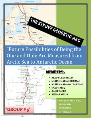
  • 1. NICE-SCEE-NUST-H-12, ISLAMABAD SECTION-B 11/15/2012 “Future Possibilities of Being the One and Only Arc Measured from Arctic Sea to Antarctic Ocean” MEMBERS:-  ASAD ULLAH MALIK  MUHAMMAD AQIB USMAN  MUHAMMAD AWAIS ARSHAD  SAAD TARIQ  AAKIF SAEED  AMMAR MALIK
  • 2. “Future Possibilities of Being the One and Only Arc Measured from Arctic Sea to Antarctic Ocean” 2012 1 Nov. 15, 2012 TABLE OF CONTENTS INTRODUCTION OF STRUVE: ___________________________________________________________ 3 STRUVE GEODETIC ARC:- ______________________________________________________________ 4 a) Introduction:__________________________________________________________________ 4 b) Measurement: ________________________________________________________________ 6 1) The Great French Revolution:_________________________________________________ 7 2) The Need For Such A Measurement: ___________________________________________ 8 3) First Moves In Russia: _______________________________________________________ 9 4) Struve And His Colleagues: __________________________________________________ 10 5) Selection Of The Route: ____________________________________________________ 10 c) The Field Work: _______________________________________________________________ 11 1) Details Of The Field Work: __________________________________________________ 14 i) FIRST PHASE: Central West Russia (1816-1831):- _____________________________ 14 1816: _____________________________________________________________ 14 1820-1821: ________________________________________________________ 14 1822 – 1827: _______________________________________________________ 15 1825-1827: ________________________________________________________ 15 1828: _____________________________________________________________ 15 ii) SECOND PHASE: Extension To The South And North (1830-1844):-_______________ 16 1831: _____________________________________________________________ 16 1833: _____________________________________________________________ 16 1835: _____________________________________________________________ 17 iii) THIRD PHASE: Sweden And Norway (1844-1851) And Bessarabia (1846-1851):-____ 17 1844: _____________________________________________________________ 18 1845: _____________________________________________________________ 18 1846-1850: ________________________________________________________ 18 1850 May: _________________________________________________________ 19 1851: _____________________________________________________________ 19 1852: _____________________________________________________________ 20 iv) FOURTH PHASE: Completion (1852-1855):-_________________________________ 20 1852-1855: ________________________________________________________ 20 d) Instrumentation:______________________________________________________________ 20 e) Monumentation:______________________________________________________________ 21 f) Units And Standards Of Length: __________________________________________________ 23
  • 3. “Future Possibilities of Being the One and Only Arc Measured from Arctic Sea to Antarctic Ocean” 2012 2 Nov. 15, 2012 g) Baselines: ___________________________________________________________________ 24 h) Reference Meridian:___________________________________________________________ 26 i) Coordinates On The Struve Arc:___________________________________________________ 26 j) Accuracy: ____________________________________________________________________ 29 k) Summary: ___________________________________________________________________ 30 l) Subsequent Comparison:________________________________________________________ 34 m) UNESCO World Heritage:_______________________________________________________ 34 The Arc of 30th Meridian: ____________________________________________________________ 38 a) Introduction:_________________________________________________________________ 39 b) Background: _________________________________________________________________ 39 c) Measurement:________________________________________________________________ 40 1) 1908-1909 (2º Arc In Uganda): _______________________________________________ 40 2) 1800-1930 (In Egypt): ______________________________________________________ 42 3) 1935-1950 (In Sudan):______________________________________________________ 44 4) 1952-1954 (Closing The Gap In The Arc In Uganda And Sudan): _____________________ 47 Possibilities Of Being The Only Arc Measured From The Arctic Sea To The Antarctic Ocean: _______ 53 a) Background: _________________________________________________________________ 53 1) Reconnaissance Of Otto Struve: ______________________________________________ 54 2) The Mediterranean Sea: ____________________________________________________ 55 b) Future: _______________________________________________ Error! Bookmark not defined. 1) Possible Routs For The Connection: _____________________ Error! Bookmark not defined. i) Route Through Asia Minor: ________________________ Error! Bookmark not defined. ii) Route From Poland To Crete: ______________________ Error! Bookmark not defined. c) Crossing The Mediterranean Sea:___________________________ Error! Bookmark not defined. D) One And The Only Arc Measured From Arctic Sea To The Antarctic Ocean:________________ 57 APPENDIX _________________________________________________________________________ 59 a) Tenner: _____________________________________________________________________ 59 b) Hansteen: ___________________________________________________________________ 60 c) Lindhagen:___________________________________________________________________ 60 d) Maupertuis: _________________________________________________________________ 61 e) Selander:____________________________________________________________________ 62 e) Svanberg: ___________________________________________________________________ 63
  • 4. “Future Possibilities of Being the One and Only Arc Measured from Arctic Sea to Antarctic Ocean” 2012 3 Nov. 15, 2012 INTRODUCTION OF STRUVE: Friedrich Georg Wilhelm Struve was a German born Russian scientist. He was born at Altona, Duchy of Holstein (then a part of the Denmark–Norway kingdoms) on 15 April 1793. He was the son of Jacob Struve (1755–1841). Struve's father moved the family away from the French occupation to Dorpat in Imperial Russia to avoid military service, equipped with Danish passports. Struve came to Tartu University as a refugee from Altona to study Philology in 1808 as his father had recommended. Indeed, he graduated from the university with a gold medal at the end of 1810.Then he decided to continue his further studies in mathematics and physics. In 1813 Struve passed the qualifying exam for the master's and doctor's degree. In 1812 when during summer he was practising land survey with a 10-inch Troughton sextant, he was taken for a French spy and was arrested by a Russian patrol and was released on the clearance of the confusion but Struve lost a week's work. From 1813 to 1820, he taught at the university and collected data at the Tartu Observatory (Dorpat). The Tartu Observatory was founded at the Imperial University of Dorpat as it was reopened in 1802 and building was completed in 1810 on the Toome hill in Dorpat.The Tartu Observatory (Estonian: Tartu Observatoorium) is the largest astronomical observatory in Estonia. The old Tartu Observatory is known internationally for its connection to Friedrich Georg Wilhelm von Struve and the Struve Geodetic Arc, of which it is the first reference point. The instruments were installed in 1814 by von Struve who Friedrich Georg Wilhelm Struve
  • 5. “Future Possibilities of Being the One and Only Arc Measured from Arctic Sea to Antarctic Ocean” 2012 4 Nov. 15, 2012 subsequently started observations. In 1820 became a full professor and director of the observatory. In 1839, he founded and became director of the new Pulkovo Observatory. The points of the triangulation chain were protected and marked by cairns, commemorative plaques or obelisks. In 1827 he was awarded their Royal Medal and was elected a member of the Royal Swedish Academy of Sciences in 1833. He died on 23 November 1864 in Pulkovo, Russia. STRUVE GEODETIC ARC:- a) Introduction: It is a concept that started in the year 1816 and was carried out by an astronomer by the name of Friedrich Georg Wilhelm von Struve. During the time of Struve’s existence, the distance between two points was measured by measuring poles. However in order to accomplish the goal that Friedrich von Struve had envisioned - calculating the size of the earth - measuring poles would not be sufficient. To do this a more sophisticated tool would be needed. Before long the Struve Geodetic Arc was created to do just that. The Struve Arc only ran through two counties, namely Russia and Sweden-Norway. But his surveys, that took place between the years of 1816 and 1855, calculated the very first measurement of a part of the Pulkovo Observatory, Russia
  • 6. “Future Possibilities of Being the One and Only Arc Measured from Arctic Sea to Antarctic Ocean” 2012 5 Nov. 15, 2012 meridian with staggering accuracy. It was the start of topographic mapping and a growing interest in earth sciences. The Struve Arc is a survey triangulation chain which has assisted scientists to map out certain areas and regions of their countries. The Struve Geodetic Arc is currently a joint venture between scientists of various countries who work together in the name of science. Today the Struve Arc survey chain runs through ten countries, namely Norway, Sweden, Lithuania, Moldova, Russia, Latvia, Belarus, Ukraine, Finland and Estonia, and stretches from Hammerfest (Norway) to the Ukrainian Black Sea. The Struve Geodetic Arc is a chain of survey triangulations stretching from Hammerfest in Norway to the Black Sea, through ten countries and over 2,820 km, which yielded the first accurate measurement of a long segment of a meridian, helping in the establishment of the exact size and shape of the world, and it exhibits an important step in the development of the earth science. The chain was established and used by Friedrich Georg Wilhelm von Struve in the years 1816 to 1855 to establish the exact size and shape of the earth. At that time, the chain passed merely through two countries: Union of Sweden-Norway and the Russian Empire. The Arc's first point is located in Tartu Observatory, where Struve conducted much of his research. All ten countries have been working together to maintain the chain’s station points and to protect the Struve Geodetic Arc. In 2005, the chain was inscribed on the World Heritage List as a memorable ensemble of the chain made up of 34 commemorative plaques or built obelisks out of the original 265 main station points which are marked by drilled holes in rock, iron crosses, cairns, others. Measurement of the triangulation chain comprises 258 main triangles and 265 geodetic vertices. The northernmost point is located near Hammerfest in Norway and the southernmost point near the Black Sea in Ukraine. In 2005, the Struve Arc was inscribed on the UNESCO World Heritage List. This inscription is located in ten countries, the most of any UNESCO World Heritage.
  • 7. “Future Possibilities of Being the One and Only Arc Measured from Arctic Sea to Antarctic Ocean” 2012 6 Nov. 15, 2012 b) Measurement: A long ongoing dispute in the French Academy of Science about the real shape of the Earth ended in the 1730's with a victory of Newton's theory which said that the Earth was not a perfect spheroid, but somewhat flattened at the poles (ellipsoid). Scientists in the next 200 years tried to get more accurate information about the size and the shape of the Earth by meridian arc measurements. So did also the Russian scientist Friedrich Georg Wilhelm Struve. In 1812 when during summer he was practising land survey with a 10- inch Troughton sextant, he was taken for a French spy and was arrested by a Russian patrol and was released on the clearance of the confusion but Struve lost a week's work. From 1813 to 1820, he taught at the university and collected data at the Tartu Observatory (Dorpat). The Tartu Observatory was founded at the Imperial University of Dorpat as it was reopened in 1802 and building was completed in 1810 on the Toome hill in Dorpat. The Tartu Observatory (Estonian: Tartu Observatoorium) is the largest astronomical observatory in Estonia. The old Tartu Observatory is known internationally for its connection to Friedrich Georg Wilhelm von Struve and the Struve Geodetic Arc. The instruments were installed in 1814 by von Struve who subsequently started observations. Around 1815 the Livonian Society of Public Utility and Economy applied to the Tartu University for technical help in land survey. They planned to issue a topographic map of Livonia (now the southern part of Estonia and the northern part of Latvia. The university made a contract with Struve who was then the extraordinary professor of mathematics and astronomy. He was allowed to spend only three to four summer months for this work. The contract foresaw that all the expenses would be covered by the Society (approximately 3000 silver roubles) as planned. Struve has been even given a horse and a wagon.
  • 8. “Future Possibilities of Being the One and Only Arc Measured from Arctic Sea to Antarctic Ocean” 2012 7 Nov. 15, 2012 The triangulation of Livonia – a big and exacting task for young and inexperienced Struve - was carried out with flying colours. Struve finished his triangulation in 1816. This was controlled by a baseline on the ice of Lake Werz-Jerw, measured in 1819. The experience accumulated during this work laid a solid basis for an enormous future project (measurement of the big arc). Struve intended to remeasure at least a part of the Livonian triangulation network but instead of that he started a much bigger project (measurement of the meridian arc of 25 degrees 20 minutes). The observation were carried out in the years 1816 to 1855 and resulted in establishing the exact size and shape of the Earth. Through the years 1816 to 1855 he managed the work on what previous was called The Russian-Scandinavian Meridian Arc Measurements. It can be considered as one part of his lifework. Until about 100 years ago it was the longest meridian arc measured on the Earth. When von Struve began assembling his Geodetic Arc in 1816, the doorstep of the observatory became its first point. For the astronomical source of the geodetic network Struve chose the university observatory whose geographical coordinates he had measured for his doctoral thesis, and the cathedral in Riga. On the other hand work in the Vilnius district was initiated by Tenner in 1816(same year) for the purpose of mapping. 1) The Great French Revolution: The seeds for the Struve Arc were sown by the Great French Revolution. Many traditional habits were replaced by new systems. Especially old measures were toppled by a new metric system. A result from the French Revolution wars was raging all around Europe. The Napoleonic wars stretched from the North Cape to Cairo and from Moscow to Atlantic Ocean. The initial defeat of Napoleon resulted in the Vienna Conference but in the middle of negotiations Napoleon made a
  • 9. “Future Possibilities of Being the One and Only Arc Measured from Arctic Sea to Antarctic Ocean” 2012 8 Nov. 15, 2012 "come back" and war broke out again. When Napoleon was finally defeated by Russia, the Vienna Conference reconvened and agreed in 1815 on the international boundaries in Europe and on the steps to be taken against the seeds of the revolution and against new uprisings. At that time there was a general restlessness among the rulers in Europe. They did not trust a lasting peace and tried to be prepared for new wars. Mapping for such military purposes was a must and all steps to its promotion were advanced. 2) The Need For Such A Measurement: The lack of a proper framework for the topographic mapping was a problem at that time. Such a framework could be likened to a human skeleton upon which the flesh (or map information) is added. At the lower order a method called framework traversing was available but the higher order was more complicated. Astronomical observations were too difficult at the density needed in traversing, especially for the determinations of the longitude which was still a very difficult problem to solve. In addition, the coordinate system required a resolution to the uncertainty of earth ellipsoid dimensions. Especially in Russia both needs were felt deeply; that of the fundamentals of geodetic surveys and that for suitable map grids. Many professors in mathematics attempted to foster new knowledge in these areas. Top military surveyors however were interested only in better mapping. It was Colonel Carl Tenner who managed to combine both needs in the triangulation work in Lithuania started in 1816. Astronomer Wilhelm Struve's proposal to the Tzar of Russia in 1819 also combined both elements. Tzar Alexander the First, after defeating Napoleon and entering Paris felt himself leader of European politics where science was fortunately among the top priorities. Struve got all the resources he needed for his project. The way was open for an arc measurement to develop the basis of a geodetic framework and to start the topographic mapping.
  • 10. “Future Possibilities of Being the One and Only Arc Measured from Arctic Sea to Antarctic Ocean” 2012 9 Nov. 15, 2012 3) First Moves In Russia: At about the same time that the Peru and Lapland arcs were being measured Joseph Delisle published in 1737, a proposal for an arc to be measured through the Russian empire and embracing some 22º of meridian. He stated that "...this set of degrees when determined would display in an incontestable manner, if their variations were uniform, would show whether different meridians have different curvatures..." Surprisingly the Empress Anne of Russia was not frightened by such a vast proposal and gave it her backing to contribute to the progress of science. Unfortunately in 1739, after Delisle got as far in his triangulation as measuring a base on the ice from Peterhof Castle in Kronstad to Doubni Castle on the island of Retusri, and connecting the base to several points by triangulation, a journey to Siberia in 1740-41 interrupted his work and it was never restarted. At that time the meter had yet to be developed and the base had actually been measured at about 13.5 verstes (an old Russian unit of approximately 1.067 km per verste or a base length of 14.4 km). The measurement itself was by wooden bars of known length placed end to end. Nothing was published on this work but in 1844 Otto Struve, son of F.G.W. Struve, did come across Delisle's manuscript in the Paris Observatory archives. For his angles Delisle talked of using a 30º sector of 12-15 ft. radius and a quadrant of 2-3 ft. radius. B.A. von Lindenau, Director of the Seeberg Observatory, proposed to Prince Wolkonsky, the measure of an arc of meridian (or section of a line of longitude) to follow the western provinces of Russia south from the White Sea. He presented the proposal to the Russian authorities. This did not progress because of a disagreement over which instruments - German or Russian- should be used. Struve's opinion however was in any case it was not a good site for well-conditioned triangulation.
  • 11. “Future Possibilities of Being the One and Only Arc Measured from Arctic Sea to Antarctic Ocean” 2012 10 Nov. 15, 2012 4) Struve And His Colleagues: Around 1815 F.G.W. Struve, Professor of Mathematics and Astronomy at the University of Dorpat was put in charge of a trigonometric survey in Livonia. This was controlled by a baseline on the ice of Lake Werz- Jerw, measured in 1819. During 1820 Struve assisted Gauss in the base measure by Schumacher made near Braack with his new Repsold equipment. This work enabled Struve to interest officials in the idea of an arc of about 3½º between Gögland, an island in the Gulf of Finland, and Jacobstadt to the south. After getting the resources he was able to observe the arc between 1821 and 1831. During more or less the same period (1816-1828) Carl Tenner was doing similar work further south in Lithuania but at that stage he was operating quite independently from Struve. Once he had completed his early surveys, Struve was keen to extend the measurements further north and south so that a very long line would result and could be the basis of a sound set of values for the earth parameters as well as having other uses. He would have been aware of the work at that time in India on the measurement of the Great Indian Arc, and that it would be an ideal partner to anything he did through Russia, to determine the earth’s parameters (As it is known that one arc on its own is insufficient to determine the parameters of an oblate spheroid). 5) Selection Of The Route: It is little surprise, since Struve worked at Dorpat University, that he decided any extensions of his surveys should follow, as nearly as possible, the line of longitude (meridian) through Dorpat Observatory at about 26º East of Greenwich. Looking at this line on a map it was clear that some work had already been done in its vicinity in the far north (by Maupertuis 1736-37; and by Svanberg 1802-03) from the northern end
  • 12. “Future Possibilities of Being the One and Only Arc Measured from Arctic Sea to Antarctic Ocean” 2012 11 Nov. 15, 2012 of the Gulf of Bothnia (north west of Finland) well into the Arctic Circle. Here was an opportunity to connect to that work and further extend the line. At the same time it became clear that Tenner was working more or less along the same meridian towards the south. While Struve could envisage the northward extension, Tenner similarly noticed how there could be a southern extension as far as the Black Sea. Thus the elements were present for an arc that stretched from Fuglenaes near Hammerfest in the far north over some 2800 km (1750 miles) to Staro- Nekrassowka near Ismail in the south over 25º of latitude. It was quite natural that both Struve and Tenner assumed the astronomical positions of Dorpat (Tartu) and Wilno (Vilnius) respectively, as zero meridians of their independent surveys. Luckily these were close enough to enable a trigonometric link. Then the observed latitudes and azimuths allowed calculation of the longitudes to the other points in relation to the zero meridians. c) The Field Work: F.G.W. Struve started his work on his ambitious project in 1816 at The Tartu Observatory. His aim was to establish a long arc of a meridian to measure the exact shape of the Earth. As far as is known there is no other such feature as the Struve Geodetic Arc represented on the UNESCO World Heritage List so no direct comparisons are possible. Worldwide there are a finite number of such features that might be similarly considered and probably only 5 that, should this nomination be accepted, rank as of anywhere near similar importance. These are in India, Eastern Africa (from Egypt to S. Africa), Peru, N. France to N. Africa and across Central Europe from Southern Ireland to the Urals in Russia. Due to the large variety of natural and political circumstances involved, each country from the Arctic to the Black Sea presented unique peculiarities in the work, at first glance, of a purely technical kind.
  • 13. “Future Possibilities of Being the One and Only Arc Measured from Arctic Sea to Antarctic Ocean” 2012 12 Nov. 15, 2012 The work on the Scandinavian sector was carried out by Swedish and Norwegian experts, with the assistance of from Poulkova Observatory and astronomers Karl Tenner, F.G.W. Struve, N H Selander and Chr. Hanste. They were the directors of the Poulkova Observatory. Norway accomplished the most northerly arc measurement in history, and the monument near Fuglenaes that marks this achievement is the most beautiful on the Arc. Swedish surveyors attempted to make the final judgment over the famous Tornea valley in Lapland being measured for the third time! – Thus they measured their principal baseline twice unlike the 9 other Struve arc baselines measured only in one direction according to the usual practice of the time. The longest arc segment in time and the second in length were measured through Finland’s forests and swamps, where the large number of surviving marks is in rock. The segment was also the best connection between the monarchies of Russian Tsar and Swedish King who both contributed to the work, thus have met at quite peaceful reason, though not in fact, on the front page of the Struve final account, and acknowledged in solemn texts on the extreme arc monuments as well. Estonia gave the origin of the meridian to be measured for 40 years ahead, and famous Wilhelm Struve started as astronomer and surveyor in this country. His Baltic arc segment reached the Latvian river Daugava (Duna) and was connected in the south with the arc segment of his friend general Carl Tenner, an outstanding Russian surveyor, who worked in Latvia, Luthiania and Belarus. Latvian fields presented the first connection of measurements based on the Russian-English unit of the sajene (7-feet Tenner’s standard) and the Russian-French unit of the toise (6-feet Struve’s standard). The famous German astronomer Wilhelm Bessel judged on this connection and later used the combined Struve-Tenner arc for several derivations of the Earth’s reliable geometry. This laid the foundation for the derivation of Bessel Ellipsoid (1841). In Lithuania the longest baseline of 11.8 km was measured with an apparatus, which was made by Tenner and some other observers, kneel down to read the scales of the level, thermometer and contact sliding rule. Besides, a
  • 14. “Future Possibilities of Being the One and Only Arc Measured from Arctic Sea to Antarctic Ocean” 2012 13 Nov. 15, 2012 unique triangle side stretching exactly along the meridian line was built in this country by Tenner to escape the complexity of orientation (azimuth) observations. In Belarus the first topographical works in Bessarabia were undertaken by Russians in 1817-1819 and 1822-1827. Karl Tenner worked here with F.G.W. Struve. Belarus presents a unique Struve-Tenner arc survival with the authentic endpoints of the Ossownitza baseline. Ukraine and Moldova present the longest arc segment, having entered into the northern extremes of the Islamic world. However, unlike Finland, the measurement took half of the time; it was due to the very favorable topographical circumstances. F.G.W. Struve together with Karl Tenner as geodesist headed triangulation explorations in Ukraine.
  • 15. “Future Possibilities of Being the One and Only Arc Measured from Arctic Sea to Antarctic Ocean” 2012 14 Nov. 15, 2012 Further research will possibly reveal the highest accuracy of measurement achieved in this country. Additional search along this arc segment, still little surveyed, may also provide other interesting finds. Unfortunately, Struve’s suggestion of expanding the measurement further to the south was not realized within the same century because of political unrest in the region. The work on the Russian part of the arc was carried out jointly by Imperial staff officers, the Dorpat Observatory and the Central Observatory of Poulkova. Karl Tenner’s and F.G.W. Struve’s work is of high importance in this context. 1) Details Of The Field Work: Struve reported the division of work on the arc in four phases encompassing seven sections. The various phases of the arc measurement are as follows: i) FIRST PHASE: Central West Russia (1816-1831):- 1816-1820: The early work by Struve had baselines measured with wooden bars and angles by Troughton sextant yet even so he got good results. In 1817 Colonel Tenner who was the previous year charged with the trigonometric survey in western Russian Provinces obtained the permission (without funds) to also carry out an arc measurement along the Vilna meridian and started it. 1820-1821: Struve obtained a grant from Dorpat University to fund further arc measurement including development of his own form of base line Northernmost Point of The Struve Arc
  • 16. “Future Possibilities of Being the One and Only Arc Measured from Arctic Sea to Antarctic Ocean” 2012 15 Nov. 15, 2012 equipment. He consulted with Schumacher, Bessel and Gauss, and decided to adopt the observing method used by Schumacher on the arc between Denmark and Hannover. He took his reconnaissance northwards from Gogland Island into Southern Finland together with H. Walbeck, and investigated the country south from the Gulf of Finland. 1822 – 1827: Struve fitted surveying observations in between his lecturing duties and observing in Dorpat Observatory. Professor Paucker from Mitau (Elgava, Latvia) helped with the astronomical observations at Jacobstadt and Gögland. Struve has crossed the larger part of the Gulf of Finland although the connection was difficult: the longest side of the arc triangles he observed from Gögland to the southern shore of the Gulf. In 1827 the chain from Gögland to Jacobstadt (Jekabpils) was completed, but whilst building substantial signals there were no rocks in which to leave bolts to mark the positions. When measuring the Simonis base in October 1827 the temperature fell to -13ºR = -16ºC. ºR = Rankin degrees ºR = ºF (Fahrenheit) + 460º 1825-1827: Tenner’s responsibilities extended into Belarus. He had completed a chain along the meridian of Wilna from Belin to Bristen tied to baselines at Ossownitza and Ponedeli. As a result Tenner’s most northerly point was then only 32 km west of Struve's most southerly station. 1828: The possibility of joining the two arcs brought Struve and Tenner together in Dorpat possibly for the first time. They were to fight the challenge of incomparability of their two very different units of length before connecting both chains.
  • 17. “Future Possibilities of Being the One and Only Arc Measured from Arctic Sea to Antarctic Ocean” 2012 16 Nov. 15, 2012 Struve and Tenner managed to solve all the problems, and as a result by 1831 there was an arc of 8º 02.5' from Gogland to Belin equipped with three base-lines and five astronomical stations with latitude and azimuth observations. The results of the connecting of the two partial arcs were published by the Academy of Sciences in its Memoirs of 1832 and also in volumes VIII and X of the Annals of deposit topography in 1832. It was soon used by Bessel who until 1841 was engaged in computations of improved values of the earth dimensions. ii) SECOND PHASE: Extension To The South And North (1830-1844):- This began with Struve requesting resources from the Tsar Nicholas I to extend northwards to Tornea. The idea was to connect with the earlier work of Maupertuis and the extension of that by Svanberg. The military (not only Russian) also had the idea of connections, and Tenner secured three (in 1832, 1843 and 1853) between his, the Prussian and the Austrian geodetic networks, here from to France and the British Islands. This was the first major in transcontinental European East-West geodetic framework. 1831: Struve obtained permission to extend northwards and connect with the Lapland arc. Angular measurements were performed by three Finnish officers who had been educated at Dorpat. 1833: In 1833 Struve was commissioned by Nicholas I to build the best Russian astronomical observatory at Pulkovo.
  • 18. “Future Possibilities of Being the One and Only Arc Measured from Arctic Sea to Antarctic Ocean” 2012 17 Nov. 15, 2012 1835: The work was mostly led by a Finnish astronomer Woldstedt, as the officers had been called off for other Russian surveys. Meanwhile Tenner was continuing his geodetic work south of the River Pripyat passing through parts of the Ukraine. His new baseline at Staro- Konstantinow was among the longest in the whole arc. Astronomical observations were made at Kremenetz (latitude 50º 06') and Suprunkowzi (latitude 48º 45'). iii) THIRD PHASE: Sweden And Norway (1844-1851) And Bessarabia (1846-1851):- Struve had a more complicated task. The first leg across autonomous Finland was not politically difficult. Moreover, he could leave the practical implementation to Woldstedt. Later political steps were needed and the necessary agreements made. The chain was joined in the north to that part carried out by Sweden as their share. In Sweden the responsibility for the work was given to the astronomer N. H. Selander. There the chain followed first the old Maupertuis arc of 1736, with western points on the Swedish side and the eastern ones on the Finnish side of the boundary. Continuing further to the north there was a new political problem that Norway belonged to the Swedish realm but had her own administration. Consequently, the rest of the chain from Atjik to the Barents Sea was measured under the responsibility of Christopher Hansteen (1784-1873) Director of the Royal Norwegian Geographic Department, as far as the northernmost point at Fuglenaes. This finished the fieldwork. The northern part included 4 additional astronomical stations and 4 base lines.
  • 19. “Future Possibilities of Being the One and Only Arc Measured from Arctic Sea to Antarctic Ocean” 2012 18 Nov. 15, 2012 1844: Struve conferred with scientists from Norway, Sweden and Russia as well as with Tenner, on the possible extension southwards to the Black Sea and for a northern extension to the Arctic. Commissioners were appointed to assess the feasibility by Sweden from Tornea to Kautokeino and Norway and Norway from there to North Cape. Later the same year Struve met with King Oscar I and proposed the extension to the Barents Sea. This was quickly agreed and N.H. Selander from Sweden was made responsible. A baseline was measured near Elim (latitude 60º 50'). 1845: Norwegian participation was put in the hands of Christopher Hansteen. Astronomical observations were made near Tornea (latitude 65º 51'). A further base was measured at Oulu (lat. 65º 00'). This then allowed a readjustment of the chain from Tornea to Ssuprunkowzi, an arc of 17º 05' 33''. In 13 June an agreement was made between Sweden and Norway for the arc to begin. Hansteen dispatched two young officers to reconnoiter(to make a military observation) the area, build signals and determine suitable sites for the baseline and astronomy. 1846-1850: In Bessarabia Tenner continued the triangulation chain as far as the fortress at Ismail, located near the mouth of the river Danube. Two more baselines were measured and two astronomical stations completed. He terminated in the village of Staro-Nekrassowka (latitude 45º 20'). Measurements of the Meridian Arc in the territory of Moldova started in August 1846, within the general triangulation frame of “Bessarabia
  • 20. “Future Possibilities of Being the One and Only Arc Measured from Arctic Sea to Antarctic Ocean” 2012 19 Nov. 15, 2012 Region”. General management was provided by Lt. Gen. Tenner, operational management by Lt. Col. Heldenbrand, and from August 1847 by First Lt. Napersnikov. Measurements of Moldovian points were completed in 1848. The whole triangulation of this area, including the surveying of the southern part of the meridian arc, is founded on two baselines: Romankauti and Tashbunar, both are in Ukraine and were surveyed by means of the Struve base equipment. The first of them was adjacent to the border between Moldova and Ukraine and the Moldovian line Gvozdauti-Briceni. Astronomy was provided by Pulkovo astronomer Sabler at the point Vadul-lui Voda in September 1848. 1850 May: The Alten base was measured by Klouman (1813-1885) and an astronomer, Lindhagen, from Struve's staff at Pulkovo. The area was flat but the base was only 1154.7 t. (2251.7 m). Each terminal was monumented with a stone block, and small iron bolt at the center. Bad weather severely delayed the astronomical observations at the northern terminal of the whole arc, Fuglenaes near the town of Hammerfest, and Lindhagen just managed to get the last boat south before the permanent winter dark set in. Unfortunately his assistant Lysander died on the long journey back to Pulkovo. There were 15 stations between Hammerfest and the Swedish border near Kautokeino. The astronomy was at Fuglenaes because North Cape itself was unsuitable for the final station because of the weather conditions and persistent fog. 1851: A baseline was measured near Tornea and the astronomy completed at Stuor-oivi.
  • 21. “Future Possibilities of Being the One and Only Arc Measured from Arctic Sea to Antarctic Ocean” 2012 20 Nov. 15, 2012 There were 24 stations in the Swedish section which was mostly observed by Selander, Lindhagen, Skogman and Wagner. 1852: The base extension of the Öfver-Tornio (Ylitornio) was completed. iv) FOURTH PHASE: Completion (1852-1855):- 1852-1855: Some supplementary re- observations of suspect values were made during this period. To honour the completion of the arc, monuments were erected at Staro-Nekrassowka and Fuglenaes. d) Instrumentation: Struve used a universal instrument (theodolite) by Reichenbach of Munich which had a 13 inch diameter horizontal circle and 11 inch vertical circle. These were graduated to 5' (= minutes of arc) and read directly by verniers to 4" (= seconds of arc). Tenner used a variety of seven instruments by a range of different makers. There were two repeating circles, one of 13 inches diameter by Baumann, which read to 4" by vernier, and the other 14.3 inches by Troughton reading by vernier to 10''. A 12 inch diameter terrestrial repetition theodolite by Reichenbach read by vernier to 4'' an 8 inch astronomical repetition theodolite by Ertel reading to 10"; a repeating theodolite of 10 inches made in the Etat-major and reading to 5''; and The Southernmost Point of The Struve Arc
  • 22. “Future Possibilities of Being the One and Only Arc Measured from Arctic Sea to Antarctic Ocean” 2012 21 Nov. 15, 2012 two instruments by Ertel. The first two of these instruments gave inclined angles whilst the other five used by Tenner and that by Struve gave horizontal angles direct. e) Monumentation: Another remarkable item of the Struve arc is the monumentation of the stations. In Finland many were marked on the solid rock by drilling a hole. The hole was filled with lead and on the top of the lead was a plate of brass. Veriö elaborated this point saying that nearly all stations between Hogland and Tornio were marked with small copper plates, which were soldered with lead into 5-7 cm deep holes drilled in the rock or big stones. In the course of time most of the plates have disappeared. In fact most of them were found missing already in the 1890s. Later the lead has been dug out, maybe to be made into shot for the hunters. However, nobody has been able to take along the holes in his pockets. In the Swedish-Norwegian part many points were marked directly on the solid rock or on big rocks by engraving a cross and are still unchanged. Unfortunately, Struve did not leave ground markers to mark the positions of his stations between Gögland and Jacobstadt (Ekabpils, Latvia), except for the two terminals. Within this section the center markers were mostly placed on timbers, which have not survived. The monumentation south of Jacobstadt belongs exclusively to the merits of Tenner. There points were marked on stones or brickwork, which were placed underground to depths of up to a meter. In general the form of the marks can range from:- - A small hole drilled in a permanent rock surface - sometimes filled with lead but often such a filling has been poached for other uses although the hole remains. - Cross shaped center and/or witness marks engraved in the rock.
  • 23. “Future Possibilities of Being the One and Only Arc Measured from Arctic Sea to Antarctic Ocean” 2012 22 Nov. 15, 2012 - To a solid block with a marker set in it. - Or a large solid structure of rocks possibly some decimeters below ground level together with a center stone or brick in which there is a drilled hole. - A measuring block on top of which was a single brick on edge of which the intersection of the diagonals designated the point. This was used by Tenner on his baselines. Essentially the marks are similar to, and serve the same purpose as, the triangulation pillars that one finds on hill tops in the many countries where there is a central mark within some larger, stable and reasonably secure structure. With the older marks these are now sometimes found 25 cm or more below ground level but on location, excavation and verification are still in their original condition. A special form of conservation is proposed for the selected Struve Geodetic Arc stations: i.e. special plaques or similar notice boards in the immediate vicinity. Existing linear cultural sites bear a description distributed along the lines and this is also envisaged in the case of the Arc points. The lengths attainable between neighbouring triangulation points vary according to several factors. These include the range of height of the topography, the vegetation cover and the suitability of points to form reasonably shaped triangles. For the full Struve Arc the longest line is 81.7 km in length (from Mäki-Päälys on Hogland Island to Halljall in Estonia) and many lines are well over 60-70 km long. The shortest line is only 479.6 m in length (from Porlom 1 to Porlom 11 in Finland). The average length between points is 27.1 km. None of the terrain over which the survey was observed could be termed mountainous as in the Peru arc of 1735 (along the Andean peaks) or the Arc of 30th Meridian (the mountains of East Africa). However the terrain varied from massive granite outcrops in the Northern latitudes, some tree covered, through low lying areas in central Finland. To the simple island
  • 24. “Future Possibilities of Being the One and Only Arc Measured from Arctic Sea to Antarctic Ocean” 2012 23 Nov. 15, 2012 of Hogland that greatly assisted the crossing from Finland to Estonia but presented poor geometry. Through thickly forested areas of Eastern Europe and the marshlands to the delta of the river Danube where long sight lines were difficult to obtain. Any hills were made use of as well as high buildings available like the tower of Alatornio church and the Observatory at Tartu. Many chains were measured in different continents in subsequent years. Some results of these activities can be seen in the development of the computed dimensions of the earth. f) Units And Standards Of Length: Although at the time of the surveys, the metric system was well established, the base measurements were recorded in two different units of length. Struve used the old French "toise" (approx. 1.949 m) because his basic standard had come from France. Meanwhile Tenner used the Russian unit the "Sajen” (approx. 2.134 m) because his basic standard had been built in St Petersburg based on English "foot”, as in the 18th century 1 sajen was defined equal to 7 English feet. The two units first "met" or came together on the Struve arc of the meridian. By 1830 Struve and Tenner had solved the problem of converting sajens into toises through careful examinations of their measuring bars and the respective standards, and Struve was able to present further results in toises. His final table of the length of the arc segments is computed in those units, probably for the last time in history and probably also as a sign of the merits of Frenchmen in measuring the earth. Some complications later occurred when trying to determine the best conversion factor for relating the toise to the modern metre. Various factors will be found ranging from 1.949 to 1.949 087. Of course, with the long distances that occured in this project the last digits can make a significant difference.
  • 25. “Future Possibilities of Being the One and Only Arc Measured from Arctic Sea to Antarctic Ocean” 2012 24 Nov. 15, 2012 The standard unit used was the toise of Paris, which was the same as the toise of Peru. Copies were specially commissioned by Struve and Bessel and constructed by Fortin. From his copy Struve had two field standards made each of about 2 toise or 1728 lignes long. (1 ligne = 1/12 inch). Tenner on the other hand used a standard of 945 lignes, which equates to the Russian sajène or 1.0946 toise. During 1850 to 1853 ninteen (19) different standards were inter-compared at Pulkovo. Thus the relationships become complicated. That used on the baselines of Simonis, Elim and Oulu was of 1728.01249 lignes of the Fortin toise at l3ºR. For the bases at Alten, over Torneå and Taschbunar the standard was of 1727.99440 lignes. For the Romankautzi base the standard was of 1728.01991 lignes. The value of Tenner’s standard, used for the bases at Ponedeli, Ossownitza and Staro-Konstantinow was of 945.75779 lignes. g) Baselines: Sprinkled among the 258 principal triangles were 10 baselines, three of which were measured with Tenner's apparatus and seven with that of Struve. The Struve equipment consisted of four wrought iron bars each of 2 toise in length. One end of each bar had a small cylinder with slightly rounded end; the other end of each had a contact lever which was pivoted to the bar. Two thermometers were set into holes in the bars and the bars were each set in boxes from which their ends protruded. Seven of the baselines were measured using this equipment and Struve estimated the probable errors of each to be around 1 ppm. The other three baselines were measured by equipment devised by Tenner. Here the bars were of forged iron 2 sajènes long. One end of each bar was fixed and the other free to move. At this latter end was a sliding scale that could be used to determine the distance between consecutive bars. Struve estimated the probable errors of Tenner's apparatus to be around 3ppm. With a single exception, all the baselines
  • 26. “Future Possibilities of Being the One and Only Arc Measured from Arctic Sea to Antarctic Ocean” 2012 25 Nov. 15, 2012 were measured in one direction only, thus control over the lengths of sides connecting successive arc segments was essential. The last column of the following table gives the quoted accuracy when computing from one baseline to the next which is not the same as the accuracies of the individual baselines.
  • 27. “Future Possibilities of Being the One and Only Arc Measured from Arctic Sea to Antarctic Ocean” 2012 26 Nov. 15, 2012 h) Reference Meridian: Struve was working in Dorpat (now Tartu) Observatory and so it was logical to select the meridian line through that place as a reference line. It was taken as the start (datum) point in both latitude and longitude. Distances were calculated N and S of Dorpat with Dorpat as 0, reaching 710 000 t to the north and 740 000 t to the south. Details are given in at the location of the reference point under the center of the Cupola of the observatory. The point was relocated from Struve’s original measurements and is now marked with a 12 mm bronze marker and a commemorative plaque unveiled in 2002. i) Coordinates On The Struve Arc: Due to his incurable illness diagnosed at the beginning of 1858, Struve never managed to publish the 3rd volume of his Arc du meridien…. A full account of the astronomic operations, final results, a critical evaluation of the world arc measurements and derivation of a series of related earth figure parameters would have been contained there. Perhaps, a full list of geographic coordinates of all the arc stations was also kept in mind for use by the Russian Army General Headquarters that shared the arc field operations from the very beginning in 1816. Such a full list was not computed until 1926. Before that time some Russian regional nets did include Struve arc stations, with subsequent derivation of their coordinates. For instance, in 1892 the Head of the Russian Survey of Finland Lieut. Gen. Järnefelt published a list of geographic cords of 91 stations of the northern part of the Struve arc from Gogland (Mäkipäällys) to the Norwegian border (Stuoroivi). The values were computed on the 1819 Walbeck ellipsoid with longitudes related to Dorpat meridian. In 1926 a vast list of Tartu Observatory
  • 28. “Future Possibilities of Being the One and Only Arc Measured from Arctic Sea to Antarctic Ocean” 2012 27 Nov. 15, 2012 coordinates of the Russian 1st order triangulation points was published, including Struve arc Russian stations south of Kakamavara (near Tornea) to Izmail, that resulted from computation on the 1841 Bessel ellipsoid, the longitudes being related to Pulkovo. Both the Lists were in the Proceedings of the Russian Military Topographers Corp (in Russian). Since then, due to the collapse of the Russian Empire and subsequent political changes in Eastern Europe, there have been no other computations for the entire arc although there have been separate calculations within national borders (Latvia, Finland, Norway, Poland, Romania). Observations for latitude and azimuth were made at 13 selected stations 3 of these were in Scandinavia and the other 10 in the Russian Empire states. This gave 12 arcs (see the Table in the topic Accuracy) varying from 1º 22' to 2º 54' in length that could be computed separately. From these the length of 1º (see the Table “Length of 1 º) was determined for each of the 12 arcs and these varied from 57 252 t in the far north to 57 068 t in the far south but there were some inconsistencies in between. Using seven different divisions there was a more regular decreasing pattern between similar extreme values. A decrease as one moves from north to south indicated an oblate rather than a prolate shape for the earth.
  • 29. “Future Possibilities of Being the One and Only Arc Measured from Arctic Sea to Antarctic Ocean” 2012 28 Nov. 15, 2012 The results of the 1816-1855 arc measurements were first published by W. Struve in 1857 (unfortunately, without astronomy and the historical preface), then in 1860 (in full) each edition in French. In 1861 an identical Russian edition was issued and some selected chapters of this were re published in 1957. Note that F.G.W. Struve tended to publish under W. Struve. In these Struve's definitive conclusion was that the overall length of the meridian arc was 1 447 787 toise (= 2 821 833 m) for 25º 20' 08.29". However, Struve became ill and could not complete the compilation of astronomical results and derivation of the definitive values of the earth’s
  • 30. “Future Possibilities of Being the One and Only Arc Measured from Arctic Sea to Antarctic Ocean” 2012 29 Nov. 15, 2012 parameters “a” and “f” (Figure 6 and Table 8). He only derived preliminary values of these combining his results with those of Bessel and Everest, resulting in semi-major axis (a) = 3 272 539 toises and flattening (f) of 1:294.73. He did however make other calculations with varied results. Others since, including Bessel (from 1834 to 1841) and Clarke (1858 and 1861), and many others afterwards all used Struve's latitudes and arc section lengths to combine with other arcs around the world. j) Accuracy: Among the various figures Struve gave were those for a measure of the accuracy achieved in the various sections were values for the probable error of each of the 12 sections between successive astronomical stations. This gave the following list and indicates the overall high accuracy of around 1/200 000 (i.e. 5 mm per km) achieved.
  • 31. “Future Possibilities of Being the One and Only Arc Measured from Arctic Sea to Antarctic Ocean” 2012 30 Nov. 15, 2012 k) Summary: 1830: End of phase one, there was a complete meridian arc from Gogland in the Gulf of Finland (latitude 60º 05') to Belin (latitude 52'02') = 8º 03' extent. 1844: End of phase two, there was a complete arc from Tornea to the Dnestre river (latitude 48º 45’). 1851: End of phase three, there was a complete arc from Fuglenaes to Staro-Nekrassowka except for the need to add some supplementary data and re-observe various suspect stations- which took place during the last phase. A summary of the whole arc: Northern terminal Hammerfest (Fuglenaes) latitude 70º 40'11.23" N Southern terminal Ismail (Staro-Nekrassowka) 45 º20’02.94’’ N Difference in geographic latitude 25º20’08.29’’ Difference in toises 1447786.783 ± 6.226 kms 2821.833711* Origin of the meridian arc located in Dorpat latitude 58º 22' 47.56"± 0.05'' Time difference between Greenwich and Dorpat 1h 46m 53.536s ± 0.066s Then longitude of Dorpat related to Greenwich = 26º 43' 23.04" * Value in kms will vary slightly according to conversion factor used.
  • 32. “Future Possibilities of Being the One and Only Arc Measured from Arctic Sea to Antarctic Ocean” 2012 31 Nov. 15, 2012 The Struve chain brought several benefits. The long and accurate chain gave a fine addition to the determination of the spheroid but it also had plenty of indirect influence. The principles of the work were published in all details and this made the arc a good example for others to adopt. Even the personal contacts made over the forty years were important. For instance, Struve had an influence on the measurement of an arc along the line of latitude 52º carried out in the second half of the century. It was Tenner who asked Bessel to derive new dimensions of the earth incorporating use of the Russian arc. Many chains were measured in different continents in subsequent years. Some results of these activities can be seen in the development of the computed dimensions of the earth. Very clearly the mutual agreement has become better since the publishing of the Struve arc and succeeding measurements. This has given a good start to uniform mapping, its framework and the map projection systems. Triangulation Chain from Arctic Sea to Black Sea
  • 33. “Future Possibilities of Being the One and Only Arc Measured from Arctic Sea to Antarctic Ocean” 2012 32 Nov. 15, 2012 Toise values from Struve records: Meter values by use of conversion factor K = 1.949 067 Note that Vassiljev in his paper of 1994 appears to have used K = 1.949 and hence all his meter values are less than those above.
  • 34. “Future Possibilities of Being the One and Only Arc Measured from Arctic Sea to Antarctic Ocean” 2012 33 Nov. 15, 2012 In all the toise-meter conversions the last three decimal places make noticeable differences. These digits are found variously as 087, 081, 067 (0668) or 061. Foot values are from 34-35. Indirectly it has also helped the spread of the metric system as it became more generally accepted in principle at the international agreement in the year 1875. It is true that the length of the basic unit no longer depends on the determination of the earth dimensions but in the 19th century it was the chosen way. Because of the number of countries it passes through the Struve arc has had a remarkable effect on the framework for mapping. Strong chains with permanent marking and good documentation have ever since belonged to the basic work in many countries. New base lines and astronomical stations were distributed along the Struve arc triangulation chain and made it an inseparable part of developing a traditional framework for European geodesy and mapping. These principles have then been followed for nearly 150 years until the Global Positioning System (GPS) has now completely changed the methods.
  • 35. “Future Possibilities of Being the One and Only Arc Measured from Arctic Sea to Antarctic Ocean” 2012 34 Nov. 15, 2012 The Struve arc has not only served triangulations as an example. Its points have been the starting points to many new triangulations and traverses in the intervening period. Up to the 1960s the Struve arc was the only connection of coordinates between South and North Finland. An additional advantage has been the careful trigonometric leveling along the points in the chain. Data from this arc was used in 1942 by Izotov and Krassovsky in their ellipsoid calculation and as recently as 1956 in the new determination of the figure of the earth by Chovitz and Fische. Norwegian geodesists repeated the astronomical observations at Fuglenaes in 1928 with Hans Jelstrup and in 1950 with Yngvar Schiott. There was good agreement with a variation in latitude of less than 6m. l) Subsequent Comparison: The amount of work is not the only merit. Taking the instrument and observation techniques of that time into account the achieved accuracy was amazing. Co-ordinate transformations between some Struve points and coinciding new points measured applying the best methods over one century later, have revealed an unexpected quality. The discrepancies were of the order of some centimeters, maybe one or two decimeters. One lost Struve point was found when measured from a nearby new triangulation point. It was about one decimeter from the computed site. Perhaps the accuracy of the methods of the time deserves admiration. m) UNESCO World Heritage: In 2005, the Struve Arc was inscribed on the UNESCO World Heritage List. This inscription is located in ten countries, the most of any UNESCO World Heritage. The Scientific Conference in Tartu took forward the idea and on August 28, 1993 agreed the following
  • 36. “Future Possibilities of Being the One and Only Arc Measured from Arctic Sea to Antarctic Ocean” 2012 35 Nov. 15, 2012 Resolution No 1: “Considering the scientific, historical and practical importance of the measurement of the arc of meridian through Tartu, made by F.G.W. Struve, Urge the governments of those countries that still possess relics of that enterprise to take all possible steps to preserve those relics, including an approach to UNESCO to declare them to be World Heritage sites.” A corresponding resolution 1/2 1994 was then made at the FIG Congress at Melbourne in 1994: “Considering the great historical value of the measurement of the arc of the meridian, and that an inventory exists of land monuments marking the arc of the meridian, called Struve, which extends over 9 countries and 25º of latitude from the Black Sea to Hammerfest situated on the north coast of Norway, Commission 1 recommends that FIG should present a request to the United Nations that the remains of this arc of meridian be added to the World Heritage List of Historical Monuments.” A similar conference to that of 1993, held in Tallinn and Tartu from 25 to 28 September 2002 under the title “Struve Arc 150”, was an ideal opportunity to discuss the arc in detail and to progress the efforts of the International Institution for the History of Surveying & Measurement (IIHSM) to have selected points in each country recognized by UNESCO as a World Heritage Monument. 50 delegates from 10 countries attended- namely Norway, Sweden, Finland, Russia, Estonia, Latvia, Lithuania, Belarus, Ukraine, Moldova, Belgium and UK. Despite the setbacks a final document of 270 pages was produced in time for presentation to the UNESCO in January 2004. The 18 month period of scrutiny within UNESCO and ICOMOS (International Council on Monuments and Sites) seemed endless but at last a decision was made on 15 July 2005 at the UNESCO annual meeting in Durban, S Africa. World Heritage status had been achieved. 34 points in Norway
  • 37. “Future Possibilities of Being the One and Only Arc Measured from Arctic Sea to Antarctic Ocean” 2012 36 Nov. 15, 2012 (4), Sweden (4), Finland (6), Russia (2), Estonia (3), Latvia (2), Lithuania (3), Belarus (5), Moldova (1) and Ukraine (4), were registered. 1) Norway:- 1: Northing: (70°40'12'') Easting: (23°39'48'') 2: Northing: (69°56'19'') Easting: (23°21'37'') 3: Northing: (69°39'52'') Easting: (23°36'08'') 4: Northing: (69°01'43'') Easting: (23°18'19'') 2) Sweden:- 1: Northing: (68°15'18'') Easting: (22°58'59'') 2: Northing: (67°16'36'') Easting: (23°14'35'') 3: Northing: (66°38'47'') Easting: (23°46'55'') 4: Northing: (66°01'05'') Easting: (23°55'21'') 3) Finland:- 1: Northing: (68°40'57'') Easting: (22°44'45'') 2: Northing: (66°23'52'') Easting: (23°43'31'') 3: Northing: (65°49'48'') Easting: (24°09'26'') 4: Northing: (61°55'36'') Easting: (25°32'01'') 5: Northing: (60°42'17'') Easting: (26°00'12'') 6: Northing: (60°16'35'') Easting: (26°36'12'') 4) Russia:- 1: Northing: (60°04'27'') Easting: (26°58'11'') 2: Northing: (60°05'07'') Easting: (26°57'40'')
  • 38. “Future Possibilities of Being the One and Only Arc Measured from Arctic Sea to Antarctic Ocean” 2012 37 Nov. 15, 2012 5) Estonia:- 1: Northing: (59°03'28'') Easting: (26°20'16'') 2: Northing: (59°02'54'') Easting: (26°24'51'') 3: Northing: (58°22'44'') Easting: (26°43'12'') 6) Latvia:- 1: Northing: (56°50'24'') Easting: (25°38'12'') 2: Northing: (56°30'05'') Easting: (25°51'24'') 7) Lithuania:- 1: Northing: (55°54'09'') Easting: (25°26'12'') 2: Northing: (54°55'51'') Easting: (25°19'00'') 3: Northing: (54°38'04'') Easting: (25°25'45'') 8) Belarus:- 1: Northing: (54°17'30'') Easting: (26°02'43'') 2: Northing: (53°33'38'') Easting: (24°52'11'') 3: Northing: (52°17'22'') Easting: (25°38'58'') 4: Northing: (52°12'28'') Easting: (25°33'23'') 5: Northing: (52°09'39'') Easting: (25°34'17'') 9) Moldova:- 1: Northing: (48°19'08'') Easting: (27°52'36'') 10) Ukraine:- 1: Northing: (49°33'57'') Easting: (26°45'22'') 2: Northing: (49°19'48'') Easting: (26°40'55'')
  • 39. “Future Possibilities of Being the One and Only Arc Measured from Arctic Sea to Antarctic Ocean” 2012 38 Nov. 15, 2012 3: Northing: (49°08'55'') Easting: (26°59'30'') 4: Northing: (45°19'54'') Easting: (28°55'41'') Map of The Struve Geodetic Arc
  • 40. “Future Possibilities of Being the One and Only Arc Measured from Arctic Sea to Antarctic Ocean” 2012 39 Nov. 15, 2012 The Arc of 30th Meridian: a) Introduction: Uganda, The Sudan and Egypt – which between them have more than half of the 608 stations on the Arc of the 30th Meridian. Work on the Arc here took place over a period of 50 years. The various parts of this are summarized to illustrate to realize David Gill’s dream, who worked in these countries in early 20th century. Four distinct periods are noted: 1908-1909, the 2º arc in Uganda; 1800- 1930 in Egypt; the Sudan before 1950 and 1952-1954 closing the gap in the arc in Uganda and Sudan. b) Background: At the beginning of the 20th century there were three colonial powers in the central part of Africa, namely Belgium, Germany and Great Britain. There was controversy between them as to the sphere of influence in this region. "Artificial" boundaries had been established a long time before, and due to the newly discovered parts, it often led to disputes. In 1894, agreement was signed between Congo and Great Britain, which met with the protest from Germany because some points in this agreement were contrary to the earlier, 1890 British and German convention. To settle the continual boundary disputes, the Anglo German Boundary Commission was formed in 1902. This Commission, through the Colonial Office, bore the greater part of the cost of camp equipment and tools with donations from professional societies. The fixing of the true position of the 30th meridian between Uganda and the Belgian Congo led to a controversy as to the boundary, and in 1906 a Commission was sent to survey the territory in dispute. This joint Anglo-Belgian Boundary Commission under Lt Col Bright was operating in the region near the 30th meridian lying between Lake
  • 41. “Future Possibilities of Being the One and Only Arc Measured from Arctic Sea to Antarctic Ocean” 2012 40 Nov. 15, 2012 Albert and the parallel 1º S, and this appeared to both Gill and to Sir Herbert Read (an original member of the Colonial Survey Committee), to be a good opportunity to utilize some of the personnel of the joint Commission to measure that part of the arc of meridian which traversed the area in which the Commission had been working. This was agreed by the two Governments; Belgium appointed M Dehalu an astronomer from Liege University to assist. c) Measurement: Four distinct periods are noted: 1: 1908-1909 (the 2º arc in Uganda) 2: 1800-1930 (in Egypt) 3: 1935-1950 (in Sudan) 4: 1952-1954 (closing the gap in the arc in Uganda and Sudan) 1) 1908-1909 (2º Arc In Uganda): In August 1908 command of British party went to Capt. E M Jack who was joined by G.T. McCaw as assistant observer. The party observed an arc from 1º11' N to 1º11' S together with Belgians and a base was selected at Semiliki (northern part of the Lake Albert flats). Sixteen trigonometric stations were fixed and permanently marked. 35 triangles in five figures were observed with a 10-inch Repsold theodolite, lent by the Transvaal Government using 5 inch helios and acetylene lamps. Using Repsold theodolites and a zenith telescope M. Dehalu observed over a period of nine months 14 latitudes using up to 49 distinct pairs of stars at a single station, and azimuths at Omunturok, NKenda and Kikerere. Climatic conditions were poor in the Ruwenzori Mountains, and each station took an average of 36 days to complete.
  • 42. “Future Possibilities of Being the One and Only Arc Measured from Arctic Sea to Antarctic Ocean” 2012 41 Nov. 15, 2012 During the same period Dehalu and Wangermée took magnetic declination observations at 58 main points of which 15 were geodetic points. In the same reference is a comment:- "The geodetic points are marked on the ground by piles of dry rocks, in a conical shape, around 5m diameter at the base and about 2.50m high; in the center, following the axis is fixed an iron tube 3m long surmounted by two circular metal discs set at right angles to one another." The length of the Arc measured in Uganda was a little over 2º and extended from the frontier of Uganda on the south to the southern shore of Lake Albert, so that not all the meridional extent of Uganda was traversed. Thus between Lake Albert and Aswan in Egypt there was a big gap in 1929. At a station at Kasunju (East of Lake Edward) small crater lakes are visible. Not only would it have been practically impossible to occupy the summit of Ruwenzori over 16 000 feet in height, but even on the higher of the two spurs which had been occupied, on Karangora peak (Between Lake Albert and Lake Edward) observations were secured with great difficulty. Observations for latitude were made at 14 out of the total of 16 stations, and for azimuth at 3 stations. At one of the latter points (Kkenda) the attraction from the west must be very considerable, yet the effect on azimuth was very slight. In such a greatly disturbed region it might be expected that the deviations of the vertical would be marked, and they are. They rise to over 20 seconds. In order to obtain a reasonably correct value of the latitude, the measures at all stations north of the equator had to be rejected, and the latitude finally selected as standard was derived as a mean of the seven stations south of the equator.
  • 43. “Future Possibilities of Being the One and Only Arc Measured from Arctic Sea to Antarctic Ocean” 2012 42 Nov. 15, 2012 The attractions on both the western and eastern sides of the chain are largely local and indeed, the greater deviations might have been anticipated qualitatively, being conditioned by the central mass under Margherita and the rift valley to the north, including Lake Albert. On the western meridional line the geoid rises to the escarpment north of Lake Victoria, on which stands Isura; on the eastern meridional line, on the other hand, in the same latitudes, the geoid drops in the Lake Victoria. On both the eastern and western lines the latitude of the summit of the geoid is approximately 0º25' N. The geoidal surface must vary considerably in an east-west direction; it will be seen that in this sense also it rises towards Margherita and climbs steeply from Lake Albert towards the Isura Escarpment. The only baseline in Uganda, at Semliki, was observed August and September 1908 by G T McCaw, Capt. Jack and Dr Chevallier and had a reduced length of 16 532.37644 m. It was located in the Semliki valley in Toro to the South of Lake Albert and was measured with 6 Jäderin invar wires of 24m each standardized at Sèvres and the NPL. 2) 1800-1930 (In Egypt): The project started in 1907 when Capt. H G Lyons became first Director General of Survey in Egypt when it was founded in July 1898 and stayed until 1909. He began the geodetic triangulation of Egypt along the NILE VALLEY in 1907. The main triangulation of Egypt consists of a narrow belt of braced quadrilaterals running north along the valley of the Nile from near the frontier with the Anglo-Egyptian Sudan to Cairo. The reconnaissance survey of somewhat less than 150 km was a long strip from Cairo (lat. 30° N) to Beba (modern Biba) (lat. 29° N), carried outby E Wande, under the charge of B Keeling, the superintendent of the Helwan Observatory near Cairo. Two baselines were chosen at this time:
  • 44. “Future Possibilities of Being the One and Only Arc Measured from Arctic Sea to Antarctic Ocean” 2012 43 Nov. 15, 2012 one near the Helwan Observatory and the second one, called Beni Suleiman (lat. 29° N), between Beba and Beni Suef. It is reported that a second section joining Cairo to Suez has been completely observed and computed. This is the first stage of a junction of the Egyptian geodetic chain with the Palestine triangulation. At the end of 1909, the reconnaissance was carried southwards to Assiut (lat. 27° N), where the third baseline was selected. In the following years as the work extended further south other baselines were measured at Luxor (lat. 25°40' N) and Aswan (lat. 24° N). The angular observations on the section, between these two latter baselines, and the determination of astronomical latitudes, were carried out by J H Cole, and for the first time since 1907, by an Egyptian, Ibrahim Azzam. In the 1920s, a chain of triangulation was observed southwards along the Nile Valley in Egypt as far as Luxor under the direction of Captain (later Sir Harry) Lyons RE. This was soon extended to Aswan under the direction of Hussein Sirry Bey and thence to Adindan (north of the Sudan border, Aswan, Egypt), across the border from Wadi Halfa in the Sudan. This triangulation followed the course of the Nile from Cairo southwards. The geodetic triangulation from Cairo to Aswan- some 550 miles- was of a very high order. At the time of starting this work the latest available figure of the earth was that by Helmert (a = 6 378 200 1/f = 298.3) of 1906, and the domestic geodesy of Egypt, including lower order triangulation continued to be based on that figure. This figure was used in preference to those of Clarke. When the Madrid Conference of 1924 accepted the figure of Hayford 1910 it was too late to change as the mapping was so far advanced although for scientific use the triangulation was computed on both figures. The positions of the arc have been recomputed on Hayford figure, but judging from the printed report of 1927, the result may increase the A-G differences. The
  • 45. “Future Possibilities of Being the One and Only Arc Measured from Arctic Sea to Antarctic Ocean” 2012 44 Nov. 15, 2012 positions of all trignometric points were also given on the Transverse Mercator. When the geodetic triangulation started there was only one point of fixed longitude in Egypt. This had been achieved at the time of the 1874 transit of Venus (connected, through subsidiary triangles, with The Helwan Observatory) at Moqattam Hill near Cairo by the exchange of telegraph signals with Greenwich Observatory and at the same time with Suez (Northern Egypt) similarly determined by Sir David Gill in 1874. For latitude, the mean discrepancy between the astronomical and geodetic latitudes of the first eight stations south of Cairo was made zero. The Egyptian chain, between Cairo and Adindan (north of the Sudan border, Aswan, Egypt), was adjusted in blocks. Laplace azimuths were used only for the southern section, between Aswan and Adindan. A chain from Cairo to Suez was established with a view to a future connection with the parallel Indian Arc. 3) 1935-1950 (In Sudan): In 1893 Major M.G.Talbot went to Wadi Halfa (Southern Egypt) and began a small triangulation after fixing his position by telegraphic comparison with Cairo. Subsequently he went into the Nubian Desert (North of Sudan) and determined the position of the oasis Murrat Wells (Northern Sudan). During the winter of 1893-4 he commenced triangulation from Suakin (west of Red Sea, Sudan), in 1896 completed a triangulation survey from Halfa to Kerma (at bank of Nile in Sudan) , in 1898 he fixed Merowe telegraphically and began a small triangulation between there and Abu Hamed. On January 1st 1900 Talbot was appointed to the newly created post of Director of Surveys and then resumed mapping the country. Gwynn surveyed the Eritrean frontier from Kassala (Eastern border of Sudan with Eritrea) to the Red Sea, closing on the Suakin (Cost of Sudan in North of Eritrea) triangulation. He measured a base at Kassala and began triangulating northwards in December 1901, completing it at
  • 46. “Future Possibilities of Being the One and Only Arc Measured from Arctic Sea to Antarctic Ocean” 2012 45 Nov. 15, 2012 Suakin in March 1902. In 1903 the Butter-Maud Expedition was to survey the Kenya east of Lake Rudolph (now Lake Turkana) and to carry triangulation to the north end of the lake in Ethiopia. They measured a base of 3 ½ miles near Lake Rudolph. Pearson succeeded Talbot as Director of Surveys, with Lieut. A.E. Coningham as Assistant Director. During 1905 and 1906 Coningham became proficient at triangulation covering 5000 sq. miles in one season and in 1907 he started triangulation south from EI Obeid (South of Northern Sudan). In 1928 a detailed resolution was passed at the first Conference of Empire Survey Officers and this led to the work by an imperial party in Tanganyika Territory, who were to connect the existing parts of the Arc in Northern Rhodesia (now Zimbabwe) and Uganda, from where the chain was to be continued northward into the Sudan. In 1929 discussions about the most economical way of dealing with the Sudan gap made considerable headway. Better knowledge of the Sudd region indicated the possibility of taking the triangulation across this area on dry land with the help of portable steel towers. E. K. G. Sweeting was able to confirm this and suggested a feasible route, east of the Bahr ez Zeraf, linking up the hills north of Juba with the Nuba Mountains. World economic crisis delayed it further because Sudan was hit severely. In 1933 the question was reopened by the International Union of Geodesy and Geophysics. They were able to loan a Geodetic Tavistock theodolite from Tanganyika and had the promise of base- measuring apparatus as soon as it was free. The fact that a single reconnaissance cum beacon building party was put in the field in October, 1935, was largely due to the energetic efforts of S. L. Milligan.
  • 47. “Future Possibilities of Being the One and Only Arc Measured from Arctic Sea to Antarctic Ocean” 2012 46 Nov. 15, 2012 Egypt had completed its part of the Arc to the Sudan border in 1930 and, as the gap south of the Sudan had not been closed by 1935; the obvious decision was made to begin in the north. The field party started from Wadi Halfa with few fixed ideas. A request for the loan of the "Macca" base measuring apparatus from the Department of Lands and Mines of Tanganyika met with a favorable reply in December, 1935. It was used on the Amentego (central North Sudan) baseline. Work lasted from March 18th to May 1st, 1936, a total of 45 days. The Quleit base was 6.2 miles long in latitude 13º 50' N. in the Northern Kordofan (North Sudan). The distance from Amentego is 600 km. measured along the meridian line of the chain. Every effort was made during reconnaissance to get its direction as nearly at right angles as possible to the prevailing winter winds from the north. The chain would follow the valley from Amentego southwards as far as Debba (central North Sudan). The natural route for triangulation was astride (on both sides) the river. But the only two places at which any facilities at all existed for ferrying the cars across the river on east side were Wadi Halfa and Dongola, and those at Dongola were very primitive. A third ferry was later organized at El Ghaba (South Sudan) just north of Debba. Due to the Second World War, there was a delay and the work resumed in 1947. Then, most of the pillars for the third section of the Arc were built. The observations at the 25 stations of this section were carried out during the observing seasons, until April 1952. D. T. F. Munsey was in charge of the field party in the first seasons of 1949 and 1950. The average triangular misclosure of the chain was 0.60". The Abu Qarn (Southmost of North Sudan) base site was selected in 1951-52 by Munsey and Mason at the southern end of the chain (lat. 10° N). Mason started its measurement from Abu Qarn base and that of the expansion figure in November 1951 and completed it in January 1952. Unfortunately it was to be the most inaccessible of the entire base lines in Sudan. From clearing the line to its completion took 39 days. The
  • 48. “Future Possibilities of Being the One and Only Arc Measured from Arctic Sea to Antarctic Ocean” 2012 47 Nov. 15, 2012 difference in length between the outward and reverse readings for all the 336 x 100 ft. bays was but 0.002 ft. For this section of about 4º the closure on the Abu Qarn base from a triangle near Quleit was: 1:150 000 in length and 2 seconds in azimuth The Sudan portion of the Arc was computed on the Modified 1880 Clarke ellipsoid. It was the recommendation of the Colonial Survey Committee to have all African surveys based on the same ellipsoid. One of the Adindan (Egypt) base terminals was chosen as the origin of the Sudan part of the Arc. Its geographical co-ordinates were computed on the Hayford 1910 figure of the earth. The longitudes required a correction of +3.45". 4) 1952-1954 (Closing The Gap In The Arc In Uganda And Sudan): With the completion in 1940, of that part of the 30th Arc between Wadi Halfa and El Obeid in the Sudan, there remained only a gap of some 630 miles (1000 km) to make the Arc complete from near Port Elizabeth (South Africa) northwards to Cairo. Half of this 630 mile (1000 km) gap was probably the most difficult section of the whole Arc from the surveying point of view, involving as it did the crossing of the vast Sudd area of the Southern Sudan. This gap extended from the Semliki flats, at the southern end of Lake Albert (now Lake Mobutu Sese Seko) in Uganda and the Belgian Congo, to the Nuba Mountains in Sudan. There was a distance of about 315 miles (500 km) crossing the Sudd region in Sudan, with no hills and floods occurred there during the rainy season. From Juba to Abu Qarn along the Nile valley the chain crossed such flat country that 33 m towers were required throughout. This section of the Arc was carried out mainly in the interest of the international geodesy.
  • 49. “Future Possibilities of Being the One and Only Arc Measured from Arctic Sea to Antarctic Ocean” 2012 48 Nov. 15, 2012 With the possibility of the “Cold War” the United States Government decided that a more accurate figure of the earth was essential for the calculation required for long range rocket warfare and decided to measure most difficult gap extended from the Semliki flats to the Nuba Mountains in Sudan. At the Conference of Commonwealth Survey Officers in 1951 discussions led to a request that a resolution be passed to encourage the execution of the necessary work. The American observer, Mr Floyd Hough, indicated that he would be making a proposal on these lines to his superiors and Conference duly passed the resolution proposed by Martin Hotine and seconded by Colonel Baumann of South Africa. Soon afterwards, a proposal by the United States Army Map Service, which had available the required equipment and the necessary skilled personnel, either of their own, or on secondment from the Coast and Geodetic Survey, for the completion of the work was submitted to the governments of the Sudan, Uganda and the Belgian Congo. This was quickly accepted and, by mid-December 1952, a large United States team was in position in Juba in the southern Sudan. The party formed up in the Sudan in 1952 and by their first entry into Uganda in April 1953, had observed a large part of the chain across the extremely difficult Sudd region using Bilby towers as “stepping stones” and bulldozing some of the taller parts of the scrub, to get as long lines as feasible. Even then, assuming level ground between them, the stations could only be sited a maximum of 18 miles apart. With 18 mile diagonals on braced quadrilaterals, this meant that side lengths could only be some 12 miles long at their maximum if forward movement was to be maintained without expense to figural strength. The party from the AMS (American Mathemitics Society) cooperated with the survey departments of the other countries. All operations in Sudan were carefully planned with the assistance of the Director of the
  • 50. “Future Possibilities of Being the One and Only Arc Measured from Arctic Sea to Antarctic Ocean” 2012 49 Nov. 15, 2012 Sudan Survey Department, Mr. Wakefield. Due to the short, four months dry season in Sudan, it was decided to complete the triangulation work during two seasons. The operations started in December 1952 from Juba (the Luluba base) and proceeded northwards to the Ayod (South Sudan) base. The steel towers were of the Bilby type and consisted of inner and outer towers of heights between 50 and 103 feet. Sudan provided twelve towers and five were brought from America. Among the array of equipment was a De Havilland “Beaver”, seating four passengers, plus pilot and mechanic; it could be used to drop mail, messages and spare parts to the observing teams. This type of plane was able to take off from a short runway carrying a heavy payload and was very popular for survey work in Canada, their country of origin. Due to bad climate Ayod baseline was measured at the end and then the work was started from the Semliki base in south between Congo and Uganda. The Semliki base had been measured in 1908, when another section of 150 miles of the 30th Arc was surveyed southwards along the eastern side of the Ruwenzori, and down into Tanganyika (then German East Africa). With a probable error of better than 1 in a million, the base was regarded as being sufficiently accurate for carrying the Arc northwards for some 300 miles (480 km) to the new Luluba base near Juba in the Sudan. The Semliki base had not been visited since the early 1930s, but reasonably adequate description cards were obtained from the Entebbe office, and both Kibuku (Eastren Uganda, border with Kenya) and Makoga (Westren, Uganda border with Congo) were easily found with the old beacons (steel pipes with round petrol drum tops as signals) still standing, but with considerable slant. Isura and Omunturok, the two western expansion stations, were both in the Congo. Before any observing commenced the Arc stations were reconnoitered right up to the line Zeu (302) – Erusi (303), on the Uganda –Congo
  • 51. “Future Possibilities of Being the One and Only Arc Measured from Arctic Sea to Antarctic Ocean” 2012 50 Nov. 15, 2012 border, to the north-west of Lake Albert. Proposed stations from existing map of the area for 110 miles of Arc were positively identified, inter- visibility checked, and best methods and routes of ground approach studied, in four hours flying from Fort Portal ( west of Uganda), by the observer who would later be occupying the particular station. For checking inter-visibility, this was done by plane. When there was any doubt about a line being clear closer flying was employed. In these cases, the line Zeu-Erusi (north west of Lake Albert) was one, for example, the pilot having flown along the bearing to the new station, and identified its proposed position, would then go a mile or two further with one of the passengers keeping the hill in view, and then turn the plane round sharply and fly back along the back bearing. As he approached the hill, with the plane on bearing, he would cut airspeed to its minimum and come down low over the ground, and then fly up the side of the hill, and as the plane flew a few feet over the top, the observers would crane forward to see if they could see the back station ahead on line- if so, well and good- but if not the pilot would repeat the process and sometimes even go back and try the line again from the other end, until the chief observer was sure that a satisfactory ray would, or would not, go through. Observing parties were all equipped with Wild T3 theodolites which had been found to be robust, accurate and yet comparatively light in weight, and all the observers were at home with them, as also with the Parkhurst theodolites that were the standard geodetic instruments in the United States at that time. All observations on the Arc were done at night to signal lamps, following USC&GS practice. Sixteen rounds of horizontal directions were laid down for geodetic triangulation, and these were observed on both faces. The rejection limits for a single observation was 4 ″ from the mean. Extra rounds were taken until a full set of 16 rounds was obtained with a spread of less than 8″.
  • 52. “Future Possibilities of Being the One and Only Arc Measured from Arctic Sea to Antarctic Ocean” 2012 51 Nov. 15, 2012 On July 8th 1953 the next 50 miles of Arc up to the latitude of Arua were reconnoitered by the plane from the Arua airstrip, and one alteration to the preliminary diagram was found desirable. By the end of July, observations had been completed up to and including the line Oyii-Kuching (north of Lake Albert). The remaining Uganda lines up to the Sudan border were flown on August 3rd and marking of these stations then went ahead whilst the observers were moving up two figures behind. By the end of August all the stations in Uganda had been completed, including a triangular fix to Koboko (north of Uganda) for the Ugandan Survey Department so that it could tie on a few local surveys in that area. For the entire Arc between the Semliki and Luluba bases:- 1. Distance: 263 miles 2. Triangles Closed: 84 3. Max Triangle Misclosure: 1.81″ 4. Average Triangle Misclosure: 0.52″ In October, the party reached Juba in Sudan. When roads were declared open in December 1953, the party moved to the Ayod base to restart the work here which was aborted due to bad climate to tie the existing triangulation in the Nuba Mountains. Now towers were erected at the The 30th Meridian Arc
  • 53. “Future Possibilities of Being the One and Only Arc Measured from Arctic Sea to Antarctic Ocean” 2012 52 Nov. 15, 2012 rate of one a day and progress was rapid. The gap in the Arc, between the Semliki base and the Abu Qarn base, was closed on the night of 27 January 1954. Sir David Gill’s arc from the Cape was connected to Cairo. Overall, 109 stations (63 on towers), with 253 triangles had been observed in 13 months. Astronomical azimuths were observed at six stations. The maximum triangular closure was 2.11” with an average value of 0.58”. d) Summary: The 30th Meridian Arc was started in 1879 by David Gill and by 1892 all of its length in South Africa was complete together with two of the four baselines. 1897-1901 saw much of Southern Rhodesia (Zimbabwe) completed by Simms except for a small piece around 21º-22º south which was filled in later. 1903-06 saw Rubin complete most of Northern Rhodesia (Zambia) and in 1908-09 Jack and McCaw did a section in southern Uganda. Thus between 1879 and 1909 the great majority of the triangulation from S Africa to the Equator was completed. The gap was from 10º S northwards to 1º S. This was partly completed by Hotine in 1931-33 and the rest by the Tanganyika (Tanzania) Survey Department in 1936-38. Looking now from the Mediterranean Sea southwards Egypt was covered between 1907 and 1930 and much of The Sudan at varying periods between 1901 and 1951. This left one last section of around 600 miles in southern Sudan and Northern Uganda which was the most difficult of all because of the terrain in the Sudan. This was finally filled in with the assistance of the US AMS during 1952-54. So the whole arc had taken 75 years to complete.
  • 54. “Future Possibilities of Being the One and Only Arc Measured from Arctic Sea to Antarctic Ocean” 2012 53 Nov. 15, 2012 Possibilities Of Being The Only Arc Measured From The Arctic Sea To The Antarctic Ocean: Further extensions in the 20th century have resulted in the "Struve" arc now theoretically reaching from near North Cape in Norway to Port Elizabeth in S. Africa. It was 1954 when two quite separate arcs- that by Struve and that started by Sir David Gill around 1882 in South Africa which gradually worked its way northwards, made a link-up feasible. Before discussing the future possibilities, a light background needs to be disclosed here. a) Background: In the Introduction to his volumes Struve wrote (translation from the French): “The arc between the mouths of the Danube and the Arctic Ocean can at this stage be regarded as the major part of an as yet unfinished task. In effect nature places no obstacle to the continuation of our triangles by an arc of nearly 12 degrees in a southerly direction towards the island of Crete, crossing continental Turkey and the islands of that Archipelago. Between Fuglenaes and Crete there are more than 37 degrees of latitude, which constitutes the European Meridian of the greatest possible extent, and at the same time this arc is the closest to the mean meridian of the continent of Europe which extends, west to east, from Cape Finisterre, longitude 8º 20’ from Ferro to the town of Iekaterinbourg, longitude 78º 14’. The mean is at 43º 17’; Dorpat lies at 44º 23’.”
  • 55. “Future Possibilities of Being the One and Only Arc Measured from Arctic Sea to Antarctic Ocean” 2012 54 Nov. 15, 2012 1) Reconnaissance Of Otto Struve: In 1868 Otto Struve (son of F G W Struve) published a detailed paper (Struve, 1868) on reconnaissance that had been done under his supervision. This extended from the first baseline north of Izmail - that at Tachbounar- through present-day Romania and Bulgaria to Greece, Turkey and the Greek Islands near Crete. This ran generally about 100 km west of the coast of the Black Sea before crossing into Turkey near Edirne and continuing south to near Gallipoli and then Izmir to Kos and the possibility of sighting to Crete. Crete was the most obvious end point. But the further work was to have been with the co-operation of Turkey but somehow or other almost at that precise moment conflict arose between the two nations and it would appear that the field work never took place. It was around the same time that David Gill was taking over as Her Majesty’s Astronomer at the Cape (of Good Hope). Now he had corresponded for some while with Otto Struve and they both had the same dream of someday connecting the two Capes (North Cape in Norway with Cape Province) with a triangulation scheme. While Otto Struve was striving to extend his father’s work to Crete so David Gill was planning a Cape to Cairo triangulation. Such schemes would have left but the crossing of the Mediterranean Sea as a gap in the Cape to Cape dream. 2) Work Of David Gill And American Air Force (North Africa To Crete): Gill started work in South Africa on a geodetic The 30th Meridian Arc in 1879. It was not completed until 1954. The same year a crossing of the Mediterranean Sea from North Africa to Crete using Hiran/Shoran was executed by the American Air Force.
  • 56. “Future Possibilities of Being the One and Only Arc Measured from Arctic Sea to Antarctic Ocean” 2012 55 Nov. 15, 2012 3) Crossing The Mediterranean Sea: By the time of completion of the 30th Arc survey techniques had sufficiently developed for it to be no longer necessary to carry the connecting survey round the Eastern end of the Mediterranean Sea through Palestine, Syria and Turkey before striking out northwards towards the Struve Arc. Using Shoran/Hiran, a form of radar technique to accurately measure very long distances, a connection was feasible from the North African coast to Crete. To do this the Arc in Egypt was extended westwards to just inside Libya so as to set up three survey stations that would make a suitably shaped figure with three points on Crete and Rhodes. Thus was completed the whole of the section from near Port Elizabeth in S Africa to Crete and on northwards to the North of Norway although many of the records for the connection south from Poland remain to be found. “Shoran (Hiran = high accuracy Shoran) was an airborne navigation system capable of determining long distances (several hundred km) to accuracies of interest to the geodesist. It was essentially a trilateration technique.” 4) The Connection From Poland To Crete: Between the two Great Wars there were moves in the IAG (International Association of Geodesy) to observe an arc of Meridian from the Arctic Ocean to the Mediterranean Sea. Maps of this new triangulation indicate that there were up to 14 survey stations said to be “coincident with Struve stations”. The difficulty with this connection is that when it was observed the territory was part of Poland, today it is in Belarus. Neither country seems to be sure which holds the records (if any still exist) of the survey observations and results or in fact whether they might even be held somewhere in Russia.
  • 57. “Future Possibilities of Being the One and Only Arc Measured from Arctic Sea to Antarctic Ocean” 2012 56 Nov. 15, 2012 Several of the possible coincident stations have been investigated and it was reported in 2004 that the Polish chain coincided in three areas with that of Struve. However not all of the stations described were truly “coincident” but other stations of the same name nearby. Some 7 stations can be either proved or look promising if coincidence can be verified. The map in below shows the triangulation from Poland southwards. The location of the coincident points between this triangulation and the Struve Geodetic Arc is further north in Poland just south of its border with Lithuania. It is hoped that these stations will be further investigated in the near future so that there is a firm foundation on which to pursue the rest of this triangulation down to Crete. Africa mostly by the British over many years used to be all kept in one archive but they have recently been dispersed to seven different locations to make it infinitely more difficult for researchers. Poland Triangulation to Crete
  • 58. “Future Possibilities of Being the One and Only Arc Measured from Arctic Sea to Antarctic Ocean” 2012 57 Nov. 15, 2012 b) One And The Only Arc Measured From Arctic Sea To The Antarctic Ocean: At present all the work is complete from Cape to Cairo, Cairo to Crete and from Arctic Sea to Crete. There is just a need of its international recognition. Efforts are being done to achieve the UNESCO World Heritage status for the remaining arcs. So that the work can be restored, published and preserved. And re-establishment of the lost control is severely needed. It will lead the arc towards completion. The other possible arc can be one having route from north pole through Greenland, crossing Canada and USA, Mexico, Guatemala, Honduras, Nicaragua, Costa Rica and Panama. After this it would be entering into South America. After this it would be crossing Colombia, Brazil, Bolivia and Argentina. The south of Argentina is nearest to the South Pole.
  • 59. “Future Possibilities of Being the One and Only Arc Measured from Arctic Sea to Antarctic Ocean” 2012 58 Nov. 15, 2012 Although the hurdle of the Antarctic Ocean between Argentina and Antarctica is minimum, but no or less work on that route has been done in the way of this route. The climatic condition of Greenland is very severe. Some other factors like difficult terrain and less availability of any previous work are also involved in the less possibility of this arc to be measured. This makes clear that the possibility of The Struve Arc is maximum (after its connection with The 30th Meridian Arc) of being one and the only one arc measured from The Arctic Sea to The Antarctic Ocean.
  • 60. “Future Possibilities of Being the One and Only Arc Measured from Arctic Sea to Antarctic Ocean” 2012 59 Nov. 15, 2012 APPENDIX A few words about the principal individuals involved are appropriate here. a) Tenner: Carl F de Tenner, or in the Russian manner, Karl Ivanovitsch de Tenner was born 22 June 1783 near Narva and died 28 December 1859 in Warschau. He spent much of his working life on the arc measurement. He became a professional surveyor by, presumably self-education, as did Struve and Bessel. As a General of Infantry of the Russian Imperial General Staff, he participated in many war campaigns against Napoleon’s troops, where his courage was rewarded with a golden sword and other Orders. In 1816 he was appointed head of the vast Russian triangulation work in western provinces of the Empire where he spent much of his working life. It was he who started measurement of a meridian arc (in 1817 south of Livonia) just on his own initiative, without any funds. He was in charge for a portion of 11º 10 ′ between the Danube and the Duna (Dvina), or from 45º20′ and 56º30′ N, and which contained 5 baselines and 125 main triangles. He became Struve's friend, and had contact with F Bessel and other prominent scientists. He was an honorary member of the Russian Academy of Sciences. Carl F de Tenner
  • 61. “Future Possibilities of Being the One and Only Arc Measured from Arctic Sea to Antarctic Ocean” 2012 60 Nov. 15, 2012 b) Hansteen: Christopher Hansteen was born 26 September 1784 in Christiana (now Oslo) and died in the same city 15 April 1873. He studied law at Copenhagen and later became Professor at Christiana, Director of the Christiana Observatory and Director of the Royal Norwegian Geographic Department. By 1817 as a President of the Geodetic Institute he played a leading role in the survey of Norway. He was particularly interested in geomagnetism and magnetic charting. For his part he was in charge of 1°46’ of the arc between Atjik and Fuglenaes on the isle of Kval- oe, in the Arctic Ocean, or from 68°54’ to 70° 40’ with one baseline and 12 main triangles. c) Lindhagen: Daniel Georg Lindhagen was born on 27 July 1819 in Askeby near Linköping, Sweden and died 5 May 1906. He was a Swedish astronomer who worked in Pulkovo before returning to Sweden to work a few years after his marriage. He spent two Christopher Hansteen Daniel Georg Lindhagen