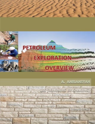
Petroleum Exploration Overview

This document provides an overview of petroleum exploration. It describes the life cycle of an oil and gas field, including the exploration, appraisal and development, production, and abandonment phases. The exploration process involves studying surface features like oil seeps and outcrops to identify potential hydrocarbon reservoirs. Subsurface data from techniques like seismic surveys is also used. Basin analysis examines sedimentary basins where source rocks may have generated hydrocarbons that migrated and were trapped in reservoir rocks. The goal is to identify "petroleum plays" with the highest probability of containing producible oil and gas to justify drilling exploratory wells. Subsurface data acquisition methods help map underground geology before drilling begins.

Recommended
More Related Content
What's hot
What's hot (20)
Similar to Petroleum Exploration Overview
Similar to Petroleum Exploration Overview (20)
More from Andi Anriansyah
More from Andi Anriansyah (20)
Recently uploaded
Recently uploaded (20)
Petroleum Exploration Overview
- 2. i FOREWORD This book, with named PETROLEUM EXPLORATION OVERVIEW is an overview of petroleum Exploration, general overview of Oil and Gas Life Cycle, Petroleum Exploration Process such; Petroleum Origin, Sedimentary rock, Surface and subsurface Exploration, Basin Analysis and Petroleum Play. Subsurface Acquisition comprises Gravity, Magnetic, Seismic, and Electromagnetic, the type of wave, Rock Properties affect the sound waves, Type of Seismic acquisition, and Sound waves Measurements in common. This book also describe generally about the Seismic Survey such Seismic acquisition, Seismic processing, and Seismic interpretation. Seismic Data acquisition involving Energy sources and Record the sound waves (receiver), Seismic Data processing explain Seismic wavelet, Velocity, and method. Then Seismic interpretation contain Geological concept such Tectonic & Startigraphy, the Reflection configuration, Projecting backwards in time, Following or extending trends, Subsurface Geological model. Finally Exploration Drilling comprises Exploration Prospect Evaluation, and wild cat drilling. Suggestions and constructive criticism is expected in the preparation of the next book about Overview petroleum industry. August, 2018 A. ANRIANSYAH
- 3. ii TABLE OF CONTENTS FOREWORD............................................................................................................................... ¡ TABLE OF CONTENTS.............................................................................................................. ¡¡ 1. INTRODUCTION.................................................................................................................... .1 1.1 Oil and Gas Field Life Cycle.............................................................................................1 1.2 Exploration Phase.............................................................................................................1 1.3 Appraisal and Development Phase.................................................................................. 2 1.4 Production Phase.......................................................................................................... ...2 1.5 Abandonment Phase ....................................................................................................... 3 2. PETROLEUM EXPLORATION PROCESS..............................................................................3 2.1 Petroleum Origin................................................................................................................4 2.2 Sedimentary Rock.............................................................................................................5 2.3 Surface and Subsurface Exploration.................................................................................7 2.3.1 Oil Seeps................................................................................................................. 8 2.3.2 Formation Outcrops............................................................................................... 10 2.4 Wild Cat Drilling.............................................................................................................. 10 2.5 Basin Analysis & Petroleum Play.................................................................................... 12 2.5.1 Petroleum System Elements................................................................................. 15 2.5.2 Petroleum System Processes................................................................................ 15 2.6 Area Elimination.............................................................................................................. 16 3. SUBSURFACE DATA ACQUISITION................................................................................... 17 3.1 The Gravity Survey......................................................................................................... 18 3.2 The Magnetic Survey.......................................................................................................22 3.3 The Seismic Survey.........................................................................................................25 3.4 The Electromagnetics Survey …………….......................................................................26 4. FUNDAMENTAL OF SEISMIC TECHNOLOGY................................................................... .28 4.1 Types of Seismic Waves................................................................................................ 29 4.1.1 The P Wave - The Compressional Wave.............................................................. 30 4.1.2 The S Wave - The Shear Waves........................................................................... 30 4.1.3 The Rayleigh Wave - Surface Wave...................................................................... 31 4.2 Rock and Fluids Properties affects the Sound Waves.................................................... 32 4.2.1 Rock Density.......................................................................................................... 32 4.2.2 Rock Elasticity........................................................................................................33 4.2.3 Rock Porosity..........................................................................................................35 4.2.4 Fluid Type In The Pores Rock.... ...........................................................................35 4.3 Type of Seismic acquisition............................................................................................ 36 4.3.1 Seismic Reflection..................................................................................................36 4.3.2 Seismic Refraction..................................................................................................37 4.3.3 Combination Seismic Reflections & Refraction......................................................38 4.4. Sound Waves Measurements... .................................................................................... 38 4.4.1 Reflective and Refractive wave..............................................................................40 4.4.2 Depth of the Water..................................................................................................41 4.4.3 One Way Travel Time - Radial Direction................................................................42 4.4.4 TWTT (Two Way Travel Time) - Reflective Wave..................................................43 5. SEISMIC SURVEY.. .............................................................................................................. 46 5.1 Seismic Data Acquisition.................................................................................................48 5.1.1 Energy Sources (Transmitter).................................................................................48 5.1.2 Record the Sound Waves (Receiver).....................................................................50
- 4. iii 5.1.3 OBC (Ocean Bottom Cable)...................................................................................52 5.2 Seismic Data Processing................................................................................................53 5.2.1 2D, 3D, and 4D Seismic.........................................................................................54 5.2.2 Subsurface Geological Model.................................................................................58 5.2.3 Seismic Wavelet.....................................................................................................59 5.2.4 Seismic Velocity.....................................................................................................61 5.2.5 Method of Seismic Data Processing.......................................................................62 5.3 Seismic Data interpretation..............................................................................................65 5.3.1 Geological Concept................................................................................................69 5.3.2 Projecting Backwards In Time................................................................................73 5.3.3 Following or Extending Trends...............................................................................75 6. EXPLORATION DRILLING.................................................................................................... 77 6.1 Exploration Prospect Evaluation......................................................................................77 6.2 Wild Cat Drilling In Exploration........................................................................................78 7. CONCLUSION ...................................................................................................................... 80 REFERENCES .......................................................................................................................... 82
- 5. 1 1. INTRODUCTION As we know the formation of the earth, the creation of petroleum, and the accumulated of hydrocarbon happened from millions of years ago. In this book we are going to discussed some of the scientific techniques and tools that geologists and geoscientists used today, to find this oil and gas accumulations. Petroleum exploration is a process that used a science and technology to find where to drilled the first well. In this book we are going to describe and illustrate the techniques and their tools that will allow petroleum engineers and petroleum geoscientists to see deep underground into what we call the sub surface. With good tools and proper interpretation we can increase chances of finding profitable accumulations of oil and gas, and how do we pinpoint the exact location that will maximize or chances of finding producible oil. 1.1 Oil and Gas Field Life Cycle Before we pinpoint the exact location of oil and gas accumulation area, let's examined what is called the life cycle of a well or Oil and gas field (Pic. 001). Pic. 001. Oil and gas Life cycle 1.2 Exploration Phase The first stage in getting oil and gas to market is called exploration; this is where the geoscientist and the petroleum engineer’s work together to locate and drill into a location that they think will produce oil (Pic. 002).
- 6. 2 Pic. 002. Petroleum Exploration phase 1.3 Appraisal and Development After they find traces of oil and gas, they must praise and evaluate the commercial potential of that discovery. In doing that they determine how much oil is available, the type of oil and gas that is present and the extent of the fields size, in a sense they calculate if they're insufficient petroleum to justify further investment. in other words will the field produce enough oil to help recover all the cost and still make a profit, will it be commercial (Pic. 003). If they determine enough oil, they will then plan the development of the field. They select were wells to be drilled, to determine the size and extent of the field. Next they planned and budget equipment tools and manpower needed to bring the field into production. Pic. 003. Petroleum Appraisal and development phase 1.4 Production Phase When all is in place the production phase begins this is where the fields starts to produce oil and gas, where to start would actually make money, in fact to production stage is the only stage that makes money and must make enough to support the other faces and still make a profit . This stage can last from a few years two decades depending on the size of the field (Pic. 004).
- 7. 3 Pic. 004. Petroleum Production phase 1.5 Abandonment Phase When there is no longer enough produce able Hydro carbon to make a profit the wells will be shut down. Before it is abandon however there are environmental concerned that must be addressed, it should be the goal of all oil professionals to leave the well sites of an abandoned well in the pristine condition that it was found, before drilling began. 2. PETROLEUM EXPLORATION PROCES This book we will concentrate on the face of exploration, let's go back to the question how do we pinpoint the exact location that will maximize our chances of finding produced able oil. To help understand the process of pinpointing an exact location to drill, let's examined what geoscientists and geologist do. In petroleum exploration they studied the surface and sub surface of the earth by looking for evidence of the lithificasion of organic material in the rock, the diagenesis of hydrocarbons, the migration of oil into a reservoir rock and the entrapping and accumulation of these hydrocarbon molecules (Pic. 005).
- 8. 4 Pic. 005. Petroleum Exploration – Surface, Subsurface, Hydrocarbon generation 2.1 Petroleum Origin By using the organic theory of how oil is created, they pinpoint possible formations were hydrocarbons could accumulate (Pic. 006). Geologists and scientists study the surface of the earth, it’s mountains it's oceans it's, and valleys it's plains, they studies satellite images of the earth, they look for signs of oil, places where oil seeps to the surface, they examine the rock types, formations, and structures called outcrops, and they use the process of elimination, once to eliminate or cross out areas where they cannot get access or areas that they know through experience will not contain oil, like areas all made up of igneous or metamorphic rock (Pic. 007). Pic. 006. Organic theory in Petroleum exploration
- 9. 5 Pic. 007. Hydrocarbon in Sedimentary Rocks 2.2 Sedimentary Rocks Sedimentary rocks commonly divided by two type there are Clastic and Non- Clastic (Pic. 008). In Petroleum exploration field the hydrocarbon reservoir usually Clastic sediments most of them is Sandstone, some of them in limestone, and few of them may in Volcanoclastic.
- 10. 6 Pic. 008. Sedimentary Rock Classification Some literature describe Clastic (silisiclastic) rocks (80-85% of the stratigraphic record), and carbonate rocks (10-15% of the stratigraphic record), and the restOrganic (carbonaceous) sediments rocks, evaporates, and volcaniclastic sediments.The environments of Clastic deposition usually in Deltas, Fluvial system , deep water. Etc. (Pic. 009) Pic. 009. The environments of Clastic deposition
- 11. 7 The Carbonate sediments and rocks (Pic. 010), Carbonate sand usually either of (fragmented) skeletal remains or non-skeletal grains. Biogenic carbonate formation occurs by a wide range of organism (e.g., mollucs, corals, forams, algae, bacteria, and many others). Most organisms initially form unconsolidated carbonat sediments coral reefsand microbial mats (e.g., stromatolites) are example of more solid carbonate structures. Carbonate mud (micrite) is commonly the product either of chemical precipitation or alga/ bacterial activity. Chemical precipitation produces non-skeletal carbonate grains of various size (e.g., ooids, pisoids, micrite). Pic. 010. Carbonate sediments and rocks Evaporites commonly lithify into consolidated rocks upon formation, and volcanoclastic sediments such Lava (cooled magma flows) and pyroclastic material (ejected particulate material). 2.3 Surface and subsurface of the earth Let’s examine the methods they used to study the surface and Sub surface of the earth in a little more detail.
- 12. 8 2.3.1 Oil seeps In the first method they looked for signs of oil on the surface, and oil seep is an area where the oil trap has been broken and oil is now seeping naturally to the surface (Pic. 011). For thousands of years people have been able to use the oil that seeps in pools and tar pit on the surface of the earth because this Oil was as easy to find, as you can see in the illustration (Pic. 012), gas use components in crude oil have evaporated, believing these heavier tars. Pic. 011. Oil seep in Surface Pic. 012. Gas evaporated to become Tar Nowadays Geologist still look for these seeps because they suggests that trap oil maybe present nearby, that the black marine shale other source rock might be nearby in the sub surface, in this image Of a hypothetical oil seep (Pic.
- 13. 9 013) you can see that entrapped oil is still present nearby, here is another example (Pic. 014) oil is entrapped but is overflowing because there is so much, this is called a spillover of a trap. Pic. 013. Hypothetical oil seep and nearby rock Pic. 014. Oil seep in remote locations Unfortunately most oil seeps have been discovered and exploited but they're still maybe some undiscovered ones in remote unexplored areas. Since the earth is dynamic and changing as we know new oil seeps can also suddenly appear after recent earthquakes that weaken the cap rock allowing Oil to migrate to the surface (Pic. 015). Although new ones are rare we still must keep finding out for them.
- 14. 10 Pic. 015. Dynamic of Earth weaken the caprock 2.3.2 Formation Outcrops Another method the geologists and geoscientist used to study the surface of the earth's geology is to focus on formation outcrops, the surface exposure of underlying rocks, they endeavor to estimate what might be underneath by studying rock structures that have been pushed to the surface, and how can the geologists know what happens to the outcrop formations that disappeared underground into the sub surface. 2.4 Wild Cat Drilling To encourage the investments of money and time needed to drill a wild cat well, the first well that is drilled in particular area geologists and geoscientists must offer more evidence or prove then gues as to what formations of the rocks are in the sub surface. they must struggle to better the odds that oil will be found on average in only one out of four wildcat wells (Pic. 016). Pic. 016. Surface and subsurface evidence
- 15. 11 They use technology to push these averages in their favor, nevertheless the oil business is still about risk and convincing others to invest large sums of money in what will most likely be a dry hole, a term we used to describe it drilled well with no commercial oil or gas. The symbol used on geological maps or wellmap (Pic. 017) to symbolized a dry hole, so why do they take these risks? if they are lucky they will find a rich field that will not only pay for the other three wells, but also produce a large profit. they're looking for the bonanza, in any of them the geologists and go scientists meticulously compiled there's surface data to convince others that there are signs of oil and that a closer look maybe in order. Pic. 017. Wellmap and exploration wells Geologists and geoscientists also study visual evidence on the surface collected from satellite and air plane image (Pic. 018) , miles high that allow them to view areas over thousands of square miles. Pic. 018. Satellite and air plane image
- 16. 12 2.5 Basin Analysis & Petroleum Play To find a good petroleum play or hydrocarbon play, geologists start by looking for sedimentary basins, where there is sedimentary rock. The yellow and orange areas on the map (Pic. 019), demonstrate sedimentary basins the brown color symbolizes known areas of oil, in this study the geologists have colored the map to show that the Middle East is a sedimentary basin with large oil deposits. In the larger map (Pic. 019) the sedimentary basin where some of the large oil fields have been found, here we can see the location of sedimentary basins containing of the world's largest oil reserves. Pic. 019. Sedimentary basin map and sedimentary rocks These large oil fields are located here in Russia, in the Gulf of Mexico, Alaska, Canada, the North Sea, the Middle East, africa and Venezuela. They know there is oil there so they continue to explore the region for new fields, some even hidden below existing field. Hydrocarbon provinces are found in sedimentary basins. Important to know how basins are formed, Basin Analysis used to identify Hydrocarbon traps, the Stratigraphy (Source rock, Reservoir rock, Cap rock), the Maturation of source rocks, and Migration path-ways some literatures called Petroleum system. Sedimentary basins are the subsiding areas where sediments accumulate to form stratigraphic successions. The plate tectonic setting is the premier criterion to distinguish different tyes of sedimentary basins (Pic. 020). There are several main type of sedimentary basin, as follows: - Rif-type Basins from at extensional plate,are associated with increased heat flow due to mantle plumes. They occur, for example at continental margins. - Foreland-type basins form at compressional plate boundaries in front of migrating fold and thrust belts
- 17. 13 - Transtensional basins occur where plates move in a strike-slip fashion relative to each other Pic. 020. Types of sedimentary basins In The illustration (Pic. 021) shows the example of Basin Analysis, where in the first stage is Pre-rift means that the initial of basin forming, the second stage Syn-Rift means extension force of the earth crust begin to form a basin, the basin filled with sediments that become first formation sediments and the basin may rotated resulting fault blocks, and then the post-rift, the basin may reactivate again where the second sediments fill become the second formation, of course the basin sediment effected by depositional environment such delta, lacustrine deep water etc.
- 18. 14 Pic. 021. Basin Analysis example We sometime can see the sedimentary basin in seismic profile (Pic. 022), the seismic profile interpreted in regional scale (hundreds to thousands of KM long) Pic. 022. The sedimentary basin in seismic profile example
- 19. 15 Petroleum system can be define as the essential elements and processes and all genetically-related hydrocarbons that occur in petroleum show, and accumulations whose provenance is a single pod of active source rock. 2.5.1 Petroleum System Elements The Petroleum System Elements (Pic. 023), consist of following: 1. Source Rock - A rock with abundant hydrocarbon-prone organic matter 2. Reservoir Rock – A rock in which oil and gas accumulates, it has porosity (space between rock grains or fractures in which oil accumulates), permeability (passage-ways between pores or pore fractures through which oil and gas move). 3. Seal Rock- A rock through which oil and gas cannot move effectively (such as mudstone and claystone). 4. Migration Route – Avenues in rock through which oil and gas moves from source rock to trap. 5. Trap – The structural and stratigraphic configuration that focuses oil and gas into an accumulation. Pic. 023. The Petroleum System Elements 2.5.2 Petroleum System Processes The Petroleum System Processes (Pic. 024) consist of following: 1. Generation – Burial of source rock to temperature and pressure regime sufficient to convert organic matter into hydrocarbon 2. Migration – Movement of hydrocarbon out of the source rock to ward and into a trap 3. Accumulation – A volume of hydrocarbon migrating into a trap faster than the trap leaks resulting in an accumulation.
- 20. 16 4. Preservation – Hydrocarbon remains in reservoir and is not altered by biodegradation or “water-washing” 5. Timing – Trap forms before and during hydrocarbon migrating. Pic. 024. The Petroleum System Processes 2.6 Area Elimination In addition geologists and geoscientists use what is known as a process of elimination, in preparing their data they look for reasons why an area can be excluded for instance they keep track of regions where it may be too dangerous to drill or areas where the rigs could not get permission to enter and drill. Political and non-geological reasons helped eliminate large as of the earth's surface that is not open to oil companies to drill (Pic. 025). Pic. 025. Area Elimination – Non Technical reason
- 21. 17 In any event, once the geologists and geoscientists have exhausted all the ways where they can require data from the surface, they turned their attention to the sub surface. Here they must rely on other types of tools and instruments to help them visualize what is down below in the sub surface, of course they want actually be able to see into the sub surface but they're tools will allow them to gather data that will enable them to plot the structures, rock types, and presence of fluids in the sub surface. 3. SUBSURFACE DAT ACQUISITION There are three basic tools that they use in the sub surface to acquire data, they are the gravity meter the magnetic meter and the seismic survey (Pic. 026), and Electromagnetics as addition tool. Surprisingly the technology used in these tools were perfected many years ago, even so this technology is still widely used today, because the technology used in these three tools still allows the petroleum geoscientists to envision the big picture of underground structures (Pic. 027). Pic. 026. Three basic tools in the sub surface acquisition
- 22. 18 Pic. 027. Underground structures 3.1 The gravity Survey The gravity meter measures the earth's gravity, the second the magnetic meter measures the earth's magnetic field, the third is the seismic survey measures sound waves refracting and reflecting of different layers of rock. Let’s look at each in more detail the gravity meter first measures that changes in rock density in the sub surface. The standard acceleration gravity constant (G) was first developed by isaac newton in the seventeenth century, today scientists have precise calculated G to equal 9.80665 m/s2 (nine pointing eight zero six six five meters per second squared) (Pic. 028). G represents the gravitational constant of the entire earth (Pic. 029). Pic. 028. The gravity meter measurements
- 23. 19 Pic. 029. Gravitational constant (G) However small deviations from this number can be measured at the surface of the plane using a gravity meter (Pic. 030), it indicates small variations in the rock density below, the last number five for example can vary between plus or minus five digits depending on the density of the rock below, this allows the geologists to measure density changes (Pic. 031). Pic. 030. Gravity meter - small deviations
- 24. 20 Pic. 031. Density changes example This is important to get G or the gravity constant of a local area, a gravity meter is put on the ground to measure whether the sub surface has a high or low density, igneous and metamorphic rocks have slightly higher densities than the average density of the earth, so when igneous and metamorphic rocks are presents, they will measure a slightly larger G reading. With sedimentary rock, the gravity meter measured slightly lower G that the average G of the earth, by taking several measurements over an area on the surface of the earth, petroleum geoscientist can begin to construct maps illustrating the positions of the different rock types below (Pic. 032). they then plot this data on a grid making countor maps (Pic. 033), high G are usually colored red indicating harder high density rock structures, low density rock or sedimentary rock is usually colored blue, it is these sedimentary rock formations and basins in blue that the geologist is interested in (Pic. 034). Pic. 032. Local gravity measurements and results
- 25. 21 Pic. 033. Gravity maps example Pic. 034. Sedimentary rock formations and basins map
- 26. 22 Surely this data is very accurate for specific locations but it can give the geologists a fairly accurate big picture of a large areas, it allows the geologists and geoscientists to eliminate areas of igneous and metamorphic rock and concentrate on the large areas where there are sedimentary basins where oil and gas may have accumulated (Pic. 035). Pic. 035. Sedimentary basins 3.2 The Magnetic Survey The second tool is the magnetic meter has a compass that points to magnetic north (Pic. 036), where in the earth we find large deposits of igneous rocks made up of iron or magnesium, these large structures can be very magnetic which allows the magnetic meter to deflect slightly from true north. by identifying these smaller magnetic fields, the magnetic meter like the gravity meter allows the Geoscientist to use the recorded measurements over a large areas to build contour maps (Pic. 037) to illustrate the presence of small magnet variations. Areas of high magnetic variations or colored red and those with low magnetic variations or colored green, the red areas our associated with igneous rocks and the green areas are associated with sedimentary basins. This example of how geoscientists use the process of elimination, they eliminate the areas of igneous rocks from further exploration consideration.
- 27. 23 Pic. 036. Magnetic survey and magnetic measurements Pic. 037. Topography, Gravity, and Magnetic model These tools while useful to view the big picture, can only suggest were to look further, Survey Magnetic by plane (Pic. 038). More detailed today is still needed to determine if the sedimentary basins contain traps and hydrocarbon accumulations.
- 28. 24 Pic. 038. Survey Magnetic by plane There are some examples of models of computer generated maps of formations that contain different structures like an declines and faults with their depths and heights, by also studying countor maps we can see what is called across profile of a structure underground (Pic. 039). It is what we might see if we could cut into the surface, like we would have a layer cake. Here we can see what looks like a mountain underground these negative numbers indicate that you are below surface, from raw data to Contour (Pic. 040). We can see what might be and anticline using how powerful computer tools we can rotate the 2D and 3D visual contour maps to look at structures from different directions and angle from the top to the bottom, from any perspective what we are looking for is closure. Pic. 039. Cross profile of a structure underground
- 29. 25 Pic. 040. Raw data to Contour. 3.3 The Seismic Survey The third and most useful most powerful tool in the geoscientist’s tool now is the seismic survey. This tool uses sound waves that allow petroleum geoscientists and petroleum engineers to interpret what is in the sub surface (Pic. 041). Seismic surveys are made from sound waves that travel through the earth, like the science used to understand gravity and magnetism, the technology for acquiring, processing and interpreting seismic waves has been around for a long time. What make seismic surveys so useful today and why we still use this technology is because powerful computer processing capabilities. A coupled with it advance software development allow us to record pinpoint and interpret with ever increasing accuracy where oil and gas might accumulate. But how do we pinpoint the exact location that will maximize our chances of finding produce able oil.
- 30. 26 Pic. 041. The seismic survey 3.4 The Electromagnetics Survey Electromagnetic methods use the response of the ground to the propagation of incident alternating electromagnetic waves, made up of two orthogonal vector components (Pic. 042), an electrical intensity € and a magnetizing force (H) in a plane perpendicular to the direction of travel. Pic. 042. Two orthogonal vector components
- 31. 27 Electromagnetic method use Transmitter and receiver, where the electromagnetic anomaly is the difference of Primary field and secondary field (Pic. 043) Pic. 043. Electromagnetic anomaly Electromagentics – Sea Bed Logging SBL (Sea Bed Logging) is a marine electromagnetic method that has the ability tomap the subsurface resistivity remoterly from the seafloor. The basis of SBL is the use of a mobile horizontal electric dipole (HED) source transmitting a low frequency electromagnetic signal and an array of seafloor electric field receivers. A hydrocarbon filled reservoir will typically have high resistivity compared with shale and a water filled reservoirs. SBL therefore has the unique potential of distinguishing between a hydrocarbon filled and a water filled reservoir. Pic. 044. SBL (Sea Bed Logging)
- 32. 28 4. FUNDAMENTAL OF SEISMIC TECHNOLOGY Understanding the fundamental of seismic technology we need to understand the basic scientific principles of sound waves. When you drop a rock into water a wave is created, it brings out in the circular pattern. The circle pattern is called the wave front from the source we draw a line that serves as a right angle to the way, we called this hypothetical line a ray, it allows us to give direction to the way front. If you are in the water you can feel the motion of the wave as it spreads over and past you and it causes you to move. With when this wave the high is called peak and the bottom of the wave is called the trough (Pic. 045). Natural waves are caused by natural forces on the earth. When you swim in the ocean or a big like you can see or feel the motion of the waves as a rushed to shore, just like water waves we can create sound waves that behaves similarly. Pic. 045. The peak and the trough of the wave As we know geoscientists use energy sources or guns to create sound waves that are shut down into the earth, these waves are then measured with receivers was called geophones on land and hydrophone at sea (Pic. 046). Here are some examples of graphs that have been created using data from these receivers (Pic. 047). They basically allow us to visually illustrate the formations and rock types below.
- 33. 29 Pic. 046. Receivers geophones and hydrophone Pic. 047. Data from the receiver’s example 4.1 Types of Seismic Waves There are three types of seismic waves that our principle interest to the geoscientists and the petroleum engineers (Pic. 048). Here will look at water waves to give us it better understanding of sound waves and how they work. The first wave is the P wave or the compression wave, the second is that S wave or shear wave, and the third wave is called the Rayleigh wave or the surface wave (Pic. 049), all three are used in seismic work.
- 34. 30 Pic. 048. Three types of seismic waves Pic. 049. P wave, S wave, and the Rayleigh wave. 4.1.1 The P Wave -The Compressional Wave Let’s look at them in closer detail, will start with the p wave the compressional wave, imagine you are the blue dot in this picture (Pic. 050), now notice when the wave hits you it pushes you forward and then back. 4.1.2 The S Wave - The Shear Waves The S wave or the shear waves this wave is what you would experience on the ocean the wave pushes you up and then down and then up. Measuring the relationship between the P wave and the S wave allows us to calculate the travel time of a sound wave (Pic. 050).
- 35. 31 Pic. 050. P wave and S wave in Seismic survey 4.1.3 The Rayleigh Wave - Surface Wave The third wave is the Rayleigh wave or surface wave, in this waves the energy travels along or near the surface. Again let's look at these two blue dots (Pic. 051), the two dots move up and down but the dot nears the surface fields more of up and down movement, the measurements of the magnitude of this wave allows us to make corrections when hydrophones or sound waves in water are used. We use the properties of these waves to help us build seismic surveys; we measure the travel times of these waves as they bounce off the earth's underground structures (Pic. 052). Pic. 051. Rayleigh wave in Seismic Survey
- 36. 32 Pic. 052. Seismic survey - underground structures 4.2 Rock and Fluids Properties affect the Sound Waves Let’s talk about what these waves illustrate (Pic. 053), the sound waves are affected by four properties when they pass through air, fluid or rock. The material or rocks and fluids properties that influence seismic wave, propagation or velocity. Pic. 053. Rock Properties affect the sound waves 4.2.1 Rock Density The first property that affects sound waves is the density or mass divided by the volume for example we have already mentioned that sound passes through hard rock faster than soft rock (Pic. 054).
- 37. 33 Pic. 054. The density or mass divided by the volume in Seismic survey 4.2.2 Rock Elasticity The second property is elasticity of matter or Rock, with elasticity matter returns to its original shape after being hit by a wave (Pic. 055), some of the energy is absorb but some of it is reflected back (Pic. 056). Pic. 055. Elasticity-Rock elasticity
- 38. 34 Pic. 056. Some wave Reflected back, some wave refracted and reflected Amazingly rock is elastic, it will stretcher expand just like an elastic band which after being stretched will return or snapback to its original shape, it is the rocks ability to return to its form or shape that made it elastic (Pic. 057). Pic. 057. Elastic band and Rock elasticity When rock is hit with some wave the rock expands and then contracts. Instruments can measure this movement (Pic. 058), for instance hard rock with tidier stacked atoms a matrix crystal doesn't contract as much as soft rock.
- 39. 35 Pic. 058. Different elasticity in layer affects the Seismic wave 4.2.3 Rock Porosity The third property that affects sound waves is porosity or the amount of pore space in the rock (Pic. 059), these pores depending on their size, changes of the speed of sound waves. if there are big pores sound waves will passed through slower than if the pores are smaller or no pores at all. Pic. 059. Rock porosity or pore space in Seismic Survey 4.2.4 Fluid Type in the Pores Rock The fourth property that affects sound is the saturation or type of fluid in the pores, for instance a sound waves passes through water at the fastest rate and slows down somewhat in the presence of oil and it's slows even further in the presence of gas or air within the pores (Pic. 060).
- 40. 36 Pic. 060. Fluid properties in Seismic Survey All of these properties affect the wave sound waves are recorded. By studying their variations we can determine the density, the elasticity, the porosity, and fluid saturation in the structures below, ultimately they allow us to determine formation characteristics such as rock type, depth and shape. 4.3 Type of Seismic acquisition 4.3.1 Seismic reflection Let’s look at how we can calculate distance for instance. Here we have a blindfolded geoscientist who wants to know how far away a wall is (Pic. 061). By having amused only his ability to hear the sound waves, let's see how we can figure out how far with that wall is, when listening to human speech with normal hearing you do not have to face the speaker. He can have his back to you and yet you can hear what he is saying, how in the room the sound waves created by his voice bounce off the wall the ceiling the floor. This wave reflected back into your ears we called these waves that bounce back reflective waves, to measure them we calculate the time it takes for a wave to get to the wall and then reflect back we call this two way travel time TWTT (Pic. 062).
- 41. 37 Pic. 061. The distance of wall Pic. 062. TWTT (two way travel time) 4.3.2 Seismic Refraction Before we go on we are going to show this example notice that some of the waves continued downward and some of them come back. The sound waves that do not bounce back but continue traveling out from the source through air, water, walls, whatever are calls refractive waves (Pic. 063).
- 42. 38 Pic. 063. Refractive waves 4.3.3 Combination Seismic Reflections & Refraction When we create waves we create refractive waves that continue on and reflective waves that after hitting a boundary bounce back. Both of these types of waves are used to help determine the properties of rock like the density, the elasticity, the porosity and fluid saturation (Pic. 064). Pic. 064. Seismic reflections & refraction in Petroleum exploration 4.4 Sound Waves Measurements Now we're going back to the blindfold geoscientist, he still needs to know how far away the wall is, to find out he will need an energy source a timing device and a receiver (Pic. 070). We began by creating an energy wave, he should off is energy wave and using a receiver with a timing device he can now get the time and calculate how long it took for the wave to travel to the wall, reflect of it and travel back. He can measure the sound waves two way travel time (TWTT) then records that the TWTT is 0.1 s (zero point one second). now knowing the exact travel time he can calculate the distance, from physics he knows that the sound travels through an environment of standard temperature and pressure at a velocity of 347 m/s (three hundred and forty seven meters per second), by using this formula and knowing that (D) equal OWTT (one way travel time) and (d) equals TWTT, we can write distances is equal to velocity multiplied
- 43. 39 by the time or d equals the (v) times (t), to calculate TWTT we write (d) equals (v) times (t) divided by 2 (two). The blindfold of geoscientists figures how far away the walls is, remember he measures the time it took for the sound wave to travel through the wall and back, if we only wants to measure the time it took for the sound wave to travel just to the wall, then we must divide the traveled time by 2(two), there for putting this numbers into the formula he write (d) equals v (velocity) times t (time) divided by 2 (two) equals 347 m/s ( three hundred and forty seven meters per second) time 0.1s (zero point one second) and divide by 2 (two) equals 17.35 m (seventeen point three five meters). The blindfold geoscientist now knows is 17.35 m (seventeen point three five meters) from the wall this is the basis of seismic (Pic. 071). Pic. 070. Timing and a receiver data Pic. 071. TWTT Distance measurements Measuring the time it takes for sound waves to travel to a boundary and back we can measure high, width and depth (Pic. 072). Understanding how to interpret these measurements of simple sound waves gives us eyes to see into the sub surface, now let's apply this concept to help us decide where to drill our
- 44. 40 first wild cat well. In this drawing we have placed our sound receiver geophone land and hydrophone in off shore. Pic. 072. Measuring sound waves time to travel to a boundary and back (high, width and depth) 4.4.1 Reflective and Refractive wave When we fire the gun sound waves created by the detonation flow out in a circle or radio direction, the wave of interest is the wave that takes the shortest most direct path (Pic. 073), using our geophone or hydrophone we record the reflected wave as it returns to the surface, by closely timing the reflected raise TWTT we can calculate the exact amount of time the waves journey takes the refraction wave continues downward and outward creating another reflective wave (Pic. 074) when it detects another boundary, because it is influenced by the density elasticity porosity and the saturation all of the matter it travels through. Pic. 073. The wave reflective and refractive waves on land
- 45. 41 Pic. 074. The wave reflective waves on ocean Our geophones and hydrophones allow us to accurately record all of these reflected waves traveled times and from these we can guess what is in the subsurface each reflection that comes back will represent another layer or boundary of where rock type changes (Pic. 075). Pic. 075. The wave represents layers or boundary of rock type changes 4.4.2 Depth of the Water Let’s look at an actual example of using seismic technology, here in the picture (Pic. 076) we have a ship out in the ocean doing seismic work. The first challenge for the geoscientist is to find the depth of the water (Pic. 077).
- 46. 42 Pic. 076. Seismic technology use in ocean Pic. 077. Seismic use in measure the depth of the water 4.4.3 One Way Travel Time - Radial Direction Let's look at how they can calculate the depth using seismic, first the geoscientists calculate the velocity of sound wave in water and then they will use the velocity calculation to determine how deep the water is under our ship, they place the guns at this point (Pic. 078) on the surface of the water, next they place the last sound receiver on the string at a precise location of 1000m (one thousand meters) away from the gun, then the gun is fired creating a sound wave.
- 47. 43 Pic. 078. One way travel time - radial direction This wave travel in a radial direction now they measure the length of time that this part of the wave takes to travel through the water from the gun to the last hydrophone, because they measured it they already know that the distance from the gun to the hydrophone is 1000m (one thousand meters) their timing device report that the traveled time was 0.6757 s (zero point six seven five seven seconds), they insert these numbers in their formula (D) equals (v) times (t) or (v) equals 1000m (one thousand meters) equals (v) time 0.6757s (zero point six seven five seven seconds), so for (v) we rewrite the formula as (v) equals (D) over (t) or (v) equals 1000m (one thousand meters) divided by 0.6757s (zero a point on six seventy five seven second). we calculate that (v) is 1480 m/s (one thousand four hundred and eighty meters per second), note that this is only one way travel time we are measuring only the time it took the wave to travel from the gun to the hydrophone. Then the velocity of this direct wave traveling through water is 1480 m/s (one thousand four hundred and eighty meter per second) (Pic. 078). the measurements of this yellow direct wave is one way travel time because it did not reflect back, it did that bounce off of any boundaries, that direct way we've traveled straight from the gun to the hydrophone. 4.4.4 TWTT (Two Way Travel Time) - Reflective Wave Now let's look at a reflective wave, here we have the first red wave (Pic. 079). Now using TWTT formula (d) equals (v) times (t) divided by 2 (two), they can calculate the depth of the water. in this calculation they are going to measure the sound wave emitted from the gun but this time instead of measuring the travel time to the last hydrophone in the stream they measure the travel time through the first. In addition they will now vertically measure the radio direction travel time of the sound waves as a reflex of the bottom, their timing device reports that the total travel time is 0.45s (zero point for five seconds) but they only wanted to measure the reflective time so they divide their total travel time by
- 48. 44 2 (two). Going back to the formula (D) equals (v) times (t), they now must account for the two way travel time TWTT, so our formula will read (d) equals (v) times (t) divided by 2 (two). putting in their numbers, they write (d) equals 1480 m/s (one thousand four hundred and eighty meters per second), time 0.45s (zero point forty five seconds) divided by 2 (two), doing the math they know that (d) equals 333 (three hundred and thirty three meters) so the depth of the water is 333m (three hundred and thirty three meters) (Pic. 079). Pic. 079. TWTT (Two way travel time) - Reflective wave By plotting this line in red, we measured the depth of the ocean (Pic. 080). This is what they call seismic data with no processing, this means that they make no corrections for noise, angles etc. we used the data exactly as it is recorded we will call this the X direction and it represents each hydrophone and its distance from the source. We represent TWTT (two way travel time) for each hydrophone, using computers we can measure and then plot the wave as it moves out to each hydrophone. By looking at the axis X and Y we can see the overlaps from the various hydrophone (Pic. 081), this impressions or lines represent different rock boundaries, as we have illustrated seismic technology allows us to see into the sub surface by using sound waves properties to illustrate formation characteristics such as rock type, depth, and shape, we have the sub surface structures (Pic. 082), now that we know the fundamental properties of seismic technology.
- 49. 45 Pic. 080. Seismic measure the depth of the ocean Pic. 081. Seismic measure the depth and rock boundaries in the ocean
- 50. 46 Pic. 082. Seismic identify formation characteristics 5. SEISMIC SURVEY Let’s discuss the three phases involved in the science of sound waves that help us in our decision of where to drill the first well. The names of the three phases are data acquisition, data processing, and data interpretation (Pic. 083). Pic. 083. Three phases of Seismic Survey
- 51. 47 Like their names apply data acquisition is where we get or collect the information (Pic. 084), data processing is where we use the data we acquired to make measurements and calculations (Pic. 085), and the data interpretation is where we analyzed, evaluate and make conclusions about what all the data means or signifies (Pic. 086). Pic. 084. Seismic data acquisition Pic. 085. Seismic data processing
- 52. 48 Pic. 086. Seismic data interpretation 5.1 Seismic Data Acquisition In data acquisition we go into the field on land or offshore to actually make measurement with our seismic equipment (Pic. 087). Pic. 087. Seismic data acquisition on land and on ocean 5.1.1 Energy Sources (Transmitter) Let’s look at the equipment used to first create seismic waves and then to record them, there are several types of equipment used to generate and record seismic wave, depending on the surface and sub surface location, composition and conditions. We will begin with equipment called the energy source (Pic. 088).
- 53. 49 Pic. 088. Seismic energy source The energy sources used to create a sound wave, there are three types of sources. The first is the air gun (Pic. 089), it is used offshore in water. The second is dynamite (Pic. 090), it is used on land typically in wetlands like jungles and swamp. The third is a vibrator mounted on trucks (Pic. 091), it is typically used on land in dry conditions like deserts where the soil is loosely compacted. Pic. 089. The air gun used in offshore or in water
- 54. 50 Pic. 090. Dynamite used on land Pic. 091. a vibrator mounted on trucks 5.1.2 Record the Sound Waves (Receiver) The next piece of equipment is called the receiver (Pic. 092), and it is used to record the sound waves. The receiver used on land is called geophone and the on offshore is called a hydrophone (Pic. 093).
- 55. 51 Pic. 092. The receiver Pic. 093. Geophone & hydrophone Both have the timing device to measure the time the sound wave traveled from the energy source to the receiver (Pic. 094). In making the recordings for instance on land, we direct explosion into the rock and then measure how fast it comes back, if the sound travels through hard rock will come back much faster than if in soft rock.
- 56. 52 Pic. 094. Measure the time of sound wave from the transmitter to the receiver 5.1.3 OBC (Ocean Bottom Cable) Let we mention one last tool that is used in data acquisition, OBC (ocean bottom cable) (Pic. 095). This seismic tool permits surveys to be done after the offshore field has been developed, when a seismic ship can no longer pull the traditionally 4(four) kilometer long string of hydrophones through that congested offshore rigs and platforms, and ocean bottom cable is used. This OBC is designed to be laid or dragged on the ocean floor and contains a series of geophones, not hydrophones that are normally used up shore. Pic. 095. OBC (ocean bottom cable)
- 57. 53 5.2 Seismic Data processing We used all of this equipment to acquire data, sent to computer centers to process the acquired data, this phase is called data processing (Pic. 096). They use computers to make very sophisticated graphs using filters to remove background noise and other unwanted effects. Here are some examples of graphs that have been created using the data from these receivers (Pic. 097), they allow us to visually illustrate the formations and rock types below the earth surface Pic. 096. Seismic data processing Pic. 097. Examples of graphs created using the data seismic
- 58. 54 Let's review, we have an energy source that admit the sound wave, a fire vibrate or explode the energy source and then measure how long the sound wave of takes to get back to our measuring device, called receiver. In other words we measure the time the sound waves take two bounce back to our receiver like measuring an echo. Sound waves travel through hard rock like igneous and metamorphic, at different rate of speed than soft rock, like sedimentary rock, we can record these sub surface echoes that bounce back from the different rock types (Pic. 098). The time for the echo to return gives us a way to determine the rock boundaries or the places where rock type changes. As we move our source and receivers around on the surface and take the new echo measurements, we can collect data that is then fed into computers that it allows us to describe the shape of the rock formations below over a large area. Pic. 098. Sound waves travel through the different rock types 5.2.1 2D, 3D, and 4D Seismic We can illustrate this data on 2D or two dimensional maps, as well as in 3D three dimensional, and 4D four dimensional maps. 2D maps have x and y coordinates, they appear flat on a page. 3D three dimensional models have an x, y, and z coordinates, they appear lifelike like the images our brains seize their images with depth, with these facsimiles we can see these structures and closures the weight fluid flows where the oil water and gas come together at the contact lines. By compiling the images in three dimensional models we can better visualize what is there (Pic. 099). In 4D maps we compare 2D and 3D three dimensional maps over time (Pic. 100).
- 59. 55 Pic. 099. 2D, 3D, and 4D Seismic Pic. 100. 4D Seismic For example, here we have a producing field with its permanent data represented in an image in 4D we look at that same field three years later maybe after we have extracted oil from the formation and have more exact data, we compare a leave available data to see if there has been any changes over time and if so, what those changes are. We also look for changes that can help predict future production forecast, therefore in 4D we have width, height, depth, and time (Pic. 101).
- 60. 56 Pic. 101. 4D Seismic can help predict future production forecast Here’s another example in this study they did a seismic survey in 1990, they’re repeated the survey in 2000 (Pic. 102), so then we can start to see fluid movement and understand how fluid is moving through the reservoir. These services were done in 1985 and again in 1999 (Pic. 103), fourteen years later. After fourteen years it is possible get a picture of what is happening inside the reservoir, the effect of pressure and saturation can be identified as well as a rise in the OWC (Oil water contact) line, here instead of oil you see mostly water (Pic. 103).
- 61. 57 Pic. 102. Seismic survey in 1990 & 2000 identify fluid movement Pic. 103. OWC (Oil water contact) line movement from 4D Seismic Now the question is to determine if it will pay to continue drilling or to shut down this field. The advantage of 4D is that of the four variables of rock properties, density elasticity, porosity, and fluid saturation. Only fluid saturation can be tracked over time. 4D seismic allows the geoscientists to see these changes over time, these examples seem make it clear how useful 4D seismic
- 62. 58 survey are in understanding the effects of the changes that the place over the life of an oil well/ field, and its reservoir. 5.2.2 Subsurface Geological Model Mature producing reservoir need frequent monitoring to help identified drilling options, select well intervention opportunities locate untapped reservoir and monitor field development. To construct seismic surveys, like the following (Pic. 104), in this survey you can see physical properties or shapes of information they have been colored by our geoscientists to allow us to see more easily the shapes or formations (Pic. 105). Pic. 104. Example Construct seismic surveys
- 63. 59 Pic. 105. Seismic physical properties or shapes of information In essence these surveys allow us to see what is in the sub surface, remember that geology is a special science, it's the primary mandate is to define what type of rock occupies, what space. They can then construct fairly accurate pictures, maps and models of what is in this subsurface (Pic. 106). In the second phase data processing its all about collecting the data and compiling it, so that later can be read in the final or third stage of data interpretation. Pic. 106. Subsurface model 5.2.3 Seismic Wavelet Here is an example of a seismic chart (Pic. 107), where each line represents a wavelet and geophone or hydrophone receiver, or can we call traces. We might have 40 or 50 in our ray, a drawing of a wave reflecting back to a receiver. As we remember the first started talking about waves, we mentioned that the highest point of a wave called a peak it has given a plus value, the lowest point of wave is called trough it is given a minus value. let we see how the geosciences used the plus component of a peak and the minus component of trough, this can be illustrated more clearly if we rotate our image of a wave ninety
- 64. 60 degrees so that it looks like the picture (Pic. 108), the horizontal angle of the peak is just a little higher and to the right of the trough which is a little lower to the left. If we color the peaks black but make the trough white, we can start to see patterns. These patterns take the form or mimic, the pattern of the rock formations below. In the picture (Pic. 108) seen another example of 4 (four) steps, but service can have as many as twenty five steps or more. Remember when in data acquisition they send the data to large computer centers. Pic. 107. Seismic wavelet Pic. 108. Seismic pattern of the rock formations and processing steps
- 65. 61 To process to this data, very large computers are necessary, anyway and each step the images made clearer, by the 4th (fourth) image we can start to see lines and shadows that resembled the sub surface geology. Once we determine the velocity of the waves as we saw earlier, we can determine the depth of the water and rock boundary (Pic. 109). Pic. 109. Velocity of the waves identify depth of the water and rock boundary 5.2.4 Seismic Velocity In our chart the picture (Pic. 110), we see that the first waves travel time was 1s (one second), the second waves travel time was 1.33s (one point three three seconds), the third 1.66s (one point six six seconds) and the fourth was 2s (two second), with the exact time we can calculate the depth. Remember the velocity of the wave changes as a travels through the different rock types, and denser rock the waves travel faster. using (v) for velocity (dz) for depth of the zone and (z) for the total depth, we can solve the following equation depth equals velocity times time divided by two, (v) equals 1500 m/s (a thousand five hundred meters per second), (dz) equals 1.0s (one point zero seconds) times (five teen hundreds) divided by 2 (two) equal 750m (seven hundred fifteen meters), (z) equal 750m (seven hundred and fifty meters), second zone (v) equals 2000m/s (two thousand meters per second) dz equals 0.33s (zero point three three the second) times 2000 (two thousand) divided by 2 (two) equals 330m (three hundred and thirty meters), (z) equals 1080m (one thousand and eighty meters), third zone (v) equal 2500m/s (two thousand five hundred meters per second) (dz) equal 0.33 (zero point three three seconds) times 2500 (two thousand and five hundred) divided by 2 (two) equals 412.5m (four hundred and twelve point five meter) (z) the equals 1492.5m (one thousand four hundred and ninety two point five) meters. fourth zone (v) equals 3000 m/s (three thousand meters per second) (dz) equals 0.33s (zero point three three seconds) times 3000 (three thousand) divided by 2 (two) equals 495m (four hundred and ninety five meter) and (z) 1987.5m (one thousand nine hundred and eighty seven point five meters) so we get a total basement depth of 1987.5m (one thousand nine hundred and eighty seven point five meters).
- 66. 62 Pic. 110. Seismic Velocity measurements example We have seen how they can use the wave is to determine the velocity as a function depth they measure the time from the first wave to the last wave and then used that to calculate to the depth of all these different layers or geological boundaries. As planned they are another step closer to being able to decide where to drill the first wildcat well. 5.2.5 Method of Seismic Data Processing In the second phase of data processing, there are two methods used raw data and filtering. Each method is used for a specific purpose (Pic. 111). Pic. 111. Method of Seismic data processing
- 67. 63 Seismic Raw data The first method uses the raw data directly from the recorders, with no filters like when they measured the depth of the water in the example we just discussed no filters were used, they just measure the travel time of the way from the gun to the hydrophone. Seismic Filtering The second method however uses data that has undergone filtering (Pic. 112), this mean the motor noises by our own or other boats nearby for example create their own sound waves that could be read by our instruments, because this sound wave made distort or interfere with our data this noise needs to be filtered out, these interfering background noise is can cause shadows or a fall steps. Pic. 112. Seismic Raw data Here is the picture (Pic. 113) an example of filtering, normal move out or NMO is a depth correction process, as you move out to the farthest hydrophones, the measure graze get longer but the depth does not change, at first glance it might appear that these longer reflected raised suggest increasing depth because they are longer the picture (Pic. 114).
- 68. 64 Pic. 113. Example of filtering - NMO (normal move out) Pic. 114. Example of filtering NMO, depth does not change As we can see however in this illustration that the depth of the water has not changed just the length of the reflected wave, in this case we must make it data correction (Pic. 115). Here is an example of a graph with the corrected wave let using the NMO technique. By using these various techniques that computer can adjust the data so that more realistic forms of the structures below can start to be seen (Pic. 116) powerful computers are necessary for these kinds of data processing.
- 69. 65 Pic. 115. NMO - data correction Pic. 116. Various techniques, computer adjust the data more realistic forms of the structures 5.3 Seismic Data interpretation The third and final phases called Seismic data interpretation (Pic. 117), in this phase geoscientist and the petroleum engineers must interpret the significance of the lines represented in the service charts and graphs. To do these lines form images that resemble geological structures, if so what kinds of geological structures. By studying these surveys the geoscientists and petroleum engineers must figure out where the domes might be, where the faults might be, where the oil might have accumulated in the sub surface. In the first to face the data acquisition phase allowed them to get the data, while the data processing face allows them to organize performed calculations and compile that data now they must decide what all this compiled and calculated data means. Because much of their data is only representative, not a truth snapshot it is sometimes difficult to see what actually lies in the sub surface.
- 70. 66 Pic. 117. Seismic data interpretation Like a radiologists with X rays (Pic. 118), geoscientists must rely on their knowledge and experience to interpret what the data is representing. Pic. 118. Radiologists with X-rays Let’s look at some examples of data interpretation (Pic. 119), they will help us make decisions about exactly where to drill the well, it is here that are unites with science. Because none of our images are real but our in fact compilation of computer generated data graft on a charter manipulated into a three dimensional image (Pic. 120). The geoscientists must still give meaning, they practice the art of trying to imagine or see these structures as they actually are, understanding how oil is created as it actually was created. They must be able to envision what all of these lines, images, blank spaces mean. Next it is also advisable to have someone with experience, someone who was practiced with reading the charts and then comparing these charts to the actual formations and structures, identified and verified by actually drilling down into the sub surface.
- 71. 67 Pic. 119. Examples of data interpretation Pic. 120. Seismic and Three dimensional image Here in the picture (Pic. 121) is a seismic survey that has been colored by the computer or the geoscientists using different colored, look at this for a second can you spot the faults, now look at it again with the yellow lines add it, now do you see them? in the chart is without the other lines do you see these structures and again with the yellow lines can use spot the fault? according to the way the lines are represented we having a normal fault. We also have two horizons, a horizons is an area on the survey that has been identified to have interesting sedimentary rock. Horizons are usually color red by the computer to make them easier to see.
- 72. 68 Pic. 121. Colored seismic survey On this chart we also have coordinates (Pic. 122), again they make the charts easier to read, the x coordinate is the distance usually measured in feet or meters, and the y coordinate is the measurements of time (TWTT). These two way travel times are 1s (one second), 2s (two seconds) and so on. The two way travel timer (TWTT) is the time that the sound wave takes to travel from the energy source after the wages bounced off the boundary and then reflected back to a receiver. the computer is plot the data but it is humans geoscientists and petroleum engineers who must tell what it means and drop conclusions (Pic. 123), are these faults large enough to contain traps or oil and gas can accumulate in large enough quantities to be commercial, geoscientists and petroleum engineers interpret the seismic data to understand the sub surface geology and to assess the likelihood of finding oil and gas accumulation (Pic. 124). Pic. 122. Coordinates X & Y seismic survey
- 73. 69 Pic. 123. Analyzing seismic survey Pic. 124. Seismic modeling in finding oil and gas accumulation 5.3.1 Geological Concept Tectonic & Startigraphy There are two main Processes in geological concept. The first is Tectonic (Pic. 125) , we may have Pull Apart/Divergent, Transform/Strike Slip, Collision, or Subduction. The second is Stratigraphy very close with sedimentation and we may have Conformity, Unconformity, Hiatus, Interfingering etc., rule of thumb of geological feature is term of “The present is the key to the past”
- 74. 70 Pic. 125. Tectonic concept Reflection Configuration The structure geology and sediment structure in subsurface can be identified by interpretated seismic in some way. The Seismic profile for sediment structure can be identified by their Reflection Configuration (Pic. 126 & Pic. 127). There are Parallel (Horizontal, Inclined, undulating), Subparallel (Regular migrating, Irregular), Clinoform (Sigmoid, Oblique, Parallel, Shingled), Discordant (Angular, Lenticular, Hummocky, Contorted, Chaotic), and their continuity (Pic. 127) Pic. 126. Reflection Configuration in Seismic profile
- 75. 71 Pic. 127. Reflection Configuration - continuity Here are the examples of reflection configuration in a Seismic profile. The seismic shows us about the geological history and the possibility of Hydrocarbon migration (after petroleum geochemical evaluation), and the entrapment of Hydrocarbon Accumulation. In here (Pic. 128), there are identified some reflection configuration such Inclined, Horizontal, sigmoid, Undulating, irregular, Chaotic and Hummocky. Pic. 128. Example Reflection Configuration in Seismic profile
- 76. 72 In the picture (Pic. 129), for example some reflection configuration 2 Dimension to become unit facies in 3 Dimension geometry such Uniform become sheet, wedge become wedging, convex upward become mound, convex downward becom fill, doubly convex become lens. Pic. 129. Geometry from Reflection Configuration in Seismic profile Here in the picture (Pic. 130), reflection configuration 2 Dimension to become unit facies in 3 Dimension geometry in seismic profile such wedge becom wedging, and convex upward become mound. Pic. 130. Example Geometry of Reflection Configuration in Seismic profile
- 77. 73 5.3.2 Projecting Backwards In Time As we know seismic surveys help us visualize what is in the subsurface. For structures like structural trap they are excellent, unfortunately they're not so helpful in identifying formations like stratigraphic traps (Pic. 131). In these instances geologists and geoscientists must use less direct tools and methods to try to understand the sub surface and then interpret what is there. for instance to help depict stratigraphic traps, geologists used a technique called projecting backwards in time, simply put this is a method where looking back in time they visualize the locations of the mountains, rivers, and oceans that were present when the reservoir rock was first deposited or laid down (Pic. 132). From there they piece together possible sequences of ancient events and figure out the arts or the likelihood of a trap having been formed. They try to reconstruct the sequence or order of geological events that happened millions of years ago. Pic. 131. Structural trap & stratigraphic traps
- 78. 74 Pic. 132. Method of projecting backwards in time By understanding what might have happened first, then second, and so on, may give them an idea of whether a reservoir rock will be productive. They interpret theorized and then make models in their attempts to understand how the formations were formed in the sub surface over time (Pic. 133). Pic. 133. Petroleum formations evolution examples from Seismic In the illustration (Pic. 134) an initial dry hole (1st well) was drilled and only shale was found, no oil was found, we know that shale can be a source rock for petroleum, so we try to imagine where the petroleum that might have formed in the shale might have migrated too. Using our subsurface maps we figure out
- 79. 75 where the ancient high is. for example, a shoreline or a mountains slope, could oil formed in the shale have migrated toward to ancient high and got trapped, is there sandstone or reservoir rock to which the oil could have migrated, could the ancient high be made out of impermeable rock, and could it evaporated as a trap these are questions you ask before you decide where you will drill our next well. Pic. 134. Subsurface Evaluation of Exploration field 5.3.3 Following or Extending Trends Another method is called following or extending trends, let's look at the illustration (Pic. 135). Let’s say we have an existing field nearby and theorize that oil formation could run along the straight line, could other petroleum traps be situated along this line and further out. We follow that line hoping to discover other accumulations, we must keep in mind however that curve lines as well as straight ones can also join two points by projecting out a straight or curved line into a new field, we might find that oil was trapped in a similar trap along the same axis this is called interpolation (Pic. 135). Pic. 135. Following or extending trends or interpolation method
- 80. 76 We may have to consider other more convincing data to confirm your ideas. using different techniques and data interpretation we look for contrasts in contour lines of the wave let on the page, if we look closely and if a trained eye can see the outline of a possible anticline or fault, this is why in seismic we do kilometers at a time, this allows us to view large areas so when we put these charts together we can see if these lines come back down to form an anticline (Pic. 136) or if they are just incline. If we look where the middle red arrow is indicating you can see the top dark line has terminated (Pic. 137), maybe this is a fault, even without drilling a well we now have a good indication of what is down below. With all this information remember that three out of four wild cat holes are still dry. Pic. 136. Seismic interpretation - contrasts in contour lines of the wave let Pic. 137. Seismic interpretation and models of normal Fault examples
- 81. 77 6. EXPLORATION DRILLING Now it is time to put all of our theories into practice, knowing that three of four wildcat wells are dry, the team was not put all of their knowledge information and their experience to the test (Pic. 138). Pic. 138. Continuing evaluation where three of four wildcat wells are dry 6.1 Exploration Prospect Evaluation Exploration Prospect Evaluation is an evaluation of oil and gas field, it might consist of Geology, Geophysics, Petrophysic, Reservoir, Facility etc. In exploration fields usulally use Risk analysis method that had been used for this study is the method developed by Otis and Schneiderman (1997). They use the estimation of POS (Probability of Success) (Pic. 139)
- 82. 78 Pic. 139. POS (Probability of Success) They will give the recommendations for the next exploration activities including the location of Wild cat drilling based on the best scenario of the Field. 6.2 Wild Cat Drilling in Exploration Here in the picture (Pic. 140) is an example of a new field, let's look at how a team of geoscientists and petroleum engineers might drilled this field based on the seismic information that they got in data acquisition and the information they processed in data processing lastly they have identified the exact location to drill using their skills of interpretation. first the team has decided to drill their first well here (Pic. 140) into what data says is an anticline, they drilled the first well and discovered that the anticline is the salt dome, there is no oil insult domes but they know from past experience that oil can sometimes be trapped along the outer room of a salt dome. Gambling that this salt dome might have such a trap, the geoscientists and petroleum engineers recommended that a second well drilled further out a long where they calculate the room of the salt dome is. Hoping to located trap, they find oil. Continuing to exploit their knowledge about salt dome, they recommended that a third well be drilled on the opposite side, again they find oil. Pic. 140. Example of a new field – drilling 3 wells
- 83. 79 By now they have identified reservoir rock, so they move out further and recommend that fourth well be drilled, here (Pic. 141) along a fault in the reservoir rock, knowing that faults are excellent formations for creating traps. This time though they do not find oil, they have drilled a dry hole. Pic. 141. Example of a previous field – additional drilling 2 wells In reviewing the seismic data that now includes actual data from drilling the four wells, they recommended that a fifth well be drilled on the other side of the fall structure, oil deposits are found. As you can see this is an example of an ever evolving drilling program that changes as the team gets more information. Each well the team drills gives them real data about the zones of rock and their formation as they drill down ward (Pic. 142). Pic. 142. The Geoscientists & petroleum engineers gets more subsurface information
- 84. 80 They continually update their data and refine their models, also their properties to improve their chances of striking more oil (Pic. 143). Pic. 143. Update the data and refine the subsurface models & properties 7. CONCLUSION Let’s review, in finding the oil discovery or startup target is potentially the most Interest are. We look first on the surface, and then into the sub surface. At the surface we look for sedimentary basins and use the knowledge we know about rock properties to narrow down our choice. We look for oil seeps, we studied rock outcrops, and we use the process elimination. In the sub surface we rely on tools like the gravity meter and the magnetic meter our objective of course is to find the promising location to study further. Once we've found sedimentary basins we then conduct seismic surveys to identify structures that might contained oil. in phase one of doing this seismic
- 85. 81 survey called data acquisition, we get the information in phase two called data processing, we can convert information into charts and maps so that in phase three, data interpretation the geoscientist and petroleum engineer can help them pinpoint the exact location of where to drilled the first wild cat well. By using data from seismic and other sources that geologists and geoscientist have acquired, they process it by generating 2D (two dimensional) charts, graphs, and surveys, and by building 3D (three dimensional) models to replicate the sub surface giving them a clear picture what is below. From these charts, graphs, survey, and models the team made up of petroleum geoscientists and petroleum engineers will then begin the art science task of interpreting what is there, so that they came decide where to drill their first wild cat. In this stage they calculate if there will be sufficient petroleum for further investment, for those answers we have more tests ahead and more decisions to make.
- 86. 82 REFERENCES Aniefiok E. ,Udo J. Ibok, Margaret U., Sunday W. Petters, Petroleum Exploration and Production: Past and Present Environmental Issues in the Nigeria’s Niger Delta, American Journal of Environmental Protection, 2013. Badley, M.E. (1985) Practical Seismic Interpretation. D. Reidel Publishing Company. E. FABER, M. SCHMIDT and A. A. FEYZULLAYEV, 2015, Geochemical Hydrocarbon Exploration – Insights from Stable Isotope Models, OIL GAS European Magazine. Fernando Barrera-Rey, 1997, The Benefits of Information Sharing In Petroleum Exploration An R&D Approach to the Study of the United Kingdom Continental Shelf, Oxford Institute for Energy Studies Ione L. Taylor, 2015, METHODS OF EXPLORATION AND PRODUCTION OF PETROLEUM RESOURCES, U.S. Geological Survey, Reston, Virginia, USA. Keary, P. & Brooks, M. (1991) An Introduction to Geophysical Exploration. Blackwell Scientific Publications. Lau Richard, Overview of the Oil Industry – Petroleum Exploration, 2014. Manzoor Muhammad Wajid, 2017, SPECIAL CORE ANALYSIS, Institute of Geology Punjab University Lahore. McQuillin, R., Bacon, M. & Barclay, W. (1984) An Introduction to Seismic Interpretation – Reflection Seismics in Petroleum Exploration. Graham & Trotman. Nachtmann Wolfgang, 2012, Petroleum Exploration, RAG and Wien Nachtmann Wolfgang, 2012, Oil & Gas Production Geology, RAG and Wien Puput Aryanto Risanto, 2016, Introduction to Oil and Gas Industry Upstream Midstream Downstream, Slide share presentation. Mussett, A.E. & Khan, M. (2000) Looking into the Earth – An Introduction to Geological Geophysics. Cambridge University Press. Sukmono Sigit, (1999), Seismik Stratigrafi,Jurusan Teknik Geofisika, ITB http://www.mpgpetrole**.com/fundamentals.html www.drill-pi*es.com www.drillingcontractor.org www.drillingsoft*are.com https://www.s*b.com/resources.aspx https://www.aapg.org/ https://www.geo.wvu.edu/ http://www.geologicres*urces.com/ http://www.ncgeolsoc.org/ https://earthscience.rice.edu/ http://www.gravm*g.com/ https://www.uprm.edu/geology/ http://petroleumgeop*ysics.com/
- 87. ABOUT THE WRITER Having more than 10 years of work experiences in Oil and Gas Industry both exploration and development such as Bandarjaya / Lampung III Project (at PT. Harpindo Mitra Kharisama), Reevaluation of Diski Oil field - North Sumatra basin (at TAC PEP – PKDP), and Preliminary Fractured evaluation some oil fields (at PT. OPAC Barata-Kejora Gas Bumi Mandiri), Evaluation for Klamono Block - Salawati Basin and Evaluation for Tebat Agung Block - South Sumatera Basin (at Trada Petroleum Pte. Ltd.), Operation of Kampung Minyak oilfield (at KSO Pertamina EP – PKM) and Formation Evaluation of Tsimororo Field - Madagascar (at Lemigas), J1J3 Oil Fields - NW Java basin (at ECC). He Was Graduated from Institute Technology of Bandung, Geology Engineering Department in 2006 as S.T. (Sarjana Teknik) or Bachelor degree in Geology. Before that He was graduated from SMUN 2 Cimahi (Senior High School) in 2001, and from SLTPN 9 Cimahi (Junior High School) in 1998, also graduated from SDN KIHAPIT I (Elementary school) in 1995.