History of navigation in the River Ganga_2013
•
1 like•10,456 views

This presents a time-line of transport along the Ganga, now designated as National Waterway 1

Recommended
More Related Content
What's hot
What's hot (20)
Similar to History of navigation in the River Ganga_2013
Similar to History of navigation in the River Ganga_2013 (12)
More from India Water Portal
More from India Water Portal (20)
Recently uploaded
Recently uploaded (20)
History of navigation in the River Ganga_2013
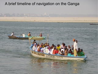
- 1. A brief timeline of navigation on the Ganga
- 2. Before the 17th century: Fragmented kingdoms mean only local transport, says J.C.Johnston Akbar brings his army to Bengal by boat in the mid-16th century
- 3. Major James Runnell, the first Surveyor General of India, was charged with mapping the Ganga in 1781.
- 4. The Golden age of navigation in the Ganga was the mid-19th century. Not only was the volume at its peak, but private steamboat companies were plying as far upstream as Garhmukteshwar. Image: "The East India Steam Navigation Company's steamer Stanley, steaming on the Ganges," Illustrated London News, 1862 (source:http://www.columbia.edu/itc/mealac/pritchett/00routesdata/0500_0599/shipping/g
- 5. Soon after this 'golden age', two other projects- the expansion of the railways and the construction of the Ganga and Yamuna canals effectively reduced the reach and volume of cargo traffic which would never after recover. Travelling 'Slowly down the Ganges' resulted in an iconic book for Eric and Wanda Newby. Part of the reason this book is so riveting is the drama created by the many problems they faced with reduced flows downstream of Haridwar. Their frustrations might be attributed to the Upper Ganga Canal which diverted most of the water out of the river itself. Navigation on the Ganga was effectively grounded by low flows and by the railways.
- 6. In 1986, the Inland Waterways Authority was established to 'develop' navigation on the main rivers of India. A 1620 km stretch of the Ganga from Haldia to Allahabad has been designated as the National Waterway no 1. (source: http://iwai.nic.in/index1.php?lang=1&level=2&sublinkid=145&lid=164)
- 7. In 1986, the Inland Waterways Authority was established to 'develop' navigation on the main rivers of India. A 1620 km stretch of the Ganga from Haldia to Allahabad has been designated as the National Waterway no 1. (source: http://iwai.nic.in/index1.php?lang=1&level=2&sublinkid=145&lid=164)
Editor's Notes
- The massive and perennial river that cuts across the breadth of the subcontinent seems to be a natural choice for transport of people, goods and armies. However, it is mystifyingly difficult to obtain reliable reports of navigation in the Ganga before the 17 th century, with the notable exception of Akbar, who brought his armies downstream to conquer Bengal. One reason for this apparent lack of interest in the use of a cheap means of transport could be the lack of law and order along the river. J.C. Johnston speculates that the fragmented kingdoms could have led to a relative lack of safety along the river.
- Major James Runnell, the first Surveyor General of India, was charged with mapping the Ganga in 1781. While his mandate was to focus on Bengal and Bihar, he did mention that river traffic was uninterrupted at the confluence of Ganga and Jamuna, or at Allahabad as we know it today. This traffic largely consisted of salt and sand. 300 years later, the sand traffic remains extant with very little difference in the boats being used.
- By the middle of the 19 th century however, trade along the Ganga from the Bengal coast to Allahabad was well established, with several steamboat companies being in operation around that time. This period can be called the golden age of navigation in the Ganga. Not only had the volume of traffic increased, but also its reach. The 1854 Gazetteer mentions that steamboats were plying as far as Garhmukteshwar, and were common upto Kanpur. Shortly after this, two other projects- the expansion of the railways and the construction of the Ganga and Yamuna canals effectively reduced the reach and volume of cargo traffic which would never after recover.