
Downloaded 22 times
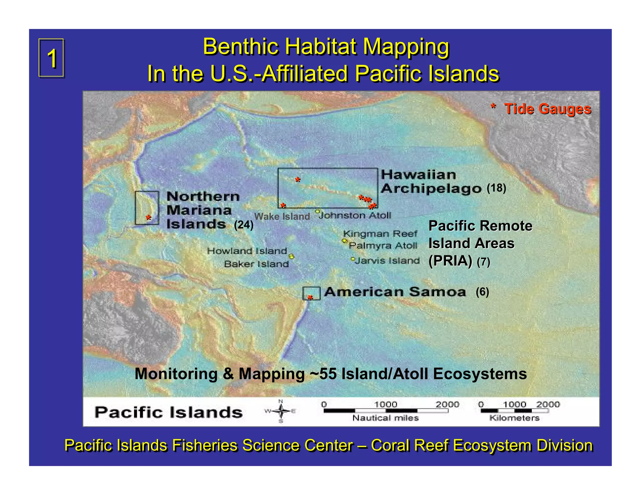
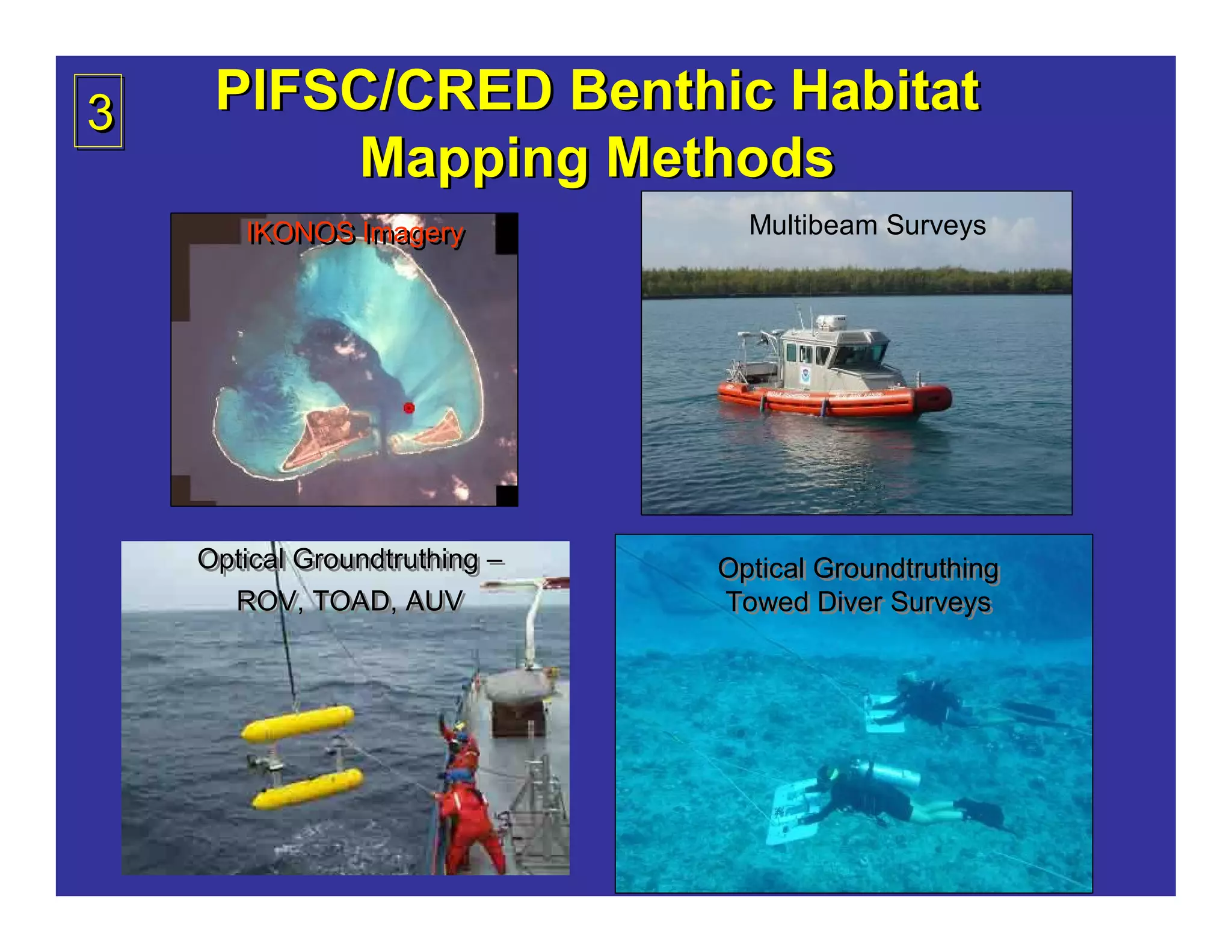
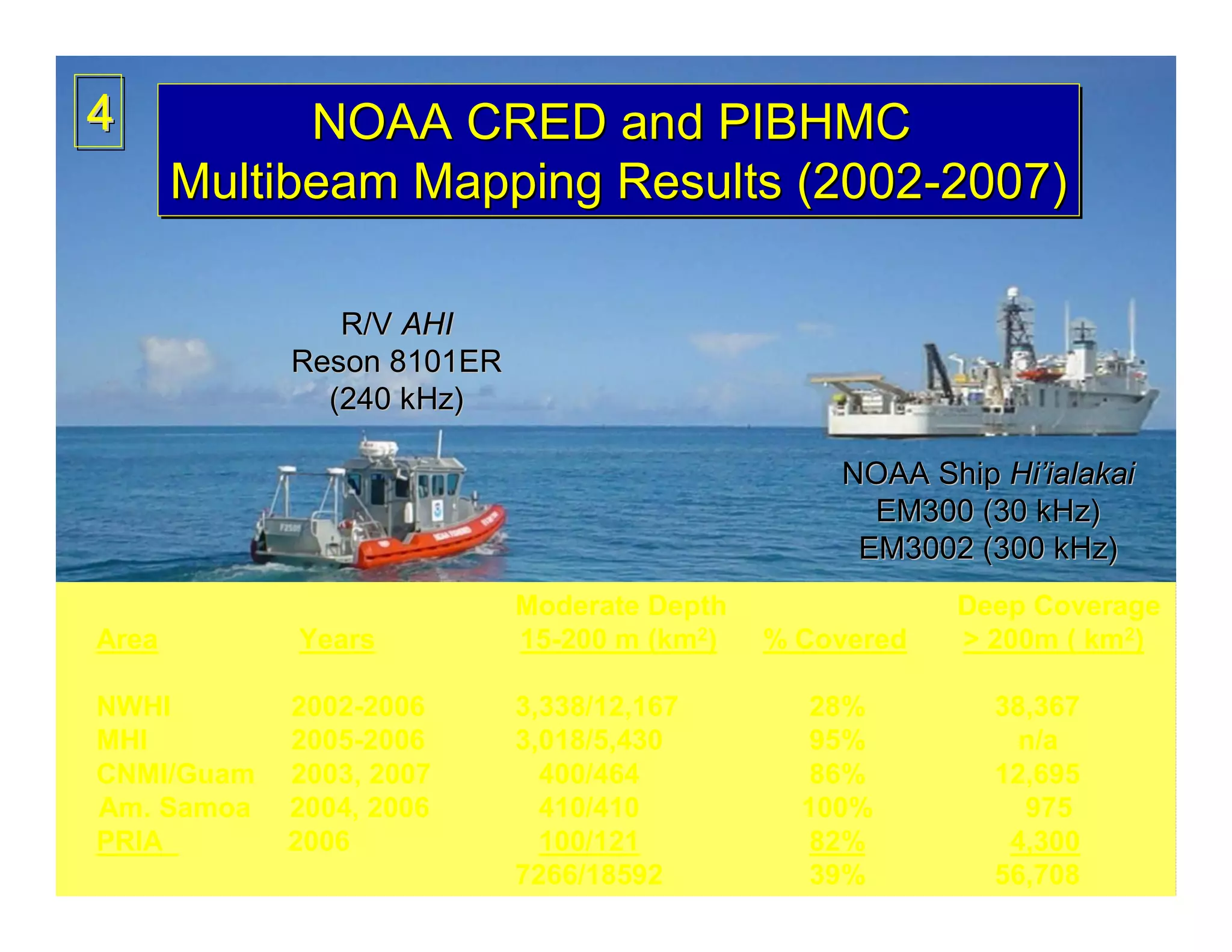
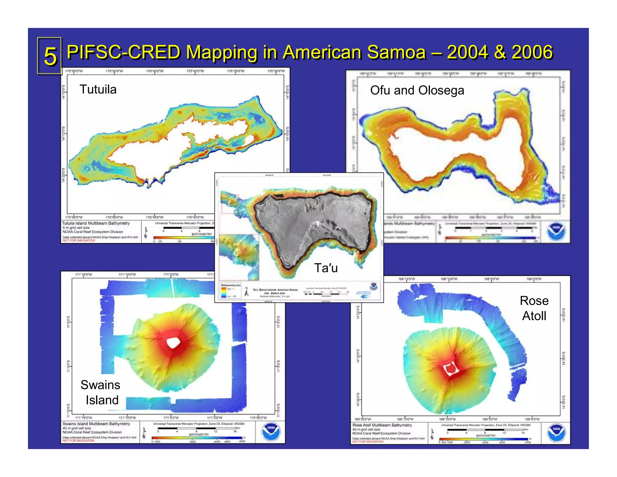
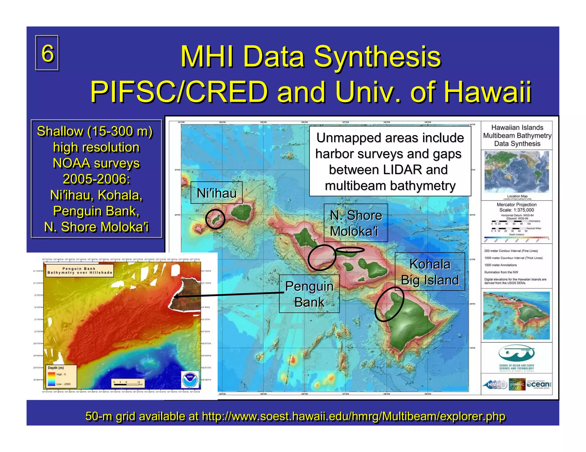
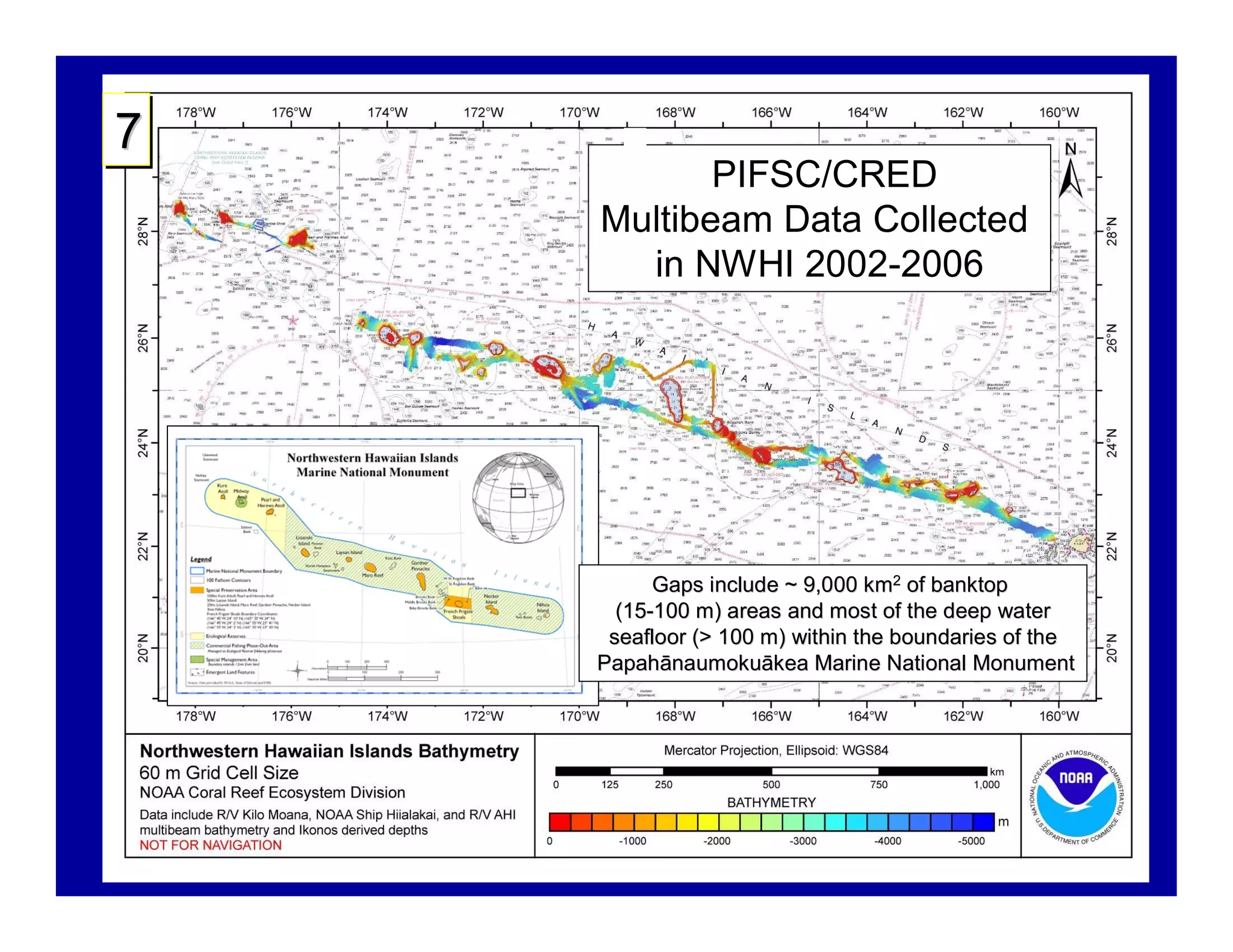
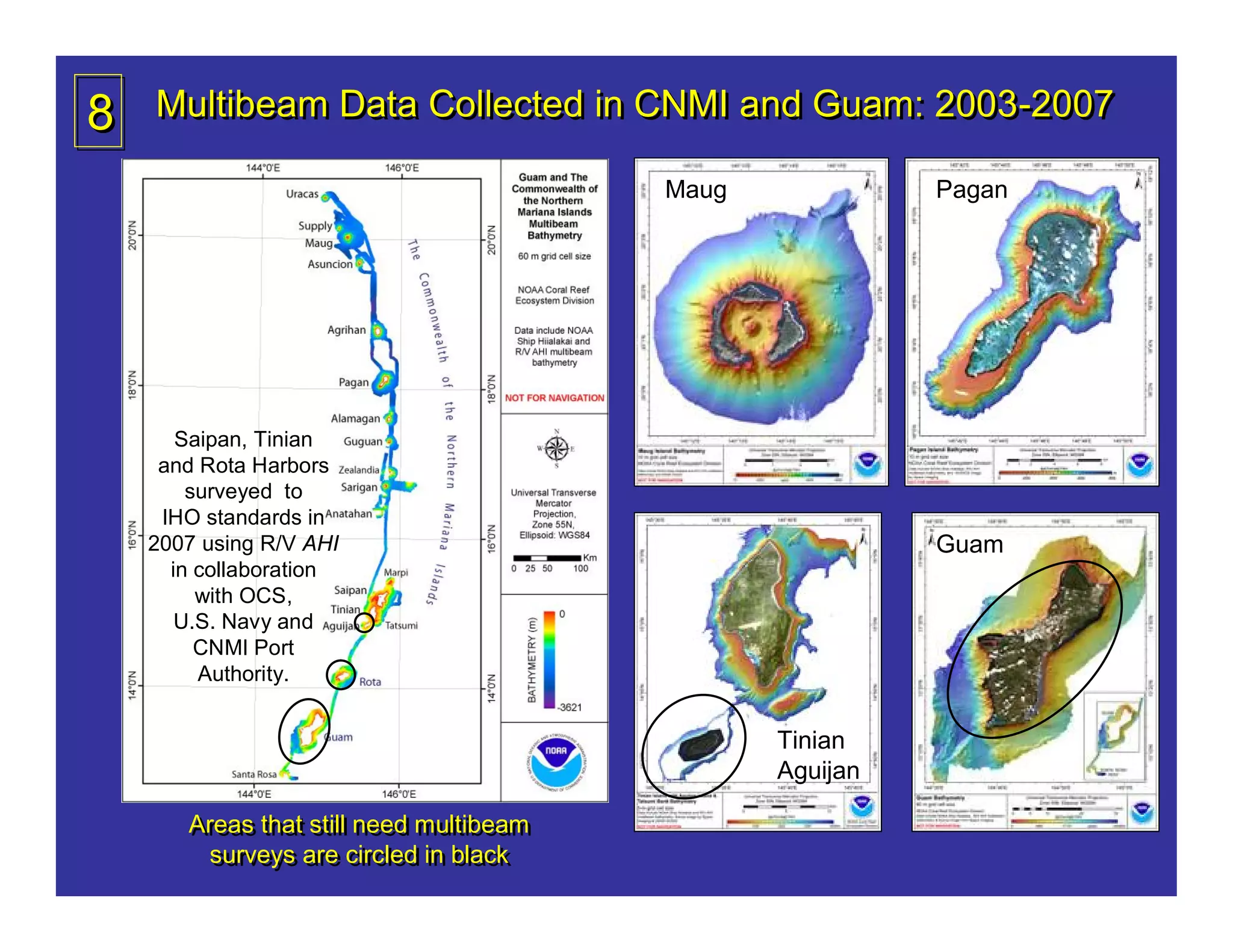
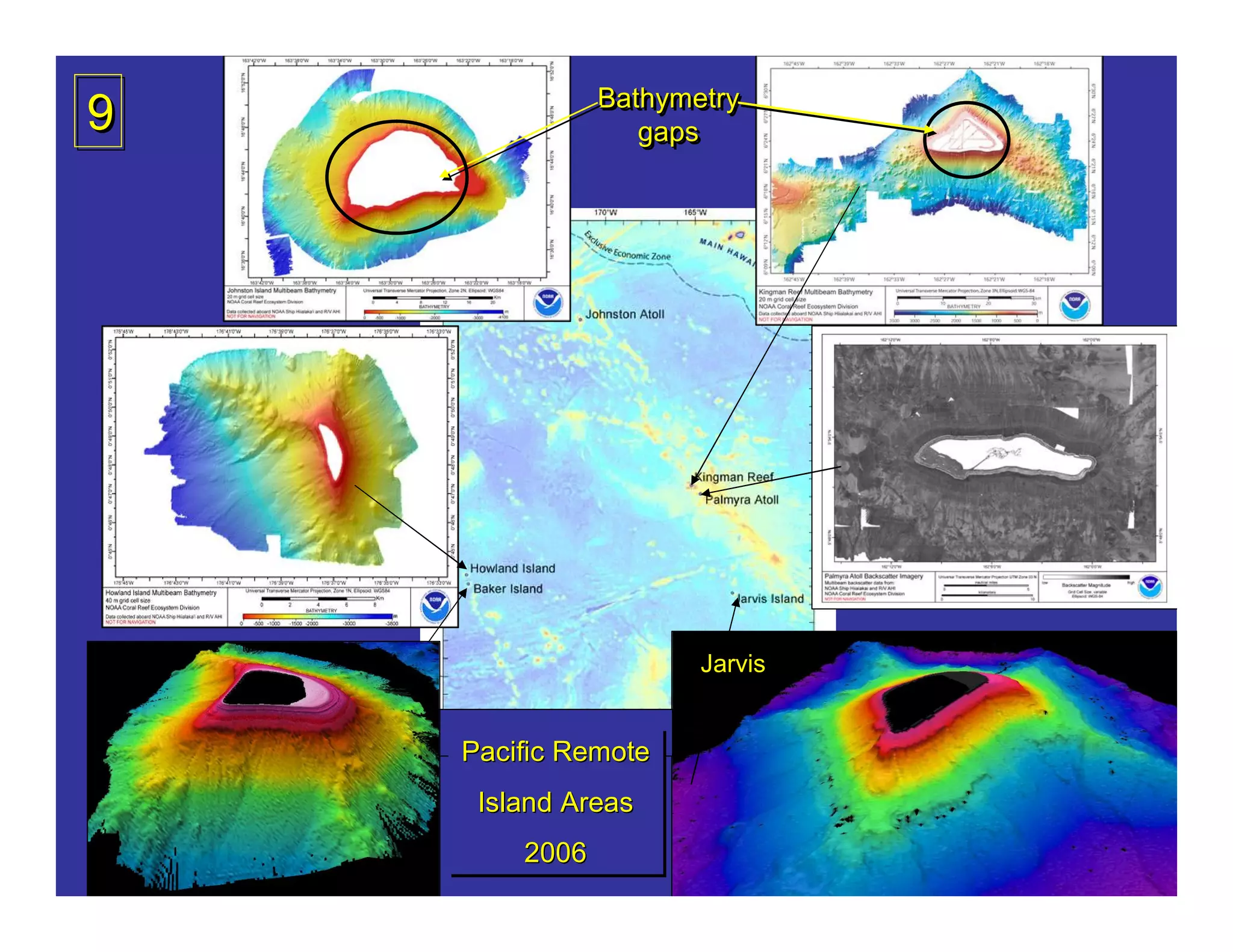
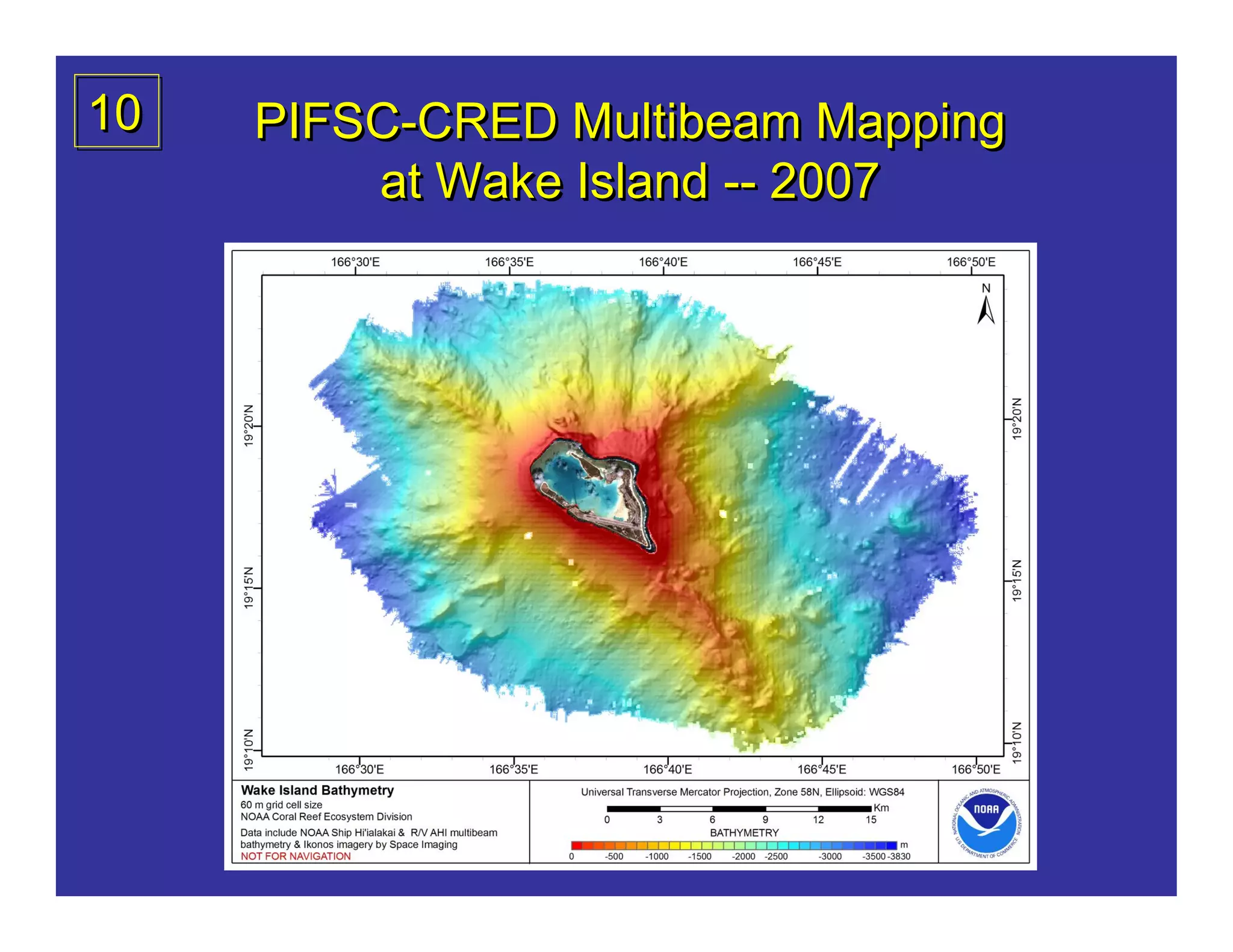
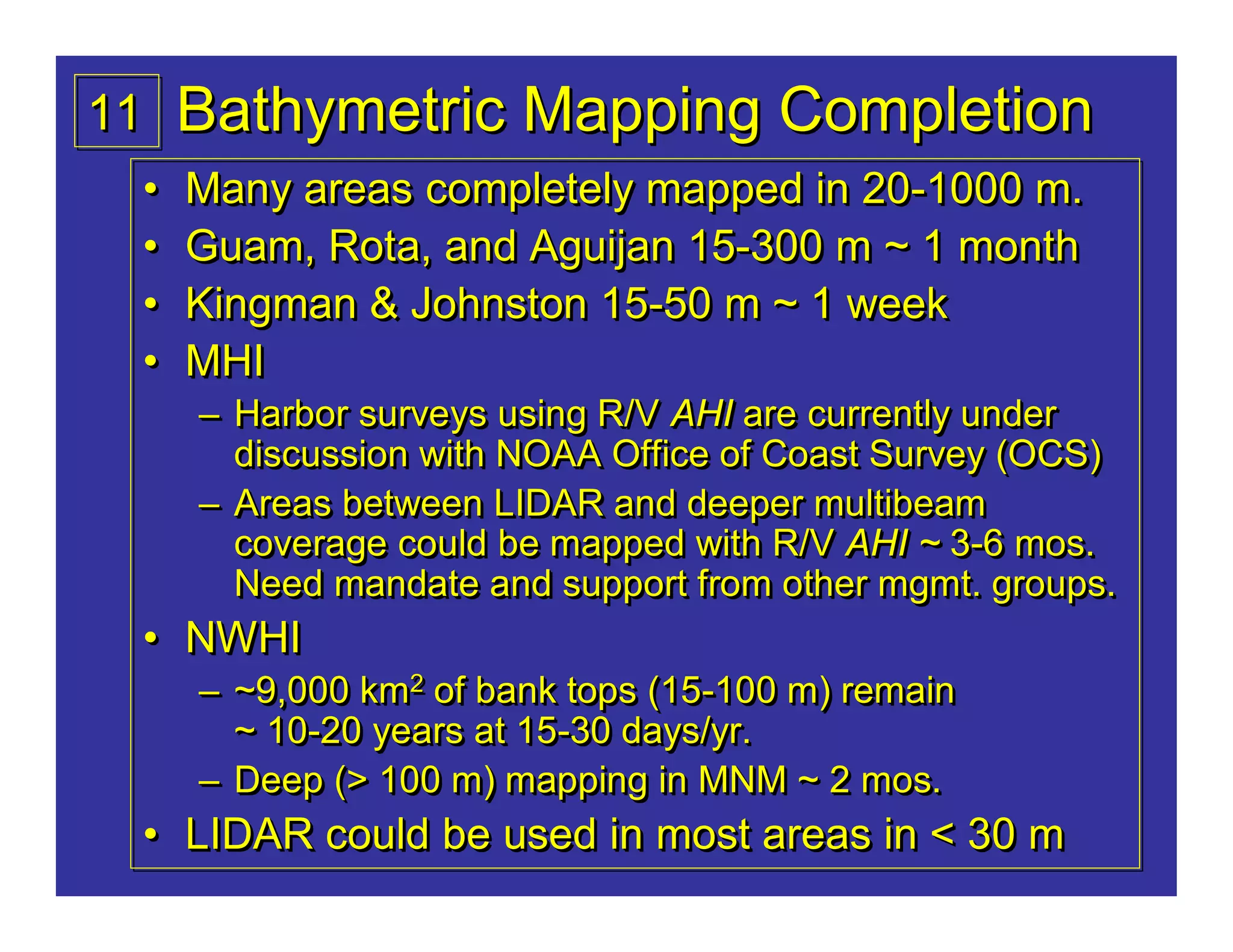
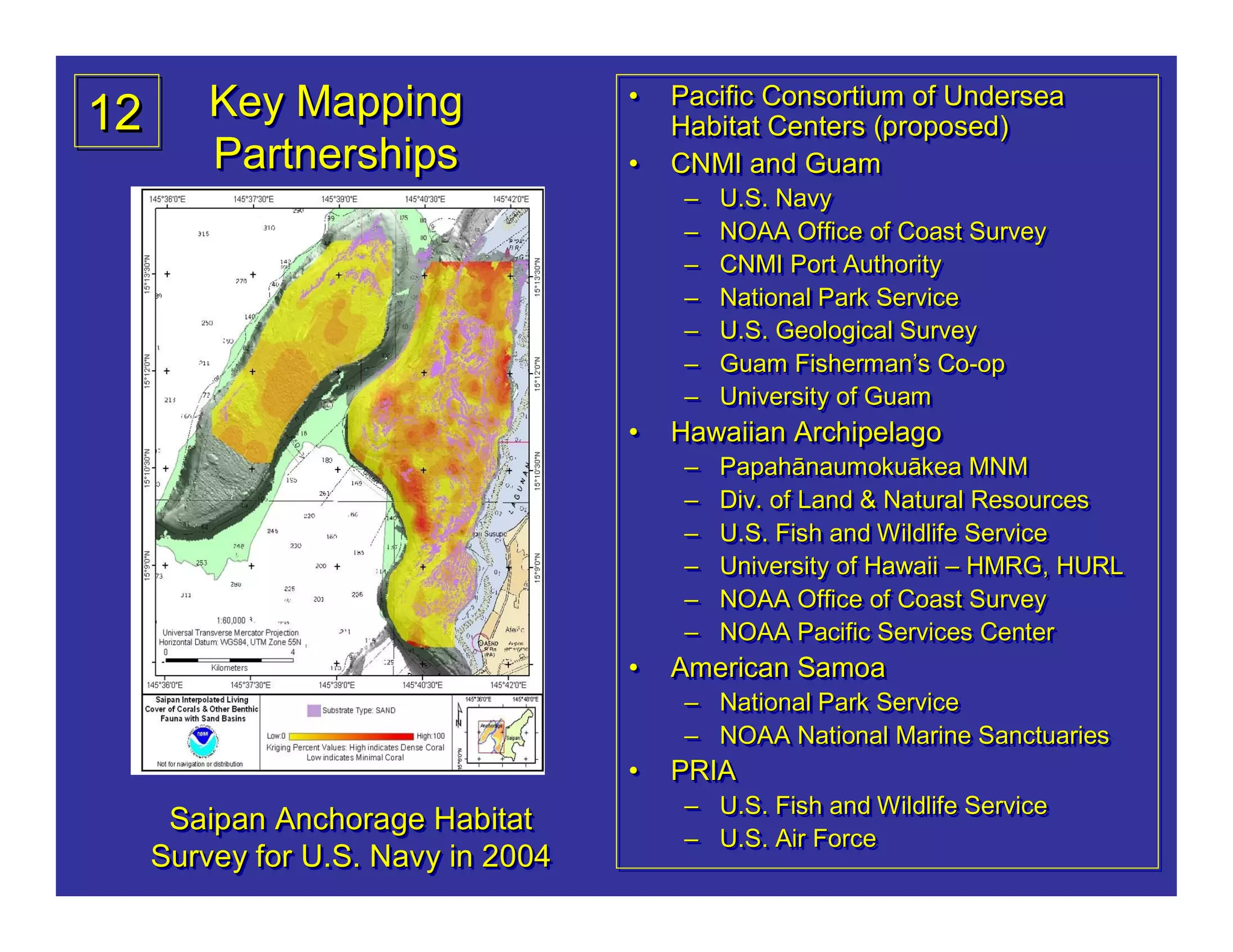
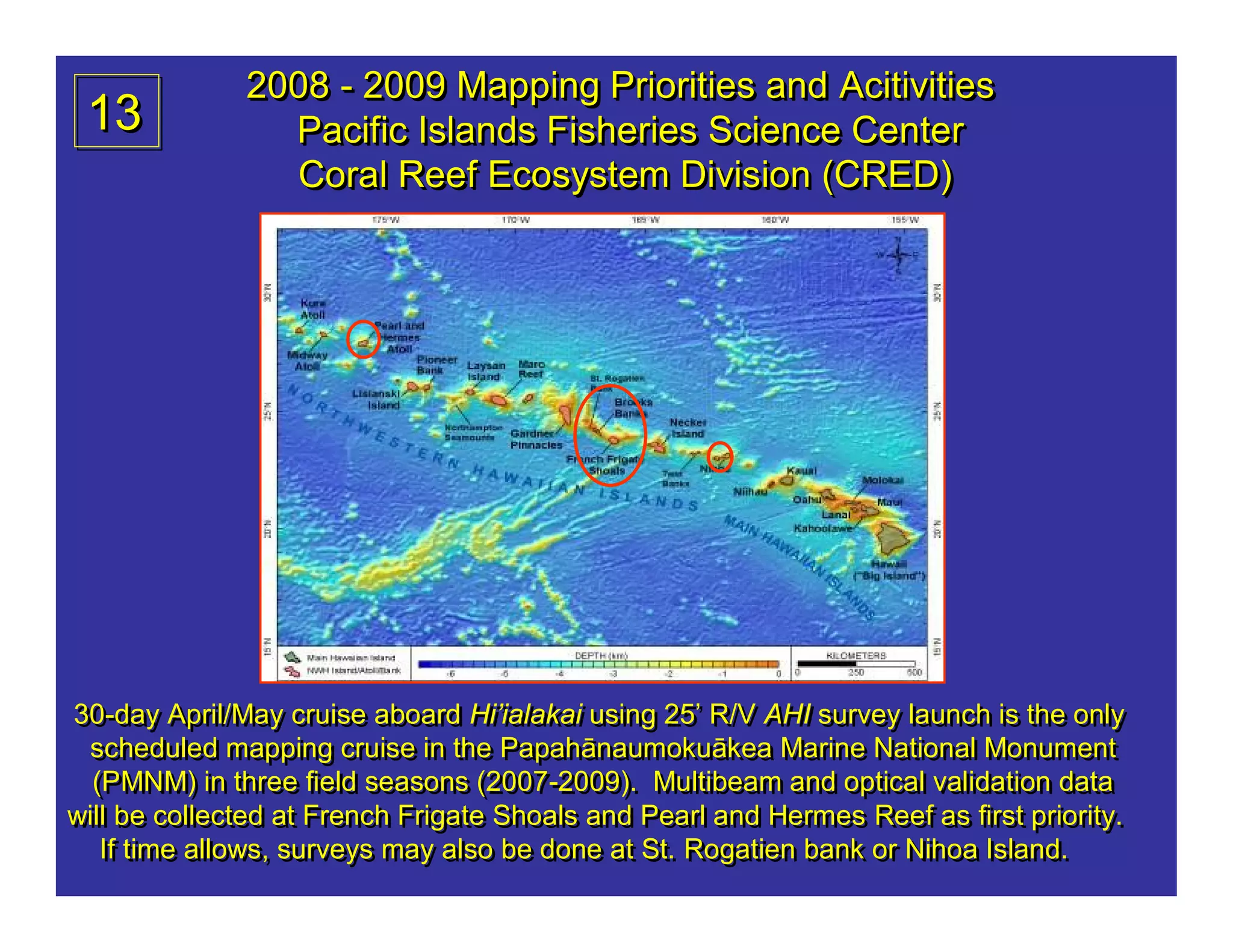
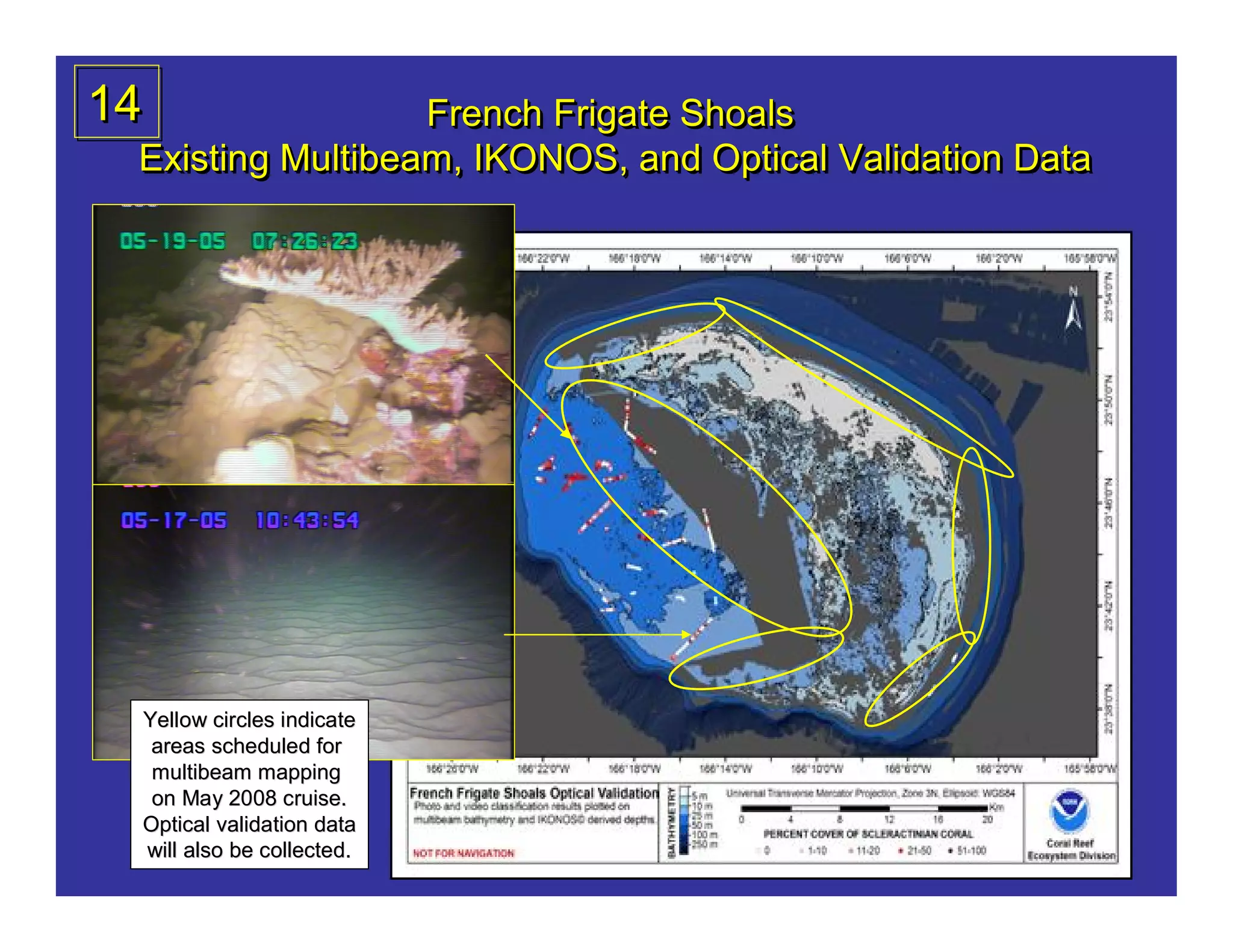
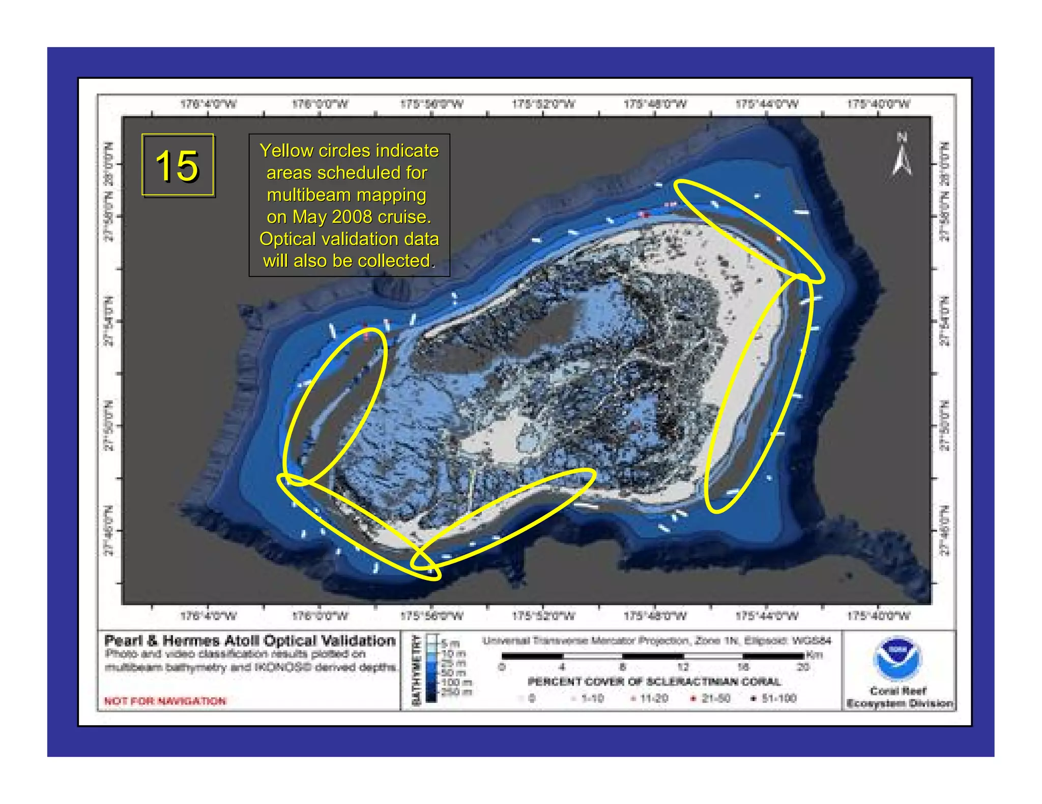


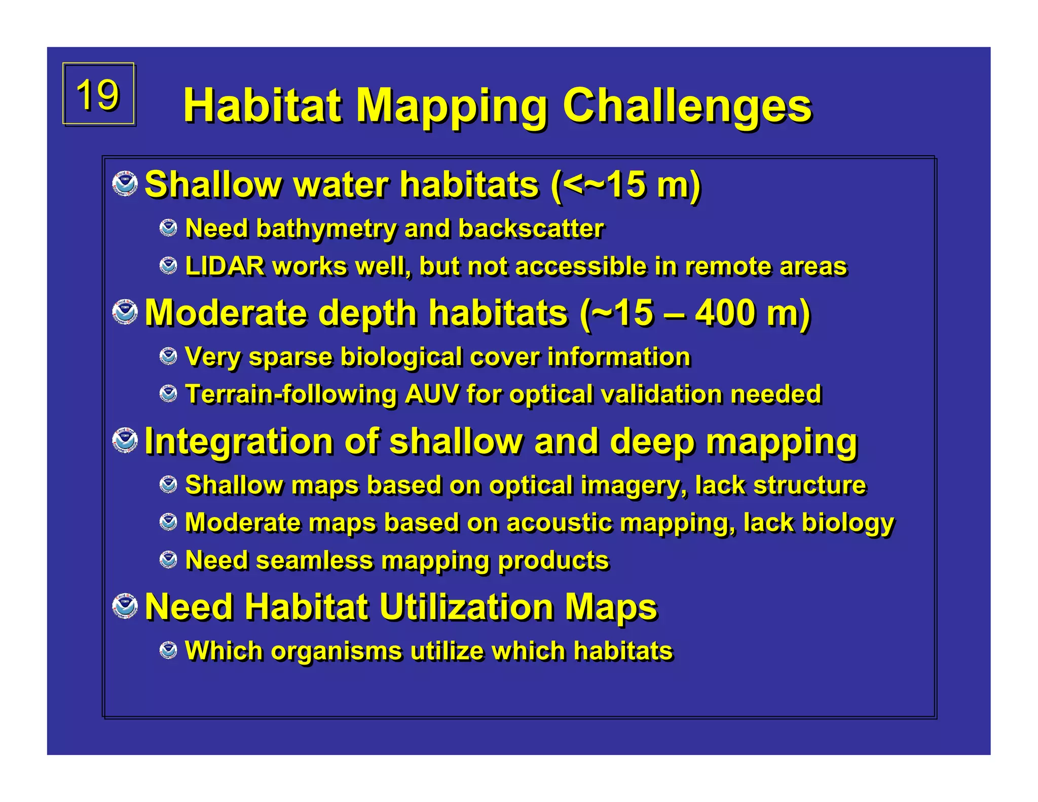
1) The Pacific Islands Fisheries Science Center is mapping benthic habitats around 55 islands and atolls in the U.S.-Affiliated Pacific Islands using multibeam sonar and optical groundtruthing to characterize coral reef ecosystems. 2) From 2002-2007, multibeam mapping was conducted around the Northwestern Hawaiian Islands, Main Hawaiian Islands, Commonwealth of the Northern Mariana Islands, American Samoa, and Pacific Remote Island Areas. 3) In 2008-2009, priority areas for additional mapping include French Frigate Shoals and Pearl and Hermes Reef in the Northwestern Hawaiian Islands to fill gaps in existing data.


![Vibe Coding vs. Spec-Driven Development [Free Meetup]](https://cdn.slidesharecdn.com/ss_thumbnails/vibecodingvsspecdrivendevelopment-251209105622-43f455e7-thumbnail.jpg?width=640&height=640&fit=bounds)


