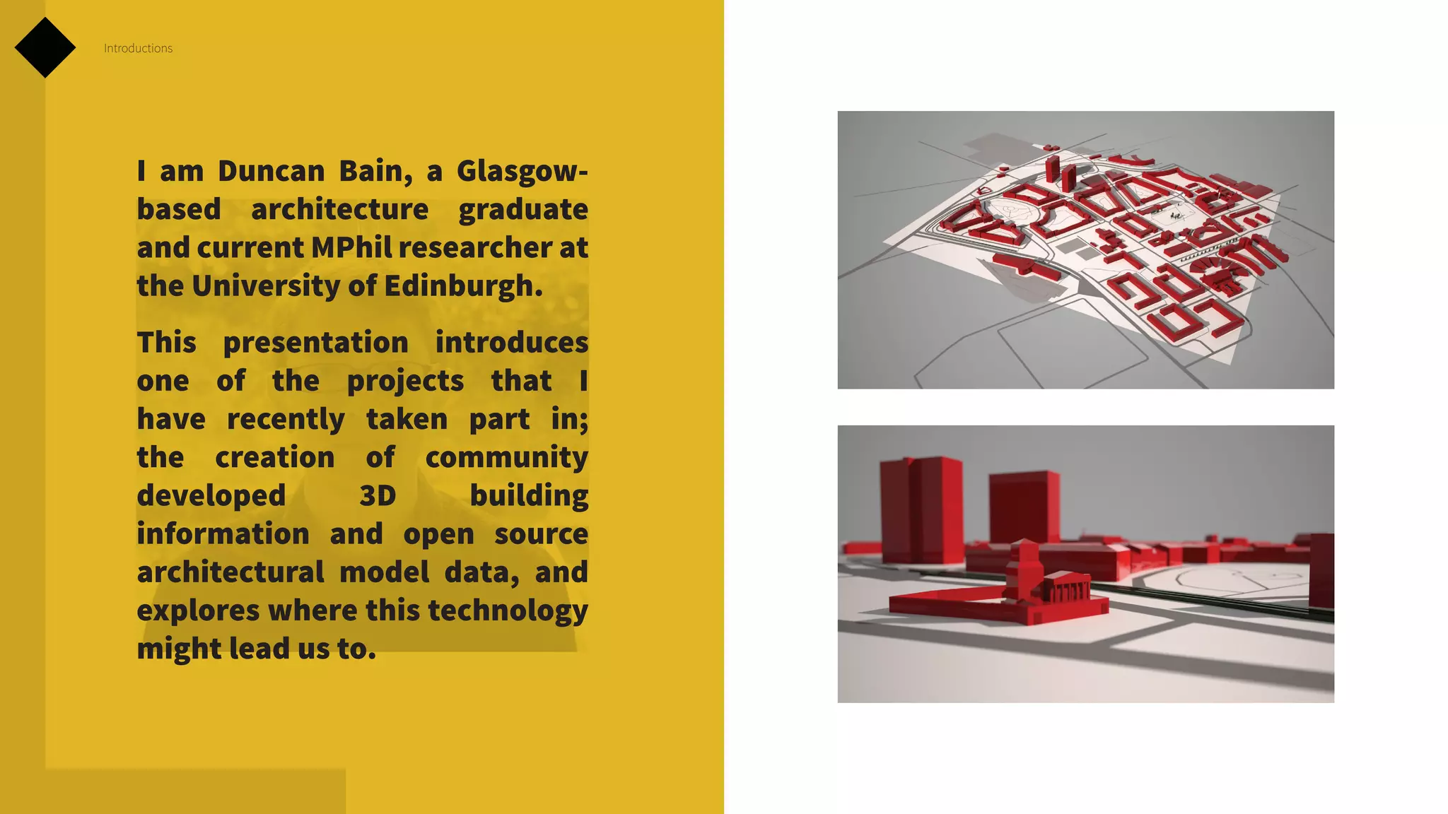
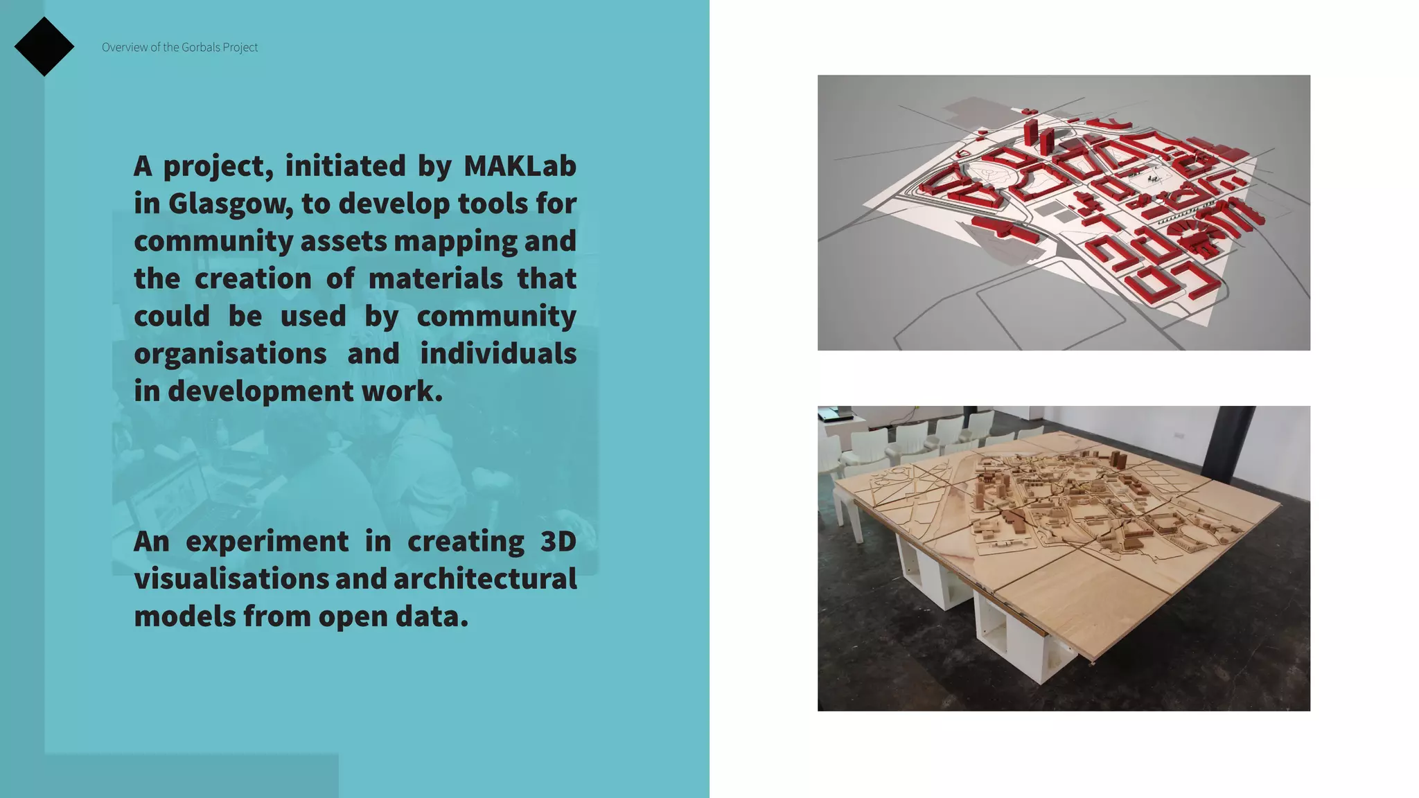
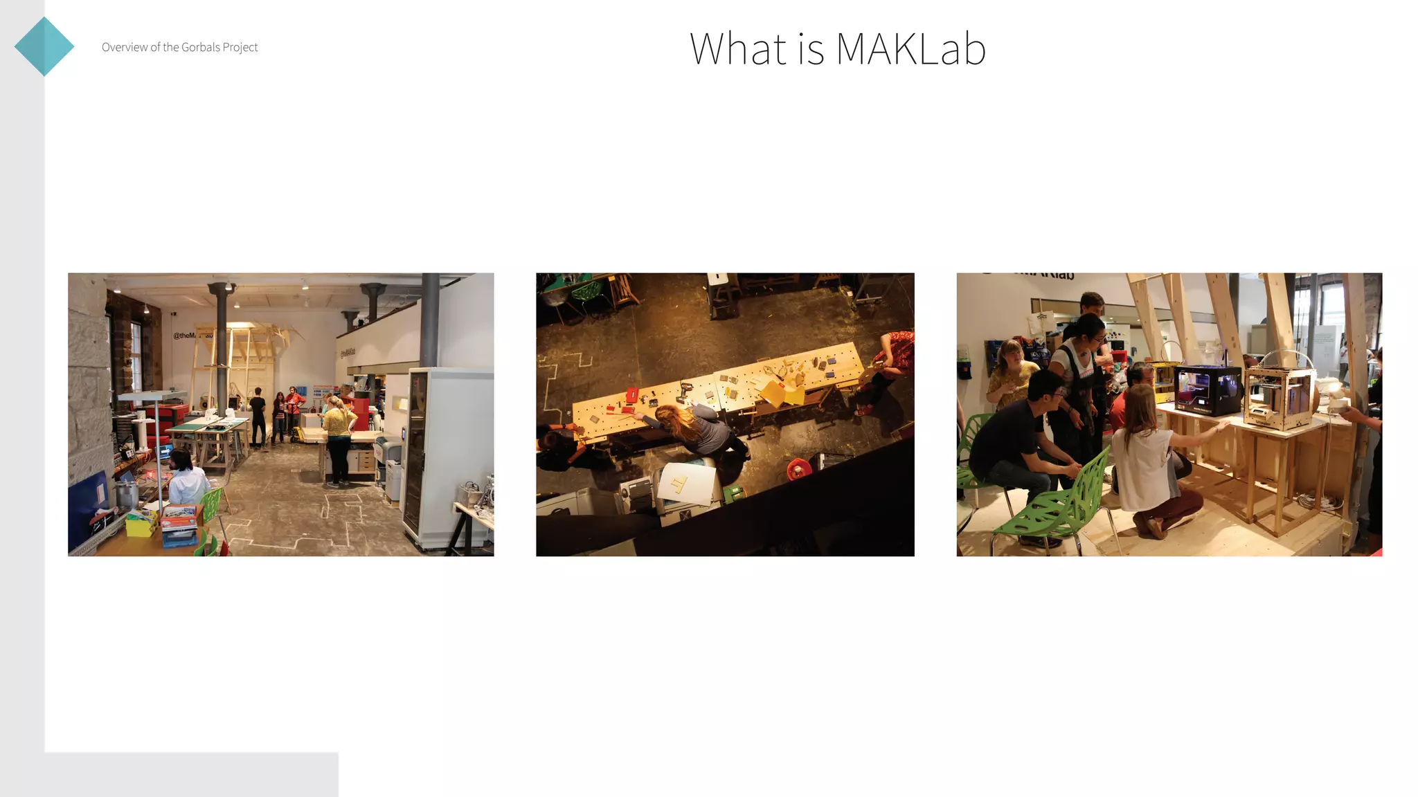
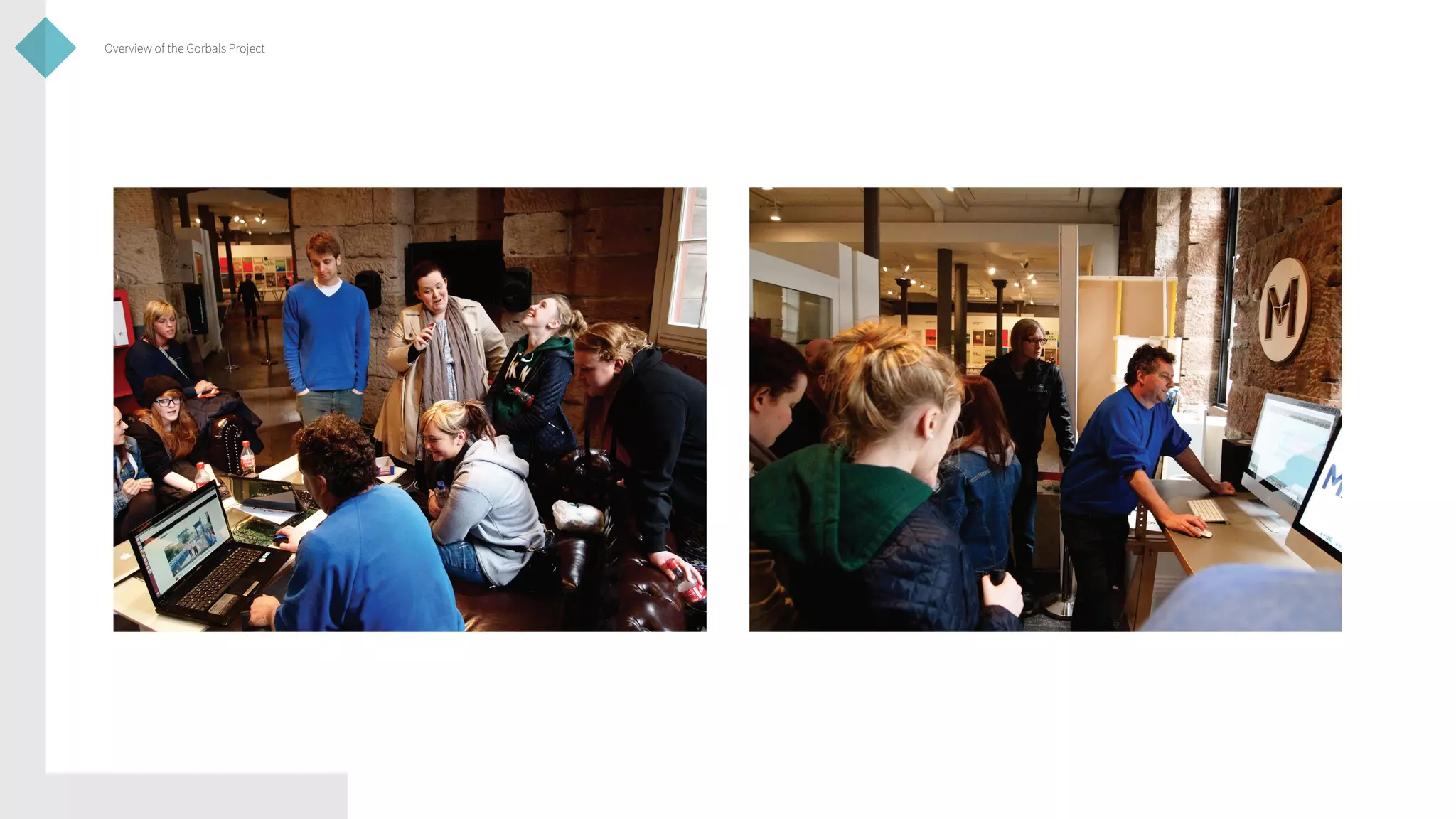
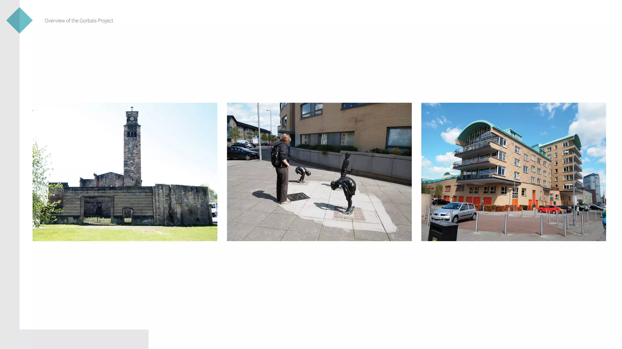
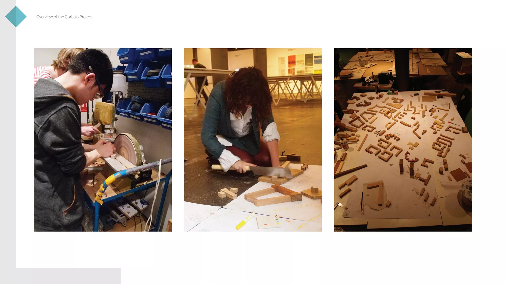
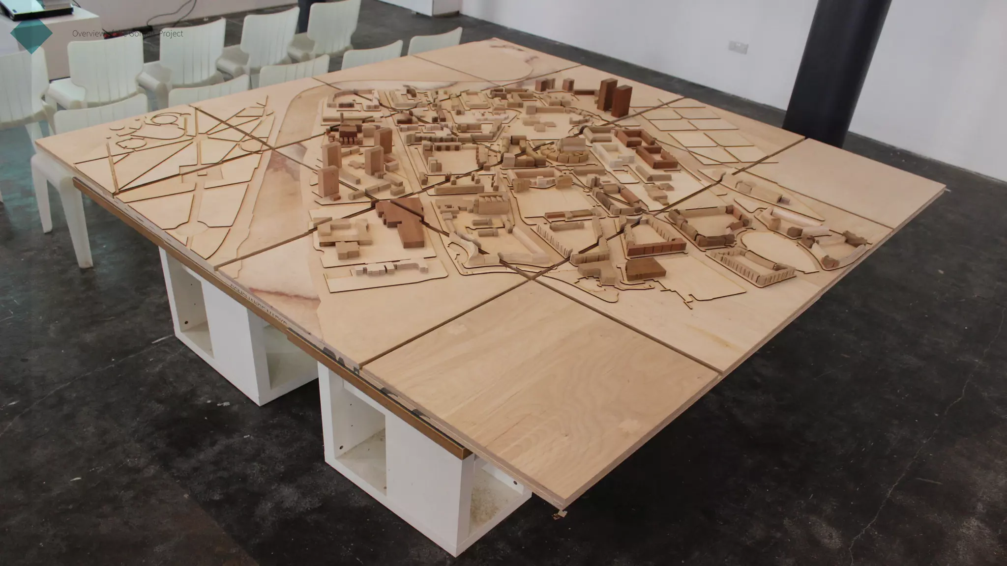
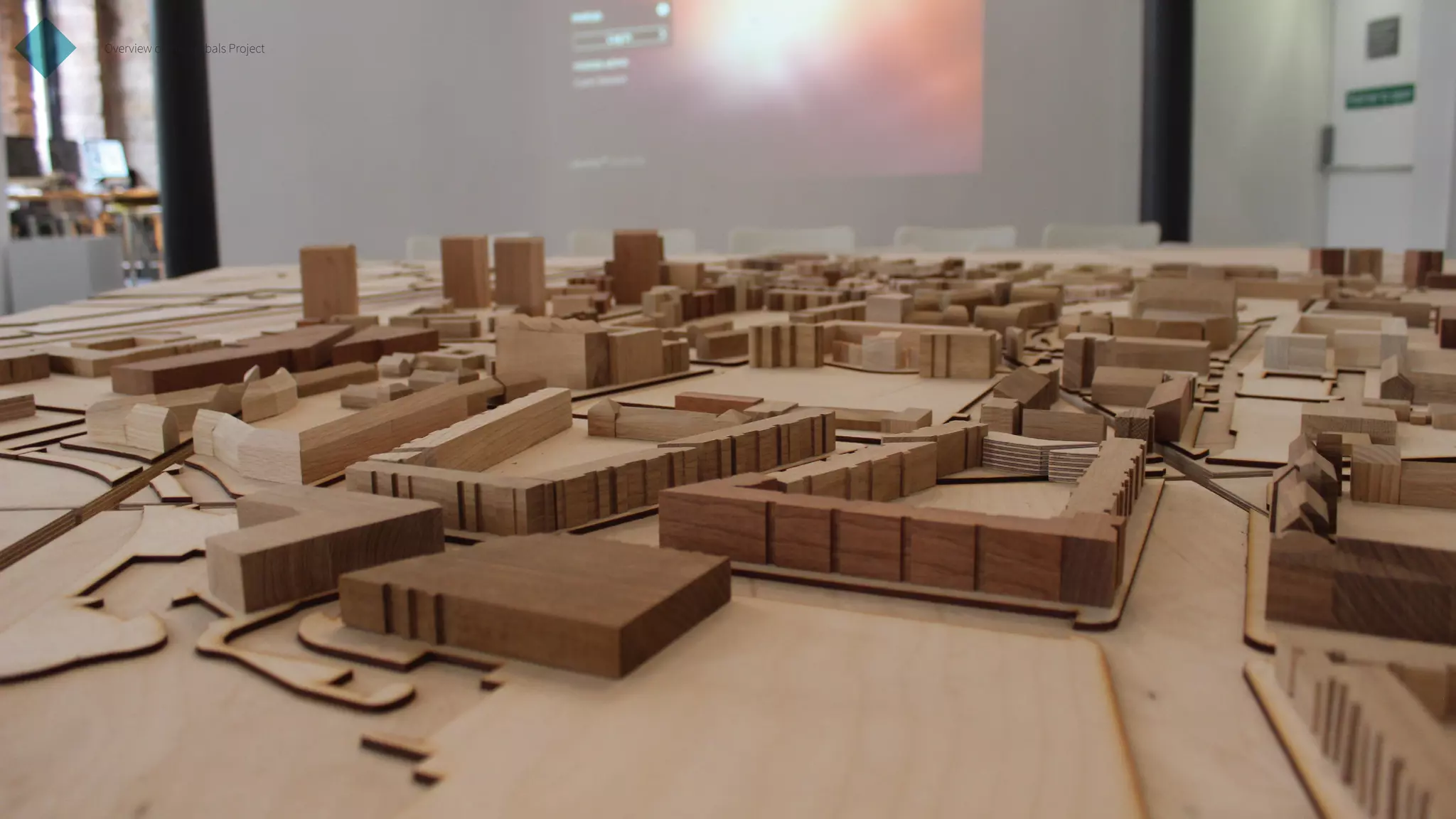
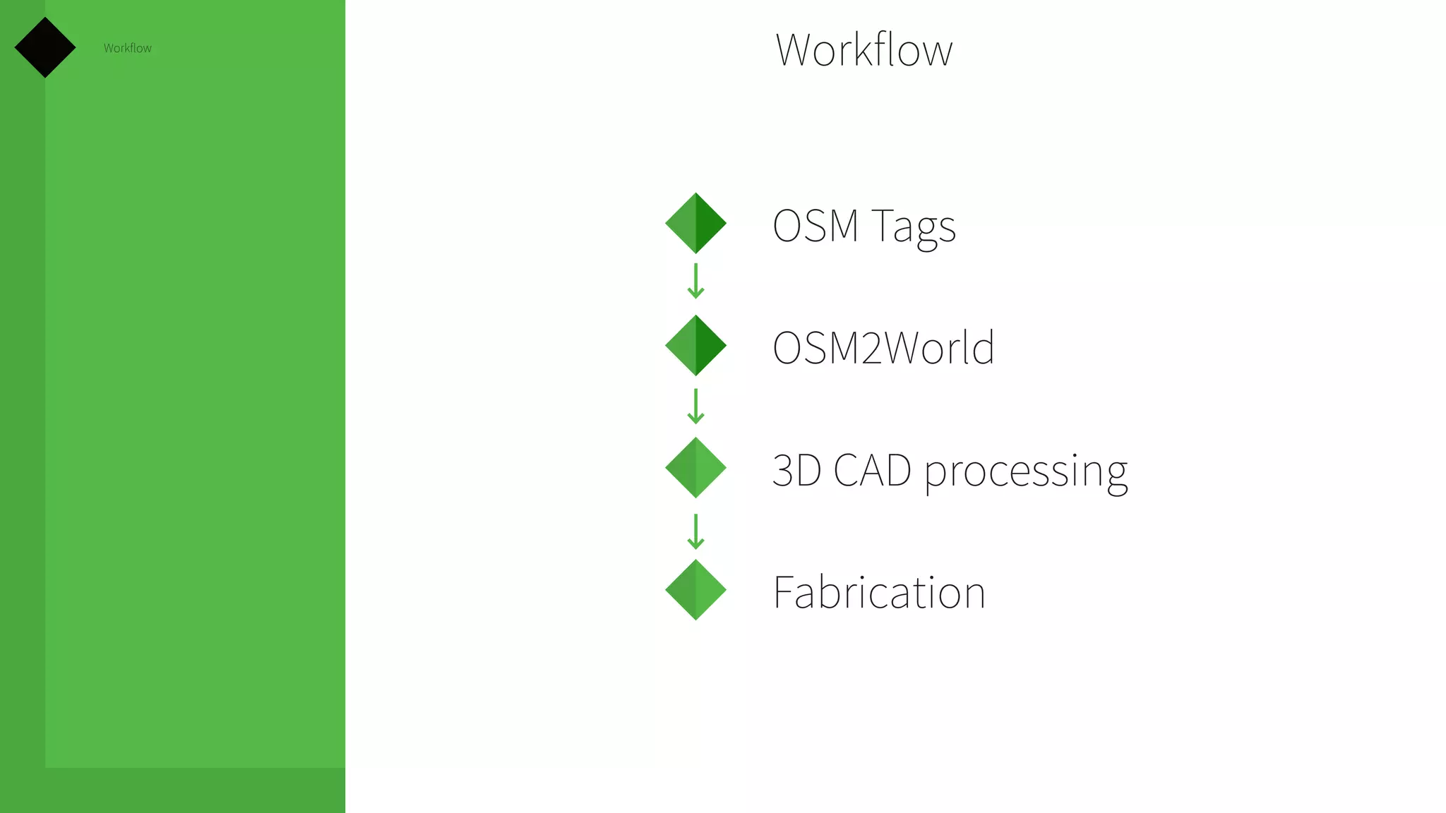
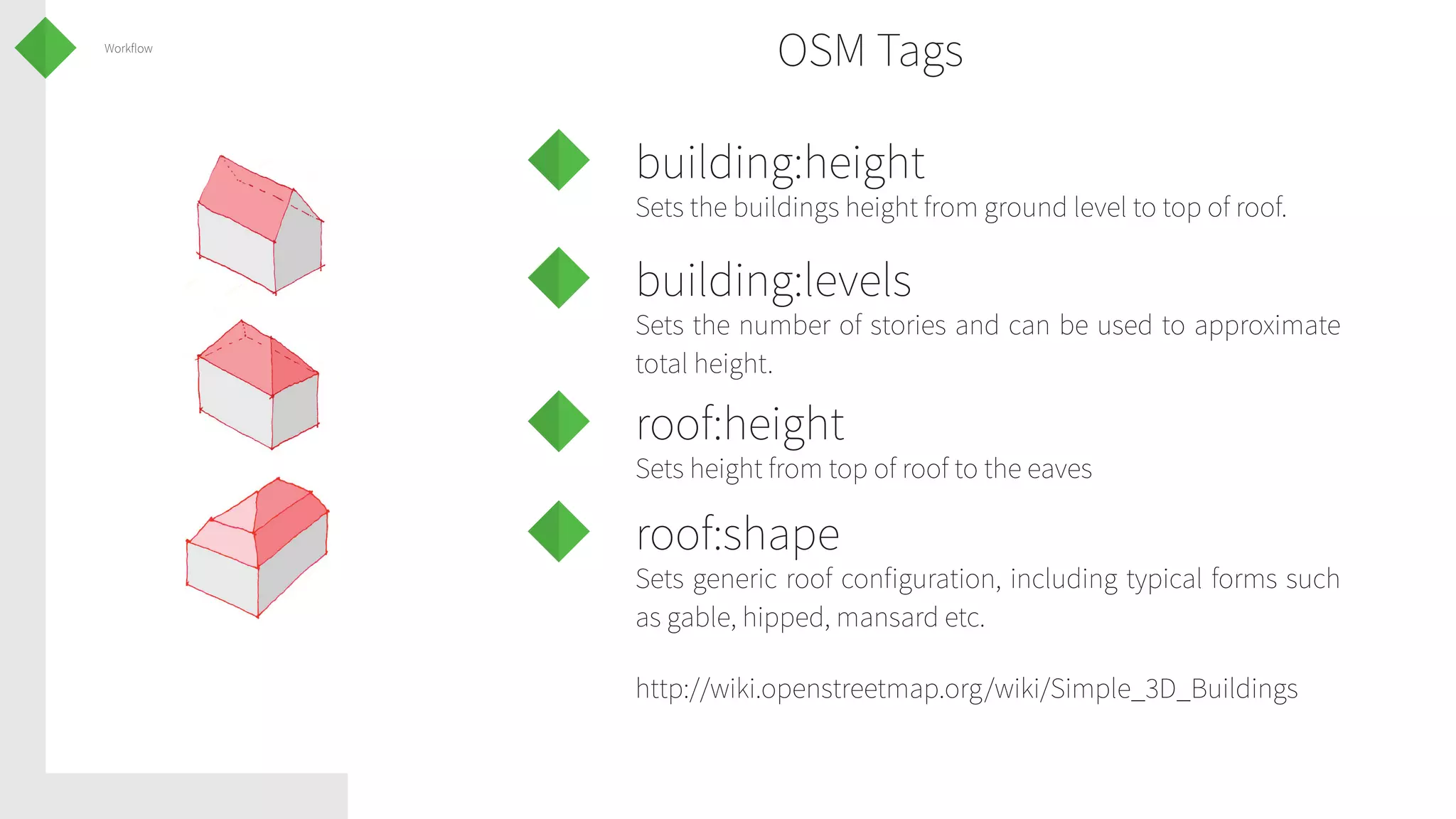
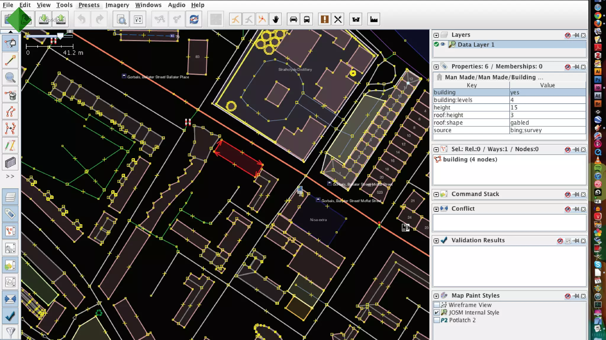
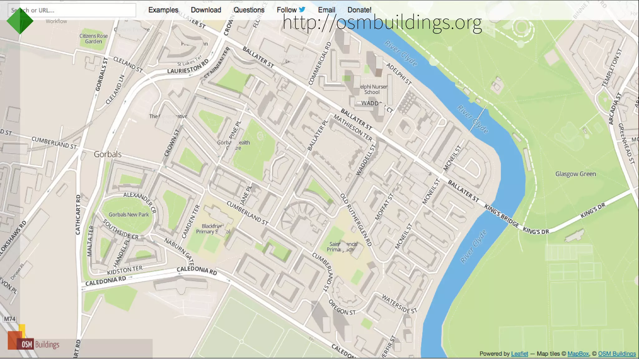
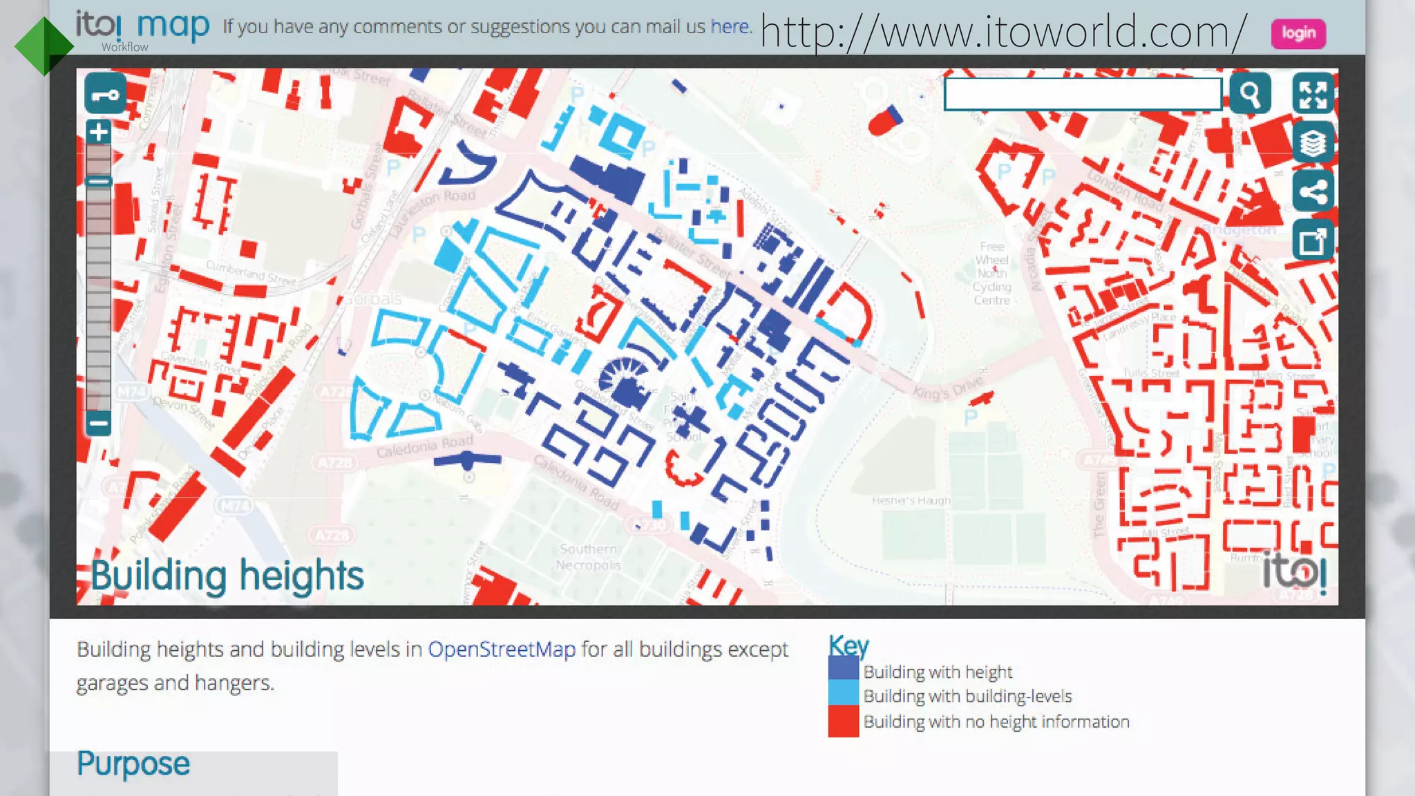
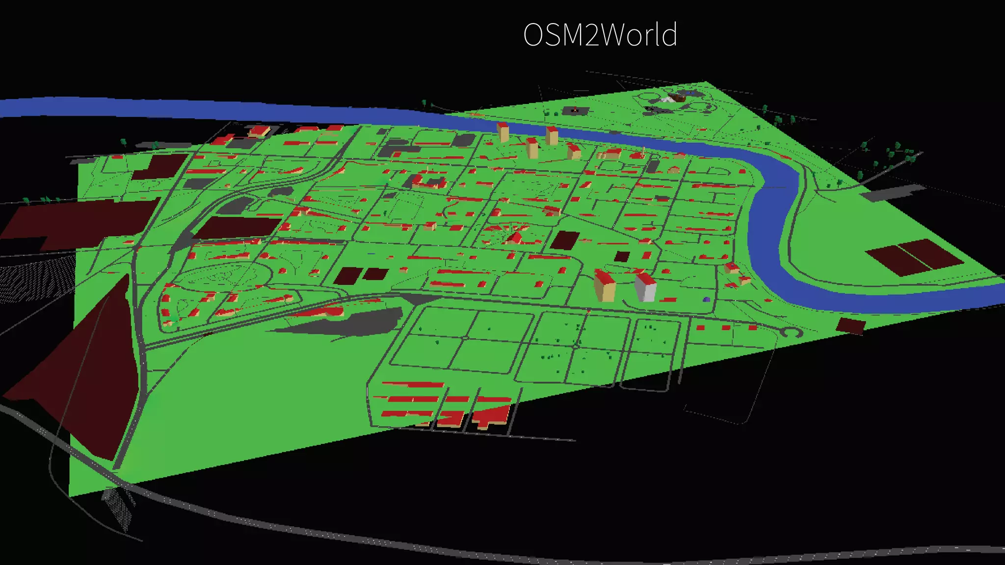
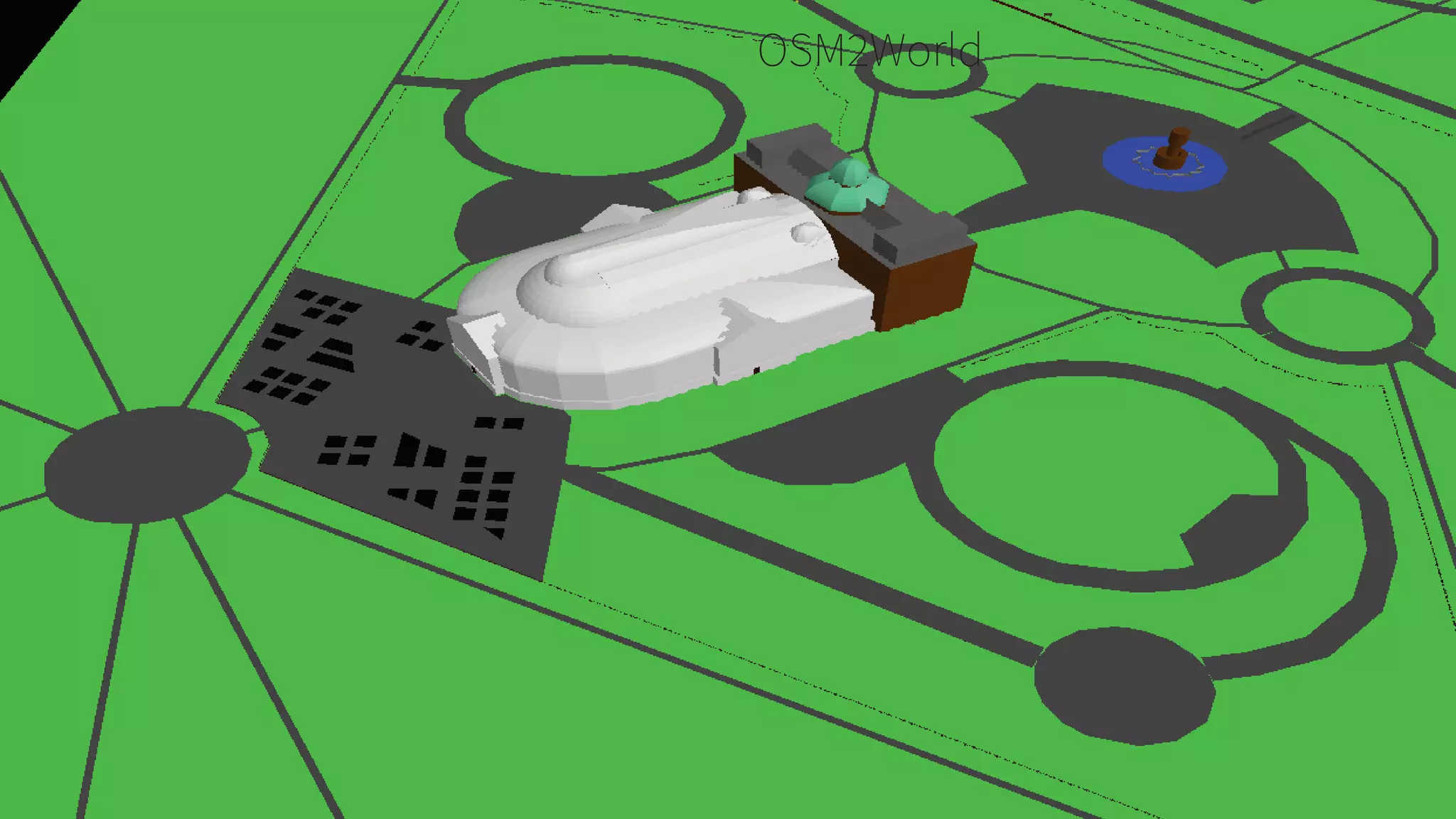
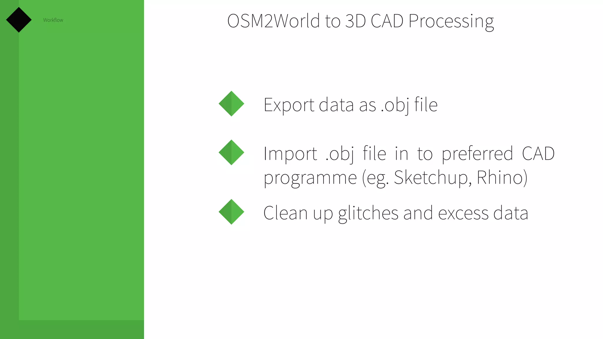
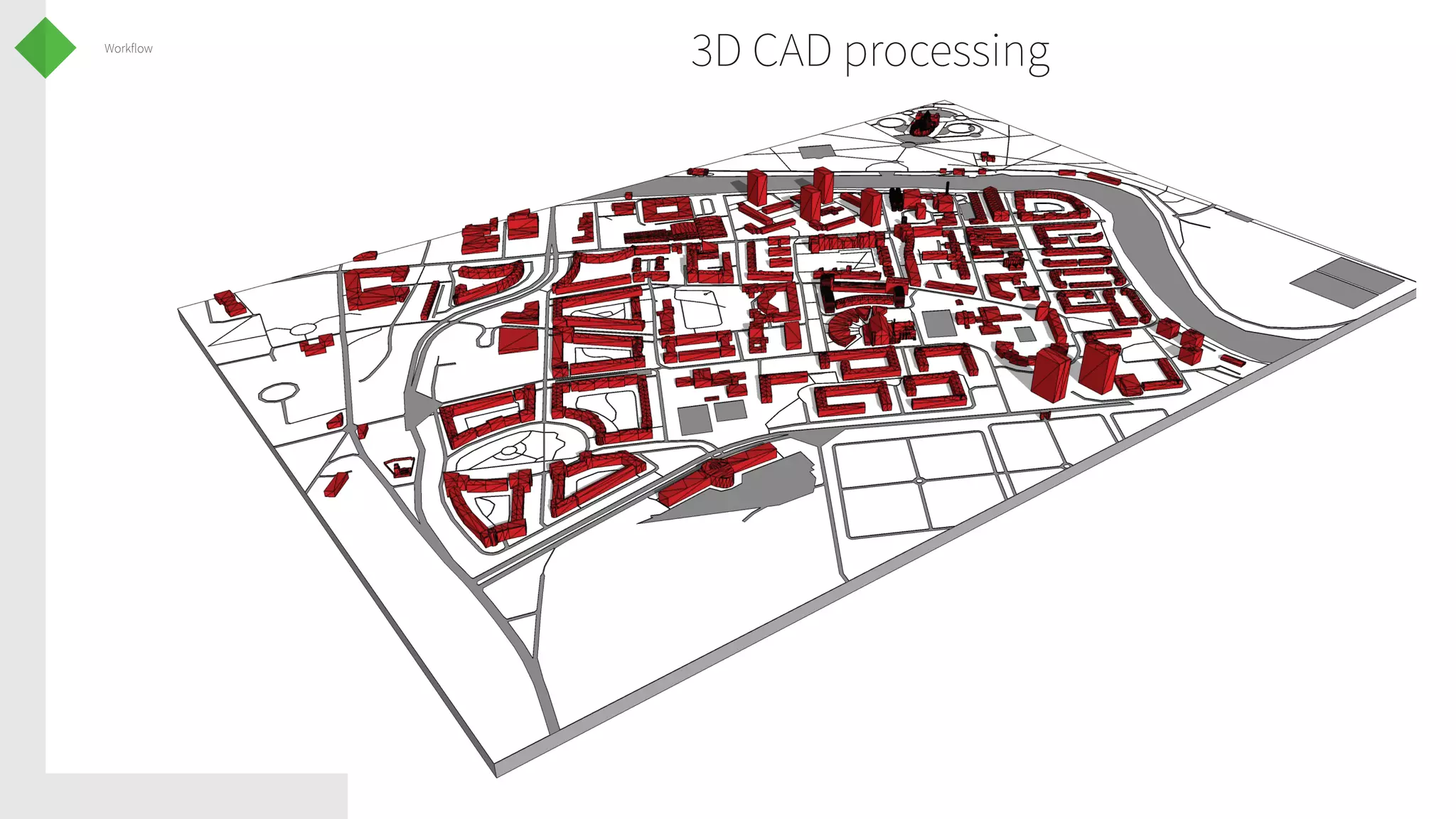
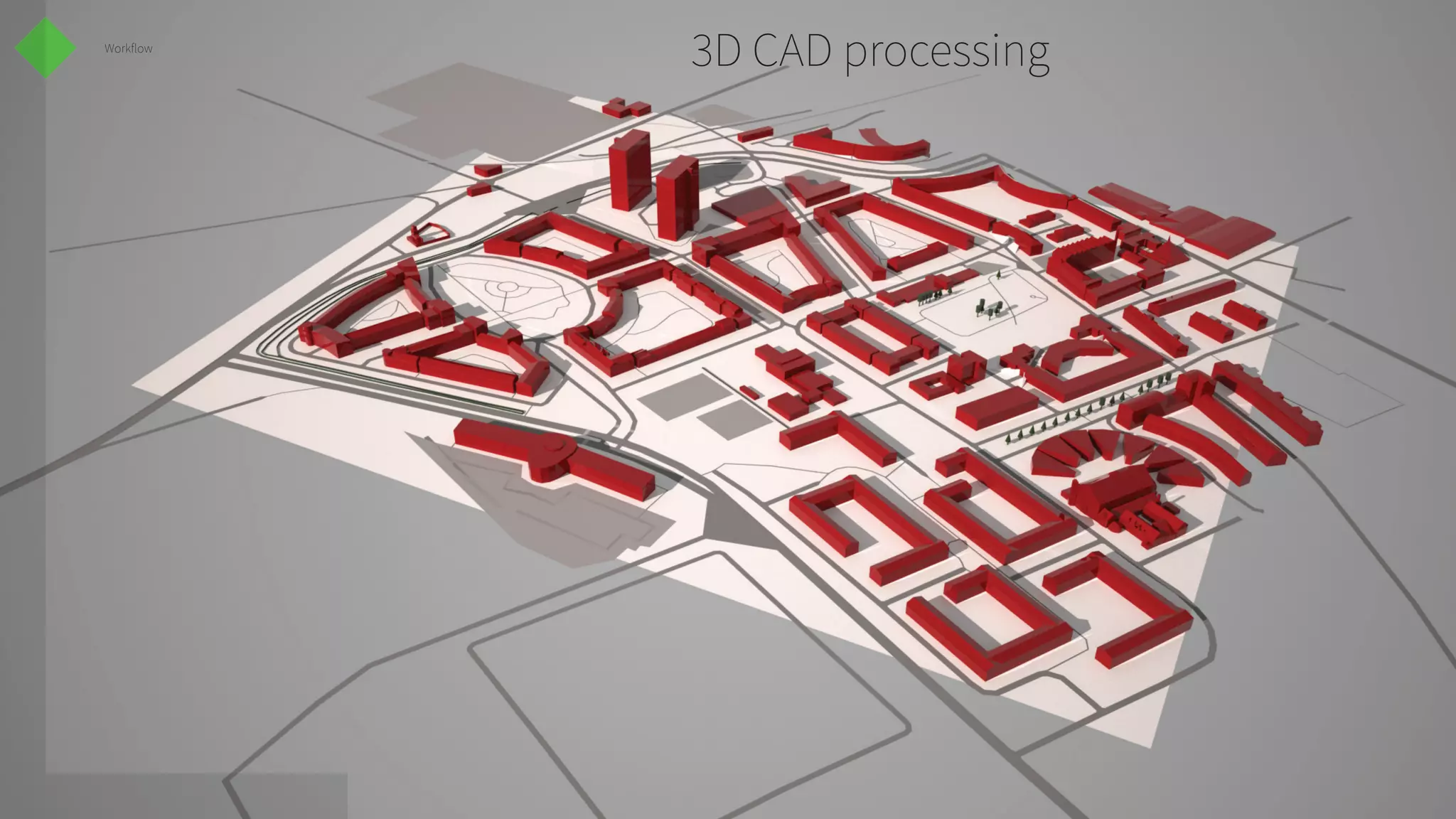
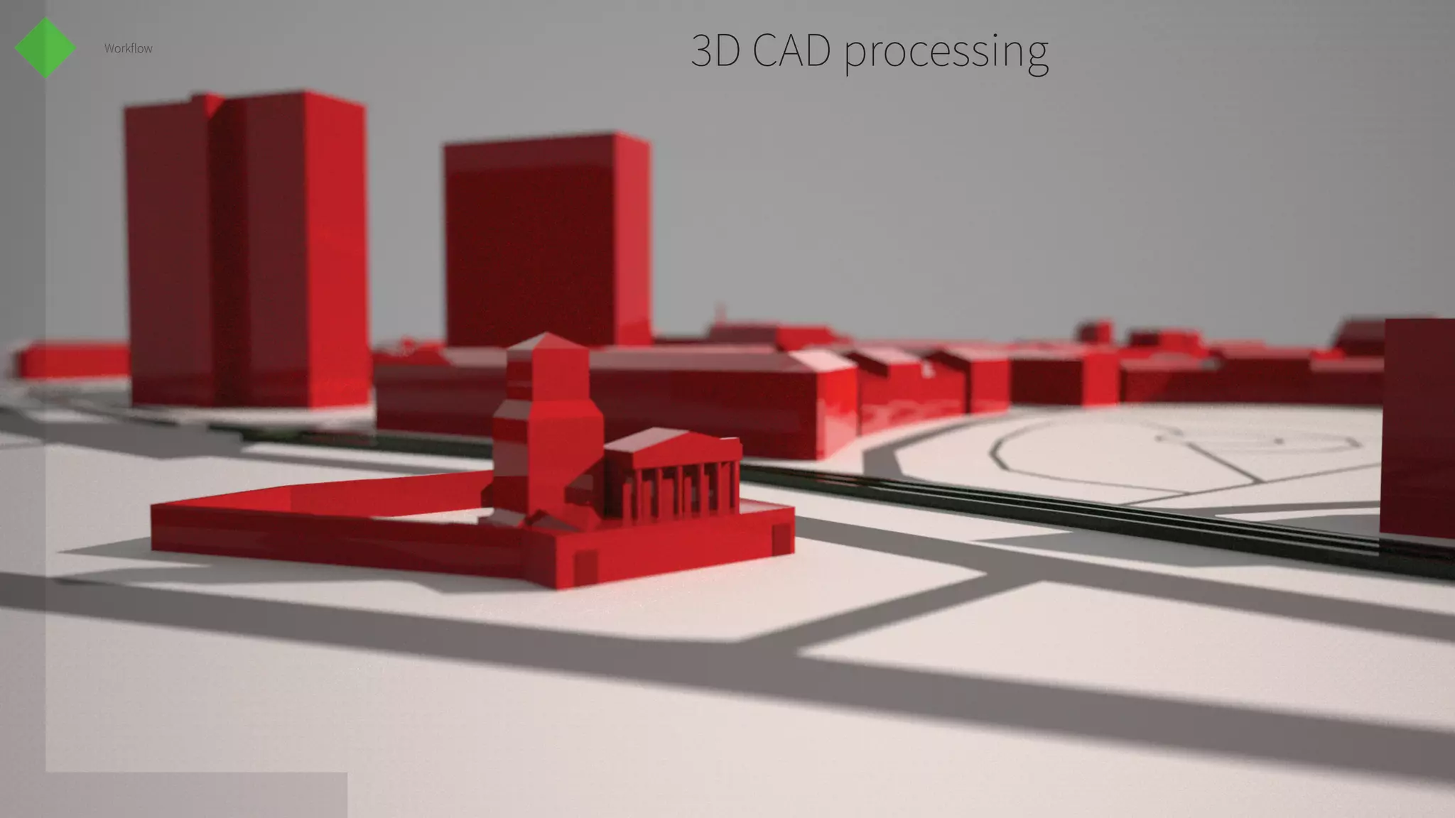
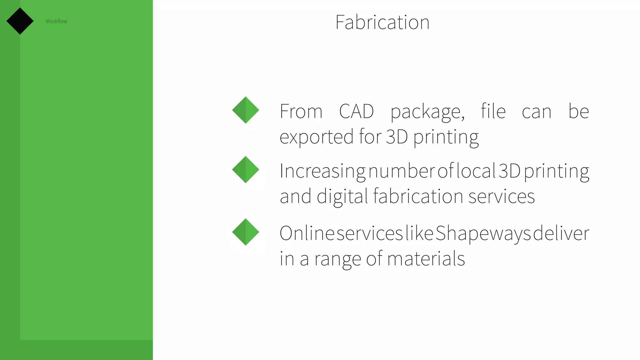
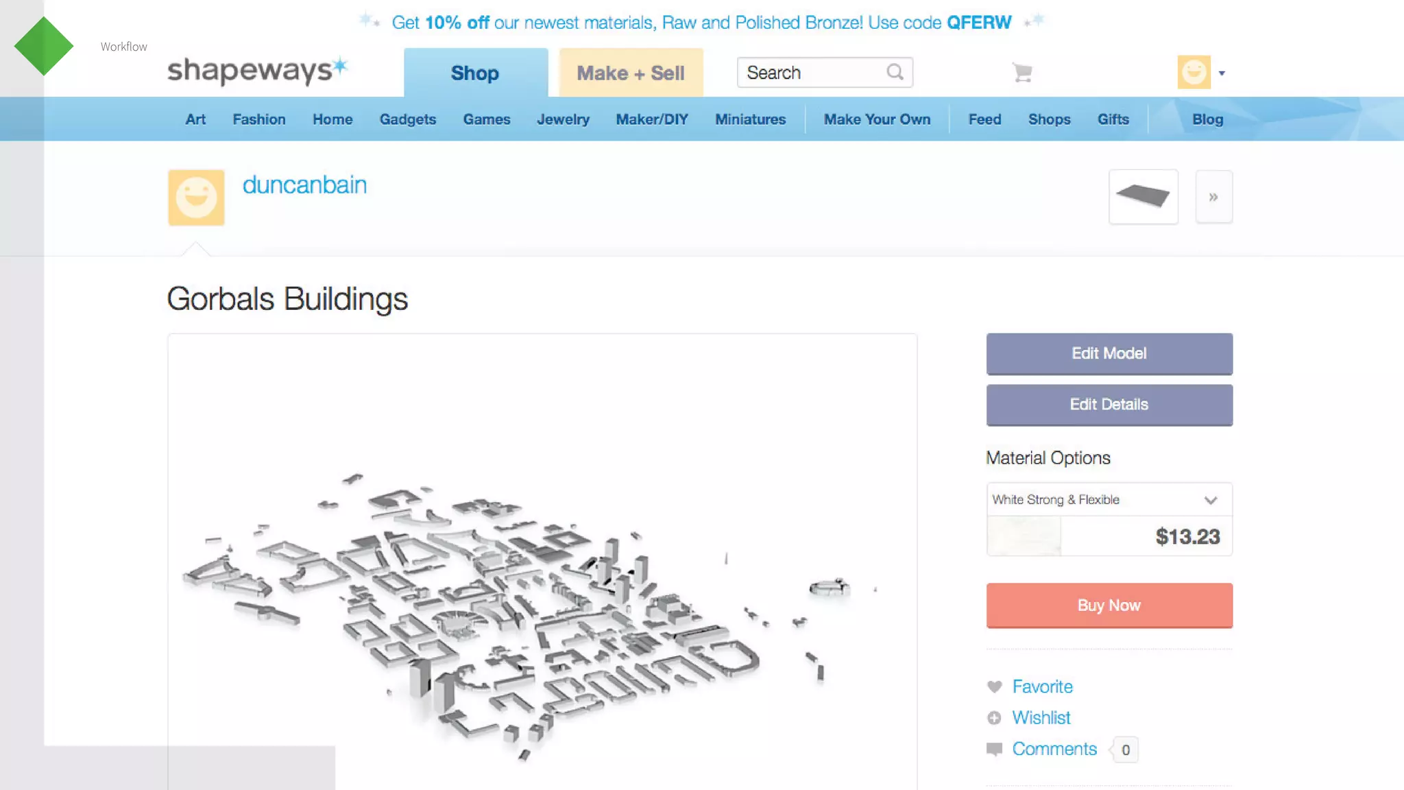
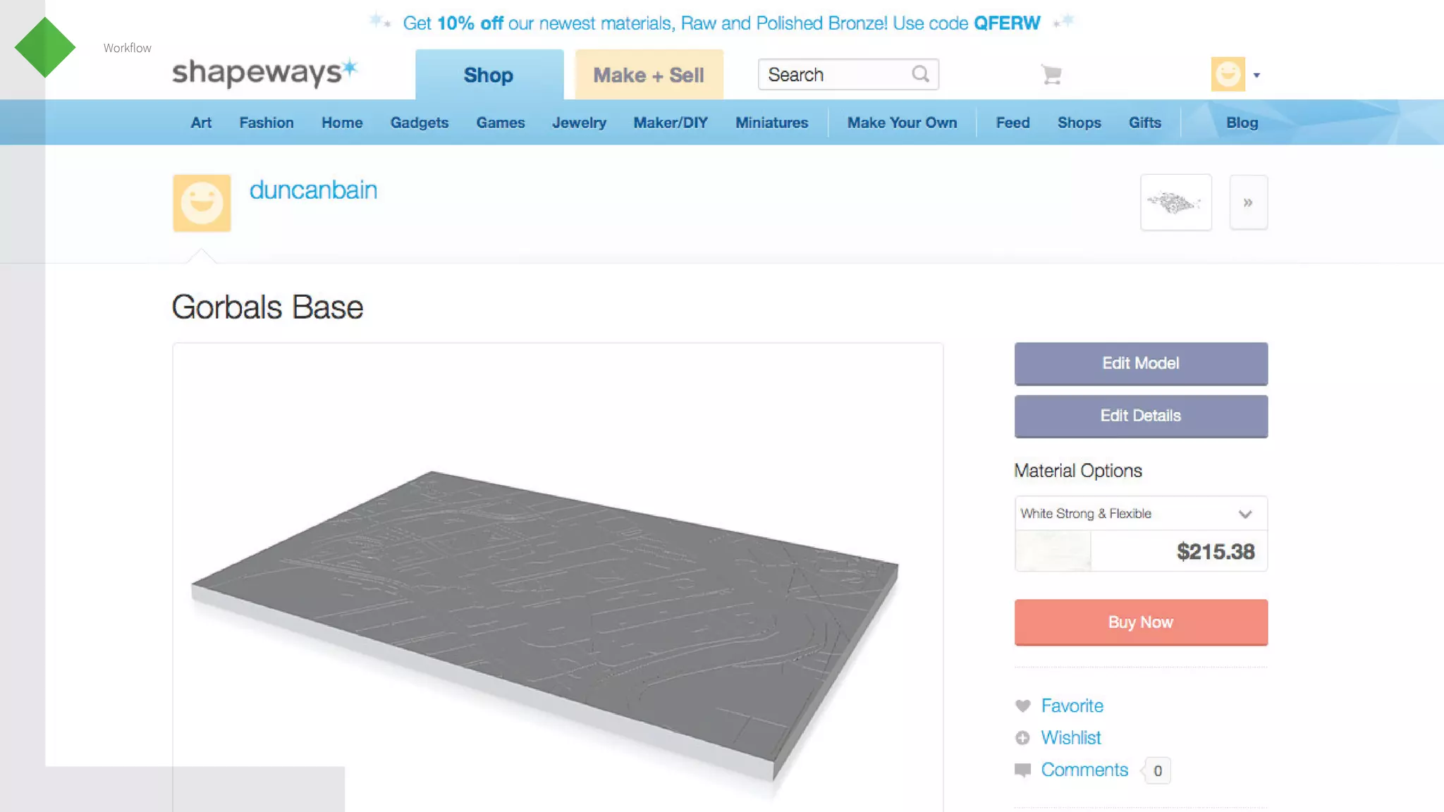
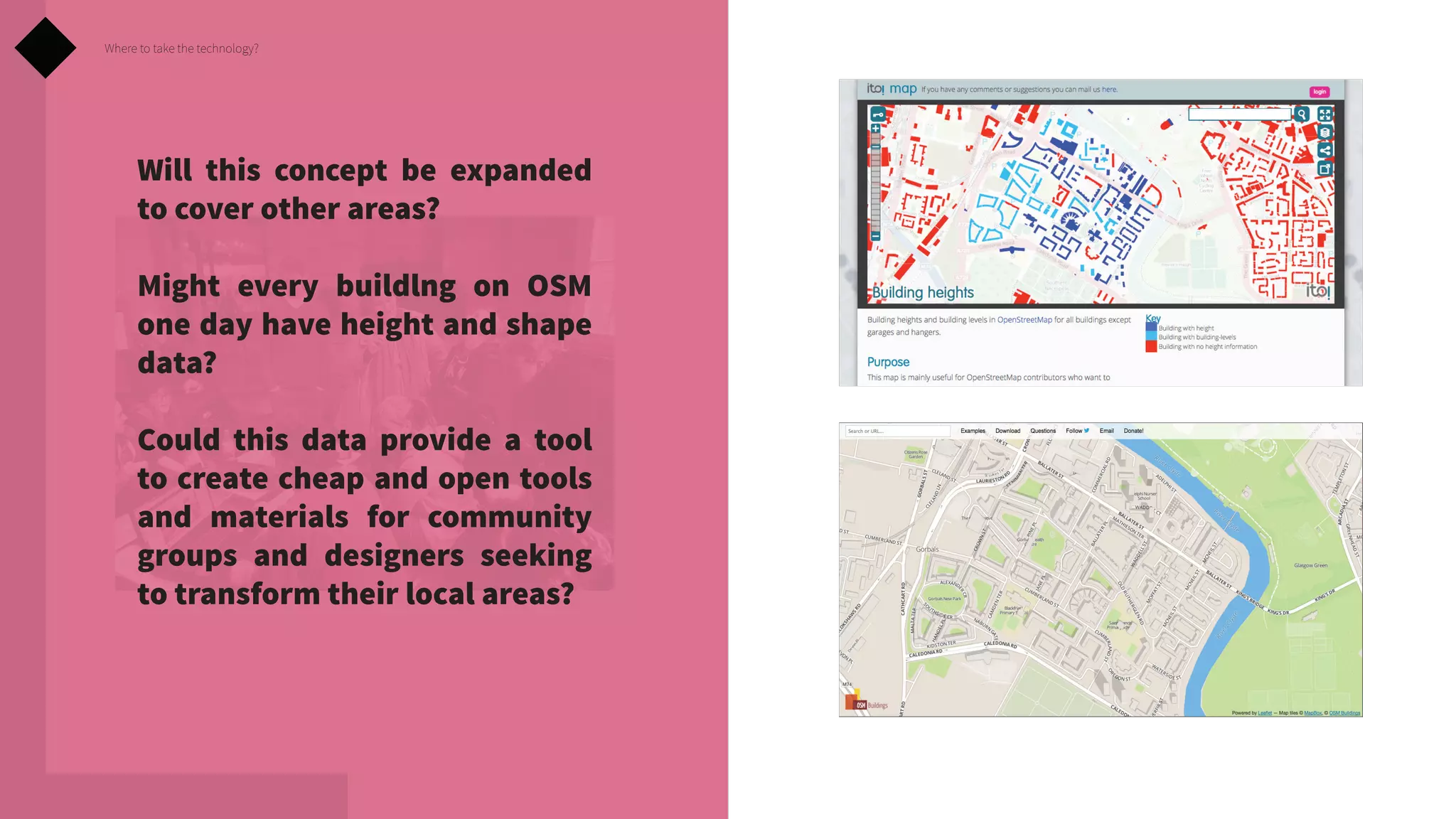
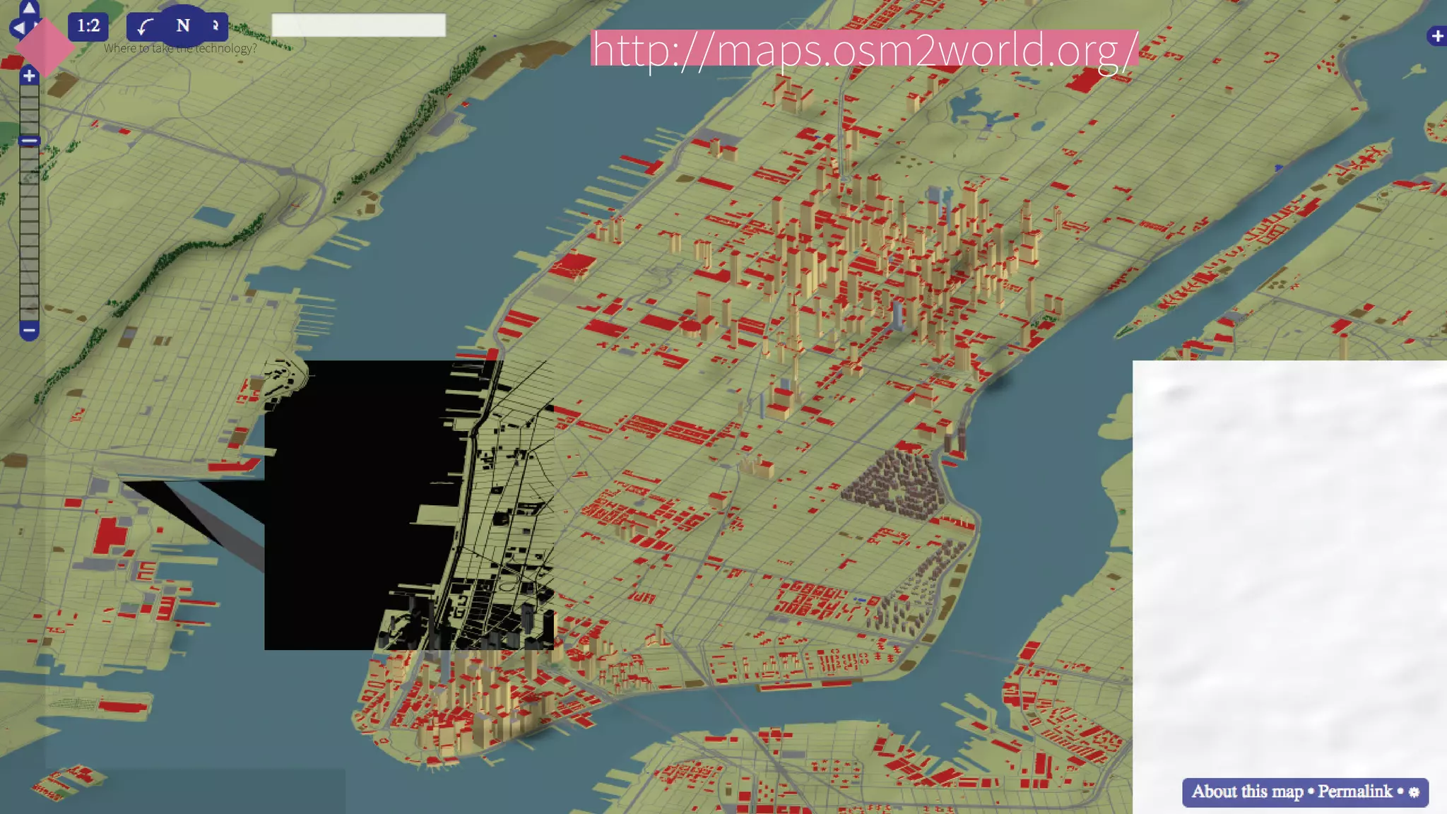
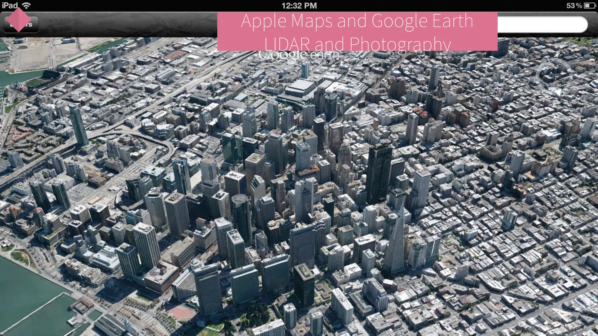
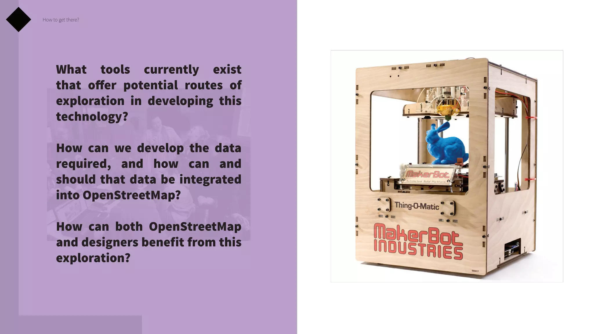
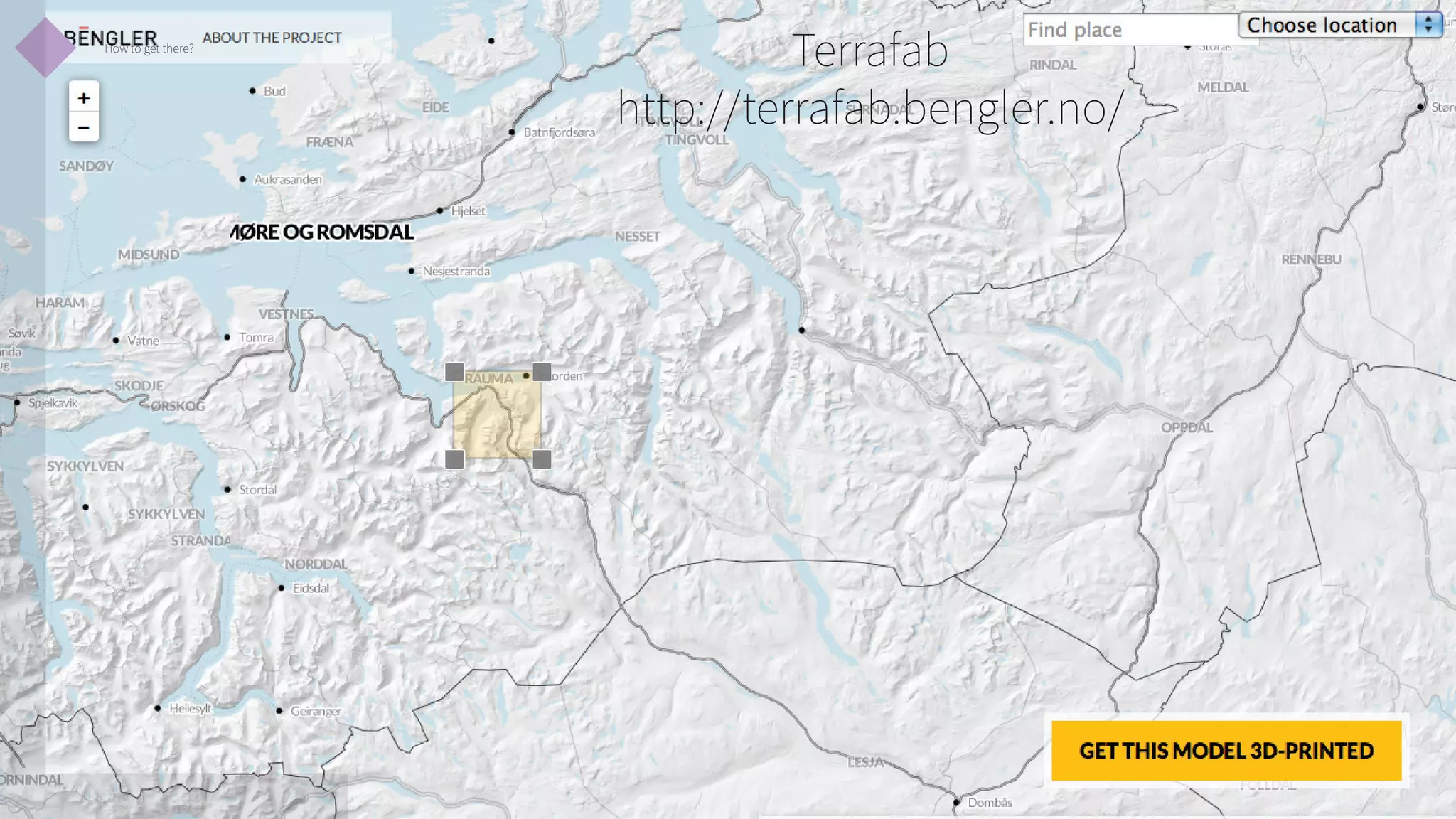
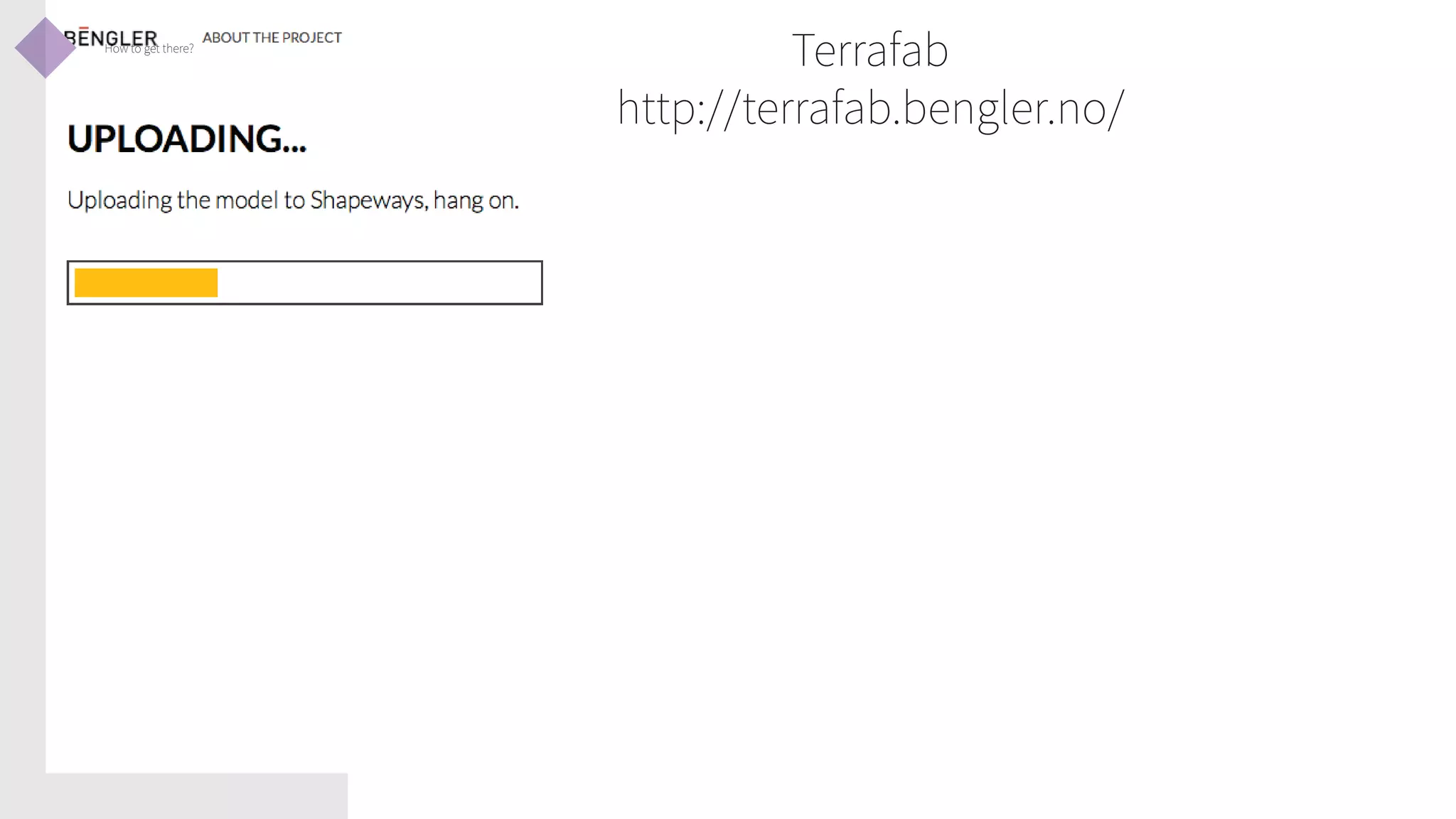
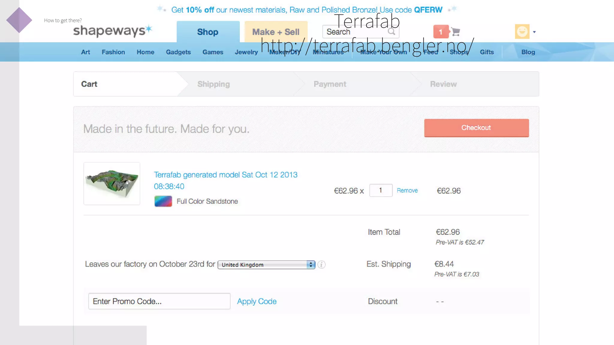
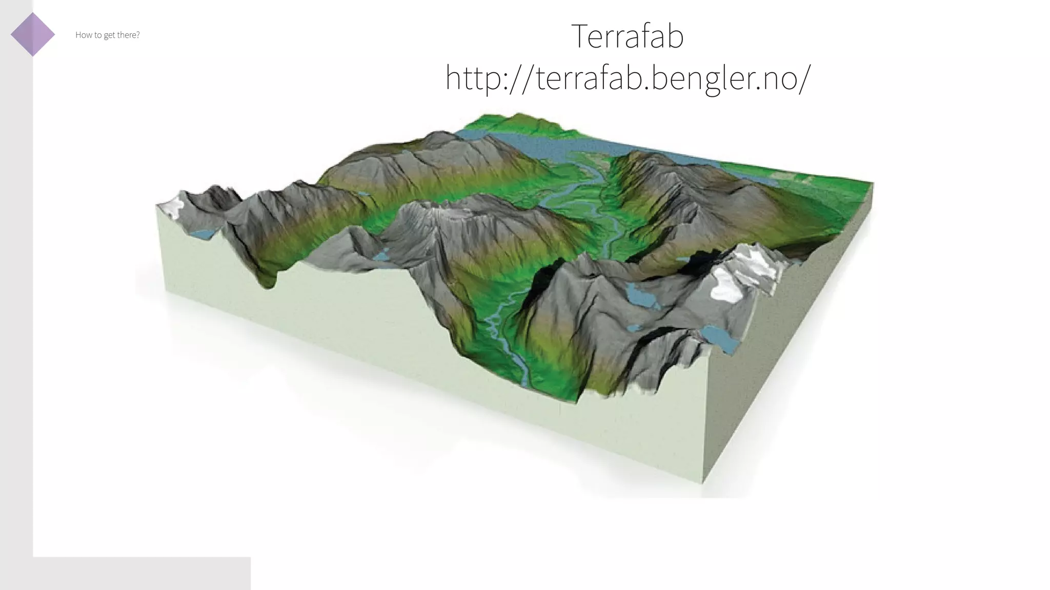
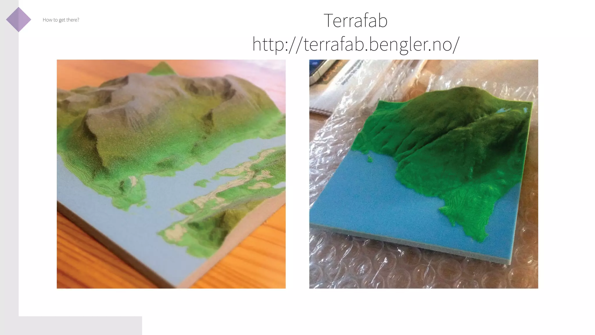
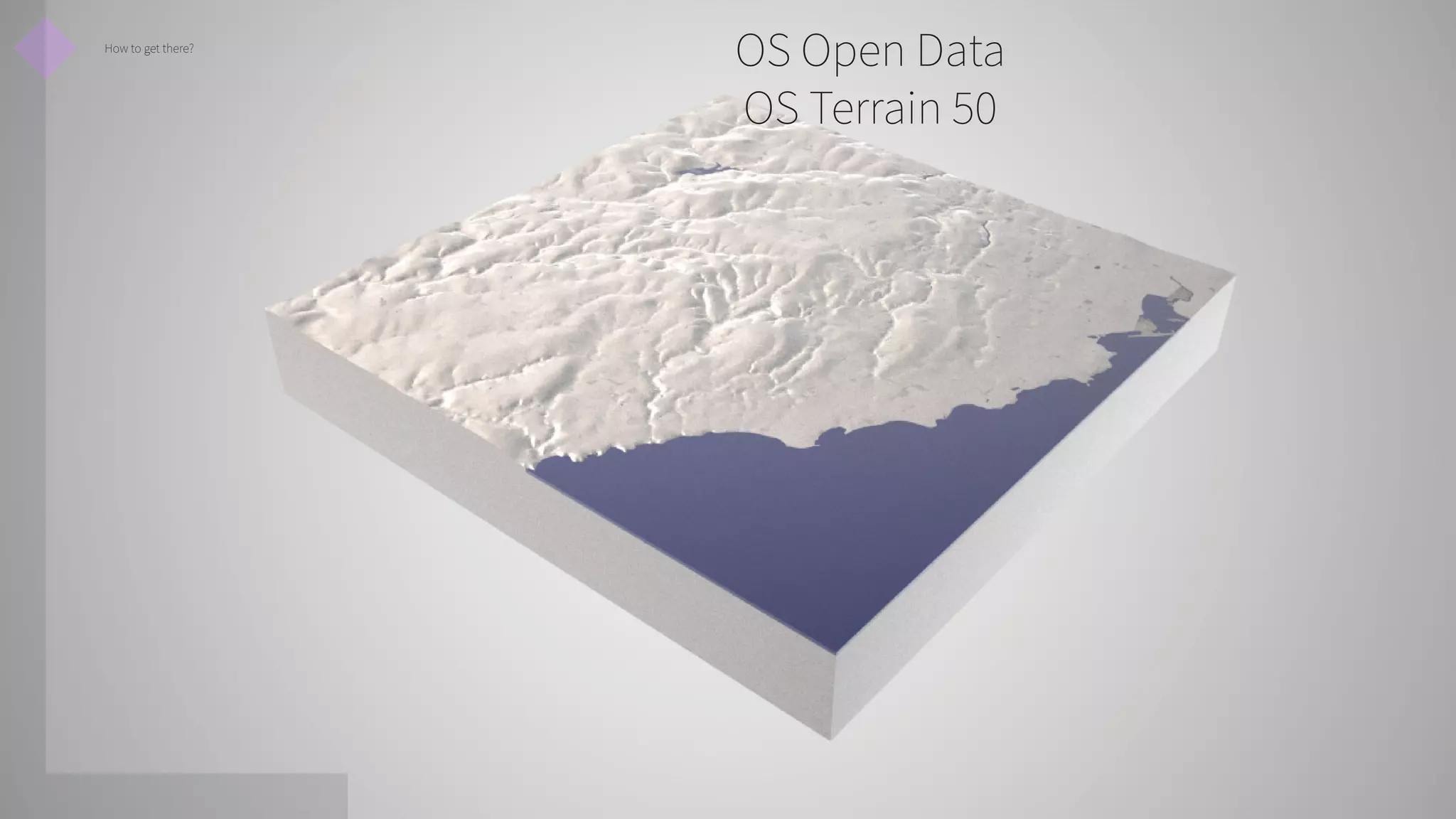
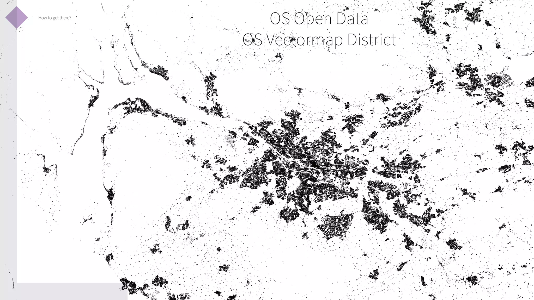
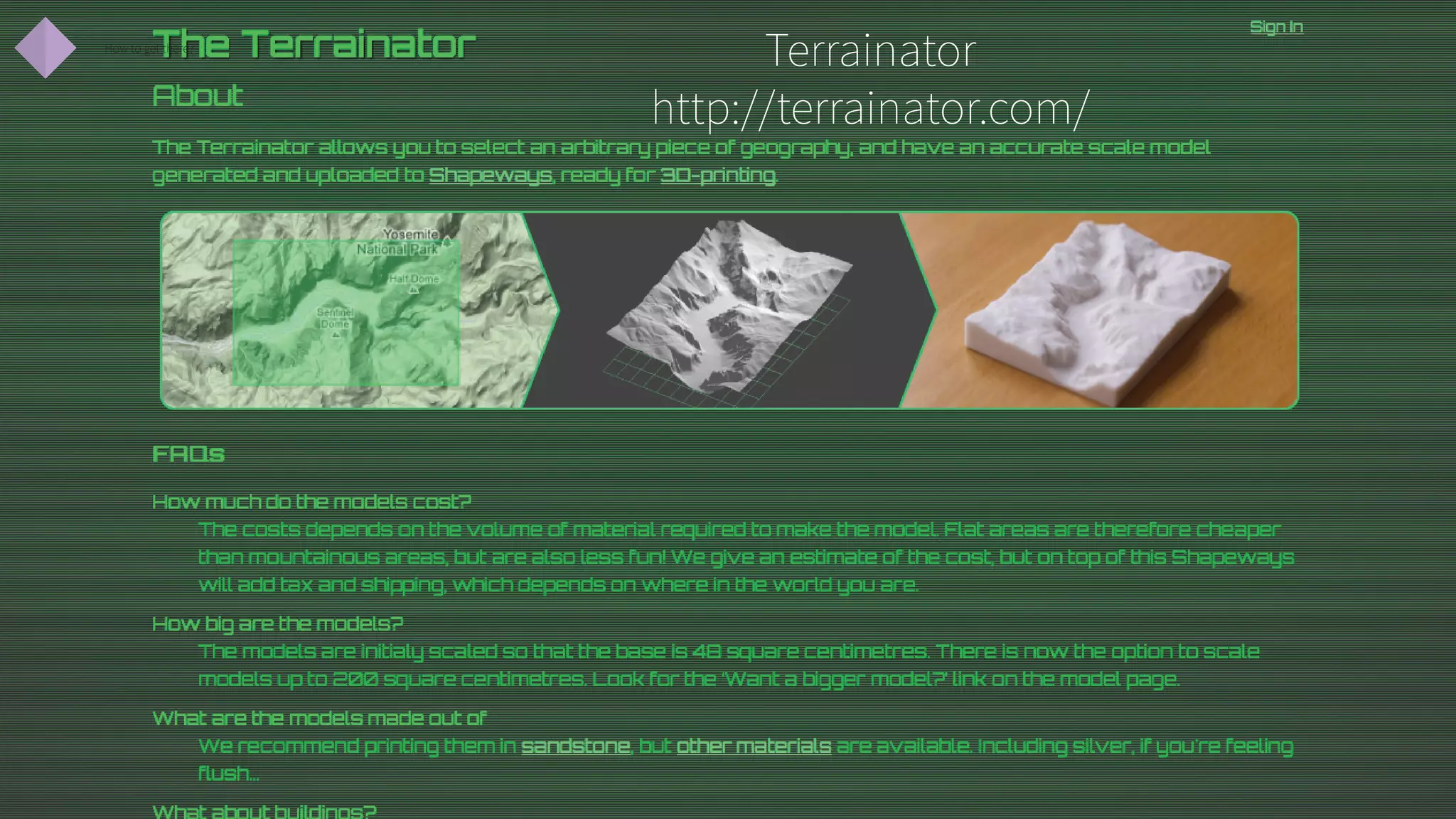
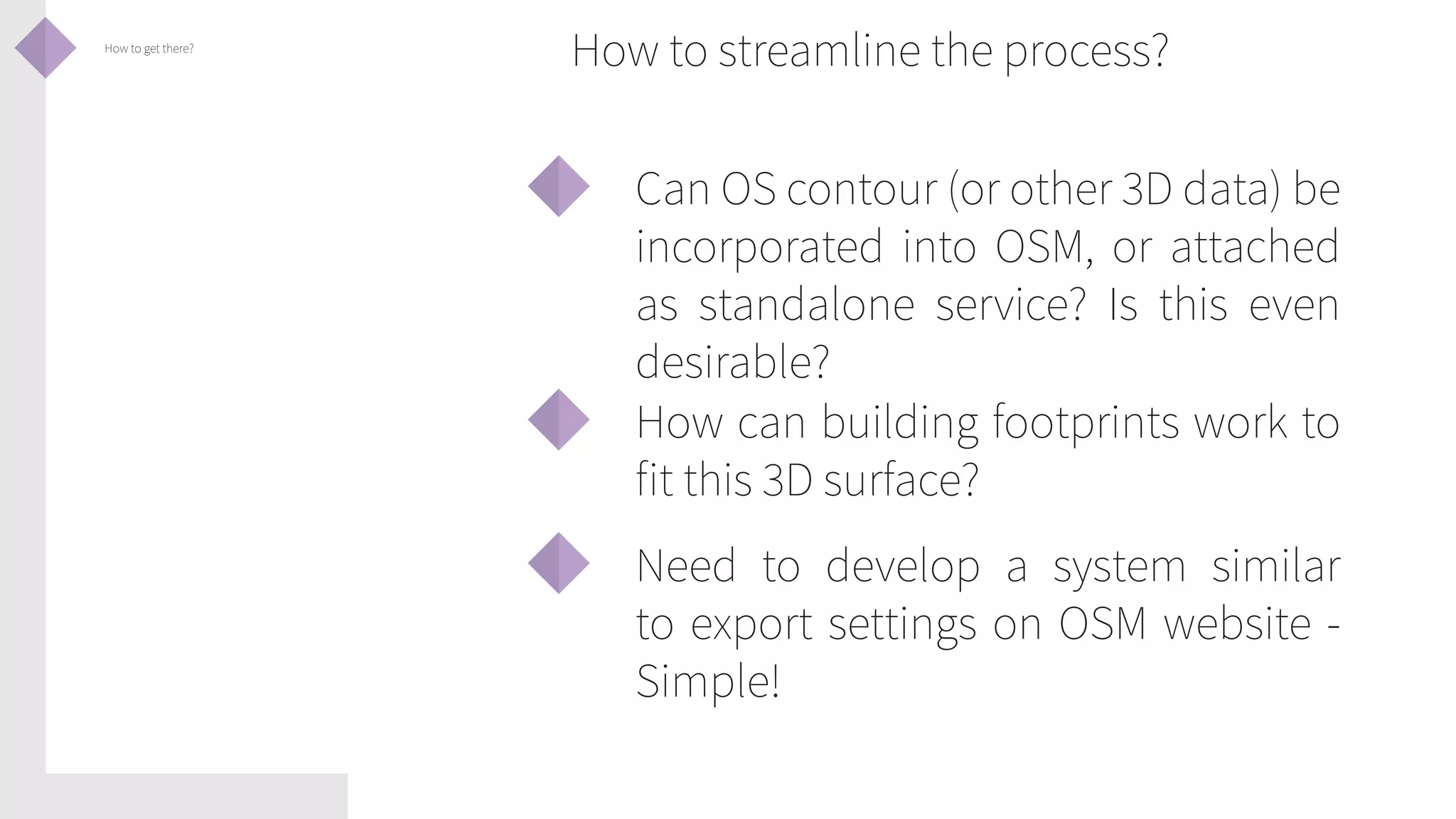
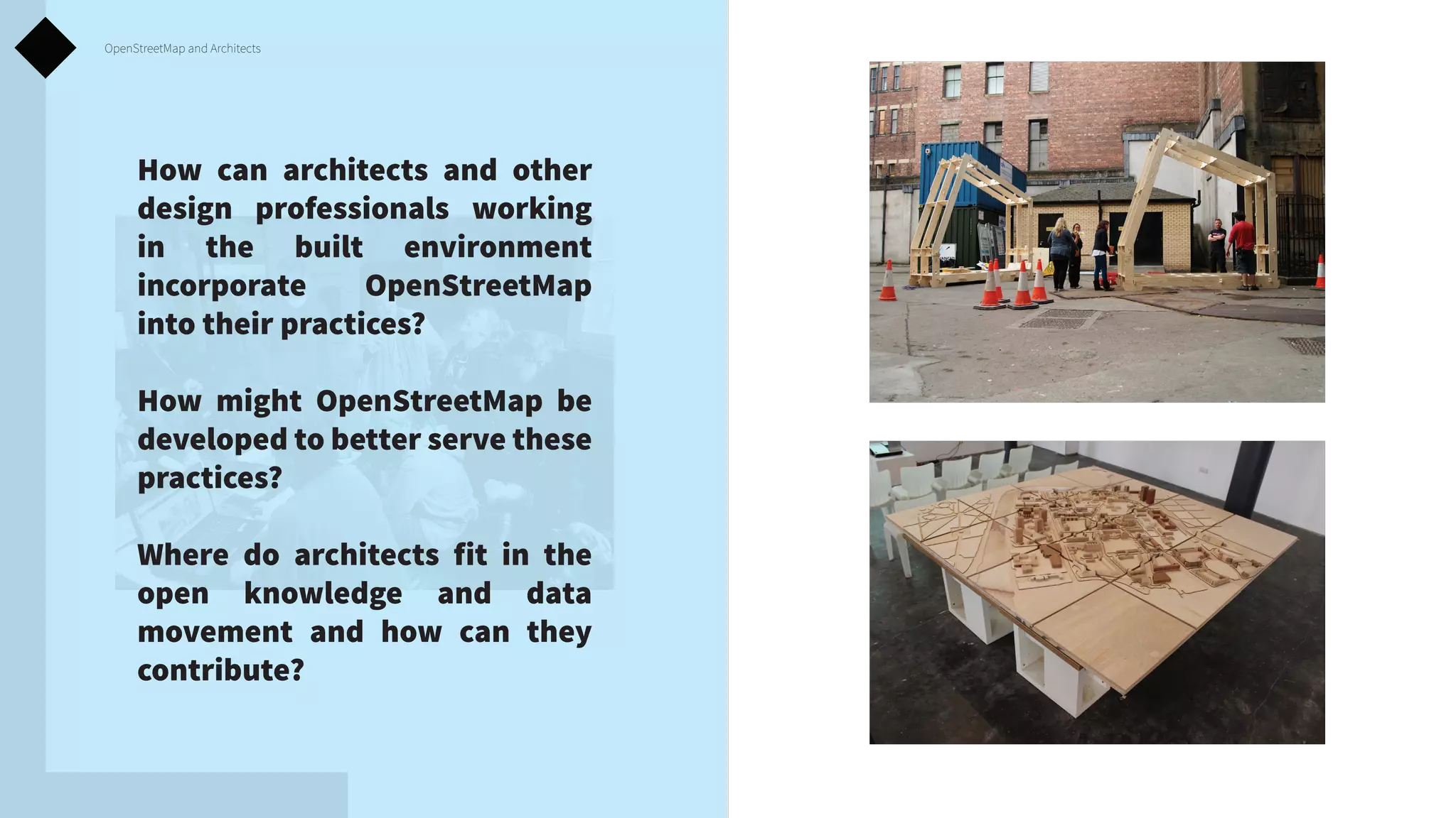
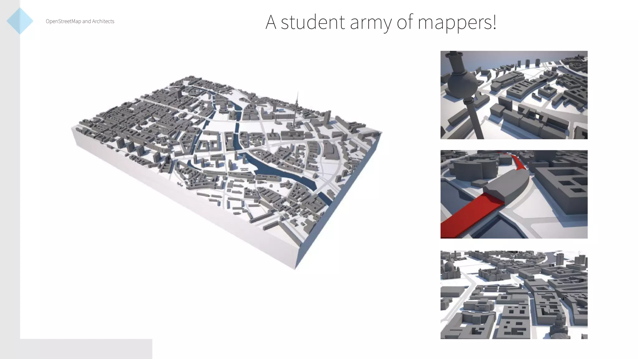
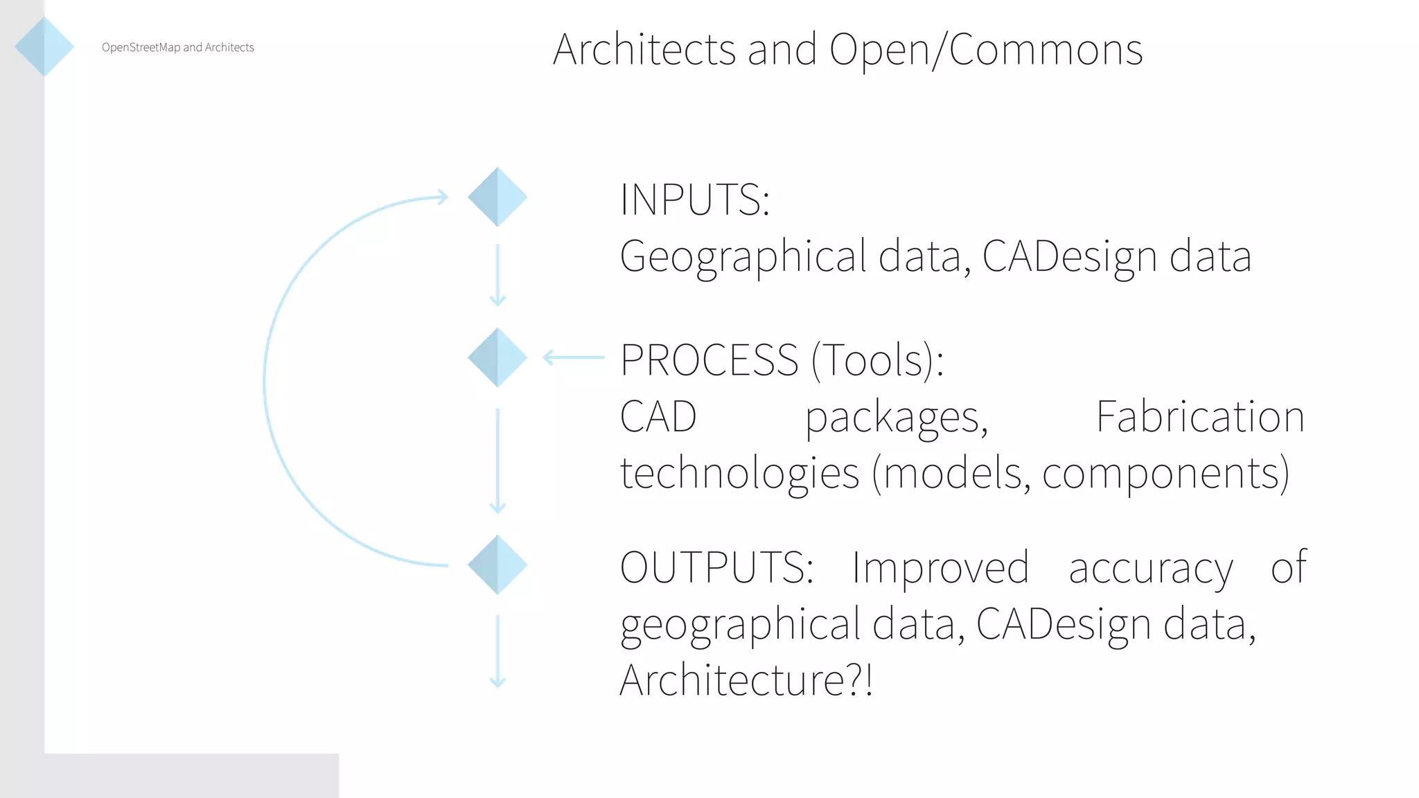
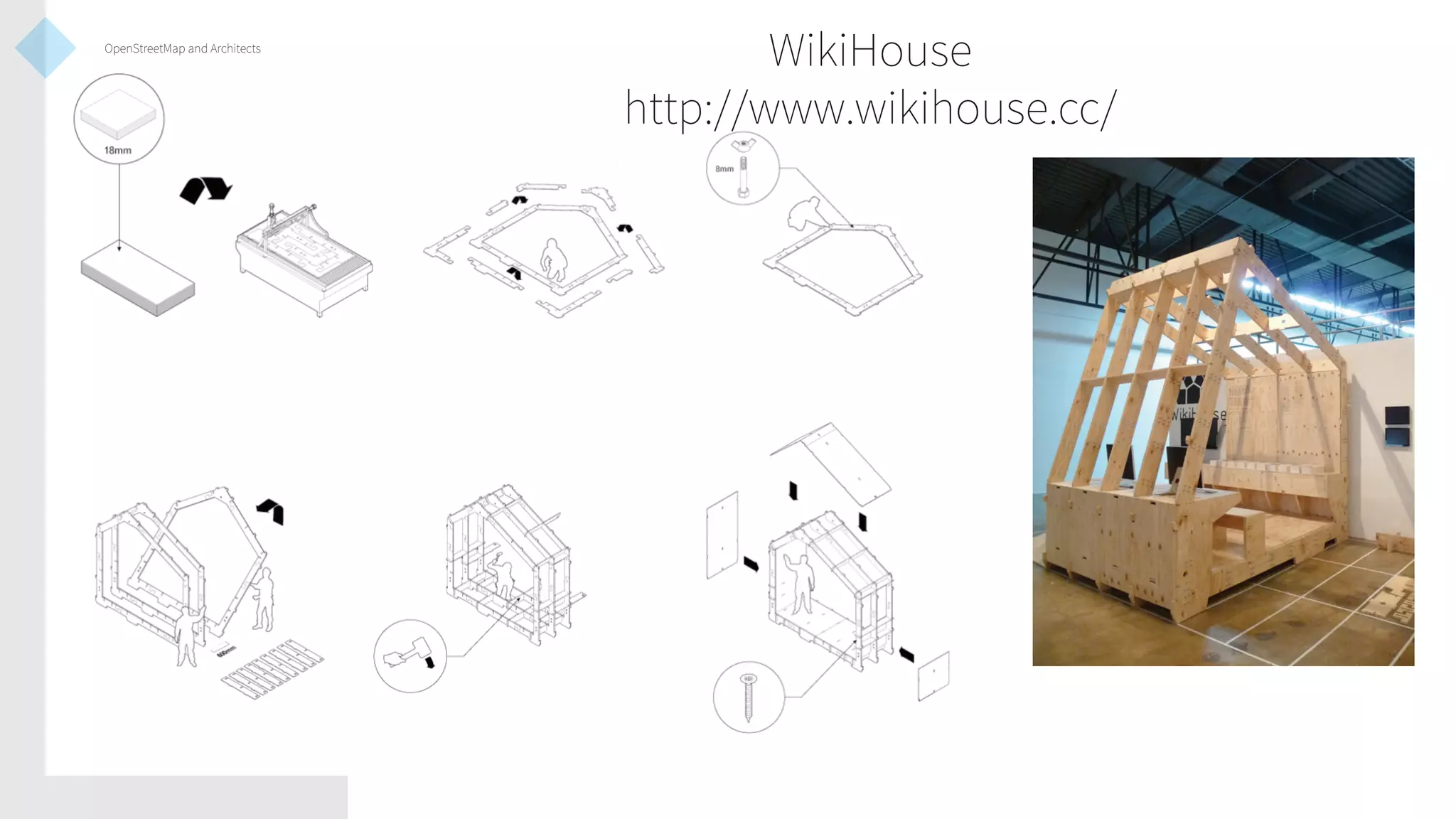
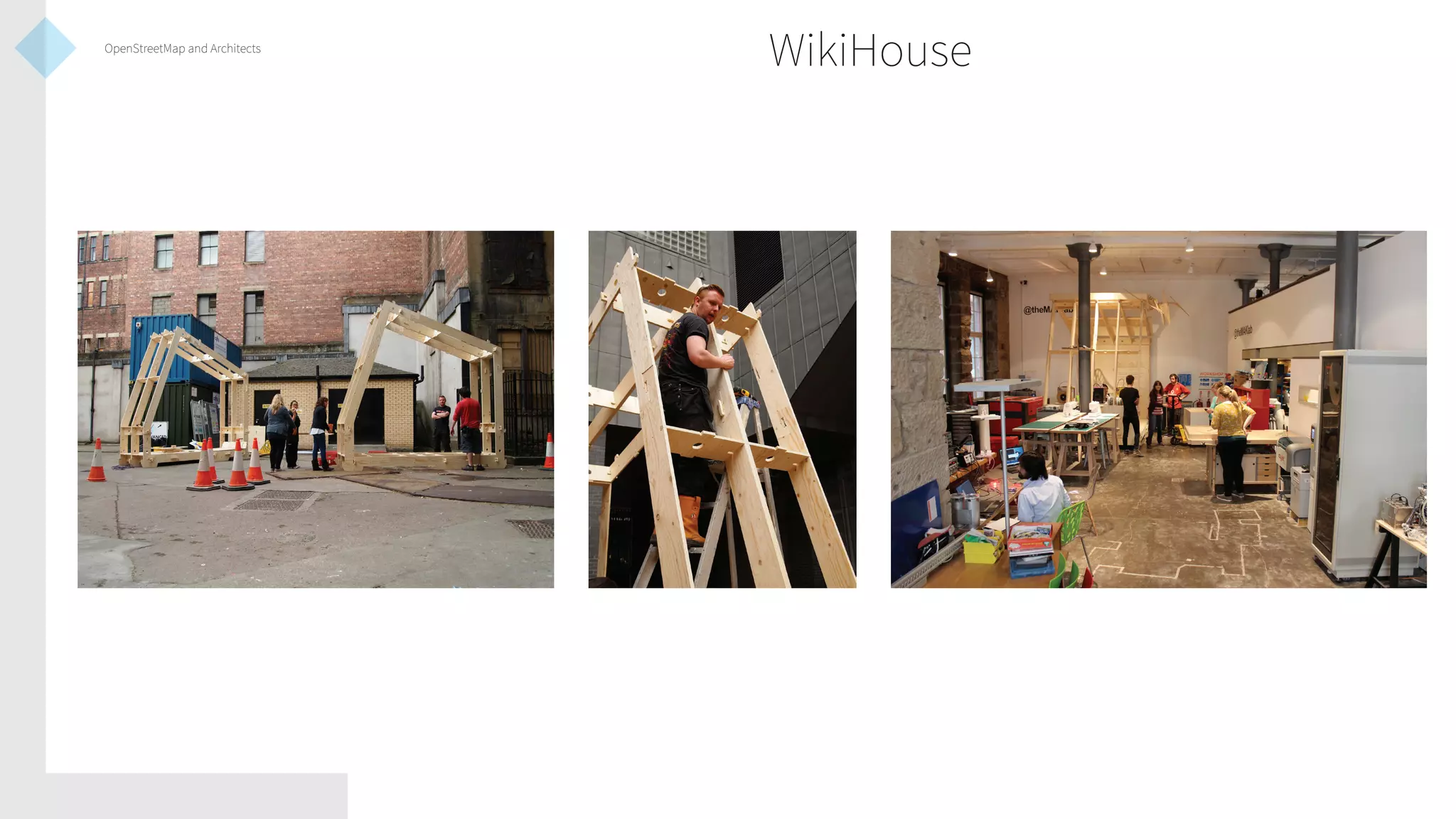
Introductions

The Gorbals in Relief:
Experiments in
OpenStreetMap and
Architectural Practice
Duncan Bain
@dncnbn
duncanbain.com
Introductions

I am Duncan Bain, a Glasgowbased architecture graduate
and current MPhil researcher at
the University of Edinburgh.
This presentation introduces
one of the projects that I
have recently taken part in;
the creation of community
developed
3D
building
information and open source
architectural model data, and
explores where this technology
might lead us to.
Introductions

Introductions
Overview of the Gorbals project
Workflow
Where to take the technology?
How to get there?
OpenStreetMap and Architects
Overview of the Gorbals Project

A project, initiated by MAKLab
in Glasgow, to develop tools for
community assets mapping and
the creation of materials that
could be used by community
organisations and individuals
in development work.

An experiment in creating 3D
visualisations and architectural
models from open data.
Overview of the Gorbals Project

What is MAKLab
Overview of the Gorbals Project
Workflow

Workflow
OSM Tags
OSM2World
3D CAD processing
Fabrication
Workflow

OSM Tags
building:height

Sets the buildings height from ground level to top of roof.

building:levels

Sets the number of stories and can be used to approximate
total height.

roof:height

Sets height from top of roof to the eaves

roof:shape

Sets generic roof configuration, including typical forms such
as gable, hipped, mansard etc.
http://wiki.openstreetmap.org/wiki/Simple_3D_Buildings
Workflow
Workflow

http://osmbuildings.org
Workflow

http://www.itoworld.com/
Workflow

From OSM to OSM2World

Export .osm file of desired area from
JOSM or OSM website.
Open OSM2World and select “Open
OSM File”
Large filesizes and areas with highly
detailed buildings will take a while to
process
OSM2World
OSM2World
Workflow

OSM2World to 3D CAD Processing

Export data as .obj file
Import .obj file in to preferred CAD
programme (eg. Sketchup, Rhino)
Clean up glitches and excess data
Workflow

3D CAD processing
Workflow

3D CAD processing
Workflow

3D CAD processing
Workflow

Fabrication

From CAD package, file can be
exported for 3D printing
Increasing number of local 3D printing
and digital fabrication services
Online services like Shapeways deliver
in a range of materials
Workflow
Workflow
Where to take the technology?

Will this concept be expanded
to cover other areas?
Might every buildlng on OSM
one day have height and shape
data?
Could this data provide a tool
to create cheap and open tools
and materials for community
groups and designers seeking
to transform their local areas?
Where to take the technology?

http://maps.osm2world.org/
How to get there?

Apple Maps and Google Earth
LIDAR and Photography
How to get there?

What tools currently exist
that offer potential routes of
exploration in developing this
technology?
How can we develop the data
required, and how can and
should that data be integrated
into OpenStreetMap?
How can both OpenStreetMap
and designers benefit from this
exploration?
How to get there?

Terrafab
http://terrafab.bengler.no/
How to get there?

Terrafab
http://terrafab.bengler.no/
How to get there?

Terrafab
http://terrafab.bengler.no/
How to get there?

Terrafab
http://terrafab.bengler.no/
How to get there?

Terrafab
http://terrafab.bengler.no/
How to get there?

OS Open Data
OS Terrain 50
How to get there?

OS Open Data
OS Vectormap District
How to get there?

Terrainator
http://terrainator.com/
How to get there?

Wikihouse/OpenDesk Model
Open data and local fabrication
How to get there?

Wikihouse/OpenDesk Model
Open data and local fabrication
How to get there?

How to streamline the process?
Can OS contour (or other 3D data) be
incorporated into OSM, or attached
as standalone service? Is this even
desirable?
How can building footprints work to
fit this 3D surface?
Need to develop a system similar
to export settings on OSM website Simple!
OpenStreetMap and Architects

How can architects and other
design professionals working
in the built environment
incorporate
OpenStreetMap
into their practices?
How might OpenStreetMap be
developed to better serve these
practices?
Where do architects fit in the
open knowledge and data
movement and how can they
contribute?
OpenStreetMap and Architects

OSM at an ‘architectural’ scale?
Will there ever be a demand for
accuracy to the scale of architectural
working drawings?
How to achieve accuracy at this scale
using existing OSM techniques?
Where to find and how to collect this
data?
OpenStreetMap and Architects

A student army of mappers!
OpenStreetMap and Architects

Architects and Open/Commons
INPUTS:
Geographical data, CADesign data
PROCESS (Tools):
CAD
packages,
Fabrication
technologies (models, components)
OUTPUTS: Improved accuracy of
geographical data, CADesign data,
Architecture?!
OpenStreetMap and Architects

WikiHouse
http://www.wikihouse.cc/
OpenStreetMap and Architects

WikiHouse
A summary...

Overview of the Gorbals project
Workflow
Where to take the technology?
How to get there?
OpenStreetMap and Architects
Introductions

The Gorbals in Relief:
Experiments in
OpenStreetMap and
Architectural Practice
Duncan Bain
@dncnbn
duncanbain.com

The Gorbals in Relief: Experiments in OpenStreetMap and Architectural Practice - State of the Map Scotland 2013 Presentation

  • 1.
    Introductions The Gorbals inRelief: Experiments in OpenStreetMap and Architectural Practice Duncan Bain @dncnbn duncanbain.com
  • 2.
    Introductions I am DuncanBain, a Glasgowbased architecture graduate and current MPhil researcher at the University of Edinburgh. This presentation introduces one of the projects that I have recently taken part in; the creation of community developed 3D building information and open source architectural model data, and explores where this technology might lead us to.
  • 3.
    Introductions Introductions Overview of theGorbals project Workflow Where to take the technology? How to get there? OpenStreetMap and Architects
  • 4.
    Overview of theGorbals Project A project, initiated by MAKLab in Glasgow, to develop tools for community assets mapping and the creation of materials that could be used by community organisations and individuals in development work. An experiment in creating 3D visualisations and architectural models from open data.
  • 5.
    Overview of theGorbals Project What is MAKLab
  • 6.
    Overview of theGorbals Project
  • 7.
    Overview of theGorbals Project
  • 8.
    Overview of theGorbals Project
  • 9.
    Overview of theGorbals Project
  • 10.
    Overview of theGorbals Project
  • 11.
  • 12.
    Workflow OSM Tags building:height Sets thebuildings height from ground level to top of roof. building:levels Sets the number of stories and can be used to approximate total height. roof:height Sets height from top of roof to the eaves roof:shape Sets generic roof configuration, including typical forms such as gable, hipped, mansard etc. http://wiki.openstreetmap.org/wiki/Simple_3D_Buildings
  • 13.
  • 14.
  • 15.
  • 16.
    Workflow From OSM toOSM2World Export .osm file of desired area from JOSM or OSM website. Open OSM2World and select “Open OSM File” Large filesizes and areas with highly detailed buildings will take a while to process
  • 17.
  • 18.
  • 19.
    Workflow OSM2World to 3DCAD Processing Export data as .obj file Import .obj file in to preferred CAD programme (eg. Sketchup, Rhino) Clean up glitches and excess data
  • 20.
  • 21.
  • 22.
  • 24.
    Workflow Fabrication From CAD package,file can be exported for 3D printing Increasing number of local 3D printing and digital fabrication services Online services like Shapeways deliver in a range of materials
  • 25.
  • 26.
  • 27.
    Where to takethe technology? Will this concept be expanded to cover other areas? Might every buildlng on OSM one day have height and shape data? Could this data provide a tool to create cheap and open tools and materials for community groups and designers seeking to transform their local areas?
  • 28.
    Where to takethe technology? http://maps.osm2world.org/
  • 29.
    How to getthere? Apple Maps and Google Earth LIDAR and Photography
  • 30.
    How to getthere? What tools currently exist that offer potential routes of exploration in developing this technology? How can we develop the data required, and how can and should that data be integrated into OpenStreetMap? How can both OpenStreetMap and designers benefit from this exploration?
  • 31.
    How to getthere? Terrafab http://terrafab.bengler.no/
  • 32.
    How to getthere? Terrafab http://terrafab.bengler.no/
  • 33.
    How to getthere? Terrafab http://terrafab.bengler.no/
  • 34.
    How to getthere? Terrafab http://terrafab.bengler.no/
  • 35.
    How to getthere? Terrafab http://terrafab.bengler.no/
  • 36.
    How to getthere? OS Open Data OS Terrain 50
  • 37.
    How to getthere? OS Open Data OS Vectormap District
  • 38.
    How to getthere? Terrainator http://terrainator.com/
  • 39.
    How to getthere? Wikihouse/OpenDesk Model Open data and local fabrication
  • 40.
    How to getthere? Wikihouse/OpenDesk Model Open data and local fabrication
  • 41.
    How to getthere? How to streamline the process? Can OS contour (or other 3D data) be incorporated into OSM, or attached as standalone service? Is this even desirable? How can building footprints work to fit this 3D surface? Need to develop a system similar to export settings on OSM website Simple!
  • 42.
    OpenStreetMap and Architects Howcan architects and other design professionals working in the built environment incorporate OpenStreetMap into their practices? How might OpenStreetMap be developed to better serve these practices? Where do architects fit in the open knowledge and data movement and how can they contribute?
  • 43.
    OpenStreetMap and Architects OSMat an ‘architectural’ scale? Will there ever be a demand for accuracy to the scale of architectural working drawings? How to achieve accuracy at this scale using existing OSM techniques? Where to find and how to collect this data?
  • 44.
    OpenStreetMap and Architects Astudent army of mappers!
  • 45.
    OpenStreetMap and Architects Architectsand Open/Commons INPUTS: Geographical data, CADesign data PROCESS (Tools): CAD packages, Fabrication technologies (models, components) OUTPUTS: Improved accuracy of geographical data, CADesign data, Architecture?!
  • 46.
  • 47.
  • 48.
    A summary... Overview ofthe Gorbals project Workflow Where to take the technology? How to get there? OpenStreetMap and Architects
  • 49.
    Introductions The Gorbals inRelief: Experiments in OpenStreetMap and Architectural Practice Duncan Bain @dncnbn duncanbain.com