How to estimate beach slopes in the absence of in situ measurements? Here are my slides from a recent presentation at the Coast2Coast webinar (organised by @Giovanni Coco, @Kristen Splinter, @Mitchell Harley) on a new technique to estimate beach slopes using satellite-derived shorelines and a global tide model.
Beach slope data available at http://coastsat.wrl.unsw.edu.au/ and preprint at https://www.essoar.org/doi/10.1002/essoar.10502903.1.
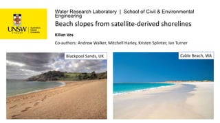
Beach slopes from satellite-derived shorelines [Coast2Coast presentation]
1. Water Research Laboratory | School of Civil & Environmental
Engineering
Co-authors: Andrew Walker, Mitchell Harley, Kristen Splinter, Ian Turner
Kilian Vos
Beach slopes from satellite-derived shorelines
Blackpool Sands, UK Cable Beach, WA
2. • Uses Google Earth Engine
• Landsat 5, 7, 8 + Sentinel-2
• Global coverage
• 30+ years shoreline change
time-series
• Validated against long-term
in-situ shoreline data in
(Vos et al. 2019)
• 10-15 m horizontal
accuracy
CoastSat open-source toolbox
(https://github.com/kvos/CoastSat)
3. Prof. Andy Short
Beach-face slope: a critical parameter
β
• Key limitation for coastal inundation
forecasting at large spatial scales
• Melet et al. 2018. Under-estimated
wave contribution to coastal sea-level
rise. Nature Climate Change: “β was set
to 0.1 globally, which is a reasonable
estimate, although it may vary
substantially in space and time”
• Needed to tidally correct satellite-
derived shorelines
4. Prof. Andy Short
Beach-face slope: a critical parameter
• Key limitation for coastal inundation
forecasting at large spatial scales
• Melet et al. 2018. Under-estimated
wave contribution to coastal sea-level
rise. Nature Climate Change: “β was set
to 0.1 globally, which is a reasonable
estimate, although it may vary
substantially in space and time”
• Needed to tidally correct satellite-
derived shorelines
5. Prof. Andy Short
Beach-face slope: a critical parameter
• Key limitation for coastal inundation
forecasting at large spatial scales
• Melet et al. 2018. Under-estimated
wave contribution to coastal sea-level
rise. Nature Climate Change: “β was set
to 0.1 globally, which is a reasonable
estimate, although it may vary
substantially in space and time”
• Needed to tidally correct satellite-
derived shorelines
Raw time-series
Tidally-corrected time-series
6. Prof. Andy Short
National scale by Geoscience Australia:
Bishop-Taylor et al. 2018
Inter-tidal digital elevation models
We need a new approach which incorporates the
dynamic nature of sandy beaches
7. From time to frequency domain
Let’s create a synthetic planar beach: 0.1 fixed beach slope, 1 m tide tanβ = 0.1
TR = 1m
MHWS
MLWS
Synthetic shoreline signal
Sampled weekly
25% randomly dropped
Seasonal shoreline change
(20 m amplitude)
White-noise (5 m STD)
Horizontal tidal excursion
8. From time to frequency domain
Let’s create a synthetic planar beach: 0.1 fixed beach slope, 1 m tide tanβ = 0.1
TR = 1m
MHWS
MLWS
Lomb-Scargle transform to compute Power
Spectrum Density of irregularly sampled signal
Msf lunisolar
synodic fortnightly
Sa solar annual
10. Tidal excursion
White noise
Seasonal signal
From time to frequency domain
Time
Domain
tanβ = 0.1
TR = 1m
MHWS
MLWS
Frequency
Domain
Tidal correction
11. Tidal excursion
White noise
Seasonal signal
From time to frequency domain
Time
Domain
tanβ = 0.1
TR = 1m
MHWS
MLWS
Frequency
Domain
Tidal correction
12. Tidal excursion
White noise
Seasonal signal
From time to frequency domain
Time
Domain
tanβ = 0.1
TR = 1m
MHWS
MLWS
Frequency
Domain
Tidal correction
13. Tidal excursion
White noise
Seasonal signal
From time to frequency domain
Time
Domain
tanβ = 0.1
TR = 1m
MHWS
MLWS
Frequency
Domain
Tidal correction
19. Regional-scale application:
SE Australia and California
• Demonstrates that this technique can be applied over large spatial scales
• A global value of tanβ = 0.1 is not a good approximation for these two coastlines
• All the data can be visualised and downloaded on a web dashboard at http://coastsat.wrl.unsw.edu.au/