SlideShare a Scribd company logo
1 of 52
Download to read offline
Page 1 of 52
SHACABKA DISTRIC
BORAMA, AWDAL SOMALILAND
Page 2 of 52
EELO
UNIVERCITY
Department of Civil engineering
Water supply
Project
2017-2018
Group Names ID No
Mohamed Abdi nour Mohamud 1488
Abdirahman Omar Abdulahi 1859
Abdirahman Farah Ainab 1467
Mohamed Ahmed Mohamed 1471
Yasin Said Mohamed 1469
Page 3 of 52
Acknowledgement
Civil Engineering student‘s at Eelo University would herby like to extent their
gratitude to certain individual and groups who took part in the successful completion
of this Mini project of water supply. It has been a tiresome almost first semester of
Senior and the work wouldn‘t have been a success without the contribution of each
and every person. Firstly we wish to thank Eelo University and Dean Faculty of
engineering Eng-Mohamed Harun and his staff all of whom played an important role
in the provision of a suitable environment for studies. Without their tireless efforts we
would not have become who we are today secondly, the team is indebted to Dean
Eng-M.Harun, Lecturer at Eelo University for his role in the process of the project. He
thoroughly followed each and every stage the project has been through and made
valuable assists and contribution. He was also very quick to deliver our needs upon
request.
Page 4 of 52
Abstract
In this senior undergraduate final year design project the provision of safe public
water supply for the community in part of Shacabka Area, which will adequately
serve the current and future community the coming decade will be designed.
The major tasks of the project is planning and designing of sustainable public water
supply scheme for the district in part of Shacabka Area and preparation of contract
document for its implementation within a one-month time after the completion of the
final design work.
The engineering design work includes all the necessary design details focusing on
structural safety.
Page 5 of 52
Contents
Acknowledgement..................................................................................................
CHAPTER ONE: INTRODUCTION
1.1 General background of the book
1.2 Water distribution Network
1.3 Geographical location and background of Borama city
1.4 Climate and rainfall of the city
1.5 Location and purpose of our project
1.6 Project design period
Chapter 2: Existing water supply system of the city
2.1 historical development of Borama supply system
2.2 Development and establishment of existing water supply of
Borama (SHABA)
2.3 present situation of water source of Borama city
CHAPTER 3: population focusing and WATER
Demand
3.1 Definition of population forecasting ………………
3.2 Methods of population forecasting
3.3 Design of population forecasting
3.4 Definition of water Demand ………..
3.5 Types of water demand……..................................................
3.6 Break up per capita Demand....................................................
Chapter 4: Selected water source..................................
Page 6 of 52
4.1. Introductions
4.2. The Global water cycle
4.3. Distribution of Fresh Water
4.4. Source of water
4.5. Ground water
4.6. Selected water source of our project
Chapter 5: Distribution of Water........................................
5.1 Definition of water distribution system
5.2 layouts of distribution Network
5.3 Pumping System
5.4 Design criteria and distribution head loss
5.5 storage Water Tank
5.6 design of circular water tank
Chapter 6: EPANET SOFTWARE..................................................
6.1. Definition
6.2. Epenet Report
6.3. Epenet tables
6.4. Epenet Graphs
Chapter 7: Conclusion and recommendation
7.1. Conclusion
7.2. Recommendation
References....................................................................................................
CHAPTER ONE
Introduction & General background
Water is one most important gift to a mankind. Essential to life, a person's survival
depends on drinking water. Water is one of the most essential elements to good
health—it is necessary for the digestion and absorption of food; helps maintain proper
muscle tone; supplies oxygen and nutrients to the cells; rids the body of wastes; and
serves as a natural air conditioning system. Health officials emphasize the importance
Page 7 of 52
of drinking at least eight glasses of clean water each and every day to maintain good
health.
1.2 Water supply Distribution network
The water in the supply network is maintained at positive pressure to ensure that water
reaches all parts of the network, that a sufficient flow is available at every take-off
point and to ensure that untreated water in the ground cannot enter the network. The
water is typically pressurized by pumps that pump water into storage tanks
constructed at the highest local point in the network. One network may have several
such service reservoirs.
1.3 Location and background of Borama city
Borama, is the capital and the largest city of the northwestern Awdal region
of Somalia which is part of the self-proclaimed republic of Somaliland. The city
locates 120 km far from the capital city of Hargaisa in western direction.
The city is sited on hilly and mountainous which geographical coordinates 90 N and
430 E Borama is one of the coldest places in somalia. The
average elevation of the town is 1460 MSL. According to the
UNDP in 2005 the city had a population of around 215,616,
making it one of the largest cities inside the borders of
Somalia
1.4 Climate and rainfall of the city
The climate of the city the warmest month of the year is June
with an average temperature of 24.1 °C. In January, the average temperature is
17.1 °C. It is the lowest average temperature of the whole year and the difference in
precipitation between the driest month and the wettest month is 110 mm. The average
temperatures vary during the year by 7 °C
Page 8 of 52
Average climate of Borama city
month Jan Feb Marc
h
Apri
l
May Jun July Aug Sep Oct Nov Dec Year
Average
high °C
(°F)
24.6
(76.3
)
25.4
(77.7
)
27.5
(81.5
)
27.8
(82)
29.3
(84.7
)
30.0
(86)
28.8
(83.8
28.8
(83.8
)
29.0
(84.2
)
27.4
(81.
3)
25.8
(78.4
)
24.4
(75.9
)
27.4
(81.3)
Average
Low °C
(°F)
9.7
(49.5)
11.7
(53.1)
13.8
(56.8)
15.7
(60.3)
17.0
(62.6)
18.3
(64.9)
17.8
(64)
17.6
(63.7)
17.3
(63.1)
13.7
(56.7
)
11.3
(52.3)
10.4
(50.7
)
14.53
(58.14
)
Average
rainfall
mm(inch
)
6
(0.24)
21
(0.83)
36
(1.42)
86
(3.39)
61
(2.4)
32
(1.26)
78
(3.07)
112
(4.41)
(
86
(3.39)
18
(0.71
)
10
(0.39)
2
(0.08
)
548
(21.59
)
1.6 Location and Purpose of our project
Our water supply plan district known as SHACABKA and it locates in central Of
Borama special it starts from the court of the city up to Harawa primary school which
is near to Rays Hotel
The purpose of the project ―Water Supply Borama‖ was the rehabilitation and
Expansion of the urban water supply system in SHACABKA distinct in Borama,
Purpose of our project is to supply adequate water to that district.
Page 9 of 52
1.6Project Design period
Design period: It is the number of years in future for which the given facility is
available to meet the demand.
Why Design period is provided
Design period is provided because
Page 10 of 52
 It is very difficult or impossible to provide frequent extension.
 It is cheaper to provide a single large unit rather to construct a number of small
units.
Factors affecting design period
Following are some factors which affect the design period of the structure.
 Life of the structure
Life of structure is the number of years in future for which the design period is
physically suitable to provide the intended facility. So it should be less than life of
structure.
 Ease or difficulty in extension
For the projects whose extension is easily possible, it is kept low. For example we can
install new tube wells at any time, so we do not need to install all tube wells which
would be required after 20 years.
But for the projects whose extension is difficult, their design period is kept
greater. For example dams and reservoirs cannot be extended easily.
 Rate of population growth
If the rate of population growth is higher, then for that region shorter design period is
required.
 Lead time
It is the time from the commencement of a project to its completion. Design period
should be greater than lead time.
Page 11 of 52
 Economy of scale
The decrease in average cost as the size of facility increase is known as economy of
scale.
If the economy of scale is small, smaller design period will be used. It is economical
to build a large structure, for longer design period.
 Performance time
Structures are checked under working condition for some time, which should not be
considered in design period. During this time it is not providing facility to community.
Our project design period is Next 25 years
Page 12 of 52
Chapter Two
Existing water supply system of the city
2.1 Historical development of Borama supply system
Historical development of Borama supply system 1938 after 3 failed attempts to drill a well
Demok spring was tapped to pump by British In 1959 the system was extended 3.5 km to town
through sh.Ali storage tank but besides main little development subsequently occurred until
after the Somali Ethiopian war of 1977 when borama received an influx of refugees.
From 1984 – 1986 USAID funded studies of regional ground water potential and test wells
were drilled in the demok and amoud valleys. A parallel hydrological investigation 1986
resulted in nine test wells. Caritas MHD and German drilled wells struck water in the same
period.
Following civil war which reached peak of intensity around 1991 only two chines wells were
in operation. During 1990s despite intervention by international aid failure in delivery of water
to town led to borama experiencing a sever water shortage between 2000-2002 by which
that time
Water system in public hands are collapsed and damok spring had dried up.
2.2 Development and establishment of existing water supply of Borama company
(SHABA)
Failure of the public sector to make required improvement trigged questions concerning water
service and management options, opening dialogue between Boorama communities the
ministry of mineral and water resources (MMWR), Unicef and USAID pioneered by
academics of amoud university workshops were organized from June 2000 where in options of
private sector involvement interested community and business leaders who showed
willingness to invest. Modalities were agreed and shares were float with $105,000 capital
raised to establish Awdal utility company (SHABA) in 2003.
2.3 Present situation water source of Borama city
Borama uses only one source of water as a water supply system, Ground water, which
seems in the late years dropping-down with no aquifer contribution. Borama, the Chinese
drilled eight boreholes in 1988, five of which are under the Management of SHABA
Company, .SHABA have four wells Only three of the boreholes are in operation, as the
fourth one was kept inoperative to avoid well depletion. Original well depth was 45.5m.
The three operational boreholes are operated for an average of 18-20 hours/day, with
average yields of 25, 25 and 20 m3/hour respectively. Also, another 2 bore holes by
Islamic relief with a depth of 120m only one bore hole is functioning and operated.
Page 13 of 52
ChapterThree
Population Forecasting and water demand
3.1 Definition of population forecasting
Population Forecasting: is the prediction of how many people will be living in a
country or in a town at the same point in the future.
Since the water supply systems are designed for a certain design period, instead of
present population, population expected in the design period must be considered in the
design of water supply systems .
Forecasting of population can be accomplished with a different mathematical methods
by using present and past population records that can be obtained from a local census
office.
3.2 Methods of population forecasting
Those methods are generally classified under two categories:
A) Short term methods (1-10 years)
 Arithmetical increase method
 Geometrical increase method
 Incremental increase method
 Simple graph method
 Decrease rate of growth method
B) Long Term Methods ( 10- 50 years )
 Comparative graph method
 The master plan method
 Logistic Method (mathematical curve fitting )
Page 14 of 52
Short term methods (1-10 years)
ARITHMETICAL INCREASE METHOD
This method is suitable for large and old city with considerable development. If it is
used for
Small, average or comparatively new cities, it will give lower population estimate
than actual
Value. In this method the average increase in population per decade is calculated from
the
Past census reports.
This increase is added to the present population to find out the population
Of the next decade. Thus, it is assumed that the population is increasing at constant
rate.
Hence, dP/dt = C i.e., rate of change of population with respect to time is constant.
Therefore, Population after nth decade will be
Pn= P + n.C
Where, Pn is the population after ‗n‘ decades and ‗P‘ is present population.
GEOMETRICAL INCREASE METHOD
(OR GEOMETRICAL PROGRESSION METHOD)
In this method the percentage increase in population from decade to decade is
assumed to Remain constant. Geometric mean increase is used to find out the future
increment in Population. Since this method gives higher values and hence should be
applied for a new Industrial town at the beginning of development for only few
decades. The population at the End of nth decade ‗Pn‘ can be estimated as:
Pn = P (1+ IG/100) n (2)
Where, IG = geometric mean (%)
P = Present population
N = no. of decades.
Page 15 of 52
INCREMENTAL INCREASE METHOD
This method is modification of arithmetical increase method and it is suitable for an
average
size town under normal condition where the growth rate is found to be in increasing
order.
While adopting this method the increase in increment is considered for calculating
future
population. The incremental increase is determined for each decade from the past
population
and the average value is added to the present population along with the average rate of
increase.
Hence, population after nth decade is
Pn = P+ n.X + {n (n+1)/2}.Y
Where, Pn = Population after nth decade
X = Average increase
Y = Incremental increase
Decreasing Rate of Growth Method
In this method, the average decrease in the percentage increase is worked out, and
is then subtracted from the latest percentage increase to get the percentage increase
of next decade
Simple graphical method Graph
Simple graphical method Graph between the population and the corresponding year
is plotted based on the available census data. The obtained curve is extended in the
same manner to get the population of required year.it is the approximate method as
the accuracy is dependent on the skill and experience of the person dragging the
curve.
Page 16 of 52
Long Term Methods (10- 50 years)
COMPARATIVE GRAPHICAL METHOD
In this method the census populations of cities already developed under similar
conditions are plotted. The curve of past population of the city under consideration
is plotted on the same graph. The curve is extended carefully by comparing with the
population curve of some similar cities having the similar condition of growth. The
advantage of this method is that the future population can be predicted from the
present population even in the absence of some of the past census report. The use of
this method is explained by a suitable example given below.
MASTER PLAN METHOD
The big and metropolitan cities are generally not developed in haphazard manner,
but are planned and regulated by local bodies according to master plan. The master
plan is prepared for next 25 to 30 years for the city. According to the master plan
the city is divided into various zones such as residence, commerce and industry.
The population densities are fixed for various zones in the master plan. From this
population density total water demand and wastewater generation for that zone can
be worked out. By this method it is very easy to access precisely the design
population.
LOGISTIC CURVE METHOD
This method is used when the growth rate of population due to births, deaths and
migrations takes place under normal situation and it is not subjected to any
extraordinary changes like epidemic, war, earth quake or any natural disaster, etc.,
and the population follows the growth curve characteristics of living things within
limited space and economic opportunity. If the population of a city is plotted with
respect to time, the curve so obtained under normal condition looks like S-shaped
curve and is known as logistic curve.
Page 17 of 52
3.3 Design of Population Forecasting
Geometrical increase method
Loop name Junction number Number of Houses
Loop 1 j1, j11, j2 50
Loop 2 J11, JB, JA, JC, JD and J10 43
Loop 3 JA,JB,J3,J2,J4 and JC 60
Loop 4 J10,J9,J8,J7 and JB 55
Loop 5 JD,JC,J6,J7 47
Loop 6 JC,J4,J5,J6 20
Total 275
The total households of SHACABKA is 275 assume that
Population of the district
Assume that the average people living in every house hold in Borama is 7 persons
And the total population of households are: 275x7=1925 persons
This data was made in 2018 and population of design area is estimated 1925
Water supply future population calculation
po =1925
Pn = future population
N=2.5
R=2.98
Pn = po ( ) n
Pn = 1925 ( ) 25
Pn = 4012 persons
Page 18 of 52
3.4 Demand of the Water
Water demand is the measure of the total amount used by the customers within the
water system. There are several things that can influence the amount of water
demanded of your system. One of the most important jobs of water system is to
continually meet this demand without interruption, rain.
Fluctuations in Rate of Demand
 Peak demand: the demand peaks during summer. Firebreak outs
are generally more in summer, increasing demand. So, there is
seasonal hourly demand
 Seasonal demand: depends on the activity. People draw out more
water on Sundays and Festival days, thus increasing demand on
hourly demand
 Daily peak demand days: are very important as they have a wide
range. During active household working hours i.e. from six to ten in
the morning and four to eight in the evening, the bulk of the daily
requirement is taken. During other hours the Requirement is
negligible
3.5 Types of water demand
The various types of water demands which a city may have may have may be
broken down into the following classes:
1. Domestic water demand
2. Industrial and commercial water demand
3. Institution and commercial water demand
4. Demand for public uses
5. Fire demand and
6. Water required to compensate losses in wastes and thefts
Page 19 of 52
Domestic Water Demand
The domestic water demand is the daily water requirement for use by human being for
different domestic purposes like drinking, cooking, bathing and etc. The domestic water
required by human being could be supplied or obtained through different modes of
services depending on the economic level and facilities owned by the individual.
Modes and level of services
In a conventional water supply system, there are five modes of services in which an
Individual could be served. These are;
 House Tap Users (HTU).
 Yard Tap Users (YTU).
 Neighborhood Tap Users (NTU).
 Public Tap Users (PTU).
 Traditional Sources Users (TSU).
Here in Borama, the modes of services are generally stick to the first three modes of
services, around 78% of Borama households uses indoor tap water divided into the
first two modes, HTU and YTU, 51% and 49% respectively of the 78% of the indoor
tap water users. The rest of 22% uses neighborhood tab users and public tap users.
However, in most water supply system feasibility studies for urban centers here in
Somaliland, the modes of services are generally stick to the first three classical modes
of services because of their simplicity from the viewpoint of service giving
institutions. Hence, for this project, in generally, it is assumed that house tap users
should be served.
In domestic demand the minimum domestic demand of water the human being can
survive is 20 l/head/day, which is the standard that the refugees supplies the water.
Page 20 of 52
Our project domestic water demand with full flashing
Type of demand Quantity (Liters/capita/day)
Drinking 5L
Bathing 35L
Cooking 5L
Clothes washing 30
Utensil washing 15
House washing 20
Total 110
Demand water for public use: this include the quantity of water
required for public utility purposes, such as watering of public parks, gardening, washing
and sprinkling and roads, use in public fountains. 6 liters /days.
Industrial water demand: the industrial water demand represents
the water demand of industries, which are either existing or are like to be starting in the
future, in the city for which water supply is been planned. in our designed SHACABKA
distinct there only two industries which are :
a) Bakery industry
b) And hallow block industry
c) Other future expectation industries
Therefore our project industrial demand is = 35 liters/head/capita
Institutional and commercial water demand: the
water requirements of institutions, such as hospitals, hotels, restaurants, schools and
colleges, rail way stations, office, factors etc.
Institutional and commercial = 15 l/h/day
Page 21 of 52
Fire demand: in the thickly populated and industrial areas, fire generally
break out and may lead to serious damages, if not controlled effectively.
Big cities, therefore, generally maintain full firefighting squads.
Fire-fighting personal require sufficiently quantity of water, so as to throw it over the
fire at higher speeds. Provision should, therefore, be made in modern public water
supply schedule for fighting fire.
3.6 Per capital demand
Per capital demand is annual average rate of flow in liter per day by person
Factors affecting per capita demand:
• Size of the city: Per capita demand for big cities is generally large as compared to
that for smaller towns as big cities have sewered houses.
• Presence of industries.
• Climatic conditions.
• Habits of economic status.
• Quality of water: If water is aesthetically $ people and their
• Medically safe, the consumption will increase as people will not resort to private
wells, etc.
• Pressure in the distribution system.
• Efficiency of water works administration: Leaks in water mains and services;
and un authorized use of water can be kept to a minimum by surveys.
• Cost of water.
• Policy of metering and charging method: Water tax is charged in two different
ways: on the basis of meter reading and on the basis of certain fixed monthly rate.
In our firefighting design we use buston’s formula it states that:
NB: use your population in 1000s
Population = 4012 which equals 4.012
Q = 5663√ = 5663√ = 11342.9 L/day
Losses and Thefts = assume that losses is approximately 15% of the domestic
demand = 0.15 x 110
= 16.5L/h/day
Page 22 of 52
BREAK UP PER CAPITA DEMAND (Q) FOR AN AVERAGE OF Water Supply Distinct.
USE DEMAND IN L/h/day
a) Domestic use 110 L
b) Industrial use 35 L
c) Commercial and institutional use 15 L
d) Civic or public use 6 L
e) Wastage and thefts 16.5 L
TOTAL 182.5 L/day
1) Domestic demand = domestic demand*population design
110L/day*4012 people = 441320 L/day
2) Industrial demand = industrial demand*population designed
35L/day*4012 people = 140,420 L/day
3) Commercial and institutional water demand = commercial
demand*population designed
15L/day*4012 people = 60180 L/day
4) Civic or public demand = civic or public *population designed
6L/day *4012 people = 24072 L/day
5) Waste and thefts demand = waste and thefts demand* population
16.5 L/day *4012 people = 66198 L/day
Total avg demand =domestic demand +institutional &commercial +industrial
+public+loses +fire demand
Total avg demand = 441320 L/day + 140420 L/day + 60180 L/day + 24072 L/day
+ 66198 L/day + 11342.9 L/day = 721532.9 L/ day.
I. The maximum daily consumption is generally taken as 180 percentage of
the average 180%*average daily demand
II. 1.8q = 1.8 x 721532.9 L /d = 1298759.22 L/d
Page 23 of 52
Peak hourly Demand: is the, maximum hourly consumption and is generally
taken as 150 percentage of its average
150%*average hourly consumption of the maximum day
1.5(
1.5( ) = 2.7( ) = 2.7( ) = 42540.75 L/hour
Page 24 of 52
Chapter Four
Selected Sources of Water
4.1. Introduction
 Nature of water source determines the components if the water supply
system:
 Factors to be consider to select source:
 Quantity
 Quality
 Reliability
 Safety of source
 Water rights
 Environmental impacts
Water resources are under major stress around the world. Rivers, lakes, and
underground aquifers supply fresh water for irrigation, drinking, and sanitation,
while the oceans provide habitat for a large share of the planet's food supply. Today,
however, expansion of agriculture, damming, diversion, over-use, and pollution
threaten these irreplaceable resources in many parts of the globe. Providing safe
drinking water for the more than 1 billion people who currently lack it is one of the
greatest public health challenges facing national governments today. In many
developing countries, safe water, free of pathogens and other contaminants, is
unavailable to much of the population, and water contamination remains a concern
even for developed countries with good water supplies and advanced treatment
systems. And over-development, especially in coastal regions and areas with strained
water supplies, is leading many regions to seek water from more and more distant
sources.
This unit describes how the world's water supply is allocated between major reserves
such as oceans, ice caps, and groundwater. It then looks more closely at how
Page 25 of 52
groundwater behaves and how scientists analyze this critical resource. After noting
which parts of the world are currently straining their available water supplies, or will
do so in the next several decades, we examine the problems posed by salinization,
pollution, and water-related diseases.
Scientists widely predict that global climate change will have profound impacts on
the hydrologic cycle, and that in many cases these effects will make existing water
challenges worse rising global temperatures will alter rainfall patterns, making
them stronger in some regions and weaker in others, and may make storms more
frequent and severe in some areas of the world. Warming will also affect other
aspects of the water cycle by reducing the size of glaciers, snow packs, and polar
ice caps and changing rates of evaporation and transpiration. In sum, climate
change is likely to make many of the water-management challenges. At the same
time, many current trends in water supply and water quality in the world are
positive. Thirty years ago, many water bodies in developed countries were highly
polluted. For example, on June 22, 1969, the Cuyahoga River in Cleveland, Ohio,
caught fire when sparks ignited an oily slick of industrial chemicals on its surface.
Today, the United States and western European countries have reduced pollution
discharges into rivers and lakes, often producing quick improvements in water
quality. These gains show that when societies make water quality a priority, many
polluted
Sources can be made usable once again. Furthermore, in the United States water
consumption rates have consistently declined over the last several decades.
Page 26 of 52
4.2. The Global Water Cycle
Water covers about three-quarters of Earth's surface and is a necessary element for
life. During their constant cycling between land, the oceans, and the atmosphere,
water molecules pass repeatedly through solid, liquid, and gaseous phases (ice, liquid
water, and water vapor), but the total supply remains fairly constant. A water
molecule can travel to many parts of the globe as it cycles.
As discussed in Unit 2, "Atmosphere," and Unit 3, "Oceans," water vapor
redistributes energy from the sun around the globe through atmospheric circulation.
This happens because water absorbs a lot of energy when it changes its state from
liquid to gas. Even though the temperature of the water vapor may not increase when
it evaporates from liquid water, this vapor now contains more energy, which is
referred to as latent heat. Atmospheric circulation moves this latent heat around
Earth, and when water vapor condenses and produces rain, the latent heat is released.
Very little water is consumed in the sense of actually taking it out of the water cycle
permanently, and unlike energy resources such as oil, water is not lost as a
consequence of being used. However, human intervention often increases the flux of
water out of one store of water into another, so it can deplete the stores of water that
are most usable. For example, pumping groundwater for irrigation depletes aquifers
by transferring the water to evaporation or river flow. Our activities also pollute
water so that it is no longer suitable for human use and is harmful to ecosystems.
There are three basic steps in the global water cycle: water precipitates from the
atmosphere, travels on the surface and through groundwater to the oceans, and
evaporates or transpires back to the atmosphere from land or evaporates from the
oceans. Figure 2 illustrates yearly flow volumes in thousands of cubic kilometers.
Page 27 of 52
Supplies of freshwater (water without a significant salt content) exist because
precipitation is greater than evaporation on land. Most of the precipitation that is not
transpired by plants or evaporated, infiltrates through soils and becomes
groundwater, which flows through rocks and sediments and discharges into rivers.
Rivers are primarily supplied by groundwater, and in turn provide most of the
freshwater discharge to the sea. Over the oceans evaporation is greater than
precipitation, so the net effect is a transfer of water back to the atmosphere. In this
way freshwater resources are continually renewed by counterbalancing differences
between evaporation and
Precipitation on land and at sea, and the transport of water vapor in the atmosphere
from the sea to the land. Nearly 97 percent of the world's water supply by volume is
held in the oceans. The other large reserves are groundwater (4 percent) and icecaps
and glaciers (2 percent), with all other water bodies together accounting for a fraction
of 1 percent. Residence times vary from several thousand years in the oceans to a few
days in the atmosphere.
Page 28 of 52
Solar radiation drives evaporation by heating water so that it changes to water vapor at
a faster rate. This process consumes an enormous amount of energy nearly one-third
of the incoming solar energy that reaches Earth's surface. On land, most evaporation
occurs as transpiration through plants: water is taken up through roots and evaporates
through stomata in the leaves as the plant takes in CO2. A single large oak tree can
transpire up to 40,000 gallons per year (footnote 1). Much of the water moving
through the hydrologic cycle thus is involved with plant growth. Since evaporation is
driven by heat, it rises and falls with seasonal temperatures. In temperate regions,
water stores rise and fall with seasonal evaporation rates, so that net atmospheric input
(precipitation minus evaporation) can vary from positive to negative. Temperatures
are more constant in tropical regions where large seasonal differences in precipitation,
such as monsoon cycles, are the main cause of variations in the availability of water.
In an effort to reduce these seasonal swings, many countries have built reservoirs to
capture water during periods of high flow or flooding and release water during periods
of low flow or drought. These projects have increased agricultural production and
mitigated floods and droughts in some regions, but as we will see, they have also had
major unintended impacts on water supplies and water quality.
The hydrologic cycle is also coupled with material cycles because rainfall erodes and
weathers rock. Weathering breaks down rocks into gravel, sand, and sediments, and is
an important source of key nutrients such as calcium and sulfur. Estimates from river
outflows indicate that some 17 billion tons of material are transported into the oceans
each year, of which about 80 percent is particulate and 20 percent is dissolved. On
average, Earth's surface weathers at a rate of about 0.5 millimeter per year. Actual
rates may be much higher at specific locations and may have been accelerated by
human activities, such as emissions from fossil fuel combustion that make rain and
snowfall more acidic.
Page 29 of 52
4.3. Distribution of Freshwater Resources
Freshwater accounts for only some 6 percent of the world's water supply, but is
essential for human uses such as drinking, agriculture, manufacturing, and
sanitation. As discussed above, two-thirds of global freshwater is found
underground. If you dig deeply enough anywhere on Earth, you will hit water.
Some people picture groundwater as an underground river or lake, but in reality it
is rarely a distinct water body (large caves in limestone aquifers are one
exception). Rather, groundwater typically fills very small spaces (pores) within
rocks and between sediment grains. The water table is the top of the saturated zone
(Fig. 3). It may lie hundreds of meters deep in deserts or near the surface in moist
ecosystems. Water tables typically shift from season to season as precipitation and
transpiration levels change, moving up during rainy periods or periods of little
transpiration and sinking during dry phases when the rate of recharge
(precipitation minus evaporation and transpiration that infiltrates from the surface)
drops. In temperate regions the water table tends to follow surface topography,
rising under hills where there is little discharge to streams and falling under valleys
where the water table intersects the surface in the form of streams, lakes, and
springs.
4.4. Sources of water
There are three classifications of source of water
 Surface water
 Ground water
 Ground water under the direct influence of surface water
Surface water
Surface water is a water that is open to the atmosphere and result from overland
flow.it is also said to be the results of surface Runoff these are two types of saying the
same thing.
Page 30 of 52
Example of surface water
Specific source that are classified as surface water including the following:
 Streams, River and Lakes
 Man-made impoundments(lake made by damming as a stream or
river|)
 Springs effected by precipitation that falls in the vicinity of the
spring
 Shallow wells effected by precipitation
 Wells drilled next to or in a stream or river
 Rain catchment
4.5. Ground water
Ground water is considered to be water that is below the earth‘s crust, but not more
than 2500 feet below the crust. Water between the earth crust and the 2500-foot level
considered usable fresh water.
Ground water can be either
 Wells
 Springs that are not influenced by surface or a local hydrologic event
There are many sources that can get a water, But in Borama they get a water from one
type and that is well although it have many rain falls with a consequence times they does
not appropriate way for water catchment or other kinds of storing water to full fit their
needs.
4.6. SELECTED WATER SOURCE OF OUR PROJECT
According to our project we selected our water Water supply source for an well.
After the failure of distribution of water in the Shacabka distinct we decided to design a
new distribution system that can supply sufficient water into that distinct.
Therefore after design we expect
Page 31 of 52
Chapter Five
Storage of Water Distribution System
5.1 Definition of Water Distribution System
Water Distribution: is used to describe collectively the facilities used to supply
water from its source to the point of usage,
The purpose of distribution system is to deliver water to consumer with
appropriate quality, quantity and pressure. Distribution system is used to describe
collectively the facilities used to supply water from its source to the point of usage.
Requirements of Good Distribution System
1. Water quality should not get deteriorated in the distribution pipes.
2. It should be capable of supplying water at all the intended places with sufficient
pressure head.
3. It should be capable of supplying the requisite amount of water during
firefighting.
4. The layout should be such that no consumer would be without water supply,
during the repair of any section of the system.
5. All the distribution pipes should be preferably laid one metre away or above the
sewer lines.
6. It should be fairly water-tight as to keep losses due to leakage to the minimum
Page 32 of 52
Distribution system facilities
1. Pumps
2. Storage facilities
3. Transmission mains
4. Vales & hydrants
5. Meters
Storage facilities
1) Clear wells
2) Stand pipes
3) Elevated storage tanks
Elevated storage tanks can be divided in to three
1) Supporting structure
2) Use gravity
3) Filled in off-peak hours
5.2 Layouts of Distribution Network
The distribution pipes are generally laid below the road pavements, and as such their
layouts generally follow the layouts of roads. There are, in general, four different
types of pipe networks; any one of which either singly or in combinations, can be used
for a particular place
Layout of Distribution Network: there are two types of layout methods:
1. Branched Distribution ( Dead end system)
2. Grid iron system ( looped system)
Branched distribution: A branch system is similar to that of a tree branch, in which
smaller pipes branch off larger pipes throughout the service area, such that the water
can take only one pathway from the source to the consumer. This type of system is
most frequently used in rural areas.
Page 33 of 52
 Relatively cheep
 Determination of discharge and pressure easier due to less number of valves
Disadvantages:
 Due to many dead ends stagnation of water occurs in pipes,
Grid iron distribution system: A grid/looped system, which consist of connected
pipe loops throughout the area to be served, is the most widely used configuration in
large municipal areas. In this type of system there are several pathways that the water
can follow from the source to the consumer.
Page 34 of 52
Advantages:
• The grid system overcomes all of the difficulties of the branching system
discussed before.
• No dead ends. (All of the pipes are interconnected).
• Water can reach a given point of withdrawal from several directions.
Disadvantages:
• Hydraulically far more complicated than branching system (Determination of
the pipe sizes is somewhat more complicated) .
• Expensive (consists of a large number of loops).
Methods of distribution:
 For efficient distribution system adequate water pressure required at various
points
 Dependent upon the level of source, topography, of the area other local
conditions the water may be forced in to distribution system by the following
methods:
a. By Gravity system
b. By Pumping system
c. Combined gravity & pumping system
Gravity Supply: The source of supply is at a sufficient elevation
above the distribution area (consumers), and suitable when the source of water is at
sufficient height, most reliable economical distribution,
Page 35 of 52
Advantages of Gravity supply
 No energy costs.
 Simple operation (fewer mechanical parts, independence of power supply)
 Low maintenance costs.
 No sudden pressure changes
5.3 Pumping system: Used whenever, the source of water is lower
than the area to which we need to distribute water to (consumers). The source
cannot maintain minimum pressure required. Pumps are used to develop the
necessary head (pressure) to distribute water to the consumer and storage
reservoirs.
Combined Supply (pumped-storage supply): is the
most common system. The treated water is pumped and stored in an elevated
distribution reservoir, economical efficient, and reliable system.
Page 36 of 52
Water pumping: The pumping of water is a basic and practical technique, far
more practical than scooping it up with one's hands or lifting it in a hand-held bucket.
This is true whether the water is drawn from a fresh source, moved to a needed
location, purified, or used for irrigation, washing, or sewage treatment, or for
evacuating water from an undesirable location. Regardless of the outcome, the energy
required to pump water is an extremely demanding component of water consumption.
All other processes depend or benefit either from water descending from a higher
elevation or some pressurized plumbing system.
Pumping for lifting water
Given Data
Population = 4012
Per capita = 182.5lday
Distance of the well from pump = 304.9 m
Friction of pipe = 0.0075
Distance of pump from tank = 437.8 m
Page 37 of 52
Difference of elevation
Tank elevation = 1462
Pump elevation = 1463
Well elevation = 1456
Assume that the depth of the well is = 25m
Section heard = 20m
Delivery heard = (tank elevation – pump elevation) + height of elevated column
, + height of tank
= (1462 – 1463) + 6 + 3 = 8m
Total head = section heard + delivery = 20 + 8 = 28m
Operation time = 12hr‘s
V = 2.4m/s
Pump efficience ( = 85%
Discharge average = 1298759.22 L/d
Discharge daily demand = 1.5(Q) = 1.5 (1,298,759.22 L/d) = 1.94 M L/day
Capacity of the pump
12hr……………………………..1,948,138.8L/day
24hr……………………………..y
Capacity of the pump = 3,896,277.6 L/day
Discharge required per second = = 0.045m3/s =
Diameter of the main pipe = 1.22√ =
1.22√ = 0.26 m
Brake horse power of pump =
H = Hs +Hd + Hf
F‘
= 4F = 4 x 0.0075 = 0.03
Head loss Hf = = = 10.33 0 m
Total lift against which pump has to work = 20 + 8 +10.33 = 38.33 m
BHP = = = 27.1 HP
Page 38 of 52
5.4 Design criteria and Distribution
Head loss
Design criteria
Velocity and pipe diameter design Criteria
Optimum velocities in pipes of different sizes
Pipe diameter (cm) Approximate velocity in m/sec
10 0.9
15 1.2
25 1.5
40 1.8
Pressure
Pressure distribution systems ranges from 150-300 kPa in residential districts with
structures of four stories or less and 400-500 kPa in commercial districts. For fire
hydrants the pressure should not be less than 150 kPa (15 m of water).
In general for any node in the network the pressure should not be less than 25 m of
water.
However, the maximum pressure should be limited to 70 m of water.
Minimum pressure should not less than 14 m.
Maximum Distribution head loss
Distance from tank to the furthest joint of the distribution = 404.3 m
F = 0.00075
Assumed velocity = 1.2m/s
Diameter of the main pipe = 1.22√ = 1.22√ = 0.26 m
there for 260 mm is greater 200mm so that use : 200mm = 0.2 m
Head loss of the distribution ==
f‘ = 4F = 4 x 0.0075 = 0.03
Head loss Hf = = = 4.45 m
Total head loss = Hf + elevated tank height = 4.45 + 8 = 12.45 m
Head loses
• Optimum range is 1-4 m/km.
• Maximum head loss should not exceed 10 m/km.
Page 39 of 52
5.5 Storage water tanks
Storage tanks are built for storing water, liqu66id petroleum, petroleum products
and similar liquids.
CLASSIFICATIONS of STORAGE TANK
Classification based on under three heads:
1) Tanks resting on ground
2) Elevated tanks supported on staging
3) Underground tanks
Classification based on shapes
1) Circular tanks
2) Rectangular tanks
3) Spherical tanks
4) Intze tanks
5) Circular tanks with conical bottom
In Our project we designed a circular elevated tank
Page 40 of 52
5.6 DESIGN OF CIRCULAR WATER TANK
Given Data
Maximum discharge = 567210l L/day = 567.210m3
/day
One pumping is working
Discharge of pumping = 0.0131m3
/s x 3600s = 47.16m3
/hr
Step one
Pumping per hour = = 12 hr
Step two
Reservoir capacity
Balancing required
12hr………………………..567.21m3
24hr……………………….y
Y = 1134.2m3
Balance required = 1134.2 – 567.210 = 567.210m3
+ 25% 709 + 8.15 fire
= 717.16m3
Height of tank = 3m
Volume = 717.65m3
V = Ah
A = ( ) x h find Diameter
D = √ = 17.4m
Page 41 of 52
Chapter 6
Epanet software
6.1 Definition
EPANET is a public domain, water distribution system modeling software package
developed by the United States Environmental Protection Agency's (EPA) Water
Supply and Water Resources Division.
USES
Which uses a visual interface to model pressurized water distribution system, using
this program, pipes network( including pipes, nodes pumbs , valves , storage tanks
and reservoirs) can be physically drawn in the user or imported through GPS output
water quality at every junction, the flow rate, headloss and everage water quality
through every pipe.
Advantage :
 Complicated network and grid system( instead of branched systems).
 Determining what pipes and which diameter should be used .
 Determining what improvements and or extension the network needs
 Determining where to install the tanks, valves and jumps
6.2 Epanet report
Page 42 of 52
Page 1 2/5/2018 9:11:26 AM
**********************************************************************
* E P A N E T *
* Hydraulic and Water Quality *
* Analysis for Pipe Networks *
* Version 2.0 *
**********************************************************************
Input File: Water supply.NET
Water supply (Shacabka)
Link - Node Table:
----------------------------------------------------------------------
Link Start End Length Diameter
ID Node Node m mm
----------------------------------------------------------------------
1 1 2 244 100
2 2 3 64.9 100
3 3 4 80.6 50
4 4 5 121 100
5 5 6 93 100
6 6 7 81.1 100
7 7 8 70.8 50
8 8 9 187 50
9 9 10 114 100
10 10 11 133 100
11 11 1 159 100
12 11 12 114 50
13 12 2 86.9 150
14 12 13 68.1 150
15 13 14 114 150
16 14 4 97.8 100
17 14 15 96.5 100
18 14 6 123 50
19 15 7 103 100
20 15 10 116 50
A a b 7516.98 14
B b c 79 14
C c d 47.4 14
D d Tank 17.8 50
E Tank 13 11.5 200
Pumpb sourcce a #N/A #N/A Pump
Page 43 of 52
Node Results at 0:00 Hrs:
----------------------------------------------------------------------
Node Demand Head Pressure Quality
ID LPS m m
----------------------------------------------------------------------
1 1.97 1506.64 44.64 0.00
2 1.97 1508.97 46.97 0.00
3 1.97 1508.73 47.73 0.00
4 1.97 1508.33 50.33 0.00
5 1.97 1507.71 58.71 0.00
6 1.97 1507.58 56.58 0.00
7 1.97 1507.56 57.56 0.00
8 1.97 1505.15 48.15 0.00
9 1.97 1505.36 53.36 0.00
10 1.97 1505.58 48.58 0.00
11 1.97 1506.00 47.00 0.00
12 1.97 1509.37 47.37 0.00
14 1.97 1509.05 51.05 0.00
15 1.97 1507.87 52.87 0.00
13 1.97 1509.91 47.91 0.00
a 1.97 1589.38 127.38 0.00
b 0.00 1511.31 1511.31 0.00
c 0.00 1510.49 1510.49 0.00
d 0.00 1510.00 1510.00 0.00
sourcce -2.00 1457.00 0.00 0.00 Reservoir
Tank -29.44 1510.00 10.00 0.00 Tank
Page 44 of 52
Page 3 water supply shacabka
Link Results at 0:00 Hrs: (continued)
----------------------------------------------------------------------
Link Flow VelocityUnit Headloss Status
ID LPS m/s m/km
----------------------------------------------------------------------
11 -3.32 0.42 4.03 Open
12 -1.57 0.80 29.51 Open
13 10.40 0.59 4.62 Open
14 -13.94 0.79 7.95 Open
15 13.57 0.77 7.56 Open
16 4.58 0.58 7.30 Open
17 6.06 0.77 12.24 Open
18 0.96 0.49 11.90 Open
19 2.83 0.36 2.99 Open
20 1.27 0.64 19.71 Open
A 0.03 0.20 10.39 Open
B 0.03 0.20 10.39 Open
C 0.03 0.20 10.38 Open
D 0.03 0.02 0.03 Open
E 29.48 0.94 7.84 Open
Pumpb 2.00 0.00 -132.38 Open Pump
Page 45 of 52
6.3 Report tables
Page 46 of 52
Page 47 of 52
Page 48 of 52
Page 49 of 52
6.4 Epanet graphs
Page 50 of 52
Page 51 of 52
Chapter 7:
conclusion and recommendation
Conclusion
 This report indicates that all the selected information sites are found to be
suitable for the proposed development. The useful life of the physical
components of the system server‘s wills servers adequately as per design
unless care implementations and operations is not may hold true.
 Projected Population The use of a reliable base population figure is very
important for optimizing the project design and sustaining the project‘s
services year. Although Borama and generally Somaliland do not have a
realistic statistical available population data, we choose for this project the
base population to be 4012 person
 The pumping unit is designed to serve for 12 hours. This could reduce the
scarcity of water. However great care should be taken in operating the
pumping unit
 The per capita average domestic water demand is increasing with the
standard of living and seasonal variations. Since, there is no available
standard per capita in Somaliland, in this project it is obtained from some
available consumption data in Borama for the last two years.
Recommendation
 In parallel with the construction the system the additional source should be
identified and combined
 We have done all the project work based on the recommended and standard
values without any survey so that it may deviate from the actual condition
due to many unforeseen conditions but it could serve the society safely.
 Although, the Somali people are pastorals that entirely depend on their
domestic animal resources, their livelihood task of animal husbandry is
facing difficulty because of the absence of water that could be used for their
livestock watering. Also, here in Borama there is some scale of irrigation
needed to take account to the calculated water demand. In this project, there
will be 10% of the domestic water demand in order to cover these two water
demand categories
 A separate source should be also assessed for any surface water system
scheme in the Area
 If there are no materials that correspond to the design, the locally available
could be adopted as per the engineer‘s decision.
 There should be a regulation kept for source protection as water pollution as
well as safe yield is affected by the local society and result in system
inefficiencies as well as economic crisis.
Page 52 of 52
References
1. Eng. Mohammed Harun
2. Water supply engineering ( Book)
3. Internet( Google and other websites)
4. Mohammed Ahmed Mohamed( senior Engineering( eng.Afguduud)

More Related Content

What's hot

Flood Hazards: A Case Study of the Floods in Bangladesh, Asia
Flood Hazards: A Case Study of the Floods in Bangladesh, AsiaFlood Hazards: A Case Study of the Floods in Bangladesh, Asia
Flood Hazards: A Case Study of the Floods in Bangladesh, AsiaUniversität Salzburg
 
Bangladesh Flood Action Plan
Bangladesh Flood Action PlanBangladesh Flood Action Plan
Bangladesh Flood Action PlanWill Williams
 
LEDC flooding case study Bangladesh 1998
LEDC flooding case study Bangladesh 1998LEDC flooding case study Bangladesh 1998
LEDC flooding case study Bangladesh 1998Mr Cornish
 
Floods In Bangladesh
Floods In BangladeshFloods In Bangladesh
Floods In Bangladeshwhiskeyhj
 
Increasing Resilience towards Floods in Mumbai city
Increasing Resilience towards Floods in Mumbai cityIncreasing Resilience towards Floods in Mumbai city
Increasing Resilience towards Floods in Mumbai cityChinmay Chauhan
 
Case Study of Flood Risk Evaluation in Surat City
Case Study of Flood Risk Evaluation in Surat CityCase Study of Flood Risk Evaluation in Surat City
Case Study of Flood Risk Evaluation in Surat Cityijtsrd
 
Bangladesh Flooding
Bangladesh FloodingBangladesh Flooding
Bangladesh Floodingsamuel valko
 

What's hot (10)

flood
 flood flood
flood
 
Flood Hazards: A Case Study of the Floods in Bangladesh, Asia
Flood Hazards: A Case Study of the Floods in Bangladesh, AsiaFlood Hazards: A Case Study of the Floods in Bangladesh, Asia
Flood Hazards: A Case Study of the Floods in Bangladesh, Asia
 
Bangladesh Flood Action Plan
Bangladesh Flood Action PlanBangladesh Flood Action Plan
Bangladesh Flood Action Plan
 
LEDC flooding case study Bangladesh 1998
LEDC flooding case study Bangladesh 1998LEDC flooding case study Bangladesh 1998
LEDC flooding case study Bangladesh 1998
 
Floods In Bangladesh
Floods In BangladeshFloods In Bangladesh
Floods In Bangladesh
 
Increasing Resilience towards Floods in Mumbai city
Increasing Resilience towards Floods in Mumbai cityIncreasing Resilience towards Floods in Mumbai city
Increasing Resilience towards Floods in Mumbai city
 
Ijciet 10 02_031
Ijciet 10 02_031Ijciet 10 02_031
Ijciet 10 02_031
 
Dam guide for communities
Dam guide for communitiesDam guide for communities
Dam guide for communities
 
Case Study of Flood Risk Evaluation in Surat City
Case Study of Flood Risk Evaluation in Surat CityCase Study of Flood Risk Evaluation in Surat City
Case Study of Flood Risk Evaluation in Surat City
 
Bangladesh Flooding
Bangladesh FloodingBangladesh Flooding
Bangladesh Flooding
 

Similar to Final book project

Rainwater harvesting
Rainwater harvestingRainwater harvesting
Rainwater harvestingshalu786
 
chapter 1 - part 1.pptx
chapter 1 - part 1.pptxchapter 1 - part 1.pptx
chapter 1 - part 1.pptxabdi977630
 
DISASTER MANAGEMENT OF FLOOD AND ITS RETAINING TECHNIQUES
DISASTER MANAGEMENT OF FLOOD AND ITS RETAINING TECHNIQUESDISASTER MANAGEMENT OF FLOOD AND ITS RETAINING TECHNIQUES
DISASTER MANAGEMENT OF FLOOD AND ITS RETAINING TECHNIQUESIRJET Journal
 
Design of Amphibious Homes
Design of Amphibious HomesDesign of Amphibious Homes
Design of Amphibious Homesvivatechijri
 
IRJET- Design of Water Supply Scheme of Bhugaon Village, Mulshi, Pune
IRJET- Design of Water Supply Scheme of Bhugaon Village, Mulshi, PuneIRJET- Design of Water Supply Scheme of Bhugaon Village, Mulshi, Pune
IRJET- Design of Water Supply Scheme of Bhugaon Village, Mulshi, PuneIRJET Journal
 
Design of concrete Gravity Dam_Project B.E final
Design of concrete Gravity Dam_Project B.E finalDesign of concrete Gravity Dam_Project B.E final
Design of concrete Gravity Dam_Project B.E finalSyed Salman
 
Project title Project Management
Project title Project Management Project title Project Management
Project title Project Management Tofik Yusuf
 
26 nov16 proposed_academic_curriculum_for_bachelor_of_technology_in_water_res...
26 nov16 proposed_academic_curriculum_for_bachelor_of_technology_in_water_res...26 nov16 proposed_academic_curriculum_for_bachelor_of_technology_in_water_res...
26 nov16 proposed_academic_curriculum_for_bachelor_of_technology_in_water_res...IWRS Society
 
PLANNING FOR SELF RELIANT AND SUSTAINABLE CITY IN TERMS OF WATER SUPPLY
PLANNING FOR SELF RELIANT AND SUSTAINABLE CITY IN TERMS OF WATER SUPPLYPLANNING FOR SELF RELIANT AND SUSTAINABLE CITY IN TERMS OF WATER SUPPLY
PLANNING FOR SELF RELIANT AND SUSTAINABLE CITY IN TERMS OF WATER SUPPLYshrikrishna kesharwani
 
A PROJECT REPORT ON RAINWATER HARVESTING AT
A PROJECT REPORT ON RAINWATER HARVESTING ATA PROJECT REPORT ON RAINWATER HARVESTING AT
A PROJECT REPORT ON RAINWATER HARVESTING ATKayla Smith
 
Multipurpose River Valley Projects and alternate water supply methods
Multipurpose River Valley Projects and alternate water supply methodsMultipurpose River Valley Projects and alternate water supply methods
Multipurpose River Valley Projects and alternate water supply methodsTannya
 
RAINWATER HARVESTING MINIPROJECT REPORT.pdf
RAINWATER HARVESTING MINIPROJECT REPORT.pdfRAINWATER HARVESTING MINIPROJECT REPORT.pdf
RAINWATER HARVESTING MINIPROJECT REPORT.pdfJeslinJose8
 
Tipaimukh dam & Bangladesh- M Shahriar Sonet
Tipaimukh dam & Bangladesh- M Shahriar SonetTipaimukh dam & Bangladesh- M Shahriar Sonet
Tipaimukh dam & Bangladesh- M Shahriar SonetM Shahriar Sonet
 
IRJET - To Study the Hurdles in Designing a Water Supply System for a City
IRJET - To Study the Hurdles in Designing a Water Supply System for a CityIRJET - To Study the Hurdles in Designing a Water Supply System for a City
IRJET - To Study the Hurdles in Designing a Water Supply System for a CityIRJET Journal
 
IRJET- Analysis, Modelling and Simulation of Subsurface Dams and their Role i...
IRJET- Analysis, Modelling and Simulation of Subsurface Dams and their Role i...IRJET- Analysis, Modelling and Simulation of Subsurface Dams and their Role i...
IRJET- Analysis, Modelling and Simulation of Subsurface Dams and their Role i...IRJET Journal
 
ROOF TOP RAIN WATER HARVESTING .pdf
ROOF TOP RAIN WATER HARVESTING .pdfROOF TOP RAIN WATER HARVESTING .pdf
ROOF TOP RAIN WATER HARVESTING .pdfMD MASOOM ALAM
 

Similar to Final book project (20)

Environmental Impact Assessment in Water Resources Projects
Environmental Impact Assessment in Water Resources ProjectsEnvironmental Impact Assessment in Water Resources Projects
Environmental Impact Assessment in Water Resources Projects
 
Rainwater harvesting
Rainwater harvestingRainwater harvesting
Rainwater harvesting
 
chapter 1 - part 1.pptx
chapter 1 - part 1.pptxchapter 1 - part 1.pptx
chapter 1 - part 1.pptx
 
Proposal
ProposalProposal
Proposal
 
DISASTER MANAGEMENT OF FLOOD AND ITS RETAINING TECHNIQUES
DISASTER MANAGEMENT OF FLOOD AND ITS RETAINING TECHNIQUESDISASTER MANAGEMENT OF FLOOD AND ITS RETAINING TECHNIQUES
DISASTER MANAGEMENT OF FLOOD AND ITS RETAINING TECHNIQUES
 
Design of Amphibious Homes
Design of Amphibious HomesDesign of Amphibious Homes
Design of Amphibious Homes
 
IRJET- Design of Water Supply Scheme of Bhugaon Village, Mulshi, Pune
IRJET- Design of Water Supply Scheme of Bhugaon Village, Mulshi, PuneIRJET- Design of Water Supply Scheme of Bhugaon Village, Mulshi, Pune
IRJET- Design of Water Supply Scheme of Bhugaon Village, Mulshi, Pune
 
Design of concrete Gravity Dam_Project B.E final
Design of concrete Gravity Dam_Project B.E finalDesign of concrete Gravity Dam_Project B.E final
Design of concrete Gravity Dam_Project B.E final
 
Project title Project Management
Project title Project Management Project title Project Management
Project title Project Management
 
26 nov16 proposed_academic_curriculum_for_bachelor_of_technology_in_water_res...
26 nov16 proposed_academic_curriculum_for_bachelor_of_technology_in_water_res...26 nov16 proposed_academic_curriculum_for_bachelor_of_technology_in_water_res...
26 nov16 proposed_academic_curriculum_for_bachelor_of_technology_in_water_res...
 
PLANNING FOR SELF RELIANT AND SUSTAINABLE CITY IN TERMS OF WATER SUPPLY
PLANNING FOR SELF RELIANT AND SUSTAINABLE CITY IN TERMS OF WATER SUPPLYPLANNING FOR SELF RELIANT AND SUSTAINABLE CITY IN TERMS OF WATER SUPPLY
PLANNING FOR SELF RELIANT AND SUSTAINABLE CITY IN TERMS OF WATER SUPPLY
 
A PROJECT REPORT ON RAINWATER HARVESTING AT
A PROJECT REPORT ON RAINWATER HARVESTING ATA PROJECT REPORT ON RAINWATER HARVESTING AT
A PROJECT REPORT ON RAINWATER HARVESTING AT
 
Hy
HyHy
Hy
 
Multipurpose River Valley Projects and alternate water supply methods
Multipurpose River Valley Projects and alternate water supply methodsMultipurpose River Valley Projects and alternate water supply methods
Multipurpose River Valley Projects and alternate water supply methods
 
RAINWATER HARVESTING MINIPROJECT REPORT.pdf
RAINWATER HARVESTING MINIPROJECT REPORT.pdfRAINWATER HARVESTING MINIPROJECT REPORT.pdf
RAINWATER HARVESTING MINIPROJECT REPORT.pdf
 
World water day 2019
World water day 2019World water day 2019
World water day 2019
 
Tipaimukh dam & Bangladesh- M Shahriar Sonet
Tipaimukh dam & Bangladesh- M Shahriar SonetTipaimukh dam & Bangladesh- M Shahriar Sonet
Tipaimukh dam & Bangladesh- M Shahriar Sonet
 
IRJET - To Study the Hurdles in Designing a Water Supply System for a City
IRJET - To Study the Hurdles in Designing a Water Supply System for a CityIRJET - To Study the Hurdles in Designing a Water Supply System for a City
IRJET - To Study the Hurdles in Designing a Water Supply System for a City
 
IRJET- Analysis, Modelling and Simulation of Subsurface Dams and their Role i...
IRJET- Analysis, Modelling and Simulation of Subsurface Dams and their Role i...IRJET- Analysis, Modelling and Simulation of Subsurface Dams and their Role i...
IRJET- Analysis, Modelling and Simulation of Subsurface Dams and their Role i...
 
ROOF TOP RAIN WATER HARVESTING .pdf
ROOF TOP RAIN WATER HARVESTING .pdfROOF TOP RAIN WATER HARVESTING .pdf
ROOF TOP RAIN WATER HARVESTING .pdf
 

Recently uploaded

Internship report on mechanical engineering
Internship report on mechanical engineeringInternship report on mechanical engineering
Internship report on mechanical engineeringmalavadedarshan25
 
GDSC ASEB Gen AI study jams presentation
GDSC ASEB Gen AI study jams presentationGDSC ASEB Gen AI study jams presentation
GDSC ASEB Gen AI study jams presentationGDSCAESB
 
(ANVI) Koregaon Park Call Girls Just Call 7001035870 [ Cash on Delivery ] Pun...
(ANVI) Koregaon Park Call Girls Just Call 7001035870 [ Cash on Delivery ] Pun...(ANVI) Koregaon Park Call Girls Just Call 7001035870 [ Cash on Delivery ] Pun...
(ANVI) Koregaon Park Call Girls Just Call 7001035870 [ Cash on Delivery ] Pun...ranjana rawat
 
IVE Industry Focused Event - Defence Sector 2024
IVE Industry Focused Event - Defence Sector 2024IVE Industry Focused Event - Defence Sector 2024
IVE Industry Focused Event - Defence Sector 2024Mark Billinghurst
 
Microscopic Analysis of Ceramic Materials.pptx
Microscopic Analysis of Ceramic Materials.pptxMicroscopic Analysis of Ceramic Materials.pptx
Microscopic Analysis of Ceramic Materials.pptxpurnimasatapathy1234
 
(RIA) Call Girls Bhosari ( 7001035870 ) HI-Fi Pune Escorts Service
(RIA) Call Girls Bhosari ( 7001035870 ) HI-Fi Pune Escorts Service(RIA) Call Girls Bhosari ( 7001035870 ) HI-Fi Pune Escorts Service
(RIA) Call Girls Bhosari ( 7001035870 ) HI-Fi Pune Escorts Serviceranjana rawat
 
Study on Air-Water & Water-Water Heat Exchange in a Finned Tube Exchanger
Study on Air-Water & Water-Water Heat Exchange in a Finned Tube ExchangerStudy on Air-Water & Water-Water Heat Exchange in a Finned Tube Exchanger
Study on Air-Water & Water-Water Heat Exchange in a Finned Tube ExchangerAnamika Sarkar
 
What are the advantages and disadvantages of membrane structures.pptx
What are the advantages and disadvantages of membrane structures.pptxWhat are the advantages and disadvantages of membrane structures.pptx
What are the advantages and disadvantages of membrane structures.pptxwendy cai
 
Introduction and different types of Ethernet.pptx
Introduction and different types of Ethernet.pptxIntroduction and different types of Ethernet.pptx
Introduction and different types of Ethernet.pptxupamatechverse
 
ZXCTN 5804 / ZTE PTN / ZTE POTN / ZTE 5804 PTN / ZTE POTN 5804 ( 100/200 GE Z...
ZXCTN 5804 / ZTE PTN / ZTE POTN / ZTE 5804 PTN / ZTE POTN 5804 ( 100/200 GE Z...ZXCTN 5804 / ZTE PTN / ZTE POTN / ZTE 5804 PTN / ZTE POTN 5804 ( 100/200 GE Z...
ZXCTN 5804 / ZTE PTN / ZTE POTN / ZTE 5804 PTN / ZTE POTN 5804 ( 100/200 GE Z...ZTE
 
Coefficient of Thermal Expansion and their Importance.pptx
Coefficient of Thermal Expansion and their Importance.pptxCoefficient of Thermal Expansion and their Importance.pptx
Coefficient of Thermal Expansion and their Importance.pptxAsutosh Ranjan
 
VIP Call Girls Service Hitech City Hyderabad Call +91-8250192130
VIP Call Girls Service Hitech City Hyderabad Call +91-8250192130VIP Call Girls Service Hitech City Hyderabad Call +91-8250192130
VIP Call Girls Service Hitech City Hyderabad Call +91-8250192130Suhani Kapoor
 
(PRIYA) Rajgurunagar Call Girls Just Call 7001035870 [ Cash on Delivery ] Pun...
(PRIYA) Rajgurunagar Call Girls Just Call 7001035870 [ Cash on Delivery ] Pun...(PRIYA) Rajgurunagar Call Girls Just Call 7001035870 [ Cash on Delivery ] Pun...
(PRIYA) Rajgurunagar Call Girls Just Call 7001035870 [ Cash on Delivery ] Pun...ranjana rawat
 
Call Girls Service Nagpur Tanvi Call 7001035870 Meet With Nagpur Escorts
Call Girls Service Nagpur Tanvi Call 7001035870 Meet With Nagpur EscortsCall Girls Service Nagpur Tanvi Call 7001035870 Meet With Nagpur Escorts
Call Girls Service Nagpur Tanvi Call 7001035870 Meet With Nagpur EscortsCall Girls in Nagpur High Profile
 
Decoding Kotlin - Your guide to solving the mysterious in Kotlin.pptx
Decoding Kotlin - Your guide to solving the mysterious in Kotlin.pptxDecoding Kotlin - Your guide to solving the mysterious in Kotlin.pptx
Decoding Kotlin - Your guide to solving the mysterious in Kotlin.pptxJoão Esperancinha
 
Call Girls Delhi {Jodhpur} 9711199012 high profile service
Call Girls Delhi {Jodhpur} 9711199012 high profile serviceCall Girls Delhi {Jodhpur} 9711199012 high profile service
Call Girls Delhi {Jodhpur} 9711199012 high profile servicerehmti665
 
SPICE PARK APR2024 ( 6,793 SPICE Models )
SPICE PARK APR2024 ( 6,793 SPICE Models )SPICE PARK APR2024 ( 6,793 SPICE Models )
SPICE PARK APR2024 ( 6,793 SPICE Models )Tsuyoshi Horigome
 
IMPLICATIONS OF THE ABOVE HOLISTIC UNDERSTANDING OF HARMONY ON PROFESSIONAL E...
IMPLICATIONS OF THE ABOVE HOLISTIC UNDERSTANDING OF HARMONY ON PROFESSIONAL E...IMPLICATIONS OF THE ABOVE HOLISTIC UNDERSTANDING OF HARMONY ON PROFESSIONAL E...
IMPLICATIONS OF THE ABOVE HOLISTIC UNDERSTANDING OF HARMONY ON PROFESSIONAL E...RajaP95
 

Recently uploaded (20)

DJARUM4D - SLOT GACOR ONLINE | SLOT DEMO ONLINE
DJARUM4D - SLOT GACOR ONLINE | SLOT DEMO ONLINEDJARUM4D - SLOT GACOR ONLINE | SLOT DEMO ONLINE
DJARUM4D - SLOT GACOR ONLINE | SLOT DEMO ONLINE
 
Internship report on mechanical engineering
Internship report on mechanical engineeringInternship report on mechanical engineering
Internship report on mechanical engineering
 
GDSC ASEB Gen AI study jams presentation
GDSC ASEB Gen AI study jams presentationGDSC ASEB Gen AI study jams presentation
GDSC ASEB Gen AI study jams presentation
 
(ANVI) Koregaon Park Call Girls Just Call 7001035870 [ Cash on Delivery ] Pun...
(ANVI) Koregaon Park Call Girls Just Call 7001035870 [ Cash on Delivery ] Pun...(ANVI) Koregaon Park Call Girls Just Call 7001035870 [ Cash on Delivery ] Pun...
(ANVI) Koregaon Park Call Girls Just Call 7001035870 [ Cash on Delivery ] Pun...
 
IVE Industry Focused Event - Defence Sector 2024
IVE Industry Focused Event - Defence Sector 2024IVE Industry Focused Event - Defence Sector 2024
IVE Industry Focused Event - Defence Sector 2024
 
Microscopic Analysis of Ceramic Materials.pptx
Microscopic Analysis of Ceramic Materials.pptxMicroscopic Analysis of Ceramic Materials.pptx
Microscopic Analysis of Ceramic Materials.pptx
 
(RIA) Call Girls Bhosari ( 7001035870 ) HI-Fi Pune Escorts Service
(RIA) Call Girls Bhosari ( 7001035870 ) HI-Fi Pune Escorts Service(RIA) Call Girls Bhosari ( 7001035870 ) HI-Fi Pune Escorts Service
(RIA) Call Girls Bhosari ( 7001035870 ) HI-Fi Pune Escorts Service
 
Study on Air-Water & Water-Water Heat Exchange in a Finned Tube Exchanger
Study on Air-Water & Water-Water Heat Exchange in a Finned Tube ExchangerStudy on Air-Water & Water-Water Heat Exchange in a Finned Tube Exchanger
Study on Air-Water & Water-Water Heat Exchange in a Finned Tube Exchanger
 
What are the advantages and disadvantages of membrane structures.pptx
What are the advantages and disadvantages of membrane structures.pptxWhat are the advantages and disadvantages of membrane structures.pptx
What are the advantages and disadvantages of membrane structures.pptx
 
Introduction and different types of Ethernet.pptx
Introduction and different types of Ethernet.pptxIntroduction and different types of Ethernet.pptx
Introduction and different types of Ethernet.pptx
 
ZXCTN 5804 / ZTE PTN / ZTE POTN / ZTE 5804 PTN / ZTE POTN 5804 ( 100/200 GE Z...
ZXCTN 5804 / ZTE PTN / ZTE POTN / ZTE 5804 PTN / ZTE POTN 5804 ( 100/200 GE Z...ZXCTN 5804 / ZTE PTN / ZTE POTN / ZTE 5804 PTN / ZTE POTN 5804 ( 100/200 GE Z...
ZXCTN 5804 / ZTE PTN / ZTE POTN / ZTE 5804 PTN / ZTE POTN 5804 ( 100/200 GE Z...
 
Coefficient of Thermal Expansion and their Importance.pptx
Coefficient of Thermal Expansion and their Importance.pptxCoefficient of Thermal Expansion and their Importance.pptx
Coefficient of Thermal Expansion and their Importance.pptx
 
VIP Call Girls Service Hitech City Hyderabad Call +91-8250192130
VIP Call Girls Service Hitech City Hyderabad Call +91-8250192130VIP Call Girls Service Hitech City Hyderabad Call +91-8250192130
VIP Call Girls Service Hitech City Hyderabad Call +91-8250192130
 
(PRIYA) Rajgurunagar Call Girls Just Call 7001035870 [ Cash on Delivery ] Pun...
(PRIYA) Rajgurunagar Call Girls Just Call 7001035870 [ Cash on Delivery ] Pun...(PRIYA) Rajgurunagar Call Girls Just Call 7001035870 [ Cash on Delivery ] Pun...
(PRIYA) Rajgurunagar Call Girls Just Call 7001035870 [ Cash on Delivery ] Pun...
 
Call Girls Service Nagpur Tanvi Call 7001035870 Meet With Nagpur Escorts
Call Girls Service Nagpur Tanvi Call 7001035870 Meet With Nagpur EscortsCall Girls Service Nagpur Tanvi Call 7001035870 Meet With Nagpur Escorts
Call Girls Service Nagpur Tanvi Call 7001035870 Meet With Nagpur Escorts
 
Decoding Kotlin - Your guide to solving the mysterious in Kotlin.pptx
Decoding Kotlin - Your guide to solving the mysterious in Kotlin.pptxDecoding Kotlin - Your guide to solving the mysterious in Kotlin.pptx
Decoding Kotlin - Your guide to solving the mysterious in Kotlin.pptx
 
Call Girls Delhi {Jodhpur} 9711199012 high profile service
Call Girls Delhi {Jodhpur} 9711199012 high profile serviceCall Girls Delhi {Jodhpur} 9711199012 high profile service
Call Girls Delhi {Jodhpur} 9711199012 high profile service
 
Exploring_Network_Security_with_JA3_by_Rakesh Seal.pptx
Exploring_Network_Security_with_JA3_by_Rakesh Seal.pptxExploring_Network_Security_with_JA3_by_Rakesh Seal.pptx
Exploring_Network_Security_with_JA3_by_Rakesh Seal.pptx
 
SPICE PARK APR2024 ( 6,793 SPICE Models )
SPICE PARK APR2024 ( 6,793 SPICE Models )SPICE PARK APR2024 ( 6,793 SPICE Models )
SPICE PARK APR2024 ( 6,793 SPICE Models )
 
IMPLICATIONS OF THE ABOVE HOLISTIC UNDERSTANDING OF HARMONY ON PROFESSIONAL E...
IMPLICATIONS OF THE ABOVE HOLISTIC UNDERSTANDING OF HARMONY ON PROFESSIONAL E...IMPLICATIONS OF THE ABOVE HOLISTIC UNDERSTANDING OF HARMONY ON PROFESSIONAL E...
IMPLICATIONS OF THE ABOVE HOLISTIC UNDERSTANDING OF HARMONY ON PROFESSIONAL E...
 

Final book project

  • 1. Page 1 of 52 SHACABKA DISTRIC BORAMA, AWDAL SOMALILAND
  • 2. Page 2 of 52 EELO UNIVERCITY Department of Civil engineering Water supply Project 2017-2018 Group Names ID No Mohamed Abdi nour Mohamud 1488 Abdirahman Omar Abdulahi 1859 Abdirahman Farah Ainab 1467 Mohamed Ahmed Mohamed 1471 Yasin Said Mohamed 1469
  • 3. Page 3 of 52 Acknowledgement Civil Engineering student‘s at Eelo University would herby like to extent their gratitude to certain individual and groups who took part in the successful completion of this Mini project of water supply. It has been a tiresome almost first semester of Senior and the work wouldn‘t have been a success without the contribution of each and every person. Firstly we wish to thank Eelo University and Dean Faculty of engineering Eng-Mohamed Harun and his staff all of whom played an important role in the provision of a suitable environment for studies. Without their tireless efforts we would not have become who we are today secondly, the team is indebted to Dean Eng-M.Harun, Lecturer at Eelo University for his role in the process of the project. He thoroughly followed each and every stage the project has been through and made valuable assists and contribution. He was also very quick to deliver our needs upon request.
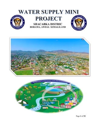
  • 4. Page 4 of 52 Abstract In this senior undergraduate final year design project the provision of safe public water supply for the community in part of Shacabka Area, which will adequately serve the current and future community the coming decade will be designed. The major tasks of the project is planning and designing of sustainable public water supply scheme for the district in part of Shacabka Area and preparation of contract document for its implementation within a one-month time after the completion of the final design work. The engineering design work includes all the necessary design details focusing on structural safety.
  • 5. Page 5 of 52 Contents Acknowledgement.................................................................................................. CHAPTER ONE: INTRODUCTION 1.1 General background of the book 1.2 Water distribution Network 1.3 Geographical location and background of Borama city 1.4 Climate and rainfall of the city 1.5 Location and purpose of our project 1.6 Project design period Chapter 2: Existing water supply system of the city 2.1 historical development of Borama supply system 2.2 Development and establishment of existing water supply of Borama (SHABA) 2.3 present situation of water source of Borama city CHAPTER 3: population focusing and WATER Demand 3.1 Definition of population forecasting ……………… 3.2 Methods of population forecasting 3.3 Design of population forecasting 3.4 Definition of water Demand ……….. 3.5 Types of water demand…….................................................. 3.6 Break up per capita Demand.................................................... Chapter 4: Selected water source..................................
  • 6. Page 6 of 52 4.1. Introductions 4.2. The Global water cycle 4.3. Distribution of Fresh Water 4.4. Source of water 4.5. Ground water 4.6. Selected water source of our project Chapter 5: Distribution of Water........................................ 5.1 Definition of water distribution system 5.2 layouts of distribution Network 5.3 Pumping System 5.4 Design criteria and distribution head loss 5.5 storage Water Tank 5.6 design of circular water tank Chapter 6: EPANET SOFTWARE.................................................. 6.1. Definition 6.2. Epenet Report 6.3. Epenet tables 6.4. Epenet Graphs Chapter 7: Conclusion and recommendation 7.1. Conclusion 7.2. Recommendation References.................................................................................................... CHAPTER ONE Introduction & General background Water is one most important gift to a mankind. Essential to life, a person's survival depends on drinking water. Water is one of the most essential elements to good health—it is necessary for the digestion and absorption of food; helps maintain proper muscle tone; supplies oxygen and nutrients to the cells; rids the body of wastes; and serves as a natural air conditioning system. Health officials emphasize the importance
  • 7. Page 7 of 52 of drinking at least eight glasses of clean water each and every day to maintain good health. 1.2 Water supply Distribution network The water in the supply network is maintained at positive pressure to ensure that water reaches all parts of the network, that a sufficient flow is available at every take-off point and to ensure that untreated water in the ground cannot enter the network. The water is typically pressurized by pumps that pump water into storage tanks constructed at the highest local point in the network. One network may have several such service reservoirs. 1.3 Location and background of Borama city Borama, is the capital and the largest city of the northwestern Awdal region of Somalia which is part of the self-proclaimed republic of Somaliland. The city locates 120 km far from the capital city of Hargaisa in western direction. The city is sited on hilly and mountainous which geographical coordinates 90 N and 430 E Borama is one of the coldest places in somalia. The average elevation of the town is 1460 MSL. According to the UNDP in 2005 the city had a population of around 215,616, making it one of the largest cities inside the borders of Somalia 1.4 Climate and rainfall of the city The climate of the city the warmest month of the year is June with an average temperature of 24.1 °C. In January, the average temperature is 17.1 °C. It is the lowest average temperature of the whole year and the difference in precipitation between the driest month and the wettest month is 110 mm. The average temperatures vary during the year by 7 °C
  • 8. Page 8 of 52 Average climate of Borama city month Jan Feb Marc h Apri l May Jun July Aug Sep Oct Nov Dec Year Average high °C (°F) 24.6 (76.3 ) 25.4 (77.7 ) 27.5 (81.5 ) 27.8 (82) 29.3 (84.7 ) 30.0 (86) 28.8 (83.8 28.8 (83.8 ) 29.0 (84.2 ) 27.4 (81. 3) 25.8 (78.4 ) 24.4 (75.9 ) 27.4 (81.3) Average Low °C (°F) 9.7 (49.5) 11.7 (53.1) 13.8 (56.8) 15.7 (60.3) 17.0 (62.6) 18.3 (64.9) 17.8 (64) 17.6 (63.7) 17.3 (63.1) 13.7 (56.7 ) 11.3 (52.3) 10.4 (50.7 ) 14.53 (58.14 ) Average rainfall mm(inch ) 6 (0.24) 21 (0.83) 36 (1.42) 86 (3.39) 61 (2.4) 32 (1.26) 78 (3.07) 112 (4.41) ( 86 (3.39) 18 (0.71 ) 10 (0.39) 2 (0.08 ) 548 (21.59 ) 1.6 Location and Purpose of our project Our water supply plan district known as SHACABKA and it locates in central Of Borama special it starts from the court of the city up to Harawa primary school which is near to Rays Hotel The purpose of the project ―Water Supply Borama‖ was the rehabilitation and Expansion of the urban water supply system in SHACABKA distinct in Borama, Purpose of our project is to supply adequate water to that district.
  • 9. Page 9 of 52 1.6Project Design period Design period: It is the number of years in future for which the given facility is available to meet the demand. Why Design period is provided Design period is provided because
  • 10. Page 10 of 52  It is very difficult or impossible to provide frequent extension.  It is cheaper to provide a single large unit rather to construct a number of small units. Factors affecting design period Following are some factors which affect the design period of the structure.  Life of the structure Life of structure is the number of years in future for which the design period is physically suitable to provide the intended facility. So it should be less than life of structure.  Ease or difficulty in extension For the projects whose extension is easily possible, it is kept low. For example we can install new tube wells at any time, so we do not need to install all tube wells which would be required after 20 years. But for the projects whose extension is difficult, their design period is kept greater. For example dams and reservoirs cannot be extended easily.  Rate of population growth If the rate of population growth is higher, then for that region shorter design period is required.  Lead time It is the time from the commencement of a project to its completion. Design period should be greater than lead time.
  • 11. Page 11 of 52  Economy of scale The decrease in average cost as the size of facility increase is known as economy of scale. If the economy of scale is small, smaller design period will be used. It is economical to build a large structure, for longer design period.  Performance time Structures are checked under working condition for some time, which should not be considered in design period. During this time it is not providing facility to community. Our project design period is Next 25 years
  • 12. Page 12 of 52 Chapter Two Existing water supply system of the city 2.1 Historical development of Borama supply system Historical development of Borama supply system 1938 after 3 failed attempts to drill a well Demok spring was tapped to pump by British In 1959 the system was extended 3.5 km to town through sh.Ali storage tank but besides main little development subsequently occurred until after the Somali Ethiopian war of 1977 when borama received an influx of refugees. From 1984 – 1986 USAID funded studies of regional ground water potential and test wells were drilled in the demok and amoud valleys. A parallel hydrological investigation 1986 resulted in nine test wells. Caritas MHD and German drilled wells struck water in the same period. Following civil war which reached peak of intensity around 1991 only two chines wells were in operation. During 1990s despite intervention by international aid failure in delivery of water to town led to borama experiencing a sever water shortage between 2000-2002 by which that time Water system in public hands are collapsed and damok spring had dried up. 2.2 Development and establishment of existing water supply of Borama company (SHABA) Failure of the public sector to make required improvement trigged questions concerning water service and management options, opening dialogue between Boorama communities the ministry of mineral and water resources (MMWR), Unicef and USAID pioneered by academics of amoud university workshops were organized from June 2000 where in options of private sector involvement interested community and business leaders who showed willingness to invest. Modalities were agreed and shares were float with $105,000 capital raised to establish Awdal utility company (SHABA) in 2003. 2.3 Present situation water source of Borama city Borama uses only one source of water as a water supply system, Ground water, which seems in the late years dropping-down with no aquifer contribution. Borama, the Chinese drilled eight boreholes in 1988, five of which are under the Management of SHABA Company, .SHABA have four wells Only three of the boreholes are in operation, as the fourth one was kept inoperative to avoid well depletion. Original well depth was 45.5m. The three operational boreholes are operated for an average of 18-20 hours/day, with average yields of 25, 25 and 20 m3/hour respectively. Also, another 2 bore holes by Islamic relief with a depth of 120m only one bore hole is functioning and operated.
  • 13. Page 13 of 52 ChapterThree Population Forecasting and water demand 3.1 Definition of population forecasting Population Forecasting: is the prediction of how many people will be living in a country or in a town at the same point in the future. Since the water supply systems are designed for a certain design period, instead of present population, population expected in the design period must be considered in the design of water supply systems . Forecasting of population can be accomplished with a different mathematical methods by using present and past population records that can be obtained from a local census office. 3.2 Methods of population forecasting Those methods are generally classified under two categories: A) Short term methods (1-10 years)  Arithmetical increase method  Geometrical increase method  Incremental increase method  Simple graph method  Decrease rate of growth method B) Long Term Methods ( 10- 50 years )  Comparative graph method  The master plan method  Logistic Method (mathematical curve fitting )
  • 14. Page 14 of 52 Short term methods (1-10 years) ARITHMETICAL INCREASE METHOD This method is suitable for large and old city with considerable development. If it is used for Small, average or comparatively new cities, it will give lower population estimate than actual Value. In this method the average increase in population per decade is calculated from the Past census reports. This increase is added to the present population to find out the population Of the next decade. Thus, it is assumed that the population is increasing at constant rate. Hence, dP/dt = C i.e., rate of change of population with respect to time is constant. Therefore, Population after nth decade will be Pn= P + n.C Where, Pn is the population after ‗n‘ decades and ‗P‘ is present population. GEOMETRICAL INCREASE METHOD (OR GEOMETRICAL PROGRESSION METHOD) In this method the percentage increase in population from decade to decade is assumed to Remain constant. Geometric mean increase is used to find out the future increment in Population. Since this method gives higher values and hence should be applied for a new Industrial town at the beginning of development for only few decades. The population at the End of nth decade ‗Pn‘ can be estimated as: Pn = P (1+ IG/100) n (2) Where, IG = geometric mean (%) P = Present population N = no. of decades.
  • 15. Page 15 of 52 INCREMENTAL INCREASE METHOD This method is modification of arithmetical increase method and it is suitable for an average size town under normal condition where the growth rate is found to be in increasing order. While adopting this method the increase in increment is considered for calculating future population. The incremental increase is determined for each decade from the past population and the average value is added to the present population along with the average rate of increase. Hence, population after nth decade is Pn = P+ n.X + {n (n+1)/2}.Y Where, Pn = Population after nth decade X = Average increase Y = Incremental increase Decreasing Rate of Growth Method In this method, the average decrease in the percentage increase is worked out, and is then subtracted from the latest percentage increase to get the percentage increase of next decade Simple graphical method Graph Simple graphical method Graph between the population and the corresponding year is plotted based on the available census data. The obtained curve is extended in the same manner to get the population of required year.it is the approximate method as the accuracy is dependent on the skill and experience of the person dragging the curve.
  • 16. Page 16 of 52 Long Term Methods (10- 50 years) COMPARATIVE GRAPHICAL METHOD In this method the census populations of cities already developed under similar conditions are plotted. The curve of past population of the city under consideration is plotted on the same graph. The curve is extended carefully by comparing with the population curve of some similar cities having the similar condition of growth. The advantage of this method is that the future population can be predicted from the present population even in the absence of some of the past census report. The use of this method is explained by a suitable example given below. MASTER PLAN METHOD The big and metropolitan cities are generally not developed in haphazard manner, but are planned and regulated by local bodies according to master plan. The master plan is prepared for next 25 to 30 years for the city. According to the master plan the city is divided into various zones such as residence, commerce and industry. The population densities are fixed for various zones in the master plan. From this population density total water demand and wastewater generation for that zone can be worked out. By this method it is very easy to access precisely the design population. LOGISTIC CURVE METHOD This method is used when the growth rate of population due to births, deaths and migrations takes place under normal situation and it is not subjected to any extraordinary changes like epidemic, war, earth quake or any natural disaster, etc., and the population follows the growth curve characteristics of living things within limited space and economic opportunity. If the population of a city is plotted with respect to time, the curve so obtained under normal condition looks like S-shaped curve and is known as logistic curve.
  • 17. Page 17 of 52 3.3 Design of Population Forecasting Geometrical increase method Loop name Junction number Number of Houses Loop 1 j1, j11, j2 50 Loop 2 J11, JB, JA, JC, JD and J10 43 Loop 3 JA,JB,J3,J2,J4 and JC 60 Loop 4 J10,J9,J8,J7 and JB 55 Loop 5 JD,JC,J6,J7 47 Loop 6 JC,J4,J5,J6 20 Total 275 The total households of SHACABKA is 275 assume that Population of the district Assume that the average people living in every house hold in Borama is 7 persons And the total population of households are: 275x7=1925 persons This data was made in 2018 and population of design area is estimated 1925 Water supply future population calculation po =1925 Pn = future population N=2.5 R=2.98 Pn = po ( ) n Pn = 1925 ( ) 25 Pn = 4012 persons
  • 18. Page 18 of 52 3.4 Demand of the Water Water demand is the measure of the total amount used by the customers within the water system. There are several things that can influence the amount of water demanded of your system. One of the most important jobs of water system is to continually meet this demand without interruption, rain. Fluctuations in Rate of Demand  Peak demand: the demand peaks during summer. Firebreak outs are generally more in summer, increasing demand. So, there is seasonal hourly demand  Seasonal demand: depends on the activity. People draw out more water on Sundays and Festival days, thus increasing demand on hourly demand  Daily peak demand days: are very important as they have a wide range. During active household working hours i.e. from six to ten in the morning and four to eight in the evening, the bulk of the daily requirement is taken. During other hours the Requirement is negligible 3.5 Types of water demand The various types of water demands which a city may have may have may be broken down into the following classes: 1. Domestic water demand 2. Industrial and commercial water demand 3. Institution and commercial water demand 4. Demand for public uses 5. Fire demand and 6. Water required to compensate losses in wastes and thefts
  • 19. Page 19 of 52 Domestic Water Demand The domestic water demand is the daily water requirement for use by human being for different domestic purposes like drinking, cooking, bathing and etc. The domestic water required by human being could be supplied or obtained through different modes of services depending on the economic level and facilities owned by the individual. Modes and level of services In a conventional water supply system, there are five modes of services in which an Individual could be served. These are;  House Tap Users (HTU).  Yard Tap Users (YTU).  Neighborhood Tap Users (NTU).  Public Tap Users (PTU).  Traditional Sources Users (TSU). Here in Borama, the modes of services are generally stick to the first three modes of services, around 78% of Borama households uses indoor tap water divided into the first two modes, HTU and YTU, 51% and 49% respectively of the 78% of the indoor tap water users. The rest of 22% uses neighborhood tab users and public tap users. However, in most water supply system feasibility studies for urban centers here in Somaliland, the modes of services are generally stick to the first three classical modes of services because of their simplicity from the viewpoint of service giving institutions. Hence, for this project, in generally, it is assumed that house tap users should be served. In domestic demand the minimum domestic demand of water the human being can survive is 20 l/head/day, which is the standard that the refugees supplies the water.
  • 20. Page 20 of 52 Our project domestic water demand with full flashing Type of demand Quantity (Liters/capita/day) Drinking 5L Bathing 35L Cooking 5L Clothes washing 30 Utensil washing 15 House washing 20 Total 110 Demand water for public use: this include the quantity of water required for public utility purposes, such as watering of public parks, gardening, washing and sprinkling and roads, use in public fountains. 6 liters /days. Industrial water demand: the industrial water demand represents the water demand of industries, which are either existing or are like to be starting in the future, in the city for which water supply is been planned. in our designed SHACABKA distinct there only two industries which are : a) Bakery industry b) And hallow block industry c) Other future expectation industries Therefore our project industrial demand is = 35 liters/head/capita Institutional and commercial water demand: the water requirements of institutions, such as hospitals, hotels, restaurants, schools and colleges, rail way stations, office, factors etc. Institutional and commercial = 15 l/h/day
  • 21. Page 21 of 52 Fire demand: in the thickly populated and industrial areas, fire generally break out and may lead to serious damages, if not controlled effectively. Big cities, therefore, generally maintain full firefighting squads. Fire-fighting personal require sufficiently quantity of water, so as to throw it over the fire at higher speeds. Provision should, therefore, be made in modern public water supply schedule for fighting fire. 3.6 Per capital demand Per capital demand is annual average rate of flow in liter per day by person Factors affecting per capita demand: • Size of the city: Per capita demand for big cities is generally large as compared to that for smaller towns as big cities have sewered houses. • Presence of industries. • Climatic conditions. • Habits of economic status. • Quality of water: If water is aesthetically $ people and their • Medically safe, the consumption will increase as people will not resort to private wells, etc. • Pressure in the distribution system. • Efficiency of water works administration: Leaks in water mains and services; and un authorized use of water can be kept to a minimum by surveys. • Cost of water. • Policy of metering and charging method: Water tax is charged in two different ways: on the basis of meter reading and on the basis of certain fixed monthly rate. In our firefighting design we use buston’s formula it states that: NB: use your population in 1000s Population = 4012 which equals 4.012 Q = 5663√ = 5663√ = 11342.9 L/day Losses and Thefts = assume that losses is approximately 15% of the domestic demand = 0.15 x 110 = 16.5L/h/day
  • 22. Page 22 of 52 BREAK UP PER CAPITA DEMAND (Q) FOR AN AVERAGE OF Water Supply Distinct. USE DEMAND IN L/h/day a) Domestic use 110 L b) Industrial use 35 L c) Commercial and institutional use 15 L d) Civic or public use 6 L e) Wastage and thefts 16.5 L TOTAL 182.5 L/day 1) Domestic demand = domestic demand*population design 110L/day*4012 people = 441320 L/day 2) Industrial demand = industrial demand*population designed 35L/day*4012 people = 140,420 L/day 3) Commercial and institutional water demand = commercial demand*population designed 15L/day*4012 people = 60180 L/day 4) Civic or public demand = civic or public *population designed 6L/day *4012 people = 24072 L/day 5) Waste and thefts demand = waste and thefts demand* population 16.5 L/day *4012 people = 66198 L/day Total avg demand =domestic demand +institutional &commercial +industrial +public+loses +fire demand Total avg demand = 441320 L/day + 140420 L/day + 60180 L/day + 24072 L/day + 66198 L/day + 11342.9 L/day = 721532.9 L/ day. I. The maximum daily consumption is generally taken as 180 percentage of the average 180%*average daily demand II. 1.8q = 1.8 x 721532.9 L /d = 1298759.22 L/d
  • 23. Page 23 of 52 Peak hourly Demand: is the, maximum hourly consumption and is generally taken as 150 percentage of its average 150%*average hourly consumption of the maximum day 1.5( 1.5( ) = 2.7( ) = 2.7( ) = 42540.75 L/hour
  • 24. Page 24 of 52 Chapter Four Selected Sources of Water 4.1. Introduction  Nature of water source determines the components if the water supply system:  Factors to be consider to select source:  Quantity  Quality  Reliability  Safety of source  Water rights  Environmental impacts Water resources are under major stress around the world. Rivers, lakes, and underground aquifers supply fresh water for irrigation, drinking, and sanitation, while the oceans provide habitat for a large share of the planet's food supply. Today, however, expansion of agriculture, damming, diversion, over-use, and pollution threaten these irreplaceable resources in many parts of the globe. Providing safe drinking water for the more than 1 billion people who currently lack it is one of the greatest public health challenges facing national governments today. In many developing countries, safe water, free of pathogens and other contaminants, is unavailable to much of the population, and water contamination remains a concern even for developed countries with good water supplies and advanced treatment systems. And over-development, especially in coastal regions and areas with strained water supplies, is leading many regions to seek water from more and more distant sources. This unit describes how the world's water supply is allocated between major reserves such as oceans, ice caps, and groundwater. It then looks more closely at how
  • 25. Page 25 of 52 groundwater behaves and how scientists analyze this critical resource. After noting which parts of the world are currently straining their available water supplies, or will do so in the next several decades, we examine the problems posed by salinization, pollution, and water-related diseases. Scientists widely predict that global climate change will have profound impacts on the hydrologic cycle, and that in many cases these effects will make existing water challenges worse rising global temperatures will alter rainfall patterns, making them stronger in some regions and weaker in others, and may make storms more frequent and severe in some areas of the world. Warming will also affect other aspects of the water cycle by reducing the size of glaciers, snow packs, and polar ice caps and changing rates of evaporation and transpiration. In sum, climate change is likely to make many of the water-management challenges. At the same time, many current trends in water supply and water quality in the world are positive. Thirty years ago, many water bodies in developed countries were highly polluted. For example, on June 22, 1969, the Cuyahoga River in Cleveland, Ohio, caught fire when sparks ignited an oily slick of industrial chemicals on its surface. Today, the United States and western European countries have reduced pollution discharges into rivers and lakes, often producing quick improvements in water quality. These gains show that when societies make water quality a priority, many polluted Sources can be made usable once again. Furthermore, in the United States water consumption rates have consistently declined over the last several decades.
  • 26. Page 26 of 52 4.2. The Global Water Cycle Water covers about three-quarters of Earth's surface and is a necessary element for life. During their constant cycling between land, the oceans, and the atmosphere, water molecules pass repeatedly through solid, liquid, and gaseous phases (ice, liquid water, and water vapor), but the total supply remains fairly constant. A water molecule can travel to many parts of the globe as it cycles. As discussed in Unit 2, "Atmosphere," and Unit 3, "Oceans," water vapor redistributes energy from the sun around the globe through atmospheric circulation. This happens because water absorbs a lot of energy when it changes its state from liquid to gas. Even though the temperature of the water vapor may not increase when it evaporates from liquid water, this vapor now contains more energy, which is referred to as latent heat. Atmospheric circulation moves this latent heat around Earth, and when water vapor condenses and produces rain, the latent heat is released. Very little water is consumed in the sense of actually taking it out of the water cycle permanently, and unlike energy resources such as oil, water is not lost as a consequence of being used. However, human intervention often increases the flux of water out of one store of water into another, so it can deplete the stores of water that are most usable. For example, pumping groundwater for irrigation depletes aquifers by transferring the water to evaporation or river flow. Our activities also pollute water so that it is no longer suitable for human use and is harmful to ecosystems. There are three basic steps in the global water cycle: water precipitates from the atmosphere, travels on the surface and through groundwater to the oceans, and evaporates or transpires back to the atmosphere from land or evaporates from the oceans. Figure 2 illustrates yearly flow volumes in thousands of cubic kilometers.
  • 27. Page 27 of 52 Supplies of freshwater (water without a significant salt content) exist because precipitation is greater than evaporation on land. Most of the precipitation that is not transpired by plants or evaporated, infiltrates through soils and becomes groundwater, which flows through rocks and sediments and discharges into rivers. Rivers are primarily supplied by groundwater, and in turn provide most of the freshwater discharge to the sea. Over the oceans evaporation is greater than precipitation, so the net effect is a transfer of water back to the atmosphere. In this way freshwater resources are continually renewed by counterbalancing differences between evaporation and Precipitation on land and at sea, and the transport of water vapor in the atmosphere from the sea to the land. Nearly 97 percent of the world's water supply by volume is held in the oceans. The other large reserves are groundwater (4 percent) and icecaps and glaciers (2 percent), with all other water bodies together accounting for a fraction of 1 percent. Residence times vary from several thousand years in the oceans to a few days in the atmosphere.
  • 28. Page 28 of 52 Solar radiation drives evaporation by heating water so that it changes to water vapor at a faster rate. This process consumes an enormous amount of energy nearly one-third of the incoming solar energy that reaches Earth's surface. On land, most evaporation occurs as transpiration through plants: water is taken up through roots and evaporates through stomata in the leaves as the plant takes in CO2. A single large oak tree can transpire up to 40,000 gallons per year (footnote 1). Much of the water moving through the hydrologic cycle thus is involved with plant growth. Since evaporation is driven by heat, it rises and falls with seasonal temperatures. In temperate regions, water stores rise and fall with seasonal evaporation rates, so that net atmospheric input (precipitation minus evaporation) can vary from positive to negative. Temperatures are more constant in tropical regions where large seasonal differences in precipitation, such as monsoon cycles, are the main cause of variations in the availability of water. In an effort to reduce these seasonal swings, many countries have built reservoirs to capture water during periods of high flow or flooding and release water during periods of low flow or drought. These projects have increased agricultural production and mitigated floods and droughts in some regions, but as we will see, they have also had major unintended impacts on water supplies and water quality. The hydrologic cycle is also coupled with material cycles because rainfall erodes and weathers rock. Weathering breaks down rocks into gravel, sand, and sediments, and is an important source of key nutrients such as calcium and sulfur. Estimates from river outflows indicate that some 17 billion tons of material are transported into the oceans each year, of which about 80 percent is particulate and 20 percent is dissolved. On average, Earth's surface weathers at a rate of about 0.5 millimeter per year. Actual rates may be much higher at specific locations and may have been accelerated by human activities, such as emissions from fossil fuel combustion that make rain and snowfall more acidic.
  • 29. Page 29 of 52 4.3. Distribution of Freshwater Resources Freshwater accounts for only some 6 percent of the world's water supply, but is essential for human uses such as drinking, agriculture, manufacturing, and sanitation. As discussed above, two-thirds of global freshwater is found underground. If you dig deeply enough anywhere on Earth, you will hit water. Some people picture groundwater as an underground river or lake, but in reality it is rarely a distinct water body (large caves in limestone aquifers are one exception). Rather, groundwater typically fills very small spaces (pores) within rocks and between sediment grains. The water table is the top of the saturated zone (Fig. 3). It may lie hundreds of meters deep in deserts or near the surface in moist ecosystems. Water tables typically shift from season to season as precipitation and transpiration levels change, moving up during rainy periods or periods of little transpiration and sinking during dry phases when the rate of recharge (precipitation minus evaporation and transpiration that infiltrates from the surface) drops. In temperate regions the water table tends to follow surface topography, rising under hills where there is little discharge to streams and falling under valleys where the water table intersects the surface in the form of streams, lakes, and springs. 4.4. Sources of water There are three classifications of source of water  Surface water  Ground water  Ground water under the direct influence of surface water Surface water Surface water is a water that is open to the atmosphere and result from overland flow.it is also said to be the results of surface Runoff these are two types of saying the same thing.
  • 30. Page 30 of 52 Example of surface water Specific source that are classified as surface water including the following:  Streams, River and Lakes  Man-made impoundments(lake made by damming as a stream or river|)  Springs effected by precipitation that falls in the vicinity of the spring  Shallow wells effected by precipitation  Wells drilled next to or in a stream or river  Rain catchment 4.5. Ground water Ground water is considered to be water that is below the earth‘s crust, but not more than 2500 feet below the crust. Water between the earth crust and the 2500-foot level considered usable fresh water. Ground water can be either  Wells  Springs that are not influenced by surface or a local hydrologic event There are many sources that can get a water, But in Borama they get a water from one type and that is well although it have many rain falls with a consequence times they does not appropriate way for water catchment or other kinds of storing water to full fit their needs. 4.6. SELECTED WATER SOURCE OF OUR PROJECT According to our project we selected our water Water supply source for an well. After the failure of distribution of water in the Shacabka distinct we decided to design a new distribution system that can supply sufficient water into that distinct. Therefore after design we expect
  • 31. Page 31 of 52 Chapter Five Storage of Water Distribution System 5.1 Definition of Water Distribution System Water Distribution: is used to describe collectively the facilities used to supply water from its source to the point of usage, The purpose of distribution system is to deliver water to consumer with appropriate quality, quantity and pressure. Distribution system is used to describe collectively the facilities used to supply water from its source to the point of usage. Requirements of Good Distribution System 1. Water quality should not get deteriorated in the distribution pipes. 2. It should be capable of supplying water at all the intended places with sufficient pressure head. 3. It should be capable of supplying the requisite amount of water during firefighting. 4. The layout should be such that no consumer would be without water supply, during the repair of any section of the system. 5. All the distribution pipes should be preferably laid one metre away or above the sewer lines. 6. It should be fairly water-tight as to keep losses due to leakage to the minimum
  • 32. Page 32 of 52 Distribution system facilities 1. Pumps 2. Storage facilities 3. Transmission mains 4. Vales & hydrants 5. Meters Storage facilities 1) Clear wells 2) Stand pipes 3) Elevated storage tanks Elevated storage tanks can be divided in to three 1) Supporting structure 2) Use gravity 3) Filled in off-peak hours 5.2 Layouts of Distribution Network The distribution pipes are generally laid below the road pavements, and as such their layouts generally follow the layouts of roads. There are, in general, four different types of pipe networks; any one of which either singly or in combinations, can be used for a particular place Layout of Distribution Network: there are two types of layout methods: 1. Branched Distribution ( Dead end system) 2. Grid iron system ( looped system) Branched distribution: A branch system is similar to that of a tree branch, in which smaller pipes branch off larger pipes throughout the service area, such that the water can take only one pathway from the source to the consumer. This type of system is most frequently used in rural areas.
  • 33. Page 33 of 52  Relatively cheep  Determination of discharge and pressure easier due to less number of valves Disadvantages:  Due to many dead ends stagnation of water occurs in pipes, Grid iron distribution system: A grid/looped system, which consist of connected pipe loops throughout the area to be served, is the most widely used configuration in large municipal areas. In this type of system there are several pathways that the water can follow from the source to the consumer.
  • 34. Page 34 of 52 Advantages: • The grid system overcomes all of the difficulties of the branching system discussed before. • No dead ends. (All of the pipes are interconnected). • Water can reach a given point of withdrawal from several directions. Disadvantages: • Hydraulically far more complicated than branching system (Determination of the pipe sizes is somewhat more complicated) . • Expensive (consists of a large number of loops). Methods of distribution:  For efficient distribution system adequate water pressure required at various points  Dependent upon the level of source, topography, of the area other local conditions the water may be forced in to distribution system by the following methods: a. By Gravity system b. By Pumping system c. Combined gravity & pumping system Gravity Supply: The source of supply is at a sufficient elevation above the distribution area (consumers), and suitable when the source of water is at sufficient height, most reliable economical distribution,
  • 35. Page 35 of 52 Advantages of Gravity supply  No energy costs.  Simple operation (fewer mechanical parts, independence of power supply)  Low maintenance costs.  No sudden pressure changes 5.3 Pumping system: Used whenever, the source of water is lower than the area to which we need to distribute water to (consumers). The source cannot maintain minimum pressure required. Pumps are used to develop the necessary head (pressure) to distribute water to the consumer and storage reservoirs. Combined Supply (pumped-storage supply): is the most common system. The treated water is pumped and stored in an elevated distribution reservoir, economical efficient, and reliable system.
  • 36. Page 36 of 52 Water pumping: The pumping of water is a basic and practical technique, far more practical than scooping it up with one's hands or lifting it in a hand-held bucket. This is true whether the water is drawn from a fresh source, moved to a needed location, purified, or used for irrigation, washing, or sewage treatment, or for evacuating water from an undesirable location. Regardless of the outcome, the energy required to pump water is an extremely demanding component of water consumption. All other processes depend or benefit either from water descending from a higher elevation or some pressurized plumbing system. Pumping for lifting water Given Data Population = 4012 Per capita = 182.5lday Distance of the well from pump = 304.9 m Friction of pipe = 0.0075 Distance of pump from tank = 437.8 m
  • 37. Page 37 of 52 Difference of elevation Tank elevation = 1462 Pump elevation = 1463 Well elevation = 1456 Assume that the depth of the well is = 25m Section heard = 20m Delivery heard = (tank elevation – pump elevation) + height of elevated column , + height of tank = (1462 – 1463) + 6 + 3 = 8m Total head = section heard + delivery = 20 + 8 = 28m Operation time = 12hr‘s V = 2.4m/s Pump efficience ( = 85% Discharge average = 1298759.22 L/d Discharge daily demand = 1.5(Q) = 1.5 (1,298,759.22 L/d) = 1.94 M L/day Capacity of the pump 12hr……………………………..1,948,138.8L/day 24hr……………………………..y Capacity of the pump = 3,896,277.6 L/day Discharge required per second = = 0.045m3/s = Diameter of the main pipe = 1.22√ = 1.22√ = 0.26 m Brake horse power of pump = H = Hs +Hd + Hf F‘ = 4F = 4 x 0.0075 = 0.03 Head loss Hf = = = 10.33 0 m Total lift against which pump has to work = 20 + 8 +10.33 = 38.33 m BHP = = = 27.1 HP
  • 38. Page 38 of 52 5.4 Design criteria and Distribution Head loss Design criteria Velocity and pipe diameter design Criteria Optimum velocities in pipes of different sizes Pipe diameter (cm) Approximate velocity in m/sec 10 0.9 15 1.2 25 1.5 40 1.8 Pressure Pressure distribution systems ranges from 150-300 kPa in residential districts with structures of four stories or less and 400-500 kPa in commercial districts. For fire hydrants the pressure should not be less than 150 kPa (15 m of water). In general for any node in the network the pressure should not be less than 25 m of water. However, the maximum pressure should be limited to 70 m of water. Minimum pressure should not less than 14 m. Maximum Distribution head loss Distance from tank to the furthest joint of the distribution = 404.3 m F = 0.00075 Assumed velocity = 1.2m/s Diameter of the main pipe = 1.22√ = 1.22√ = 0.26 m there for 260 mm is greater 200mm so that use : 200mm = 0.2 m Head loss of the distribution == f‘ = 4F = 4 x 0.0075 = 0.03 Head loss Hf = = = 4.45 m Total head loss = Hf + elevated tank height = 4.45 + 8 = 12.45 m Head loses • Optimum range is 1-4 m/km. • Maximum head loss should not exceed 10 m/km.
  • 39. Page 39 of 52 5.5 Storage water tanks Storage tanks are built for storing water, liqu66id petroleum, petroleum products and similar liquids. CLASSIFICATIONS of STORAGE TANK Classification based on under three heads: 1) Tanks resting on ground 2) Elevated tanks supported on staging 3) Underground tanks Classification based on shapes 1) Circular tanks 2) Rectangular tanks 3) Spherical tanks 4) Intze tanks 5) Circular tanks with conical bottom In Our project we designed a circular elevated tank
  • 40. Page 40 of 52 5.6 DESIGN OF CIRCULAR WATER TANK Given Data Maximum discharge = 567210l L/day = 567.210m3 /day One pumping is working Discharge of pumping = 0.0131m3 /s x 3600s = 47.16m3 /hr Step one Pumping per hour = = 12 hr Step two Reservoir capacity Balancing required 12hr………………………..567.21m3 24hr……………………….y Y = 1134.2m3 Balance required = 1134.2 – 567.210 = 567.210m3 + 25% 709 + 8.15 fire = 717.16m3 Height of tank = 3m Volume = 717.65m3 V = Ah A = ( ) x h find Diameter D = √ = 17.4m
  • 41. Page 41 of 52 Chapter 6 Epanet software 6.1 Definition EPANET is a public domain, water distribution system modeling software package developed by the United States Environmental Protection Agency's (EPA) Water Supply and Water Resources Division. USES Which uses a visual interface to model pressurized water distribution system, using this program, pipes network( including pipes, nodes pumbs , valves , storage tanks and reservoirs) can be physically drawn in the user or imported through GPS output water quality at every junction, the flow rate, headloss and everage water quality through every pipe. Advantage :  Complicated network and grid system( instead of branched systems).  Determining what pipes and which diameter should be used .  Determining what improvements and or extension the network needs  Determining where to install the tanks, valves and jumps 6.2 Epanet report
  • 42. Page 42 of 52 Page 1 2/5/2018 9:11:26 AM ********************************************************************** * E P A N E T * * Hydraulic and Water Quality * * Analysis for Pipe Networks * * Version 2.0 * ********************************************************************** Input File: Water supply.NET Water supply (Shacabka) Link - Node Table: ---------------------------------------------------------------------- Link Start End Length Diameter ID Node Node m mm ---------------------------------------------------------------------- 1 1 2 244 100 2 2 3 64.9 100 3 3 4 80.6 50 4 4 5 121 100 5 5 6 93 100 6 6 7 81.1 100 7 7 8 70.8 50 8 8 9 187 50 9 9 10 114 100 10 10 11 133 100 11 11 1 159 100 12 11 12 114 50 13 12 2 86.9 150 14 12 13 68.1 150 15 13 14 114 150 16 14 4 97.8 100 17 14 15 96.5 100 18 14 6 123 50 19 15 7 103 100 20 15 10 116 50 A a b 7516.98 14 B b c 79 14 C c d 47.4 14 D d Tank 17.8 50 E Tank 13 11.5 200 Pumpb sourcce a #N/A #N/A Pump
  • 43. Page 43 of 52 Node Results at 0:00 Hrs: ---------------------------------------------------------------------- Node Demand Head Pressure Quality ID LPS m m ---------------------------------------------------------------------- 1 1.97 1506.64 44.64 0.00 2 1.97 1508.97 46.97 0.00 3 1.97 1508.73 47.73 0.00 4 1.97 1508.33 50.33 0.00 5 1.97 1507.71 58.71 0.00 6 1.97 1507.58 56.58 0.00 7 1.97 1507.56 57.56 0.00 8 1.97 1505.15 48.15 0.00 9 1.97 1505.36 53.36 0.00 10 1.97 1505.58 48.58 0.00 11 1.97 1506.00 47.00 0.00 12 1.97 1509.37 47.37 0.00 14 1.97 1509.05 51.05 0.00 15 1.97 1507.87 52.87 0.00 13 1.97 1509.91 47.91 0.00 a 1.97 1589.38 127.38 0.00 b 0.00 1511.31 1511.31 0.00 c 0.00 1510.49 1510.49 0.00 d 0.00 1510.00 1510.00 0.00 sourcce -2.00 1457.00 0.00 0.00 Reservoir Tank -29.44 1510.00 10.00 0.00 Tank
  • 44. Page 44 of 52 Page 3 water supply shacabka Link Results at 0:00 Hrs: (continued) ---------------------------------------------------------------------- Link Flow VelocityUnit Headloss Status ID LPS m/s m/km ---------------------------------------------------------------------- 11 -3.32 0.42 4.03 Open 12 -1.57 0.80 29.51 Open 13 10.40 0.59 4.62 Open 14 -13.94 0.79 7.95 Open 15 13.57 0.77 7.56 Open 16 4.58 0.58 7.30 Open 17 6.06 0.77 12.24 Open 18 0.96 0.49 11.90 Open 19 2.83 0.36 2.99 Open 20 1.27 0.64 19.71 Open A 0.03 0.20 10.39 Open B 0.03 0.20 10.39 Open C 0.03 0.20 10.38 Open D 0.03 0.02 0.03 Open E 29.48 0.94 7.84 Open Pumpb 2.00 0.00 -132.38 Open Pump
  • 45. Page 45 of 52 6.3 Report tables
  • 49. Page 49 of 52 6.4 Epanet graphs
  • 51. Page 51 of 52 Chapter 7: conclusion and recommendation Conclusion  This report indicates that all the selected information sites are found to be suitable for the proposed development. The useful life of the physical components of the system server‘s wills servers adequately as per design unless care implementations and operations is not may hold true.  Projected Population The use of a reliable base population figure is very important for optimizing the project design and sustaining the project‘s services year. Although Borama and generally Somaliland do not have a realistic statistical available population data, we choose for this project the base population to be 4012 person  The pumping unit is designed to serve for 12 hours. This could reduce the scarcity of water. However great care should be taken in operating the pumping unit  The per capita average domestic water demand is increasing with the standard of living and seasonal variations. Since, there is no available standard per capita in Somaliland, in this project it is obtained from some available consumption data in Borama for the last two years. Recommendation  In parallel with the construction the system the additional source should be identified and combined  We have done all the project work based on the recommended and standard values without any survey so that it may deviate from the actual condition due to many unforeseen conditions but it could serve the society safely.  Although, the Somali people are pastorals that entirely depend on their domestic animal resources, their livelihood task of animal husbandry is facing difficulty because of the absence of water that could be used for their livestock watering. Also, here in Borama there is some scale of irrigation needed to take account to the calculated water demand. In this project, there will be 10% of the domestic water demand in order to cover these two water demand categories  A separate source should be also assessed for any surface water system scheme in the Area  If there are no materials that correspond to the design, the locally available could be adopted as per the engineer‘s decision.  There should be a regulation kept for source protection as water pollution as well as safe yield is affected by the local society and result in system inefficiencies as well as economic crisis.
  • 52. Page 52 of 52 References 1. Eng. Mohammed Harun 2. Water supply engineering ( Book) 3. Internet( Google and other websites) 4. Mohammed Ahmed Mohamed( senior Engineering( eng.Afguduud)