A brief look at how scientists are monitoring fish using acoustic tags and hydroacoustic echo sounders, as well as what's next in advanced equipment for fisheries research. Presented by HTIsonar to the Washington State Department of Transportation.
2018 GIS in Conservation: Utah and Colorado Water ResourcesGIS in the Rockies
Since the completion of the Flaming Gorge Dam in 1964, artificial flow releases along the Green River have promoted channel narrowing and encouraged non-native vegetation encroachment into the active stream channel. These changes in the Green River’s flow regime have reduced the backwater habitat of four native endangered fish species: the Colorado pikeminnow (Ptychocheilus lucius), Razorback Sucker (Xyrauchen texanus), Humpback Chub (Gila cypha), and Bonytail (Gila elegans). To promote population recovery, this project developed the River Morphology Evaluation Toolbox (RMET), a Google Earth Engine (GEE) tool, to more efficiently and cost-effectively monitor changes in vegetation and hydrology across large spatial and temporal scales. Using imagery collected from Landsat 5 Thematic Mapper (TM), Landsat 7 Enhanced Thematic Mapper Plus (ETM+), Landsat 8 Operational Land Imager (OLI) and Thermal Infrared Sensor (TIRS), Shuttle Radar Topography Mission (SRTM), and Sentinel-2 Multispectral Instrument (MSI) satellites, the team used the normalized difference vegetation index (NDVI), soil adjusted vegetation index (SAVI), modified normalized difference water index (MNDWI), and normalized difference water index (NDWI) to detect landcover changes. Trends in spectral index changes over user-selected focal years and the magnitudes of those changes were isolated and visualized through RMET. The project partners at the National Park Service and the Upper Colorado River Endangered Fish Recovery Program will use RMET to identify potential sites where changes in riparian vegetation and the active stream channel may have reduced fish habitat to make more informed recommendations for flow releases from the Flaming Gorge Dam.
Talks provided at the Scottish Fisheries Co-ordination Centre/Institute of Fisheries Management MAPPING FISHERIES workshop in Edinburgh on March 1st-2nd 2016
Tendências mapeadas para o primeiro encontro do BIG 2016 - Business Insights Group. Temas discutidos: Novas formas de trabalho/ O Futuro do trabalho em 2030.
Efficient & Cost-Effective CNG-Based Natural Gas Delivery for Ranges up to 500 km beyond the pipeline
Clean Energy Compression’s Fullfill & Maxoffload technology provides efficient and quick and fueling at source and the most complete offloading at destination. This technology makes CNG virtual pipelines an affordable remote energy solution by decreasing the cost per energy unit delivered.
RV 2015: If You Build It, Will it Flood? Climate Change Vulnerabilities and S...Rail~Volution
Extreme weather events, flooding and rising sea levels devastate communities, destroy or severely damage costly infrastructure, and introduce a strong element of uncertainty in current and future planning. This new normal spotlights how and where we build new -- or strengthen existing -- infrastructure and communities and the governance systems that manage and regulate these decisions and investments. Hear experts tackle these issues, from Hurricane Sandy to sea level rise in the Bay Area. What are the weak links in terms of existing infrastructure, cross-jurisdictional government response systems and disaster preparedness? Learn about state guidelines and legislation. Discuss how transportation agencies deal with major transit infrastructure challenges. Discover the role of natural systems in protecting critical transit infrastructure
Moderator: Allison Brooks, Executive Director, Bay Area Regional Collaborative, Oakland, California
Eric Fang, AIA, AICP, LEED AP, Associate Principal, EE&K, a Perkins Eastman Company, New York, New York
Projjal Dutta, AIA, LEED AP, Director, Sustainability Initiatives, Metropolitan Transportation Authority, New York, New York
James Allison, Manager of Planning, Capitol Corridor Joint Powers Authority, Oakland, California
JR DeLaRosa, Special Assistant for Climate Change, California Natural Resources Agency, Sacramento, California
11 9 2010 Am. Trails Symposium Mods For Rec.Boatingjmpflaum
This was a presentation I made regarding how low head dams, utility crossings and other river obstructions can be modified to provide recreational boating access. I presented this at the 2010 American Trails Symposium.
Nelson Perez-Jacome Miami Beach Presentation regarding how sea level rise and higher tides affect the efficacy of drainage wells and outfalls. Discussed issues related to resilience and sustainability as well as water quality. Provided illustrations that portray the effects of the astronomical high tide (king tide) and sunny day flooding.
Elevating Tactical DDD Patterns Through Object CalisthenicsDorra BARTAGUIZ
After immersing yourself in the blue book and its red counterpart, attending DDD-focused conferences, and applying tactical patterns, you're left with a crucial question: How do I ensure my design is effective? Tactical patterns within Domain-Driven Design (DDD) serve as guiding principles for creating clear and manageable domain models. However, achieving success with these patterns requires additional guidance. Interestingly, we've observed that a set of constraints initially designed for training purposes remarkably aligns with effective pattern implementation, offering a more ‘mechanical’ approach. Let's explore together how Object Calisthenics can elevate the design of your tactical DDD patterns, offering concrete help for those venturing into DDD for the first time!
Generative AI Deep Dive: Advancing from Proof of Concept to ProductionAggregage
Join Maher Hanafi, VP of Engineering at Betterworks, in this new session where he'll share a practical framework to transform Gen AI prototypes into impactful products! He'll delve into the complexities of data collection and management, model selection and optimization, and ensuring security, scalability, and responsible use.
State of ICS and IoT Cyber Threat Landscape Report 2024 previewPrayukth K V
The IoT and OT threat landscape report has been prepared by the Threat Research Team at Sectrio using data from Sectrio, cyber threat intelligence farming facilities spread across over 85 cities around the world. In addition, Sectrio also runs AI-based advanced threat and payload engagement facilities that serve as sinks to attract and engage sophisticated threat actors, and newer malware including new variants and latent threats that are at an earlier stage of development.
The latest edition of the OT/ICS and IoT security Threat Landscape Report 2024 also covers:
State of global ICS asset and network exposure
Sectoral targets and attacks as well as the cost of ransom
Global APT activity, AI usage, actor and tactic profiles, and implications
Rise in volumes of AI-powered cyberattacks
Major cyber events in 2024
Malware and malicious payload trends
Cyberattack types and targets
Vulnerability exploit attempts on CVEs
Attacks on counties – USA
Expansion of bot farms – how, where, and why
In-depth analysis of the cyber threat landscape across North America, South America, Europe, APAC, and the Middle East
Why are attacks on smart factories rising?
Cyber risk predictions
Axis of attacks – Europe
Systemic attacks in the Middle East
Download the full report from here:
https://sectrio.com/resources/ot-threat-landscape-reports/sectrio-releases-ot-ics-and-iot-security-threat-landscape-report-2024/
Le nuove frontiere dell'AI nell'RPA con UiPath Autopilot™UiPathCommunity
In questo evento online gratuito, organizzato dalla Community Italiana di UiPath, potrai esplorare le nuove funzionalità di Autopilot, il tool che integra l'Intelligenza Artificiale nei processi di sviluppo e utilizzo delle Automazioni.
📕 Vedremo insieme alcuni esempi dell'utilizzo di Autopilot in diversi tool della Suite UiPath:
Autopilot per Studio Web
Autopilot per Studio
Autopilot per Apps
Clipboard AI
GenAI applicata alla Document Understanding
👨🏫👨💻 Speakers:
Stefano Negro, UiPath MVPx3, RPA Tech Lead @ BSP Consultant
Flavio Martinelli, UiPath MVP 2023, Technical Account Manager @UiPath
Andrei Tasca, RPA Solutions Team Lead @NTT Data
Key Trends Shaping the Future of Infrastructure.pdfCheryl Hung
Keynote at DIGIT West Expo, Glasgow on 29 May 2024.
Cheryl Hung, ochery.com
Sr Director, Infrastructure Ecosystem, Arm.
The key trends across hardware, cloud and open-source; exploring how these areas are likely to mature and develop over the short and long-term, and then considering how organisations can position themselves to adapt and thrive.
Smart TV Buyer Insights Survey 2024 by 91mobiles.pdf91mobiles
91mobiles recently conducted a Smart TV Buyer Insights Survey in which we asked over 3,000 respondents about the TV they own, aspects they look at on a new TV, and their TV buying preferences.
Essentials of Automations: Optimizing FME Workflows with ParametersSafe Software
Are you looking to streamline your workflows and boost your projects’ efficiency? Do you find yourself searching for ways to add flexibility and control over your FME workflows? If so, you’re in the right place.
Join us for an insightful dive into the world of FME parameters, a critical element in optimizing workflow efficiency. This webinar marks the beginning of our three-part “Essentials of Automation” series. This first webinar is designed to equip you with the knowledge and skills to utilize parameters effectively: enhancing the flexibility, maintainability, and user control of your FME projects.
Here’s what you’ll gain:
- Essentials of FME Parameters: Understand the pivotal role of parameters, including Reader/Writer, Transformer, User, and FME Flow categories. Discover how they are the key to unlocking automation and optimization within your workflows.
- Practical Applications in FME Form: Delve into key user parameter types including choice, connections, and file URLs. Allow users to control how a workflow runs, making your workflows more reusable. Learn to import values and deliver the best user experience for your workflows while enhancing accuracy.
- Optimization Strategies in FME Flow: Explore the creation and strategic deployment of parameters in FME Flow, including the use of deployment and geometry parameters, to maximize workflow efficiency.
- Pro Tips for Success: Gain insights on parameterizing connections and leveraging new features like Conditional Visibility for clarity and simplicity.
We’ll wrap up with a glimpse into future webinars, followed by a Q&A session to address your specific questions surrounding this topic.
Don’t miss this opportunity to elevate your FME expertise and drive your projects to new heights of efficiency.
Securing your Kubernetes cluster_ a step-by-step guide to success !KatiaHIMEUR1
Today, after several years of existence, an extremely active community and an ultra-dynamic ecosystem, Kubernetes has established itself as the de facto standard in container orchestration. Thanks to a wide range of managed services, it has never been so easy to set up a ready-to-use Kubernetes cluster.
However, this ease of use means that the subject of security in Kubernetes is often left for later, or even neglected. This exposes companies to significant risks.
In this talk, I'll show you step-by-step how to secure your Kubernetes cluster for greater peace of mind and reliability.
The Art of the Pitch: WordPress Relationships and SalesLaura Byrne
Clients don’t know what they don’t know. What web solutions are right for them? How does WordPress come into the picture? How do you make sure you understand scope and timeline? What do you do if sometime changes?
All these questions and more will be explored as we talk about matching clients’ needs with what your agency offers without pulling teeth or pulling your hair out. Practical tips, and strategies for successful relationship building that leads to closing the deal.
Transcript: Selling digital books in 2024: Insights from industry leaders - T...BookNet Canada
The publishing industry has been selling digital audiobooks and ebooks for over a decade and has found its groove. What’s changed? What has stayed the same? Where do we go from here? Join a group of leading sales peers from across the industry for a conversation about the lessons learned since the popularization of digital books, best practices, digital book supply chain management, and more.
Link to video recording: https://bnctechforum.ca/sessions/selling-digital-books-in-2024-insights-from-industry-leaders/
Presented by BookNet Canada on May 28, 2024, with support from the Department of Canadian Heritage.
PHP Frameworks: I want to break free (IPC Berlin 2024)Ralf Eggert
In this presentation, we examine the challenges and limitations of relying too heavily on PHP frameworks in web development. We discuss the history of PHP and its frameworks to understand how this dependence has evolved. The focus will be on providing concrete tips and strategies to reduce reliance on these frameworks, based on real-world examples and practical considerations. The goal is to equip developers with the skills and knowledge to create more flexible and future-proof web applications. We'll explore the importance of maintaining autonomy in a rapidly changing tech landscape and how to make informed decisions in PHP development.
This talk is aimed at encouraging a more independent approach to using PHP frameworks, moving towards a more flexible and future-proof approach to PHP development.
DevOps and Testing slides at DASA ConnectKari Kakkonen
My and Rik Marselis slides at 30.5.2024 DASA Connect conference. We discuss about what is testing, then what is agile testing and finally what is Testing in DevOps. Finally we had lovely workshop with the participants trying to find out different ways to think about quality and testing in different parts of the DevOps infinity loop.
Epistemic Interaction - tuning interfaces to provide information for AI supportAlan Dix
Paper presented at SYNERGY workshop at AVI 2024, Genoa, Italy. 3rd June 2024
https://alandix.com/academic/papers/synergy2024-epistemic/
As machine learning integrates deeper into human-computer interactions, the concept of epistemic interaction emerges, aiming to refine these interactions to enhance system adaptability. This approach encourages minor, intentional adjustments in user behaviour to enrich the data available for system learning. This paper introduces epistemic interaction within the context of human-system communication, illustrating how deliberate interaction design can improve system understanding and adaptation. Through concrete examples, we demonstrate the potential of epistemic interaction to significantly advance human-computer interaction by leveraging intuitive human communication strategies to inform system design and functionality, offering a novel pathway for enriching user-system engagements.
5. EL. 184.0 ft. EL. 239.0 ft. EL. 228.5 ft. EL. 238.9 ft. EL. 208.0 ft. EL. 201.6 ft. 30,905 AC - FT FLOOD CONTROL 2,498 AC - FT Joint FC and Water Supply Cross Over Weir Weir Separating East & West Pit EL. 188.0 ft. 31,742 AC - FT SPILLWAY SURCHARGE EL. 200.0 ft. Rio Hondo San Gabriel River Taking Line EL. 229.0 ft. 9 - 50’Wx29’H Spillway Gates 55 ft 4 - 30’Wx20H’ Outlet Gates 252 Acres 2,411 Acres 2,498 AC - FT 65,677 AC - FT EL. 213.5 ft. 532 AC - FT Joint FC and Water Supply Based on: WNSG - April 1978 Survey Data WNRH - August 1977 Survey Data EL. 220.15 ft. Parking Lot Ground Floor 3,622 Acres EL. 231.15 ft. Building Ground Floor 50 yr EL 221.8 100 yr EL 227.0 200 yr El 230.0 33,935 AC - FT Flood Basins or Something Else? EO 11988 – Floodplain Management?
11. Water Management Complications Storage in Thousand acre-feet Flood control reservation in thousand acre-feet (Negative values for use only with adjustment criteria). Rain Flood Snowmelt Flood Flood Control Diagram for: Friant Dam, Millerton Lake San Joaquin River, California Maximum Flood Control Reservation 390,000 ac-ft Precipitation Parameters 170,000 ac-ft
12. The Tulare Basin - A Typically Complex Basin FRI PNF TRM SCC ISB Buena Vista Lake Bed Mendota Pool Tulare Lakebed California Aqueduct San Joaquin R. Kings R. (8 kcfs) Kaweah R. Tule R. Kern R. Kern River Intertie (<1kcfs) Mammoth Pool (SCE) 123 kAF Wishon (PG&E) 123 kAF Courtright (PG&E) 128 kAF 390/520 kAF 1,637 sq.mi. 1,000kAF 1,545 sq.mi. 143 kAF 561 sq.mi. 82 kAF 391 sq.mi. 570 kAF 1,009 sq.mi. BDC 30/46 kAF 82 sq.mi. McKay’s Point Madera Canal (1kcfs) Friant-Kern Canal (4kcfs) Chowchilla Canal Eastside Bypass (5.5kcfs) (2.5 kcfs) (4.75 kcfs) (5.5 kcfs) (3.5 kcfs) (4.6 kcfs) (3.2 kcfs) Army Weir Crescent Weir St. John’s R. Cross Crk. 40 k 60-103 k San Joaquin R. Delta-Mendota Canal Porterville (10kcfs) Fresno (8 kcfs) Visalia Bakersfield (125y) (45y) (36y) (333y) Fresno Slough (25y) Cottonwood Crk Gould Canal Fresno Canal
13. Water Management Decisions for Balancing Impacts Associated Damages Release From Dam $ 2 M $ 400 K $ 100 K 10,000 cfs 3,000 cfs 1,000 cfs 2 ft Water Conservation
14. Glen Cyn Dam Hoover Dam Little Colorado River Clover Creek Mathews Cyn Dam Pine Cyn Dam Meadow Valley Wash ALMO DAM Bill Williams River Imperial Dam Salt River San Francisco River Stewart Mt. Dam Mormon Flat Dam Horse Mesa Dam Roosevelt Dam Tat Momolikot Dam Coolidge Dam Gila River Santa Cruz River San Pedro River PTRK DAM New Waddell Dam Bartlett Dam Horseshoe Dam Salt River Salt River Santa Rosa Wash Gila River Gila River Granite Reef Dam Verde River Agua Fria Coachella Canal All American Canal Parker Dam Headgate Rock Dam Las Vegas Holbrook Flagstaff Phoenix Yuma Lees Ferry Gila River Colorado River Gulf of California MWD Colorado River Aqueduct . Needles . Parker Palo Verde Div. Dam . Blythe Laguna Dam Morelos Dam . Tucson Salton Sea Davis Dam [ 45 K ] [ 28 K ] [ 40 K ] [ 28 K ] [ 20 K ] [ 180 K ] [ 180 K ] [ 7 K ] [ 4 K ] [ 35 K ] [ 7 K ] [ 0.3 K ] [ 10 K ] [ 5 K ] [ 20 K ] CA Mexico AZ UT NV Water Management – Risk Management 1983 1993
16. Painted Rock Dam Spillway Erosion Didn’t look bad during the flood!
17. Impacts of Vegetation on Levees Vegetation attracts burrowing animals which create tunnels and create piping and seepage problems
18. … from 1994 pub indicating species endangerment patterns in the U.S. greatest number next greatest least greatest minimal number Endangered Species Hot Spots
22. Balancing/Juggling Project Purposes and Public Values Flood Control Hydro- power Reservoir recreation Urban Runoff D/s levees D/s fish Reservoir fish D/s wildlife Reservoir Wildlife D/s Recreation Laws Dissolved Oxygen Temperature M&I Water Supply Agriculture Reservoir Easements Public Politicians Resource Agencies
28. Top-down View of Information Needs Meteorology Water levels Breach locations Flood mapping
29.
30. Inspection and Monitoring Data Continuous Electric Sounding Thermal Infrared Spectroscopy Laser Scanning
31. And Remote Levee Sensor Monitoring Data- “Smart Levees” **BOTDR = Brillouin Optical Time Domain Reflectometry
32. IJkdijk – Slope Stability test site IJkdijk – Slope Stability Test Site
33. Macro Stability Experiment The levee was subjected to natural forces by several activities under controlled circumstances and collapsed on Saturday the 27th of September at 16.02 PM.
34.
35. A Second Sensor System - HydroDetect Geotextile Fabric with Fiber Optics Water channel (hole, crack, root) WATER Leak detection : Warning! 2
36. A Third Sensor System – Ported Cable with Fiber Optics tested by ERDC 3
38. Leaky cable resistivity GeoBeads GeoDETECT Water depth & temperature Gold, Silver + Bronze “ Gold” “ Bronze” “ Silver”
39. SMART Levee Test System GeoBeads Pore Pressure, Temperature and Inclinometer MEMS GeoDETECT Fiber optic temperature and stress Leaky Cable Resistivity Water Depth and Temperature Sensors Meteorological data station LAN WAN Iridium or VSAT Monitoring and analysis center
61. Who is ARCADIS? ARCADIS offers project and construction management, design, engineering and consultancy services on issues in society relating to Infrastructure, Environment, Buildings and Water.
Water Management Whittier Narrow dam in southern california is a dry project… most of the time. About 12 years ago, that vacant land looked pretty valuable to numerous developers. Suddenly, a swarm of applicants wanted to build auto malls, hospitals, thaetres, etc. in this highly desirable location.
Our dams are old. The age of the dams increases the importance of dam safety awareness.
This slide shows a schematic of a typical complex system Especially with backwater effects, upstream dams, and changing development patterns In 1997, El Nino brought warm storms onto an above-average snowpack We faced the prospect of 14 dam spills in the central valley over one infamous weekend during the El Nino driven flood season. Note where Sacramento sits and where Olivehurst sits What if…
Many rural communities along a 125 mile stretch suffered from levee breaches Could have been an urban area like Sacramento
Water Management (1): JOINT FLOOD CONTROL(RAIN FLOOD)/WATER SUPPLY = 475,000 ac ft JOINT FLOOD CONTROL (SNOWMELT)/WATER SUPPLY =1,000,000 ac ft [FEB 1 -> AUG 1] (2)*: AVG. IRRIGATION DEMAND, FEB 1 -> JUN 10 = 731,000 ac ft, JUN 10 -> JUL 31=665,000 ac ft (3)*: CONTRACTED WATER USER: KING’S RIVER WATER ASSOCIATION (4)*: SPILLWAY CREST - 6 TAINTER GATES (5)*: TOP OF PARAPET WALL.
For our dams, there has been much planning done beforehand, and regulation plans were developed to account for many basin characteristics such as snowpack density , ground wetness, forecasted rainfalls and other human parameters, such as agricultural needs later in the year. These plans of how much water to release from the dam are codified in laws… but cannot account for every situation, so tough decisions are constantly being made.
11/08/09 SPD/Bigornia System complexities… Upstream projects New urban development Levee adequacy? Maintenance, floodfight, ICW/RIP. inventory Rotenone white bass Water supply at our projects vs flood control in Tulare Lakebed USBR and State Water Project Deviations
This is important because we need to forecast how much water will be able to be conatined in our reservoirs’ flood pools. While operating the dams, many conflicting interests need to be prioritized, with residual risk in mind. In this diagram, we need to figure out how much water to release from the dam, and when to do it. These decisions might be made hourly, or even more often. In a typical operation scenario, we could have endangered species nesting at the edge of the reservoir, and downstream , there could be agricultural fields, a bridge crossing and homes, all potentially damaged at different water levels. How much water needs to be released to minimize damage… and when…
Another complex system is the Colorado River. Our dry Painted Rock Dam filled its 2.5 MAF capacity with a 200-yr event in 1993. We held water back to avoid overtopping levees and nearly ended up with a catastrophe on our hands.
After several weeks of spill, we examined the spillway, and found that we were a little lucky. We came about this close to spillway failure. Had the spillway eroded a few more feet, a couple of million acre feet would have rushed into the Colorado River at Yuma and into Mexico
Another complication is that vegetation is home to many threatened and endangered species, especially in our region with over 300 TES in California alone.
NEPA is thought of as the umbrella overseeing all other environmental compliance.
Your roles as project managers is not enviable, in that you have to juggle so many different goals, with such limited resources. The water control team at the division is working to help your team balance and juggle all these competing interests under the scrutiny of each of those competing interests. We’re proud to be a part of your team.
So after the recovery, it is once again time for us to evaluate what has happened, to apply any lessons learned into being better positioned and prepared for future flood events. The evaluation and preparation really brings us back to the beginning of the cycle the planning, which leads to designing and building…
Nadruk op wat de beslisser kan doen, welke info heeft hij nodig? Wij kijken daar naar over alle disciplines heen en integreren waar nodig.
**More than 350 miles of levees in the southeast Louisiana area **41 miles sustained severe damage **128 miles of levee sustained minor damage 5 Parishes 350 Miles of Levee/Floodwall 68 Pumping Stations (Fed & Non-Fed) 4 Gated Outlets
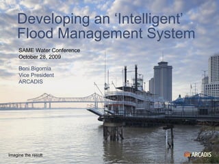
November 8, 2009
Precipitation Hydrology and hydraulics Hurricane tracks, wind and surge Infrastructure response to loadings Levee integrity and system response Real-time floodplan flows Evacuation Special motel considerations Levee system interrelationships Risk analysis November 8, 2009
Towards a smart, networked flood control organization Improve quality of decision making during emergencies Better knowledge of crisis decision making and uncertainties Fast and real time prediction of calculated risks Education and training, scenario studies, design, O&M Integration of Dutch flood control expertise and IBM IT knowledge November 8, 2009
Content is same as previous slide. Change background by changing Slide Color Scheme (Menu > Format > Slide Color Scheme...)
And we also work together on research. This is a plane that the NWS flies into El Nino storms to drop data-gathering electronics through the atmosphere and into the ocean to retrieve important meteorological and oceanographic information. We are very interested in other agencies’ improvements in forecasting technologies, as that will ultimately help our flood damage reduction mission.
**More than 350 miles of levees in the southeast Louisiana area **41 miles sustained severe damage **128 miles of levee sustained minor damage 5 Parishes 350 Miles of Levee/Floodwall 68 Pumping Stations (Fed & Non-Fed) 4 Gated Outlets
**More than 350 miles of levees in the southeast Louisiana area **41 miles sustained severe damage **128 miles of levee sustained minor damage 5 Parishes 350 Miles of Levee/Floodwall 68 Pumping Stations (Fed & Non-Fed) 4 Gated Outlets
**More than 350 miles of levees in the southeast Louisiana area **41 miles sustained severe damage **128 miles of levee sustained minor damage 5 Parishes 350 Miles of Levee/Floodwall 68 Pumping Stations (Fed & Non-Fed) 4 Gated Outlets