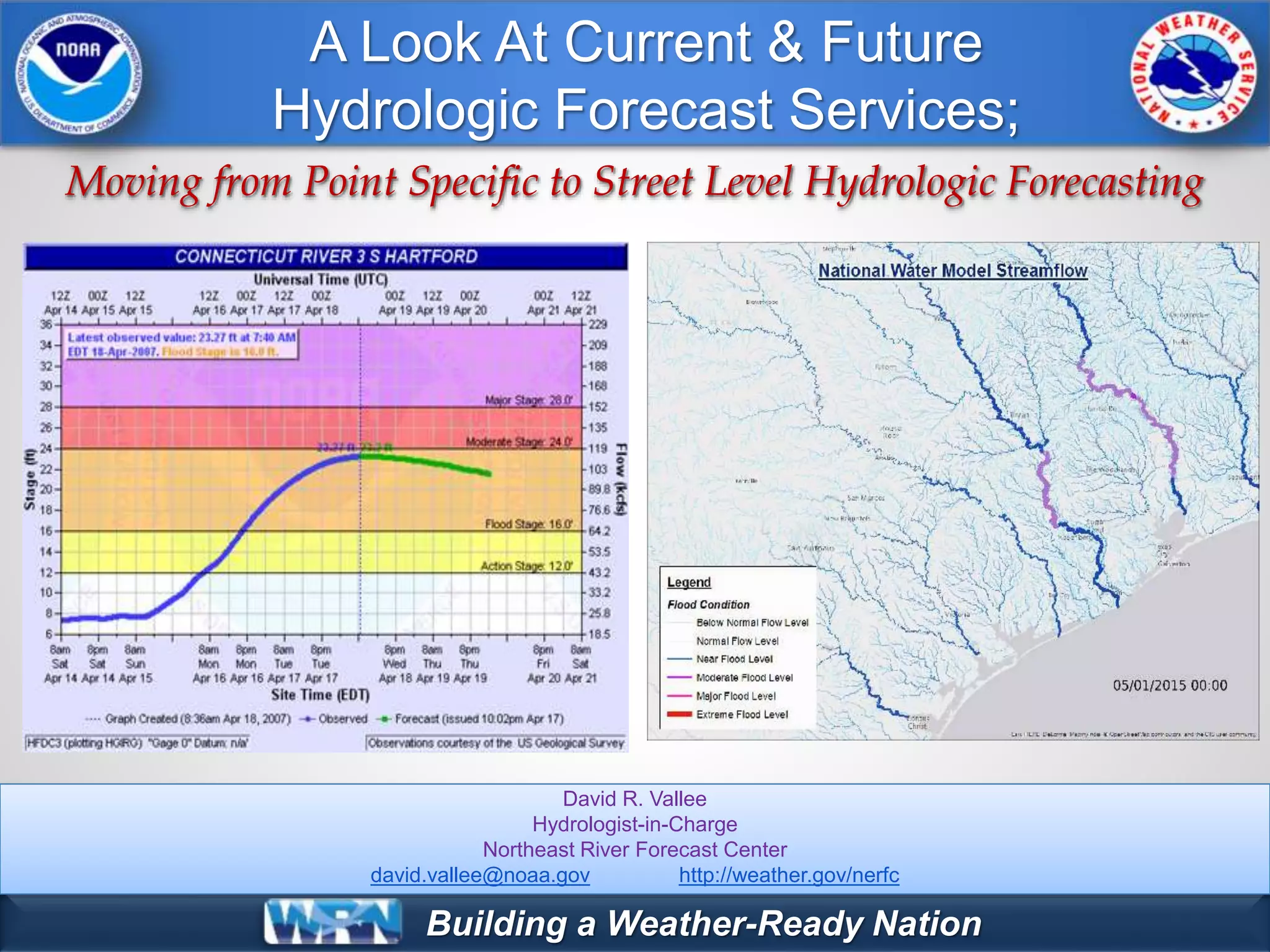
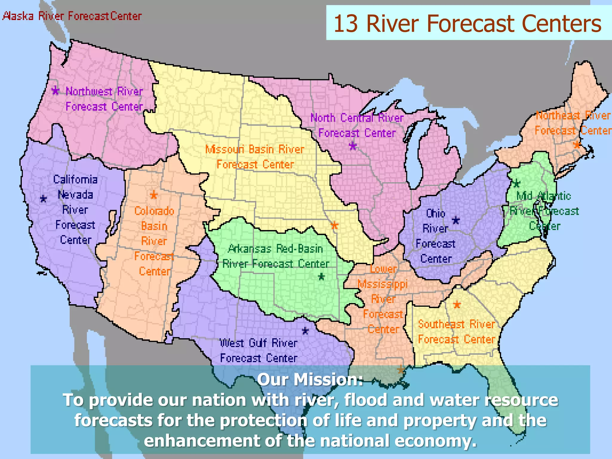
This document discusses NOAA's river forecasting services and plans for improving hydrologic modeling. The 13 River Forecast Centers currently provide river level forecasts at 200 locations using precipitation and temperature forecasts. NOAA aims to develop street-level hydrologic modeling through the National Water Model, which will provide hourly streamflow simulations along 2.6 million river reaches at 1km resolution across the continental US. This high-resolution modeling will improve flood warnings and support emergency management.