Download as PDF, PPTX
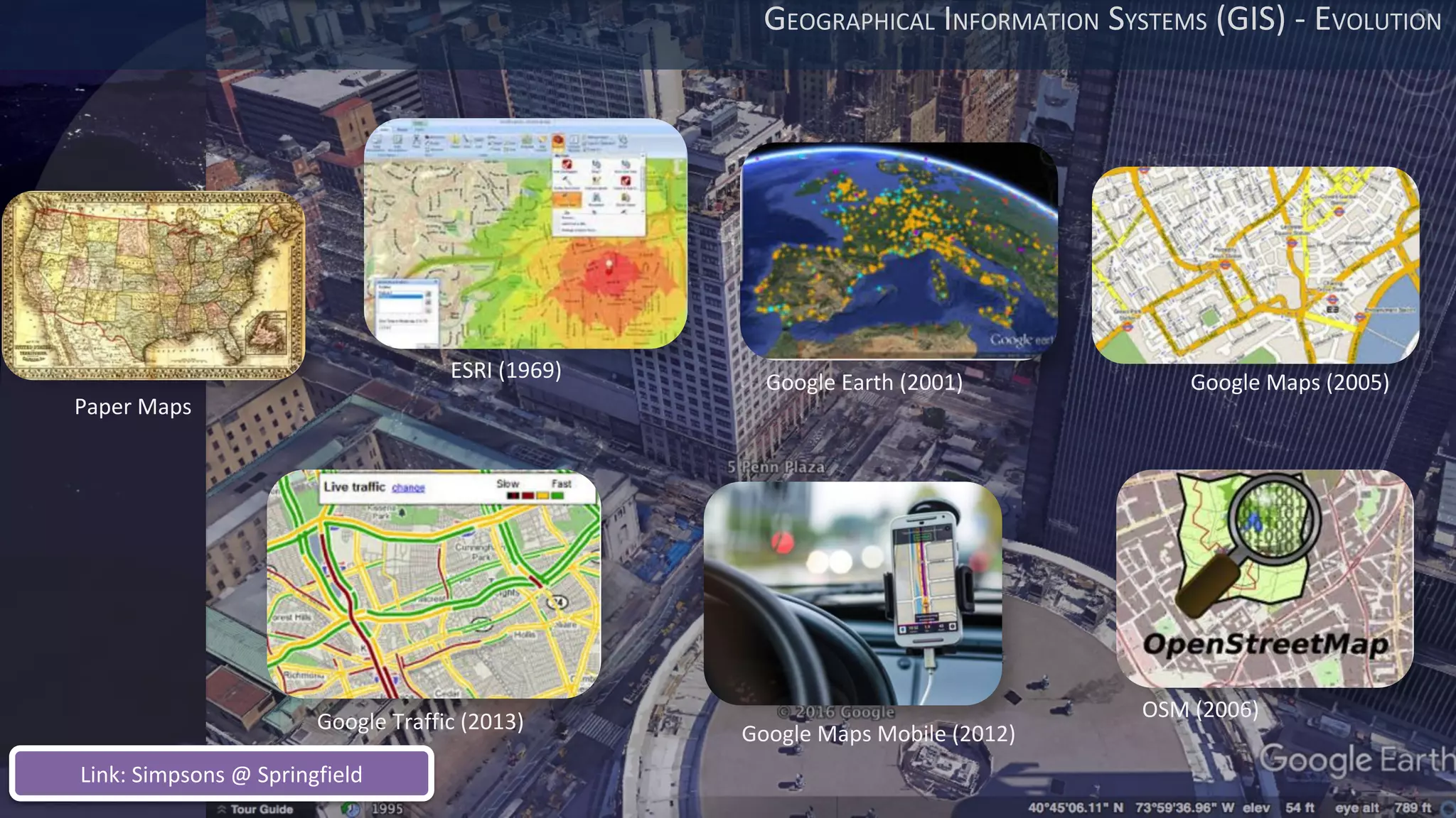
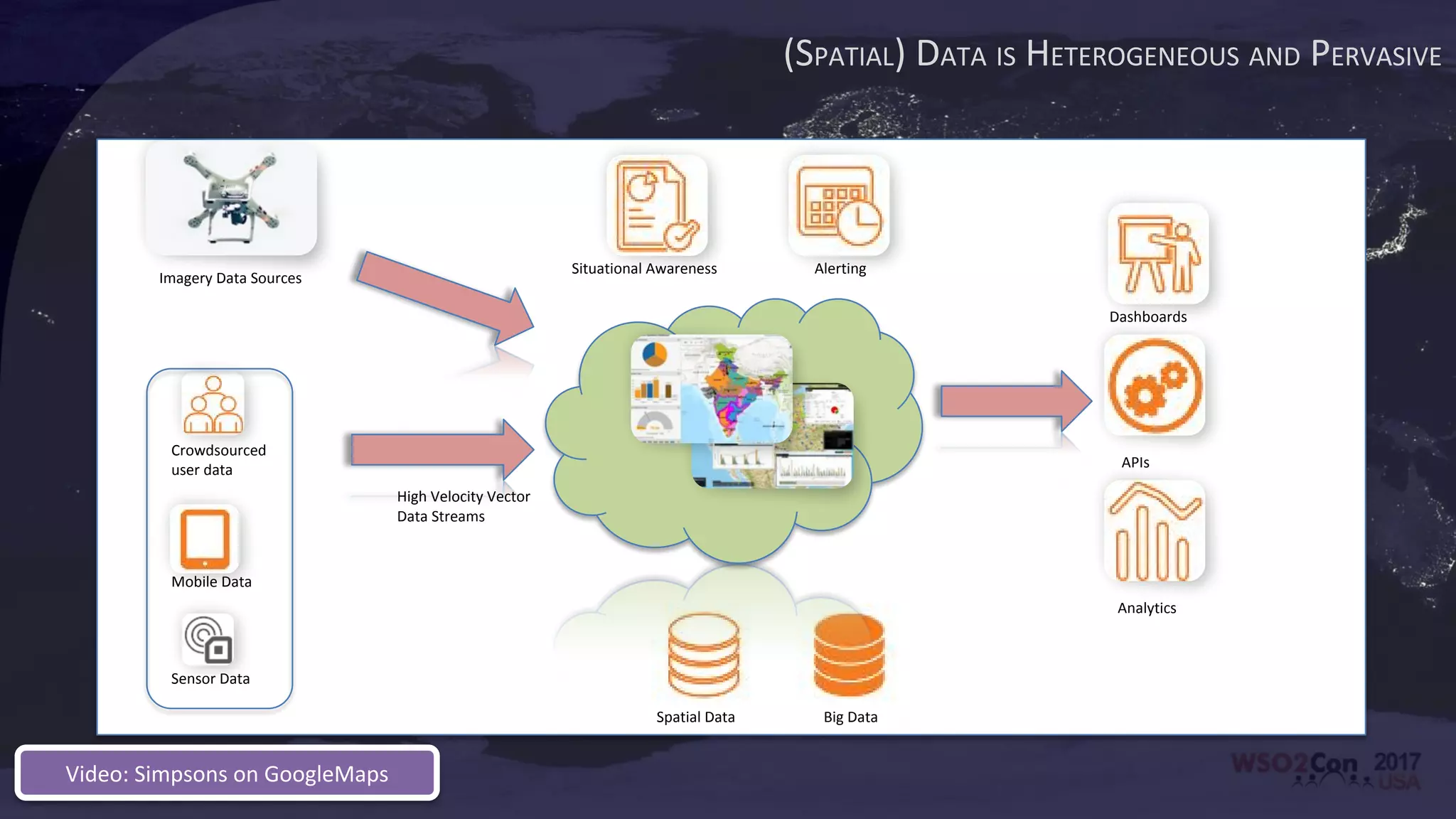
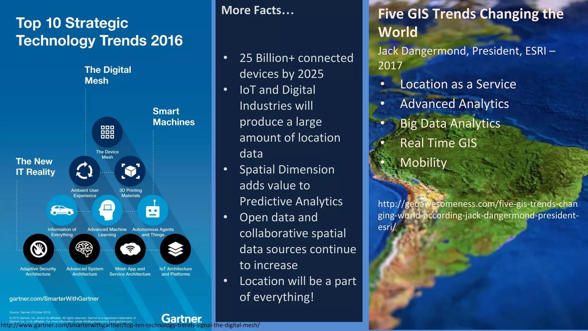
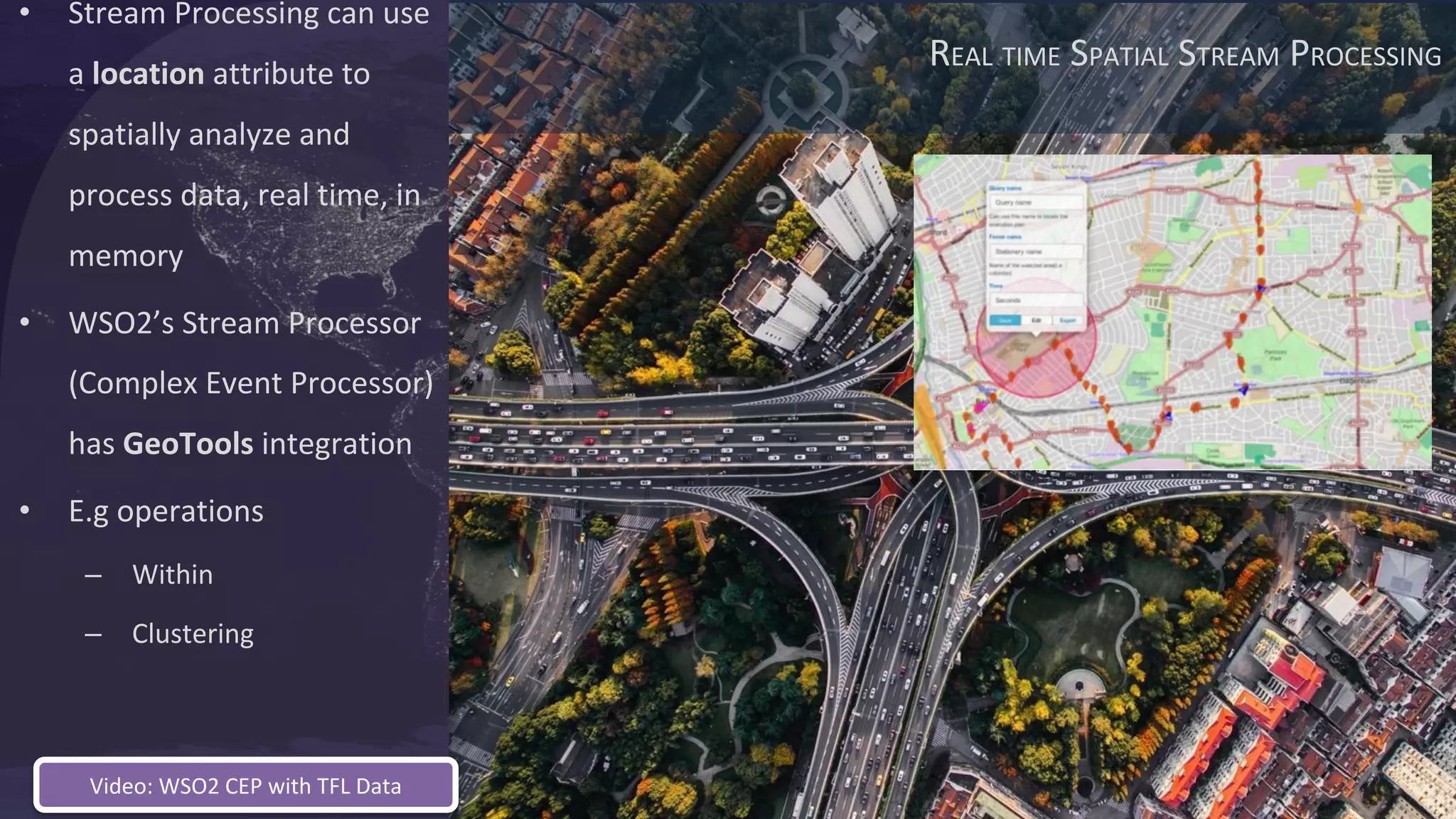
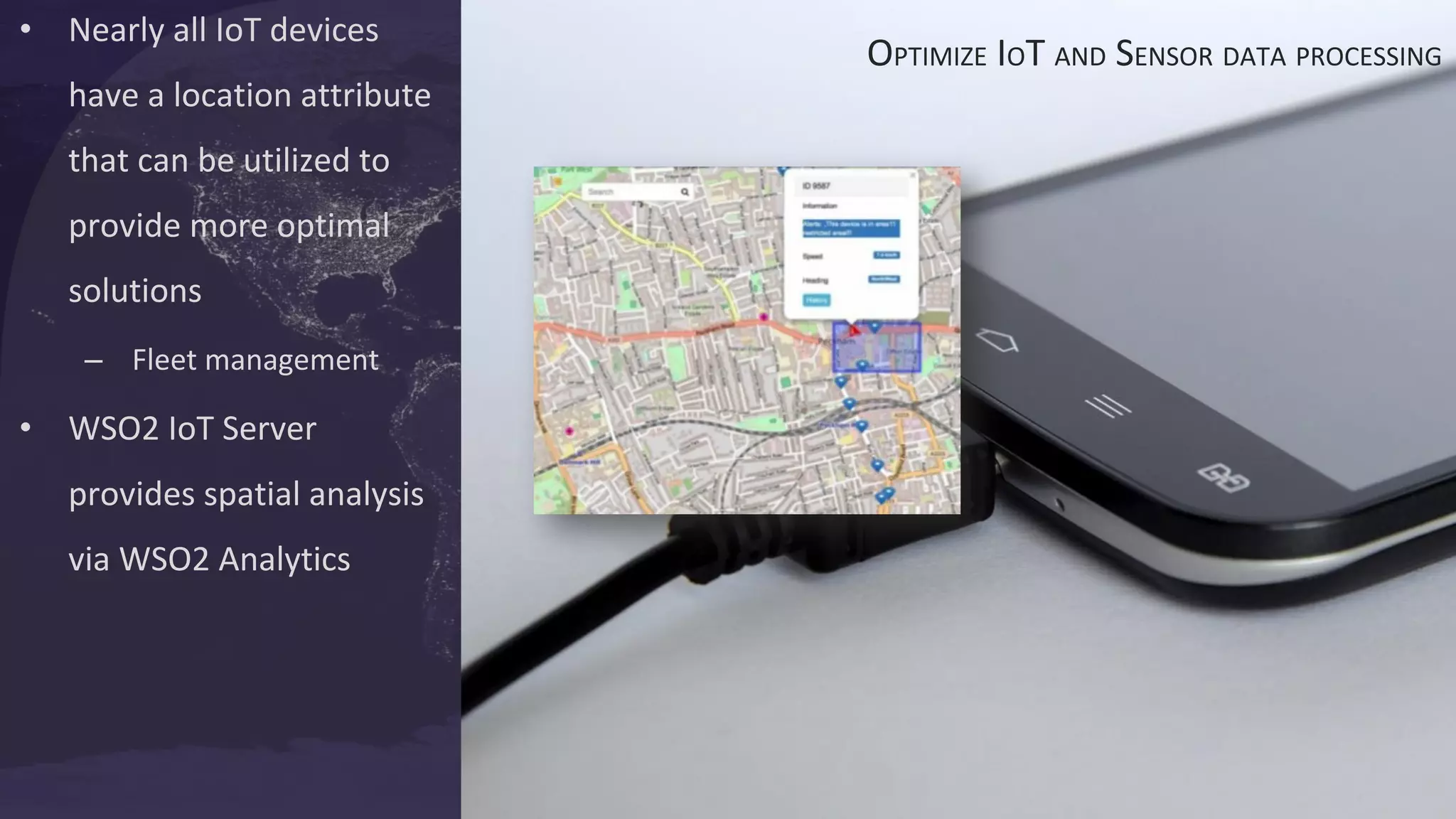
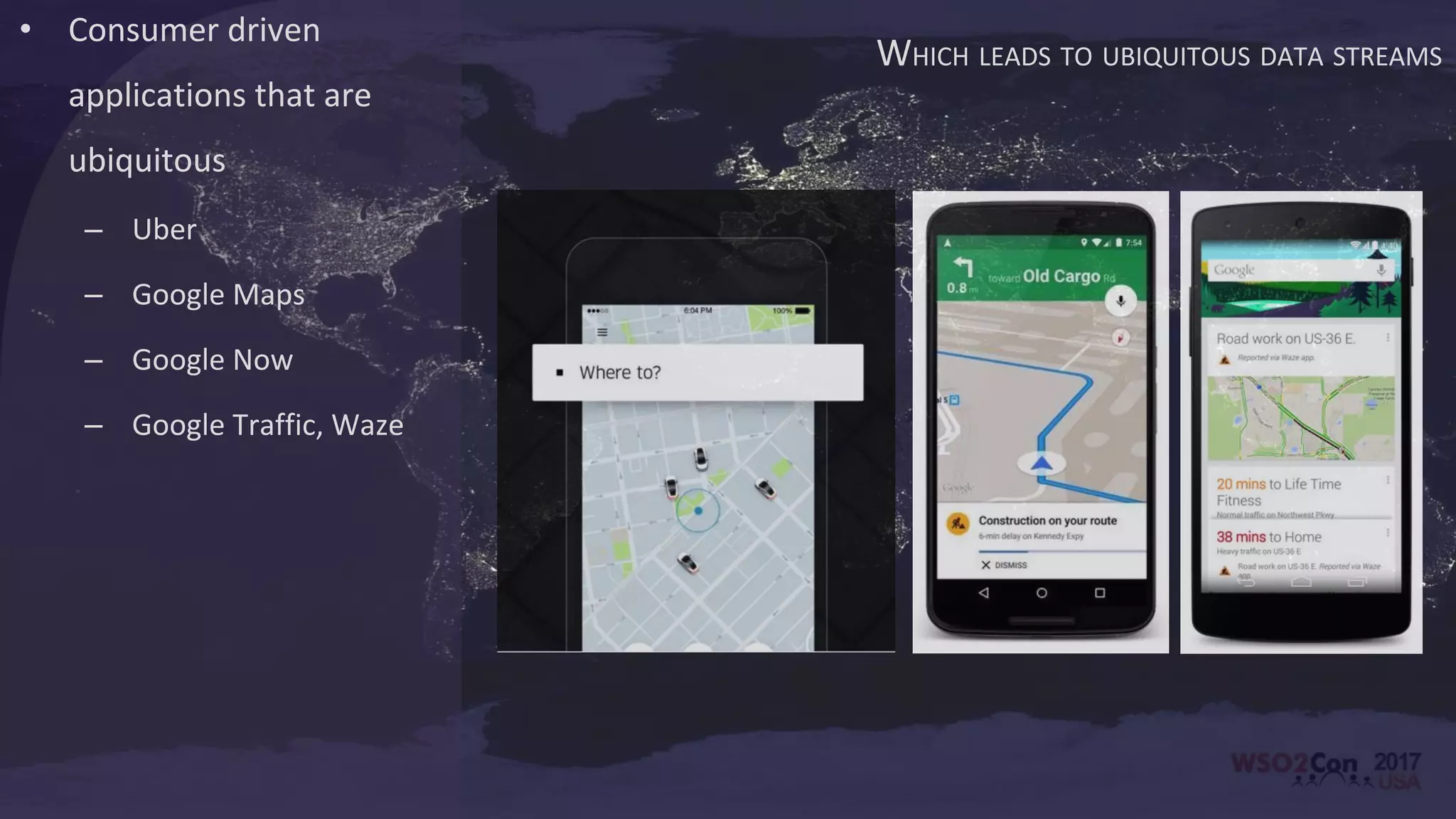
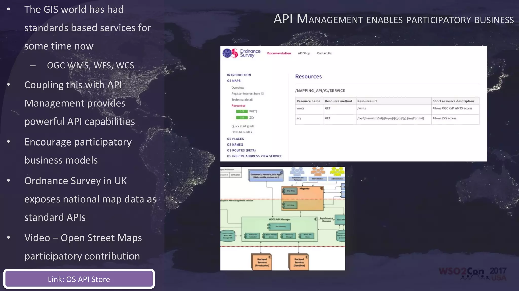
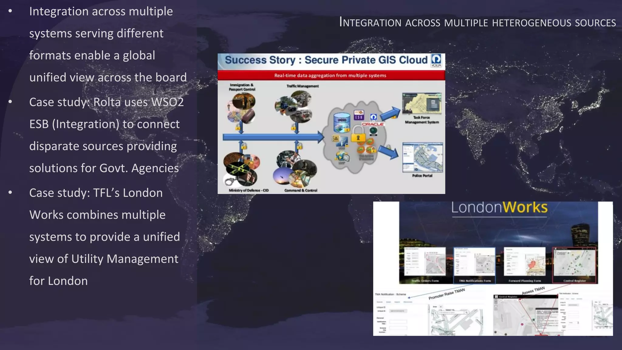

This document discusses the evolution of geospatial technology and how location data is becoming more ubiquitous and integrated across various applications and sectors. Some key points: - Geospatial data is increasingly heterogeneous, coming from diverse sources like sensors, IoT devices, and user-generated content. This data is also growing at a massive scale. - Emerging technologies like stream processing enable real-time spatial analysis of high-velocity and continuous location-based data streams. - Location data adds value to predictive analytics and optimization across various domains like transportation, utilities and more. - API management and integration across sources allows for a unified view of geospatial information and encourages participatory business models. - These trends


![[Roundtable] Choreo - The AI-Native Internal Developer Platform as a Service](https://cdn.slidesharecdn.com/ss_thumbnails/choreo-deck-250328074645-511dded7-thumbnail.jpg?width=640&height=640&fit=bounds)


![Vibe Coding vs. Spec-Driven Development [Free Meetup]](https://cdn.slidesharecdn.com/ss_thumbnails/vibecodingvsspecdrivendevelopment-251209105622-43f455e7-thumbnail.jpg?width=640&height=640&fit=bounds)


