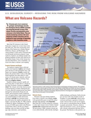
The USGS monitors almost 70 active and potentially active volcanoes in the US to assess hazards and closely monitor the most dangerous ones. Volcanoes produce many hazards including eruption columns and clouds, lava and pyroclastic flows, landslides, and lahars (mudflows) that can kill people and destroy property even long distances away. The USGS works to detect signs of unrest and warn the public of impending eruptions and hazards in order to protect lives and property.