![Typology and Approach
• The typology of case study selected is of Urban Central
Node which incorporates Commercial-Economic and Socio
– Cultural attributes required in an Urban context
• The case studies selected shall reflect and analyse these
values [ their enhancement] with its adaptation over the
years.
• The selection is based on comparable demographic and
historic layers of the places
• The cause factor analysis of the changes are looked into
due scope limitation of the current work.
URBAN LANDSCAPE DESIGN ANALYSIS - Parvathi M, MArch,SAP 2016
2](https://image.slidesharecdn.com/asssignmentuld-170307225831/85/Urban-Landscape-Design-2-320.jpg)
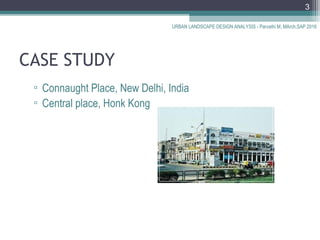


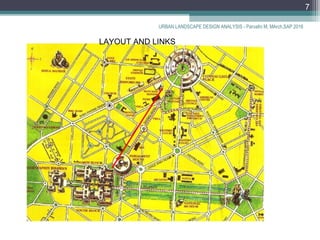
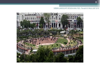
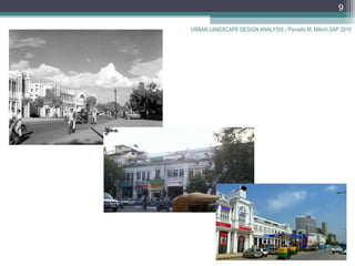
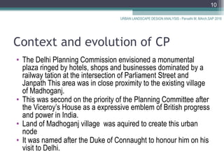
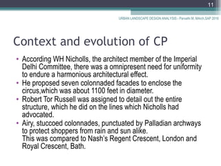
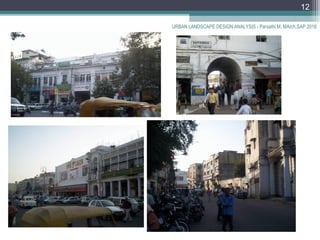
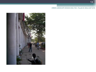
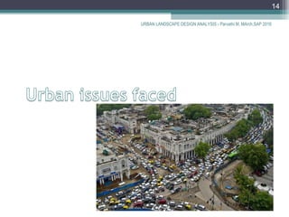
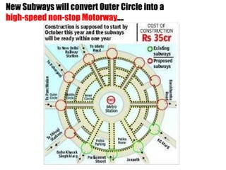
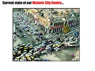
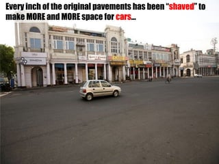
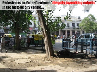
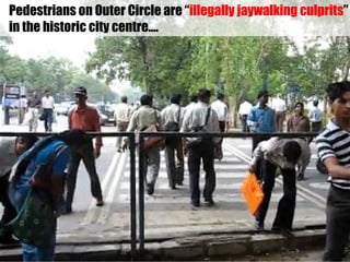
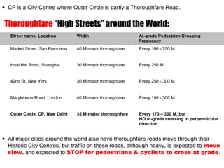
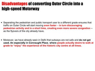
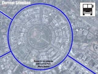
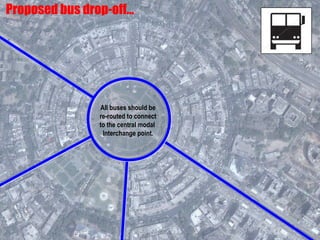
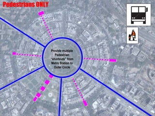
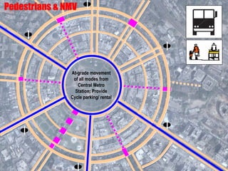
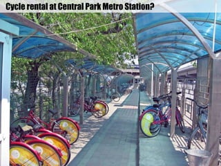
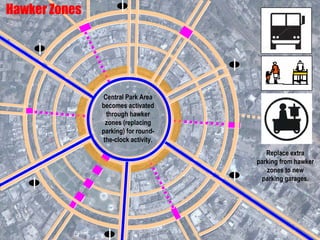
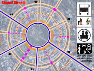

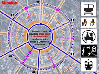
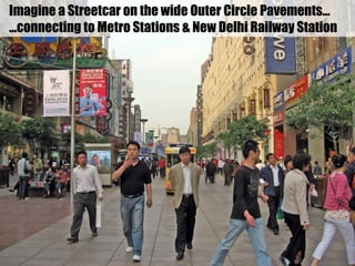
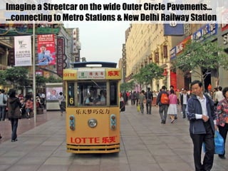
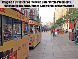
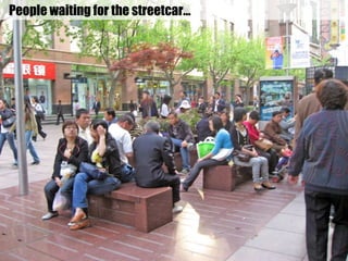
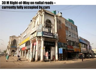
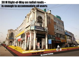
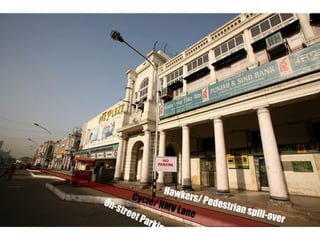
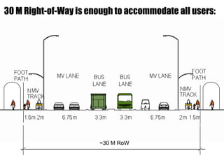
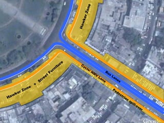

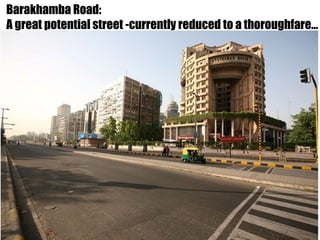
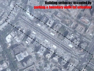
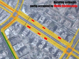
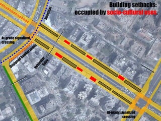
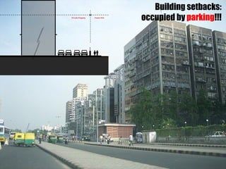
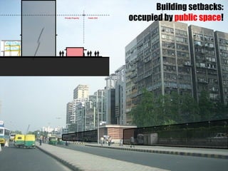
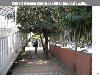
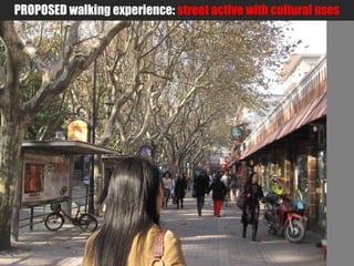
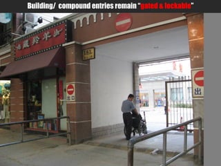

This document summarizes and compares two case studies of urban central nodes: Connaught Place in New Delhi, India and Central Place in Hong Kong. It provides details on the context and evolution of Connaught Place, originally envisioned as a plaza by British imperial planners in 1911. It describes how the land was acquired and layout planned, with colonnaded facades enclosing the circular area. The document examines the current state of Connaught Place and proposes principles and designs for improving multi-modal integration, equitable use of public space, and restoring street life through measures like dedicated bus lanes, cycle lanes, pedestrian zones and a streetcar system.


![74676371-Coagulation-and-Flocculation[1].ppt](https://cdn.slidesharecdn.com/ss_thumbnails/74676371-coagulation-and-flocculation1-260116154109-a3cbf55e-thumbnail.jpg?width=640&height=640&fit=bounds)


