
Recommended
More Related Content
What's hot
What's hot (20)
Similar to MineExcellence - drones platform for mining industry
Similar to MineExcellence - drones platform for mining industry (20)
More from Mason Taylor
More from Mason Taylor (11)
Recently uploaded
Recently uploaded (20)
MineExcellence - drones platform for mining industry
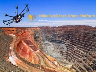
- 1. June 2020 MineExcellence Drone Platform
- 2. Introduction In Mining industry UAV/Drone survey provide aerial images delivering high accurate Topography data, 3D Digital Elevation Models and Digital Surface Models (DSM). MineExcellence Drone Platform provides 2D/3D visualization with various tools helping in scoping, assessment, planning, surveying, design and inspection.
- 4. Applications Drones provide high definition imagery, elevation data and 3D models to enable better scoping, planning, design and maintenance decisions. Exploration & Planning • Feature Extraction & Environmental Assessment Elevation & Contours • Digital Terrain Modelling (DTM) for height and elevation data of the site • Digital Elevation Modelling (DEM) for height and depth of the entire site • Mine Survey • Design of Roads Operations & Maintenance • Mine Growth Mapping • Stock Pile Calculations • Pre & Post blast assessment & calculations • Development analysis • Documentations • Blast video in slow motion resolution
- 5. Applications • Volumetric Analysis: Calculation of stockpiles, waste piles, rocks, or any other matter is easy. Measure volume, areas, distance, etc. • Slope Analysis: The slopes can be shown as per the angles in specific colors to get a better understanding for planning of mines. • Contour Mapping: Contours can be marked throughout the mines at any specific unit. From 10m to 0.1m to any other unit, contour lines can be generated for a depth analysis. • Distances: Any specific distance can be calculated whether horizontally or vertically. • Boundaries: The boundaries can be generated to view the breakpoints more easily to plan its recovery. • Blast Design: Designing blast in real time view of the site over a drone file and analyse its impacts like flyrock, air & ground vibrations etc. • Front Row Burden Analysis: Try different front row burdens and analyse its impacts on flyrock and fragmentation etc.
- 6. BlastDesign
- 9. Contourlines
- 10. FaceProfile
- 11. Quarry&Blasting Design drill patterns, calculate burden analysis, apply blasting parameters, and tie in the shot.
- 15. BlastVideoinSlowMotionResolution The video data can be used to analyze the firing order, as well as detect imperfections in the detonation.
- 17. Applications
- 18. Applications
- 19. SurveyviaTraditionalvsDronemethods Using traditional ground methods, a 60-acre site could easily take two or even three weeks to survey.
- 21. CollaborationviaCloud Share data to all the stakeholders to increase collaboration. Digital drone data, hosted in a secure online cloud environment, makes collaboration with stakeholders simple. Whether taking decisions to improve operational planning, depletion accounting, monitoring environmental factors or identifying and agreeing on required maintenance work.
- 22. YourBenefits Safety • Personnel safety improvement • Operational safety enhancement • Safety enhancement – Reduction of personnel working at heights • Risk minimization Resources • Optimization of crew deployment – Shorter notification time for ground crew • Short term adjustment on resources – Efficient material procurement • Faster inspection intervals – Shorter inspection time for equipment set-up • Resource planning optimization – More efficient allocation of highly skilled labor Cost • Replacement of conventional methods – Low cost UAV surveying Solutions • Reduction of opportunity cost – Less operation shutdown • Reduction of expensive conventional methods – Less teams & platforms • Lower opportunity cost – Reduced asset downtime Reporting • Up-to-date reporting to better track progress– Speed-up decision making • Digitalized workable data – Stakeholders interaction through a single platform • Accurate and precise data sets – Ensuring 100% inspection coverage • Evidence on every identified irregularities – Workable digital data
- 23. AerialSurveyingworkflow Compared to traditional methods of mapping, Aerial 3D mapping is more convenient, faster, economical & accurate. Large areas of land can be mapped in matter of few hours with the data delivered within 24-48 hours
- 25. Sukiran, New Pali Road, Jodhpur, Rajasthan -342001 India Representative Office Thank You support@mineexcellence.com (0291) 2624063 (+61) 03 9444 7454 www.mineexcellence.com