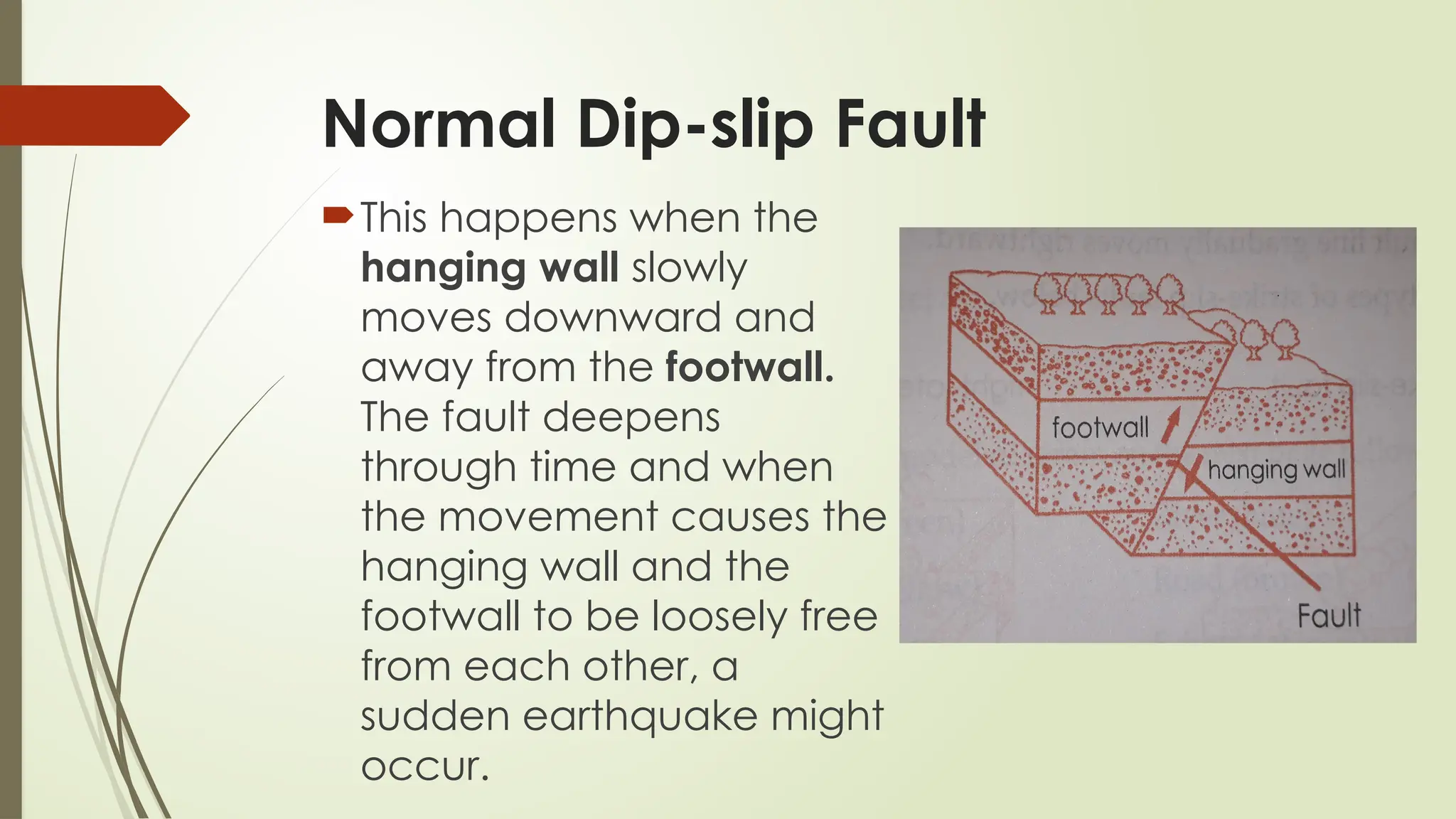
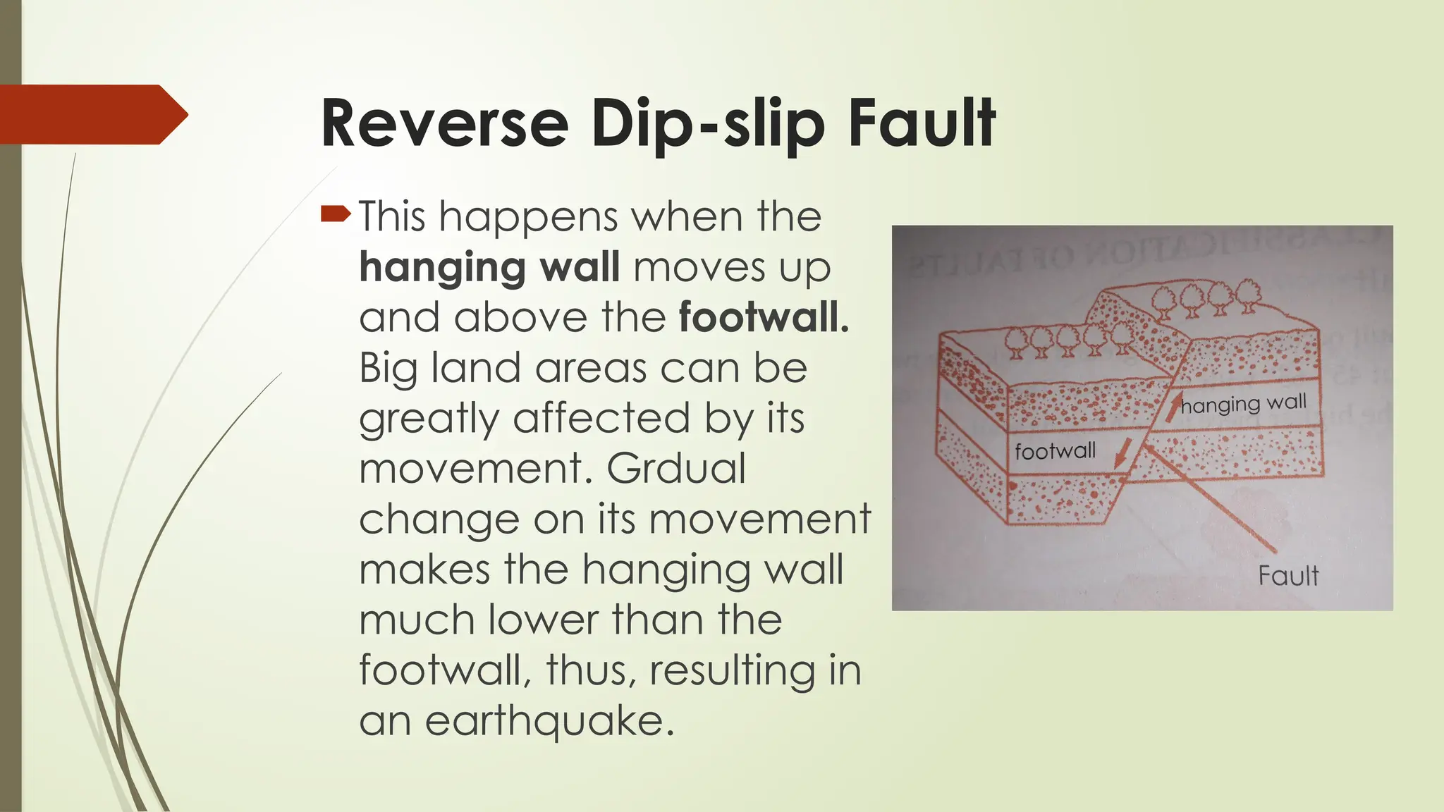
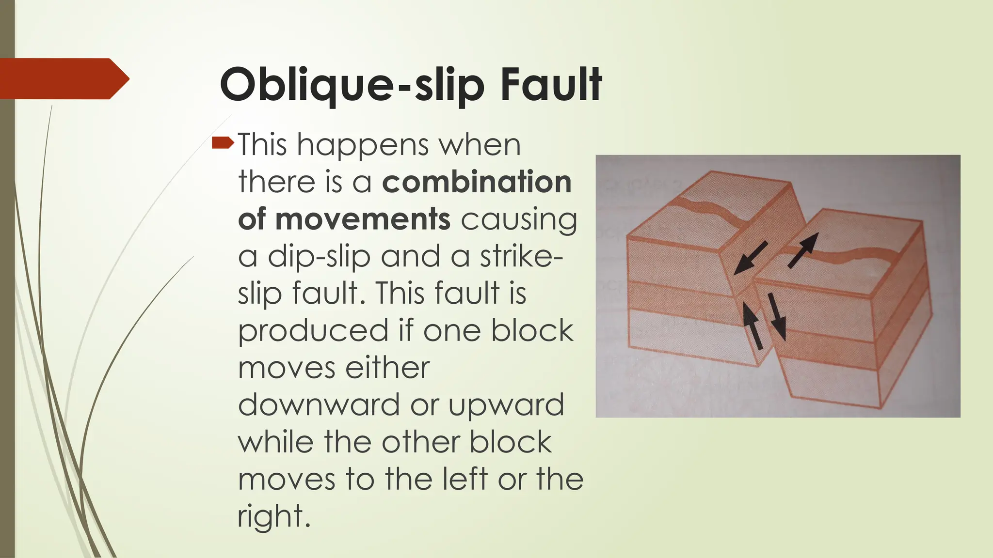
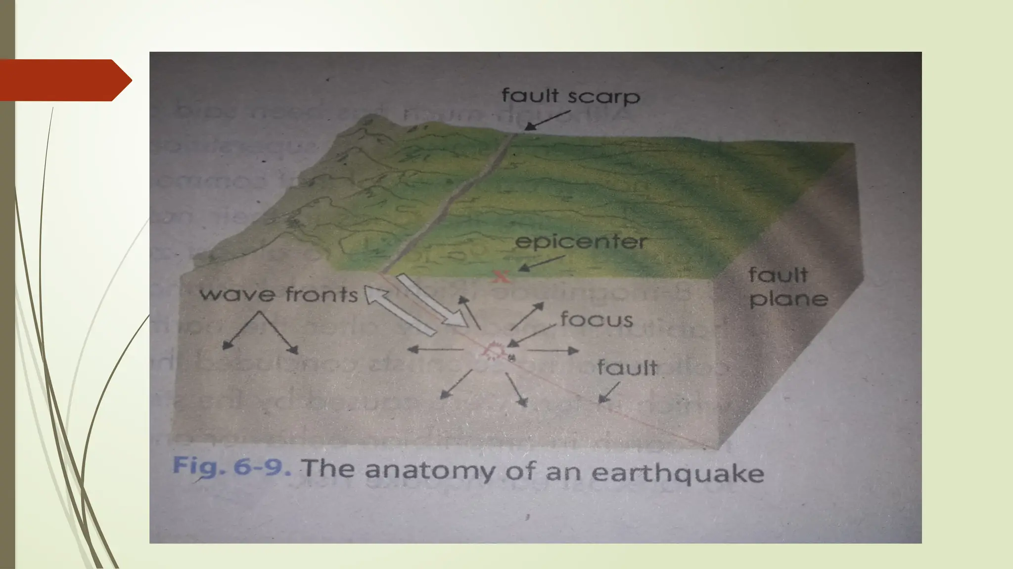
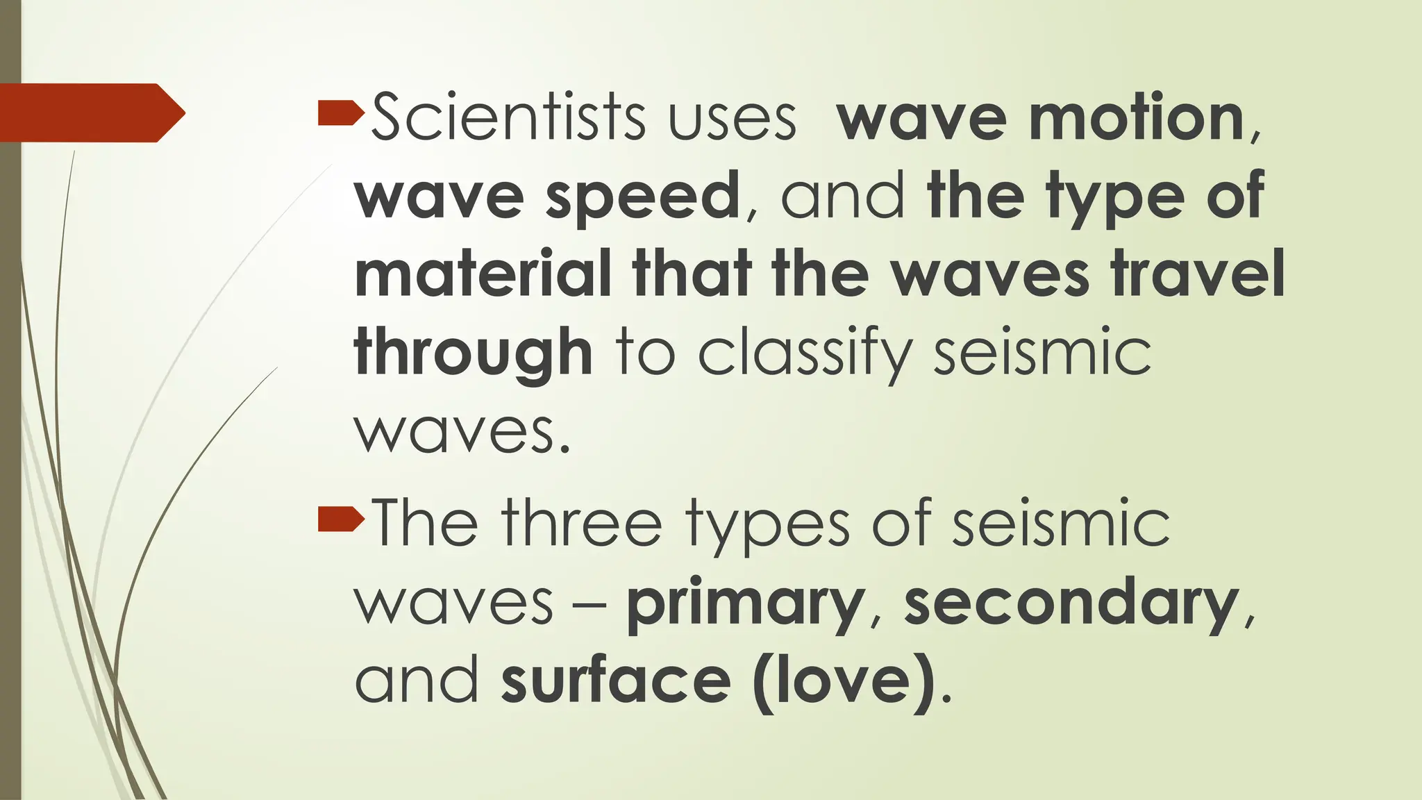
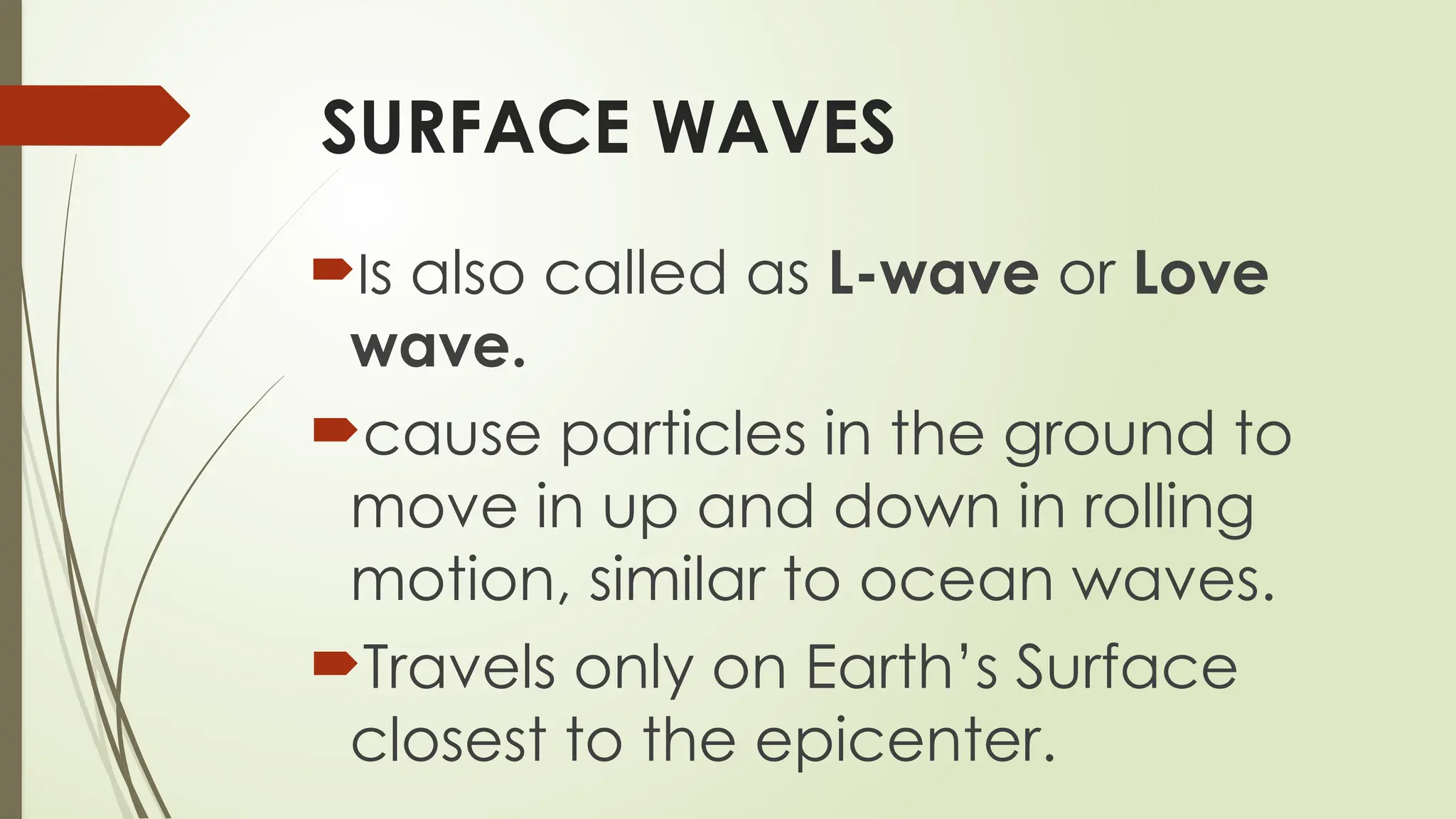
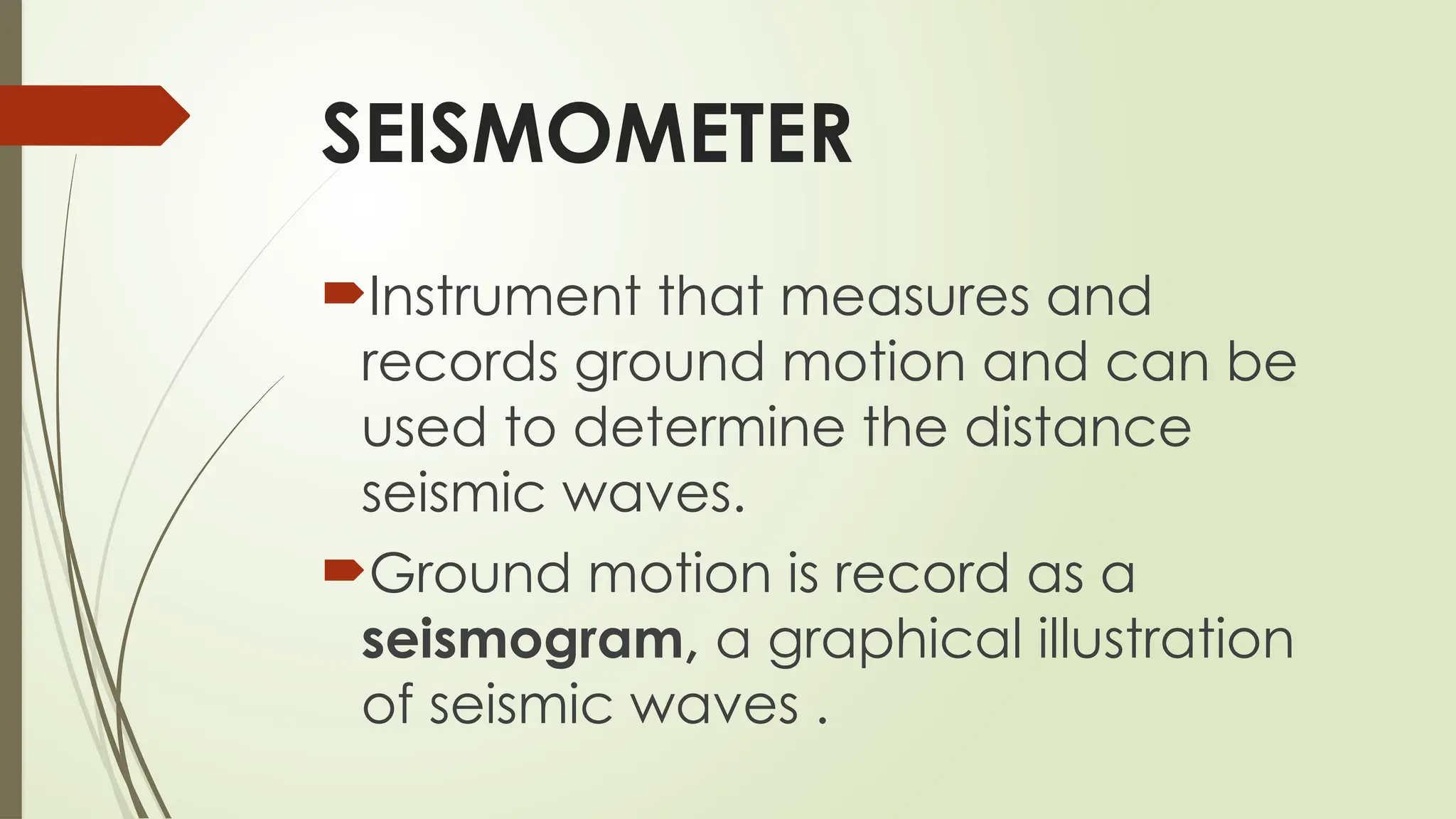
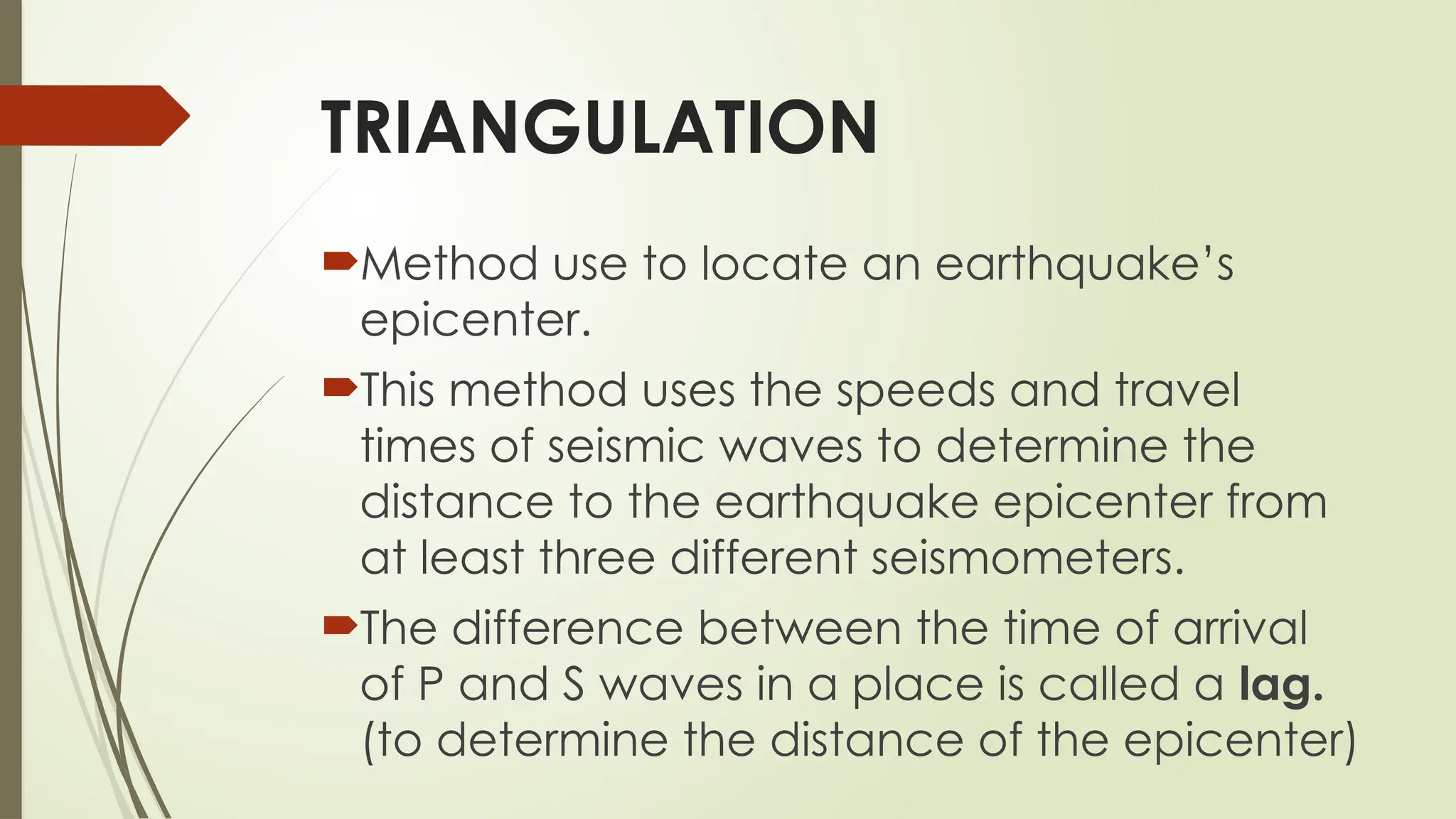
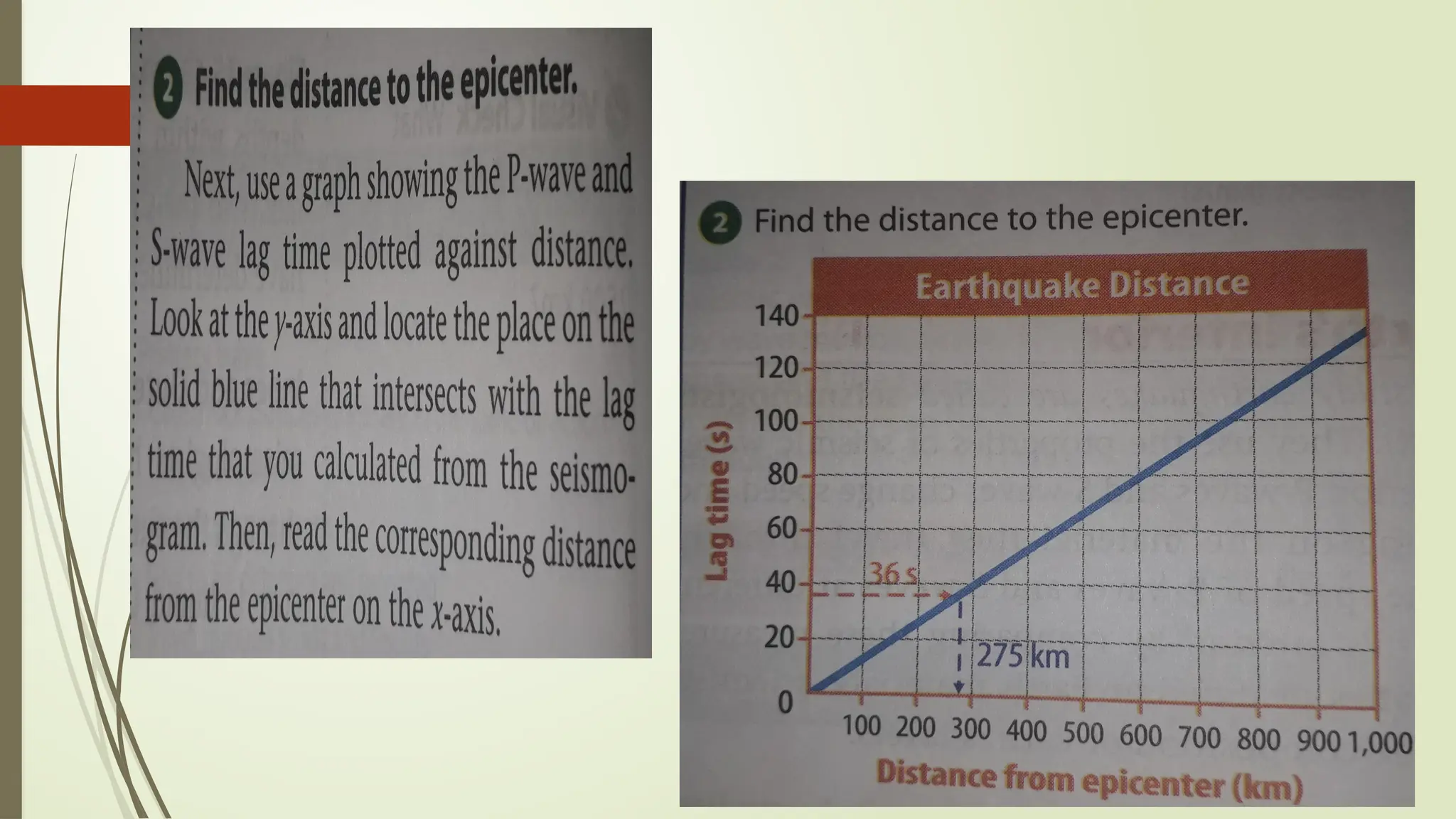
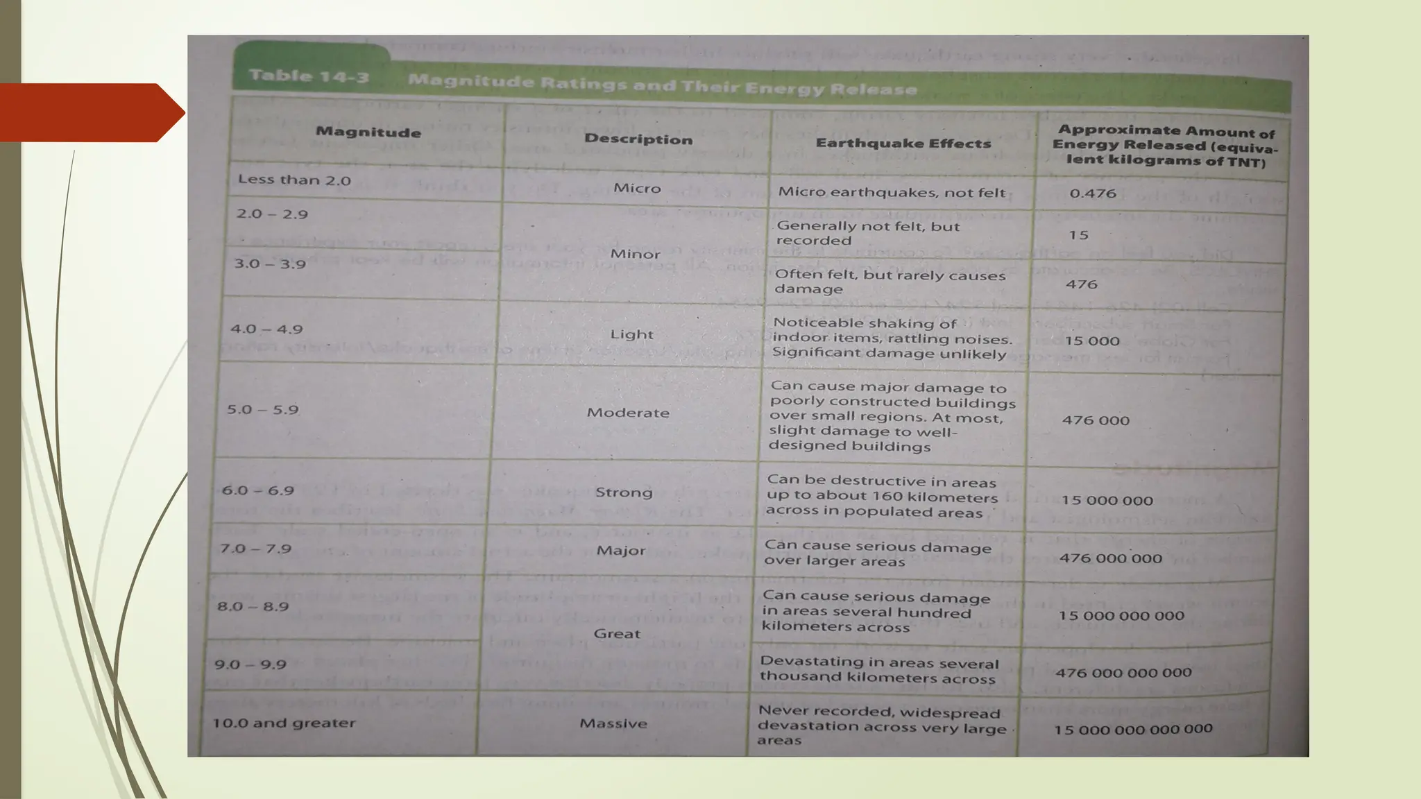
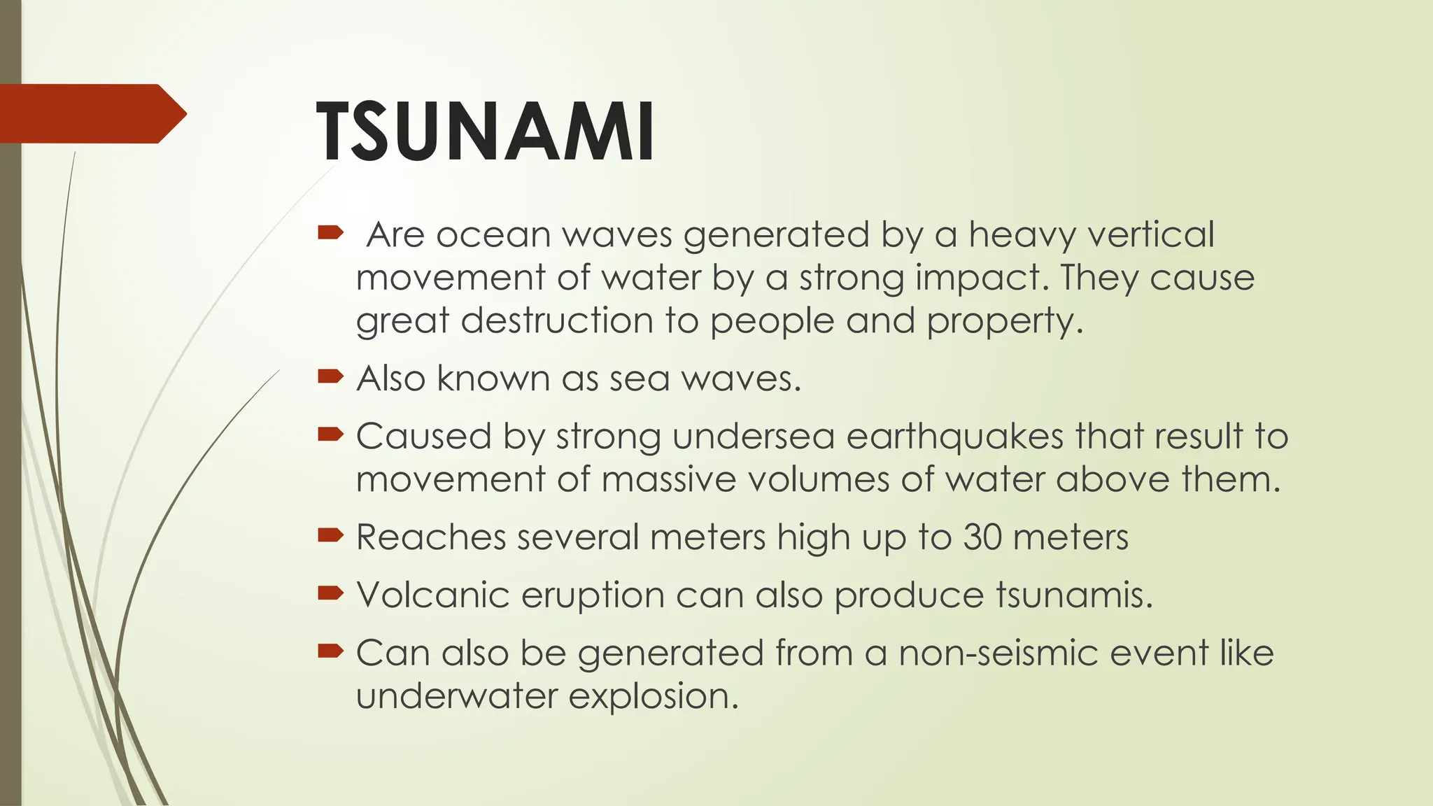
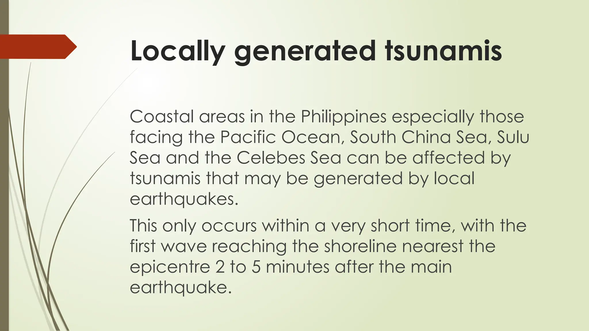
Earth and
Space
Location
How does this
affect us?
People who live along the
Ring of Fire must anticipate
the occurrence of
earthquakes and volcanic
eruptions.
EARTHQUAKE
EARTHQUAKE
 is a sudden movement of the
earth's crust caused by the release
of stress accumulated along
geologic faults or by volcanic
activity which can result to
destruction of properties and the
loss of many lives.
EARTHQUAKE
is the shaking of the surface of the
Earth resulting from the sudden
release of energy in the Earth’s
lithosphere. The energy will
eventually be released once the
fault overcomes the friction
movement.
EARTHQUAKE
is brought about by an abrupt slip on a fault, much
like what happens when you snap your fingers.
Going before the snap, you push your fingers
together and sideways. Since you are pushing them
together, friction keeps them from moving to the
side. At the point when you push sideways hard
enough to overcome this friction, your fingers move
unexpectedly, discharging energy in a form of
sound waves that set the air vibrating and travel
from your hand to your ear, where you hear the
snap.
TECTONIC EARTHQUAKE VS
VOLCANIC EARTHQUAKE
The shifting or movement of the crustal
plates gives rises to tectonic earthquake.
When moves along a fissure, they cause
the earth’s crust to tremble, too. The
magma may reach the surface and when
this happens, a volcanic eruption occurs.
Earthquakes caused by volcanic activity
are called volcanic earthquakes.
Since 1968, the Philippine Institute of Volcanology and
Seismology (PHIVOLCS), the government agency overlooking
all seismic and volcanic activities in the Philippines, have
recorded 12 destructive earthquakes. This is largely due the
Philippine’s location within the Pacific Ring of Fire.
The top 10 provinces that are at risk to Earthquakes include:
1. Surigao del Sur 6. Tarlac
2. La Union 7. Ifugao
3. Benguet 8. Davao Oriental
4. Pangasinan 9. Nueva Vizcaya
5. Pampanga 10. Nueva Ecija
Role Playing
Directions: Make a 2 -3
minute role playing act
showing what people do
when earthquake strikes.
The
Supercontinent
and the
movement of
plates
Tectonic plates
are several large solid rocks that
are in constant motion beneath
the earth’s surface.
These plates build the
continents and the ocean floors.
Theory of Plate Tectonics or the
Continental Drift Theory
Alfred Wegener
He is most remembered as the originator of the
theory of continental drift by hypothesizing in
1912 that the continents are slowly drifting
around the Earth. He theorized that the
continents once existed as a single landmass ,
which he called Pangaea.
What is a FAULT?
A fault is a fracture or zone of fractures
between two blocks of rock. Faults allow the
blocks to move relative to each other. This
movement may occur rapidly, in the form of
an earthquake - or may occur slowly, in the
form of creep. Faults may range in length
from a few millimeters to thousands of
kilometers. Most faults produce repeated
displacements over geologic time.
What is a FAULT?
Faults are thin zones of crushed blocks of
rocks. These are often in centimeters to
thousands of kilometers long. Their surfaces
can be vertical or horizontal. These can
expand into the earth and might possibly
reach out up to the earth's surface. These
are also breaking in the Earth's crust where
rocks on either side of the crack have slid
past each other.
FAULT ZONES
These are breaks that are
spread over a wide area.
FAULT LINE
Is the fault fracture
surface along which
rocks have cracked.
Classification of
Faults
FAULTS
There are three kinds of faults: strike-
slip, normal, and thrust (reverse)
faults. Each type is the outcome of
different forces pushing or pulling on
the crust, causing rocks to slide up,
down or past each other. The
amount of ground displacement in
an earthquake is called the slip.
Dip-slip Fault
Occurs when the ground breaks into two
parts, having an angle of about 45º - 65º
with the surface. The lower broken piece is
the footwall while the higher piece is the
hanging wall.
Normal Dip-slip Fault
This happens when the
hanging wall slowly
moves downward and
away from the footwall.
The fault deepens
through time and when
the movement causes the
hanging wall and the
footwall to be loosely free
from each other, a
sudden earthquake might
occur.
Reverse Dip-slip Fault
This happens when the
hanging wall moves up
and above the footwall.
Big land areas can be
greatly affected by its
movement. Grdual
change on its movement
makes the hanging wall
much lower than the
footwall, thus, resulting in
an earthquake.
Strike-slip Fault
This happens when the break formed is
straight, unlike the slanting dip-slip fault.
Here, rocks along the fault are also
colliding past each other, causing a sort of
dislocation in nearby land areas. At first, a
strike-slip fault looks like a shallow crack on
the ground. But because of weathering
and continuous friction and movement
between faults, earthquake occurs.
Strike-slip Fault has two types – the
right and left lateral.
The left-lateral strike slip fault is
produced when one block continues
to move gradually to the left, while
the right-lateral strike-slip fault occurs
when one block along the fault line
gradually moves rightward.
Oblique-slip Fault
This happens when
there is a combination
of movements causing
a dip-slip and a strike-
slip fault. This fault is
produced if one block
moves either
downward or upward
while the other block
moves to the left or the
right.
Active and
Inactive
Faults
ACTIVE FAULT
Is likely to cause another earthquake sometime
in the future.
Faults are considered to be active if they have
moved one or more times in at least or
within10,000 years.
Example of active faults in the Philippines are
the West Valley Fault Line System and the
Philippine Fault, which actually cuts across the
whole country.
INACTIVE FAULT
Do not show signs of activity in the recent past.
Faults are considered to be inactive if they don’t
experience earthquakes for a very long time or
in the last 10,000 year; however they may be
reactivated by forces acting on the crust or
upper mantle.
EPICENTER
Is the point on the surface of
the earth located directly
above the center of an
earthquake’s origin. The
center or the source of the
earthquake is called focus.
FOCUS
Is usually located between the
Earth’s surface to a depth of 700 km.
Is the source of energy of the
earthquakes and is also referred to as
hypocenter.
Article Reading
Earthquake wreaks havoc in the
Philippines
1.Where is the epicenter of
the earthquake?
2.How many individuals are
affected by the
earthquakes?
3.Discuss how devastating a
7.7 intensity earthquake is.
When rocks move along a fault
they release energy that travels
as vibrations on and in Earth
called seismic waves.
These waves originate where
rocks first move along the fault, at
a location inside earth called the
focus.
Types of
Seismic waves
Scientists uses wave motion,
wave speed, and the type of
material that the waves travel
through to classify seismic
waves.
The three types of seismic
waves – primary, secondary,
and surface (love).
PRIMARY WAVES
Is also called as P-waves, cause
particles in the ground to move in
push-pull motion similar to a coiled
spring.
Are the fastest-moving seismic
waves.
They are the first waves that you feel
following an earthquake.
SECONDARY WAVES
Is also called as S-waves, are
slower than P-waves.
cause particles in the ground to
move in up and down at right
angles relative to the direction
the wave travels.
SURFACE WAVES
Is also called as L-wave or Love
wave.
cause particles in the ground to
move in up and down in rolling
motion, similar to ocean waves.
Travels only on Earth’s Surface
closest to the epicenter.
P-waves and S-waves can
travel through the Earth’s
interior or within the Earth’s
surface.
However, scientists have
discovered that S-waves
cannot travel through liquid.
Locating an
Earthquake’s
Epicenter
SEISMOMETER
Instrument that measures and
records ground motion and can be
used to determine the distance
seismic waves.
Ground motion is record as a
seismogram, a graphical illustration
of seismic waves .
TRIANGULATION
Method use to locate an earthquake’s
epicenter.
This method uses the speeds and travel
times of seismic waves to determine the
distance to the earthquake epicenter from
at least three different seismometers.
The difference between the time of arrival
of P and S waves in a place is called a lag.
(to determine the distance of the epicenter)
How do waves
travel through
the Earth’s
interior?
Once body waves (P and S-wave)
make it through the earth’s interior,
they are detected by seismographs
when they reach the surface.
The velocity of the waves is determined
by the density of the material that they
pass through, so P-waves travel faster
in solids than in liquids because solids
are denser.
As the P-waves pass from crust into
the mantle, their speed suddenly
increases.
The speed change marks a
physical boundary called
discontinuity (caused by a density
difference across the boundary).
MOHOROVICIC DISCONTINUITY
- Is the discontinuity between the
crust and the mantle, or the Moho
named after the Croatian
seismologist who discovered it,
Andrija Mohorovicic
S-waves behave the same way
from crust into the mantle,
speeding up with the increasing
density, though moving slower
than the P-waves.
Through the mantle, the speed of
P-waves continuously increases
with increasing rock density. At a
depth of 2,900 km, their speed
decreases abruptly.
GUTENBERG DISCONTINUITY
- Is the boundary between the
solid lower mantle and the liquid
outer core, named after the
German-American seismologist
Beno Gutenberg, who studied
the discontinuity and was also
Charles Richter’s mentor at
Caltech.
Because the outer core is liquid, it is
less compact than the mantle even
though it is denser. Thus, once they
enter the outer core, the P-waves are
refracted to about 140º to 180º
distance (arc length).
This leaves an area where P-waves
are not detected on the surface
known as P-wave shadow zone.
However, it is not a perfect
shadow zone because some
weak P-wave energy can be
reflected from the solid inner core
and can reach the surface within
the zone.
S-waves, however are completely
blocked by the outer core. Seismographs
at 105º to 180º distance (arc length) from
the epicenter do not detect any S-
waves; this is called S-wave shadow
zone. The location of these shadow zones
have been ddetermined by seismologists
who have studies the data received by
seismograph stations all over the world.
INTENSITY AND
MAGNITUDE
INTENSITY
Tells us how much a certain area was shaken
when the earthquake reached that area.
Actual earthquake effect observed in a specific
area.
Measure of the degree of shaking and trembling
on that locality.
It is greater closer to the epicenter and it
decreases gradually farther and farther from the
epicenter.
ROSSI-FORREL SCALE
Used in the Philippines to evaluate earthquake’s
intensity and was modified into PHIVOLCS
Earthquake Intensity Scale (PEIS) ranging from I to
X depending on the effects on people, structures ,
and objetcs.
Made by Michele Stefano Conte de Rossi of Italy
and Francis-Alphonse Forrel of Switzerland in 1884.
In 1935, Fr. William Repetti modified the scale and
adapted it to Philippine conditions/
MODIFIED MERCALLI SCALE
A scale of earthquake intensity ranging
from I for an earthquake detected only by
seismographs to XII for one causing total
destruction of all buildings.
Named after Guiseppe Mercalli, an Italian
priest and geologist and was use year
1921.
MAGNITUDE
Is the size of an earthquake which can be
measured by a seismograph.
Describes the total munt of energy that was
released by the earthquake at the focus.
Mathematical way of comparing the
strength of earthquakes was devised in 1935
by the America seismologist and Physicist
Charles Richter.
RICHTER MAGNITUDE SCALE
Describes the total amount of
energy that is released by an
earthquake at force. Each
number on the scale rates the
strength of the earthquake and is
not the actual amount of energy
itself.
Earth’s Interior
Crust – 5 km to 70 km thick
Mantle - 2,890 km thick
Outer core – 2, 266 km thick
Inner core - 1, 220 km thick
TSUNAMI
TSUNAMI
 Are ocean waves generated by a heavy vertical
movement of water by a strong impact. They cause
great destruction to people and property.
 Also known as sea waves.
 Caused by strong undersea earthquakes that result to
movement of massive volumes of water above them.
 Reaches several meters high up to 30 meters
 Volcanic eruption can also produce tsunamis.
 Can also be generated from a non-seismic event like
underwater explosion.
Locally generated tsunamis
Coastal areas in the Philippines especially those
facing the Pacific Ocean, South China Sea, Sulu
Sea and the Celebes Sea can be affected by
tsunamis that may be generated by local
earthquakes.
This only occurs within a very short time, with the
first wave reaching the shoreline nearest the
epicentre 2 to 5 minutes after the main
earthquake.
Some natural signs of an approaching local tsunamis.
A felt earthquake
Unusual sea level change: sudden
seawater drop or rise
Rumbling sound of approaching
waves.
BE AWARE, BE PREPARED,
KNOW THE NATURAL
SIGNS OF AN
APPROACHING TSUNAMI
What to do BEFORE an earthquake?
 Make sure you have a fire extinguisher, first aid kit, a battery-
powered radio, a flashlight, and extra batteries at home.
 Learn first aid
 Learn how to turn off the gas, water and electricity.
 Make up a plan of where to meet your family after an
earthquake.
 Don’t leave heavy objects on shelves (they’ll fall during a
quake).
 Anchor heavy furniture, cupboards, and appliances to the
walls or floor.
 Learn the earthquake plan at your school or workplace.
What to do DURING an earthquake?
 Stay calm! If you are indoors, stay inside. If you are outside, stay outside.
 If you’re indoors, stand against a wall near the center of the building,
stand in a doorway, or crawl under heavy furniture (a desk or a table).
Stay away from windows and outside doors
 If you’re outdoors, stay in the open away from power lines or anything
that might fall. Stay away from buildings (stuff might fall off the building
or the building could fall on you).
 Don’t use matches, candles or any flame. Broken gas lines and fire
don’t mix.
 If you’re in a car, stop the car and stay inside the car until the
earthquake stops.
 Don’t use elevators (they probably get stuck anyway).
What to do AFTER an earthquake?
Check yourself and others for injuries. Provide first aid for
anyone who needs it.
Check water, gas, and electric lines for damage. If any
are damaged, shut off the valves. Check for the smell
of gas. If you smell it, open all the windows and doors,
leave immediately, and report it to the authorities.
Turn on the radio. Don’t use the phone unless it’s an
emergency.
Stay out of damaged buildings.
Ba careful around broken glass and debris. Wear boots
or sturdy shoes to keep from cutting your feet.
What to do AFTER an earthquake?
Be careful of chimneys (they may fall on you).
Stay away from beaches, tsunamis and seiches
sometimes hit after the ground has stopped
shaking.
Stay away from damaged areas.
If you’re at school or work, follow the emergency
plan or the instructions of the person in charge.
Expect aftershocks.

LESSON 1: Earthquakes - SCIENCE 8 - QUARTER 2

  • 1.
  • 2.
  • 4.
  • 5.
    People who livealong the Ring of Fire must anticipate the occurrence of earthquakes and volcanic eruptions.
  • 6.
  • 8.
    EARTHQUAKE  is asudden movement of the earth's crust caused by the release of stress accumulated along geologic faults or by volcanic activity which can result to destruction of properties and the loss of many lives.
  • 9.
    EARTHQUAKE is the shakingof the surface of the Earth resulting from the sudden release of energy in the Earth’s lithosphere. The energy will eventually be released once the fault overcomes the friction movement.
  • 10.
    EARTHQUAKE is brought aboutby an abrupt slip on a fault, much like what happens when you snap your fingers. Going before the snap, you push your fingers together and sideways. Since you are pushing them together, friction keeps them from moving to the side. At the point when you push sideways hard enough to overcome this friction, your fingers move unexpectedly, discharging energy in a form of sound waves that set the air vibrating and travel from your hand to your ear, where you hear the snap.
  • 11.
    TECTONIC EARTHQUAKE VS VOLCANICEARTHQUAKE The shifting or movement of the crustal plates gives rises to tectonic earthquake. When moves along a fissure, they cause the earth’s crust to tremble, too. The magma may reach the surface and when this happens, a volcanic eruption occurs. Earthquakes caused by volcanic activity are called volcanic earthquakes.
  • 12.
    Since 1968, thePhilippine Institute of Volcanology and Seismology (PHIVOLCS), the government agency overlooking all seismic and volcanic activities in the Philippines, have recorded 12 destructive earthquakes. This is largely due the Philippine’s location within the Pacific Ring of Fire. The top 10 provinces that are at risk to Earthquakes include: 1. Surigao del Sur 6. Tarlac 2. La Union 7. Ifugao 3. Benguet 8. Davao Oriental 4. Pangasinan 9. Nueva Vizcaya 5. Pampanga 10. Nueva Ecija
  • 13.
    Role Playing Directions: Makea 2 -3 minute role playing act showing what people do when earthquake strikes.
  • 15.
  • 16.
    Tectonic plates are severallarge solid rocks that are in constant motion beneath the earth’s surface. These plates build the continents and the ocean floors.
  • 17.
    Theory of PlateTectonics or the Continental Drift Theory Alfred Wegener He is most remembered as the originator of the theory of continental drift by hypothesizing in 1912 that the continents are slowly drifting around the Earth. He theorized that the continents once existed as a single landmass , which he called Pangaea.
  • 19.
    What is aFAULT? A fault is a fracture or zone of fractures between two blocks of rock. Faults allow the blocks to move relative to each other. This movement may occur rapidly, in the form of an earthquake - or may occur slowly, in the form of creep. Faults may range in length from a few millimeters to thousands of kilometers. Most faults produce repeated displacements over geologic time.
  • 20.
    What is aFAULT? Faults are thin zones of crushed blocks of rocks. These are often in centimeters to thousands of kilometers long. Their surfaces can be vertical or horizontal. These can expand into the earth and might possibly reach out up to the earth's surface. These are also breaking in the Earth's crust where rocks on either side of the crack have slid past each other.
  • 21.
    FAULT ZONES These arebreaks that are spread over a wide area.
  • 22.
    FAULT LINE Is thefault fracture surface along which rocks have cracked.
  • 23.
  • 24.
    FAULTS There are threekinds of faults: strike- slip, normal, and thrust (reverse) faults. Each type is the outcome of different forces pushing or pulling on the crust, causing rocks to slide up, down or past each other. The amount of ground displacement in an earthquake is called the slip.
  • 26.
    Dip-slip Fault Occurs whenthe ground breaks into two parts, having an angle of about 45º - 65º with the surface. The lower broken piece is the footwall while the higher piece is the hanging wall.
  • 27.
    Normal Dip-slip Fault Thishappens when the hanging wall slowly moves downward and away from the footwall. The fault deepens through time and when the movement causes the hanging wall and the footwall to be loosely free from each other, a sudden earthquake might occur.
  • 28.
    Reverse Dip-slip Fault Thishappens when the hanging wall moves up and above the footwall. Big land areas can be greatly affected by its movement. Grdual change on its movement makes the hanging wall much lower than the footwall, thus, resulting in an earthquake.
  • 29.
    Strike-slip Fault This happenswhen the break formed is straight, unlike the slanting dip-slip fault. Here, rocks along the fault are also colliding past each other, causing a sort of dislocation in nearby land areas. At first, a strike-slip fault looks like a shallow crack on the ground. But because of weathering and continuous friction and movement between faults, earthquake occurs.
  • 30.
    Strike-slip Fault hastwo types – the right and left lateral. The left-lateral strike slip fault is produced when one block continues to move gradually to the left, while the right-lateral strike-slip fault occurs when one block along the fault line gradually moves rightward.
  • 32.
    Oblique-slip Fault This happenswhen there is a combination of movements causing a dip-slip and a strike- slip fault. This fault is produced if one block moves either downward or upward while the other block moves to the left or the right.
  • 33.
  • 34.
    ACTIVE FAULT Is likelyto cause another earthquake sometime in the future. Faults are considered to be active if they have moved one or more times in at least or within10,000 years. Example of active faults in the Philippines are the West Valley Fault Line System and the Philippine Fault, which actually cuts across the whole country.
  • 35.
    INACTIVE FAULT Do notshow signs of activity in the recent past. Faults are considered to be inactive if they don’t experience earthquakes for a very long time or in the last 10,000 year; however they may be reactivated by forces acting on the crust or upper mantle.
  • 36.
    EPICENTER Is the pointon the surface of the earth located directly above the center of an earthquake’s origin. The center or the source of the earthquake is called focus.
  • 37.
    FOCUS Is usually locatedbetween the Earth’s surface to a depth of 700 km. Is the source of energy of the earthquakes and is also referred to as hypocenter.
  • 38.
    Article Reading Earthquake wreakshavoc in the Philippines
  • 39.
    1.Where is theepicenter of the earthquake? 2.How many individuals are affected by the earthquakes? 3.Discuss how devastating a 7.7 intensity earthquake is.
  • 41.
    When rocks movealong a fault they release energy that travels as vibrations on and in Earth called seismic waves. These waves originate where rocks first move along the fault, at a location inside earth called the focus.
  • 42.
  • 43.
    Scientists uses wavemotion, wave speed, and the type of material that the waves travel through to classify seismic waves. The three types of seismic waves – primary, secondary, and surface (love).
  • 44.
    PRIMARY WAVES Is alsocalled as P-waves, cause particles in the ground to move in push-pull motion similar to a coiled spring. Are the fastest-moving seismic waves. They are the first waves that you feel following an earthquake.
  • 45.
    SECONDARY WAVES Is alsocalled as S-waves, are slower than P-waves. cause particles in the ground to move in up and down at right angles relative to the direction the wave travels.
  • 46.
    SURFACE WAVES Is alsocalled as L-wave or Love wave. cause particles in the ground to move in up and down in rolling motion, similar to ocean waves. Travels only on Earth’s Surface closest to the epicenter.
  • 47.
    P-waves and S-wavescan travel through the Earth’s interior or within the Earth’s surface. However, scientists have discovered that S-waves cannot travel through liquid.
  • 49.
  • 50.
    SEISMOMETER Instrument that measuresand records ground motion and can be used to determine the distance seismic waves. Ground motion is record as a seismogram, a graphical illustration of seismic waves .
  • 52.
    TRIANGULATION Method use tolocate an earthquake’s epicenter. This method uses the speeds and travel times of seismic waves to determine the distance to the earthquake epicenter from at least three different seismometers. The difference between the time of arrival of P and S waves in a place is called a lag. (to determine the distance of the epicenter)
  • 56.
    How do waves travelthrough the Earth’s interior?
  • 57.
    Once body waves(P and S-wave) make it through the earth’s interior, they are detected by seismographs when they reach the surface. The velocity of the waves is determined by the density of the material that they pass through, so P-waves travel faster in solids than in liquids because solids are denser.
  • 58.
    As the P-wavespass from crust into the mantle, their speed suddenly increases. The speed change marks a physical boundary called discontinuity (caused by a density difference across the boundary).
  • 59.
    MOHOROVICIC DISCONTINUITY - Isthe discontinuity between the crust and the mantle, or the Moho named after the Croatian seismologist who discovered it, Andrija Mohorovicic
  • 60.
    S-waves behave thesame way from crust into the mantle, speeding up with the increasing density, though moving slower than the P-waves.
  • 61.
    Through the mantle,the speed of P-waves continuously increases with increasing rock density. At a depth of 2,900 km, their speed decreases abruptly.
  • 62.
    GUTENBERG DISCONTINUITY - Isthe boundary between the solid lower mantle and the liquid outer core, named after the German-American seismologist Beno Gutenberg, who studied the discontinuity and was also Charles Richter’s mentor at Caltech.
  • 63.
    Because the outercore is liquid, it is less compact than the mantle even though it is denser. Thus, once they enter the outer core, the P-waves are refracted to about 140º to 180º distance (arc length). This leaves an area where P-waves are not detected on the surface known as P-wave shadow zone.
  • 64.
    However, it isnot a perfect shadow zone because some weak P-wave energy can be reflected from the solid inner core and can reach the surface within the zone.
  • 65.
    S-waves, however arecompletely blocked by the outer core. Seismographs at 105º to 180º distance (arc length) from the epicenter do not detect any S- waves; this is called S-wave shadow zone. The location of these shadow zones have been ddetermined by seismologists who have studies the data received by seismograph stations all over the world.
  • 67.
  • 68.
    INTENSITY Tells us howmuch a certain area was shaken when the earthquake reached that area. Actual earthquake effect observed in a specific area. Measure of the degree of shaking and trembling on that locality. It is greater closer to the epicenter and it decreases gradually farther and farther from the epicenter.
  • 69.
    ROSSI-FORREL SCALE Used inthe Philippines to evaluate earthquake’s intensity and was modified into PHIVOLCS Earthquake Intensity Scale (PEIS) ranging from I to X depending on the effects on people, structures , and objetcs. Made by Michele Stefano Conte de Rossi of Italy and Francis-Alphonse Forrel of Switzerland in 1884. In 1935, Fr. William Repetti modified the scale and adapted it to Philippine conditions/
  • 71.
    MODIFIED MERCALLI SCALE Ascale of earthquake intensity ranging from I for an earthquake detected only by seismographs to XII for one causing total destruction of all buildings. Named after Guiseppe Mercalli, an Italian priest and geologist and was use year 1921.
  • 73.
    MAGNITUDE Is the sizeof an earthquake which can be measured by a seismograph. Describes the total munt of energy that was released by the earthquake at the focus. Mathematical way of comparing the strength of earthquakes was devised in 1935 by the America seismologist and Physicist Charles Richter.
  • 74.
    RICHTER MAGNITUDE SCALE Describesthe total amount of energy that is released by an earthquake at force. Each number on the scale rates the strength of the earthquake and is not the actual amount of energy itself.
  • 76.
    Earth’s Interior Crust –5 km to 70 km thick Mantle - 2,890 km thick Outer core – 2, 266 km thick Inner core - 1, 220 km thick
  • 77.
  • 78.
    TSUNAMI  Are oceanwaves generated by a heavy vertical movement of water by a strong impact. They cause great destruction to people and property.  Also known as sea waves.  Caused by strong undersea earthquakes that result to movement of massive volumes of water above them.  Reaches several meters high up to 30 meters  Volcanic eruption can also produce tsunamis.  Can also be generated from a non-seismic event like underwater explosion.
  • 79.
    Locally generated tsunamis Coastalareas in the Philippines especially those facing the Pacific Ocean, South China Sea, Sulu Sea and the Celebes Sea can be affected by tsunamis that may be generated by local earthquakes. This only occurs within a very short time, with the first wave reaching the shoreline nearest the epicentre 2 to 5 minutes after the main earthquake.
  • 80.
    Some natural signsof an approaching local tsunamis. A felt earthquake Unusual sea level change: sudden seawater drop or rise Rumbling sound of approaching waves.
  • 81.
    BE AWARE, BEPREPARED, KNOW THE NATURAL SIGNS OF AN APPROACHING TSUNAMI
  • 82.
    What to doBEFORE an earthquake?  Make sure you have a fire extinguisher, first aid kit, a battery- powered radio, a flashlight, and extra batteries at home.  Learn first aid  Learn how to turn off the gas, water and electricity.  Make up a plan of where to meet your family after an earthquake.  Don’t leave heavy objects on shelves (they’ll fall during a quake).  Anchor heavy furniture, cupboards, and appliances to the walls or floor.  Learn the earthquake plan at your school or workplace.
  • 83.
    What to doDURING an earthquake?  Stay calm! If you are indoors, stay inside. If you are outside, stay outside.  If you’re indoors, stand against a wall near the center of the building, stand in a doorway, or crawl under heavy furniture (a desk or a table). Stay away from windows and outside doors  If you’re outdoors, stay in the open away from power lines or anything that might fall. Stay away from buildings (stuff might fall off the building or the building could fall on you).  Don’t use matches, candles or any flame. Broken gas lines and fire don’t mix.  If you’re in a car, stop the car and stay inside the car until the earthquake stops.  Don’t use elevators (they probably get stuck anyway).
  • 84.
    What to doAFTER an earthquake? Check yourself and others for injuries. Provide first aid for anyone who needs it. Check water, gas, and electric lines for damage. If any are damaged, shut off the valves. Check for the smell of gas. If you smell it, open all the windows and doors, leave immediately, and report it to the authorities. Turn on the radio. Don’t use the phone unless it’s an emergency. Stay out of damaged buildings. Ba careful around broken glass and debris. Wear boots or sturdy shoes to keep from cutting your feet.
  • 85.
    What to doAFTER an earthquake? Be careful of chimneys (they may fall on you). Stay away from beaches, tsunamis and seiches sometimes hit after the ground has stopped shaking. Stay away from damaged areas. If you’re at school or work, follow the emergency plan or the instructions of the person in charge. Expect aftershocks.