Download to read offline


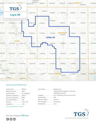
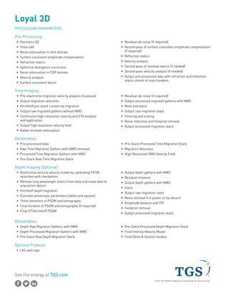
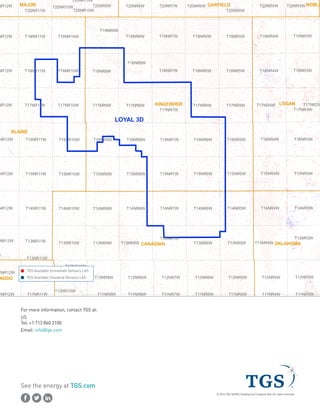

This document provides information about a 3D seismic survey called the Loyal 3D located in Blaine, Kingfisher, and Canadian counties in Oklahoma. It includes details on the acquisition parameters such as source type, receiver and source line spacing, bin size, record length, and sample rate. It also describes the pre-processing and imaging workflows to be applied including velocity analysis, multiple attenuation, stacking, and optional depth imaging. Finally, it lists the deliverables and contact information for the project.