Falzon Das Se Ag Compressed
•
0 likes•171 views
Falzon "The Dynamic Aerial Survey Algorithm: Precision Fertiliser Applications", SEAg 2011 Conference, Sep, Surfers Paradise, Qld, Australia.
Report
Share
Report
Share
Download to read offline

Recommended
TGS NSA- Freeport 3D
TGS-NOPEC Geophysical Company has acquired a 3D multi-client onshore seismic survey covering 470 square miles in eastern Ohio. The survey was acquired with vibrator trucks and dynamite sources along lines spaced 880 feet apart. Processing will include pre-stack time and depth migration to produce seismic images and velocity models. Deliverables will include pre-processed seismic data, pre-stack and post-stack migrated volumes, and associated velocity models. Optional products include available well logs from the area.
TGS NSA- Firestone 3D
This document describes the acquisition and processing parameters for a 3D seismic survey called Firestone 3D conducted in Carroll and Columbiana Counties, Ohio. It details the acquisition geometry including receiver and source line spacing, bin size, record length, and maximum offset. It also provides an overview of the pre-processing, time imaging, and optional depth imaging workflows that were applied to the seismic data.
Earth Observation and applications on environmental studies
This document discusses using earth observation data and applications for environmental studies. It provides examples of how sensors like optical satellites, lidar, and aircraft collect geospatial data. The data is then processed and analyzed to extract information and knowledge about environmental issues like forest decline monitoring, agriculture and soil fertility mapping, climate change impacts, and soil moisture retrieval. Case studies are presented on using satellite data to study these topics in Catalonia.
TGS NSA- Loyal 3D
This document provides information about a 3D seismic survey called the Loyal 3D located in Blaine, Kingfisher, and Canadian counties in Oklahoma. It includes details on the acquisition parameters such as source type, receiver and source line spacing, bin size, record length, and sample rate. It also describes the pre-processing and imaging workflows to be applied including velocity analysis, multiple attenuation, stacking, and optional depth imaging. Finally, it lists the deliverables and contact information for the project.
Jonathan Lefman presents his work on Superresolution chemical microscopy
This document discusses several microscopy techniques including structured illumination fluorescence microscopy, time-of-flight secondary ion mass spectrometry, coherent anti-Stokes Raman scattering microscopy, photoactivated localization microscopy, stimulated emission depletion microscopy, and 4Pi microscopy. It focuses on describing improvements made to structured illumination fluorescence microscopy including parallel GPU processing to accelerate image analysis and a new automated imaging framework. Time-of-flight secondary ion mass spectrometry imaging is discussed with applications to iterative clustering and classification analysis.
Geo_DC Meetup talk: Mapping a marathon
This document provides instructions for mapping a marathon using various tools:
1. Use RunKeeper, Strava, or Nike+ to track a run and export the GPS data as a GPX file. Convert the GPX file to a shapefile using ogr2ogr and append multiple runs.
2. Style the tracks in Mapbox or Carto including thin lines for the marathon track and thicker semi-transparent lines for the GPS tracks.
3. Aggregate marathon finisher data by city using Python and publish the results as an interactive map in Mapbox or Carto, with city points sized by number of finishers and colored by average time.
2009-1 중간고사문제(초고주파공학)
This document contains a mid-term examination on microwave engineering with 5 questions. Question 1 asks to show that a sinusoidal wave function represents a wave and find the direction of propagation. Question 2 calculates the reflection and transmission coefficients and powers for a coaxial line with a resistor attached. Question 3 calculates the reflection coefficient for a coaxial line with an inductor attached. Question 4 calculates the reflection coefficient for a coaxial line with a real inductor and resistor attached. Question 5 calculates the VSWR for the system in question 4.
Modeling Geometry and Reference Systems on the Web of Data - LGD 2014
"Modeling Geometry and Reference Systems on the Web of Data" - Talk given at the W3C Workshop on Linking Geospatial Data (LGD), 5-6 March 2014
10 10-12 tf communications
This document provides an update on the TF GLXP Mission. It discusses awaiting a response from ILDD, actively working mission areas with or without invitation, continuing to grow the team, and sufficient funding for 2011 demonstrations involving rover operations, balloon flights, and Masten flights. It also includes block diagrams of the communications systems and bandwidth requirements, and poses continuing questions around interfaces, solutions, standards, and algorithms.
Spectral Analysis at the Limit - Applications in Radio Astronomy
Spektralanalyse am technologischen Limit: Anwendungen in der Radioastronomie
Wo Prozessoren in ihrer Leistungsfähigkeit nicht mehr ausreichen, wird programmierbare Logik in Form von FPGAs (Field Programmable Gate Arrays) eingesetzt. Hunderte von Rechenoperationen können damit innert Nanosekunden erledigt werden. Diese Technologie eignet sich vorzüglich für die Echtzeit-Spektralanalyse von Signalen.
Typische Anwendungen finden sich in der Radioastronomie oder der Atmosphärenphysik. Typisch sind die enormen Abtastraten von mehreren Giga-Samples pro Sekunde bei Wandler-Auflösungen von ³ 10 Bit, Signal-Bandbreiten von > 1 GHz, aufgelöst in ³ 16'384 Kanälen. Die Leistungsgrenze wird in diesen Bereichen stetig nach oben geschoben.
Mit dem präsentierten Projekt wurde ein neuer Meilenstein punkto Funktionalität und Verarbeitungsgeschwindigkeit gesetzt. So ist das realisierte Spektrometer 1- oder 2-kanalig konfigurierbar, in der 2-kanaligen Version können beispielsweise die Summen- und Differenzspektren gerechnet werden, oder das Kreuzleistungs-Spektrum. Anstelle der "normalen" Fast Fourier Transform (FFT) wurde eine digitale Filterbank implementiert.
Im Vortrag werden aktuelle und künftige Anwendungen im Bereich der Radioastronomie vorgestellt. Es sind Anlagen und Projekte, die weltweit in Betrieb sind oder in Planung stehen. Messresultate zeigen die enorme Leistungsfähigkeit, aber auch die Grenzen der digitalen Spektralanalyse.
Bruno Stuber, Hochschule für Technik FHNW und Christian Monstein, ETH Zürich
Applied maths for electronics engineers june 2013 (2)
This document contains two parts:
Part A provides examples of classifying fuzzy propositions and different types of fuzzy quantifiers.
Part B presents four mathematical problems: 1) determining the QR decomposition of a matrix, 2) finding the Cholesky decomposition of a matrix, 3) calculating properties of the Poisson distribution and finding moments of a given random variable, 4) solving problems related to the normal distribution including finding probabilities and the probability density function of a function of a Gaussian random variable.
FOSDEM 2015: Distributed Tile Processing with GeoTrellis and Spark
This is a talk I gave at FOSDEM that explained how we use GeoTrellis and Spark to process the NASA NEX Climate Dataset.
LHCb Computing Workshop 2018: PV finding with CNNs
The document discusses using a convolutional neural network (CNN) to quickly find primary vertices (PVs) in high-energy physics events recorded by the LHCb experiment. A prototype tracking algorithm is used to generate a 1D kernel density estimate (KDE) histogram from hit triplets. This histogram is then used to train a CNN to predict the locations of PVs. Initial results show the CNN approach can find PVs with 70-75% efficiency and a false positive rate of 0.08-0.13, outperforming current algorithms. Further work aims to improve resolution, find secondary vertices, and integrate the approach into iterative tracking.
Parallel Wavelet Schemes for Images
The two-dimensional discrete wavelet transform (DWT) can be applied in the heart of many image-processing algorithms.
Until recently, several studies have compared the performance of such transform on parallel architectures, for example, on graphics
processing units (GPUs). All these studies however considered only separable calculation schedules.
AIP seminar - ARCHES WP6
The document discusses calibrating data from the Canada-France-Hawaii Telescope (CFHT) survey and comparing it to data from the Sloan Digital Sky Survey (SDSS) to search for distant galaxy clusters. It notes some limitations of SDSS data and the need to calibrate CFHT data, including using photo-z codes and spectral energy distribution calibrations. It also compares using photo-z versus redshift-color modeling for cluster finding.
Molecular Variation of Potato virus Y Isolated from Egypt
Potato Virus Y (PVY) is one of the most important viruses affecting cultivated potatoes in Egypt. Different potato plants were collected from an experimental station in Giza Governorate, Egypt and were tested using RT-PCR. PVY was amplified using primers represented portion of the Coat Protein (CP) gene and 3' Untranslated Regions (UTR). Phylogenetic tree showed two main strain groups: Group I regroups PVYN and PVYNTN stains while Group II includes PVYO, PVYW and PVYN:O strains. The Egyptian PVY isolate was clearly classified within group I and was more closely related to PVYNTN strains. Ten nucleotide substitutions resulted in 3 conserved amino acid substitutions (V1→I, G7→E, M or V and S8→G) and were able to differentiate between both groups. The partial coat protein region was more diverse than that of the 3'UTR (92.6-100% and 97.7-100% identity, respectively). The 3'UTR of the Egyptian isolate showed RNA secondary structures different from those of the 5 PVY strains.
IGARSS2011_TU1.T03.2_Zhan.ppt
Different passive microwave soil moisture retrieval algorithms can give different results because they make different assumptions and use different input parameters. The single-channel algorithm is highly sensitive to errors in the optical depth estimate, while the land parameter retrieval model and multi-channel inversion algorithm are less sensitive as they estimate additional parameters from multiple frequencies. An uncertainty analysis found that varying temperatures and brightness temperatures within realistic error bounds did not significantly impact soil moisture retrievals from the land parameter retrieval model or multi-channel inversion algorithm, but did impact the single-channel algorithm.
Q4 2016 GeoTrellis Presentation
This is a slide deck that I have been using to present on GeoTrellis for various meetings and workshops. The information is speaks to GeoTrellis pre-1.0 release in Q4 of 2016.
FIBRE presentation at GEC25
FIBRE future plans presented in the International Collaboration session at GENI Engineering Conference. Miami, 14 March 2017.
hadoop introduce
MapReduce is a programming model for processing large datasets in a distributed environment. It originated from Google and features parallel processing on commodity hardware with fault tolerance. The three phases of MapReduce are Map, Shuffle, and Reduce. Mappers process key-value pairs and emit intermediate key-value pairs. Reducers then process all intermediate pairs with the same key and emit the final results. HDFS is a distributed file system that stores massive amounts of data reliably on large clusters of commodity hardware through data replication. It features a master node that coordinates access and stores metadata, and stores files as blocks across data nodes.
Raster Processing with Scipy.ndimage (Dev Meet Up II)
Presentation by Henry Walshaw. For Esri Australia's Developer Meetup in Melbourne 27/09/12. Taking a look at SciPy for raster processing.
PREDICTING THE TIME OF OBLIVIOUS PROGRAMS. Euromicro 2001
PREDICTING THE TIME OF OBLIVIOUS PROGRAMS
The BSP model can be extended with a zero cost synchronization mechanism, which can be used when the number of messages due to receives is known. This mechanism, usually known as "oblivious synchronization" implies that different processors can be in different supersteps at the same time. An unwanted consequence of these software improvements is a loss of accuracy in prediction. This paper proposes an extension of the BSP complexity model to deal with oblivious barriers and shows its accuracy.
G2+ worldwide positioning services
This document summarizes Fugro's G2+ worldwide centimetre-level positioning service. It discusses the history of Fugro's positioning capabilities from 1974 to present, including the introduction of G2+ in 2015. G2+ uses precise satellite orbit and clock data with integer ambiguity resolution to provide centimetre-level positioning accuracy globally in real-time. Static and dynamic testing shows G2+ achieves 95% horizontal accuracy of 3.5 cm and vertical accuracy of 8 cm. G2+ is being used for offshore applications like tide measurement, platform monitoring, and unmanned vessel navigation.
LIDAR-derived DTM for archaeology and landscape history research some recent ...
This document discusses using QGIS and GRASS software to analyze LIDAR data and digital terrain models (DTMs) for archaeology and landscape history research. It provides examples of merging DTM tiles, applying color styles, using GRASS tools like r.slope.aspect to exaggerate surface differentials and reveal archaeological features, and overlaying processed DTMs with historical maps. GDAL and Python scripts are also used to further process the DTM data.
Core B-H Curve Simulation using LTspice
This document discusses simulating core B-H curves using LTspice. It contains 5 sections that examine using square waves and sine waves to model the magnetic behavior of ferromagnetic materials in the core of inductors and transformers.
Application of HDF/HDF-EOS data to atmospheric and climate sciences at Univer...
Application of HDF/HDF-EOS data to atmospheric and climate sciences at Univer...The HDF-EOS Tools and Information Center
Over the past decade, massive amounts of satellite data have been extensively used to explore atmospheric and climate sciences by Prof. Larry Di Girolamo's research group at University of Illinois. These data produced from multiple instruments on NASA's satellites(MISR,MODIS etc.) are in either HDF or HDF-EOS formats. In the presentation, we will briefly review how these data are processed and demonstrate the tools we have developed. Examples of the scientific applications of the data will be also given. In addition, we will discuss the technical supports we need to facilitate accessing and visualizing HDF/HDF-EOS data in the future. Core B-H Curve Simulation using LTspice
This document discusses simulations of core B-H curves using LTspice software. It contains brief headings about simulating square waves and sine waves to model the magnetic behavior of cores under different input signals.
An evaluation of gnss code and phase solutions
This document evaluates GNSS code and phase solutions. It summarizes the key differences between code-only and code+phase differential GPS (DGPS) processing techniques. Code measurements are affected by biases while phase measurements also contain integer ambiguities. The document tests DGPS code and code+phase solutions using a dual-frequency GPS receiver to collect data at points within 10km of a reference station. Results show coordinate discrepancies between the two solutions are generally below 1m.
Foss4g2009tokyo Realini Go Gps
FOSS4G 2009 Tokyo(フォスフォージー2009東京)
-フリー&オープンソースGISの祭典-
http://www.osgeo.jp/foss4g2009-in-tokyo/
2009年11月1日(日) ~ 2日(月)
More Related Content
What's hot
10 10-12 tf communications
This document provides an update on the TF GLXP Mission. It discusses awaiting a response from ILDD, actively working mission areas with or without invitation, continuing to grow the team, and sufficient funding for 2011 demonstrations involving rover operations, balloon flights, and Masten flights. It also includes block diagrams of the communications systems and bandwidth requirements, and poses continuing questions around interfaces, solutions, standards, and algorithms.
Spectral Analysis at the Limit - Applications in Radio Astronomy
Spektralanalyse am technologischen Limit: Anwendungen in der Radioastronomie
Wo Prozessoren in ihrer Leistungsfähigkeit nicht mehr ausreichen, wird programmierbare Logik in Form von FPGAs (Field Programmable Gate Arrays) eingesetzt. Hunderte von Rechenoperationen können damit innert Nanosekunden erledigt werden. Diese Technologie eignet sich vorzüglich für die Echtzeit-Spektralanalyse von Signalen.
Typische Anwendungen finden sich in der Radioastronomie oder der Atmosphärenphysik. Typisch sind die enormen Abtastraten von mehreren Giga-Samples pro Sekunde bei Wandler-Auflösungen von ³ 10 Bit, Signal-Bandbreiten von > 1 GHz, aufgelöst in ³ 16'384 Kanälen. Die Leistungsgrenze wird in diesen Bereichen stetig nach oben geschoben.
Mit dem präsentierten Projekt wurde ein neuer Meilenstein punkto Funktionalität und Verarbeitungsgeschwindigkeit gesetzt. So ist das realisierte Spektrometer 1- oder 2-kanalig konfigurierbar, in der 2-kanaligen Version können beispielsweise die Summen- und Differenzspektren gerechnet werden, oder das Kreuzleistungs-Spektrum. Anstelle der "normalen" Fast Fourier Transform (FFT) wurde eine digitale Filterbank implementiert.
Im Vortrag werden aktuelle und künftige Anwendungen im Bereich der Radioastronomie vorgestellt. Es sind Anlagen und Projekte, die weltweit in Betrieb sind oder in Planung stehen. Messresultate zeigen die enorme Leistungsfähigkeit, aber auch die Grenzen der digitalen Spektralanalyse.
Bruno Stuber, Hochschule für Technik FHNW und Christian Monstein, ETH Zürich
Applied maths for electronics engineers june 2013 (2)
This document contains two parts:
Part A provides examples of classifying fuzzy propositions and different types of fuzzy quantifiers.
Part B presents four mathematical problems: 1) determining the QR decomposition of a matrix, 2) finding the Cholesky decomposition of a matrix, 3) calculating properties of the Poisson distribution and finding moments of a given random variable, 4) solving problems related to the normal distribution including finding probabilities and the probability density function of a function of a Gaussian random variable.
FOSDEM 2015: Distributed Tile Processing with GeoTrellis and Spark
This is a talk I gave at FOSDEM that explained how we use GeoTrellis and Spark to process the NASA NEX Climate Dataset.
LHCb Computing Workshop 2018: PV finding with CNNs
The document discusses using a convolutional neural network (CNN) to quickly find primary vertices (PVs) in high-energy physics events recorded by the LHCb experiment. A prototype tracking algorithm is used to generate a 1D kernel density estimate (KDE) histogram from hit triplets. This histogram is then used to train a CNN to predict the locations of PVs. Initial results show the CNN approach can find PVs with 70-75% efficiency and a false positive rate of 0.08-0.13, outperforming current algorithms. Further work aims to improve resolution, find secondary vertices, and integrate the approach into iterative tracking.
Parallel Wavelet Schemes for Images
The two-dimensional discrete wavelet transform (DWT) can be applied in the heart of many image-processing algorithms.
Until recently, several studies have compared the performance of such transform on parallel architectures, for example, on graphics
processing units (GPUs). All these studies however considered only separable calculation schedules.
AIP seminar - ARCHES WP6
The document discusses calibrating data from the Canada-France-Hawaii Telescope (CFHT) survey and comparing it to data from the Sloan Digital Sky Survey (SDSS) to search for distant galaxy clusters. It notes some limitations of SDSS data and the need to calibrate CFHT data, including using photo-z codes and spectral energy distribution calibrations. It also compares using photo-z versus redshift-color modeling for cluster finding.
Molecular Variation of Potato virus Y Isolated from Egypt
Potato Virus Y (PVY) is one of the most important viruses affecting cultivated potatoes in Egypt. Different potato plants were collected from an experimental station in Giza Governorate, Egypt and were tested using RT-PCR. PVY was amplified using primers represented portion of the Coat Protein (CP) gene and 3' Untranslated Regions (UTR). Phylogenetic tree showed two main strain groups: Group I regroups PVYN and PVYNTN stains while Group II includes PVYO, PVYW and PVYN:O strains. The Egyptian PVY isolate was clearly classified within group I and was more closely related to PVYNTN strains. Ten nucleotide substitutions resulted in 3 conserved amino acid substitutions (V1→I, G7→E, M or V and S8→G) and were able to differentiate between both groups. The partial coat protein region was more diverse than that of the 3'UTR (92.6-100% and 97.7-100% identity, respectively). The 3'UTR of the Egyptian isolate showed RNA secondary structures different from those of the 5 PVY strains.
IGARSS2011_TU1.T03.2_Zhan.ppt
Different passive microwave soil moisture retrieval algorithms can give different results because they make different assumptions and use different input parameters. The single-channel algorithm is highly sensitive to errors in the optical depth estimate, while the land parameter retrieval model and multi-channel inversion algorithm are less sensitive as they estimate additional parameters from multiple frequencies. An uncertainty analysis found that varying temperatures and brightness temperatures within realistic error bounds did not significantly impact soil moisture retrievals from the land parameter retrieval model or multi-channel inversion algorithm, but did impact the single-channel algorithm.
Q4 2016 GeoTrellis Presentation
This is a slide deck that I have been using to present on GeoTrellis for various meetings and workshops. The information is speaks to GeoTrellis pre-1.0 release in Q4 of 2016.
FIBRE presentation at GEC25
FIBRE future plans presented in the International Collaboration session at GENI Engineering Conference. Miami, 14 March 2017.
hadoop introduce
MapReduce is a programming model for processing large datasets in a distributed environment. It originated from Google and features parallel processing on commodity hardware with fault tolerance. The three phases of MapReduce are Map, Shuffle, and Reduce. Mappers process key-value pairs and emit intermediate key-value pairs. Reducers then process all intermediate pairs with the same key and emit the final results. HDFS is a distributed file system that stores massive amounts of data reliably on large clusters of commodity hardware through data replication. It features a master node that coordinates access and stores metadata, and stores files as blocks across data nodes.
Raster Processing with Scipy.ndimage (Dev Meet Up II)
Presentation by Henry Walshaw. For Esri Australia's Developer Meetup in Melbourne 27/09/12. Taking a look at SciPy for raster processing.
PREDICTING THE TIME OF OBLIVIOUS PROGRAMS. Euromicro 2001
PREDICTING THE TIME OF OBLIVIOUS PROGRAMS
The BSP model can be extended with a zero cost synchronization mechanism, which can be used when the number of messages due to receives is known. This mechanism, usually known as "oblivious synchronization" implies that different processors can be in different supersteps at the same time. An unwanted consequence of these software improvements is a loss of accuracy in prediction. This paper proposes an extension of the BSP complexity model to deal with oblivious barriers and shows its accuracy.
PREDICTING THE TIME OF OBLIVIOUS PROGRAMS. Euromicro 2001
PREDICTING THE TIME OF OBLIVIOUS PROGRAMS
The BSP model can be extended with a zero cost synchronization mechanism, which can be used when the number of messages due to receives is known. This mechanism, usually known as "oblivious synchronization" implies that different processors can be in different supersteps at the same time. An unwanted consequence of these software improvements is a loss of accuracy in prediction. This paper proposes an extension of the BSP complexity model to deal with oblivious barriers and shows its accuracy.
G2+ worldwide positioning services
This document summarizes Fugro's G2+ worldwide centimetre-level positioning service. It discusses the history of Fugro's positioning capabilities from 1974 to present, including the introduction of G2+ in 2015. G2+ uses precise satellite orbit and clock data with integer ambiguity resolution to provide centimetre-level positioning accuracy globally in real-time. Static and dynamic testing shows G2+ achieves 95% horizontal accuracy of 3.5 cm and vertical accuracy of 8 cm. G2+ is being used for offshore applications like tide measurement, platform monitoring, and unmanned vessel navigation.
LIDAR-derived DTM for archaeology and landscape history research some recent ...
This document discusses using QGIS and GRASS software to analyze LIDAR data and digital terrain models (DTMs) for archaeology and landscape history research. It provides examples of merging DTM tiles, applying color styles, using GRASS tools like r.slope.aspect to exaggerate surface differentials and reveal archaeological features, and overlaying processed DTMs with historical maps. GDAL and Python scripts are also used to further process the DTM data.
Core B-H Curve Simulation using LTspice
This document discusses simulating core B-H curves using LTspice. It contains 5 sections that examine using square waves and sine waves to model the magnetic behavior of ferromagnetic materials in the core of inductors and transformers.
Application of HDF/HDF-EOS data to atmospheric and climate sciences at Univer...
Application of HDF/HDF-EOS data to atmospheric and climate sciences at Univer...The HDF-EOS Tools and Information Center
Over the past decade, massive amounts of satellite data have been extensively used to explore atmospheric and climate sciences by Prof. Larry Di Girolamo's research group at University of Illinois. These data produced from multiple instruments on NASA's satellites(MISR,MODIS etc.) are in either HDF or HDF-EOS formats. In the presentation, we will briefly review how these data are processed and demonstrate the tools we have developed. Examples of the scientific applications of the data will be also given. In addition, we will discuss the technical supports we need to facilitate accessing and visualizing HDF/HDF-EOS data in the future. Core B-H Curve Simulation using LTspice
This document discusses simulations of core B-H curves using LTspice software. It contains brief headings about simulating square waves and sine waves to model the magnetic behavior of cores under different input signals.
What's hot (20)
Spectral Analysis at the Limit - Applications in Radio Astronomy
Spectral Analysis at the Limit - Applications in Radio Astronomy
Applied maths for electronics engineers june 2013 (2)
Applied maths for electronics engineers june 2013 (2)
FOSDEM 2015: Distributed Tile Processing with GeoTrellis and Spark
FOSDEM 2015: Distributed Tile Processing with GeoTrellis and Spark
LHCb Computing Workshop 2018: PV finding with CNNs
LHCb Computing Workshop 2018: PV finding with CNNs
Molecular Variation of Potato virus Y Isolated from Egypt
Molecular Variation of Potato virus Y Isolated from Egypt
Raster Processing with Scipy.ndimage (Dev Meet Up II)
Raster Processing with Scipy.ndimage (Dev Meet Up II)
PREDICTING THE TIME OF OBLIVIOUS PROGRAMS. Euromicro 2001
PREDICTING THE TIME OF OBLIVIOUS PROGRAMS. Euromicro 2001
PREDICTING THE TIME OF OBLIVIOUS PROGRAMS. Euromicro 2001
PREDICTING THE TIME OF OBLIVIOUS PROGRAMS. Euromicro 2001
LIDAR-derived DTM for archaeology and landscape history research some recent ...
LIDAR-derived DTM for archaeology and landscape history research some recent ...
Application of HDF/HDF-EOS data to atmospheric and climate sciences at Univer...
Application of HDF/HDF-EOS data to atmospheric and climate sciences at Univer...
Similar to Falzon Das Se Ag Compressed
An evaluation of gnss code and phase solutions
This document evaluates GNSS code and phase solutions. It summarizes the key differences between code-only and code+phase differential GPS (DGPS) processing techniques. Code measurements are affected by biases while phase measurements also contain integer ambiguities. The document tests DGPS code and code+phase solutions using a dual-frequency GPS receiver to collect data at points within 10km of a reference station. Results show coordinate discrepancies between the two solutions are generally below 1m.
Foss4g2009tokyo Realini Go Gps
FOSS4G 2009 Tokyo(フォスフォージー2009東京)
-フリー&オープンソースGISの祭典-
http://www.osgeo.jp/foss4g2009-in-tokyo/
2009年11月1日(日) ~ 2日(月)
Signal Processing Algorithms for MIMO Radar
The document outlines Chun-Yang Chen's candidacy presentation on signal processing algorithms for MIMO radar. It begins with a review of MIMO radar and space-time adaptive processing (STAP). It then proposes a new MIMO-STAP method, including formulations, representations of clutter signals, and simulations. The conclusion discusses future work. Key points covered include MIMO radar transmitting orthogonal waveforms, using antenna arrays for beamforming to control directionality digitally, and adapting beams to interference.
How gps works
The document provides an introduction to the NAVSTAR GPS system, including:
- A brief history of GPS development from feasibility studies in the 1960s to full operational capability in 1995.
- An overview of the three segments (space, control, and user) that make up the GPS architecture.
- An explanation of how GPS determines position based on calculating the time difference for signals from multiple satellites.
- The sources of error that can impact GPS accuracy for civilian users, such as ionospheric delays and receiver noise.
Second Order Perturbations During Inflation Beyond Slow-roll
This document outlines research on second-order perturbations during inflation beyond the slow-roll approximation. It discusses perturbation theory at first and second order, and presents results on the source term and second-order perturbations for inflation models with features. The document also describes Pyflation, an open-source Python code for numerically calculating inflationary perturbations up to second order, and outlines future goals for the code including calculating the three-point function and incorporating multi-field models.
How gps works
The document provides an introduction to the NAVSTAR GPS system, including its history, components, and functions. It describes the three segments (space, control, and user), how GPS determines position via satellite timing signals, sources of error, and applications for civilian and military use. It also covers differential GPS techniques which improve accuracy, such as WAAS.
Selm Falzon Compressed
Falzon "Functional Data Analysis Tools for the Livestock Science Researcher", 2011 Spatially Enabled Livestock Management Symposium, 29th Sep. 2011, Surfers Paradise, Qld, Australia.
goGPS (March 2010)
goGPS is open source software that improves the accuracy of low-cost GPS devices through real-time kinematic (RTK) positioning and Kalman filtering. It was initially developed through 2007-2009 at the Polytechnic of Milan and Osaka City University. The software provides sub-meter level positioning and is being ported from MATLAB to Java to manage it as a collaborative open source project. goGPS processing will also be offered as a web service to provide accurate positioning from raw GPS data. Future work includes expanding supported signals and sensors and developing hardware to run the software-defined radio front-end.
Chap2 ofdm basics
This document discusses single carrier and multicarrier transmission techniques. Multicarrier transmission divides the transmission bandwidth into multiple narrow subchannels transmitted in parallel. This reduces intersymbol interference compared to single carrier as each subchannel experiences flat fading, even if the overall channel is frequency selective. Orthogonal frequency division multiplexing (OFDM) is described as a multicarrier technique that achieves orthogonality between subcarriers using the discrete Fourier transform. This allows overlapping subcarriers to prevent interference. OFDM is used widely but has drawbacks including sensitivity to synchronization errors and high peak-to-average power ratios.
2_prats_IGARSS2011_distributed_imaging_v4.ppt
The document discusses experiments performed using TerraSAR-X (TSX) and TanDEM-X (TDX) satellites to demonstrate capabilities of distributed imaging with bi-static SAR systems. Three key experiments are described:
1) Super resolution in range was achieved through step-frequency acquisitions from both satellites, combining the signals coherently to increase range resolution beyond the individual satellite limitations.
2) Super resolution in azimuth used the satellites' Doppler offsets to synthesize a signal with twice the azimuth resolution of either satellite alone.
3) Quad-polarized images were synthesized from dual-polarized acquisitions from each satellite, using one polarization for imaging and the other for calibration.
Real Time Spectroscopy
In this talk I will present real-time spectroscopy and different code to perform this kind of calculations.
This presentation can be download here:
http://www.attaccalite.com/wp-content/uploads/2022/03/RealTime_Lausanne_2022.odp
Bloco2 produtos gerados_pelo_inpe
This document provides a list and descriptions of products available from the GEONETCAST system operated by INPE. It includes composites of GOES and MSG images, visible and infrared channels from GOES, water vapor, enhanced infrared, nowcasting of convection, winds, rainfall estimates, vegetation indices, fire detection, land surface temperature, dry days, lightning, UV index, and 5-day weather forecasts. It also describes CBERS satellite images from CCD and HRC sensors and the process for fusing them into colorized high-resolution CHC images.
Modal Analysis Basic Theory
This document discusses modal analysis and parameter estimation. It introduces single degree of freedom (SDOF) and multi degree of freedom (MDOF) system theory, including equations of motion, transfer functions, frequency response functions, and impulse responses. Parameter estimation can be performed in the frequency domain using FRFs or the time domain using impulse response functions. The goal is to estimate modal parameters like natural frequencies, damping ratios, and mode shapes.
CELEBRATION 2000 (3rd Deployment) & ALP 2002
Generation of a 3D-Model of the ...
CELEBRATION 2000 and ALP 2002 are two large 3-D-refraction campaigns which target the crustal and upper mantle structure in Central Europe. This study is based on these seismic data sets and concentrates on the area of the Eastern Alps region and the surrounding forelands and basins. The tectonic setting of the investigation area is characterized by a continent-continent-collision of the Adriatic and European plate and subsequently by a lateral extrusion eastwards to the Pannonian basin. (Fig. Xxx)
The 3-D-model is described by a tomographic solution of the crust and depths and velocities for the Moho. In both cases, lateral resolution is 20 km on a 31x34-horizontal grid. The vertical distance of the depth nodes for the crust is 1 km down to 20 km depth and larger intervals from there on.
The merged datasets of ALP2002 and of the 3rd deployment of CELEBRATION 2000 result in approximately 78000 seismic traces. Signal detection (STA/LTA) and stacking techniques (offset bins) were applied to the data in order to guarantee a reliable interpretation even in areas of degraded seismic energy transmission. Refractors like the Moho are modeled by a delaytime approach at a first step. The following depth conversion will make use of the velocity model of the crust. These techniques will be presented at this meeting on Friday .
Modelling the crust
To obtain the tomographic image of the crust, for each gridpoint with sufficient coverage CMP-sorted traces over all azimuths were stacked. The stack is treated as a 1D-traveltime-curve, subsequently picked (Pg only !) and inverted. On the expense of detailed images of shallow layers, the stacking process enhances Pg at large (over-critical) offsets, so that the average penetration depth is 16 km, with a maximum of over 40 km.
射頻電子 - [第六章] 低雜訊放大器設計
This document discusses the design of low-noise amplifiers. It begins with an overview of the basic structure of transmitters and receivers in wireless communication systems. It then reviews the relationships between power and gain and introduces the concept of the available power gain circle. The document discusses a design method for amplifiers that does not require simultaneous conjugate matching of both ports. It also covers noise theory for two-port networks and the fixed noise figure circle. The key points are utilizing available power gain circles and fixed noise figure circles to design amplifiers through tradeoffs between gain and noise on the Smith chart.
CAPACITIVE SENSORS ELECTRICAL WAFER SORT
This document discusses testing capacitive sensors using electrical measurements. It describes an electrical model of a capacitive sensor and how its capacitance varies with applied bias voltage. Methods are presented for testing for leakage currents, measuring the capacitance-voltage relationship, and determining the sensor's dynamic behavior by analyzing its resonant frequency and quality factor. Requirements for the test setup include using a capacitance meter, waveform generator, and digitizer configured for Fourier analysis to isolate the sensor's motional signal from background terms in its output current spectrum. Calibration procedures are also outlined to compensate for stray capacitances in the test circuit.
MUMS Opening Workshop - Model Uncertainty in Data Fusion for Remote Sensing -...
MUMS Opening Workshop - Model Uncertainty in Data Fusion for Remote Sensing -...The Statistical and Applied Mathematical Sciences Institute
Data fusion is the process of combining data from different sources to enhance the utility of the combined product. In remote sensing, input data sources are typically massive, noisy, and have different spatial supports and sampling characteristics. We take an inferential approach to this data fusion problem: we seek to infer a true but not directly observed spatial (or spatio-temporal) field from heterogeneous inputs. We use a statistical model to make these inferences, but like all models it is at least somewhat uncertain. In this talk, we will discuss our experiences with the impacts of these uncertainties and some potential ways addressing them.2.5 pda-capwap - gray
The document discusses high strain pile testing using a Pile Driving Analyzer (PDA) system. It provides an overview of PDA testing methodology, including measuring strain and acceleration at the pile top to determine forces and stresses in the pile. It also describes using PDA data to evaluate pile integrity, bearing capacity, and resistance distribution. The document outlines PDA capabilities such as remote monitoring and analyzing restrike data. It further explains the Case Method for determining static pile capacity from PDA measurements.
Pda capwap - frank rausche
The document discusses high strain pile testing using the Pile Driving Analyzer (PDA) system. It outlines how the PDA measures strain, acceleration, force and velocity during pile driving to evaluate forces and stresses in piles, integrity, bearing capacity and resistance. It provides examples of PDA testing results and discusses problems that can be identified. The PDA and CAPWAP methods are described for analyzing test results to determine pile capacity and resistance distributions.
Lb2519271931
This document summarizes a research paper that proposes using complex wavelet transform (CWT) with a custom thresholding algorithm to estimate Doppler profiles from MST radar signals. CWT has advantages over real wavelet transforms by generating complex coefficients. The custom thresholding function is continuous around the threshold and can be adapted to signal characteristics. The algorithm applies CWT thresholding to the radar signal spectrum before Doppler estimation. Results on test radar data show the method can estimate Doppler at higher altitudes where noise dominates, unlike existing techniques.
Similar to Falzon Das Se Ag Compressed (20)
Second Order Perturbations During Inflation Beyond Slow-roll
Second Order Perturbations During Inflation Beyond Slow-roll
CELEBRATION 2000 (3rd Deployment) & ALP 2002
Generation of a 3D-Model of the ...
CELEBRATION 2000 (3rd Deployment) & ALP 2002
Generation of a 3D-Model of the ...
MUMS Opening Workshop - Model Uncertainty in Data Fusion for Remote Sensing -...
MUMS Opening Workshop - Model Uncertainty in Data Fusion for Remote Sensing -...
Falzon Das Se Ag Compressed
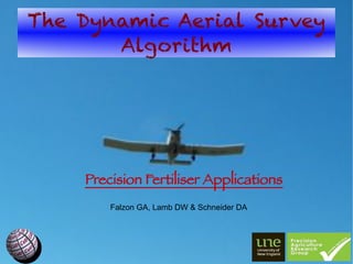
- 1. The Dynamic Aerial Survey Algorithm Precision Fertiliser Applications Falzon GA, Lamb DW & Schneider DA
- 2. Overview The Need for Top-dress Fertilisers. The Advent of Active Optical Sensors. Real-Time Aerial Crop Survey & its Challenges. The Solution: DAS. Future Developments.
- 3. Top-Dress Fertilisers Irrigated durum wheat: 2 applications of N/season 322 kg N/ha, $A309.84/ha (July 2011). 300 ha cereal feld requires $A92,952 N/application and $A185,904 total. Extra on-costs! Aircraft cost $A7000- $A10000/9ight. We need greater effciency!!!
- 4. Active-Optical Sensors CropCircleTM ACS210 'red head' & GeoSCOUT 400 data-logger λ 1=650nm (red) λ 2=880nm (NIR) 4.00m 2.28m m 0.44
- 5. Real-Time Aerial Survey Fletcher FU24954 aircraft Garmin GPS18 5Hz On-The-Go Sensing: 80 kts = 144 km/h Can we create an accurate prescription map after each pass?
- 6. The DAS Algorithm: Pt I Paddock Polygons cumulative passes Ragged Arrays geo-referenced samples: different dimensions
- 7. The DAS Algorithm: Pt II
- 8. The DAS Algorithm: Pt III Support Vector Machines Nk f ( z)=∑i=1 [β −β K ( z i , z)+β0 ] 1 i 2 i Kernels Polynomial Radial Sigmoid T n (γ z⋅z +κ) −∣z−z T∣ T tanh (γ z⋅z +κ) exp( 2 ) 2σ
- 9. The DAS Algorithm: Pt IV
- 10. The DAS Algorithm: Pt V Divide f ( z) into prescription zones M P =( M 1, P ,… , M N , P ) Pre-set Levels e.g. NDVI = {0.0,0.2,0.4,0.6,0.8} Divide into N levels e.g. n = 10 K-means clustering, e.g. cluster into three groups (low, med, high).
- 11. The DAS Algorithm: In Action
- 12. Future Developments Incorporate Prior Information Prior survey results Additional information such as soil surveys and yield maps Expert knowledge
- 13. Future Developments Joint Air-Ground Operations Extension of Prior Survey Models. Ground Validation, Small Scale Areas, Combined Air/Ground Fertiliser Teams. Field Calibration & Validations Wind shear, height, droplet size (I. Yule), servo latency. Compare drop zone to management map.
- 14. Thank you! M. Trotter (UNE PARG) SUPERAIR CRC for Spatial Information (CRCSI) Sugar Research & Development Corporation (SRDC) Nick Barton (Twynam Agriculture) Andrew Smart (Precision Cropping Technologies) Nick Gillingham (Sundown Pastoral Company) Dr. F. Honey (SpecTerra Services)