The document contains summaries of four GIS projects:
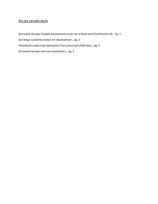
1) A land suitability analysis in Brunswick, Georgia identifying areas not in flood zones for development.
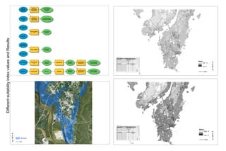
2) A suitability analysis for development in San Diego using fuzzy overlay of urban areas, highways, parks, and elevation.
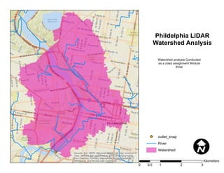
3) A watershed delineation for Philadelphia using processed LIDAR data.
4) A land use classification of Brunswick, Georgia into eight classes based on supervised classification.