Copernicus is the European Union's Earth observation program that provides free and open access to data and processing tools. It includes a series of Sentinel satellites that monitor the Earth's land, atmosphere, oceans and climate. The document discusses accessing Copernicus data through tools like SNAP, QGIS and Pytroll. It also describes the six Copernicus services that provide thematic data products on topics like marine monitoring, land cover mapping, and emergency response.
Air Pollution in Sofia - Solution through Data Science by Kiwi teamData Science Society
Some of you have already know how serious is the problem with air pollution in the capital of Bulgaria, Sofia but ...
▶️Do you know how it could be solved?
Our community represented by 1800 members all around the world tried to tackle the issue at our previous #GlobalDatathon and our international #DataScience #MonthlyChallenge, part of a university program.
Team Kiwi is solving the problem by implementing algorithms and statistical methods for air pollution prediction in the next 24 hours.
Emmanuel Mondon (Copernicus World Alliance) described the activities of the Copernicus World Alliance aiming to secure the return of investment in Copernicus and other Earth observation (EO) programmes resulting in societal and economic benefits. One of their contribution towards this goal is to test a multi-cloud solution that can handle the enormous amount of data coming from EO.
Use Of Geospatial Tools And Data For Underwriting And Claims - Turkish Insurance Conference on Technology Advances For Underwriting And Claims - Matthew Eagle (2015)
Walkalytics - Accurate planning for your pedestrian-based servicesStephan Heuel
With walkalytics.GWR and walkalytics.STAT, we introduce two datasets which can be directly used in conjunction with open government datasets: the first one relates every Swiss entrance from the federal register of buildings and dwellings (GWR) with the closest public transportation stop including additional information such as walking time. The second dataset enhances the population and household statistics (STATPOP) and the business demography statistics (STATENT) with reachability measures for each hectar in Switzerland.
Where’s My Stuff? Ready Asset TrackingNicole Weber
In this webinar, we show how GPS tracking can help you streamline operations and maximize revenue. Ready Asset Tracking allows you to track powered and non-powered assets anywhere in the U.S.
Application packaging and systematic processing in earth observation exploita...terradue
An overview of Terradue's solutions supporting Earth Observations (EO) Exploitation Platforms across multiple domains.
Presentation done as part of the Open Geospatial Consortium (OGC) Technical Committee ad-hoc meeting for the setup of a new domain working group on EO Exploitation Platforms.
Accelerating Research and Enterprise Solutions by Bridging HPC and AIinside-BigData.com
In this deck from the UK HPC Conference, Venkatesh Kannan from Irish Centre for High-End Computing (ICHEC) presents: Accelerating Research and Enterprise Solutions by Bridging HPC and AI.
"The presentation will highlight the need to address the symbiotic relationship between HPC and AI at different levels - technology development, education & training, and policy making - in order to enable the adoption and accelerating the development of AI solutions by the research and enterprise communities. A number of efforts and projects that are undertaken at the Irish Centre for High-End Computing towards enabling and achieving this in the Irish and European context will be presented."
Learn more: https://www.ichec.ie/
and
http://hpcadvisorycouncil.com/events/2019/uk-conference/agenda.php
Sign up for our insideHPC Newsletter: http://insidehpc.com/newsletter
How easy is it to find Insitu data on the Internet? This presentation uses a Arctic Observations Value Tree Analysis as an example of what can be found and how. Conclusions will highlight what should be improved for data dissemination systems to improve the situation. The presentation was held at the GEO Data Technology Workshop in April 2019.
Agrohacks - Down To Earth ~ a tool alerting farmers about forecasted severe w...plan4all
Presentation of the #SanJuanINSPIREHackathon winning team, showing their project: Bajada a Tierra (Down To Earth) ~ a tool alerting farmers about forecasted severe weather conditions.
5th International Disaster and Risk Conference IDRC 2014 Integrative Risk Management - The role of science, technology & practice 24-28 August 2014 in Davos, Switzerland
The European Commission completed in November 2016 a large-scale study which examined the overall impact of the Copernicus programme on the European economy and its benefits for the space industry, the downstream sector and end-users.
The results of this exercise were published in the first Copernicus Market Report.
5th International Disaster and Risk Conference IDRC 2014 Integrative Risk Management - The role of science, technology & practice 24-28 August 2014 in Davos, Switzerland
This presentation will cover the extensive application of hydraulic modelling on the national Catchment-based Flood Risk Assessment & Management (CFRAM) programme, as well as discussing the likely future modelling requirements for the detailed development of over 100 flood relief schemes programmed over the coming decade.
Presented at the DHI Ireland Symposium 2018.
Enhanced flood mapping service from multi-source data to actionable information - (Federica Mastracci, Telespazio)
Sustainable Land Management Session - EU Space Week 2018
The Copernicus programme (REGULATION (EU) No 377/2014) is a cornerstone of the European Union´ efforts:
To monitor the Earth, its environment and ecosystems
To ensure its citizens are prepared and protected for crises, security risks and natural or man-made disasters
Copernicus as user driven Programme
Places a world of insight (data and information) about our planet at the disposal of citizens, public authorities and policy makers, scientists, entrepreneurs and businesses on a full, free and open basis
Is a tool for economic development and a driver for the digital economy
5th International Disaster and Risk Conference IDRC 2014 Integrative Risk Management - The role of science, technology & practice 24-28 August 2014 in Davos, Switzerland
The EGI Federation of clusters and research clouds are components of the European Open Science Cloud, and they offer technical solutions and an infrastructure to support the EuroGEOSS pilots, GEOSS and EO data exploitation platforms.
Learn how, by looking at the collaboration of EGI with NextGEOSS, the production support of the Geohazards TEP of Terradue and the EOSC-hub collaboration with GEOSS.
José Luis Ornelas de Anda, Instituto Nacional de Estadística y GeografíaOECD Governance
Presentation made at the expert meeting organised jointly by the European Commission, the OECD and the project PLACARD, in Paris 26th -28th October 2016. For more information see www.oecd.org/gov/risk/joint-expert-meeting-on-disaster-loss-data.htm
Since last year:
THIRD SUCCESSFUL QUAD LAUNCH in July 2018 with ARIANE V
26 Satellites in orbit
Initial SERVICES beyond expectation
New procurement initiated for subsequent satellites
Commercial Service re-baselined
Emergency Warning Service under definition
Launch of User Consultation Platform
Towards Galileo 2nd GENERATION decision
Similar to Space Edition, Dr. Ali Nadir Arslan (20)
Forklift Classes Overview by Intella PartsIntella Parts
Discover the different forklift classes and their specific applications. Learn how to choose the right forklift for your needs to ensure safety, efficiency, and compliance in your operations.
For more technical information, visit our website https://intellaparts.com
Saudi Arabia stands as a titan in the global energy landscape, renowned for its abundant oil and gas resources. It's the largest exporter of petroleum and holds some of the world's most significant reserves. Let's delve into the top 10 oil and gas projects shaping Saudi Arabia's energy future in 2024.
6th International Conference on Machine Learning & Applications (CMLA 2024)ClaraZara1
6th International Conference on Machine Learning & Applications (CMLA 2024) will provide an excellent international forum for sharing knowledge and results in theory, methodology and applications of on Machine Learning & Applications.
CW RADAR, FMCW RADAR, FMCW ALTIMETER, AND THEIR PARAMETERSveerababupersonal22
It consists of cw radar and fmcw radar ,range measurement,if amplifier and fmcw altimeterThe CW radar operates using continuous wave transmission, while the FMCW radar employs frequency-modulated continuous wave technology. Range measurement is a crucial aspect of radar systems, providing information about the distance to a target. The IF amplifier plays a key role in signal processing, amplifying intermediate frequency signals for further analysis. The FMCW altimeter utilizes frequency-modulated continuous wave technology to accurately measure altitude above a reference point.
Hybrid optimization of pumped hydro system and solar- Engr. Abdul-Azeez.pdffxintegritypublishin
Advancements in technology unveil a myriad of electrical and electronic breakthroughs geared towards efficiently harnessing limited resources to meet human energy demands. The optimization of hybrid solar PV panels and pumped hydro energy supply systems plays a pivotal role in utilizing natural resources effectively. This initiative not only benefits humanity but also fosters environmental sustainability. The study investigated the design optimization of these hybrid systems, focusing on understanding solar radiation patterns, identifying geographical influences on solar radiation, formulating a mathematical model for system optimization, and determining the optimal configuration of PV panels and pumped hydro storage. Through a comparative analysis approach and eight weeks of data collection, the study addressed key research questions related to solar radiation patterns and optimal system design. The findings highlighted regions with heightened solar radiation levels, showcasing substantial potential for power generation and emphasizing the system's efficiency. Optimizing system design significantly boosted power generation, promoted renewable energy utilization, and enhanced energy storage capacity. The study underscored the benefits of optimizing hybrid solar PV panels and pumped hydro energy supply systems for sustainable energy usage. Optimizing the design of solar PV panels and pumped hydro energy supply systems as examined across diverse climatic conditions in a developing country, not only enhances power generation but also improves the integration of renewable energy sources and boosts energy storage capacities, particularly beneficial for less economically prosperous regions. Additionally, the study provides valuable insights for advancing energy research in economically viable areas. Recommendations included conducting site-specific assessments, utilizing advanced modeling tools, implementing regular maintenance protocols, and enhancing communication among system components.
Student information management system project report ii.pdfKamal Acharya
Our project explains about the student management. This project mainly explains the various actions related to student details. This project shows some ease in adding, editing and deleting the student details. It also provides a less time consuming process for viewing, adding, editing and deleting the marks of the students.
Overview of the fundamental roles in Hydropower generation and the components involved in wider Electrical Engineering.
This paper presents the design and construction of hydroelectric dams from the hydrologist’s survey of the valley before construction, all aspects and involved disciplines, fluid dynamics, structural engineering, generation and mains frequency regulation to the very transmission of power through the network in the United Kingdom.
Author: Robbie Edward Sayers
Collaborators and co editors: Charlie Sims and Connor Healey.
(C) 2024 Robbie E. Sayers
Immunizing Image Classifiers Against Localized Adversary Attacksgerogepatton
This paper addresses the vulnerability of deep learning models, particularly convolutional neural networks
(CNN)s, to adversarial attacks and presents a proactive training technique designed to counter them. We
introduce a novel volumization algorithm, which transforms 2D images into 3D volumetric representations.
When combined with 3D convolution and deep curriculum learning optimization (CLO), itsignificantly improves
the immunity of models against localized universal attacks by up to 40%. We evaluate our proposed approach
using contemporary CNN architectures and the modified Canadian Institute for Advanced Research (CIFAR-10
and CIFAR-100) and ImageNet Large Scale Visual Recognition Challenge (ILSVRC12) datasets, showcasing
accuracy improvements over previous techniques. The results indicate that the combination of the volumetric
input and curriculum learning holds significant promise for mitigating adversarial attacks without necessitating
adversary training.
Hierarchical Digital Twin of a Naval Power SystemKerry Sado
A hierarchical digital twin of a Naval DC power system has been developed and experimentally verified. Similar to other state-of-the-art digital twins, this technology creates a digital replica of the physical system executed in real-time or faster, which can modify hardware controls. However, its advantage stems from distributing computational efforts by utilizing a hierarchical structure composed of lower-level digital twin blocks and a higher-level system digital twin. Each digital twin block is associated with a physical subsystem of the hardware and communicates with a singular system digital twin, which creates a system-level response. By extracting information from each level of the hierarchy, power system controls of the hardware were reconfigured autonomously. This hierarchical digital twin development offers several advantages over other digital twins, particularly in the field of naval power systems. The hierarchical structure allows for greater computational efficiency and scalability while the ability to autonomously reconfigure hardware controls offers increased flexibility and responsiveness. The hierarchical decomposition and models utilized were well aligned with the physical twin, as indicated by the maximum deviations between the developed digital twin hierarchy and the hardware.
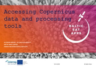
1. Ali Nadir Arslan20.11.2018
Accessing Copernicus
data and processing
tools
ALI NADIR ARSLAN – ali.nadir.Arslan@fmi.fi
ARCTIC SPACE CENTER
FINNISH METEOROLOGICAL INSTITUTE
2. Ali Nadir Arslan20.11.2018
CONTENTS
• General overview of Copernicus
• Copernicus Sentinels
• Copernicus Data Access
• Some use cases
• Sentinel data toolbox and processing
3. Copernicus
C O P E R N I C U S I N B R I E F
• Copernicus, a flagship programme of the European Union:
– Monitors the Earth, its environment and ecosystems
– Prepares for crises, security risks and natural or man-made
disasters
– Contributes to the EU’s role as a global soft power
• Adopts a full, free and open data policy
• Is a tool for economic development and a driver for the digital economy
3
4. Copernicus
C O P E R N I C U S H I S T O R Y
1998
2001
2005
2006
2008
2011
2013
2014
Baveno
Manifesto
Gothenburg
EU Summit
GMES –
Flagship of EU
Space Policy
EC - GMES
Bureau
EC-ESA
Agreement on
GMES
Copernicus
Regulation and Data
Policy
Start of GMES
GIO
Start of
Full service
operations
GMES
Copernicus
GIO = GMES Initial Operation
4
19. Ali Nadir Arslan20.11.2018
• Six thematic services (http://copernicus.eu/main/services), with products
• Atmosphere (Copernicus Atmosphere Monitoring Service, CAMS)
https://atmosphere.copernicus.eu/ (Europe’s air quality forecast etc.)
• Marine (Copernicus Marine Environment Monitoring Service, CMEMS)
http://marine.copernicus.eu/ (marine products, trends etc.)
• Land (Copernicus Land Monitoring Service, CLMS) https://land.copernicus.eu/
(Global, Pan European and local; landcover/usage, urban atlas, CLC 2012, tree
cover density 2015, hotspots)
• Climate (Copernicus Climate Change Service, C3S) https://climate.copernicus.eu/
(monthly maps to tell about the state of climate at that moment etc.)
• Emergency (Copernicus Emergency Management Service, EMS)
http://emergency.copernicus.eu/ (EMS-map showing flooding, forest fires etc.)
• Security (Copernicus service for security applications )
http://copernicus.eu/main/security (preventing and preparing for crises)
Copernicus-services
41. Ali Nadir Arslan20.11.2018
ESA is developing free open source toolboxes for the scientific exploitation of
Earth Observation missions under the the Scientific Exploitation of Operational
Missions (SEOM) programme element. STEP is the ESA community platform for
accessing the software and its documentation, communicating with the
developers, dialoguing within the science community, promoting results and
achievements as well as providing tutorials and material for training scientists
using the Toolboxes.
ESA Scientific Toolbox Exploitation Platform
The ESA toolboxes support the scientific exploitation for the ERS-ENVISAT missions,
the Sentinels 1/2/3 missions and a range of National and Third Party missions. The
three toolboxes are called respectively Sentinel 1, 2 and 3 Toolboxes and share a
common architecture called SNAP. They contain some functionalities of historical
toolboxes such as BEAM, NEST and Orfeo Toolbox that were developed over the last
years.
http://step.esa.int/main/
42. Ali Nadir Arslan20.11.2018
SNAP
A common architecture for all Sentinel Toolboxes is being jointly developed by
Brockmann Consult, Array Systems Computing and C-S called the Sentinel
Application Platform (SNAP).
The SNAP architecture is ideal for Earth Observation processing and analysis due
to the following technological innovations: Extensibility, Portability, Modular Rich
Client Platform, Generic EO Data Abstraction, Tiled Memory Management, and a
Graph Processing Framework.
47. Ali Nadir Arslan20.11.2018
• QGIS
• One way to view and process Sentinel data is to use QGIS (https://qgis.org/ ). It is a free
and open source software.
• There is also a plugin for QGIS https://qgis.org/ (SCP Semi-Automatic Classification
Plugin) that can be used to download and process satellite images
https://fromgistors.blogspot.com/p/semi-automatic-classification-plugin.html .
• After processing and exporting the satellite image from SNAP, it can be opened in QGIS
to view and process further. It can be opened e.g. on top of Google maps or
OpenStreetMap.
• ESRI
• http://www.arcgis.com
• Pytroll
• One way to process Sentinel data is to use Pytroll (http://pytroll.github.io/). It is a free
and open source python framework to process Earth Observation (EO) satellite data. The
packages, supported satellites, tutorials and examples can be found from the home page
of Pytroll.
• SatPy
• With SatPy package you can read many Level-1 and Level-2 products, resample, make
RGB images and save e.g. as netcdf, GeoTIFF or png images. The documentation for
SatPy can be found from http://satpy.readthedocs.io/en/latest/ .
KansisivuTaustakuvan voit vaihtaa klikkaamalla hiiren kakkospainiketta → Muotoile tausta –kohdastaLiukuväri tulee ensin siirtää kuvan päältä pois klikkaamalla liukua ja vetämällä oikean reunan keskimmäisestä pallosta vasemmalle päin sen verran että taustalla oleva kuva tulee esiin. Tällä tavalla liuku ei siirry paikaltaan
Kaksi sisältökohdetta, joko kaksi palstaa tekstiä tai teksti + grafiikka.Valittavissa Uusi dia – (kaksi sisältökohdetta + otsikko)
GIO- GMES Initial Operations
Kaksi sisältökohdetta, joko kaksi palstaa tekstiä tai teksti + grafiikka.Valittavissa Uusi dia – (kaksi sisältökohdetta + otsikko)
Kiitossivulla on tilaa omille yhteystiedoille. Taustalle voi lisätä taustakuvan tai vaihtaa taustan väriä hiiren oikea näppäin → Muotoile tausta -kohdassa