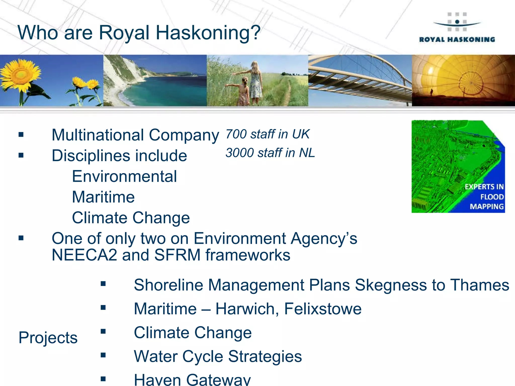
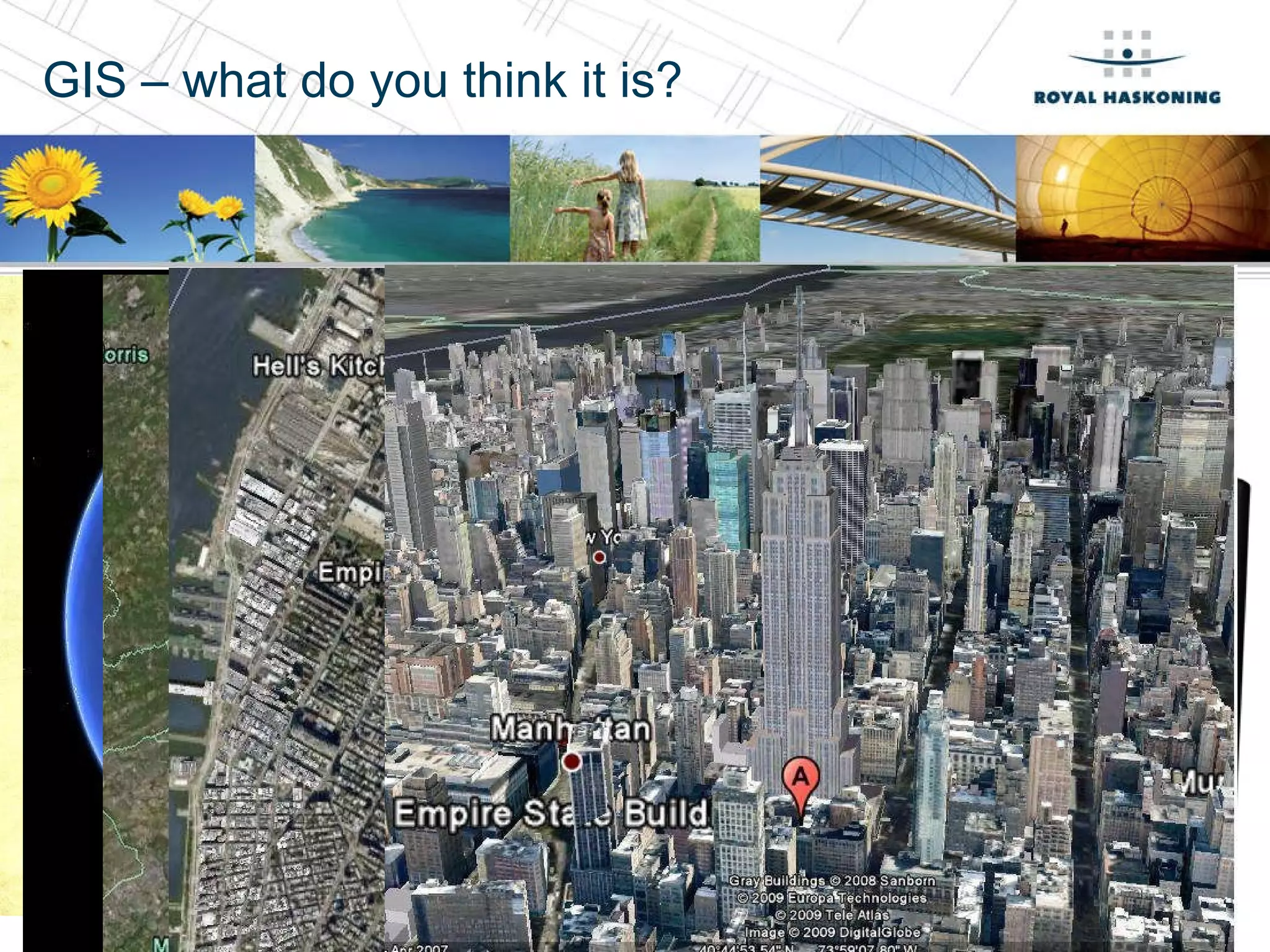
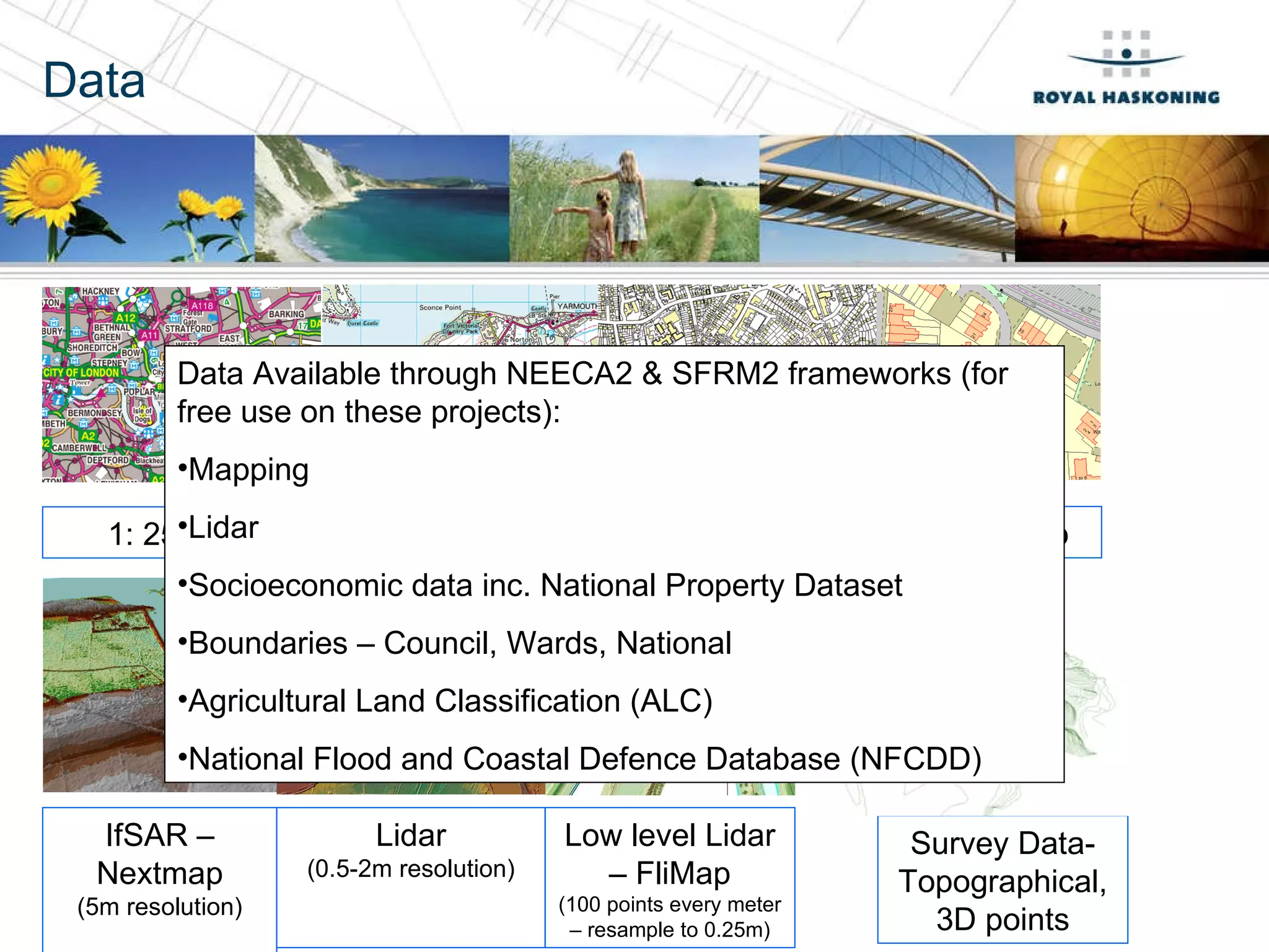
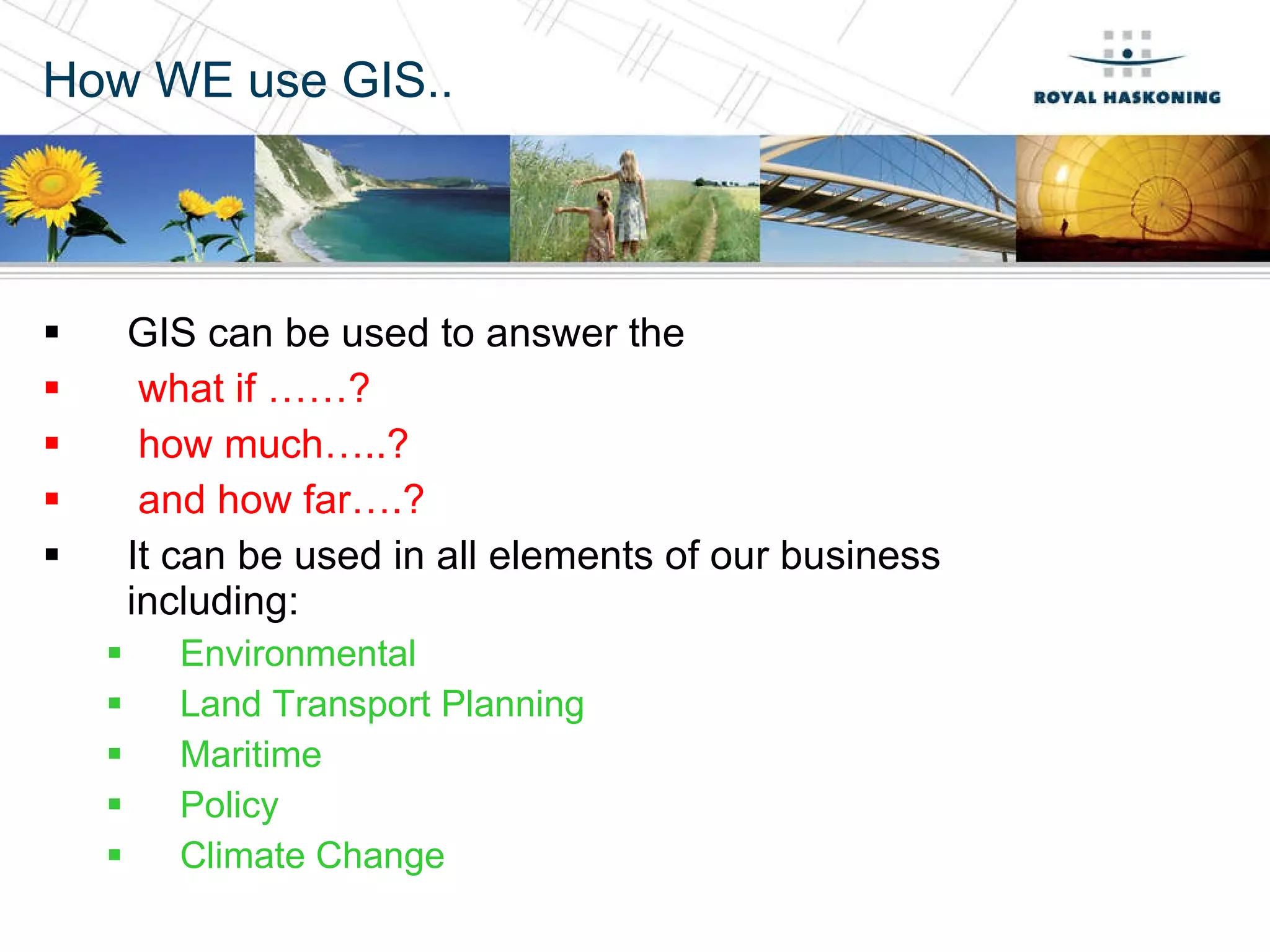
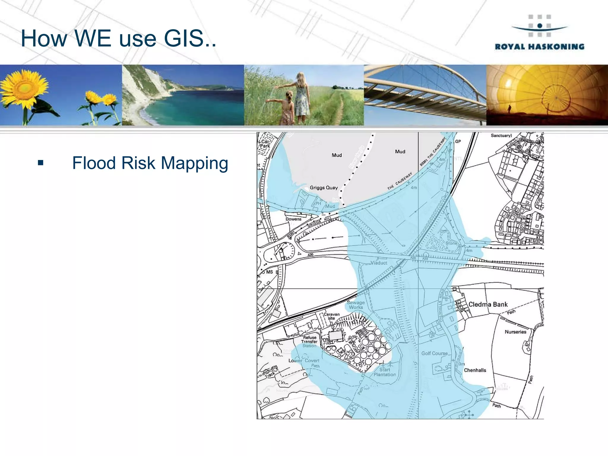
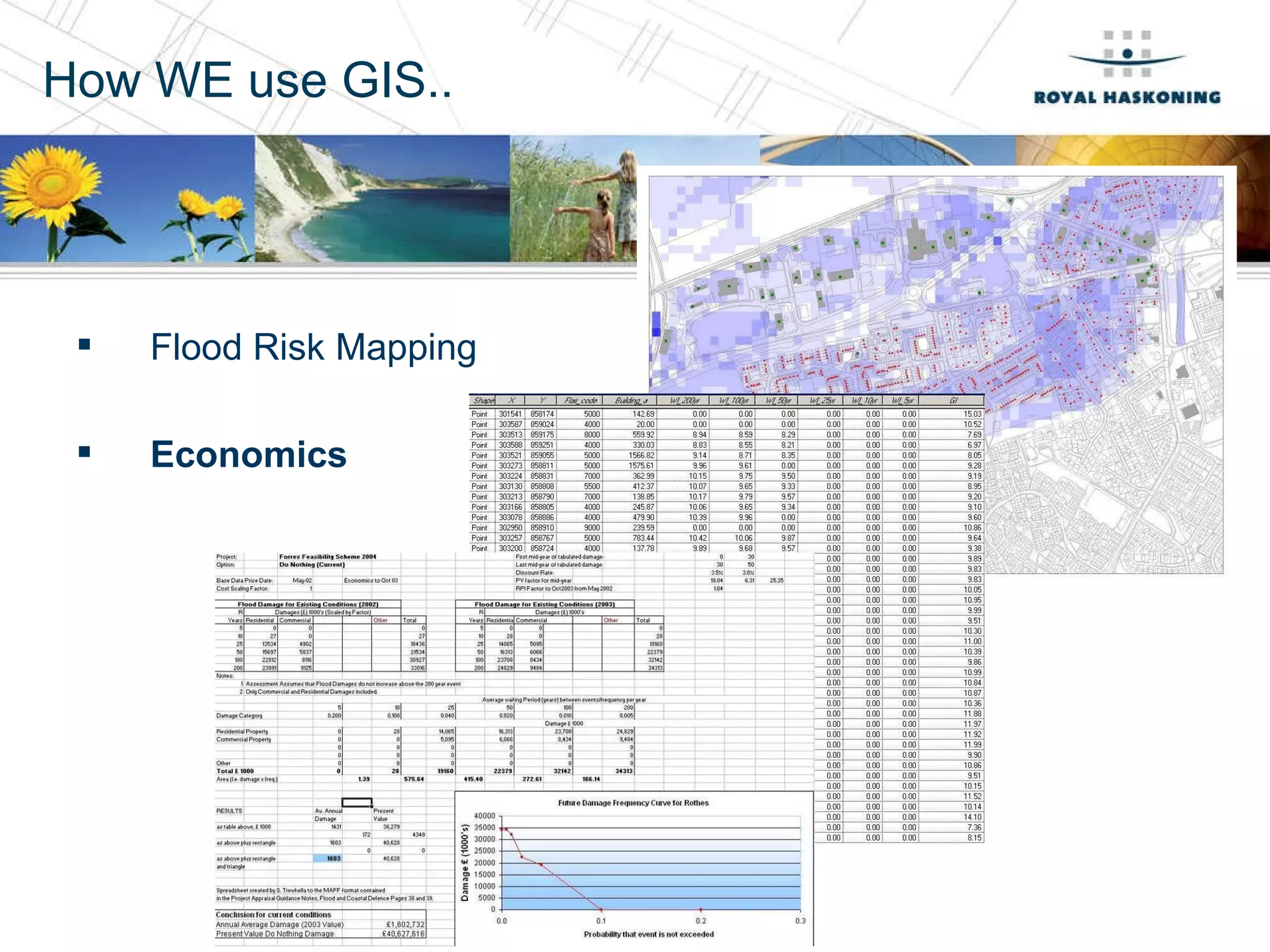
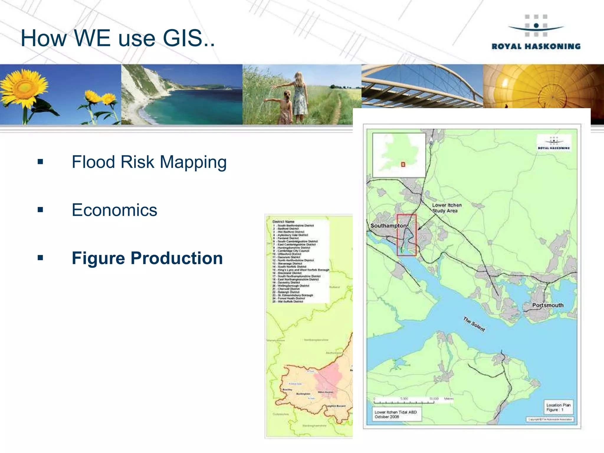
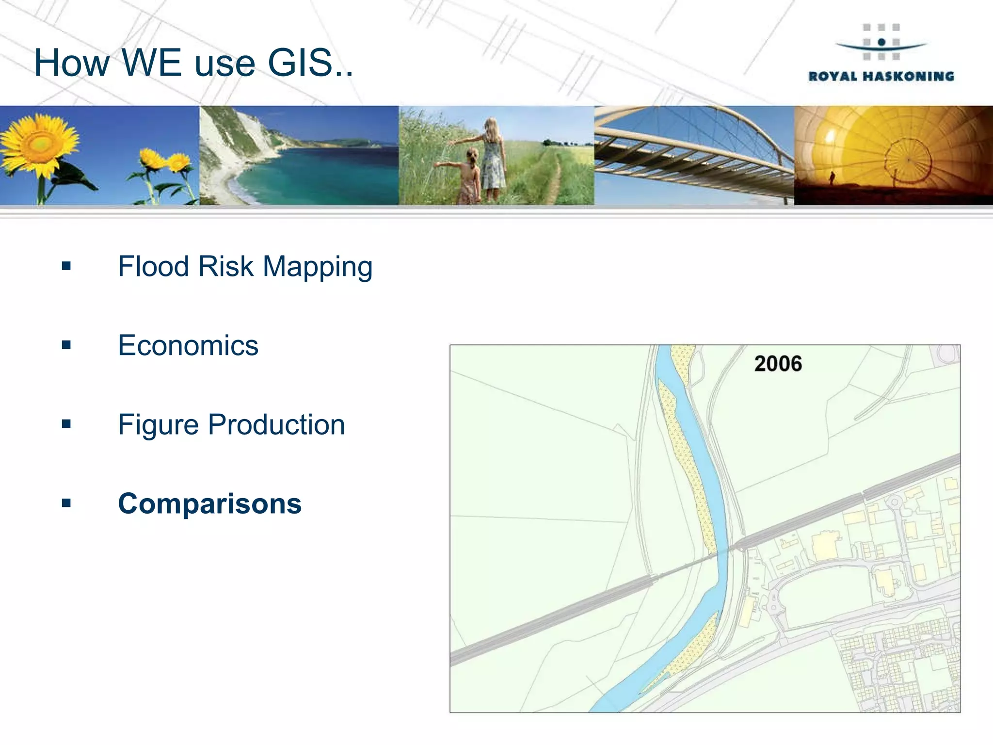
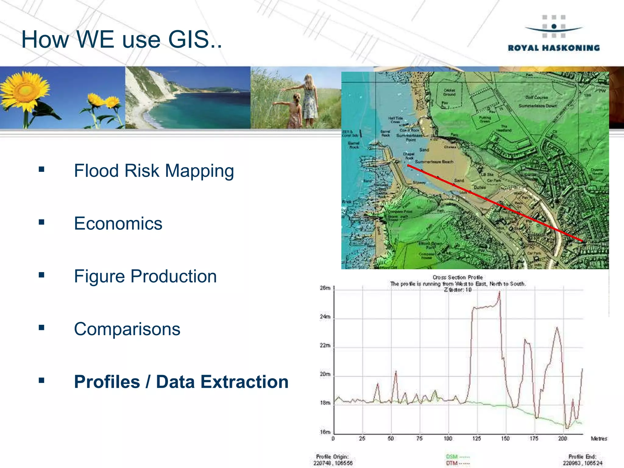
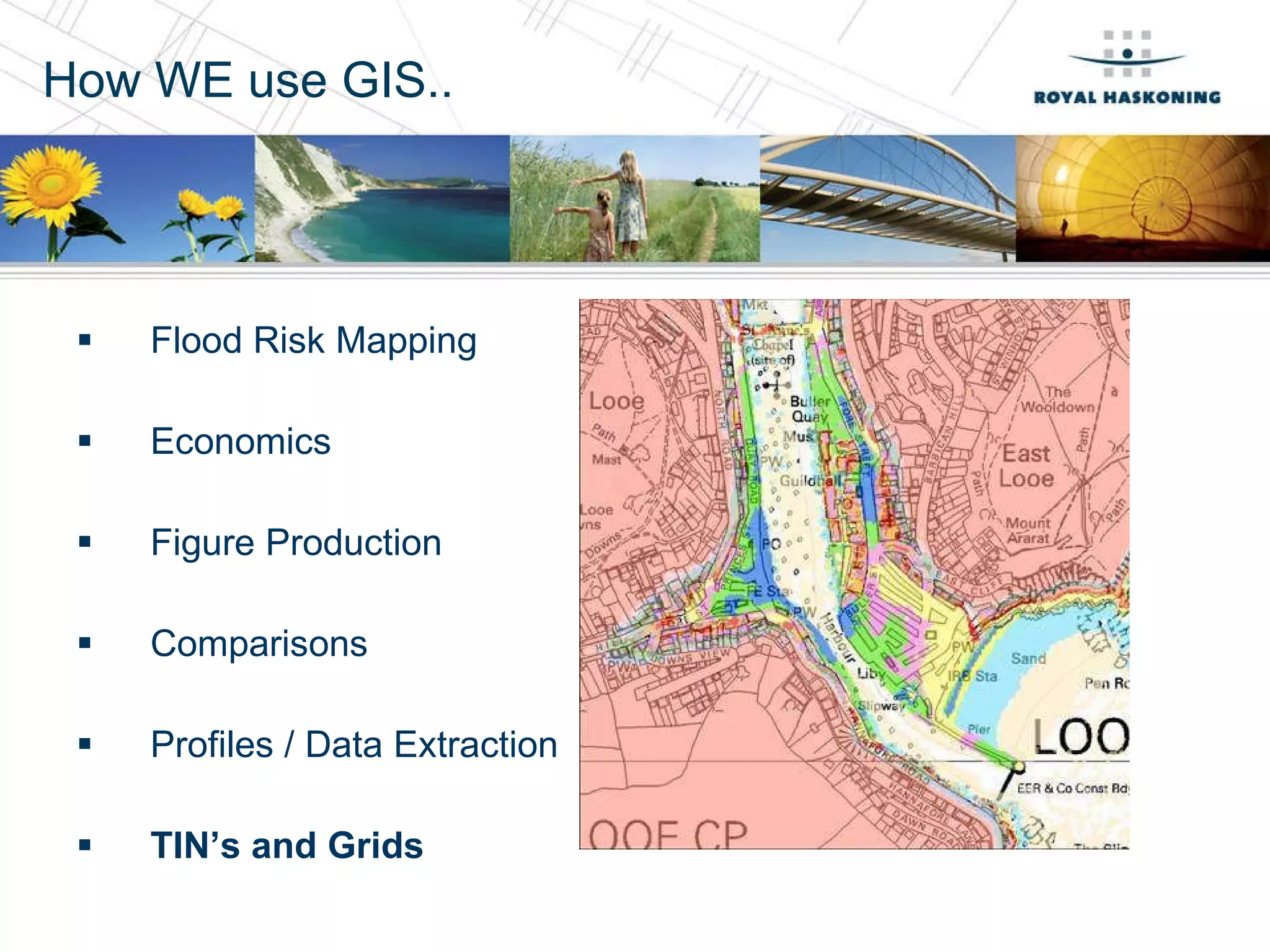
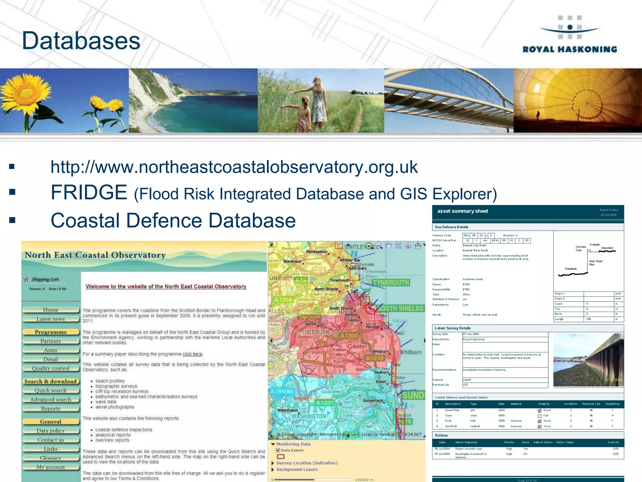
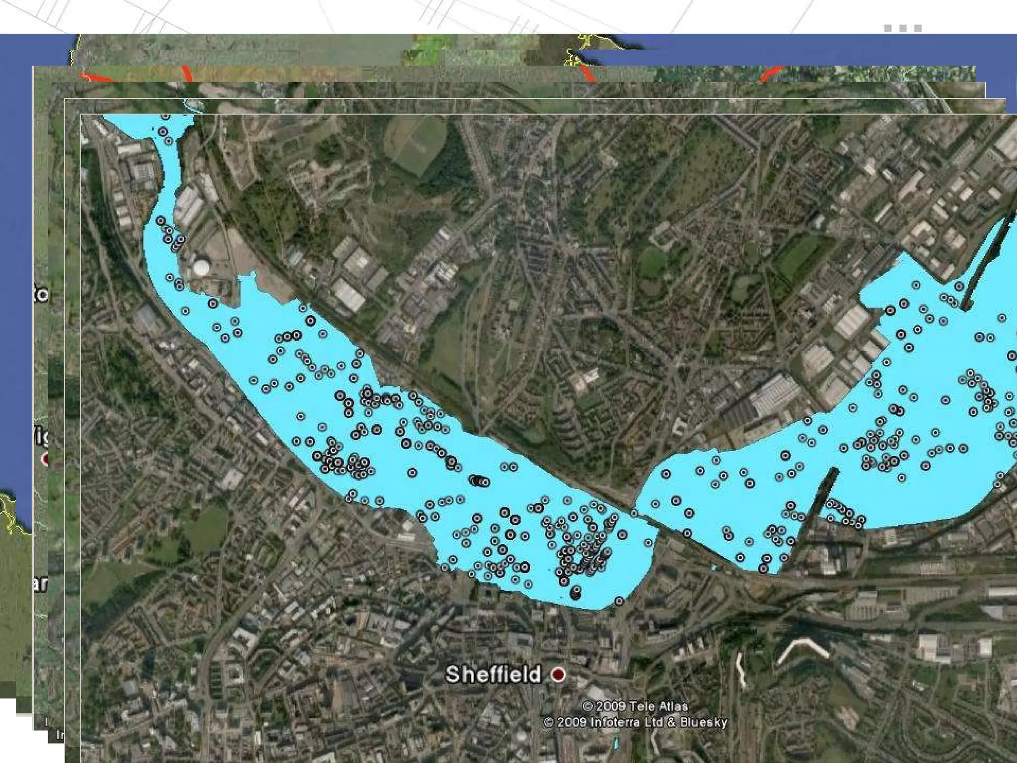
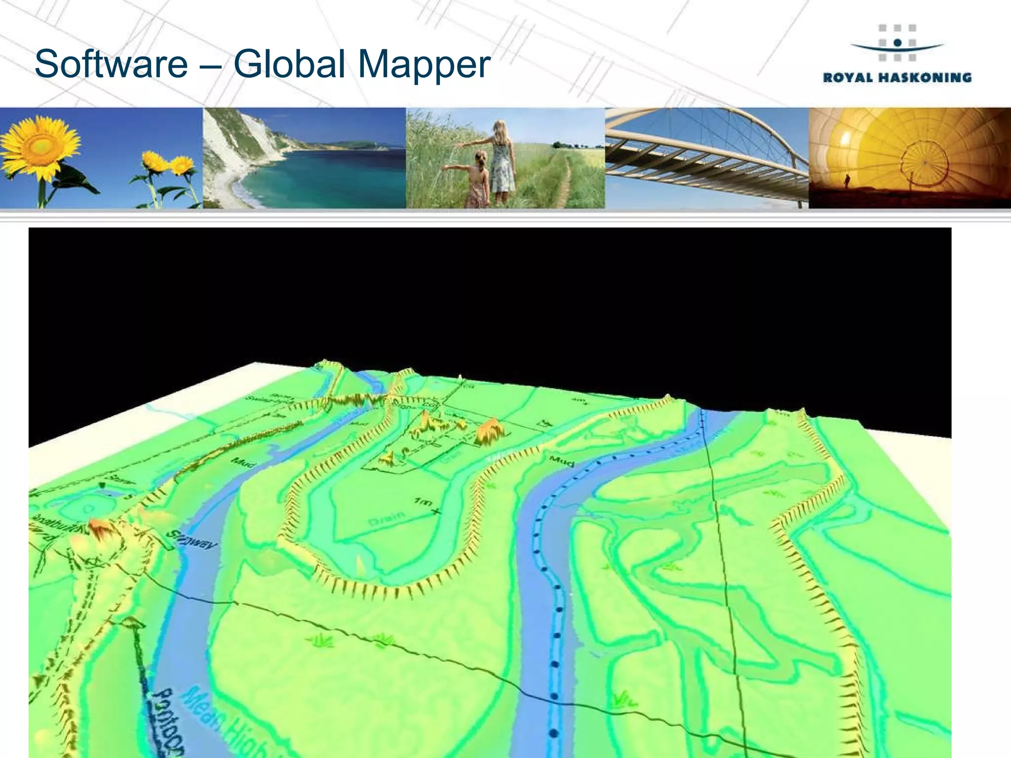
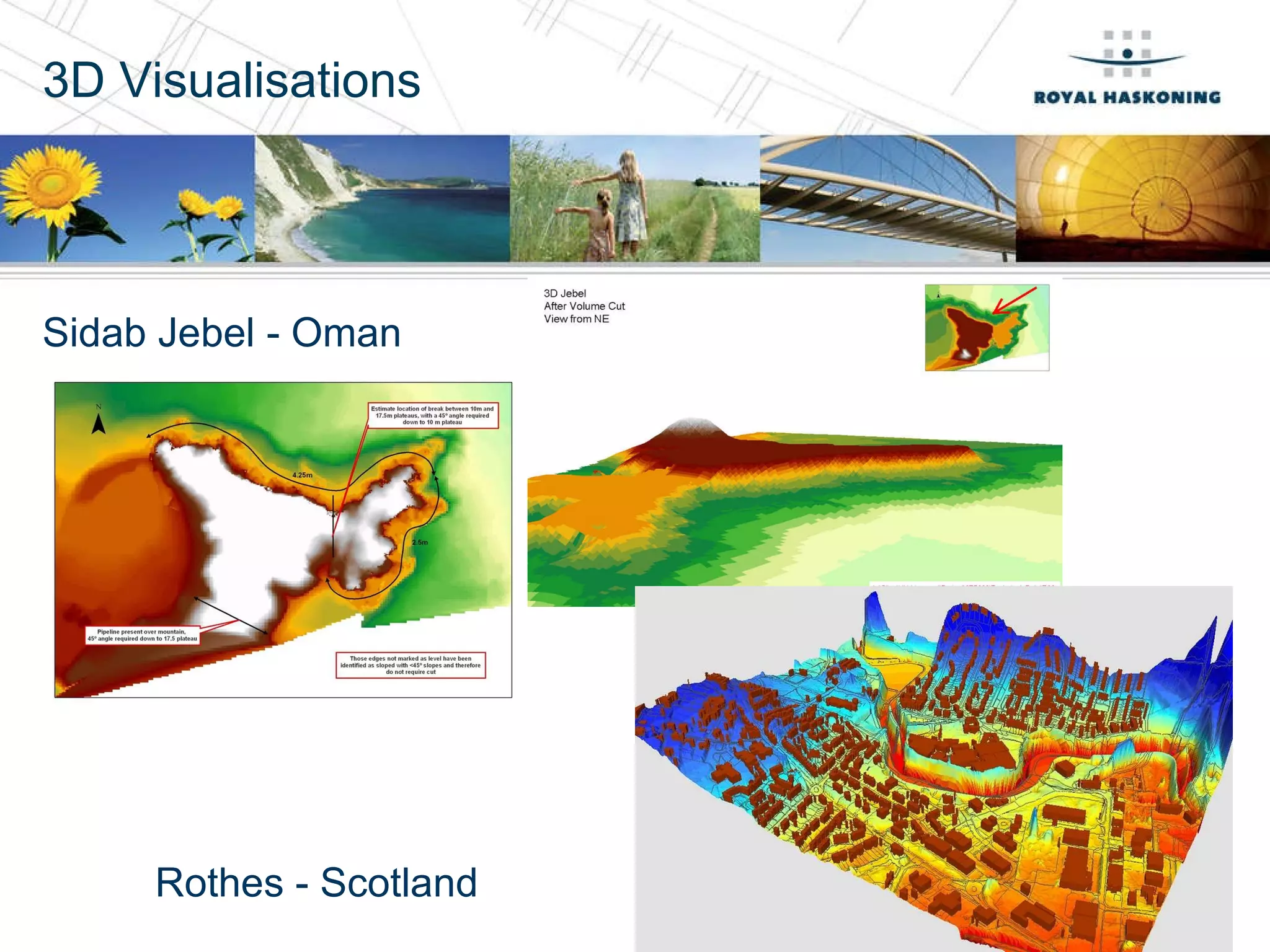
Thursday 13 th  May 2010 Applied Hydraulics and Operational Technology Team –  What we can do for you…. By Nadine Welsh [email_address] 01733336120
Who are Royal Haskoning? Multinational Company Disciplines include Environmental Maritime Climate Change One of only two on Environment Agency’s NEECA2 and SFRM frameworks 700 staff in UK 3000 staff in NL Shoreline Management Plans Skegness to Thames Maritime – Harwich, Felixstowe Climate Change Water Cycle Strategies Haven Gateway Projects
GIS – what do you think it is?
Data 1: 250,000 Mastermap IfSAR – Nextmap (5m resolution) Lidar (0.5-2m resolution) Low level Lidar – FliMap (100 points every meter – resample to 0.25m) Survey Data- Topographical, 3D points Data Available through NEECA2 & SFRM2 frameworks (for free use on these projects): Mapping Lidar Socioeconomic data inc. National Property Dataset Boundaries – Council, Wards, National Agricultural Land Classification (ALC) National Flood and Coastal Defence Database (NFCDD) 1: 50,000 1: 10,000
How WE use GIS.. GIS can be used to answer the  what if ……?  how much…..?  and how far….? It can be used in all elements of our business including: Environmental Land Transport Planning Maritime Policy Climate Change
How WE use GIS.. Flood Risk Mapping
How WE use GIS.. Flood Risk Mapping Economics
How WE use GIS.. Flood Risk Mapping Economics Figure Production
How WE use GIS.. Flood Risk Mapping Economics Figure Production Comparisons
How WE use GIS.. Flood Risk Mapping Economics Figure Production Comparisons Profiles / Data Extraction
How WE use GIS.. Flood Risk Mapping Economics Figure Production Comparisons Profiles / Data Extraction TIN’s and Grids
Databases http://www.northeastcoastalobservatory.org.uk  FRIDGE  (Flood Risk Integrated Database and GIS Explorer) Coastal Defence Database
Deliverables Free GIS Platform International Data 2D & 3D 11
Software – Global Mapper
3D Visualisations Sidab Jebel - Oman Rothes - Scotland
Win Bids! Beat your competitors! Add value… Add innovation… Save man hours… Let us to help you win that work!
Thank you for your time Nadine Welsh [email_address] 01733 336120

Linked In Upload Gis

  • 1.
    Thursday 13 th May 2010 Applied Hydraulics and Operational Technology Team – What we can do for you…. By Nadine Welsh [email_address] 01733336120
  • 2.
    Who are RoyalHaskoning? Multinational Company Disciplines include Environmental Maritime Climate Change One of only two on Environment Agency’s NEECA2 and SFRM frameworks 700 staff in UK 3000 staff in NL Shoreline Management Plans Skegness to Thames Maritime – Harwich, Felixstowe Climate Change Water Cycle Strategies Haven Gateway Projects
  • 3.
    GIS – whatdo you think it is?
  • 4.
    Data 1: 250,000Mastermap IfSAR – Nextmap (5m resolution) Lidar (0.5-2m resolution) Low level Lidar – FliMap (100 points every meter – resample to 0.25m) Survey Data- Topographical, 3D points Data Available through NEECA2 & SFRM2 frameworks (for free use on these projects): Mapping Lidar Socioeconomic data inc. National Property Dataset Boundaries – Council, Wards, National Agricultural Land Classification (ALC) National Flood and Coastal Defence Database (NFCDD) 1: 50,000 1: 10,000
  • 5.
    How WE useGIS.. GIS can be used to answer the what if ……? how much…..? and how far….? It can be used in all elements of our business including: Environmental Land Transport Planning Maritime Policy Climate Change
  • 6.
    How WE useGIS.. Flood Risk Mapping
  • 7.
    How WE useGIS.. Flood Risk Mapping Economics
  • 8.
    How WE useGIS.. Flood Risk Mapping Economics Figure Production
  • 9.
    How WE useGIS.. Flood Risk Mapping Economics Figure Production Comparisons
  • 10.
    How WE useGIS.. Flood Risk Mapping Economics Figure Production Comparisons Profiles / Data Extraction
  • 11.
    How WE useGIS.. Flood Risk Mapping Economics Figure Production Comparisons Profiles / Data Extraction TIN’s and Grids
  • 12.
    Databases http://www.northeastcoastalobservatory.org.uk FRIDGE (Flood Risk Integrated Database and GIS Explorer) Coastal Defence Database
  • 13.
    Deliverables Free GISPlatform International Data 2D & 3D 11
  • 14.
  • 15.
    3D Visualisations SidabJebel - Oman Rothes - Scotland
  • 16.
    Win Bids! Beatyour competitors! Add value… Add innovation… Save man hours… Let us to help you win that work!
  • 17.
    Thank you foryour time Nadine Welsh [email_address] 01733 336120