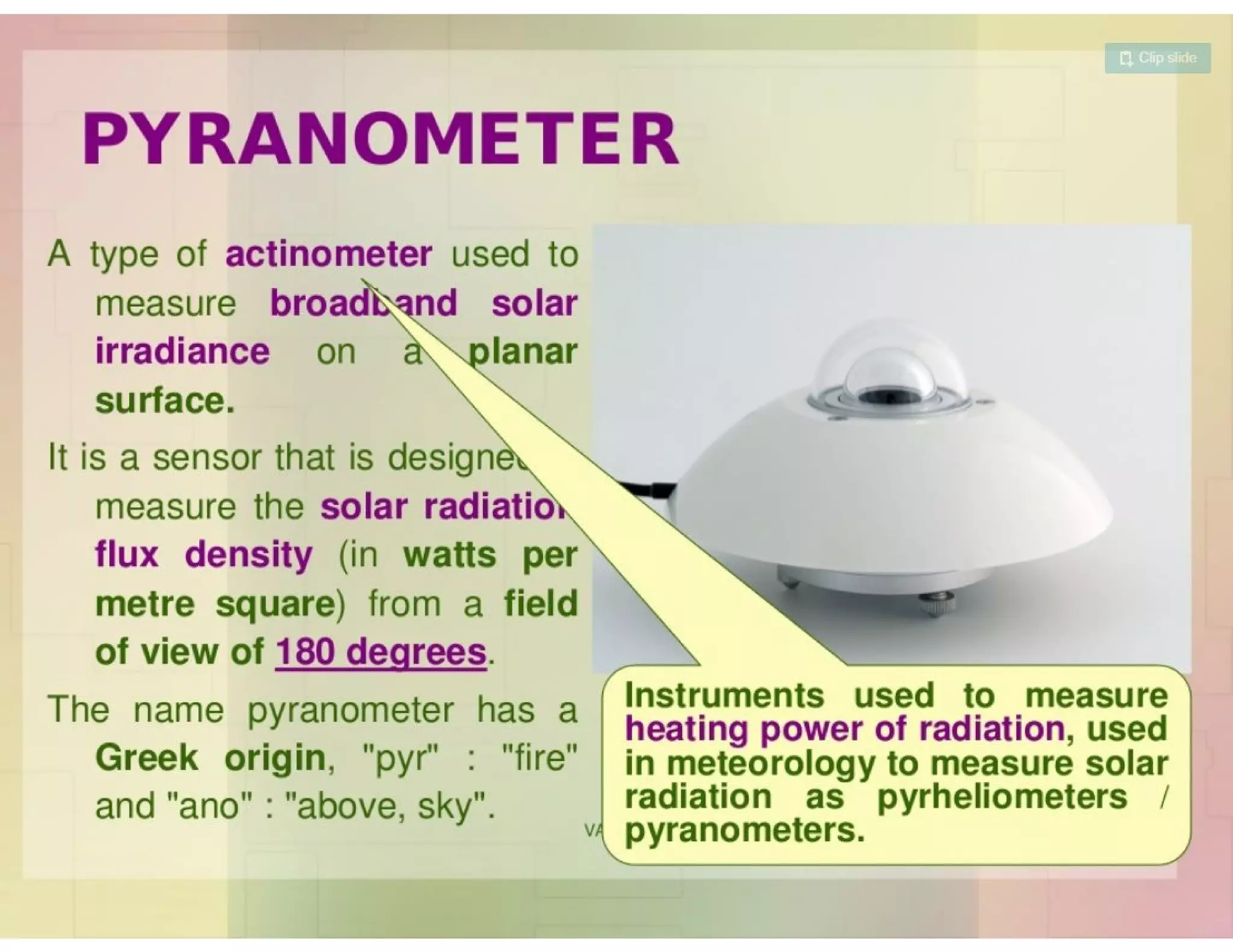
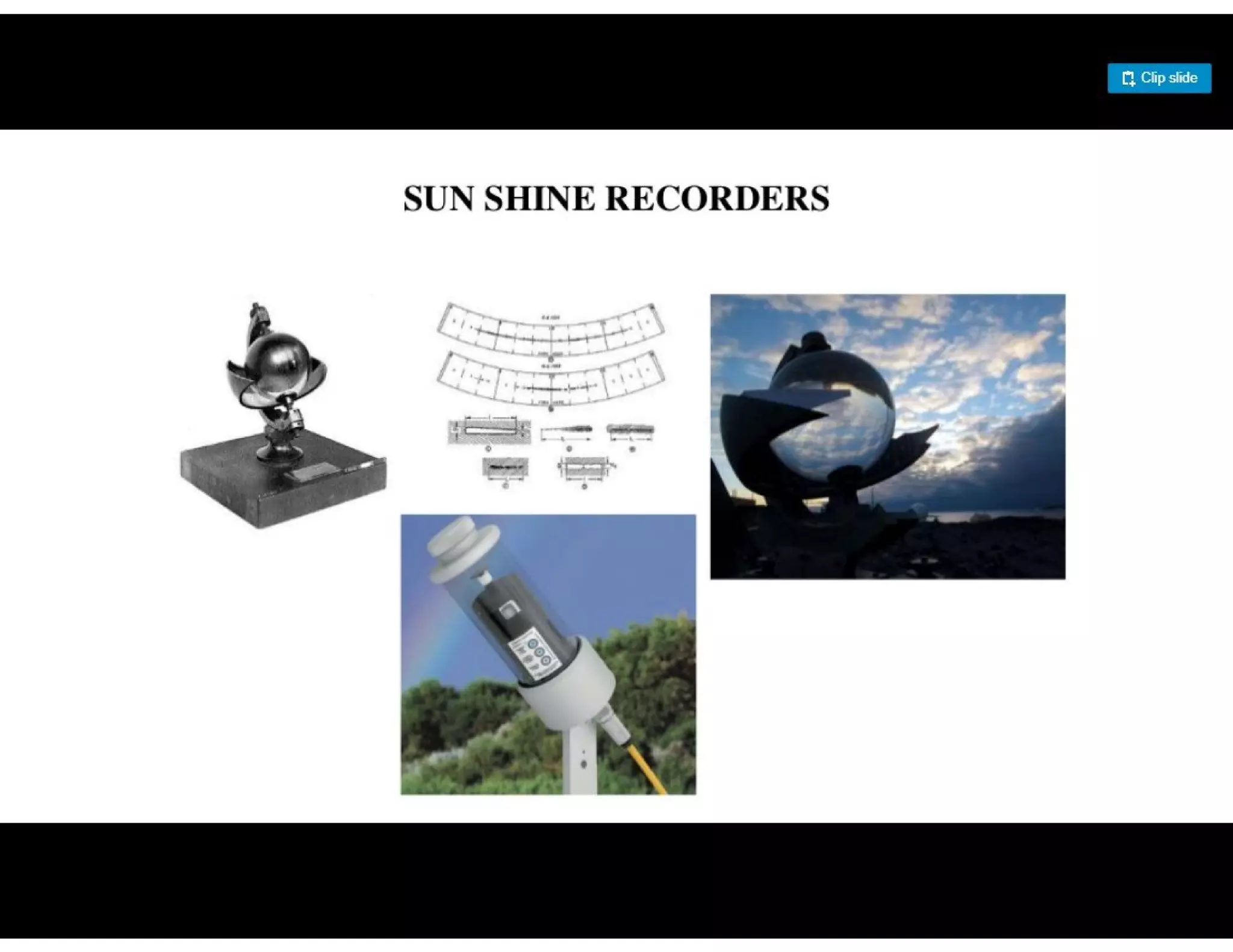
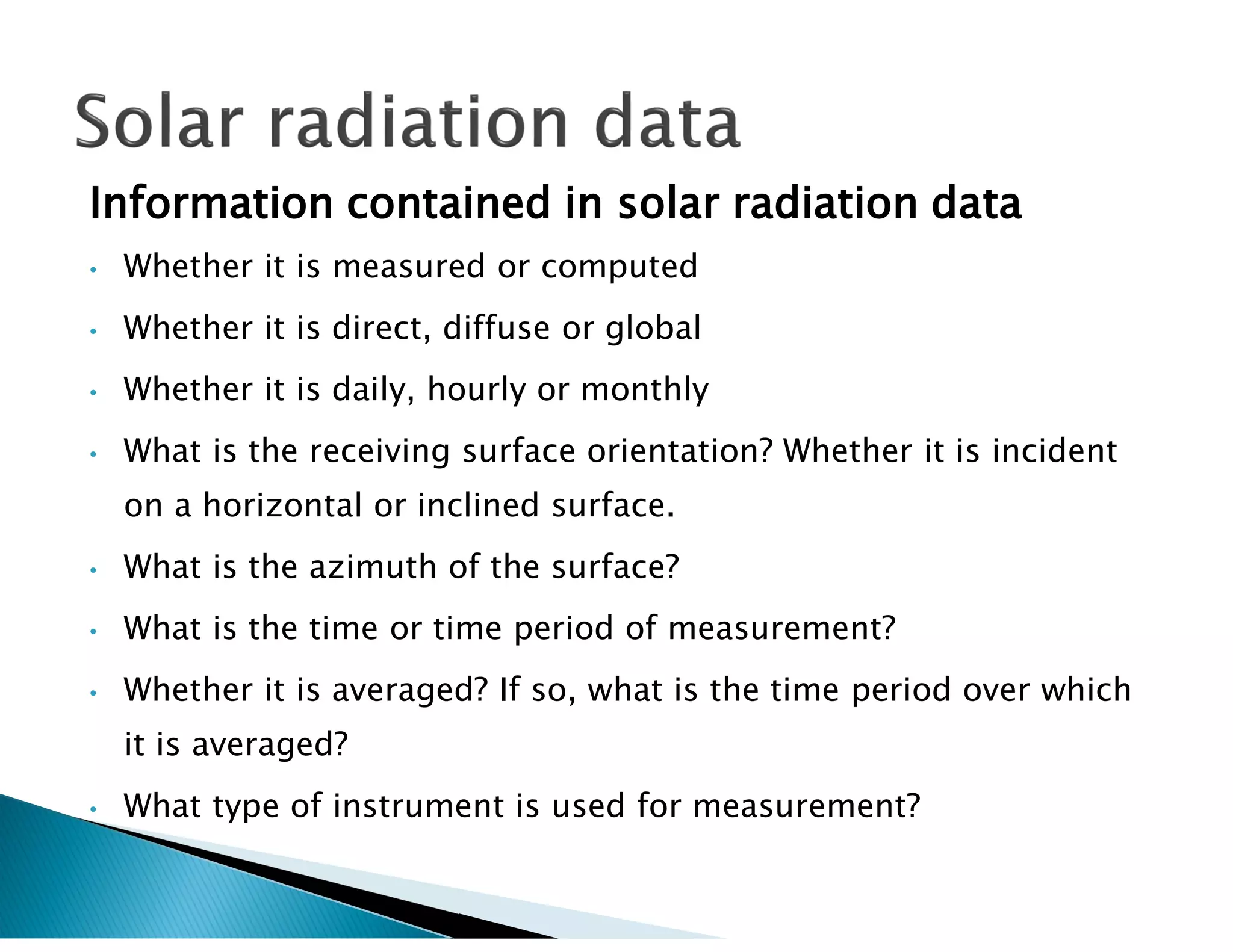
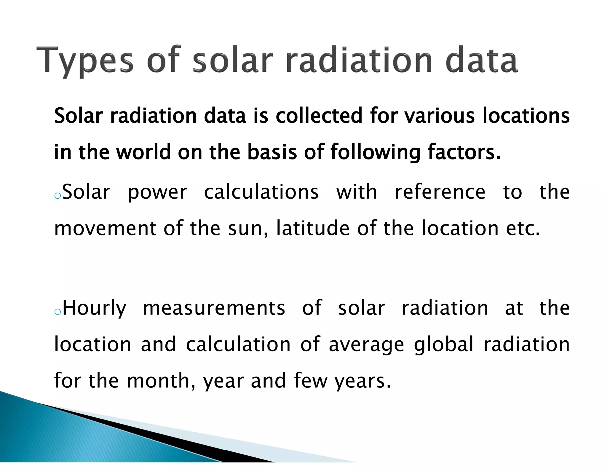
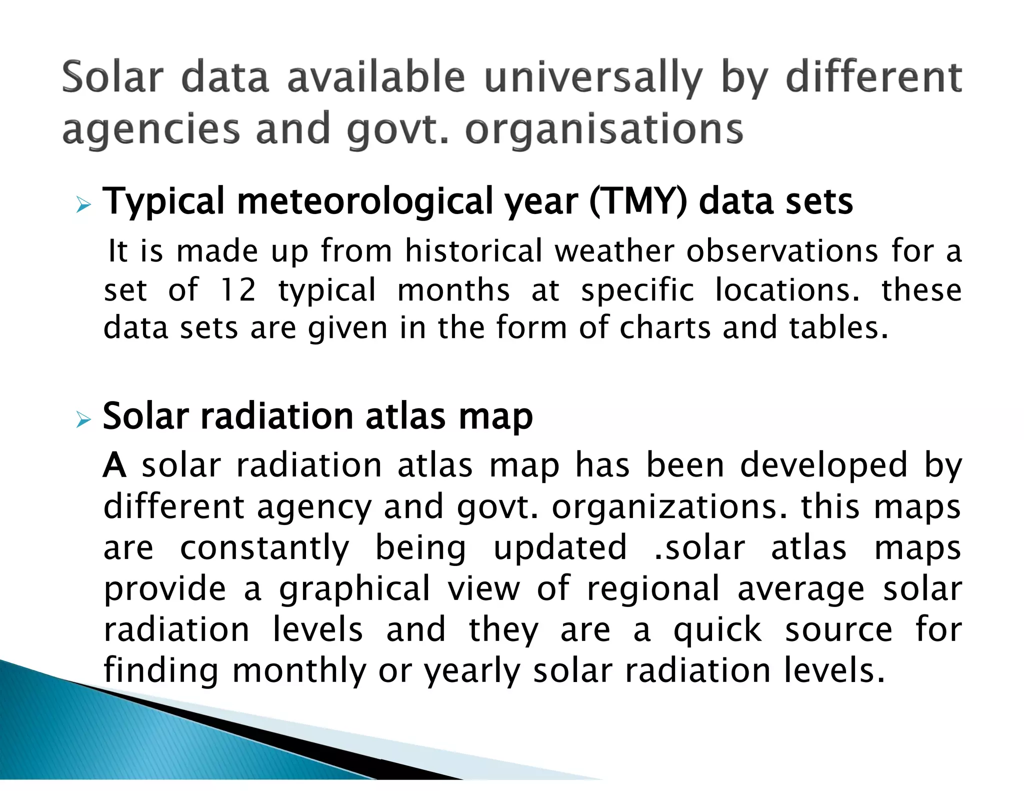
Clarity index is defined as the ratio of radiation
received on earths horizontal surface over a given
period to radiation on equal surface area beyond
the earths atmosphere in direction perpendicular to
the beam. It depends upon the clarity of
atmosphere for the passage of solar beam
radiation. Clarity index can be between 0.1 to 0.7.
Concentration ratio (CR) is the ratio f solar power
per unit area of the concentrator surface to solar
power unit area on the line or point focus. For flat
plate collectors (CR=1). CR up to 100 can be
achieved by using parabolic trough collectors with
sun tracking in one plane.
Solar insolation (Incident solar radiation) is defined
as the solar radiation received on a flat horizontal
surface on earth at a particular instant of time. It
depends on the follwing parameters.
 Daily variation
 Seasonal variation
 Atmospheric clarity
 Shadows of trees, tall structures, adjacent solar
panels etc
 Degree of latitude of the location
 Area of exposed surface, m^2
 Angle of tilt of solar panel.
 Generally solar radiation is measured on a
horizontal surface but for solar energy applications
and for thermal environmental designs, the
knowledge of radiation on inclined surface is
required.
 Solar energy received on a given surface depend on
the orientation of the surface with reference to the
sun.
 A fully sun tracking surface that always face the
sun receives the maximum possible solar at a
particular location.
 Pyrheliometer it measures only the direct solar
radiation flux at normal incidence. this instrument
is usually attached to an electrically driven eqtorial
mount which tracks the sun.
 Pyranometer it measures both Direct and diffuse
solar radiation arriving from the whole hemisphere.
 Pyrheliometer and Pyranometer are basically a
radiometer which absorbs the solar radiation at its
sensor, transforms in to heatand measure the
resulting amount of heat to ascertain the level of
solar radiation.
Information contained in solar radiation data
• Whether it is measured or computed
• Whether it is direct, diffuse or global
• Whether it is daily, hourly or monthly
• What is the receiving surface orientation? Whether it is incident
on a horizontal or inclined surface.
• What is the azimuth of the surface?
• What is the time or time period of measurement?
• Whether it is averaged? If so, what is the time period over which
it is averaged?
• What type of instrument is used for measurement?
Solar radiation data is collected for various locations
in the world on the basis of following factors.
oSolar power calculations with reference to the
movement of the sun, latitude of the location etc.
oHourly measurements of solar radiation at the
location and calculation of average global radiation
for the month, year and few years.
 Typical meteorological year (TMY) data sets
It is made up from historical weather observations for a
set of 12 typical months at specific locations. these
data sets are given in the form of charts and tables.
 Solar radiation atlas map
A solar radiation atlas map has been developed by
different agency and govt. organizations. this maps
are constantly being updated .solar atlas maps
provide a graphical view of regional average solar
radiation levels and they are a quick source for
finding monthly or yearly solar radiation levels.

solar radiation measurement

  • 1.
    Clarity index isdefined as the ratio of radiation received on earths horizontal surface over a given period to radiation on equal surface area beyond the earths atmosphere in direction perpendicular to the beam. It depends upon the clarity of atmosphere for the passage of solar beam radiation. Clarity index can be between 0.1 to 0.7. Concentration ratio (CR) is the ratio f solar power per unit area of the concentrator surface to solar power unit area on the line or point focus. For flat plate collectors (CR=1). CR up to 100 can be achieved by using parabolic trough collectors with sun tracking in one plane.
  • 2.
    Solar insolation (Incidentsolar radiation) is defined as the solar radiation received on a flat horizontal surface on earth at a particular instant of time. It depends on the follwing parameters.  Daily variation  Seasonal variation  Atmospheric clarity  Shadows of trees, tall structures, adjacent solar panels etc  Degree of latitude of the location  Area of exposed surface, m^2  Angle of tilt of solar panel.
  • 3.
     Generally solarradiation is measured on a horizontal surface but for solar energy applications and for thermal environmental designs, the knowledge of radiation on inclined surface is required.  Solar energy received on a given surface depend on the orientation of the surface with reference to the sun.  A fully sun tracking surface that always face the sun receives the maximum possible solar at a particular location.
  • 4.
     Pyrheliometer itmeasures only the direct solar radiation flux at normal incidence. this instrument is usually attached to an electrically driven eqtorial mount which tracks the sun.  Pyranometer it measures both Direct and diffuse solar radiation arriving from the whole hemisphere.  Pyrheliometer and Pyranometer are basically a radiometer which absorbs the solar radiation at its sensor, transforms in to heatand measure the resulting amount of heat to ascertain the level of solar radiation.
  • 35.
    Information contained insolar radiation data • Whether it is measured or computed • Whether it is direct, diffuse or global • Whether it is daily, hourly or monthly • What is the receiving surface orientation? Whether it is incident on a horizontal or inclined surface. • What is the azimuth of the surface? • What is the time or time period of measurement? • Whether it is averaged? If so, what is the time period over which it is averaged? • What type of instrument is used for measurement?
  • 36.
    Solar radiation datais collected for various locations in the world on the basis of following factors. oSolar power calculations with reference to the movement of the sun, latitude of the location etc. oHourly measurements of solar radiation at the location and calculation of average global radiation for the month, year and few years.
  • 37.
     Typical meteorologicalyear (TMY) data sets It is made up from historical weather observations for a set of 12 typical months at specific locations. these data sets are given in the form of charts and tables.  Solar radiation atlas map A solar radiation atlas map has been developed by different agency and govt. organizations. this maps are constantly being updated .solar atlas maps provide a graphical view of regional average solar radiation levels and they are a quick source for finding monthly or yearly solar radiation levels.