Downloaded 238 times
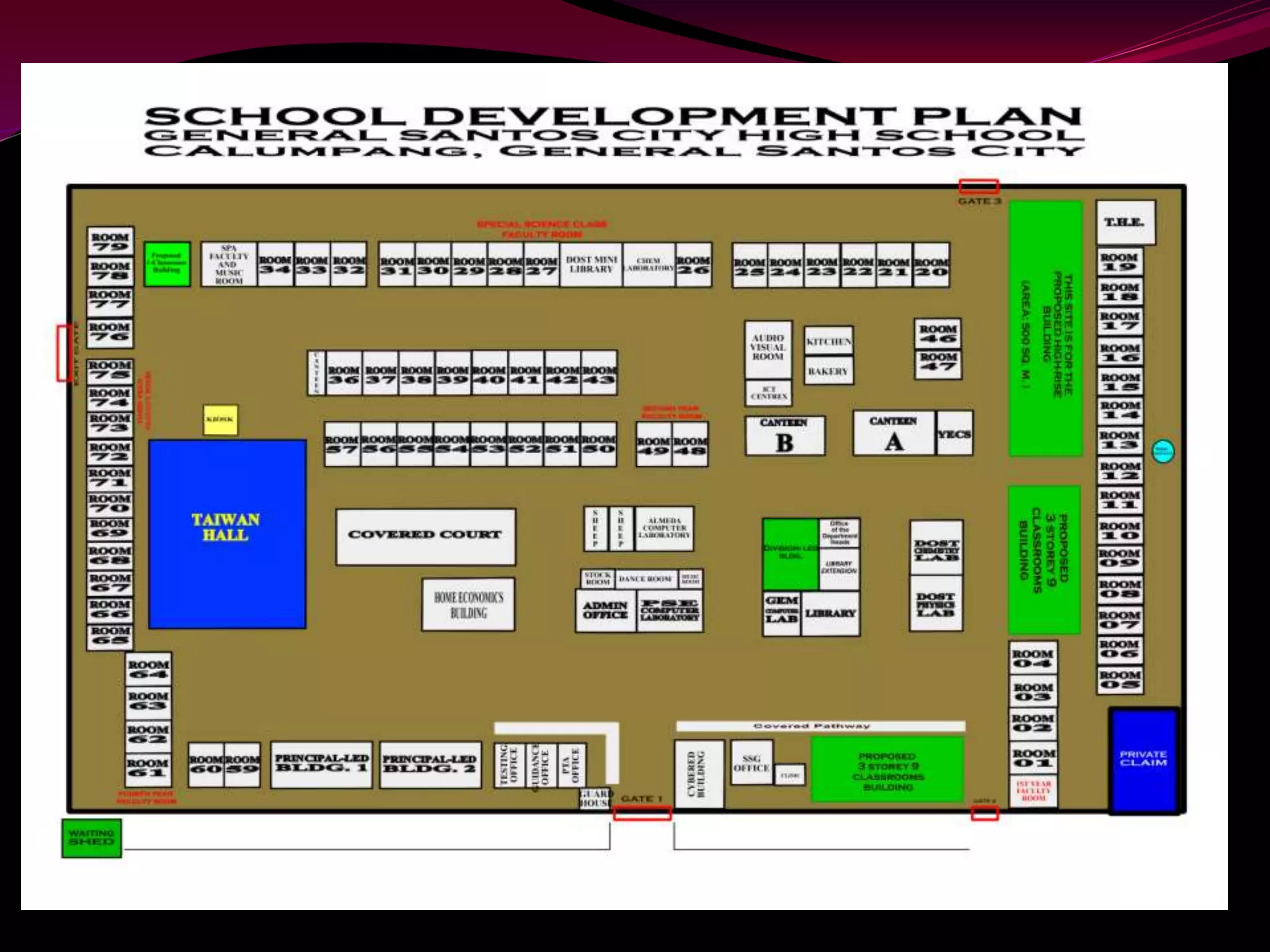
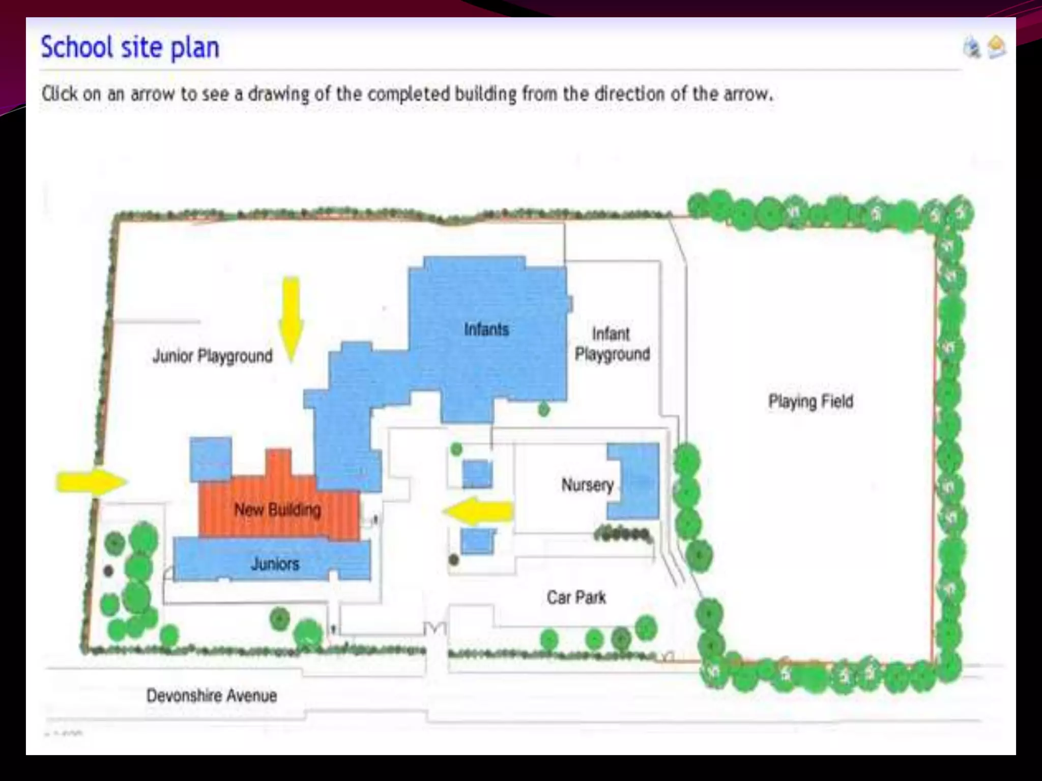
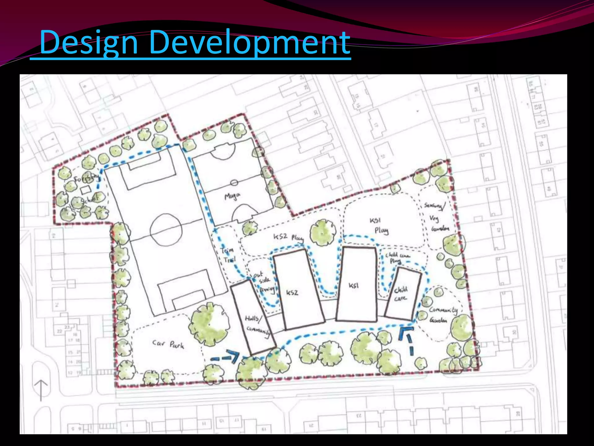
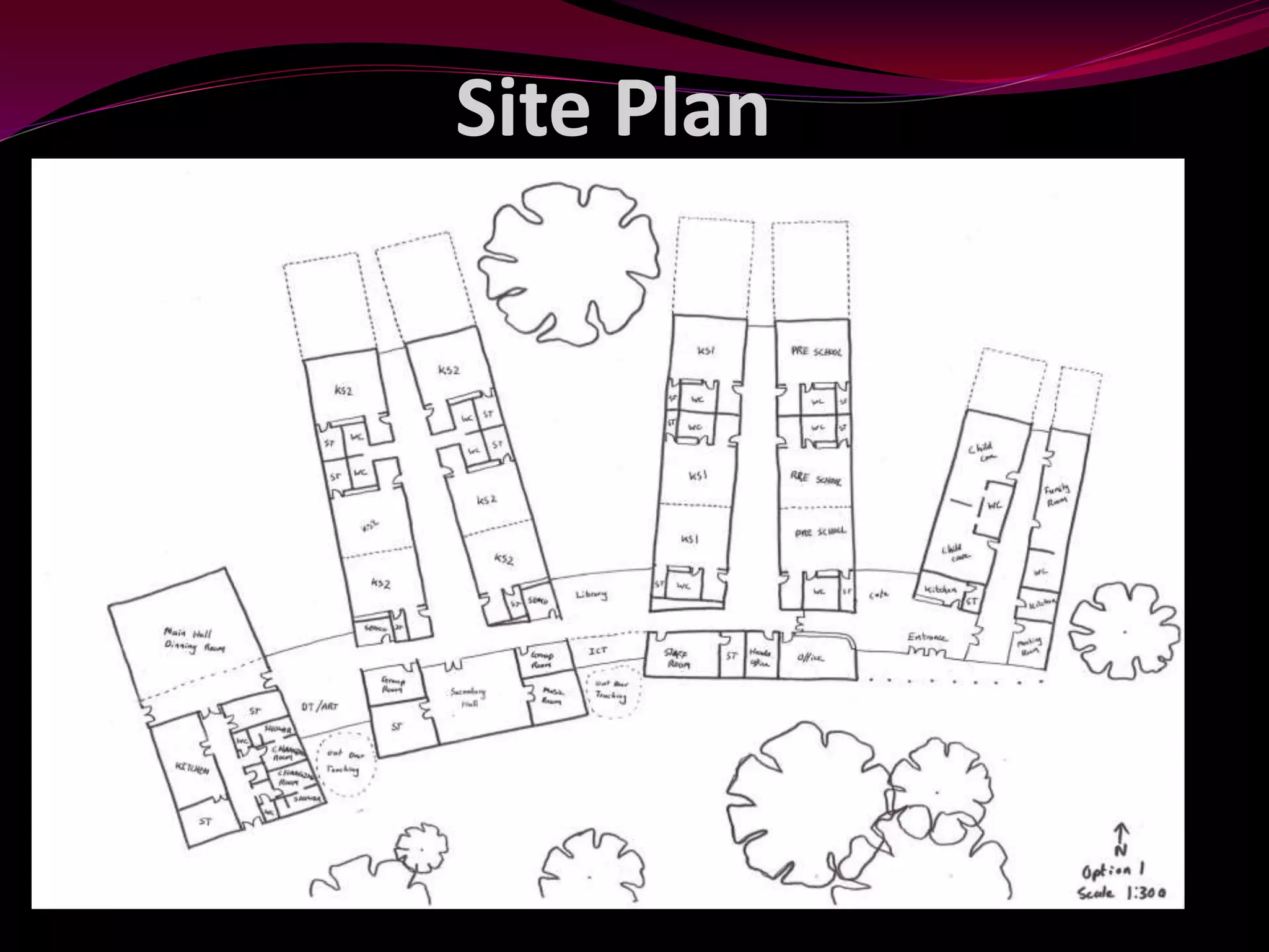
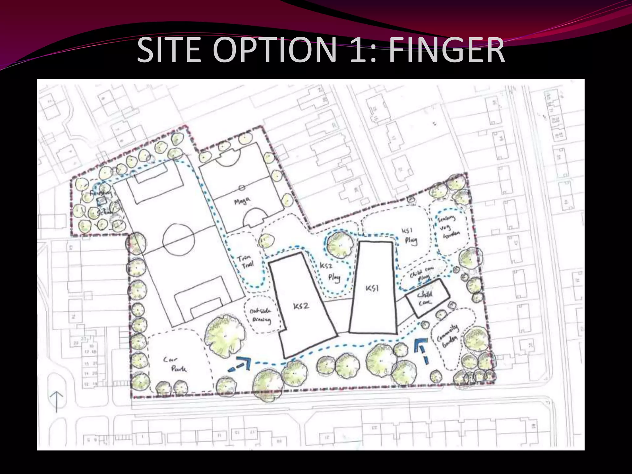
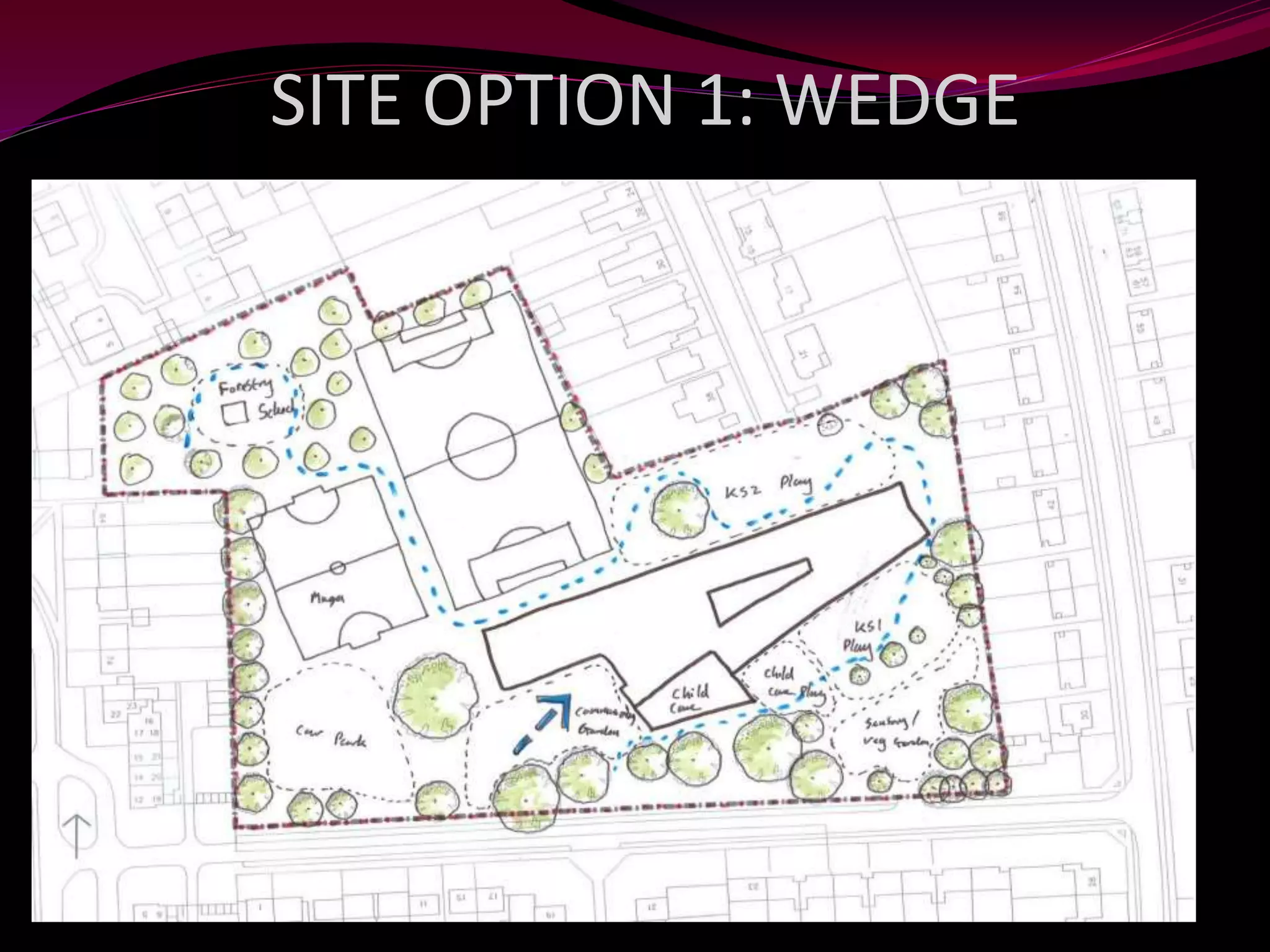
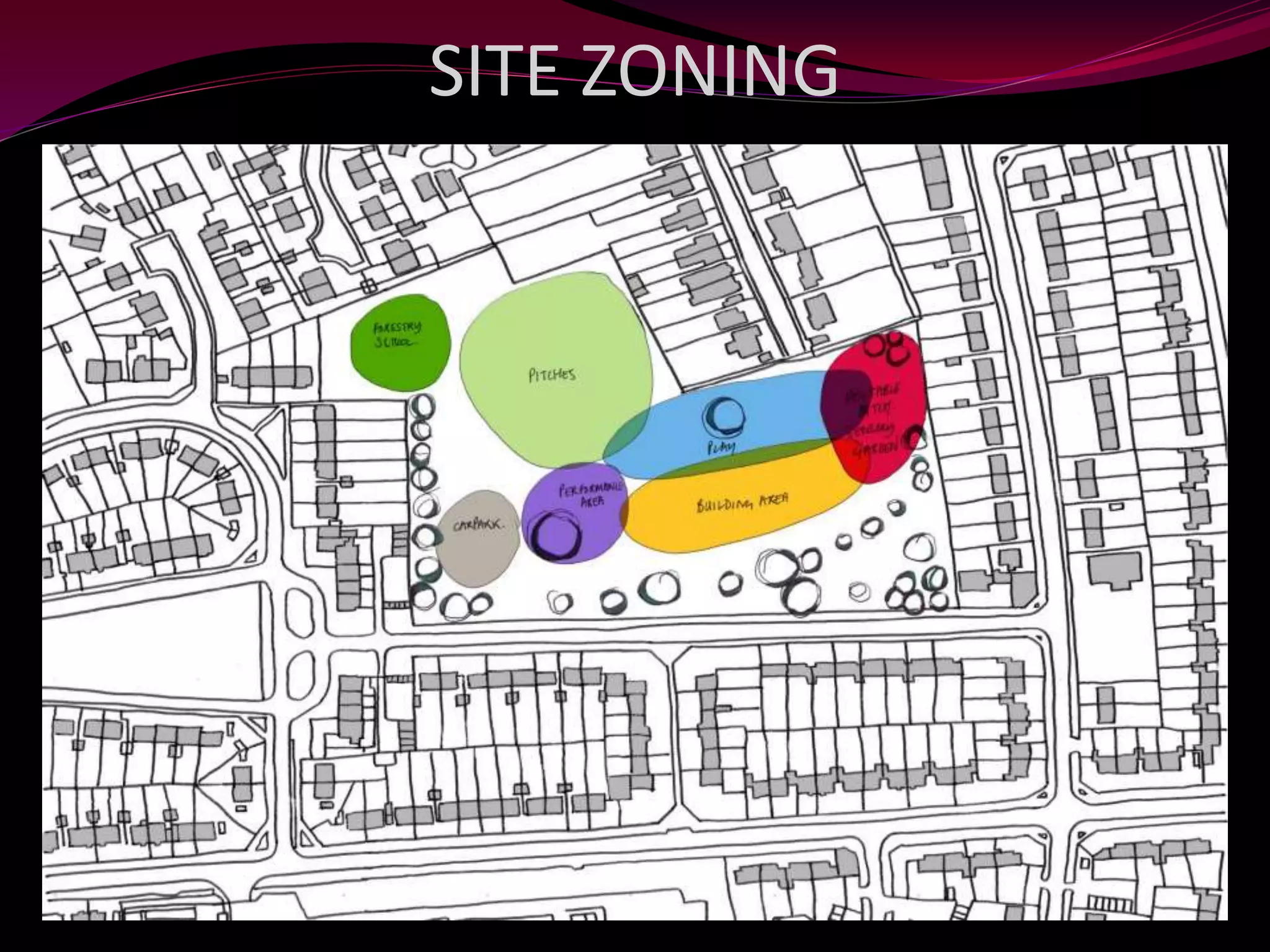
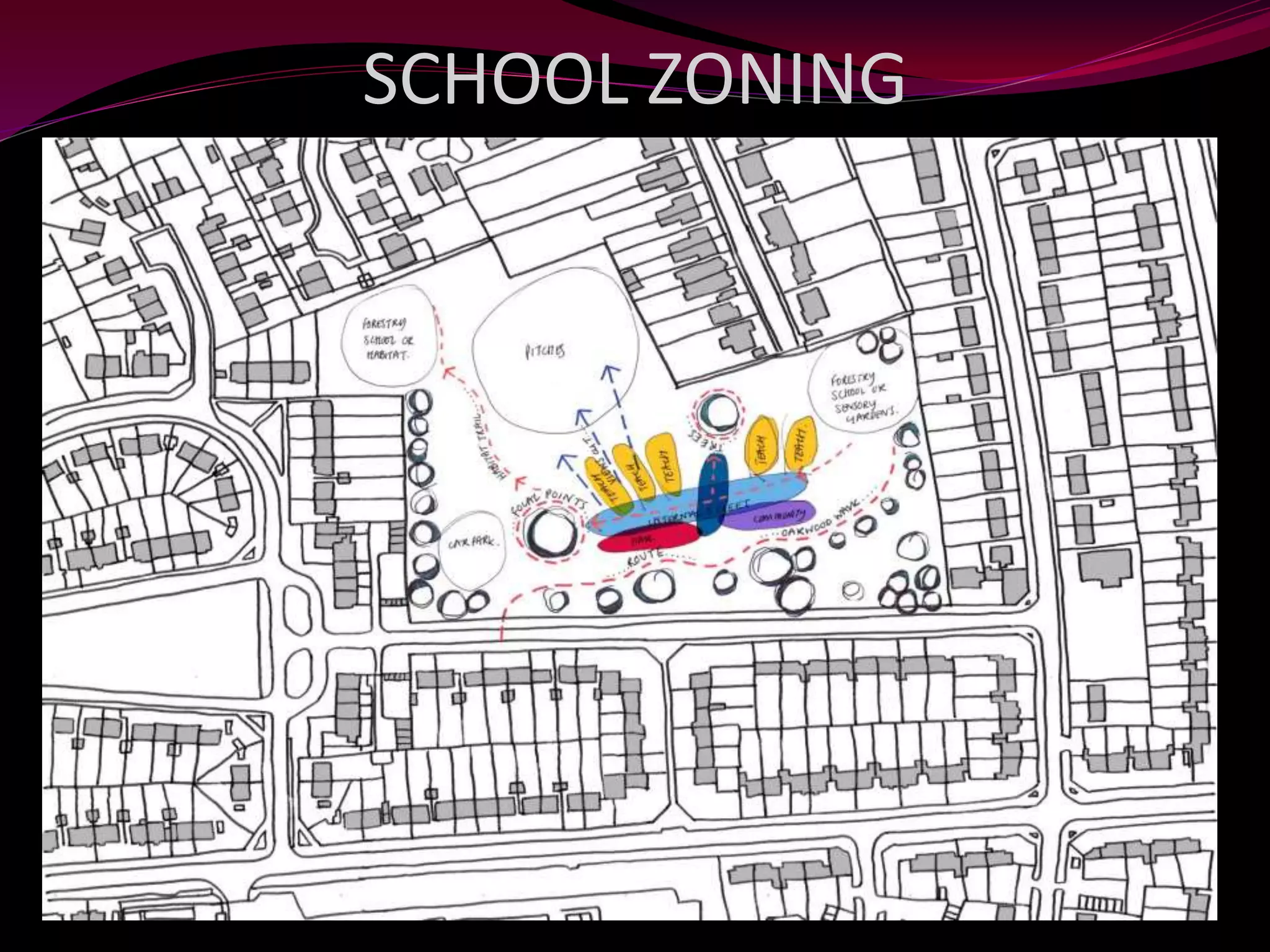

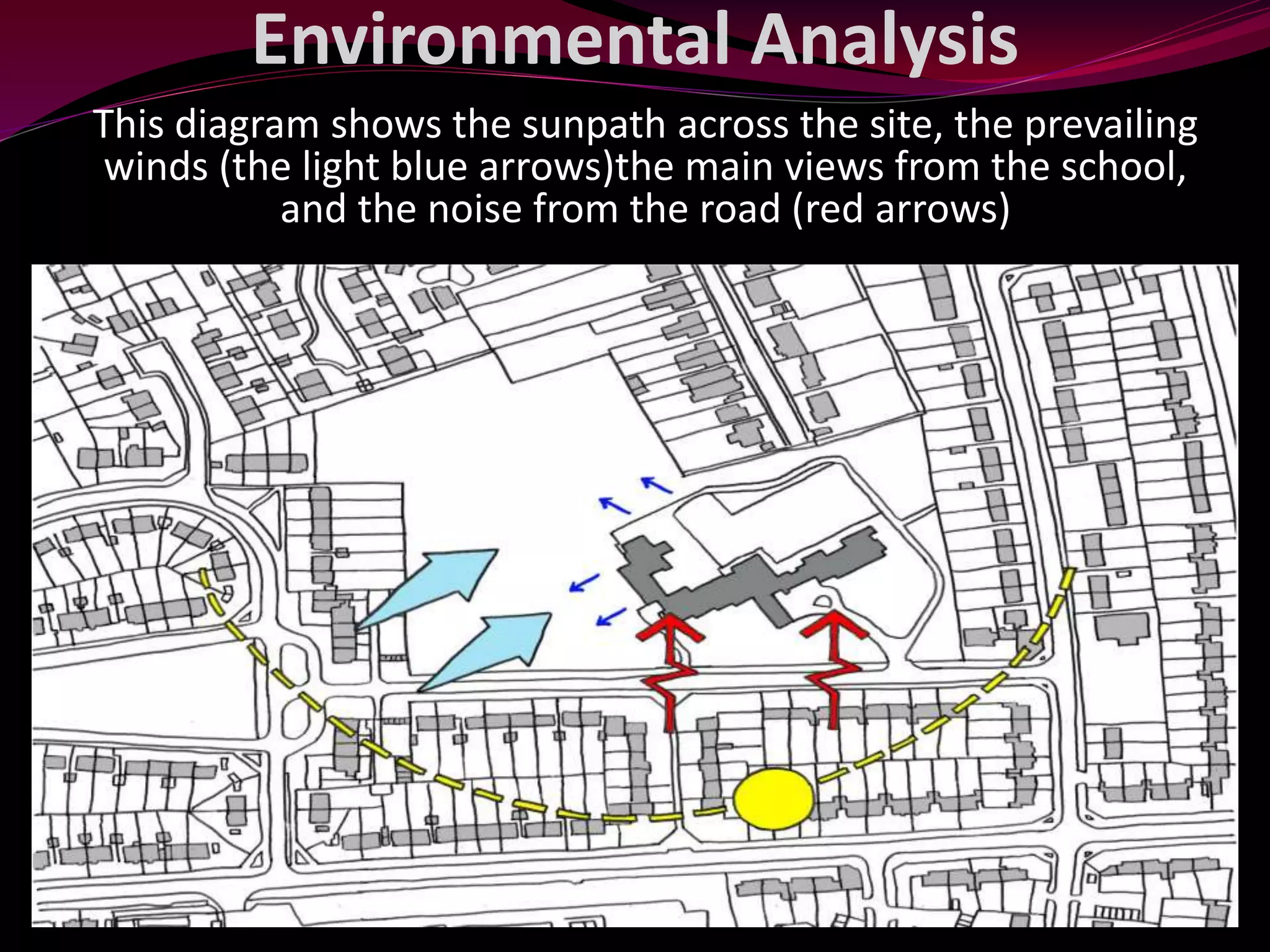
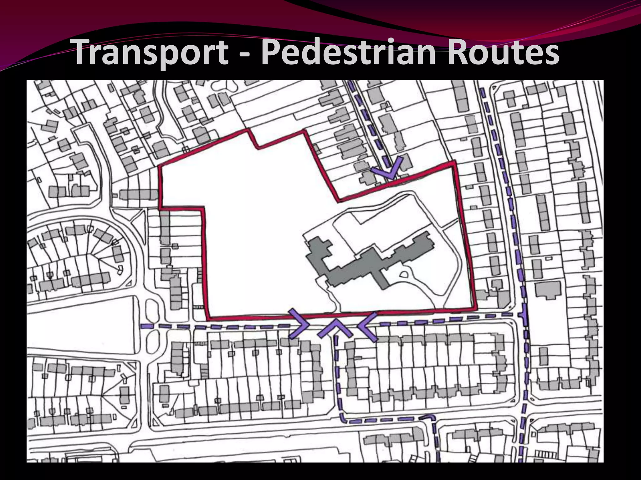
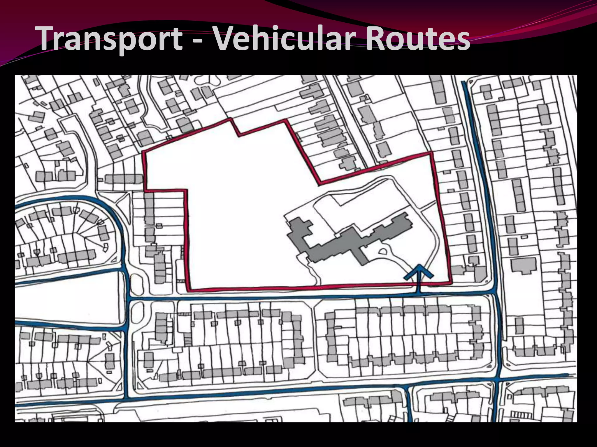
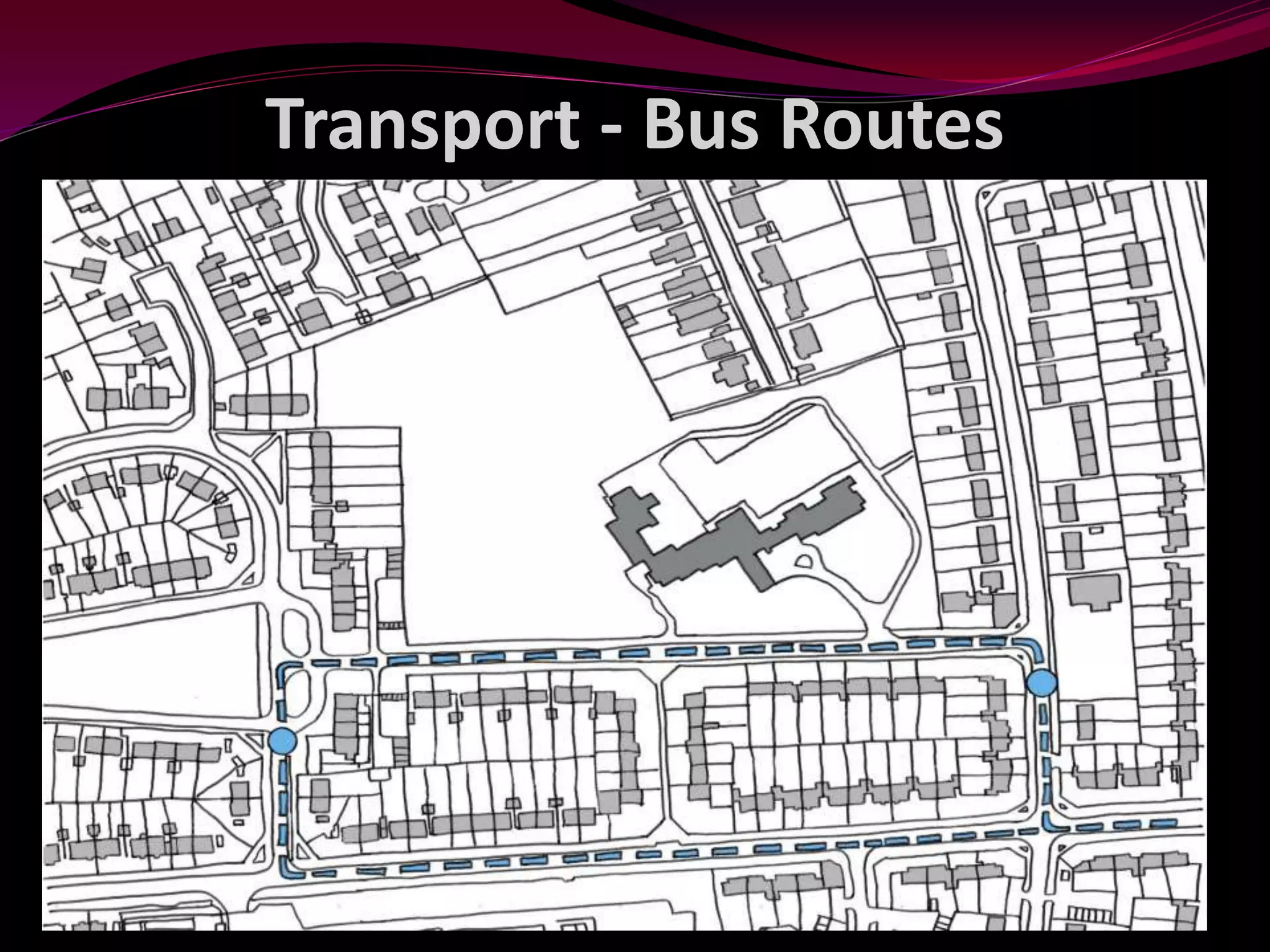

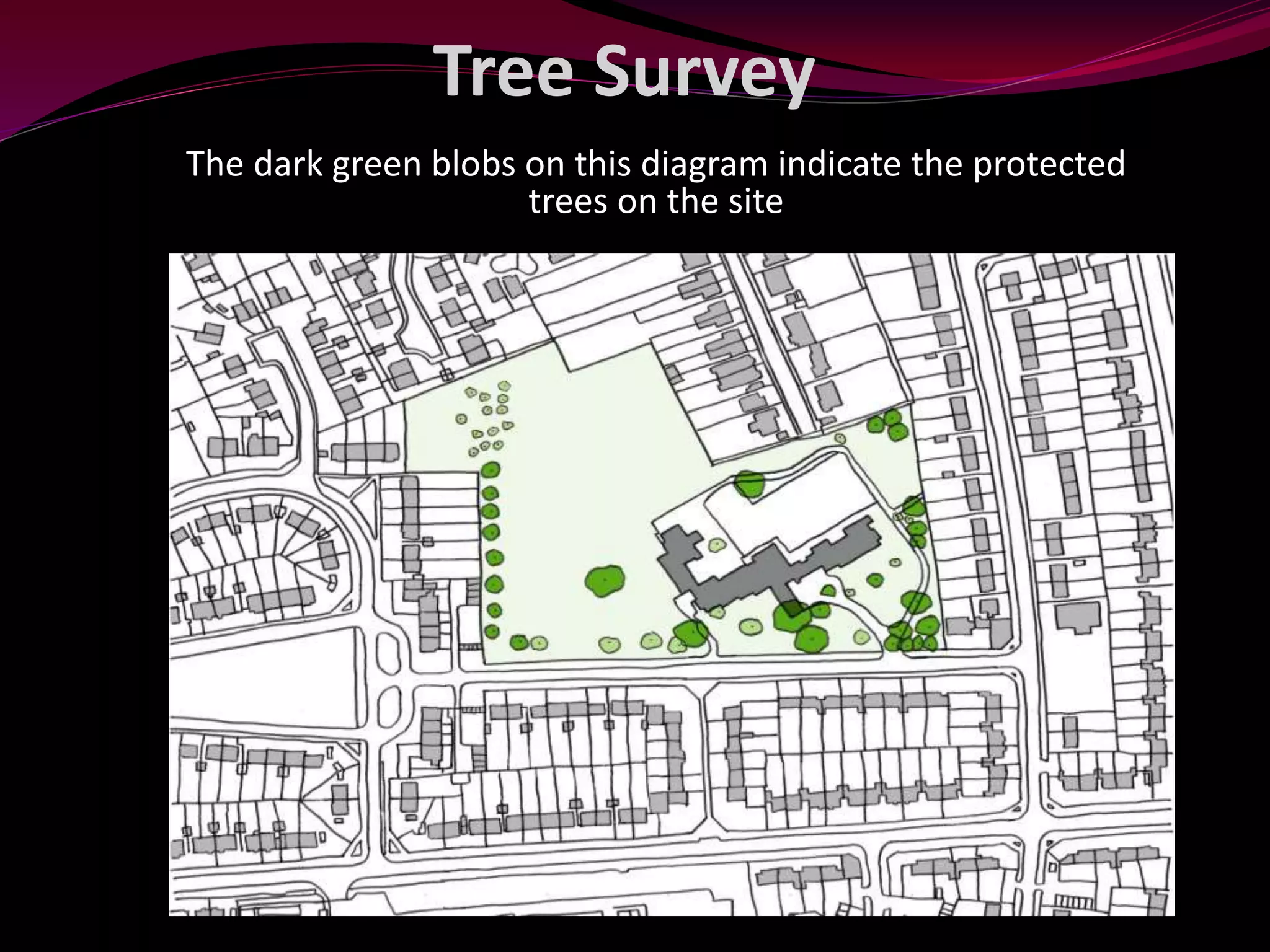


This document discusses principles of school site development planning. It describes how a site development plan is used to layout buildings, structures, and zones within a school based on considerations like sun paths, wind, noise barriers, and open spaces. The purpose is to plan infrastructure and facilities to contribute to a conducive teaching and learning environment. Key areas or zones discussed include visual, physical, functional, agricultural, playgrounds, athletic fields, and evacuation areas.


