Downloaded 95 times

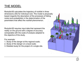
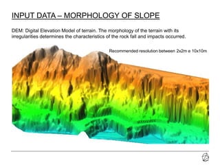
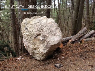
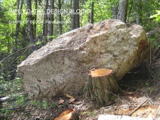
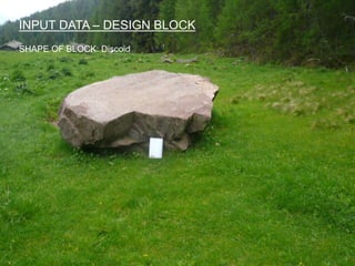
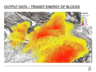


The document discusses the Rockyfor3D software, which simulates rockfall trajectories in three dimensions, requiring accurate input data such as terrain morphology and block shapes for effective analysis. It highlights the advantages of 3D simulations over 2D, including quick assessment, consideration of vegetation effects, and comprehensive output data. However, it also notes challenges like sensitivity to input data format and the need for GIS software knowledge for data creation.


