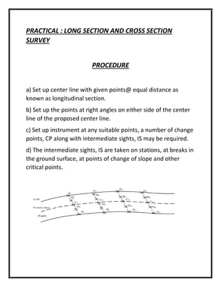
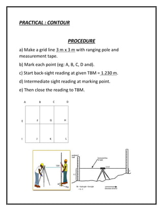
1) The document describes a field work report for an engineering survey levelling practical. It includes an introduction to levelling, materials used, rise and fall method examples, procedures, collected data, analysis of the data including arithmetic checking and correction of reduced levels, and a practical on long section, cross section, and contour surveying.
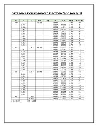
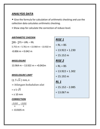
2) The report details the procedures for taking staff readings at stations using an automatic level to determine elevation differences between points and reduced levels. Arithmetic checking is used to calculate misclosure and corrections.
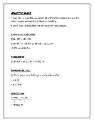
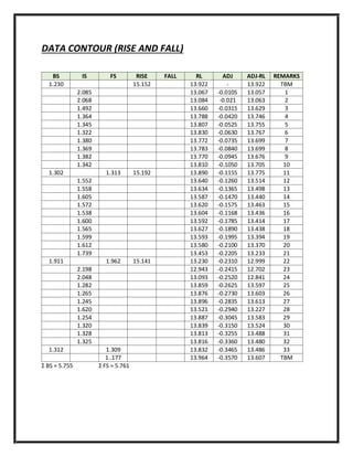
3) Data is presented from the levelling practical using the rise and fall method to compute reduced levels at stations. Analysis shows the arithmetic checking and steps to calculate corrections to the reduced levels