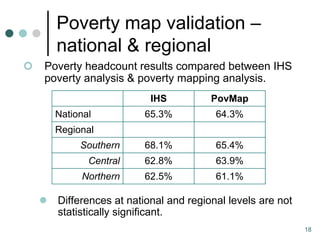
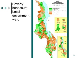
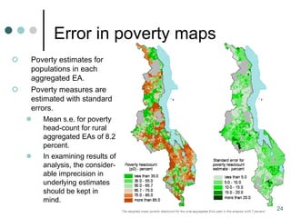
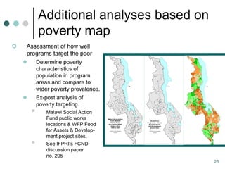
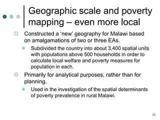
The document describes methods for poverty mapping based on an analysis in Malawi. Small-area estimation is used to 1) discover relationships between household characteristics and welfare levels in survey data and 2) apply these models to census data to predict welfare levels for all households. Validation showed national and regional poverty estimates from mapping matched survey analysis, though some district estimates differed. Maps were produced at local scales down to wards of around 1,000 people.
![Poverty Mapping
An overview of methods,
based on a Malawi analysis
Todd Benson
International Food Policy Research Institute
June 2009 [t.benson@cgiar.org]](https://image.slidesharecdn.com/povertymappingmalawitoddbenson-091214065850-phpapp02/85/Poverty-Mapping-An-overview-of-methods-based-on-a-Malawi-1-320.jpg)
![Poverty Mapping
An overview of methods,
based on a Malawi analysis
Todd Benson
International Food Policy Research Institute
June 2009 [t.benson@cgiar.org]](https://image.slidesharecdn.com/povertymappingmalawitoddbenson-091214065850-phpapp02/75/Poverty-Mapping-An-overview-of-methods-based-on-a-Malawi-1-2048.jpg)