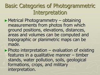
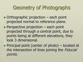
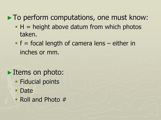
Photogrammetry is the science of obtaining information about physical objects through images. Key points:
- Aerial photography is commonly used for topographic mapping, with photos taken from planes. Stereoscopic analysis allows extraction of 3D surface data.
- Factors like terrain, scale, overlap, camera settings must be planned to get usable data. Flying height impacts scale and relief displacement.
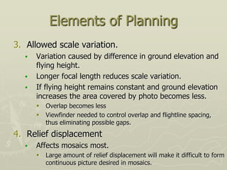
- Historically it has been used for tasks like mapping, reconnaissance, and engineering projects. Advances in computing have increased its accuracy and affordability.
- Proper planning of flight parameters, ground control, and compilation is needed to successfully execute a photogrammetry project. Calculations consider camera specs, terrain and
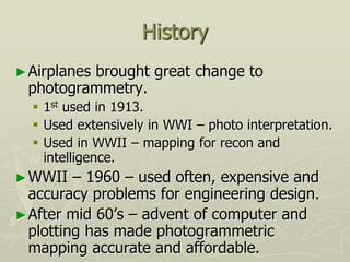
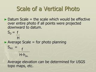
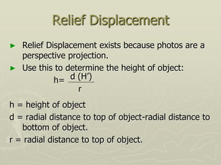
![Scale of a Vertical Photo
► S = or
► f = focal length 6” or 152.4 mm is common
► H’ = height of plane above ground
► h = height (elevation) of ground
► H = height of place above datum [altimeter
reading (2% error)]
f
H’
f
H-h](https://image.slidesharecdn.com/photogrammetry-231009183000-558d04fe/85/photogrammetry-ppt-15-320.jpg)


![제 23회 보아즈(BOAZ) 빅데이터 컨퍼런스 - [MBOAX] : ABSA를 활용한 소비자 반응 분석 기반 운영 효율화 대시보드 설계](https://cdn.slidesharecdn.com/ss_thumbnails/3-1boaz23rdconferencemboax-260203102709-9d519923-thumbnail.jpg?width=640&height=640&fit=bounds)


