SlideShare a Scribd company logo
1 of 22
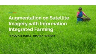
Augmentation on Satellite
Imagery with Information
Integrated Farming
“IF YOU ATE TODAY , THANK A FARMER !”
PBL
Agenda
● Why this field?
● Overview
● Challenges
● Problem Statement
● Objectives
● Existing Work
● Proposed solution
● Design
● Implementation
Why this field ?
● Agriculture is the backbone of India.
Being the single largest contributor to GDP of the nation
● 52% of the total population involved with it.
Overview
1 To build Low Cost
Integrated Informatics
System
2
Improving efficiency and
productivity of stakeholder
3 Decision Support System
for different stakeholders
4 How it contributes ?
Challenges
1 Choice of Visualization
Interface for mixed data
2 Managing multiple plot
and physical status of it
3 Lack of awareness of
relationship and stakeholders
interests
4 Scalability
The Gap that's not a addressed
Methods currently available are cumbersome and perishable in
nature. Visualization and processing of data is inefficient and
induced error rate is high, leading to weak support for making
decisions.
Problem Statement
Design and development of Decision Support System for
different stakeholders by augmenting physical statistica and
land statistics with Information Integrated Farming
Stakeholders:
Objectives
● To represent data based on
different stakeholders interest
● Augmentation of Farming stats
on Land stats wrt to GPS
● Develop Integrated system
connecting stakeholders to
market place
● To build DSS to achieve accuracy
Existing System
● Crop IO- real time
● AgriVi- track financial expenditure
Previous Work
1) Research and Design of an Integrated Farm Information Management System Based on
Component GIShttps:// ieeexplore.ieee.org/document/5190024.
1) Aqeel-ur-Rehman and Zubair Ahmed Shaikh. ONTAgri : Scalable Service Oriented Agriculture
Ontology for Precision Farming. (2011).
1) Muchina, Solomon et al. Agricultural Systems in IGAD Region A Socio-Economic Review. (2018).
1) Pruthvi Vs, Rohit Naik and Vijaya kumar Bp, “Prediction Based Policy Setting by Finding
Significance Of Attributes From The Ontological Framework In Agricultural Domain”, IEEE SSCI,
December 2018, Bangalore.
Proposed
Solution
Design
Data Collection
Views Of Stakeholders
Visualization
Implementation
Map Interface
Better representation of
complex relationship
between data and its geo
importance
Query Interface/ User
Interface to visualize,
interests of different
stakeholders.
The results are pictured in
map interface
Scalability
There is a requirement to
handle huge data and
users, hence NO-SQL
fashion storage and query.
USE -
CASE
DIAGRAM
Current Work
We with help of our Institution
M S Ramaiah Institute Of
Technology
Have collected data from 8 villages
in “Kaiwara” town
&
We are in phase of Implementation
Future Work
Image Processing and
Machine Learning
Integrate with E-
mandi and other
beneficiaries
App Based data
collection , harnessing
power of mobile
sensors like GPS etc..
Thank you.

More Related Content

What's hot

What's hot (8)

Geography and Public Health: Using Technology to Strengthen Programs
Geography and Public Health: Using Technology to Strengthen ProgramsGeography and Public Health: Using Technology to Strengthen Programs
Geography and Public Health: Using Technology to Strengthen Programs
 
Gis applications in civil engineering
Gis applications in civil engineeringGis applications in civil engineering
Gis applications in civil engineering
 
Fyp presentation
Fyp presentationFyp presentation
Fyp presentation
 
Interdisciplinary GIS Applications in Challenging RISK
Interdisciplinary GIS Applications in Challenging RISKInterdisciplinary GIS Applications in Challenging RISK
Interdisciplinary GIS Applications in Challenging RISK
 
R&D Plan-Informatics in the Era of Big Data
R&D Plan-Informatics in the Era of Big DataR&D Plan-Informatics in the Era of Big Data
R&D Plan-Informatics in the Era of Big Data
 
Parth khare cv_july19
Parth khare cv_july19Parth khare cv_july19
Parth khare cv_july19
 
Investigating the impact of a web-based, ‘discussion support’, agricultural c...
Investigating the impact of a web-based, ‘discussion support’, agricultural c...Investigating the impact of a web-based, ‘discussion support’, agricultural c...
Investigating the impact of a web-based, ‘discussion support’, agricultural c...
 
Application of GIS in Construction Management
Application of GIS in Construction ManagementApplication of GIS in Construction Management
Application of GIS in Construction Management
 

Similar to PBL final ppt

SEMANTIC WEB QUERY ON EGOVERNANCE DATA AND DESIGNING ONTOLOGY FOR AGRICULTURE...
SEMANTIC WEB QUERY ON EGOVERNANCE DATA AND DESIGNING ONTOLOGY FOR AGRICULTURE...SEMANTIC WEB QUERY ON EGOVERNANCE DATA AND DESIGNING ONTOLOGY FOR AGRICULTURE...
SEMANTIC WEB QUERY ON EGOVERNANCE DATA AND DESIGNING ONTOLOGY FOR AGRICULTURE...
csandit
 
Strategy For Assessment Of Land And Complex Fields Type Analysis Through GIS ...
Strategy For Assessment Of Land And Complex Fields Type Analysis Through GIS ...Strategy For Assessment Of Land And Complex Fields Type Analysis Through GIS ...
Strategy For Assessment Of Land And Complex Fields Type Analysis Through GIS ...
ijistjournal
 
Strategy For Assessment Of Land And Complex Fields Type Analysis Through GIS ...
Strategy For Assessment Of Land And Complex Fields Type Analysis Through GIS ...Strategy For Assessment Of Land And Complex Fields Type Analysis Through GIS ...
Strategy For Assessment Of Land And Complex Fields Type Analysis Through GIS ...
ijistjournal
 
Government Process Re-engineering - Min. of Water Resources
Government Process Re-engineering - Min. of Water Resources Government Process Re-engineering - Min. of Water Resources
Government Process Re-engineering - Min. of Water Resources
Praveer Singh
 

Similar to PBL final ppt (20)

Gramya Vikas-paper-gopesh
Gramya Vikas-paper-gopeshGramya Vikas-paper-gopesh
Gramya Vikas-paper-gopesh
 
SDI-Initiatives-in-Nepal (1).pptx
SDI-Initiatives-in-Nepal (1).pptxSDI-Initiatives-in-Nepal (1).pptx
SDI-Initiatives-in-Nepal (1).pptx
 
IRJET-Implementation of GIS for Land Record Management
IRJET-Implementation of GIS for Land Record ManagementIRJET-Implementation of GIS for Land Record Management
IRJET-Implementation of GIS for Land Record Management
 
Dynamic AI-Geo Health Application based on BIGIS-DSS Approach
Dynamic AI-Geo Health Application based on BIGIS-DSS ApproachDynamic AI-Geo Health Application based on BIGIS-DSS Approach
Dynamic AI-Geo Health Application based on BIGIS-DSS Approach
 
VRIDHI
VRIDHIVRIDHI
VRIDHI
 
SEMANTIC WEB QUERY ON EGOVERNANCE DATA AND DESIGNING ONTOLOGY FOR AGRICULTURE...
SEMANTIC WEB QUERY ON EGOVERNANCE DATA AND DESIGNING ONTOLOGY FOR AGRICULTURE...SEMANTIC WEB QUERY ON EGOVERNANCE DATA AND DESIGNING ONTOLOGY FOR AGRICULTURE...
SEMANTIC WEB QUERY ON EGOVERNANCE DATA AND DESIGNING ONTOLOGY FOR AGRICULTURE...
 
A THROUGHPUT ANALYSIS OF TCP IN ADHOC NETWORKS
A THROUGHPUT ANALYSIS OF TCP IN ADHOC NETWORKS A THROUGHPUT ANALYSIS OF TCP IN ADHOC NETWORKS
A THROUGHPUT ANALYSIS OF TCP IN ADHOC NETWORKS
 
Semantic web query on e governance data and designing ontology for agricultur...
Semantic web query on e governance data and designing ontology for agricultur...Semantic web query on e governance data and designing ontology for agricultur...
Semantic web query on e governance data and designing ontology for agricultur...
 
SEMANTIC WEB QUERY ON EGOVERNANCE DATA AND DESIGNING ONTOLOGY FOR AGRICULTURE...
SEMANTIC WEB QUERY ON EGOVERNANCE DATA AND DESIGNING ONTOLOGY FOR AGRICULTURE...SEMANTIC WEB QUERY ON EGOVERNANCE DATA AND DESIGNING ONTOLOGY FOR AGRICULTURE...
SEMANTIC WEB QUERY ON EGOVERNANCE DATA AND DESIGNING ONTOLOGY FOR AGRICULTURE...
 
Enabling Data-Driven Real-Time Governance
Enabling Data-Driven Real-Time GovernanceEnabling Data-Driven Real-Time Governance
Enabling Data-Driven Real-Time Governance
 
Lr presentation
Lr presentationLr presentation
Lr presentation
 
Semantic Web Query on e-Governance Data and Designing Ontology for Agricultur...
Semantic Web Query on e-Governance Data and Designing Ontology for Agricultur...Semantic Web Query on e-Governance Data and Designing Ontology for Agricultur...
Semantic Web Query on e-Governance Data and Designing Ontology for Agricultur...
 
Decision support system for precision agriculture
Decision support system for precision agricultureDecision support system for precision agriculture
Decision support system for precision agriculture
 
Open Data Initiative India
Open Data Initiative IndiaOpen Data Initiative India
Open Data Initiative India
 
Gis for Sustainable Development Goals (SDG)
Gis for Sustainable Development Goals (SDG)Gis for Sustainable Development Goals (SDG)
Gis for Sustainable Development Goals (SDG)
 
Ease-of-use and Effectiveness of Participatory GIS in Empowering Rural Commun...
Ease-of-use and Effectiveness of Participatory GIS in Empowering Rural Commun...Ease-of-use and Effectiveness of Participatory GIS in Empowering Rural Commun...
Ease-of-use and Effectiveness of Participatory GIS in Empowering Rural Commun...
 
Strategy For Assessment Of Land And Complex Fields Type Analysis Through GIS ...
Strategy For Assessment Of Land And Complex Fields Type Analysis Through GIS ...Strategy For Assessment Of Land And Complex Fields Type Analysis Through GIS ...
Strategy For Assessment Of Land And Complex Fields Type Analysis Through GIS ...
 
Strategy For Assessment Of Land And Complex Fields Type Analysis Through GIS ...
Strategy For Assessment Of Land And Complex Fields Type Analysis Through GIS ...Strategy For Assessment Of Land And Complex Fields Type Analysis Through GIS ...
Strategy For Assessment Of Land And Complex Fields Type Analysis Through GIS ...
 
Government Process Re-engineering - Min. of Water Resources
Government Process Re-engineering - Min. of Water Resources Government Process Re-engineering - Min. of Water Resources
Government Process Re-engineering - Min. of Water Resources
 
The State of GIS in Washington & Oregon The 2014 GMI Metric Survey
The State of GIS in Washington & Oregon  The 2014 GMI Metric SurveyThe State of GIS in Washington & Oregon  The 2014 GMI Metric Survey
The State of GIS in Washington & Oregon The 2014 GMI Metric Survey
 

Recently uploaded

Cara Menggugurkan Sperma Yang Masuk Rahim Biyar Tidak Hamil
Cara Menggugurkan Sperma Yang Masuk Rahim Biyar Tidak HamilCara Menggugurkan Sperma Yang Masuk Rahim Biyar Tidak Hamil
Cara Menggugurkan Sperma Yang Masuk Rahim Biyar Tidak Hamil
Cara Menggugurkan Kandungan 087776558899
 
Introduction to Robotics in Mechanical Engineering.pptx
Introduction to Robotics in Mechanical Engineering.pptxIntroduction to Robotics in Mechanical Engineering.pptx
Introduction to Robotics in Mechanical Engineering.pptx
hublikarsn
 
scipt v1.pptxcxxxxxxxxxxxxxxxxxxxxxxxxxxxxxxxxxxxxxxxxxxxxxxxxxxxxxxxxxxxxxxx...
scipt v1.pptxcxxxxxxxxxxxxxxxxxxxxxxxxxxxxxxxxxxxxxxxxxxxxxxxxxxxxxxxxxxxxxxx...scipt v1.pptxcxxxxxxxxxxxxxxxxxxxxxxxxxxxxxxxxxxxxxxxxxxxxxxxxxxxxxxxxxxxxxxx...
scipt v1.pptxcxxxxxxxxxxxxxxxxxxxxxxxxxxxxxxxxxxxxxxxxxxxxxxxxxxxxxxxxxxxxxxx...
HenryBriggs2
 
XXXXXXXXXXXXXXXXXXXXXXXXXXXXXXXXXXXXXXXXXXXXXXXXXXXX
XXXXXXXXXXXXXXXXXXXXXXXXXXXXXXXXXXXXXXXXXXXXXXXXXXXXXXXXXXXXXXXXXXXXXXXXXXXXXXXXXXXXXXXXXXXXXXXXXXXXXXXX
XXXXXXXXXXXXXXXXXXXXXXXXXXXXXXXXXXXXXXXXXXXXXXXXXXXX
ssuser89054b
 

Recently uploaded (20)

PE 459 LECTURE 2- natural gas basic concepts and properties
PE 459 LECTURE 2- natural gas basic concepts and propertiesPE 459 LECTURE 2- natural gas basic concepts and properties
PE 459 LECTURE 2- natural gas basic concepts and properties
 
Cara Menggugurkan Sperma Yang Masuk Rahim Biyar Tidak Hamil
Cara Menggugurkan Sperma Yang Masuk Rahim Biyar Tidak HamilCara Menggugurkan Sperma Yang Masuk Rahim Biyar Tidak Hamil
Cara Menggugurkan Sperma Yang Masuk Rahim Biyar Tidak Hamil
 
Introduction to Serverless with AWS Lambda
Introduction to Serverless with AWS LambdaIntroduction to Serverless with AWS Lambda
Introduction to Serverless with AWS Lambda
 
AIRCANVAS[1].pdf mini project for btech students
AIRCANVAS[1].pdf mini project for btech studentsAIRCANVAS[1].pdf mini project for btech students
AIRCANVAS[1].pdf mini project for btech students
 
Signal Processing and Linear System Analysis
Signal Processing and Linear System AnalysisSignal Processing and Linear System Analysis
Signal Processing and Linear System Analysis
 
COST-EFFETIVE and Energy Efficient BUILDINGS ptx
COST-EFFETIVE  and Energy Efficient BUILDINGS ptxCOST-EFFETIVE  and Energy Efficient BUILDINGS ptx
COST-EFFETIVE and Energy Efficient BUILDINGS ptx
 
Introduction to Data Visualization,Matplotlib.pdf
Introduction to Data Visualization,Matplotlib.pdfIntroduction to Data Visualization,Matplotlib.pdf
Introduction to Data Visualization,Matplotlib.pdf
 
Worksharing and 3D Modeling with Revit.pptx
Worksharing and 3D Modeling with Revit.pptxWorksharing and 3D Modeling with Revit.pptx
Worksharing and 3D Modeling with Revit.pptx
 
Post office management system project ..pdf
Post office management system project ..pdfPost office management system project ..pdf
Post office management system project ..pdf
 
Max. shear stress theory-Maximum Shear Stress Theory ​ Maximum Distortional ...
Max. shear stress theory-Maximum Shear Stress Theory ​  Maximum Distortional ...Max. shear stress theory-Maximum Shear Stress Theory ​  Maximum Distortional ...
Max. shear stress theory-Maximum Shear Stress Theory ​ Maximum Distortional ...
 
NO1 Top No1 Amil Baba In Azad Kashmir, Kashmir Black Magic Specialist Expert ...
NO1 Top No1 Amil Baba In Azad Kashmir, Kashmir Black Magic Specialist Expert ...NO1 Top No1 Amil Baba In Azad Kashmir, Kashmir Black Magic Specialist Expert ...
NO1 Top No1 Amil Baba In Azad Kashmir, Kashmir Black Magic Specialist Expert ...
 
Basic Electronics for diploma students as per technical education Kerala Syll...
Basic Electronics for diploma students as per technical education Kerala Syll...Basic Electronics for diploma students as per technical education Kerala Syll...
Basic Electronics for diploma students as per technical education Kerala Syll...
 
Computer Graphics Introduction To Curves
Computer Graphics Introduction To CurvesComputer Graphics Introduction To Curves
Computer Graphics Introduction To Curves
 
Convergence of Robotics and Gen AI offers excellent opportunities for Entrepr...
Convergence of Robotics and Gen AI offers excellent opportunities for Entrepr...Convergence of Robotics and Gen AI offers excellent opportunities for Entrepr...
Convergence of Robotics and Gen AI offers excellent opportunities for Entrepr...
 
Introduction to Robotics in Mechanical Engineering.pptx
Introduction to Robotics in Mechanical Engineering.pptxIntroduction to Robotics in Mechanical Engineering.pptx
Introduction to Robotics in Mechanical Engineering.pptx
 
Path loss model, OKUMURA Model, Hata Model
Path loss model, OKUMURA Model, Hata ModelPath loss model, OKUMURA Model, Hata Model
Path loss model, OKUMURA Model, Hata Model
 
Augmented Reality (AR) with Augin Software.pptx
Augmented Reality (AR) with Augin Software.pptxAugmented Reality (AR) with Augin Software.pptx
Augmented Reality (AR) with Augin Software.pptx
 
Ground Improvement Technique: Earth Reinforcement
Ground Improvement Technique: Earth ReinforcementGround Improvement Technique: Earth Reinforcement
Ground Improvement Technique: Earth Reinforcement
 
scipt v1.pptxcxxxxxxxxxxxxxxxxxxxxxxxxxxxxxxxxxxxxxxxxxxxxxxxxxxxxxxxxxxxxxxx...
scipt v1.pptxcxxxxxxxxxxxxxxxxxxxxxxxxxxxxxxxxxxxxxxxxxxxxxxxxxxxxxxxxxxxxxxx...scipt v1.pptxcxxxxxxxxxxxxxxxxxxxxxxxxxxxxxxxxxxxxxxxxxxxxxxxxxxxxxxxxxxxxxxx...
scipt v1.pptxcxxxxxxxxxxxxxxxxxxxxxxxxxxxxxxxxxxxxxxxxxxxxxxxxxxxxxxxxxxxxxxx...
 
XXXXXXXXXXXXXXXXXXXXXXXXXXXXXXXXXXXXXXXXXXXXXXXXXXXX
XXXXXXXXXXXXXXXXXXXXXXXXXXXXXXXXXXXXXXXXXXXXXXXXXXXXXXXXXXXXXXXXXXXXXXXXXXXXXXXXXXXXXXXXXXXXXXXXXXXXXXXX
XXXXXXXXXXXXXXXXXXXXXXXXXXXXXXXXXXXXXXXXXXXXXXXXXXXX
 

PBL final ppt

  • 1. Augmentation on Satellite Imagery with Information Integrated Farming “IF YOU ATE TODAY , THANK A FARMER !”
  • 2. PBL Agenda ● Why this field? ● Overview ● Challenges ● Problem Statement ● Objectives ● Existing Work ● Proposed solution ● Design ● Implementation
  • 3. Why this field ? ● Agriculture is the backbone of India. Being the single largest contributor to GDP of the nation ● 52% of the total population involved with it.
  • 4. Overview 1 To build Low Cost Integrated Informatics System 2 Improving efficiency and productivity of stakeholder 3 Decision Support System for different stakeholders 4 How it contributes ?
  • 5. Challenges 1 Choice of Visualization Interface for mixed data 2 Managing multiple plot and physical status of it 3 Lack of awareness of relationship and stakeholders interests 4 Scalability
  • 6. The Gap that's not a addressed Methods currently available are cumbersome and perishable in nature. Visualization and processing of data is inefficient and induced error rate is high, leading to weak support for making decisions.
  • 7. Problem Statement Design and development of Decision Support System for different stakeholders by augmenting physical statistica and land statistics with Information Integrated Farming
  • 9. Objectives ● To represent data based on different stakeholders interest ● Augmentation of Farming stats on Land stats wrt to GPS ● Develop Integrated system connecting stakeholders to market place ● To build DSS to achieve accuracy
  • 10. Existing System ● Crop IO- real time ● AgriVi- track financial expenditure
  • 11. Previous Work 1) Research and Design of an Integrated Farm Information Management System Based on Component GIShttps:// ieeexplore.ieee.org/document/5190024. 1) Aqeel-ur-Rehman and Zubair Ahmed Shaikh. ONTAgri : Scalable Service Oriented Agriculture Ontology for Precision Farming. (2011). 1) Muchina, Solomon et al. Agricultural Systems in IGAD Region A Socio-Economic Review. (2018). 1) Pruthvi Vs, Rohit Naik and Vijaya kumar Bp, “Prediction Based Policy Setting by Finding Significance Of Attributes From The Ontological Framework In Agricultural Domain”, IEEE SSCI, December 2018, Bangalore.
  • 18. Map Interface Better representation of complex relationship between data and its geo importance Query Interface/ User Interface to visualize, interests of different stakeholders. The results are pictured in map interface Scalability There is a requirement to handle huge data and users, hence NO-SQL fashion storage and query.
  • 20. Current Work We with help of our Institution M S Ramaiah Institute Of Technology Have collected data from 8 villages in “Kaiwara” town & We are in phase of Implementation
  • 21. Future Work Image Processing and Machine Learning Integrate with E- mandi and other beneficiaries App Based data collection , harnessing power of mobile sensors like GPS etc..