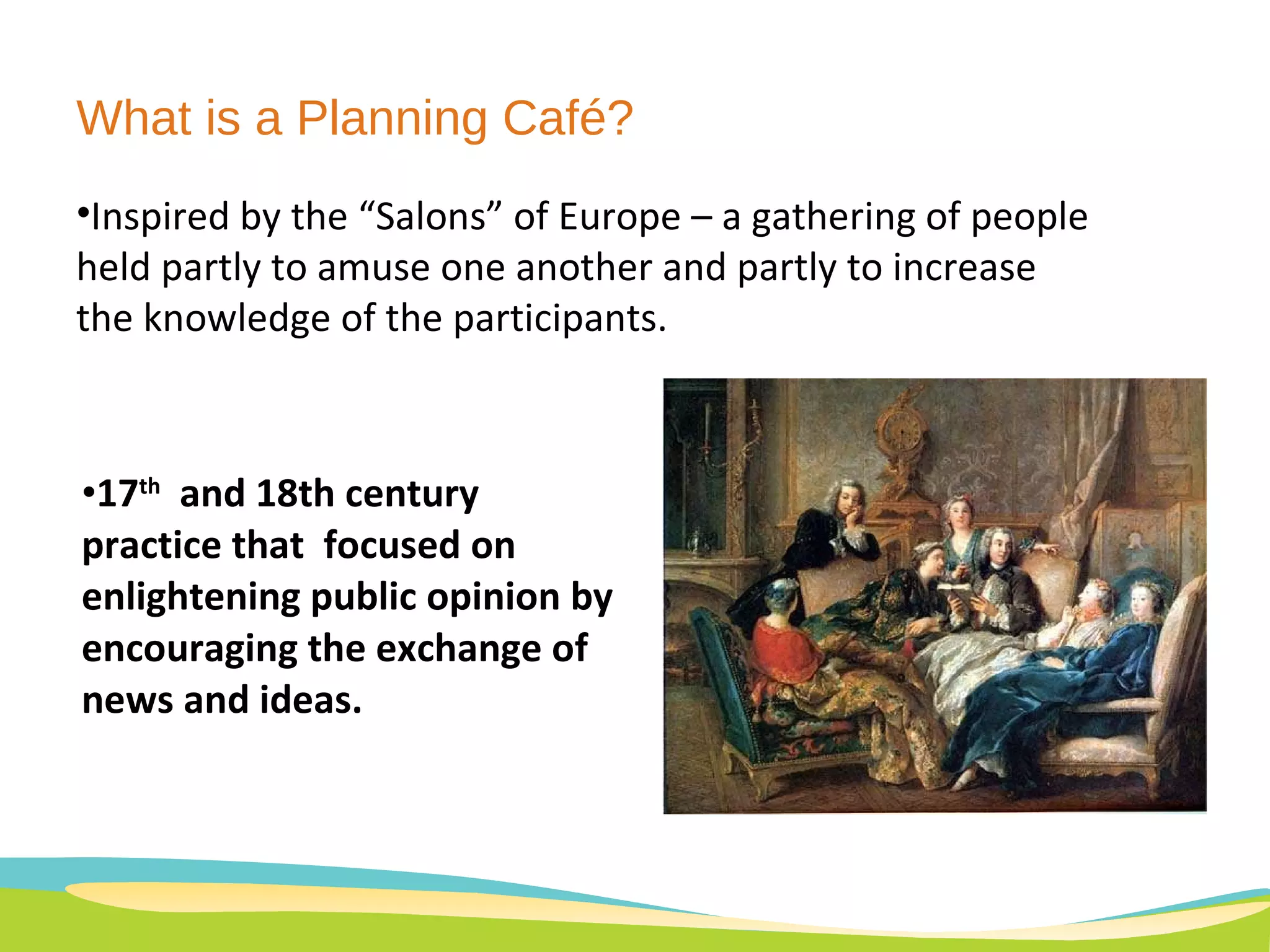
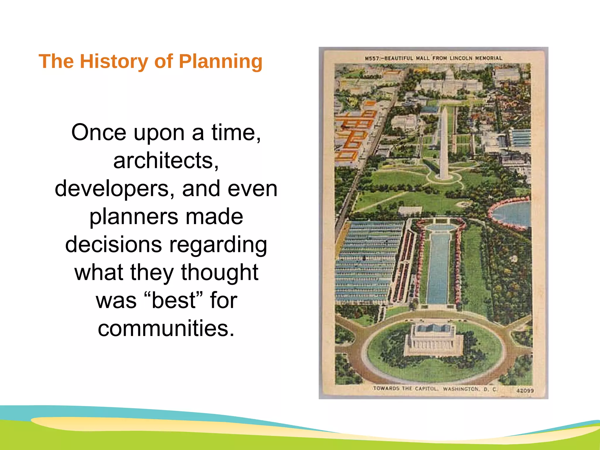
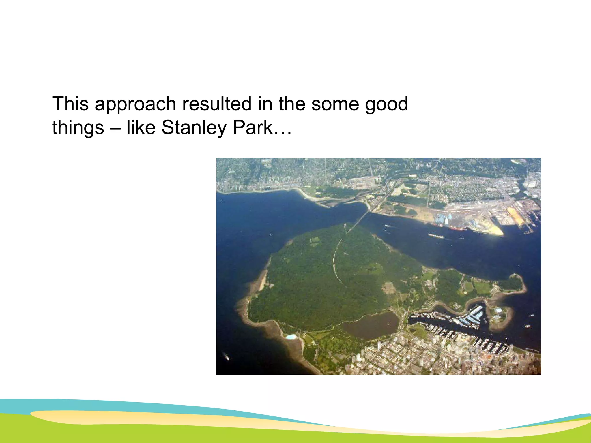
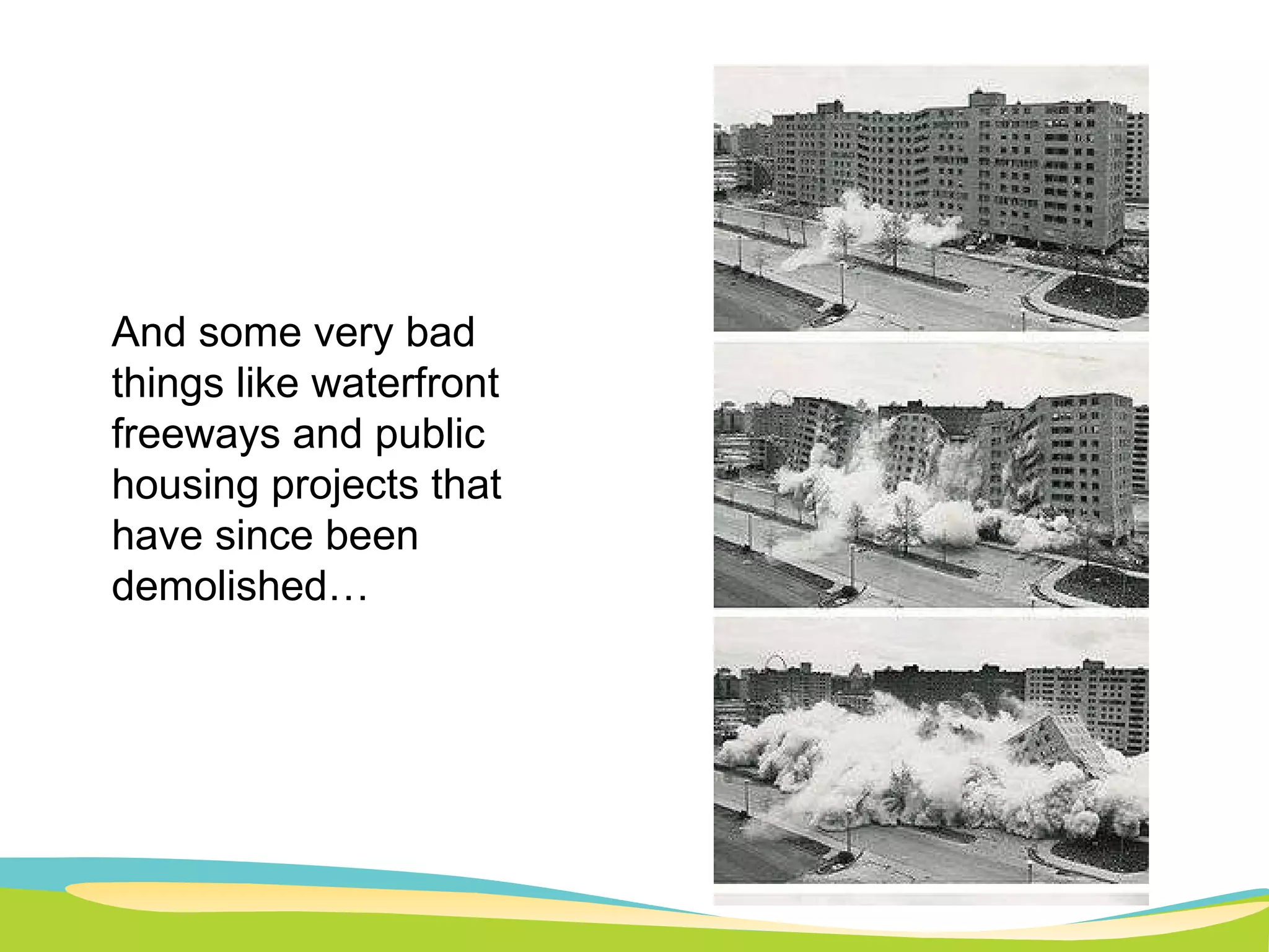
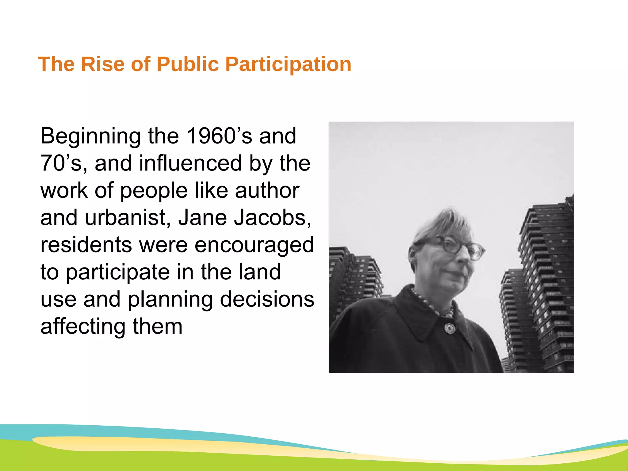
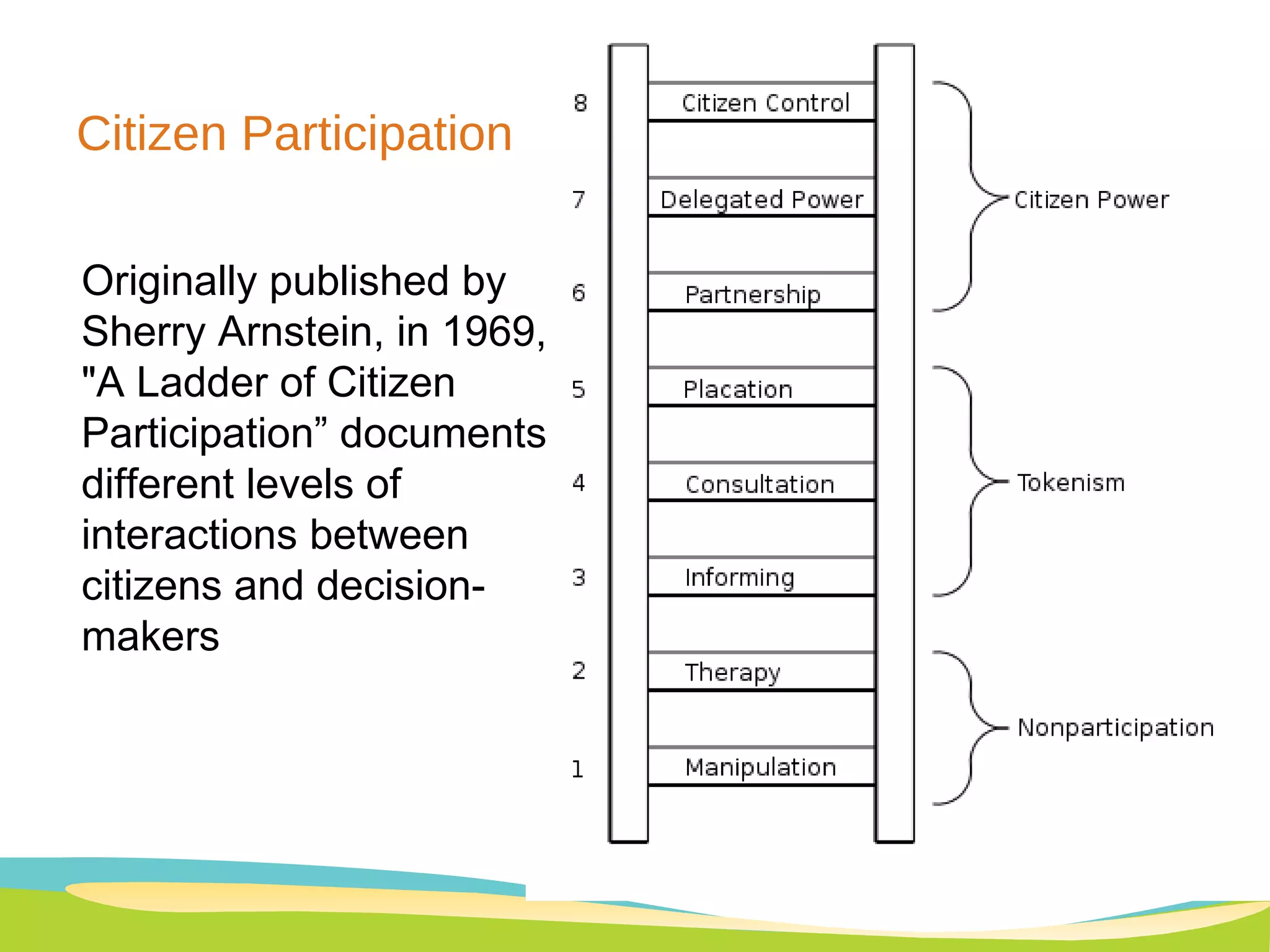
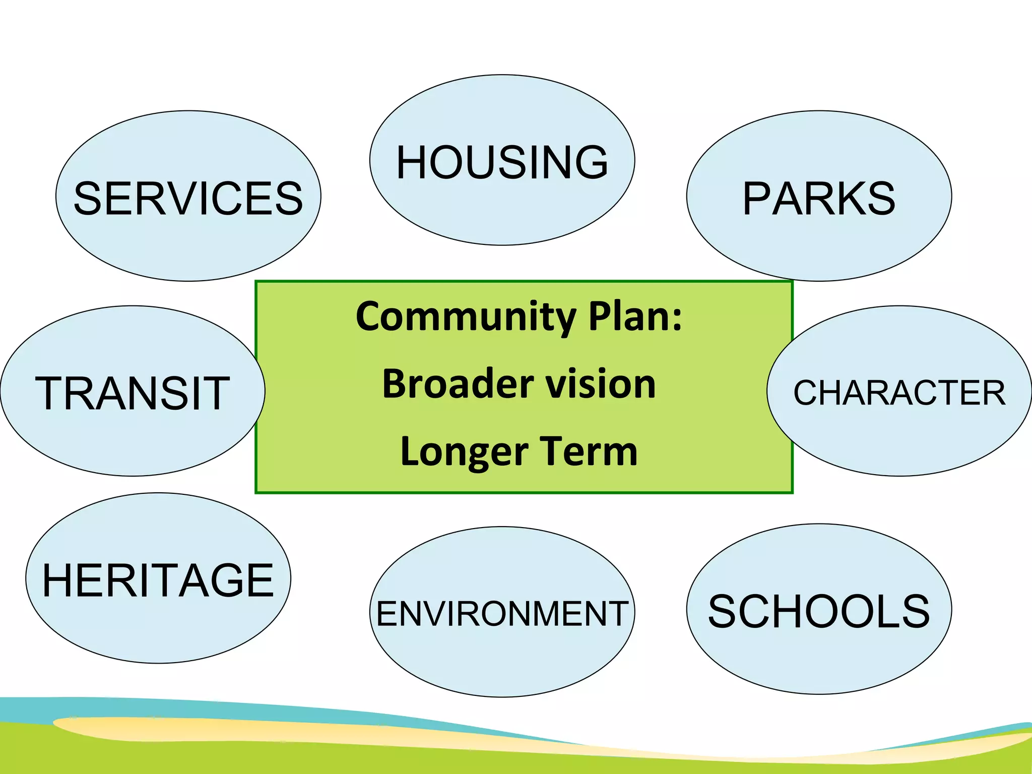
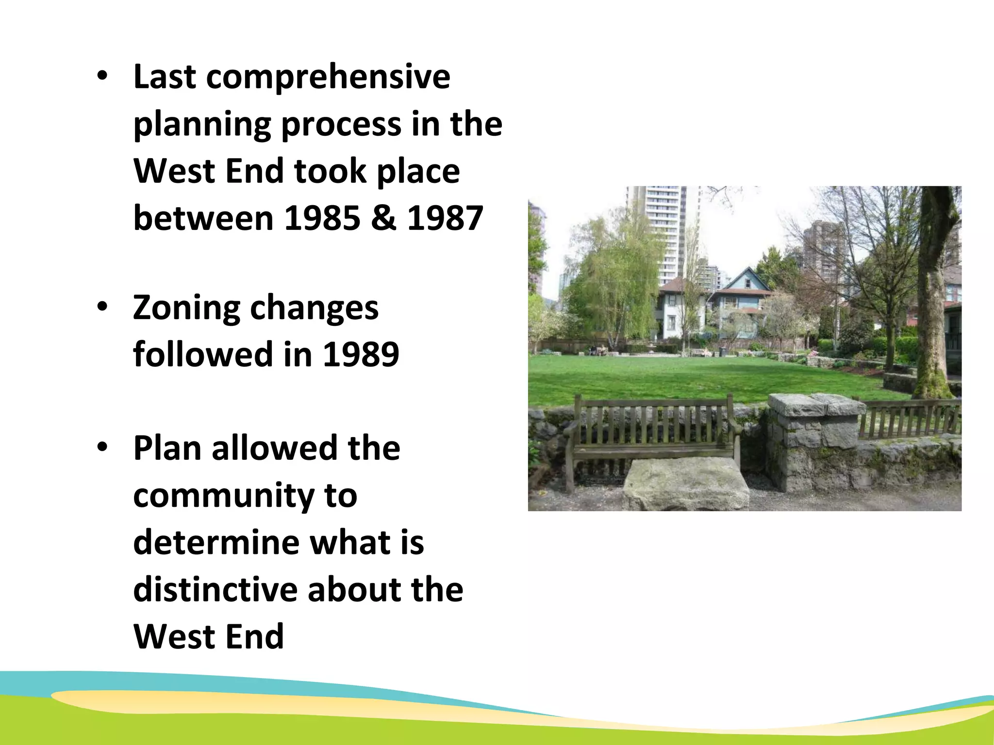
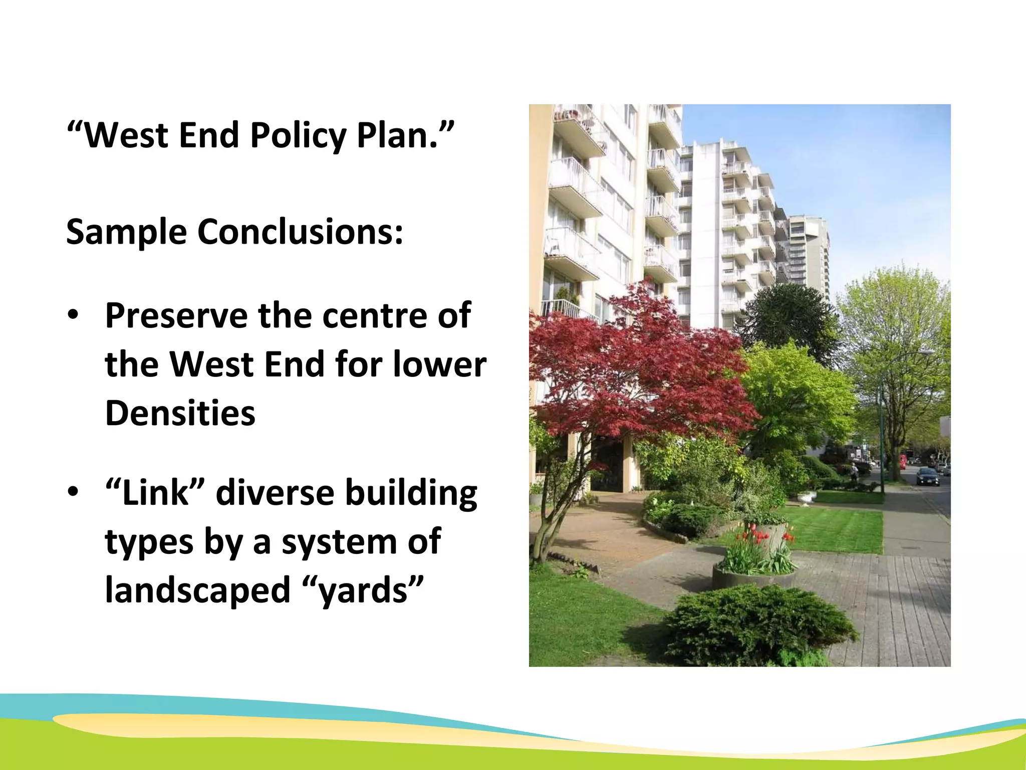
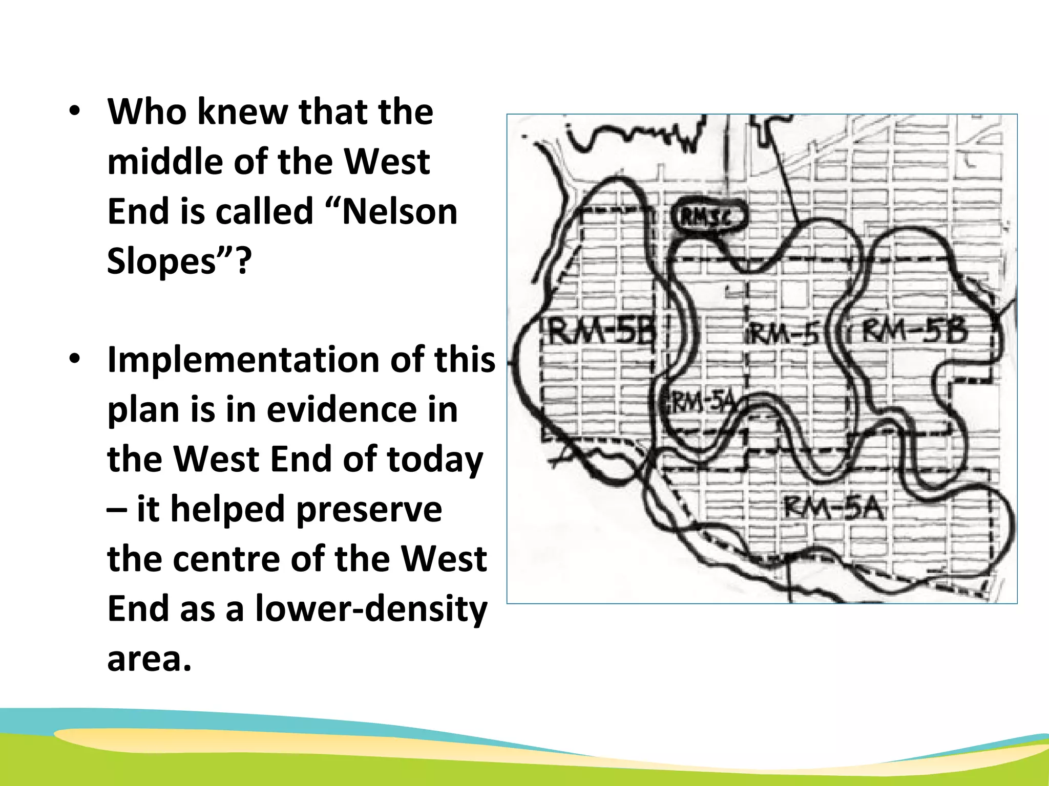
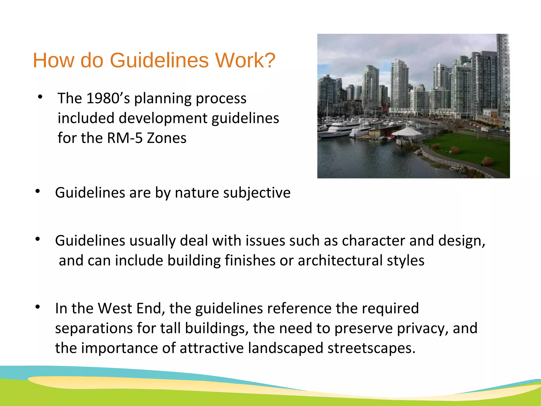
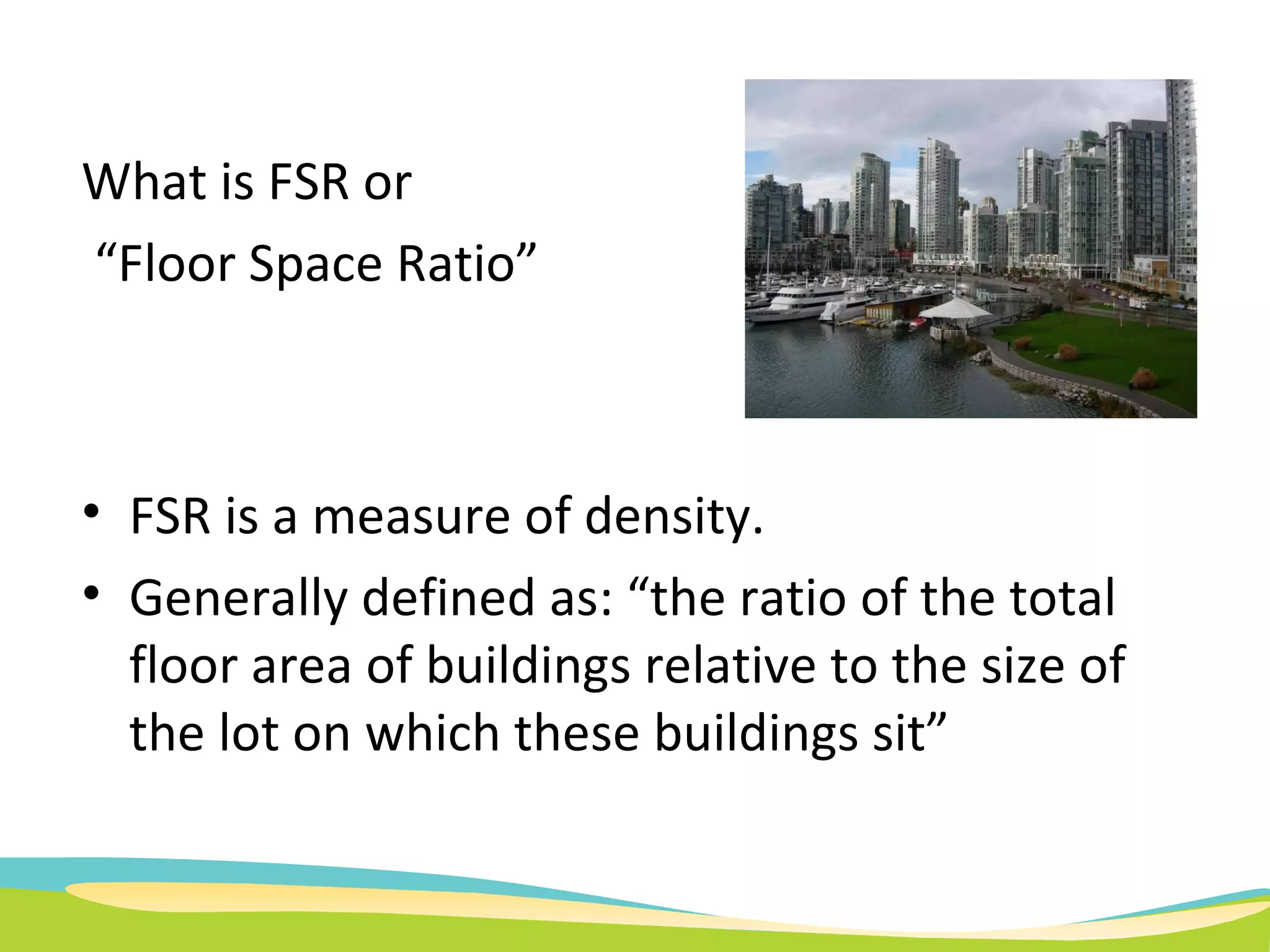
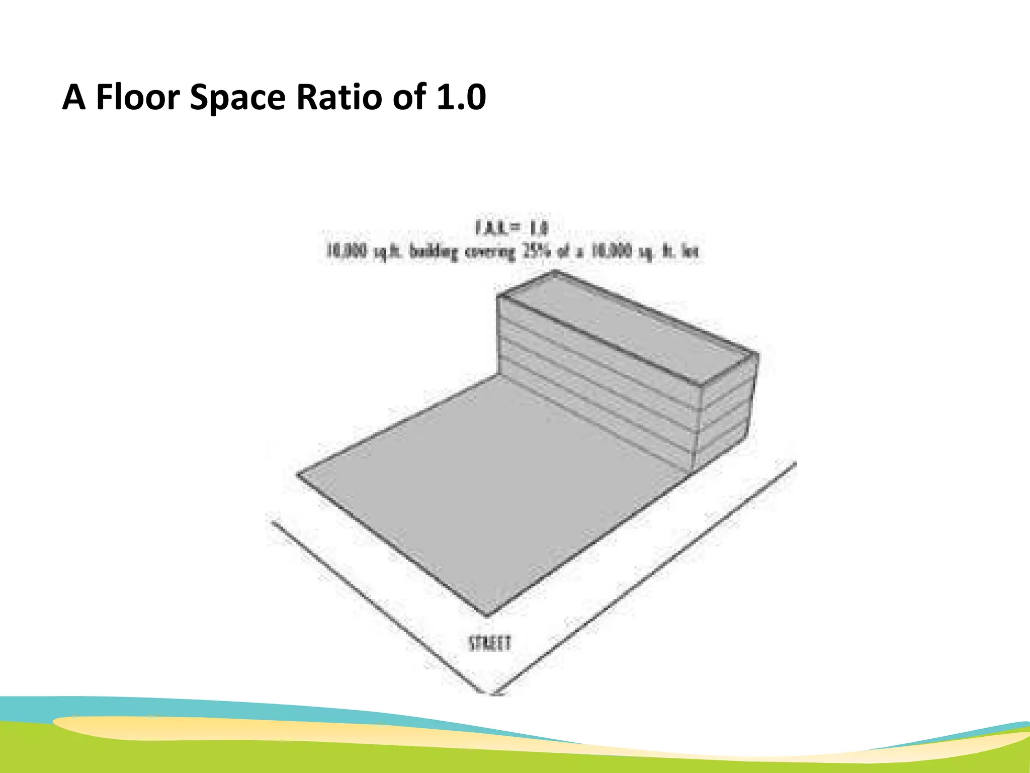
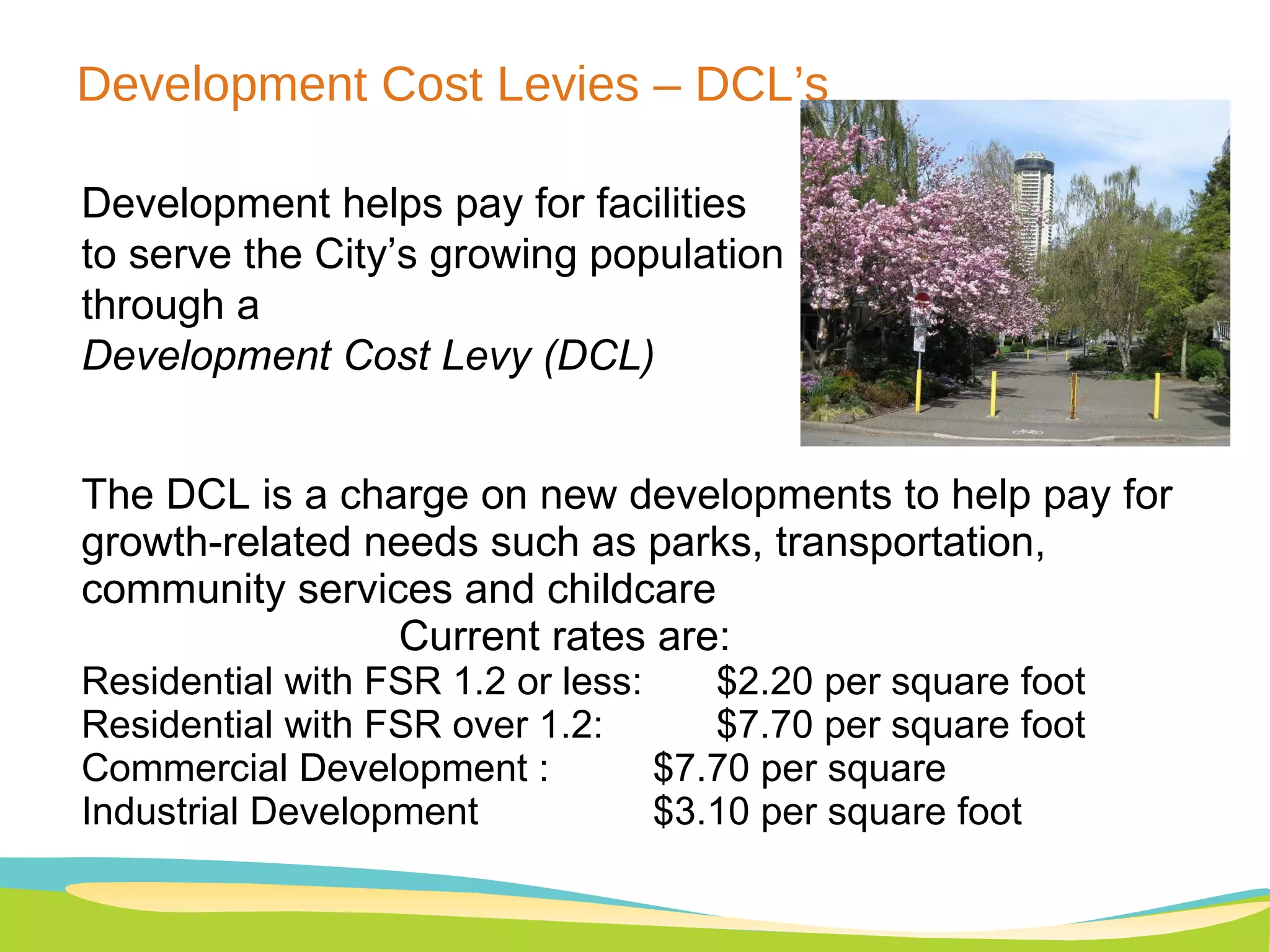
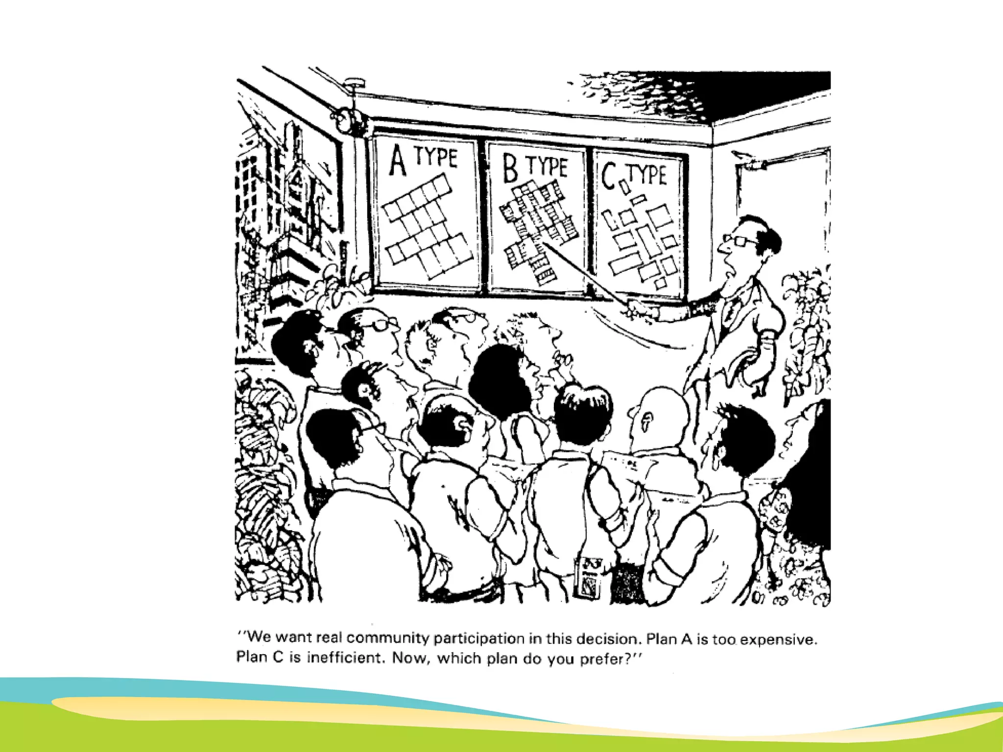
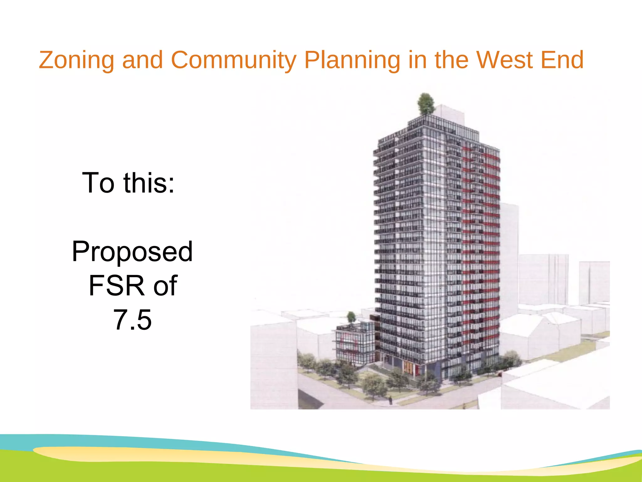
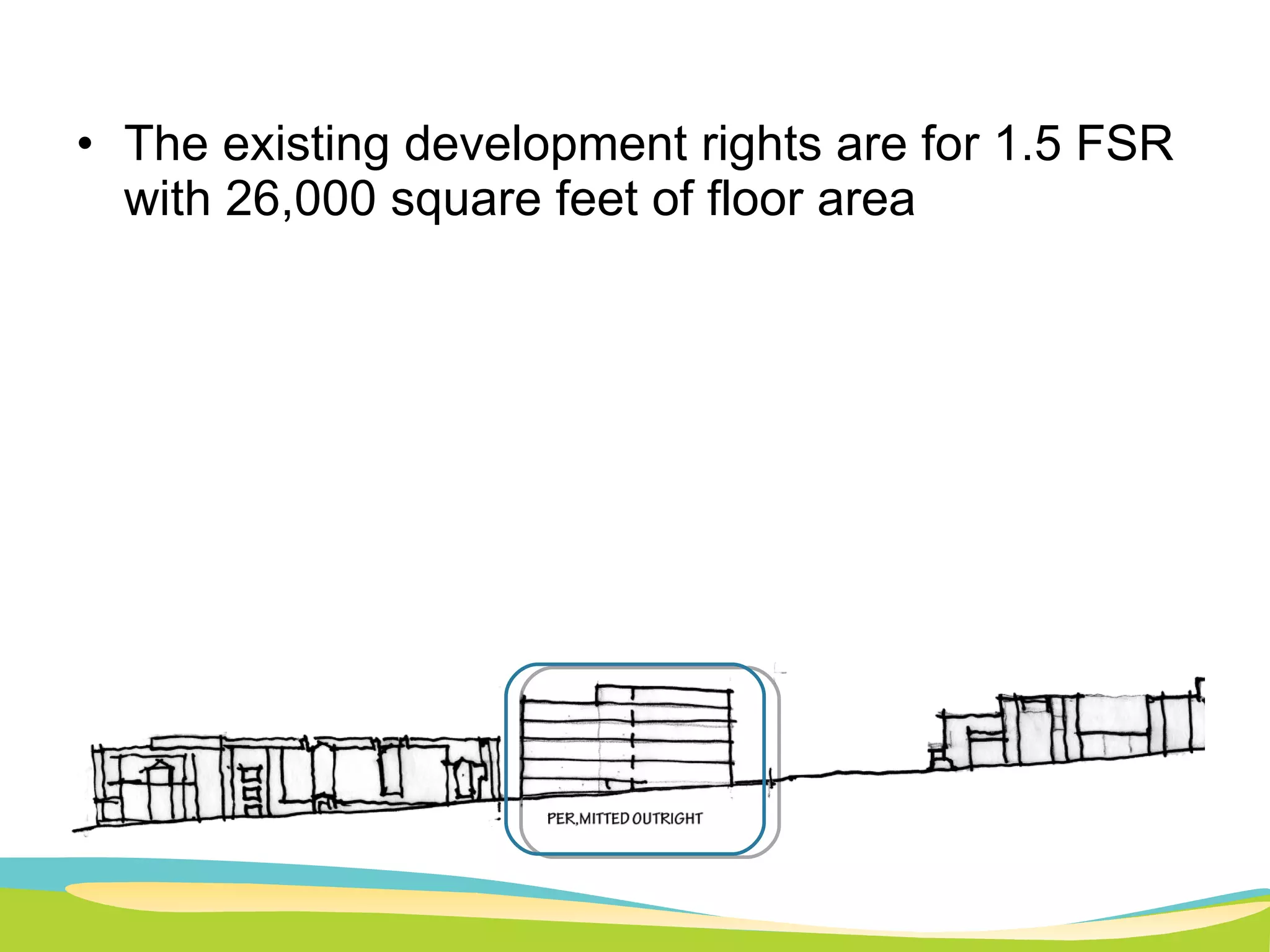
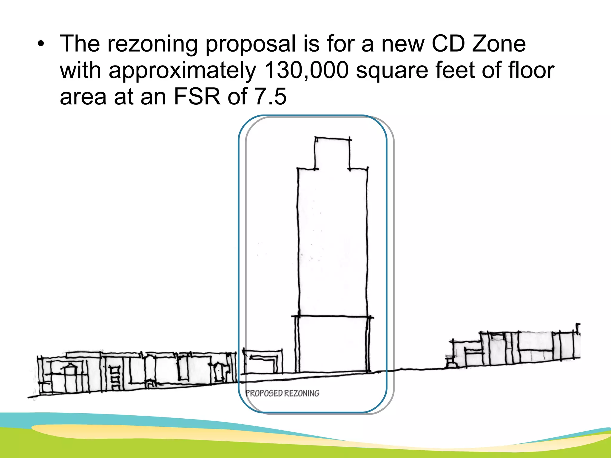
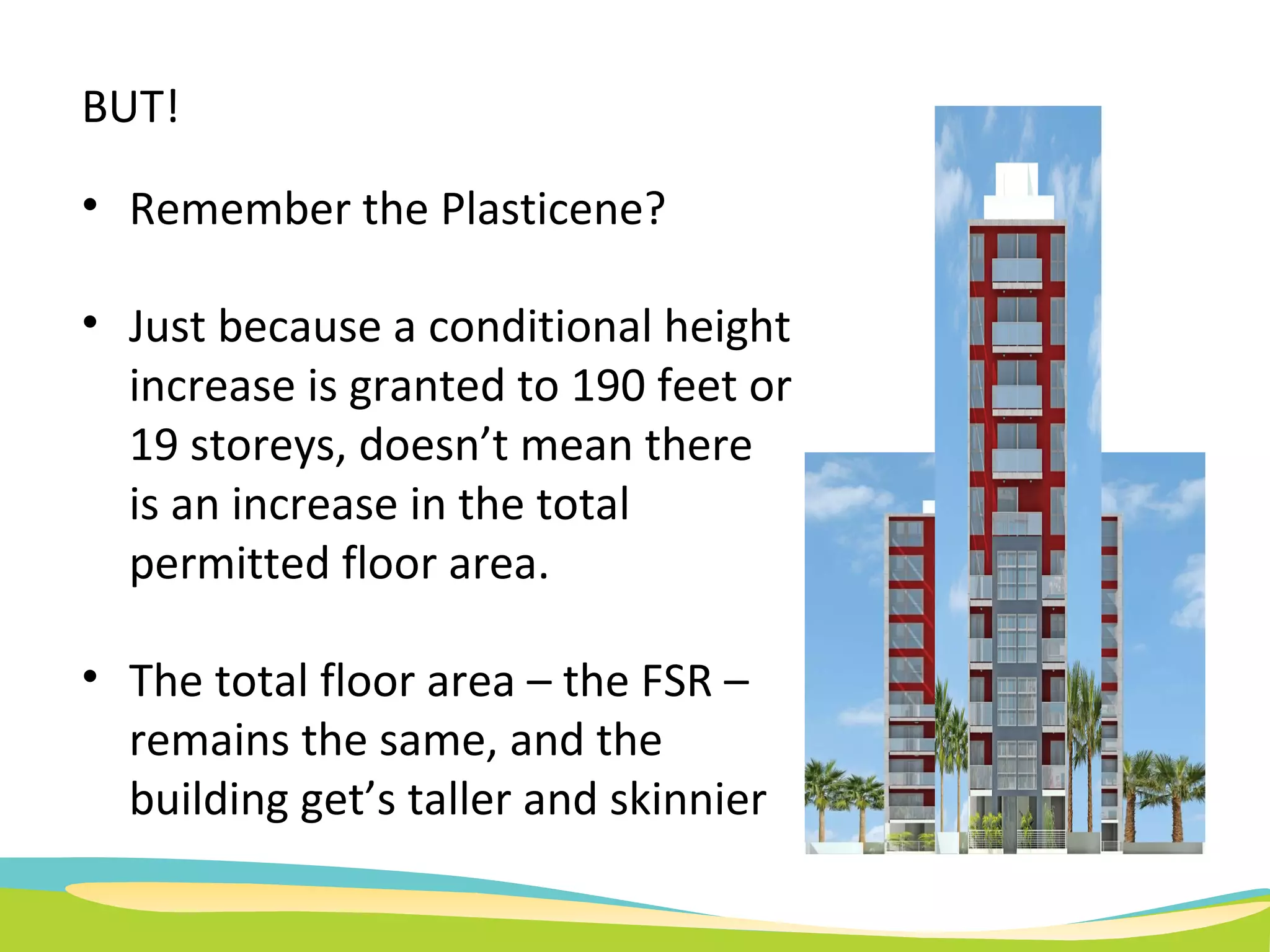
WEST END NEIGHBOURS  “Planning Cafe" An Informal Talk on Urban Planning Issues with a Special Focus on the West End   June 3, 2010
Welcome: Objectives and Topics General overview about planning, policy, zoning The purpose of zoning The current community plan framework in the West End  and the history of West End planning Consultation in the planning process What’s the Lingo?  FSR, DCL’s, CAC’s Heritage preservation tools and opportunities
What is a Planning Café? 17 th   and 18th century practice that  focused on enlightening public opinion by encouraging the exchange of news and ideas. Inspired by the “Salons” of Europe – a gathering of people held partly to amuse one another and partly to increase the knowledge of the participants.
Order of Events Brief Presentation on Planning Topics Question / Answer / Discussion to Follow For those questions I cannot answer, I will attempt to find the information and report back to the WEN Website: www.westendneighbours.ca
“ The scientific, aesthetic, and orderly disposition of land, resources, facilities and services with a view to securing the physical, economic and social efficiency, health and well-being of urban and rural communities” The Canadian Institute of Planners defines  Land Use Planning as:
The History of Planning Once upon a time, architects, developers, and even planners made decisions regarding what they thought was “best” for communities.
This approach resulted in the some good things – like Stanley Park…
And some very bad things like waterfront freeways and public housing projects that have since been demolished…
The Rise of Public Participation A typology of eight levels of participation may help in analysis of this confused issue. For illustrative purposes the eight types are arranged in a ladder pattern with each rung corresponding to the extent of citizens' power in deter-mining the end product. (See Figure 2.) Figure 2. Eight rungs on the ladder of citizen participation                                                                                                                                                                                       Beginning the 1960’s and 70’s, and influenced by the work of people like author and urbanist, Jane Jacobs, residents were encouraged to participate in the land use and planning decisions affecting them
Citizen Participation A typology of eight levels of participation may help in analysis of this confused issue. For illustrative purposes the eight types are arranged in a ladder pattern with each rung corres-ponding to the extent of citizens' power in deter-mining the end product. (See Figure 2.) Figure 2. Eight rungs on the ladder of citizen participation                                                                                                                                                                                       Originally published by Sherry Arnstein, in 1969,  "A Ladder of Citizen Participation” documents different levels of interactions between citizens and decision-makers
Land Use Regulation  Typical Land Use Regulation includes a community plan and a zoning schedule Community Plans outline the longer term future of the community Zoning provides the “rules” for the use of a specific property
Community Plan:  Broader vision  Longer Term  TRANSIT HOUSING SERVICES PARKS SCHOOLS HERITAGE ENVIRONMENT CHARACTER
Last comprehensive planning process in the West End took place between 1985 & 1987  Zoning changes followed in 1989 Plan allowed the community to determine what is distinctive about the West End
“ West End Policy Plan.” Sample Conclusions: Preserve the centre of the West End for lower Densities “ Link” diverse building types by a system of landscaped “yards”
Who knew that the middle of the West End is called “Nelson Slopes”? Implementation of this plan is in evidence in the West End of today – it helped preserve the centre of the West End as a lower-density area.
What is the Purpose of Zoning?  Zoning may regulate density, building height, lot coverage, and similar characteristics, or some combination of these  Zoning typically does NOT regulate tenure Zoning is used by local governments to define permitted uses of land based on the idea of separating different types of land uses
The 1987 Plan included the adoption of a new zoning schedule for the West End
Zoning in the West End
Our Challenge:   There is no current “Framework” to consider changes to zoning in the West End Response? The City can “update” or “refresh” the planning policy for the West End to provide an “interim solution” Would need to include consultation with the community to establish what is still valued, and what needs have changed.
Guidelines are by nature subjective Guidelines usually deal with issues such as character and design,  and can include building finishes or architectural styles In the West End, the guidelines reference the required separations for tall buildings, the need to preserve privacy, and the importance of attractive landscaped streetscapes. The 1980’s planning process included development guidelines for the RM-5 Zones How do Guidelines Work?
FSR is a measure of density. Generally defined as: “ the ratio of the total floor area of buildings relative to the size of the lot on which these buildings sit” What is FSR or  “ Floor Space Ratio”
A Floor Space Ratio of 1.0
Development Cost Levies – DCL’s Development helps pay for facilities to serve the City’s growing population through a  Development Cost Levy (DCL) The DCL is a charge on new developments to help pay for growth-related needs such as parks, transportation, community services and childcare Current rates are:  Residential with FSR 1.2 or less:  $2.20 per square foot Residential with FSR over 1.2:  $7.70 per square foot  Commercial Development :  $7.70 per square Industrial Development  $3.10 per square foot
Community Amenity Contributions – CAC’s Community Amenity Contribution (CAC):  A monetary or in-kind charge on additional density which has been approved by City Council through a rezoning CAC’s can be used to secure a wider variety of amenities than DCLs.  The CAC is $3 per square foot (on additional density) for “standard” rezonings  “ Non-standard” rezonings (i.e., sites Downtown or large sites) have a negotiated CAC – typically based 75% of the “land lift” arising from the rezoning.
Heritage Preservation in Vancouver Vancouver’s Heritage Register was adopted in 1986 Includes  buildings, landscapes, monuments and archaeological sites that have heritage significance A site does not have to be designated to be included on the Register.  Approximately 2,400 resources listed on the Register ranging from cottages, to trees, to mansions, to commercial buildings. About 500 of these sites are Heritage designated
 
Heritage Preservation in Vancouver Heritage designation: a legal means of heritage protection. Allows the City to regulate, by By-law, the demolition, relocation and alteration of heritage property.  Simply being listed on the Register does not. One of the tools to encourage heritage designation is the granting of additional development rights or project flexibility as part of a development proposal. in exchange for through a guarantee of designation and therefore preservation of the resource.
The Role of the Public What can each of us do? Think about what we enjoy, value, and need in our community Communicate these ideas to our decision-makers Assist in developing solutions that will address needs in the community while still protecting  livability  VOTE!
 
Questions/Answers/Discussion
WEST END NEIGHBOURS  “Planning Cafe" An Informal Talk on Urban Planning Issues with a Special Focus on the West End   June 3, 2010
Case Study: STIR Rezoning Proposal at    1401 Comox Street Changing this:  Existing permitted FSR of 1.5
Zoning and Community Planning in the West End To this:  Proposed FSR of 7.5
The existing development rights are for 1.5 FSR with 26,000 square feet of floor area
The rezoning proposal is for a new CD Zone with approximately 130,000 square feet of floor area at an FSR of 7.5
Is this the future view from the Broughton Street sidewalk? Or is it something else?
BUT! Remember the Plasticene? Just because a conditional height increase is granted to 190 feet or 19 storeys, doesn’t mean there is an increase in the total permitted floor area.  The total floor area – the FSR – remains the same, and the building get’s taller and skinnier

Online course on planning issues, wen, july 2010

  • 1.
    WEST END NEIGHBOURS “Planning Cafe" An Informal Talk on Urban Planning Issues with a Special Focus on the West End   June 3, 2010
  • 2.
    Welcome: Objectives andTopics General overview about planning, policy, zoning The purpose of zoning The current community plan framework in the West End and the history of West End planning Consultation in the planning process What’s the Lingo? FSR, DCL’s, CAC’s Heritage preservation tools and opportunities
  • 3.
    What is aPlanning Café? 17 th and 18th century practice that focused on enlightening public opinion by encouraging the exchange of news and ideas. Inspired by the “Salons” of Europe – a gathering of people held partly to amuse one another and partly to increase the knowledge of the participants.
  • 4.
    Order of EventsBrief Presentation on Planning Topics Question / Answer / Discussion to Follow For those questions I cannot answer, I will attempt to find the information and report back to the WEN Website: www.westendneighbours.ca
  • 5.
    “ The scientific,aesthetic, and orderly disposition of land, resources, facilities and services with a view to securing the physical, economic and social efficiency, health and well-being of urban and rural communities” The Canadian Institute of Planners defines Land Use Planning as:
  • 6.
    The History ofPlanning Once upon a time, architects, developers, and even planners made decisions regarding what they thought was “best” for communities.
  • 7.
    This approach resultedin the some good things – like Stanley Park…
  • 8.
    And some verybad things like waterfront freeways and public housing projects that have since been demolished…
  • 9.
    The Rise ofPublic Participation A typology of eight levels of participation may help in analysis of this confused issue. For illustrative purposes the eight types are arranged in a ladder pattern with each rung corresponding to the extent of citizens' power in deter-mining the end product. (See Figure 2.) Figure 2. Eight rungs on the ladder of citizen participation                                                                                                                                                                                       Beginning the 1960’s and 70’s, and influenced by the work of people like author and urbanist, Jane Jacobs, residents were encouraged to participate in the land use and planning decisions affecting them
  • 10.
    Citizen Participation Atypology of eight levels of participation may help in analysis of this confused issue. For illustrative purposes the eight types are arranged in a ladder pattern with each rung corres-ponding to the extent of citizens' power in deter-mining the end product. (See Figure 2.) Figure 2. Eight rungs on the ladder of citizen participation                                                                                                                                                                                       Originally published by Sherry Arnstein, in 1969, "A Ladder of Citizen Participation” documents different levels of interactions between citizens and decision-makers
  • 11.
    Land Use Regulation Typical Land Use Regulation includes a community plan and a zoning schedule Community Plans outline the longer term future of the community Zoning provides the “rules” for the use of a specific property
  • 12.
    Community Plan: Broader vision Longer Term TRANSIT HOUSING SERVICES PARKS SCHOOLS HERITAGE ENVIRONMENT CHARACTER
  • 13.
    Last comprehensive planningprocess in the West End took place between 1985 & 1987 Zoning changes followed in 1989 Plan allowed the community to determine what is distinctive about the West End
  • 14.
    “ West EndPolicy Plan.” Sample Conclusions: Preserve the centre of the West End for lower Densities “ Link” diverse building types by a system of landscaped “yards”
  • 15.
    Who knew thatthe middle of the West End is called “Nelson Slopes”? Implementation of this plan is in evidence in the West End of today – it helped preserve the centre of the West End as a lower-density area.
  • 16.
    What is thePurpose of Zoning? Zoning may regulate density, building height, lot coverage, and similar characteristics, or some combination of these Zoning typically does NOT regulate tenure Zoning is used by local governments to define permitted uses of land based on the idea of separating different types of land uses
  • 17.
    The 1987 Planincluded the adoption of a new zoning schedule for the West End
  • 18.
    Zoning in theWest End
  • 19.
    Our Challenge: There is no current “Framework” to consider changes to zoning in the West End Response? The City can “update” or “refresh” the planning policy for the West End to provide an “interim solution” Would need to include consultation with the community to establish what is still valued, and what needs have changed.
  • 20.
    Guidelines are bynature subjective Guidelines usually deal with issues such as character and design, and can include building finishes or architectural styles In the West End, the guidelines reference the required separations for tall buildings, the need to preserve privacy, and the importance of attractive landscaped streetscapes. The 1980’s planning process included development guidelines for the RM-5 Zones How do Guidelines Work?
  • 21.
    FSR is ameasure of density. Generally defined as: “ the ratio of the total floor area of buildings relative to the size of the lot on which these buildings sit” What is FSR or “ Floor Space Ratio”
  • 22.
    A Floor SpaceRatio of 1.0
  • 23.
    Development Cost Levies– DCL’s Development helps pay for facilities to serve the City’s growing population through a Development Cost Levy (DCL) The DCL is a charge on new developments to help pay for growth-related needs such as parks, transportation, community services and childcare Current rates are: Residential with FSR 1.2 or less: $2.20 per square foot Residential with FSR over 1.2: $7.70 per square foot Commercial Development : $7.70 per square Industrial Development $3.10 per square foot
  • 24.
    Community Amenity Contributions– CAC’s Community Amenity Contribution (CAC): A monetary or in-kind charge on additional density which has been approved by City Council through a rezoning CAC’s can be used to secure a wider variety of amenities than DCLs. The CAC is $3 per square foot (on additional density) for “standard” rezonings “ Non-standard” rezonings (i.e., sites Downtown or large sites) have a negotiated CAC – typically based 75% of the “land lift” arising from the rezoning.
  • 25.
    Heritage Preservation inVancouver Vancouver’s Heritage Register was adopted in 1986 Includes buildings, landscapes, monuments and archaeological sites that have heritage significance A site does not have to be designated to be included on the Register. Approximately 2,400 resources listed on the Register ranging from cottages, to trees, to mansions, to commercial buildings. About 500 of these sites are Heritage designated
  • 26.
  • 27.
    Heritage Preservation inVancouver Heritage designation: a legal means of heritage protection. Allows the City to regulate, by By-law, the demolition, relocation and alteration of heritage property. Simply being listed on the Register does not. One of the tools to encourage heritage designation is the granting of additional development rights or project flexibility as part of a development proposal. in exchange for through a guarantee of designation and therefore preservation of the resource.
  • 28.
    The Role ofthe Public What can each of us do? Think about what we enjoy, value, and need in our community Communicate these ideas to our decision-makers Assist in developing solutions that will address needs in the community while still protecting livability VOTE!
  • 29.
  • 30.
  • 31.
    WEST END NEIGHBOURS “Planning Cafe" An Informal Talk on Urban Planning Issues with a Special Focus on the West End   June 3, 2010
  • 32.
    Case Study: STIRRezoning Proposal at 1401 Comox Street Changing this: Existing permitted FSR of 1.5
  • 33.
    Zoning and CommunityPlanning in the West End To this: Proposed FSR of 7.5
  • 34.
    The existing developmentrights are for 1.5 FSR with 26,000 square feet of floor area
  • 35.
    The rezoning proposalis for a new CD Zone with approximately 130,000 square feet of floor area at an FSR of 7.5
  • 36.
    Is this thefuture view from the Broughton Street sidewalk? Or is it something else?
  • 37.
    BUT! Remember thePlasticene? Just because a conditional height increase is granted to 190 feet or 19 storeys, doesn’t mean there is an increase in the total permitted floor area. The total floor area – the FSR – remains the same, and the building get’s taller and skinnier