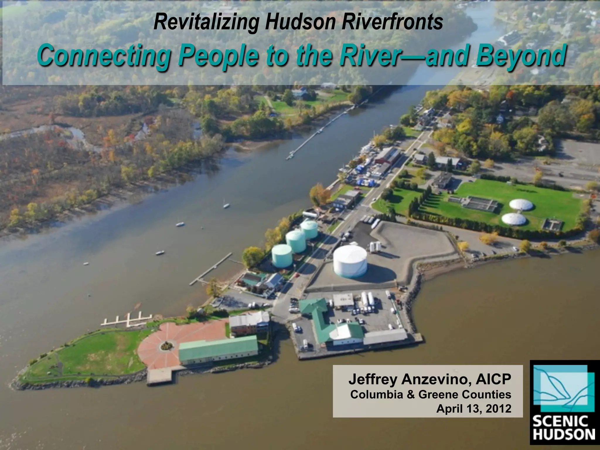
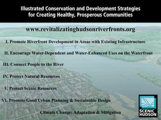
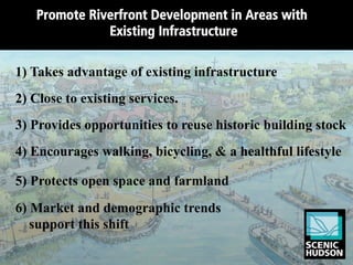
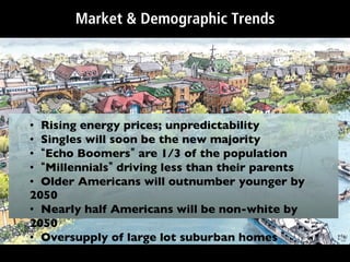
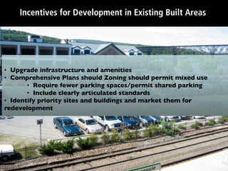
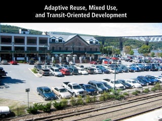
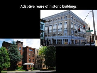
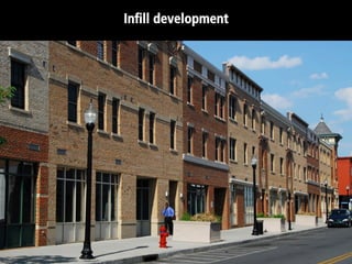
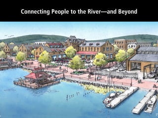
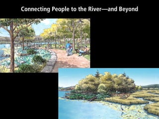
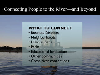
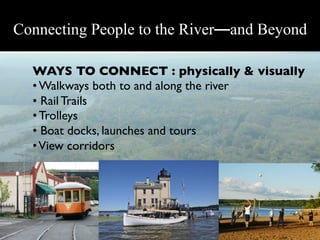
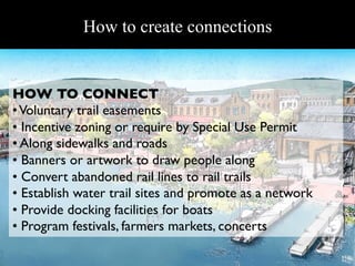
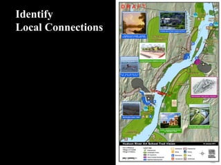
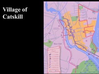
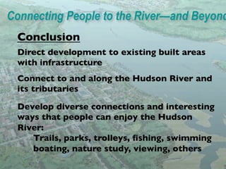
"Connecting People to the River" presentation by Jeff Anzevino, AICP, Scenic Hudson, delivered at the 4/13/12 Columbia-Greene Revitalizing Hudson Riverfronts Forum
The document discusses land tenure and community development in Thailand. It addresses questions about how to engage temple land for community development, balance living heritage and tourism, and how the Crown Property Bureau can learn from demand-led processes. It also discusses issues of increasing lease lengths, upgrading housing without addressing land tenure, and reaching diverse socio-economic groups. Ways forward include connecting fragmented communities and visions of culture through spatial, institutional and social connections.
The Missoula County Trails Bond Program allocated $3 million to provide additional recreation opportunities and connect communities through trails. The bond funding leverages other funding sources to maximize benefits like health, conservation, transportation, and tourism. Projects are evaluated based on access, support, design, opportunity, and ability to be maintained. A multi-step application process involves review by parks and trails boards and commissioners hearing before projects are implemented.
The Brush Creek Overview is an uncommon collaboration of organizations dedicated to redeveloping the Brush Creek Corridor in Kansas City as a desirable place to live, work and play. It provides coordinated leadership and plans programs agreed upon by its diverse members to benefit the community. Major projects include developing healthy neighborhoods, connecting residents to the internet, and revitalizing neighborhoods through a tennis complex and other public investments. Successes include creating a community vision plan and securing funding for flood control and beautification projects.
Strategies and Guidelines for Waterfront DevelopmentsHazreena Hussein
This document outlines strategies and guidelines for waterfront developments. It discusses the background of urban waterfront redevelopments in the 1980s. The research objectives are to produce general strategies and design guidelines for waterfront areas. Some strategic guidelines include ensuring accessibility to the waterfront, maintaining a consistent physical form, enhancing the river as a historical element, and providing recreational river spaces. The document also lists various general urban design guidelines related to topics like site planning, infrastructure, preservation, and development management.
Nj future redevelopment forum 2014 plenary baudouinNew Jersey Future
This document summarizes the transformation of downtown Providence, Rhode Island over the past 20 years through six major redevelopment projects: rail relocation, river relocation, downtown revitalization, the Providence Downtown Improvement District, downtown parks, and I-195 relocation. It notes that these projects have led to over $2 billion in private investment, 1,400 new housing units, and 38,980 jobs in downtown Providence. Key factors in its success have included developing a bold long-term vision, gaining consensus among stakeholders, strong leadership, cooperation across different levels of government and the private sector, and celebrating incremental successes.
A green community is an intentional approach to growth that protects natural water drainage and streams. There are seven principles of a green community: 1) water management by retaining stormwater on site and allowing it to permeate naturally, 2) green infrastructure like trees and wetlands to manage water, 3) maintaining natural landscapes, 4) appropriate transportation networks with multiple routes to reduce congestion, 5) livable communities with mixed residential and commercial areas and public spaces, 6) protecting community character through design guidelines, and 7) supporting the local economy through education and workforce development.
The Jamaica Bay Greenway is a proposed 19-mile loop route for biking and walking around Jamaica Bay in New York City. It would connect over 10,000 acres of federal, state, and city parkland, and be within a half mile of around 300,000 residents. Completing the Greenway requires community engagement, identifying a preferred route, and building short-term projects. Stakeholder groups that need involvement include community organizations, civic associations, and local residents.
The neighborhood is defined as a combination of two or more mohallas according to the National Reference Manual. It can also be defined as the smallest unit which serves the local community and encourages neighborhood spirit. Characteristics of a neighborhood include a secondary school, mosque, and population of around 25,000 people. Neighborhood planning was conceived as a means to insulate communities from increasing traffic and gives residents power to develop a shared vision and shape local development. Elements of neighborhood planning include facilities, sector size, street systems, boundaries, and layout of buildings. The goals are to foster socialization, support a safe environment, provide safety and share public amenities.
Clean Rivers, Clean Lake 8 -- Leveraging Resources -- Robert MonnatSweet Water
The document discusses leveraging water and open space resources to create more livable cities. It notes that water is highly valuable real estate that can attract residents and development if integrated well into the urban design. However, modern cities often lack ecological and biophilic design, disconnecting urban planning from natural resources. The document calls for viewing management and using waterfronts to increase property values and quality of life through recreation and views of open spaces.
Clarence Perry defined the neighborhood unit as having a population of 5,000-6,000 people within a 160 acre area. The neighborhood unit centers around an elementary school located within a half mile walking distance of all homes. It also includes small shopping centers, parks, and community facilities clustered near the school. Perry's conceptualization of the neighborhood unit aimed to make key services and amenities accessible by foot to residents. Later authors refined the neighborhood unit model by suggesting smaller walking distances and connecting multiple units around shared high schools and commercial centers.
Project posters describing some of the projects completed under the MAPC's Sustainable Communities Regional Planning Grant. The posters were displayed at the final meeting of the Sustainable Communities Consortium on May 21, 2014, Boston, Massachusetts.
This document outlines Ramin Seifi's presentation on sustainability initiatives in the Township of Langley, British Columbia. It discusses the township's history and growth, policy framework to guide development, and focus on smart growth principles like compact neighborhoods, mixed uses, and diverse housing and transportation options. The township aims to build a legacy for future generations through socially, culturally, economically and environmentally balanced development.
This document discusses settlements in geography. It defines a settlement as a place where people live and interact through activities like agriculture, trading, and entertainment. Settlements help understand the relationship between humans and their environment. Factors that influence settlement locations include resources, soils, shelter from the elements, and defense from enemies. The document then discusses different types of settlement patterns like nucleated, dispersed, and linear, as well as hierarchies of urban settlements from world metropolises to smaller cities. It also discusses problems associated with rapid urbanization in developing countries.
The document proposes creating an urban green trail in Kingston, New York to promote sustainability and community development. It identifies partner organizations and outlines several projects along the proposed trail, including restoring the historic Kirkland Hotel with green features, creating a green roof garden and solar installation, and connecting local people with local food through a farmers market. The green trail aims to reduce Kingston's carbon footprint through strategic partnerships and replicable models that energize the community and focus on green building renovations.
The document proposes a "slum networking" approach to infrastructure development in Kibera, Kenya's largest informal settlement. It involves integrating basic services like water, sewer, drainage and roads by following natural topographical features and drainage paths. This would exploit nature's gradient routes and link slums. The proposal identifies Ngong River, drainage networks and transportation routes in Kibera and divides the area into sectors for phased development, starting with clearing drainage channels, introducing parks and roads, and eventually replacing slum housing with higher density, mixed-use buildings to improve living conditions. Lessons from a similar project in India suggest participatory planning and leveraging natural resources are effective for upgrading slums.
Online course on planning issues, wen, july 2010 WestEnd Prepare
The document summarizes an information session on urban planning issues for the West End neighborhood of Vancouver. It discusses the history of planning in the area, including a shift toward more citizen participation starting in the 1960s-1970s. It also covers current planning frameworks like community plans and zoning, tools used in planning like floor space ratios and development cost levies, and heritage preservation. The session provided information on these topics and took questions from attendees.
This document discusses the STIR program in Vancouver and its impact on neighbourhoods. It provides opinions from residents who feel the STIR program was implemented without proper consultation and is allowing excessive increases in density and building heights. It summarizes findings from city studies that showed residents' top priorities were neighbourhood character, parks/green space, and housing affordability. The document expresses concerns that increased development is putting pressure on local infrastructure like schools and libraries without providing affordable housing options. It advocates for a comprehensive community plan to guide development instead of site-by-site rezoning.
This document discusses different types of rural and urban settlements and settlement patterns. It defines a settlement as a place where people live and work. Settlements are classified as rural or urban based on population size, main functions, available amenities, and way of life. Rural settlements typically have smaller populations and are involved in activities like farming, mining and fishing. Urban settlements have larger populations and focus on manufacturing and business. Common settlement patterns include dispersed, linear and nucleated. Examples of each type are described along with reasons for their development based on geography, transportation and sharing of resources.
This document summarizes Ronald Lee Fleming's views on placemaking and infrastructure projects. It advocates that 1) new infrastructure should strengthen communities rather than divide them, 2) artists should be involved in the planning process to craft narratives about place, and 3) a modest budget for public art can build community value and support for projects. The document provides examples of projects the Townscape Institute has worked on that transformed communities through enhancing streetscapes, parks, and public spaces. It recommends that future development should preserve and enhance the distinctive character of places.
The document outlines 9 guiding land use principles for the Maui Island Plan:
1) Respect island culture and traditions while ensuring access to resources and protecting culturally significant sites.
2) Promote sustainable planning and livable communities by focusing growth in existing areas, mixed-use development, and protecting resources.
3) Protect traditional small towns through compatible development and greenbelts.
4) Preserve agricultural lands and open space through innovative design and a vibrant agricultural economy.
5) Guide growth away from environmentally sensitive lands to protect habitat, watersheds, and shorelines.
The Lafitte Corridor Revitalization ProjectBart Everson
The Lafitte Corridor Revitalization Project aims to convert an abandoned rail corridor into a continuous greenway and spur economic development. It will connect neighborhoods in New Orleans through a multi-use trail and leverages public investment to stimulate private reinvestment. Funding has been secured from various sources to support trail planning, design, and implementation. Community organizations are advocating for the greenway's completion to improve transportation access, public health, and redevelopment in the area.
The document outlines a strategic development and action plan for Central Falls, Rhode Island. It describes Central Falls as a walkable city with a variety of parks and community events. It aims to improve education and career opportunities for residents, develop the local food economy, and implement catalyst projects focused on transit, housing, arts and green space to make Central Falls a regional destination. The action plan prioritizes immediate actions around asset mapping and partnerships, medium-range plans for workforce development and infrastructure, and long-range goals to establish Central Falls through connected neighborhoods and mobility networks.
This document summarizes concerns about the demolition of historic buildings in San Diego to make way for parking lots. It notes that the historic review board decision was reversed, community advisory committees were not consulted, proper notice was not given, and community plans calling for adaptive reuse and fine-grained development were ignored. Destroying buildings eliminates opportunities and creates parking lots that disrupt the urban fabric for years. It asks people to sign a petition to deliver to the mayor calling for an emergency ordinance or directive to staff to prevent further demolitions.
From Rebuilding to Resilience: Observations from New Orleansjuliekannai
by Nathan Lott, Water Collaborative of Greater New Orleans
This talk covers strategies tried in New Orleans after Katrina, both successful and not, and provides lessons learned.
The document summarizes the definition, types, importance, weaknesses, and process of developing a successful waterfront vision. It discusses mixed-use, recreational, residential, and working waterfronts. Examples provided include the waterfronts of Kuantan, Singapore, and Dubai. The Singapore waterfront follows a "Necklace Concept" while Dubai focuses on leisure and high-end residential areas around the waterfront.
Human settlements began when early humans started settling down in one place to grow food after discovering that seeds they dropped would grow into plants. They chose sites that provided key resources like good farmland, fresh water, building materials, fuel sources, shelter, and protection. Over many years, more people settled in these areas and some settlements grew larger and larger, developing into villages, towns, and eventually cities as populations increased and more services were needed. Early settlers prioritized defense, farmland, water supply, building materials, and shelter when choosing where to establish permanent settlements.
Mohawk Towpath Byway, Scenic Conservation Action Plan, Section 3 - Prioritization of Scenic Issues. Also includes an introductory paragraph to the Tool Box in Section 4.
This document summarizes the West Houston Trails Master Plan presented at the 2012 Texas Trails & Active Transportation Conference in San Antonio. The plan was developed through community involvement to create over 100 miles of interconnected trails. It provides the timeline of the plan from 2007-2011. Citizen surveys showed most want to use the trails for exercise and recreation. The plan identifies existing and proposed trails, including along drainage corridors, and how they will provide transportation and recreation benefits to the community.
This document outlines a community vision and master plan for relocating the Fort Pierce Waste Water Treatment Plant and redeveloping the surrounding area on the western peninsula of Hutchinson Island. Over 200 community members participated in a public planning process to develop goals and concepts for the area, including: announcing arrival to the island, preserving natural areas and connecting to parks/beaches, providing public waterfront access, creating an interconnected street network, implementing a "blueway" water transportation system, and establishing complementary commercial and retail uses to support economic prosperity. The resulting Citizens' Master Plan aims to ensure predictability for residents, businesses, and investors in the redevelopment of the area following relocation of the waste water treatment plant.
This document discusses projects and initiatives focused on creating more sustainable, walkable, and economically vibrant communities. It highlights projects focused on transit-oriented development, historic preservation, social entrepreneurship, and housing development. The organization's mission is to build sustainable and diverse communities through collaboration and economic revitalization. Examples of past projects include Walk/Live St. Louis 2012 and connecting opportunities through partnerships. The document promotes creating places where people and communities can thrive.
Conservation Development in Jerome Village: A Case Study of Responsible Devel...OHM Advisors
The presentation summarizes a proposed planned community development called Jerome Village in Jerome Township, Ohio. It discusses how the development will use smart growth and conservation design principles to create a walkable mixed-use community centered around open space that preserves the township's rural character. These include clustering homes, preserving natural areas, and incorporating a town center with housing, offices, and retail. The development aims to be a model for managing future growth in a way that benefits both developers and the township.
Urban water bodies like tanks, ponds, and canals are constructed to harvest rainwater for local use and provide environmental benefits. They serve functions like flood control, irrigation, drinking water supply, and groundwater recharge. Major examples of urban water body developments discussed include the Sabarmati Riverfront Development in Ahmedabad, which redeveloped over 500 acres along the riverfront, and the Kankaria Lake redevelopment in Ahmedabad, which enhanced a historic 4.8 km lake surrounded by public spaces and activities. Challenges to managing urban water bodies in India include a lack of clear definitions, data, strategies, and balanced management approaches.
The document outlines a local area plan for the Downtown Eastside neighborhood of Vancouver, with a focus on the Oppenheimer District sub-area. It analyzes issues in the area related to housing, transportation, arts/culture, parks/open spaces, and utilities/services. The plan proposes strategies to address these issues by prioritizing affordable housing, improving walking and cycling infrastructure, preserving cultural spaces, upgrading parks, and improving water and sewer systems in the district.
This document outlines a strategic development action (SDAT) plan for Coral Bay, St. John USVI. It identifies key findings such as significant natural resources but a lack of local control and planning capacity. The plan's programs include low impact development, improving marine health, creating a public realm plan, developing experiential tourism, and fostering community development. It recommends establishing a Coral Bay Community Development Corporation to build community capacity and promote sustainable development. Early actions include relocating waste management, starting a nature trail, and convening a task force to establish the CDC.
The document summarizes an agenda for a meeting at the Northwestern Indiana Regional Planning Commission (NIRPC). It discusses NIRPC and its 2040 regional plan, including goals to encourage livable communities through transit-oriented development. It also discusses the Marquette Plan to establish public access and a trail along Lake Michigan, and provides an update on integrating frameworks around transportation, recreation, green infrastructure, and historical and cultural assets into the plan.
This document discusses the work of the Blackstone Valley Tourism Council in promoting sustainable tourism development in the Blackstone River Valley region. It outlines the Council's efforts to build partnerships across various stakeholders, develop tourism while preserving environmental and cultural resources, and establish the region as a sustainable tourism destination through initiatives like the Sustainable Tourism Laboratory. The Council works to balance economic development, environmental protection, and social improvement through place-making and following principles from organizations like the UNWTO and National Geographic.
Presentation by Metro Vancouver Parks Committee chair Gayle Martin to Langley (BC) Township Council on MV's Experience the Fraser trail and park plan. July 20, 2009.
This document describes a collaborative student project to create educational materials about the Prairie Club and its efforts to conserve the Indiana Dunes. A team of 12 students from various departments researched the natural and cultural history of the dunes. They then created 11 film shorts, 11 poster illustrations, and 2 children's books to communicate the Prairie Club's contribution to conserving the Indiana Dunes. The materials were showcased on campus and at Indiana Dunes State Park.
Presentation_Final Draft_Lesser Slave Lake Sustainable Development Study_June...Ganna Samoylenko
The document summarizes a study on sustainable development opportunities for Lesser Slave Lake in Alberta. The study aimed to identify and propose solutions for sustainable tourism development and other opportunities for the lake. Objectives included providing historical trends, evaluating current initiatives, and assessing the lake's capacity for further development. Recommendations focused on collaboration between stakeholders, developing a regional lake management plan, supporting entrepreneurs and businesses, marketing the region, diversifying the local economy, and implementing sustainable tourism strategies.
vision of lideta ,objective,stratage,programnhatty966
The site is located in an active corridor between Torhayloch and Mexico in Lideta, Addis Ababa. It has potential due to high social interaction, proximity to institutions like Lideta Church, and the presence of a river. However, manufacturing industries occupy much space and cause pollution of the river. The vision is for Lideta to foster a sustainable society with mixed activities and an accessible, engaging river corridor within 20 years. Objectives include enhancing sociability, creating communal spaces, developing the river recreationally, improving accessibility, creating an active commercial corridor, and formalizing street vendors.
The Lake Oswego Interceptor Sewer Upgrade project involved replacing a 3-mile sewer line below Oswego Lake. To gain public support for the $110 million project, the team provided timely information to address concerns about costs, disruptions, and the innovative design. Over 5,000 citizens in Beaverton, Oregon shared their visions for the future through various engagement methods to develop the Beaverton Community Vision plan. The Portland Development Commission conducted over 600 stakeholder interviews to inform the North/Northeast Economic Development Initiative and address concerns about displacement.
Multiple Benefits: Regional Visioning to Local EngagementPark Pride
The document presents the Emerald Necklace Expanded Vision Plan, which aims to create an interconnected network of parks, greenways, and open spaces across Los Angeles County. The plan seeks to realize the original vision of the Emerald Necklace by protecting natural areas, restoring habitats, and connecting communities through green infrastructure. It identifies opportunities to implement regional goals like improving public health, access to nature, water management, and climate resilience through local projects along river corridors and in underserved areas from the mountains to the coast. The vision is to realize an aspirational green network across the entire county through collaborative regional planning and local implementation efforts.
This document summarizes a public information meeting for the Wabash River Scenic Byway Corridor Management Plan. The meeting provided an introduction to the consultant team and agenda, an overview of the planning process and where they are in it, a discussion of what was heard from the first public meeting, and presentations on intrinsic qualities, character zones, transportation concepts, and the economy along the scenic byway. Attendees were asked to provide comments to help guide the next steps in preparing recommendations for the management plan.
CPL150 | South Branch | Public Mtg 1 PresentationksuCUDC
Slide presentation shown at the first public meeting for the Cleveland Public Library's Community Vision Plan in the South Branch area.
The public meeting was held on Wednesday, December 10th at 6pm at Gruss Hall (3115 Scranton Rd.) in Cleveland's Tremont neighborhood.
More info on CPL's Community Vision Plan at www.cpl150.org
Similar to Connecting People to the River by Jeff Anzevino (20)
"Green Infrastructure to Manage Combined Sewer Overflows and Flooding" by Emi...scenichudson
"Green Infrastructure to Manage Combined Sewer Overflows and Flooding" presentation by Emily Vail of NYSDEC Hudson River Estuary Program from the 4/13/12 Columbia-Greene Revitalizing Hudson Riverfronts forum.
"Climate Change, Sea Level Rise and Sustainable Communities: Defining the Cha...scenichudson
"Climate Change, Sea Level Rise and Sustainable Communities: Defining the Challenge and the Opportunities" presentation by Sacha Spector, Scenic Hudson from the 4/13/12 Columbia-Greene Revitalizing Hudson Riverfronts forum.
"Hudson River School Art Trail" by Elizabeth Jacksscenichudson
"Hudson River School Art Trail" by Elizabeth Jacks of the Thomas Cole National Historic Site, presented at the 4/13/12 Columbia-Greene Revitalizing Hudson Riverfronts forum.
"Policy Options for Managing Waterfront Vulnerability to Flooding" by Betsy B...scenichudson
"Policy Options for Managing Waterfront Vulnerability to Flooding" presentation by Betsy Blair, NYSDEC Hudson River National Estuarine Research Reserve, from the 4/13/12 Columbia-Greene Revitalizing Hudson Riverfronts forum .
Fueling AI with Great Data with Airbyte WebinarZilliz
This talk will focus on how to collect data from a variety of sources, leveraging this data for RAG and other GenAI use cases, and finally charting your course to productionalization.
OpenID AuthZEN Interop Read Out - AuthorizationDavid Brossard
During Identiverse 2024 and EIC 2024, members of the OpenID AuthZEN WG got together and demoed their authorization endpoints conforming to the AuthZEN API
For the full video of this presentation, please visit: https://www.edge-ai-vision.com/2024/06/building-and-scaling-ai-applications-with-the-nx-ai-manager-a-presentation-from-network-optix/
Robin van Emden, Senior Director of Data Science at Network Optix, presents the “Building and Scaling AI Applications with the Nx AI Manager,” tutorial at the May 2024 Embedded Vision Summit.
In this presentation, van Emden covers the basics of scaling edge AI solutions using the Nx tool kit. He emphasizes the process of developing AI models and deploying them globally. He also showcases the conversion of AI models and the creation of effective edge AI pipelines, with a focus on pre-processing, model conversion, selecting the appropriate inference engine for the target hardware and post-processing.
van Emden shows how Nx can simplify the developer’s life and facilitate a rapid transition from concept to production-ready applications.He provides valuable insights into developing scalable and efficient edge AI solutions, with a strong focus on practical implementation.
Ocean lotus Threat actors project by John Sitima 2024 (1).pptxSitimaJohn
Ocean Lotus cyber threat actors represent a sophisticated, persistent, and politically motivated group that poses a significant risk to organizations and individuals in the Southeast Asian region. Their continuous evolution and adaptability underscore the need for robust cybersecurity measures and international cooperation to identify and mitigate the threats posed by such advanced persistent threat groups.
Let's Integrate MuleSoft RPA, COMPOSER, APM with AWS IDP along with Slackshyamraj55
Discover the seamless integration of RPA (Robotic Process Automation), COMPOSER, and APM with AWS IDP enhanced with Slack notifications. Explore how these technologies converge to streamline workflows, optimize performance, and ensure secure access, all while leveraging the power of AWS IDP and real-time communication via Slack notifications.
5th LF Energy Power Grid Model Meet-up SlidesDanBrown980551
5th Power Grid Model Meet-up
It is with great pleasure that we extend to you an invitation to the 5th Power Grid Model Meet-up, scheduled for 6th June 2024. This event will adopt a hybrid format, allowing participants to join us either through an online Mircosoft Teams session or in person at TU/e located at Den Dolech 2, Eindhoven, Netherlands. The meet-up will be hosted by Eindhoven University of Technology (TU/e), a research university specializing in engineering science & technology.
Power Grid Model
The global energy transition is placing new and unprecedented demands on Distribution System Operators (DSOs). Alongside upgrades to grid capacity, processes such as digitization, capacity optimization, and congestion management are becoming vital for delivering reliable services.
Power Grid Model is an open source project from Linux Foundation Energy and provides a calculation engine that is increasingly essential for DSOs. It offers a standards-based foundation enabling real-time power systems analysis, simulations of electrical power grids, and sophisticated what-if analysis. In addition, it enables in-depth studies and analysis of the electrical power grid’s behavior and performance. This comprehensive model incorporates essential factors such as power generation capacity, electrical losses, voltage levels, power flows, and system stability.
Power Grid Model is currently being applied in a wide variety of use cases, including grid planning, expansion, reliability, and congestion studies. It can also help in analyzing the impact of renewable energy integration, assessing the effects of disturbances or faults, and developing strategies for grid control and optimization.
What to expect
For the upcoming meetup we are organizing, we have an exciting lineup of activities planned:
-Insightful presentations covering two practical applications of the Power Grid Model.
-An update on the latest advancements in Power Grid -Model technology during the first and second quarters of 2024.
-An interactive brainstorming session to discuss and propose new feature requests.
-An opportunity to connect with fellow Power Grid Model enthusiasts and users.
Introduction of Cybersecurity with OSS at Code Europe 2024Hiroshi SHIBATA
I develop the Ruby programming language, RubyGems, and Bundler, which are package managers for Ruby. Today, I will introduce how to enhance the security of your application using open-source software (OSS) examples from Ruby and RubyGems.
The first topic is CVE (Common Vulnerabilities and Exposures). I have published CVEs many times. But what exactly is a CVE? I'll provide a basic understanding of CVEs and explain how to detect and handle vulnerabilities in OSS.
Next, let's discuss package managers. Package managers play a critical role in the OSS ecosystem. I'll explain how to manage library dependencies in your application.
I'll share insights into how the Ruby and RubyGems core team works to keep our ecosystem safe. By the end of this talk, you'll have a better understanding of how to safeguard your code.
Have you ever been confused by the myriad of choices offered by AWS for hosting a website or an API?
Lambda, Elastic Beanstalk, Lightsail, Amplify, S3 (and more!) can each host websites + APIs. But which one should we choose?
Which one is cheapest? Which one is fastest? Which one will scale to meet our needs?
Join me in this session as we dive into each AWS hosting service to determine which one is best for your scenario and explain why!
GraphRAG for Life Science to increase LLM accuracyTomaz Bratanic
GraphRAG for life science domain, where you retriever information from biomedical knowledge graphs using LLMs to increase the accuracy and performance of generated answers
Cosa hanno in comune un mattoncino Lego e la backdoor XZ?Speck&Tech
ABSTRACT: A prima vista, un mattoncino Lego e la backdoor XZ potrebbero avere in comune il fatto di essere entrambi blocchi di costruzione, o dipendenze di progetti creativi e software. La realtà è che un mattoncino Lego e il caso della backdoor XZ hanno molto di più di tutto ciò in comune.
Partecipate alla presentazione per immergervi in una storia di interoperabilità, standard e formati aperti, per poi discutere del ruolo importante che i contributori hanno in una comunità open source sostenibile.
BIO: Sostenitrice del software libero e dei formati standard e aperti. È stata un membro attivo dei progetti Fedora e openSUSE e ha co-fondato l'Associazione LibreItalia dove è stata coinvolta in diversi eventi, migrazioni e formazione relativi a LibreOffice. In precedenza ha lavorato a migrazioni e corsi di formazione su LibreOffice per diverse amministrazioni pubbliche e privati. Da gennaio 2020 lavora in SUSE come Software Release Engineer per Uyuni e SUSE Manager e quando non segue la sua passione per i computer e per Geeko coltiva la sua curiosità per l'astronomia (da cui deriva il suo nickname deneb_alpha).
Main news related to the CCS TSI 2023 (2023/1695)Jakub Marek
An English 🇬🇧 translation of a presentation to the speech I gave about the main changes brought by CCS TSI 2023 at the biggest Czech conference on Communications and signalling systems on Railways, which was held in Clarion Hotel Olomouc from 7th to 9th November 2023 (konferenceszt.cz). Attended by around 500 participants and 200 on-line followers.
The original Czech 🇨🇿 version of the presentation can be found here: https://www.slideshare.net/slideshow/hlavni-novinky-souvisejici-s-ccs-tsi-2023-2023-1695/269688092 .
The videorecording (in Czech) from the presentation is available here: https://youtu.be/WzjJWm4IyPk?si=SImb06tuXGb30BEH .
Taking AI to the Next Level in Manufacturing.pdfssuserfac0301
Read Taking AI to the Next Level in Manufacturing to gain insights on AI adoption in the manufacturing industry, such as:
1. How quickly AI is being implemented in manufacturing.
2. Which barriers stand in the way of AI adoption.
3. How data quality and governance form the backbone of AI.
4. Organizational processes and structures that may inhibit effective AI adoption.
6. Ideas and approaches to help build your organization's AI strategy.
Digital Marketing Trends in 2024 | Guide for Staying AheadWask
https://www.wask.co/ebooks/digital-marketing-trends-in-2024
Feeling lost in the digital marketing whirlwind of 2024? Technology is changing, consumer habits are evolving, and staying ahead of the curve feels like a never-ending pursuit. This e-book is your compass. Dive into actionable insights to handle the complexities of modern marketing. From hyper-personalization to the power of user-generated content, learn how to build long-term relationships with your audience and unlock the secrets to success in the ever-shifting digital landscape.
Skybuffer SAM4U tool for SAP license adoptionTatiana Kojar
Manage and optimize your license adoption and consumption with SAM4U, an SAP free customer software asset management tool.
SAM4U, an SAP complimentary software asset management tool for customers, delivers a detailed and well-structured overview of license inventory and usage with a user-friendly interface. We offer a hosted, cost-effective, and performance-optimized SAM4U setup in the Skybuffer Cloud environment. You retain ownership of the system and data, while we manage the ABAP 7.58 infrastructure, ensuring fixed Total Cost of Ownership (TCO) and exceptional services through the SAP Fiori interface.
Best 20 SEO Techniques To Improve Website Visibility In SERPPixlogix Infotech
Boost your website's visibility with proven SEO techniques! Our latest blog dives into essential strategies to enhance your online presence, increase traffic, and rank higher on search engines. From keyword optimization to quality content creation, learn how to make your site stand out in the crowded digital landscape. Discover actionable tips and expert insights to elevate your SEO game.
Unlock the Future of Search with MongoDB Atlas_ Vector Search Unleashed.pdfMalak Abu Hammad
Discover how MongoDB Atlas and vector search technology can revolutionize your application's search capabilities. This comprehensive presentation covers:
* What is Vector Search?
* Importance and benefits of vector search
* Practical use cases across various industries
* Step-by-step implementation guide
* Live demos with code snippets
* Enhancing LLM capabilities with vector search
* Best practices and optimization strategies
Perfect for developers, AI enthusiasts, and tech leaders. Learn how to leverage MongoDB Atlas to deliver highly relevant, context-aware search results, transforming your data retrieval process. Stay ahead in tech innovation and maximize the potential of your applications.
#MongoDB #VectorSearch #AI #SemanticSearch #TechInnovation #DataScience #LLM #MachineLearning #SearchTechnology
2. Illustrated Conservation and Development Strategies
for Creating Healthy, Prosperous Communities
www.revitalizatinghudsonriverfronts.org
Illustrated Strategies for
I. Promote Riverfront Development in Areas with Existing Infrastructure
Public Officials, Developers,
II. Encourage Water-Dependent and Water-Enhanced Uses on the Waterfront
Community Groups, and Citizens
III. Connect People to the River
IV. Protect Natural Resources
V. Protect Scenic Resources
VI. Promote Good Urban Planning & Sustainable Design
Climate Change: Adaptation & Mitigation
3. Promote Riverfront Development in Areas with
Existing Infrastructure
1) Takes advantage of existing infrastructure
2) Close to existing services.
3) Provides opportunities to reuse historic building stock
4) Encourages walking, bicycling, & a healthful lifestyle
5) Protects open space and farmland
6) Market and demographic trends
support this shift
4. Market & Demographic Trends
• Rising energy prices; unpredictability
• Singles will soon be the new majority
• Echo Boomers are 1/3 of the population
• Millennials driving less than their parents
• Older Americans will outnumber younger by
2050
• Nearly half Americans will be non-white by
2050
• Oversupply of large lot suburban homes
5. Incentives for Development in Existing Built Areas
• Upgrade infrastructure and amenities
• Comprehensive Plans should Zoning should permit mixed use
• Require fewer parking spaces/permit shared parking
• Include clearly articulated standards
• Identify priority sites and buildings and market them for
redevelopment
11. Connecting People to the River—and Beyond
WHAT TO CONNECT
• Business Districts
• Neighborhoods
• Historic Sites
• Parks
• Educational Institutions
• Other communities
• Cross-river connections
12. Connecting People to the River—and Beyond
WAYS TO CONNECT : physically & visually
• Walkways both to and along the river
• Rail Trails
• Trolleys
• Boat docks, launches and tours
• View corridors
13. Revitalizing Hudson Riverfronts
How to create connections
HOW TO CONNECT
• Voluntary trail easements
• Incentive zoning or require by Special Use Permit
• Along sidewalks and roads
• Banners or artwork to draw people along
• Convert abandoned rail lines to rail trails
• Establish water trail sites and promote as a network
• Provide docking facilities for boats
• Program festivals, farmers markets, concerts
17. Connecting People to the River—and Beyond
Conclusion
Direct development to existing built areas
with infrastructure
Connect to and along the Hudson River and
Illustrated Strategies for
its tributaries
Officials, Developers,
Public
Develop diverse connectionsCitizens
Community Groups, and and interesting
ways that people can enjoy the Hudson
River:
Trails, parks, trolleys, fishing, swimming
boating, nature study, viewing, others
18. Connecting People to the River—and Beyond
Illustrated Strategies for
Public Officials, Developers,
Questions?
Community Groups, and Citizens
janzevino@scenichudson.org
845-473-4440 x221
www.revitalizatinghudsonriverfronts.org