This Project report pertains to the study of Anorthosites and Associated rocks of Oddanchatram, Palani Taluk, Dindigul Anna District of Tamil nadu The area is comprised of interesting and rare rock types namely Anorthosite, Pyroxenite, Norite, Charnockite, Garnet-Sillimanitegneiss,migmatite, pink granite, pegmatite, aplite and minor occurrences of molybdenite and iron ores.The area under investigation, Oddanchatram is located on the northern slope of kodai hills ( Palani Hills) which forms a part of western ghat range.It is represented in the portions of survey of India topographic sheets numbering 58 f/10, 58 F/11, 58 f/14 and 58 f/15 published in the year 1921. The area lies between North Latitude 10° 27' and 10° 32' and East Longitude 77° 40' and 77° 48'. The Total extent of the area is roughly 66 Sq.miles. The field work was conducted by using clinometer and Brunton compass. The area was traversed across and along foliation and strike directions in order to precisely demarcate the lithological boundaries and to note variations in structure, texture, and mineral characters. The structures of the study area is quite interesting with much contortion, folding, shearing, jointing and faulting which are normally anticipated in the Archaean terrain.
SOME OF THE MOST COMMON TEXTURES AND INTERGROWTHS OF IGNEOUS ROCKS, WHICH YOU SHOULD KNOW AS A PETROLOGIST.
ALSO, YOU WILL FIND PICTURES OF THE DESCRIBED CONTENT BOTH PETRO SECTION ALONG WITH THIN SECTION.
Information about these fluids is an invaluable aid in mineral exploration.
Conventional academic methods of analysing fluid inclusions are too slow and tedious to be of practical application in typical mineral exploration activities.
However, the academic data from numerous studies does show that CO2 is an exceptionally important indicator when exploring for most types of gold deposit.
Because the baro-acoustic decrepitation method is a rapid and reliable method to measure CO2 contents in fluids, it can be used to study a spatial array of data and it is an invaluable and practical exploration method.
Measurements of temperatures of fluid inclusions does not usually help in mineral exploration as hydrothermal minerals deposit over a wide temperature range and there is no specific temperature which is indicative of mineralisation. However, if temperatures are available on a large spatial array of samples, then temperature trends may be a useful exploration method to find the hottest part of the system, which is presumably the location of the best economic mineralisation. Baro-acoustic decrepitation is the most practical method to determine temperatures of the large numbers of samples required.
Salinities of fluid inclusions are of limited use in exploration and are difficult to measure. However, they can be used to recognise intrusion related hydrothermal systems.
GEOLOGICAL THERMOMETERS
DEFINITION AND CLASSIFICATION
Proper understanding of origin of mineral deposits and their classification requires the knowledge of formation-temperatures of these deposits. Certain minerals, present over there, give information’s with regard to temperatures of their formations and of the enclosing deposits and they are known as geological thermometers. These geological thermometers may be classed chiefly into the following groups based on their preciseness:
1. The thermometers that record fairly accurately the specific temperature condition of formation of deposits.
2. The thermometers that provide an upper or a lower temperature, above or below which the deposits do not form
3. The thermometers that provide a range of temperature within which the deposits form; and
4. The thermometers that serve as rough indications of temperatures of formation of mineral deposits.
The presence of two or more of less precise geological thermometers in a deposit narrows the range of temperature of formation for the deposits
Metallogenic Epoch and Province
Metallogenetic Epochs
Metallogenetic epochs, as defined above, are specific periods characterised by formation of large number of mineral deposits. It does not mean that all the mineral deposits formed during a definite metallogenetic epochs. In India the chief metallogenetic epochs were:
1. Precambrian
2. Late Palaeozoic
3. Late Mesozoic to Early Tertiary
CLASSIFICATION OF ORE DEPOSITS
The Mixture of ore minerals are gangue minerals form an Ore deposit. The ore
deposits are generally found enclosed within the country rocks. The ore deposits
are formed in many different ways. Depending upon the process that may
operate to produce them, the ore deposits may be classified as follow:
Magmatic ore deposits.
Sublimation ore deposits.
Pegmatitic ore deposits.
Contact metasomatic ore deposits.
Hydrothermal ore deposits
Cavity filling deposits.
Replacement deposits.
Sedimentation ore deposits.
Evaporation ore deposits.
Residual and mechanical concentration deposits
Metamorphic ore deposits.
MAGMATIC ORE DEPOSITS:
The magmatic ore deposits are the magmatic products which crystallize from
magmas. The magmatic ore deposits are classified as follows:
o Early magmatic deposits
o Late magmatic deposits
Early magmatic deposits:
Early magmatic deposits are formed during the
early stage of the magmatic period. In this case the
ore minerals crystallize earlier than the rock
silicates. The Minerals of Nickel, Chromium, and
Platinum are usually found as early magmatic
deposits. The early magmatic deposits can be sub
divided into two groups:
o Dissemination deposits
o Segregation deposits
Dissemination deposits:
When magma crystallizes
conditions, a granular igneous rock is formed. In
such a rock early formed crystals of
may occur in dissemination.
Segregation deposits:
Magmatic segregation deposits are
formed as a result of gravitative
crystallization differentiation. In
case, the ore mineral which crystallize
early, get ocean-trated on a particular
part of igneous part. The ore deposits
thus formed are known as “Segregation
deposits”.
rly under seated
ore minerals
such
Late Magmatic Deposits:
The ore deposits which are formed to
called late magmatic deposits. The late magmatic deposits contain those ore
minerals which have crystallized at rather low temperature from the residual
magma. The magma which is left after crystallization of early for
is called residual magma. This magma frequently contains many ore minerals. The
late magmatic deposits include most of the magmatic deposits of iron and
titanium ores, these deposits are almost always associated with mafic igneous
rocks.
SUBLIMATION DEPOSITS:
Sublimation is a very minor process of formation of ore deposits. Sublimation
deposits contain only those minerals which have been volatilized by hear and
subsequently redeposit in the same form at low temperature and pressure. The
sublimation deposits are found associated with Volcanoes and Fumaroles. Sulfur
of this origin has been mined in Japan, Italy, and Mexico.
Komattite
Named after the Komati River in South Africa.
first described by Morris and Richard (twins) for ultramafic units in the Barberton Greenstone belt of South Africa.
Mostly of komatiite are Archean age
distributed in the Archaean shield areas.
Also a few are Proterozoic and Phanerozoic.
In all ages komatiites are highly magnesium.
Mostly a volcanic rock; occasionally intrusive.
Mafic rocks were identified as extrusive because of their volcanic textures and structures, and they seem to have been accepted as a normal component of Archean volcanic successions, Abitibi in Canada.
The ultramafic rocks were interpreted as intrusive which are founded as sills and dykes, Barberton in South Africa.
Spinifex texture-typical of Komatiites:
Process of Transport and Generation of Sedimentary StructuresAkshayRaut51
sedimentary structures ,sedimentary rocks ,weathering and erosion ,sediment transport mechanism ,hjulstrom curve ,types of flow of sediments ,reynold number ,froude number ,laminations ,bedding plane ,cross bedding ,herringbone structure ,ripple marks ,graded bedding ,sole marks ,mud cracks ,ball and pillow structures ,stylolites ,concretion ,nodules
Design and Improved Performance of Rectangular Micro strip Patch Antenna for ...IJERA Editor
In the resent year the development in communication system requires the development of low cast, minimum weight and low profile antennas that are capable of maintaining high performance over wide spectrum of frequency. This technological trend has focused much effort into the design of micro strip patch antenna. The object of this paper is to design an micro strip line fed rectangular micro strip patch antenna which operate in C-band at 5.33 GHz the antenna design is based on high frequency structure simulation (HFSS) software which is infinite element method based. This proposed antenna is design at height of 1.5 mm from the ground plane at frequency of 5.33GHz. The HFSS software has become the most versatile, easy to used, efficient and accurate simulation tool. After the simulation the performance characteristics such as input impedance, return loss, and VSWR are obtained
Development of Abrasive Selection Model/Chart for Palm Frond Broom Peeling Ma...IJERA Editor
A model for predicting the friction required by a palm frond broom peeling machine for effective peeling of palm leaf to broom bristle and a chart for selecting the best abrasive material for this machine’s peeling operation were developed in this study using mechanistic modeling method. The model quantified the relationship between the coefficient of friction and other operational parameters of this machine while the abrasives selection chart constitutes a plot of this measured friction parameter against the abrasive materials used in palm frond broom peeling machine fabrication. The values of the coefficient of friction of palm leaf on different abrasive materials used in this plot were determined from experimental study of the effect of moisture content level of naturally withered palm leaves (uninfluenced by external forces) on their coefficient of friction with the abrasives. Results revealed the average moisture content of palm leaf this machine can peel effectively as 6.96% and also that the roughest among the abrasives that approximate the coefficient of friction for a specific design of this peeling machine gives maximum peeling efficiency. Thus, the roughest among the abrasive materials that approximate the coefficient of friction for a specific design of this machine should be selected and used for its fabrication and operation.
Scopri insieme a MailUp come rendere più efficace la tua
comunicazione. Invia una newsletter, una DEM o un’email
transazionale all’indirizzo che riceverai via email dopo aver
compilato il form che trovi a questo indirizzo:
http://www.mailup.it/email-checkup/
Puoi usare la tua console o un altro sistema di invio.
This is attempt to reach student of social work of maharashtra who are taking education in marathi language. Nothing can be achieved without having targets so goals of counselling is itself the way for achieving knowledge and skill of counselling.
Analysis Of RC Structures Subject To Vibration By Using AnsysIJERA Editor
Recent historic events have shown that buildings that are designed in compliance with conventional building codes are not necessarily able to resist blast effects. It was observed in the past events that progressive or disproportionate collapse generally occurred due to deficient blast performance of the structure, albeit in compliance with conventional design codes. In the past, safety of structures against blast effects was ensured, to a limited extent, through perimeter control; which minimizes damage by preventing the direct impact of the blast effects on the building. With the emergence of blast resistant structural design, methodologies to inhibit progressive collapse through the structural components performance can be developed, although there are no available adequate tools to simulate or predict progressive collapse behavior of concrete buildings with acceptable precision and reliability. This paper presents part of an effort to find an affordable solution to the problem. State of the art review of the blast analysis and progressive collapse analysis procedures will be presented. Preliminary analysis has been carried out to establish the vulnerability of a typical multistory reinforced concrete framed building in Riyadh when subjected to accidental or terrorist attack blast scenarios. In addition, the results of the blast vulnerability assessment will be used to develop mitigation approach to control or prevent progressive collapse of the building. For protective structures, reinforced concrete is commonly used. Concrete structures subjected to explosive loading in a combination of blast and fragments will have very different response than statically loaded structure. During the blast and the fragment impacts the structure will shake and vibrate, severe crushing of concrete occurs and a crater forms (spalling) in the front of the concrete; for large penetration, scabbing may occur at the backside of the wall, or even perforation, with a risk of injury for people inside the structure. This thesis is intended to increase the knowledge of reinforced concrete structures subjected to explosive loading, i.e. effects of blast and fragmentation. A further aim is to describe and use the non-linear finite element (FE) method for concrete penetration analyses. Particular attention is given to dynamic loading, where the concrete behavior differs compared to static loading. The compressive and tensile strengths increase due to the strain rate effects. Initial stiffness increases, and moreover the concrete strain capacity is increased in dynamic loading. Traditionally, for prediction of the depth of penetration and crater formation from fragments and projectiles, empirical relationships are used, which are discussed here together with the effects of the blast wave that is caused by the explosion. To learn more about the structural behavior of concrete subjected to severe loading, a powerful tool is to combine advanced non-linear FE analyses and exper
Çağdaş dünyanın en etkili iletişim yolu sosyal medya ve interneti doğru kullanmak. Günümüzde sosyal medyayı doğru kullananlar fark yaratıyor ve fark ediliyorlar. Artık doğru hedef kitlesine ulaşan, doğru iletişim yapan, müşterileriyle direkt iletişim ve etkileşim halinde olanlar kazanıyor.
Bu eğitimde, katılımcıların, sosyal medyanın kullanım alanları hakkında detaylı bilgi sahibi olmaları, sosyal medyayı ürün ve hizmetlerinin sunumunda etkili şekilde kullanabilmeleri, hedef kitleye nasıl ulaşılabileceğini öğrenmeleri ve bu kitlenin sadık takipçilere çevrilmesinin yollarını görmeleri uygulamalı olarak aktarılacaktır.
*Bu eğitim programı, 29 Haziran 2013’te Resmi Gazetede yayınlanan Koç (Seviye 6) meslek standartları ve halihazırda üzerinde çalışılan mesleki yeterlilikler çerçevesinde, profesyonel koçların bilgi ve beceri sahibi olmaları gereken konular arasında yer alan “Temel İşletmecilik Bilgisi ile İş ve Organizasyon Becerileri” kapsamında destekleyici bir eğitim olarak hazırlanmıştır.
Identification and Investigation of Solid Waste Dump in Salem DistrictIJERA Editor
Solid waste management is one of the most significant functions out by ULBs. However, the scarcity of suitable landfill sites is one of the constraints increasingly being faced by ULBs in the discharge of their functions. As a result, even several years after the issuance of the MSW Rules 2000, the state of MSW management systems in the country continues to raise serious public health concerns. Regional or inter-municipal solutions provide a viable option to redress this situation. Working together can be a practical and cost-effective way to discharge common tasks, share resources, and take advantage of the economies of scale that such arrangements would provide. This is applicable in the case of both large municipal bodies which experience scarcity of land resources, as well as smaller ones which may find technical and financial resources a challenge. Therefore, in public interest and with the aim of improving standards of public health and sanitation in the states, the Government of India has developed this Guidance Note on regional solid waste management to facilitate the creation of appropriate strategies by the states and ULBs. This note is the result of work done over a period of about 18 months, and aims to support decision making towards the implementation of regional arrangements for safe treatment and disposal of MSW. Regional approaches to MSW management are common in several countries, and have recently gained momentum in a few states in India. Studies undertaken attest to the importance of two factors in the successful implementation of regional initiatives: (a) an explicit policy, supporting the adoption of regional approaches; and (b) a robust institutional framework, underpinning development and implementation. In this respect, it is intended that this Guidance Note may form the basis for states to formulate and notify state- level policy directives to recognize regional initiatives, strategies to encourage their adoption, and tools to facilitate implementation. The Note also includes a few case studies illustrating frameworks and implementation strategies adopted in other jurisdictions and sectors. Frameworks observed include legislation supporting municipalities to priorities regional initiatives to effectively use available resources as well as options for Creation of regional solid waste management authorities or entities empowered by law to undertake waste management activities over a region or state; Creation of solid waste management „regions‟; and Municipalities jointly constituting a company, or common authority, to implement a regional waste management project. The present work aims at identifying, locating and quantifying the industrial and domestic waste dump sites located in and around Salem urban and rural districts of Salem, Tamilnadu state, India. In our project we identify the suitable location and investigation for dumping yard which is not affecting the environment.
An advisory firm delivering services to the investors may help you in this sector. They use to provide such professionals who give such tips and hints which benefits the traders and help them to achieve the desired success.
Hydrogeological Studies At Jalakandapuram Sub – Basin Of Sarabanga Minor Basi...IJERA Editor
The main objective of the present study is to investigate the hydrogeology of the Jalakandapuram sub – basin, groundwater potential and quality of groundwater for domestic, industrial and agricultural purposes. Jalakandapuram ( Latitudes 11° 35‟30‟‟N to 11°46‟25‟‟N and Longitudes 77°48‟30‟‟ E to 78°2‟E) Sub- basin is one among the four sub- basins of the Sarabanga minor basins which comes under the Cauvery basin. It has an areal extent of about 325 Sq.Kms. The study area has been studied with aerial Photographs (Block and white) prepared under UNDP Project (1971) and satellite Imageries (IRS IA – LISS II ). The base map of the Jalakandapuram sub – basin has been prepared from the topo sheets (1: 50,000 scale) 58 E/14, 58 E/13, 58 I/2 Published by the Geological Survey of India in the year 1972. The location of the study area, its accessibility, Physiography, climate, rainfall and vegetation are presented. to classify the groundwater of Jalakandapuram sub-basin. This was done using the 25 water samples that were collected by the author and analysed in the Soil Testing Laboratory, Salem – 1. Plots of water samples in the hydrogeochemical classification diagrams (Piper‟s, Handa‟s and USSL) throw light on the quality of groundwater within the study area.
Petrological and Geochemical Studies on Granitoids in BibinagarBhongir Area, ...IJERA Editor
The Granitoids of the Bibinagar- Bhongir area in the Nalgonda district are purely high potassic calc alkaline and
meta aluminous and A-type belongs to Peninsular Gneissic Complex of the Eastern Dharwar Craton. The
petrographic study of granitoids indicates that of pure magmatic origin in the form of different magmatic
textures viz. perthitic, porphyritic and poiklitic textures. Geochemically the granitoids are rich in K2O & Na2O
suggesting source from calc-alkaline magma. The Granitoids are falling mostly in the volcanic arc field on Yb
vs Ta discrimination plot. The REE pattern shows strong Eu negative anomaly, suggesting early separation of
plagioclase and the enhanced level of LILE relative to HFSE in Bibinagar-Bhongir granitoids points to the
subduction zone enrichment and/or crustal contamination of the source region.
Heavy Mineral Analysis and Provenance Studies of Surma Sediments in and Aroun...RSIS International
A thick sedimentary succession belonging to Surma
Group (Miocene) is well exposed along the road section (NH-37)
in and around Nungba, Tamenglong district, Western Manipur.
The Surma sediments have been analyzed for their heavy
mineral suite following heavy liquid separation technique. The
research result reveals the dominance of transparent varieties
over the opaques. The diagnostic non-opaque variety includes
Zircon, Tourmaline, Rutile, Garnet, Phlogopite, Sphene,
Scapolite, Humite, Glauconite, Glaucophane, Wollastonite,
Sillimanite, Staurolite, Chlorite, Chloritoid, Chondrodite and
Hedenbergite. The heavy minerals suite is characterised by the
presence Euhedral, Anhedral as well as Rounded to Sub-rounded
varieties indicating a mixed provenance for the Surma
sedimentation. Among the opaque variety iron-oxide is most
abundant. The value for ZTR Index has been calculated to be
40.4 indicating a mineralogically an overall submature for
Surma sediments.
Evaluation of Heterogeneous Aquifers in Crystalline Rocks from Resistivity So...theijes
The International Journal of Engineering & Science is aimed at providing a platform for researchers, engineers, scientists, or educators to publish their original research results, to exchange new ideas, to disseminate information in innovative designs, engineering experiences and technological skills. It is also the Journal's objective to promote engineering and technology education. All papers submitted to the Journal will be blind peer-reviewed. Only original articles will be published.
Andaman Nicobar Islands-Brief Environmental HistorySwaran V
This short presentation was made for the Ecology course assignment in 2016.
Disclaimer: Needless to say, this is concise and not an exhaustive survey of key moments of A&N Islands' Environmental History
Subsurface Determination Of Cavities In Limestone Rock Area By Geoelectric Me...IJERA Editor
Two Dimensional of geoelectric method can be used to find out the conductive formation in the earth surface. The purpose of this research is to give the description about the geological subsurface formation, that the high resistivity value is indicate the potential area of cave and void in the limestone rocks. The dipole dipolegeoelectric method is used in this research with the path of lines is 250 m with 10 m electrode spacing. The total lines is 7 and the azimuth is from east to west. Resistivity method is started with inject the electrical current into the earth by current electrode, then potential difference will arise and measured by potential electrode. Variation value of resistance for each layer rock can calculated by divided potential defference with current value. The existence of the cavity is known by the resistivity value is more than 2500 ohm-m, while the cracks have a resistivity of 1500 to 2500 ohm-m.
Lithology, Structure and Geomorphology of the Nagari outliers, Chittoor distr...iosrjce
Nagari Quartzite of the Nallamali Group of the Cuddapah Supergroup occurs as outliers in the
southern end of the Cuddapah basin. These are also called Nagari outliers named after the type area of Nagari
Quartzite. All the Nagari outliers exhibit a sequence of basal conglomerate, grit and quartz arenite/quartzite.
Conglomerate is mature and an oligomictic one with the pebbles of quartzite dominating over the chert, quartz,
jasper and vein quartz with siliceous and ferruginous matrix. The clasts in the southern part of the outlier of Sri
Kalahasti have been subjected to shearing resulting in the elongation of pebbles. The grit unit is similar to
conglomerate in composition, but the grains are sub-rounded to angular, medium to coarse grained and set in a
siliceous matrix. The quartzite unit in the Nagari outliers is predominantly fine grained quartz arenite and
occasionally ferruginous in nature. Fining upward of this sequence can be easily recognised in this unit. There
are a number of mini and intermediate cycles, the former is less than half- a- meter and the latter is up to 1
meter in thickness. The varying thickness of the quartzite in different outliers can be considered as a major
cycle. These outliers reflect 2nd order topography. This also exemplifies one of the fundamental concept of
geomorphology that “lithology and structure control the evolution of land forms” put forward by Woolridge.
The major land forms that are clearly visible, even from a distance are the escarpments and cuestas. The hills
are synclinal in structure and are made up of highly resistant quartzite. The intervening valleys that are
anticlinal have granite in the core. The relative competency has played a major role in carving out the mature
topography. It is evident that the synclinal structure that has developed at the time of formation has been refined
by the subsequent tectonics, resulting in the formation of synclinal hills
Correlation of Cretaceous of Trichinopoly and Narmada basin.pptxShubhra Verma
It includes the stratigraphy of Cretaceous of Trichinopoly, Lameta and Bagh beds of Narmada basin, also their lithological and paleontological correlation.
lithological discrimination of anorthosite using aster data in oddanchatram areaIJAEMSJORNAL
The present study applies with hyperspectral remote sensing techniques to map the lithology of the Oddanchatram anorthosite. The hyperspectral data were subjected to Principal Component Analysis (PCA), Independent Component Analysis (ICA) and Minimum Noise Fraction (MNF), Pixel Purity Index (PPI) and n-Dimensional Visualization for better lithology mapping. The proposed study area has various typical rock types. The PCA, ICA and MNF have been proposed best band combination for effectiveness of lithological mapping such as PCA (R: G: B=2:1:3), MNF (R: G: B=4:3:2) and ICA (R: G: B=3:1:2). The derived lithological map has compared with published geological map from Geological Survey of India and validated with field investigation. Therefore, ASTER data based lithological mapping are fast, cost-effective and more accurate.
An outline view of Minor Project Presentation during my Under Graduation on the topic, "Petrographic study of Khajamalai Outcrop" in Tiruchirrapalli District, Tamil Nadu, India.
Integration of Aeromagntic Data and Landsat Imagery for structural Analysis f...iosrjce
In this study, different digital format data sources including aeromagnetic and remotely sensed
(Landsat 8 and ASTER) images were used for structural and tectonic interpretation of the Mahabubnager
and Gulbarga districts of Telangana and Karnataka states in the Eastern Dharwarcraton. From analysis of
Landsat and ASTER images, the surface morphology and major lineaments trending in the NW–SE, E-W and
NE-SW were identified. Qualitative analysis of IGRF corrected aeromagnetic data were carried out using the
analytical signal, reduction to pole, horizontal & vertical gradient maps, several lineaments trending in three
major directions NE-SW, NW-SE and E-W were delineated. The structural features inferred from image
analysis were corroborated, the zones of intersection of these structural trends which could have acted as
potential sites for kimberlites emplacement were accordingly delineated at 21 locations. Subsequently,
quantitative analysis of magnetic inversion at 21 profiles are carried out utilizing GM-SYS and Geosoft
software, brought out the subsurface configuration of kimberlites. The inferred magnetic models are exhibiting
V-shaped / Oval type structure. Depth of the inferred structures has been revealed by the Euler deconvolution
methods suggest depth varies from 536 to 1640 mts
Petrochemistry of Phyllites from Patharkhola, Lesser Kumaun Himalaya with Reference to Tectonic Implications
Geophysical Evaluation of Agricultural Potential of Orlu and Environs Using Landsat Imagery
Interpretation of Geothermal Magnetic Depths, Physicochemical Parameters and Heavy Metals Determination of Lamurde Hot-spring in the North-Eastern Benue Trough, Nigeria
Results of the Application of Direct-search Mobile Technology in the Exploration Blocks of Shakal and Halabja (Kurdistan)
Some Remarks about Asteroid Impact Triggered “Bioaerosol” Escape during a Putative Microbial Exchange between Early Earth and Mars
Contribution to the Knowledge of Twenty Members of the Lagenid Benthic Foraminifera in the Southern Tethys
Revisiting Recent Amplitude and Phase Variations of the Chandler Wobble and Free Core Nutation
Facies and Hydrocarbon Reservoir Rock Characterization of the Paleozoic Rocks of Peshawar Basin, Northwest Pakistan
Origin of the Moon and Lunar Water
The Malwa constituting the Deccan Trap volcanic province (Upper Cretaceous –Eocene). The Malwa region occupies a plateau in Western M.P and South-Eastern Rajasthan (between 21010’ N and 73045 E ) with Gujarat in the West . The region include the M.P district of Agar, Dewas, Dhar, Indore, Jhabua, Mandsaur, Neemuch, Rajgarh, Ratlam, Shajapur, Ujjain parts of Guna and Sehore and the Rajasthan district of Jhalawar and parts of Banswara and Pratapgarh. It is covered an area of 81,767 sq. km. and elevation of 500m.Ujjain region constituting the Malwa region. Ujjain District is situated in Madhya Pradesh and lies between longitude 750 45’ to 750 50’ and latitude 230 15’ to 230 5’ and area lies the toposheet No. 45M/16 and 46M/12.
Evolution Analysis of Structures And Landforms Of Thalisain Area, Garhwal Him...paperpublications3
Abstract: Evolution of landforms of any basin is due to its diversity in lithology, geological structures and their impact on drainage pattern. Thalisan area is combination of two basin (partially) Western and Eastern Nayar and Bino, the area has a distinctive landform-ecology. The landforms are severely deteriorated by geo catastrophic processes like landslide, rockfall, soil creep and debris flow. Impact of morphological characters on the terrain is reflected by drainagebasin of the area. The repetitive calculated values of all the morphometric parameters of different litho-tectonic zones were processed. The quantitative study of these morphometric parameters suggests that the basin shape, stream density, relief, ruggedness, stream frequency and circularity index are controlled by altitude and climateas well as nature of bed rocks. The morphometric parameters like absolute relief, relative relief, dissection index, drainage texture, drainage frequency and slope were analysised and superimposed to workout homogeneity in landforms units.
Natural Disaster (Tsunami) and Its Socio Economic and Environmental Impact – ...IJERA Editor
Natural Disaster (Tsunami) and Its Socio Economic And Environmental Impact – A Case Study Of
Kanyakumari Coast”. Kanyakumari is the southernmost district of Tamil Nadu. The software Arc Gis are used
to demarcate the Natural Disaster ( Tsunami) and its socio Economic and Environment Impact. The district lies
between longitudes is 77˚15‟ E 77˚36‟ Eastern longitudes. The Latitudes is 8˚03‟ N to 8˚35‟ Northern
latitudes.The District is bound by Tirunelveli District on the North and the East. The South Eastern boundary is
the Gulf of Manner. On the South and the South West, the boundaries are the Indian Ocean and the Arabian Sea.
On the West and Northwest it is bounded by Kerala. The Kanyakumari District total areas area is 1430.3Km.
The Coastal Villages elevations are 5 meter to 50 meter above mean sea level.Tirunelveli linked with the
Kanyakumari city by both road and railways. It is located south of Trichy at distance of 335km .Kanyakumari
was formed 1835 AD. It has an area of 1671.3 Km2 with 16.76 Lakh populations as per 2011 Census. The study
made by the researcher confirmed the various relief measures carried out in the affected areas in general and in
Agashteeshwaram Taluk in Kanyakumari measures be programmed in such a way that they facilities of their
livelihood besides regaining their aspirations of life.
Similar to Anorthosite and Associated Rocks of Oddanchatram, Dindigul Anna District, Tamil Nadu. (20)
Essentials of Automations: Optimizing FME Workflows with ParametersSafe Software
Are you looking to streamline your workflows and boost your projects’ efficiency? Do you find yourself searching for ways to add flexibility and control over your FME workflows? If so, you’re in the right place.
Join us for an insightful dive into the world of FME parameters, a critical element in optimizing workflow efficiency. This webinar marks the beginning of our three-part “Essentials of Automation” series. This first webinar is designed to equip you with the knowledge and skills to utilize parameters effectively: enhancing the flexibility, maintainability, and user control of your FME projects.
Here’s what you’ll gain:
- Essentials of FME Parameters: Understand the pivotal role of parameters, including Reader/Writer, Transformer, User, and FME Flow categories. Discover how they are the key to unlocking automation and optimization within your workflows.
- Practical Applications in FME Form: Delve into key user parameter types including choice, connections, and file URLs. Allow users to control how a workflow runs, making your workflows more reusable. Learn to import values and deliver the best user experience for your workflows while enhancing accuracy.
- Optimization Strategies in FME Flow: Explore the creation and strategic deployment of parameters in FME Flow, including the use of deployment and geometry parameters, to maximize workflow efficiency.
- Pro Tips for Success: Gain insights on parameterizing connections and leveraging new features like Conditional Visibility for clarity and simplicity.
We’ll wrap up with a glimpse into future webinars, followed by a Q&A session to address your specific questions surrounding this topic.
Don’t miss this opportunity to elevate your FME expertise and drive your projects to new heights of efficiency.
Encryption in Microsoft 365 - ExpertsLive Netherlands 2024Albert Hoitingh
In this session I delve into the encryption technology used in Microsoft 365 and Microsoft Purview. Including the concepts of Customer Key and Double Key Encryption.
Generating a custom Ruby SDK for your web service or Rails API using Smithyg2nightmarescribd
Have you ever wanted a Ruby client API to communicate with your web service? Smithy is a protocol-agnostic language for defining services and SDKs. Smithy Ruby is an implementation of Smithy that generates a Ruby SDK using a Smithy model. In this talk, we will explore Smithy and Smithy Ruby to learn how to generate custom feature-rich SDKs that can communicate with any web service, such as a Rails JSON API.
Software Delivery At the Speed of AI: Inflectra Invests In AI-Powered QualityInflectra
In this insightful webinar, Inflectra explores how artificial intelligence (AI) is transforming software development and testing. Discover how AI-powered tools are revolutionizing every stage of the software development lifecycle (SDLC), from design and prototyping to testing, deployment, and monitoring.
Learn about:
• The Future of Testing: How AI is shifting testing towards verification, analysis, and higher-level skills, while reducing repetitive tasks.
• Test Automation: How AI-powered test case generation, optimization, and self-healing tests are making testing more efficient and effective.
• Visual Testing: Explore the emerging capabilities of AI in visual testing and how it's set to revolutionize UI verification.
• Inflectra's AI Solutions: See demonstrations of Inflectra's cutting-edge AI tools like the ChatGPT plugin and Azure Open AI platform, designed to streamline your testing process.
Whether you're a developer, tester, or QA professional, this webinar will give you valuable insights into how AI is shaping the future of software delivery.
Securing your Kubernetes cluster_ a step-by-step guide to success !KatiaHIMEUR1
Today, after several years of existence, an extremely active community and an ultra-dynamic ecosystem, Kubernetes has established itself as the de facto standard in container orchestration. Thanks to a wide range of managed services, it has never been so easy to set up a ready-to-use Kubernetes cluster.
However, this ease of use means that the subject of security in Kubernetes is often left for later, or even neglected. This exposes companies to significant risks.
In this talk, I'll show you step-by-step how to secure your Kubernetes cluster for greater peace of mind and reliability.
DevOps and Testing slides at DASA ConnectKari Kakkonen
My and Rik Marselis slides at 30.5.2024 DASA Connect conference. We discuss about what is testing, then what is agile testing and finally what is Testing in DevOps. Finally we had lovely workshop with the participants trying to find out different ways to think about quality and testing in different parts of the DevOps infinity loop.
Elevating Tactical DDD Patterns Through Object CalisthenicsDorra BARTAGUIZ
After immersing yourself in the blue book and its red counterpart, attending DDD-focused conferences, and applying tactical patterns, you're left with a crucial question: How do I ensure my design is effective? Tactical patterns within Domain-Driven Design (DDD) serve as guiding principles for creating clear and manageable domain models. However, achieving success with these patterns requires additional guidance. Interestingly, we've observed that a set of constraints initially designed for training purposes remarkably aligns with effective pattern implementation, offering a more ‘mechanical’ approach. Let's explore together how Object Calisthenics can elevate the design of your tactical DDD patterns, offering concrete help for those venturing into DDD for the first time!
UiPath Test Automation using UiPath Test Suite series, part 4DianaGray10
Welcome to UiPath Test Automation using UiPath Test Suite series part 4. In this session, we will cover Test Manager overview along with SAP heatmap.
The UiPath Test Manager overview with SAP heatmap webinar offers a concise yet comprehensive exploration of the role of a Test Manager within SAP environments, coupled with the utilization of heatmaps for effective testing strategies.
Participants will gain insights into the responsibilities, challenges, and best practices associated with test management in SAP projects. Additionally, the webinar delves into the significance of heatmaps as a visual aid for identifying testing priorities, areas of risk, and resource allocation within SAP landscapes. Through this session, attendees can expect to enhance their understanding of test management principles while learning practical approaches to optimize testing processes in SAP environments using heatmap visualization techniques
What will you get from this session?
1. Insights into SAP testing best practices
2. Heatmap utilization for testing
3. Optimization of testing processes
4. Demo
Topics covered:
Execution from the test manager
Orchestrator execution result
Defect reporting
SAP heatmap example with demo
Speaker:
Deepak Rai, Automation Practice Lead, Boundaryless Group and UiPath MVP
Neuro-symbolic is not enough, we need neuro-*semantic*Frank van Harmelen
Neuro-symbolic (NeSy) AI is on the rise. However, simply machine learning on just any symbolic structure is not sufficient to really harvest the gains of NeSy. These will only be gained when the symbolic structures have an actual semantics. I give an operational definition of semantics as “predictable inference”.
All of this illustrated with link prediction over knowledge graphs, but the argument is general.
Key Trends Shaping the Future of Infrastructure.pdfCheryl Hung
Keynote at DIGIT West Expo, Glasgow on 29 May 2024.
Cheryl Hung, ochery.com
Sr Director, Infrastructure Ecosystem, Arm.
The key trends across hardware, cloud and open-source; exploring how these areas are likely to mature and develop over the short and long-term, and then considering how organisations can position themselves to adapt and thrive.
Transcript: Selling digital books in 2024: Insights from industry leaders - T...BookNet Canada
The publishing industry has been selling digital audiobooks and ebooks for over a decade and has found its groove. What’s changed? What has stayed the same? Where do we go from here? Join a group of leading sales peers from across the industry for a conversation about the lessons learned since the popularization of digital books, best practices, digital book supply chain management, and more.
Link to video recording: https://bnctechforum.ca/sessions/selling-digital-books-in-2024-insights-from-industry-leaders/
Presented by BookNet Canada on May 28, 2024, with support from the Department of Canadian Heritage.
UiPath Test Automation using UiPath Test Suite series, part 3DianaGray10
Welcome to UiPath Test Automation using UiPath Test Suite series part 3. In this session, we will cover desktop automation along with UI automation.
Topics covered:
UI automation Introduction,
UI automation Sample
Desktop automation flow
Pradeep Chinnala, Senior Consultant Automation Developer @WonderBotz and UiPath MVP
Deepak Rai, Automation Practice Lead, Boundaryless Group and UiPath MVP
Builder.ai Founder Sachin Dev Duggal's Strategic Approach to Create an Innova...Ramesh Iyer
In today's fast-changing business world, Companies that adapt and embrace new ideas often need help to keep up with the competition. However, fostering a culture of innovation takes much work. It takes vision, leadership and willingness to take risks in the right proportion. Sachin Dev Duggal, co-founder of Builder.ai, has perfected the art of this balance, creating a company culture where creativity and growth are nurtured at each stage.
Builder.ai Founder Sachin Dev Duggal's Strategic Approach to Create an Innova...
Anorthosite and Associated Rocks of Oddanchatram, Dindigul Anna District, Tamil Nadu.
1. T. Subramani et al. Int. Journal of Engineering Research and Applications www.ijera.com
ISSN : 2248-9622, Vol. 4, Issue 12( Part 5), December 2014, pp.100-111
www.ijera.com 100 | P a g e
Anorthosite and Associated Rocks of Oddanchatram, Dindigul
Anna District, Tamil Nadu.
T. Subramani1
, C.Kathirvel2
, S.Sekar3
, C.T.Sivakumar4
1
Professor & Dean, Department Of Civil Engineering, VMKV Engineering College, Vinayaka Missions
University, Salem, India.
2, 3
Assistant Professors, Department Of Civil Engineering, VMKV Engineering College, Vinayaka Missions
University, Salem, India.
4
Associate Professor, Department Of Civil Engineering, Mahendra Engineering College, Mallasamudram,
Namakkal District, Tamilnadu, India
ABSTRACT
This Project report pertains to the study of Anorthosites and Associated rocks of Oddanchatram, Palani Taluk,
Dindigul Anna District of Tamil nadu The area is comprised of interesting and rare rock types namely
Anorthosite, Pyroxenite, Norite, Charnockite, Garnet-Sillimanitegneiss,migmatite, pink granite, pegmatite,
aplite and minor occurrences of molybdenite and iron ores.The area under investigation, Oddanchatram is
located on the northern slope of kodai hills ( Palani Hills) which forms a part of western ghat range.It is
represented in the portions of survey of India topographic sheets numbering 58 f/10, 58 F/11, 58 f/14 and 58
f/15 published in the year 1921. The area lies between North Latitude 10° 27' and 10° 32' and East Longitude
77° 40' and 77° 48'. The Total extent of the area is roughly 66 Sq.miles. The field work was conducted by using
clinometer and Brunton compass. The area was traversed across and along foliation and strike directions in
order to precisely demarcate the lithological boundaries and to note variations in structure, texture, and mineral
characters. The structures of the study area is quite interesting with much contortion, folding, shearing, jointing
and faulting which are normally anticipated in the Archaean terrain.
KEYWORDS: Anorthosite, Associated rocks, Oddanchatram, pyroxenite, Archaean terrain, charnockite.
I INTRODUCTION
1.1 Introduction
This Project report pertains to the study of
anorthosites and associated rocks of oddanchatram,
Palani Taluk, Dindigul Anna district of Tamil nadu.
The area is comprised of interesting and rare rock
types namely anorthosite, pyroxenite, norite,
charnockite, garnet- sillimanitegneiss, migmatite,
pink granite, pegmatite, aplite and minor
occurrences of molybdenite and iron ores.
1.2 Location of the study area
The area under investigation,
oddanchatram (Fig.1) is located on the northern
slope of kodai hills ( Palani Hills) which forms a
part of western ghat range.It is represented in the
portions of survey of India topographic sheets
numbering 58 f/10, 58 F/11, 58 f/14 and 58 f/15
published in the year 1921. The area lies between
North Latitude 10° 27' and 10° 32' and East
Longitude 77° 40' and 77° 48'. The Total extent of
the area is roughly 66 Sq.miles. Oddanchatram
is 35 km west of Dindigul, Headquarter of newly
formed Anna district and 35km east of Palani, the
famous pilgrimage centre and one of the abodas of
Lord Muruga. The study area is well connected by
State Highways and numerous metalled and non-
metalled roads. The area is also connected by
Southern Railway metre gauge line running between
Dindigul and Pollachi. Almost all the Villages
around the study area are connected by network of
cart tracks and footpaths.
1.3 Previous work
Vinayak (1960) Surveyed a part of the area
and gave a good account of the Iithological
association and paragenesis of Oddanchatram
anorthosites. P.R.J .Naidu (1960) studied this area in
detail and described the rocks as "anorthite gnesis"
which occur as xeneliths.Narasimha Rao (1963,
1964) published a few papers peratining to the twin
laws fo Plagiclase of anorthosites and their
significance in the petrogenesis of the rock and also
about the granitic rocks of the area.'De' (1969)
suggested that it belonged to a belt of massive
proterozoic, Adirandock type
anorthosites.Saravanan and Lakshmi Narayanan
(1972) discussed about the origin and development
of garnet in the sheard contact zones of anorthosites
basic granulites.Subsequently, Narasimha Rao
(1974,1975) reported about the occurrece of " Block
RESEARCH ARTICLE OPEN ACCESS
2. T. Subramani et al. Int. Journal of Engineering Research and Applications www.ijera.com
ISSN : 2248-9622, Vol. 4, Issue 12( Part 5), December 2014, pp.100-111
www.ijera.com 101 | P a g e
structures "and hornfelsic xenoliths in the
anorthosite. Windley and selvam (1975) made a
comparative study of anorthosites of Tamilnadu and
described them as deformed and isolated slices of
anorthosite bearing Archaean mafic stratiform
compex. Janardhan and Wiebe (1985) discussed the
petrology and geochemistry of this area and
mineralogical characters of oddachatram
anorthosites are similar to that of proterozoic massif
anorthosites.
1.4 Methods of study
The field work was conducted by using
clinometer and Bruton compass. The area was
traversed across and along foliation and strike
directions in order to precisely demarcate the
lithological boundaries and to note variations in
structure, texture, and mieneral characters. A base
map was prepared from Survey of India
topographical sheets numbering 58 F/10, 58 f/11, 58
f/14 and 58 f/15 published in the year 1921. The
portions of the above topographic sheets where
suitably enlarged for convenient field geological
mapping. The area is comprised of many hillocks of
considerable heights namely kuzhandaivelappan hill
(Δ1381), Ethilan malai (Δ 2000), vannan karadu, (Δ
1220), Anai karadu (Δ 1211), Ragaswami malai (Δ
1920),Veriyappur malai (Δ1723) etc., These hillocks
are visible from any part of the investigated area
and hence they were taken as reference points for
locating a place. Structural features like strike and
dip of the foliation, lineation, jointpattern, minor
folds, slickensides, shear planes and contact
relationships of various lithological units were
systematically studied in the field. In each ΔΔΔand
every locality, bearings were taken and specimen
were collected and numbered serially. Textural,
mineralogical , structural and other variations, were
carefully noted. All the above observations and
readings were plotted on the enlarged base map to
show distinctly the relationship among the rock
units. Interesting geological features were
photographed and neatly sketched and detailed
descriptions about them were noted down in the
field note book. Thin sections were prepared from
the hand specimens collected in the field. The
petrography of the various rock types were studied
in the laboratory by the examination of thin sections
under the petrological microscope. optical
characters like pleochroism extinction angle, 2V, of
a few constituent minerals and anorthite content of
plagioclase feldspars were determined.
II GEOMORPHOLOGY
2.1 Physiography and drainage
The area under investigation forms a
northern slope of kodai hills (Palani hills) Which is
an offshoot of western Ghats. The area is mainly an
undulating, rugged terrain surrounded by a number
of hillocks rising to about 1000 to 2000 feet from
mean sea level. The south and South - Western part
of the study area is occupied by the north-eastern
portion of Kodai Hills. The northern and north-
western part of the study area comprised of small
hillocks namely Anaikaradu (Δ 1277), Kollankaradu
(Δ 1262), Kurinchakaradu (Δ 1585), Vannankaradu
(Δ1220), etc. on the western part of the study area
prominent hillocks namely Ethilankaradu
(Vettilaimalai Δ 2000), Thandiyan karadu (Δ1350),
Kanavaimalai (Δ1300), Kuzhanthaivelappanmalai
(Δ1381), etc. In the eastern and north eastern part of
the study area there are two prominent hills namely
Rangaswami Malai (Δ1920), and Veriyappur karadu
(Δ 1793). The alignment of the above hillocks are
generally NE-SW direction which is roughly
parallel to the strike of the rock bodies(Figure.2.1
and 2.2).
The general drainage pattern of the area is
dentritic in the plains and sub-parallel in the
hillocks. The drainage is mainly controlled by
geological structures.(Figure.2.3) Nanganji Ar is the
only river that drains the area from south to north.
The river originates from the northern part of Kodai
Hills near the place Pachalur and flows towards
north through sirumalai and Aiyulur hills in the
name of parapalar. Near Vadakodu, a dam has been
costructed across parapalar river. Further north, this
river takes a steep fall of 120 feet. The it takes a
surface run-off from Virupakshi in the name of
Nanganji Ar. Further, it takes a north-eastern turn
and finally joins with Amaravathi river.
Figure.2.1 Panoromic view of the western part of
the study area as viewed from
kuzhandaivelappanmalai (∆ 1381)
3. T. Subramani et al. Int. Journal of Engineering Research and Applications www.ijera.com
ISSN : 2248-9622, Vol. 4, Issue 12( Part 5), December 2014, pp.100-111
www.ijera.com 102 | P a g e
Figure.2.2 The water falls Thalaikuthi formed by
the river parappalar. A set of joints are also seen on
the fault plane.
2.2 Weather and climate
The climate of the study area is tropical
mosoonal. The temperature of the hill range is
different from that of the plains. Temperature ranges
between 15o
c to 38 °
c on the lowland, while it is 10°
to 18° on the hillocks. The summer season prevails
during April and May. The strong wind from south-
West prevails during june. Jully and August.
Rainfall is scanty and the distribution of rainfall
shows bimodal. The first mode is centred around
August but the maximum rainfall occurs during
north-east Monsoon around November. The hilly
area, in addition, receives south-west Monsoon rain.
Generally the climate of the study area is arid and
that 50 to 60% of the total amount of rain falls
during the rainy season. The rainfall varies from 50
to 75 cm in the plains while, it is as high as 150 to
200 cm in the hillocks. Variability of rainfall is
about 20 to 30%, a characteristics of a semi-arid
region. Aridity is common in the lowland once in 3
to 5 years. The Nanganji Ar is noted for its seasonal
floods and the supply of water dwindles during
hotter periods.
Figure 2.3 Drainage Map of Oddanchatram, Palani
Taluk, Dindigul Anna District of Tamil nadu
2.3 Vegetation
Eventhough the hillocks, get higher rainfall
comparatively, they lie on the leeward-side of the
southern monsoon winds. Hence the vegetation on
the northern slopes of these hillocks is dry type. The
hillocks are clothed with dry monsoon forest. At
some places, on the hillocks medicinal shrubs are
noted as in the palani hills. The palani Hills are
having much open forest type and more barren soil.
Which is covered with coarse grasses while
sheltered valleys are wooded. The vegetation
of the plains comprises of scattered trees in the
fields, avenue trees and shrubs mostly cactus and
other nerophytic plants around hill range, all other
peaks and heights have little vegetatio and they
comprise of deciduous trees occasionally and throny
plants and shrubs mostly. Slopes of palani range
comprises of deciduous trees, like vegai, Vekkali,
White and Red cerdars, Some teak and black wood.
Gallnut trees are numerous. Lower and palani
plateaus are more valuable and contain evergreen
trees. The distribution of natural vegetation is
governed by a complex of environmental factors
including geology, soil, climate, ete. Natural
vegetation is considerably being damaged by
indiscriminate felling and burning. Hence, due
afforestation and soil conservation measures should
be taken up in the hill reserves to protect natural
vegetation cover and to check crosion hazard.
2.4 Weathering
Anorthosites show evidences of greater of
greater weathering in comparision to the adjacent
country rocks like charnockite, gneiss and
migmatite. Since anorthosites are composed mostly
of felsic minerals, they are susceptible to easy
weathering. Because of this reason, the anorthosites
commonly occur in low-lying area surrounded by
resistant country rocks like charnockite, gneiss and
migmatite. Most of the cultivated lands are situated
on the weathered soils of anorthosite. As anorthosite
exposures are scarce on the surface, due to quick
weathering, and subsequent erosion, most of the
fresh samples of anorthosites were collected from
well cuttings.(Figure 2.4) Basic granulites show
mostly spheroidal weathering in a number of places
resulting in onion like spheroidal boulder (Figure
2.5). These spheroidal boulders prominently
displayed by the basic granulites were photographed
in the field.
2.5 Soil types:
The black and red soils are the two major
types found in the study area. The soil is classified
into three units namely, black clayey, black loamy
and the black sandy. These are confined to the
western parts of the study area. More than 85% is
red soil, in which red loamy ad red sandy and black
4. T. Subramani et al. Int. Journal of Engineering Research and Applications www.ijera.com
ISSN : 2248-9622, Vol. 4, Issue 12( Part 5), December 2014, pp.100-111
www.ijera.com 103 | P a g e
sandy soils contain gypsum and kankar in their
subsoil. Mostly these soils are derived through
weathering of anorthosites, charnockites and
gneisses.Alluvium is confined in a narrow zone
along Nanganji Ar. This acts as a good aquifer while
weathered charnockite and gneisses are poor
aquifers. Hence, shallow water bodies become dry
during summer. Water level from the surface
ranging from 3 to 20 mts. is a reflective factor for
dry semi-arid climatic condition and the presence of
poor aquifer in the study area. All the soils appear to
have been developed mostly on similar geology and
from one and the same parent material. Yet,
differences in soil properties are seen which might
be due to the differences in topography, drainage
and mineralogical composition of the rock types.
Figure.2.4 Ptymatically folded mafic bands within
anorthosites.
Fig.2.5 Spheroidal weathering displayed by basic
granulites
III OUTLIE OF THE GEOLOGY OF THE
STUDY AREA
3.1 Geological settings
Garnetiferous gneisses, basic granulites and
migmatites are the oldest group of rocks whcih are
presumably of Dharwarsia age,
Metasediments(Calcareous,ferruginous ad
pelitic)granite and pegmatite are associated with
them. The anorthosite body forms a narrow and
tabular sheet running parallal to the NE - SW
foliation of the pre-existing granulitic rocks. The
intrusive character of the anorthosite into the basic
granulitic terrainis maifested in the field. In basic
graulite is included as xenoliths, while in some other
cases, the anorthosite intruded the basic granulite
with sharp contact on either side. The area has been
affected by poly-phases of deformation and
metamorphism in which anorthosites and basic
granulites are participated. In consequence of these
deformation, new structural trends, mineral
lineations, foliation and minor fold axes have been
introduced locally in the area. Fracture zones
have been developed and shearing along this plane,
produce mylonite, cataclasitc fabric and slickensides
in the rocks. There are also narrow zones principally
in the directions of the newly imposed trends
showing thorough recrystallisation and introduction
of new minerals like garnet,sillimate,etc., in
equilibrium with attended P-T conditions. There are
certain contacts between anorthosites and basic
granulites which exhibit the above said characters.
3.2 Geological Sequence
The stratigraphic sequence established by
the present investigation is as follows:
Table 3.1Stratigraphic sequence
Stratigraphic Position Rock Types
Recent
Arcot granite
Anorthesites
Charnockites
Peninsular gneiss
Dharwars
Black and red soil
Alluvium
Kankar
Quartz veins
Aplite
Pegmatite
Pink granite
Garnetiferous
anorthosite
Pure anorthosite
Charnockite ( acid and
intermediate)
Proxenite
Norite
Garnetiferous mica
gnesis
Garnet – sillimanite
gnesis
Migmatite
Quartzite
Magnetite quartzite
3.3 Rock types and their field relationships
The main rock types of the area are
anorthosite and basic granulite of Archaean group.
In addition to the above rocks, the terrain consists
locally of charnockites, meta-sedimentary rocks and
calc-silicates. The contact between the various rock
5. T. Subramani et al. Int. Journal of Engineering Research and Applications www.ijera.com
ISSN : 2248-9622, Vol. 4, Issue 12( Part 5), December 2014, pp.100-111
www.ijera.com 104 | P a g e
types in most of the places are inferential as the
critical areas are under soil cover. The failed
relationship of the various rock types of the area are
described in the following order and not in the order
and not in the order of stratigraphic sequence.
3.3.1 Anorthosite
The anorthosite covers roughly an area of
about 12 Sq.miles. The main outcrops of the
anorthosite are observed.(Figure. 3.1) in ∆ 1223
hillock ( Near Oddanchatram railway station).
Kuzhanthaivelappan malai (∆ 1381), in ∆ 1194 hill
(half a mile South of Virupakshi), in Ehtilankaradu
(Vettiaimalai ∆ 2000), in Vannankaradu (∆1220), in
a ridge Kaveriammapatti, in the eastern slope of
Anaikaradu (∆ 1277), in the Erraiya Kavundanpudur
and Western foothill of Veriyappur karadu (∆1793).
The presence of the same rock in other places were
observed in several well sections, In most of the
above locations, the anorthosites are founded in a
highly weathered condition. The anorhtosite rocks
are partly covered by soil and Kankar cappings,
which attain a maxium thickness of about 40 feet.
3.3.2 Charnockite
These rock types are found in the form of
lenses, bands and patchy masses within gneisses.
The charnockite rocks ar foliated and they can be
observed on the weathered surfaces. The foliaton of
the rock is due to the parallel arrangement of planer
minerals. The mineral composition is variable due to
migmatitic nature of the rock. In the charnockites
xenoliths of basic granulites and quartz magnetite
occur as bands. The main outcrops of charnockite of
Pachalur: in the southern and eastern foothill of
Rangeswamyamalai: in the northern and western
flank of Kurichakaradu and in the hill 1507, one
mile south of Chatrapatti.(Figure. 3.2)
3.3.3 Norites
Norites do mot occur widely in the study
area. They are found only as lenses and intercaleted
bands within bodies of anorthosite and charnockite.
Number of norite bands are found on the western
slope of Kuzhanthaivelappanmalai
(Figure.2.6). These noritic bands are running in the
NE direction and also extend upto ∆ 1223 hillock.
The noritic bands are found parallel to that of
foliation planes of the country rock.
3.3.4 Proxenites
A the pyroxenite band occurs in a portion
of the eastern flank of Ethilankaradu (Vettilaimalai)
and Thandiyankaradu (∆ 1350). In this pyroxenite
band a zone of sulphide mineralization of 150 m.
long and 15 m which has been observed. Stringers
of pyrrhotite and chalcopyrite are also found within
this zone. Geological Survey of India has done a test
pit sampling of estimating the reserves of sulphide
ores.
Figure.3.1 Linear bands of norites within
anorthosites on the western slope of
kuzhandaivelappanmalai (∆ 1381)
Figure.3.2 Two directional joints in charnockite
along Oddanchatram - pachalur Road.
3.3.5 Peninsular gneiss
The northwestern and southeastern parts of
the study area is occupied by the Peninsular gneiss.
It includes different members such as garnet-
micagneiss, biotite gneiss and banded gneisses of
migmatitic nature. They display excellent banded
structure (Plate IV Fig.2) The foliation of the
gneisses trend NE – SE in the northwestern portion
an dips almost vertically. The extend however
changes from NE-SW to E-W in some parts of the
southeastern portion of the study area. These rocks
carry lenses, streaks and veins of charnockite and
norite.
3.3.6 Garnet –sillimanite-gnesis ( Khondalite)
These rocks are encountered at
Vannankaradu (∆ 1220) near Rangappanpudar. It
forms a narrow to broad band of 100 to 500 feet
thickness extending from Rangappanpudur to
Thangachiammapatti where in attains a maximum
thickness. The general trend of the khondalitic rocks
is NE-SE. Good outcrops of these rocks are found as
elongated ridges near kaveriammapatti and in
Anaikardu near Erraiyakavundanpudur. Since these
rocks are highly resistant to weathering they occur
an elongated ridges when compared with the
adjacent rock types.
3.3.7 Magnetite quartzite
Magnetite quartzite represents one of the
oldest rock unites of the study area and is invariably
seen all along the boundaries of basic granulite.
6. T. Subramani et al. Int. Journal of Engineering Research and Applications www.ijera.com
ISSN : 2248-9622, Vol. 4, Issue 12( Part 5), December 2014, pp.100-111
www.ijera.com 105 | P a g e
Magnetite and quartz are found as alternate thin
bands. The thickness of the body varies from place
to place. These rock types are found as very thin
bands on the western flank of Ehtilan karadu (∆
2000): on the western foothill of Anaikaradu (∆
1277) and also on the western sideo of
Veriyappurkaradu (∆ 1790)
3.3.8 Migmatite
Migmatites and granitic gneisses are
observed in the northwestern corner of the area and
extend towards south upto Chatrapatti. The hillock
(∆ 1477) near Reddiyapatti is composed of biotite
gneiss, hornblends-biotite gnesis and garnetiferous-
mica gneiss. Hornblende-biotite gneiss and
garnetiferous –mica gneiss. The general trend of
these rocks is NE-SE and tures of N-S near
Reddiyapatti. These rock types show minor
movements along certain weak planes and such
planes are mostly filled with pegmatitic veins. The
occurrences of hornblende-biotite gneiss is also
found along the road cutting between Oddanchatram
and Vadakadu.
3.3.9 Pink granite
Pink granite is the last phase of major
igneous activity of the study area. It pierces through
the foliation planes of the country rocks namely
charnockite,granitic gneisses and basic granulites.
The trend of the pink granite of pre-existing rocks.
The width of the pink granite varies from place to
place. The average width being roughly about 30
feet. The typical exposure of the pink granite is
observed in the southwestern part o
Rangaswamimalai and extend towards NE direction
through the entire peak of the same hillock. The
above granitic intrusion, while extending from
Rangaswamimalai towards S-W, it disappers along
the low lying cultivated lands. Further, the same
granitic intrusion reappears again on the
northeastern part of palani hills along
oddanchatram-pachalur road. Here, the grain size of
the pink granite becomes finer and assumes aplitic
character here and there.
3.3.10 Pegmatite and quartz vein
Minor occurrences of pegmatite and quartz
veins are found traversing through anorthosite, basic
granulites, charnockite and migmatites. A prominent
occurrence of pegmatite and quartz veins is
observed on the top of Rangaswamimalai where
commercial exploitation of quartz and feldspar
minerals is going on by private quarry owners.
3.4 Petrography
Thin sections were prepared from typical
rock specimens. On the basis of thin section studies,
the rock units were classified. The petrological and
petrographic studies were useful as a feed back
study for mapping the area. Carl zeiss petrological
microscope was used for petrographic studies. A
short account of the petrographical features of each
rock types is discussed below.
3.4.1 Magnetite quartzites
This hard and compact rock is composed of
alternate thin layers of quartz and magnetite. The
magnetite is steel – grey in colour and is readly
attrached by a magnet. In a few rock specimens, the
thickness of the magnetite layering is greater than
quarts. Under the microscope, the opaque magnetite
is isotropic and occurs as elongated grains. Quartz is
abundant and shows wavy extinction.It carries
inclusions of elongated and irregular magnetite
grains. Feebly pleochroic and pink coloured
orthopyroxene is also observed in this rock. Modal
percentage of magnetite varies between 10 to 30%.
3.4.2 Migmatite
According to Mehnert (1968) “ A
migmatite is a megascopically composite rock
consisting two or more petrographically different
parts, one of which is the country rock which is
generally plutonic appearance.” The above
definition excellently applies to the migmatites of
the study area. The parent rocks (Placement)
involved in the formation of migmatites are
charnockites and gneisses. The intruding rocks
(neosome) responsible for migmatization are mostly
pink, granites, pegmatites and aplites ( Figure.3.3)
by virtue of thorough migmatization between
palaeosome and neosome, rocks of mixed erigin
exhibiting of variety of textures are extensively
developed. In the field, these rocks are
predominantly nonhomogenous and variable in
texture and appearance. Development of ptymatic
folds, xenolithic inclusions of palaeosome,
brecciated and layered nature of the rocks are some
of the field structures observed in the migmatites.
The rocks showing the above structural features
were mapped as one lithological unit in the enclosed
geological map (Figure.3.4)
Figure.3.3 A typical exposure of migmatite showing
xenoliths of melanocratic palaeosome and
leucocratic neosome.
7. T. Subramani et al. Int. Journal of Engineering Research and Applications www.ijera.com
ISSN : 2248-9622, Vol. 4, Issue 12( Part 5), December 2014, pp.100-111
www.ijera.com 106 | P a g e
Figure.3.4 Geological Map of Oddanchatram, Palani
Taluk, Dindigul Anna District of Tamil nadu
3.4.3 Garnet-sillimanite-Gneiss: (Khondalite)
It is a tough rock, composed of needles of
sillimanite, seales of biotite, potash fieldspar, pink
coloured garnet, Occasionally, graphite and
magnetite are also present, In a few specimens
presence of orhtopyroxene is also noted. Green
spinel is rarely seen. Silky luature and prismatic
habit are the typical characters for sillimanite.
Under the microscope, sillimanite occurs as
aggregate needles with transverse cracks and
occasional cleavages. The needles are not properly
distributed and their orientation is irregular.
Sillimanite is colourless and often occurs along with
quartz. Spinel is green is colour and is isotropic
under the microscope. Sillimanite needles show high
relief and irregular cracks. Biotite shows plechroism
from yellow to brown and occurs as scales.Feldspars
are orthoclase and oligoclase in composition.
Magnetite is black in colour and isotropie.
3.4.4 Peninsular gneiss
These rock types are repreented in the
study area by garnetiferous mica
gneiss.(Figure.3.5)The mineral components of this
rock are quartz, feldspar, biotite,hornblende and iron
ore. The percentage of mafics varies from section to
section. Quartz grains are elongated and occur as
aggregate and show wavy extinction. Potash
feldspars are represented by Orthoclane. The
plagioclase is oligoclass in composition and it shows
polysythetic twinning. Biotite si plechric from
yellow to brown. Hornblende is green in colour and
shows prismatic elevages and low extinction angle
ranging from 16° to 21°.Garnet is anhedral in shape
with numerous cracks and shows isotropic character.
Modal percentage of mieral components of this rock
are as follows: Quartz – 29%, K-feldspar –
26%,Plagioclase – 20%, Garnet – 10%, Hornblende
– 7% Garnet – 6%, and Iron orea – 2%.
Figure.3.5 Peninsular gnesis showing excellent
banded structure – oddanchatram to Pachalur road
3.4.5 Charnockite
Variants of charnockite are represented in
the field in the form of norite, pyroxenite and acid
charnockite. These three rocks altogether form as
most prevalent country rock in the field. Norites
are distributed in the field in the form of lenses and
intercalated bands within the anorthosite masses.
Norite is melanocratic, equigranular and medium
grained. In thin section it shows labradorite,
diopside, hypersthene and hornblende. Vermicular
intergrowth of prismatic grains of pyroxene within
plagioclases are occasionally noted. Pyroxene shows
alteration to hornblende. Apatite, garnet and
magnetite are the accossories. The palgioclasses are
sodic labradorite with polysynthetic twinning.
Orthopyroxene (hypersthene) is feebly pleochroic
from colourless to pink. Orthopyroxene shows
prismatic cleavages and straight extinction. Noritic
rocks are regarded as basic variety of charnockite
series.Pyroxenite is a hard, compact and
melanocratic rock with well developed prismatic
cleavages which are megascopically visible. Under
the microscope, the rock shows the presence of both
ortho and clinopyrexenes. Orthopyroxene is
represented by hypersthene which shows perfect
prismatic cleavages, feeble pleochroism and straight
extinction. Clinopyroxene is represented by augite,
which shows perfect prismatic cleavages. Colourless
and inclined extinction ranging from 45 – 45°.
Pyroxenite is regarded as ulterbasic variety of
charnockite.
The important mineral of acid and intermediate
charnockite group of rock is hypersthene. Generally,
these rocks are dark coloured and hence it is
difficult to distinguish the acid variety from the
intermediate variety in the hand specimen. Under
the microscopel, the acid variety is composed of
quartz, K-feldspar, sodic plagioclase, hypersthene
and iron ore. The intermediate variety is made up of
andesine plagioclase, orthopyroxene, augite and iron
ores with or without Quartz. Subparallel
arrangement of mafics is seen in both the varieties.
The optical properties of hypersthene in the acid
8. T. Subramani et al. Int. Journal of Engineering Research and Applications www.ijera.com
ISSN : 2248-9622, Vol. 4, Issue 12( Part 5), December 2014, pp.100-111
www.ijera.com 107 | P a g e
variety are as follows:Z∆C = 2-5°, Pleochroic
scheme; X = Pink., Z = light green. In the
intermediate variety, the optical properties of
hypersthene is similar to acid variety. Modal
percentage of acid Charnockite is as follows: Quartz
= 35%, K-feldspar = 40%, Plagioclase = 19%
Hypersthene = 4%, other accessories = 2%, Modal
percentage of intermediate charnockite is as follows:
Quratz 10 %, K-feldspar =5%, Plagioclase = 40%,
Clio and orthopyroxenes = 40% and other
accessories = 5%
3.4.6 Pink granite, pegmatite, aplite and quartz
veins
In hand specimen, pink granite is pink
coloured and shows crude gneissosity owing to the
planar parallelism of mafic minerals. Quartz is seen
to have lineated in hand specimen. Under the
microscope, perthitic intergrowth between quartz
and microline is observed. The grains are coarse and
irregular, Graphic texture is also common. The
study area is travered by the intrusion of
pergmatities, aplites and quartz veins. The intrusion
of these acidic rocks favour the distintegration and
feldspathization of pre-existing rocks. Pegmatites
are extraordinarily coarse grained and pink coloured
due to the abundant presence of orthoclase feldspar.
Under the microscope pegmatite shows coarse
grained and graphic texture between quartz and
microline. Mafic minerals are mostly muscovite.
Accessory minerals present in the pegmatite are
apatite, beryl and sphene. Aplite is fine grained,
equigranular and pink coloured rock. In hand
specima, and under microscope. It contains the same
minerals as in pegmatite under the microscope,
aplite shows holocrystalling and allotrimorphic
texture. Intergrowth texture is also common. Mafic
minerals are not common. Quartz veins are found
traversing the county rocks of the study area in
almost all the directions. The quartz veins contain
garnet in places and are also sometimes associated
with coarse hornblende crystals.
IV STRUCTURAL FEATURES OF THE
STUDY AREA
4.1 Introduction
The structures of the study area is quite
interesting with much contortion, folding,
shearing,jointing and faulting which are normally
anticipated in the Archaean terrain. The various
structural elements delineated and interpreted throw
light on the fact that the various lithological units
have been involved in a sequence of a few intrusive,
metamorphic and deformational episodes.
Generally, the rocks are characterised by a foliated
structure to which all joints and other structure are
geometrically related. The strike of the formations
in the area under investigation varies from N 40° E
to N80°E. The anorthosites are generally massive
and devoid of any foliation. However, along the
eastern and western margins, a crude foliation is
developed in these rocks, as revealed by the linear
disposition of the mafic constituents.
4.2 Folds:
The inconsistences observed in the
foliation direction of the various rock types of the
area prompted the author to make a few trips to
some parts of the area. Based on these observations ,
a few remarks of general nature applicable to whole
region are made here. All these data reveal the
existence of a major isoclinal fold, perhapa
overturned. The trend of the axial plane is NNE-SSE
and is in conformity with the regional strike of the
area. Infact, the various congruous foarces occurring
within the domain of the major fold have been of
immense value in fixing up the axial plane of the
latter. After assessing the shapes and symmetry of
such small scale at different positions occurring
within the major fold area and also the profile
pattern of the fold as viewed from it axis, the
direction of the fold axis has been determined. The
location of the axial plane by such graphical method
is further confirmed in the field by the presence of
such characteristic features as diallational structures
like Boudinage,pinching and swelling.
4.3 Minor Folds
In some Places, anorthosites show
extreme contortion and ptygmatic folds (Figure.4.1)
A careful study of the various minor folds, their
amplitude and wavelengths has been taken in order
to evaluate as far as possible, the sequence of the
fold them. Accordingly, several folds with
amplitudes to a few cms to several metres have been
identified in the area.
4.4 Joints:
Two directional jointing is well developed
in basic granuilte and charnockite of the study area
(Figure.4.2.) The strike joints trending NE-SW dip
at vertical angles generally towards NW while the
oblique joints striking NE-SE are almost vertical,
sometimes showing steep dips towards S-W. The
anorthosites are conspicuously unaffected by
jointing. Horizontal joints are commonly noted in
the charnockitses.
4.5 Shear Zones:
The eastern and western margins of the
anorthosite masses appear to be zones of shearing
and deformation. This is evidenced by
i) Extreme crushing, granulation and strike
variation in the basic granulites along the western
flank of Rangaswamimalai and in quartzite and in
garnet – sillimanite gneiss in Vannankaradu
9. T. Subramani et al. Int. Journal of Engineering Research and Applications www.ijera.com
ISSN : 2248-9622, Vol. 4, Issue 12( Part 5), December 2014, pp.100-111
www.ijera.com 108 | P a g e
ii) Prolific development of garnets along the
sheared contact zone of anorthosite – basic
granultie. Shear planes are seen developing along
the fold axial planes of minor folds. Two sets of
shears are prominent in the area and they trend N
45⁰E and 35⁰ W of which the former is older
and the latter is observed dislocating the former in
the field.
Figure.4.1 Extreme shearing folding contortion and
layering in migmatites.
Figure 4.2 Displacement of pegmatite vein due to
shearing movements.
4.6 Fault
The presence of the major zones of the
shear noticed in the area appear to be oblique
strikeslip fault. The fault zones are indicated in the
study area by the presence of slickensides and fault
gauge. The trends of the faults vary from N25⁰ to N
45⁰ E. These faults have affected anorthosites also.
Evidences for the strike-slip fault are seen in the
strike course of the shear zones, having steep angles
of dip and crushing of the rocks in the vicinity and
in the existence of small bent parallel faults. The
actual faulty plane is situated in the stream course of
Nanganji Ar.
4.7 Structural analysis and sequence of fold systems
in the area:
The area of planar clements such as
foliation planes, compositional planes and fold axial
planes were recorded, Linear elements measured
include oriented minerals, minor fold axes, and
lensoid bodies.
4.7.1 F1-Fold phases:
The earliest recongnizable deformation
noticed in this area belongs to F1 fold phases. The
hinges of these folds are defined by aggregate of
mafic minerals and their preservation and indentity
is due to the offering of resistance to later
migmatization. Type isoclinals flexural force are
recognized in such granular rock type like basic
granulite also with fold axial plane sub-parallel to its
foliation.
The linear elements characteristically
associated with F1 folding of the strong mineral
lineations (L1) exhibited by the oriented hornblende
crystals in the basic granulite and internal foliation.
The original direction of fold axis can no longer
been determined with any degree of certainity in the
area, as a they are immensely affected by later fold
phases.
4.7.2 F2-Fold Phases:
This is by far the dominating structural
fabric seen in this area. Early folding subsequent to
F1 is indicated by the presence of isoclinal folds.
The fabrics are representative from regional scale to
hand specimen and even micro section reveral
oriented arrangement of constituent minerals.
The major fault system which immediately
followed the fold systems F2. From the trend, it is
clear that the deformative forces that brought about
the F2 fold system is responsible to bring about the
major linear structure (L2) observed in this area are
also due to these deformative forces.
The analysis of structural data clearly
indicate the intrusion of the anorthsistic rock in the
area during these deformative episodes. The fault
planes and fold axis F2 of these deformative forces
are in cofirmity with the trend of anorthositc body
in the study area.
V ANORTHOSITES OF ODDANCHATRAM
5.1 Review on Anorthosites
The name “ Anorthosite” was proposed by
sterry Hunt in the year 1862, for a felsic rock,
essentially composed of andesine – labradorite
plagioclases the rock was referred to as
Labradorfels, Labradosite or Hypersthene rocks,
before the name anorthosite was given to this rock.
Anorthosite is defined as a rock consisting of 90%
or more plagioclase feldspar, Gabbroic, Noritic or
Troctolitic anorthosite contains 10-22% mafic
minerals.
Two principal types of anorthosites are
distinguished based on field occurrences.
1. Layered anorthosited instratified
complexes of Igneous rocks.
Eg:- Stillwater igneous
complex,Montana,U.S.A sittampundi
complex of Tamilnadu.
2. Large massif type anorthosite.
Eg:- Domical Adirandock massif, New
York,
10. T. Subramani et al. Int. Journal of Engineering Research and Applications www.ijera.com
ISSN : 2248-9622, Vol. 4, Issue 12( Part 5), December 2014, pp.100-111
www.ijera.com 109 | P a g e
U.S.A ., Irregular massif of Lake
St.John Quebec.
Among the massif type anorthosites, two
varieties are dinstinguished based on the
composition of Plagioclase and iron-ititanium
oxides. The labradorite type is characterized by
plagioclase in the range An 68-45% and titaniferous
magnetite. The “andesine-type is marked by the
plagioclase range An 48-25% antiperthite and
hemo-ilmenite.Important mafic minerals that
constitute the anorthosite are orhto and clino-
pyroxens,olivine is usually present in troctolite
varieties. Ores may be present as inclusions. Garnet
is always found as marginal metamorphic facies.
Hornblende and biotite are retrograde mafic
products. Though more than a hundred massif type
anorhtosite bodies have been reported throughout
the world with their field set-up, no general
consensus on the petrogenesis of anorthosites and its
relationship with orhtopyroxene bearing rocks have
been arrived.
5.2 Characteristic features of oddanchatram
anorhosites:
The anorthosite body is a tabular sheet of
six miles long and 2 miles wide and it elongation is
almost parallel to the foliation planes of the country
rock. This anorthosite pluton occurs within th
extensive granulite facies terrain of South India. It
occupies in a low-lying elliptical area surrounded by
resistant country rocks like gneisses and migmatites.
The contact relationships are excellently exposed at
many locations along the boundary (Plate VI.Fig.1).
Anorthosite body carries inclusions of older rocks
like norite,pyroxenite and gneisses.Occassionally it
show foliated appearance whenever mafic contents
are present in considerable amount. No
metamorphic aureole is observed around the body of
anorthosite.
Garnets are developed along the sheared
marginal contacts of anorthosited and basic
garnulites. Cataclastic fabric is also prevalent in the
anorthosite body. Secondary twinning and marginal
crushing around perphyroblasts of plagioclase
feldspars are common features. The plagioclase
feldspars constitute more than 90%of the rock and
the compositional range is between 45 – 60%
An.Saussurititsation is incipient along the deformed
palgioclases. The common mafic mineral present in
the anorthosite is green hornblende, and pyroxene is
generally absent. Pyroxene shows alteration ot
hornblende.Biotite in always been secondary after
hornblende. The mafic bands within the bodies of
Anorthosite shows, in certain places, contorted
foldings as is common in migmatitic terrain.This
indicates the possibility of intrusion of anorthositic
magma into the earlier nortic rocks. The
anorthosites shows a colour variation and tend to be
darker and brownish yellow in colour in the
proximity of contact zone while its colour becomes
lighter farther away from such contact zone.
5.3 Mineralogy and mode of occurrence:
The anorhtosites of Oddanchatram consist
of 95% plagioclase with little hornblende and iron
ores. It is coarse grained and often porphyritic with
variable colours ranging from grey, pink,purple and
occasionally brown. The play of colours of
plagioclase feldspar under sunlight is a
characteristic feature. In thin section, the rock is
hypidimorphic granular and shows conspicuously
the protoclasitc effects like granulation, bending and
wedging of plagioclase and undulose extinction, the
plagioclase is almost invariably twinned. It shows
alteration to calcite and chlorite. Pyroxene is
generally absent and the usual mafic constituent is
hornblende.However, thin sections of specimens
from the proximity of enclosed norite bands show
the presence of orhto and clinopyroxenes in minor
amounts. Hypersthene anhedra are also found
intergrown within plagioclase feldspars, the
pyroxenes shows alteration along the periphery,
cracks and cleavages to biotite, hornblende and
chlorite Garnet occurs embedded in anorhtosites as
ovoids and almond-shaped grains. There are
occurrences of garnet grains rimmed by a thin zone
of mafices of half millimeter width. The removal of
these garnets, due to weathering, imparts a pitted
appearance to the host rocks. The garnet has a
tendency to be developed along the deformed
narrow zones.magnetite grains occurring in
anorthosites show a linear disposition. Magnetite
occasionally includes grains of hypersthene. Biotite
has been formed at the contacts of ore and
plagioclase.
With regard to the mode of occurrence
anorthosite body forms a narrow and tubular sheet
running parallel to the NE-SE foliation planes of the
pre-exiting granulitic rocks.The intrusive character
of the anorthosite in the rocks granulite is
manifested in the field. In some cases, the basic
granulite is included as xenoliths while in some
other cases,the anorthosite intruded the basic
granulite with sharp contacts on either side (Plate
VI,Fig.1).
5.1 petrography
Based on field and laboratory evidences,
oddanchatram anorthosites can be broadly
classified into two divisions:
1. Pure anorthosites and
2. Garnetiferous anorthosites.
11. T. Subramani et al. Int. Journal of Engineering Research and Applications www.ijera.com
ISSN : 2248-9622, Vol. 4, Issue 12( Part 5), December 2014, pp.100-111
www.ijera.com 110 | P a g e
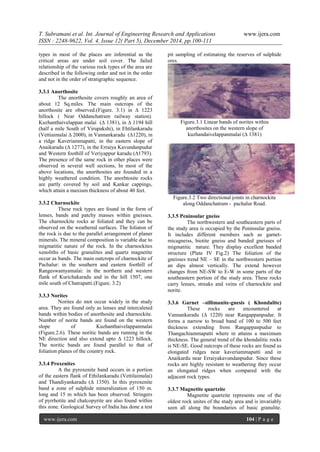
5.2 Pure anorthosites:
This is the most predominating type in the
study area. It is coarse grained, somewhat
porphyritic with plagioclase of variable colours
ranging from grey, pink, purple, and brown. It
consist of 95% plagioclase with little hornblende
and frequently shows play of colours. Under thin
section, the rock is hypidiomorphic granular and
shows protoclastic effects like crushing, granulation,
bending and wedging of twin lamellae of
plagioclase feldspar. The anorthite content of
plagioclase feldspar ranges from An 45-An 65. the
plagioclase is almost invariably twinned. it shows
alteration to calcite . It shows alteration to calcite
and chlorite. Pyroxene is generally absent and the
usual mafic mineral is hornblende. Prismatic grains
of hypersthenes are found intergrown within
plagioclase feldspars. The clino and orthopyroxenes
show alteration to hornblende, biotite and chlorite.
This rock type is free from garnet.
However, some thin sections show the presence of
euhedral garnet, crystals which are irregularly
distributed. An interesting feature is that these
garnet crystals have developed a mafic rim around
their margin. The plagioclase, feldspars show
occasional zoning in both twinned and untwined
crystals. Magnetite grains also show a linear
disposition.
5.3 Garnetiferous anorthosites:
This variety of anorthosite is distinguished
from pure anorthosites by the characteristic presence
of garnet. In the outcrops minute grains of garnets
can be observed. In hand specimens, the rock is dark
coloured, equigranular and medium grained.
This rock is found to consists of about 75%
plagioclase (An 65-An 75), 23% garnet and the rest
are green hornblende, magnetite and sphene. Under
thin section, the rock is hypidiomorphic granular.
Plagioclase is both twinned and untwined. It shows
alteration to scapolite. Garnet occurs as anhedral
grains in the interstitial spaces between plagioclase
crystals. There is an intergrowth formed between
hypersthenes and plagioclase.
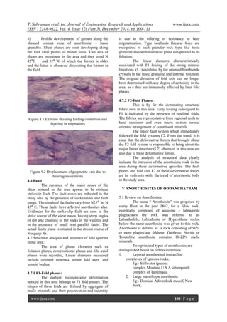
Fig.1 A sharp contact between leucocratic
anorthosites and melanocratic basic granulites.
VI SUMMARY AND CONCLUSION
Oddanchatram is situated in the North
Eastern side of Kodai Hills and surrounded by
Ranaswamimalai, Veriyappurkaradu, Anaikaradu,
Vannnankaradu, Thandiyankaradu, Ehthilankaradu
and Kuzhanthaivelappanmalai, only one small river,
Nanganji Ar,is flowing in the study area occupying
faulty zones. The lithological variations within the
study area is highly significant. Attempt has been
made to decipher the various lithological units
particularly anorthsite and eits releationships with
other rock types. A detailed geological investigation
including field mapping, thin section study under
petrological microscope and determination of
anorthite content have been undertaken to throw
light on the characterstic features of oddanchatram
anorthosite. Gemorphologically, the area is
highly rugged and undulating topography,
Physiography,drainage, weather,climate,vegetation,
weathering and soil types are discussed. The
geology of oddanchatram and description of the
various rock units present in the area under
investigation are covered. Detailed petrographic
study was undertaken with the help of thin sections
prepared from rock samples collected from the study
area. The results of the study are presented. The
structure of the area under investigation is very
interesting with much folding, shearing and faulting
normally anticipated in the archaean terrain.
Inferences from field observation about folds are
discussed. A review on anorthosites of
oddanchatram has been presented. Its mineralogy,
made of occurrence and petrography have also been
discussed. Views of earlier workers on
oddanchatram anorthosite are also presented. The
author further opines that comeparative study of
various anorthosites from anorthositic complexes
occurring within the same orogenic belt or different
orogenic belts of peninsular India may ultimately
yield valuable clues on the genesis of the massif
anorthositic rocks of Oddanchatram.
REFERENCES
[1]. Agarwal, V.K. and Varma, R.S. (1980).
Qualitative analysis, stability and treatment
of cut slopes of the proposed Jammu-
Udhampur railway alignment. Proc.
International Symposium on Landslides,
(ISL 80). April 7-11, New Delhi. Vol. I. pp.
45-48.
[2]. Allix, A. (1924). Avalanches, Geographical
Review, Vol. 14, p.5.
[3]. Anurag Sharma (1993). Ecology of
Landslide Damages. Pointer Publishers,
Jaipur, India. P.154.
[4]. Basu, P. (1979). Erosion and Landslides on
Darjeeling Himalayas, Geographical Review
of India, 41, 1, pp. 50-57.
12. T. Subramani et al. Int. Journal of Engineering Research and Applications www.ijera.com
ISSN : 2248-9622, Vol. 4, Issue 12( Part 5), December 2014, pp.100-111
www.ijera.com 111 | P a g e
[5]. Beaty, C.B. (1950). Landslides and slope
exposure. Journal of Geology. Vol. 64, pp.
70-74.
[6]. Subramani.T, Manikandan.T, “Analysis Of
Urban Growth And Its Impact On
Groundwater Tanneries By Using Gis”,
International Journal of Engineering
Research and Applications, Vol. 4, Issue 6(
Version 2), pp.274-282, 2014.
[7]. Subramani, T “Assessment Of Potential
Impacts On NH7 – 4 Laning From Salem To
Karur”, International Journal of Modern
Engineering Research, Vol.2, No.3,pp 707-
715, 2012.
[8]. Subramani.T , Someswari.P, “Identification
And Analysis Of Pollution In Thirumani
Muthar River Using Remote Sensing”,
International Journal of Engineering
Research and Applications, Vol. 4, Issue 6(
Version 2), pp.198-207, 2014.
[9]. Subramani.T, Krishnamurthi.P, “Geostatical
Modelling For Ground Water Pollution in
Salem by Using Gis”, International Journal
of Engineering Research and Applications
,Vol. 4, Issue 6( Version 2), pp.165-172,
2014.
[10]. Subramani,T, Krishnan.S. And
Kumaresan.P.K., Study on Exixting Traffic
condition in Salem City and Identify the
transport facility improvement projects,
International Journal of Applied Engineering
Research IJAER, Vol.7,No.7, Pp 717 – 726,
2012
[11]. Subramani.T, Manikandan.T, “Analysis Of
Urban Growth And Its Impact On
Groundwater Tanneries By Using Gis”,
International Journal of Engineering
Research and Applications, Vol. 4, Issue 6(
Version 2), pp.274-282, 2014.
[12]. Subramani, T “Assessment Of Potential
Impacts On NH7 – 4 Laning From Salem To
Karur”, International Journal of Modern
Engineering Research, Vol.2, No.3,pp 707-
715, 2012.
[13]. Subramani.T , Someswari.P, “Identification
And Analysis Of Pollution In Thirumani
Muthar River Using Remote Sensing”,
International Journal of Engineering
Research and Applications, Vol. 4, Issue 6(
Version 2), pp.198-207, 2014.
[14]. Subramani.T, Krishnamurthi.P, “Geostatical
Modelling For Ground Water Pollution in
Salem by Using Gis”, International Journal
of Engineering Research and Applications
,Vol. 4, Issue 6( Version 2), pp.165-172,
2014.
[15]. Subramani,T, Krishnan.S. And
Kumaresan.P.K., Study on Exixting Traffic
condition in Salem City and Identify the
transport facility improvement projects,
International Journal of Applied Engineering
Research IJAER, Vol.7,No.7, Pp 717 – 726,
2012
[16]. T. Subramani, Sekar.S ,Kathirvel.C,
Sivakumar.C.T, “Geomatics Based
Landslide Vulnerability Zonation Mapping -
Parts Of Nilgiri District, Tamil Nadu,
India”, International Journal of Engineering
Research and Applications, Vol. 4, Issue 12(
Part 3), pp.139-149, 2014.
[17]. T. Subramani, Sekar.S ,Kathirvel.C,
Sivakumar.C.T, ”Identification Of Soil
Erosion Prone Zones Using Geomatics
Technology In Parts Of North Arcot And
Dharmapuri District” ”, International
Journal of Engineering Research and
Applications Vol. 4, Issue 12( Part 3),
pp.150-159, 2014.