Ncert india rivers
•Download as DOCX, PDF•
3 likes•2,082 views

The document discusses India's drainage systems and major rivers. It describes the two main river systems - the Himalayan rivers which originate in the Himalayas, including the Indus, Ganges and Brahmaputra Rivers, and the Peninsular rivers which flow eastwards towards the Bay of Bengal. It provides details on the basins and tributaries of major rivers like the Godavari, Mahanadi, Krishna and Kaveri Rivers. It also discusses the roles of rivers in the economy, issues of river pollution, and conservation efforts.

Recommended
Recommended
More Related Content
What's hot
Similar to Ncert india rivers
Similar to Ncert india rivers (20)
More from Venu Gopal Kallem
More from Venu Gopal Kallem (20)
Recently uploaded
Recently uploaded (20)
Ncert india rivers
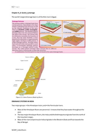
- 1. 1 | P a g e Chapter 9_3: Geo9_3_drainage The world’s largest drainage basin is of the Nile river in Egypt. DRAINAGE SYSTEMS IN INDIA Two major groups: • the Himalayan rivers; and • the Peninsular rivers. Most of the Himalayan Rivers are perennial. It means that they have water throughout the year. The two major Himalayan Rivers, the Indus and the Brahmaputra originate from the north of the mountain ranges. Most of the rivers of peninsular India originate in the Western Ghats and flow towards the Bay of Bengal. NCERT_India Rivers
- 2. 2 | P a g e The Himalayan Rivers The major Himalayan Rivers are the Indus, the Ganga and the Brahmaputra. These rivers are long, and are joined by many large and important tributaries. A river along with its tributaries may be called a river system. The Indus River System The river Indus rises in Tibet, near Lake Mansarowar. Flowing west, it enters India in the Ladakh district of Jammu and Kashmir. • According to the regulations of the Indus Water Treaty (1960), India can use only 20 per cent of the total water carried by Indus river system. This water is used for irrigation in the Punjab, Haryana and the southern and western parts of Rajasthan. The Ganga River System The headwaters of the Ganga, called the ‘Bhagirathi’ is fed by the Gangotri Glacier and joined by the Alaknanda at Devaprayag in Uttaranchal. At Haridwar the Ganga emerges from the mountains on to the plains. • The Sundarban Delta derived its name from the Sundari tree which grows well in marshland. • It is the world’s largest and fastest growing delta. It is also the home of Royal Bengal tiger. The Ganga is joined by many tributaries from the Himalayas, a few of them being major rivers such as the Yamuna, the Ghaghara, the Gandak and the Kosi. Enlarged with the waters from its right and left bank tributaries, the Ganga flows eastwards till Farakka in West Bengal Ambala is located on the water divide between the Indus and the Ganga river systems. The Brahmaputra River System The Brahmaputra rises in Tibet east of Mansarowar Lake very close to the sources of the Indus and the Satluj. On reaching the Namcha Barwa (7757 m), it takes a ‘U’ turn and enters India in Arunachal Pradesh through a gorge Brahmaputra is known as the Tsang Po in Tibet and Jamuna in Bangladesh. The Peninsular Rivers Most of the major rivers of the Peninsula such as the Mahanadi, the Godavari, the Krishna and the Kaveri flow eastwards and drain into the Bay of Bengal. The Narmada and the Tapi are the only long rivers, which flow west and make estuaries The Narmada Basin The Narmada raises in the Amarkantak hills in Madhya Pradesh. The ‘Marble rocks’, near Jabalpur where the Narmada flows through a deep gorge, and the ‘Dhuadhar falls’ where the river plunges over steep rocks, are some of the notable ones The Narmada basin covers parts of Madhya Pradesh and Gujarat NCERT_India Rivers
- 3. 3 | P a g e The Tapi Basin The Tapi raises in the Satpura ranges, in the Betul district of Madhya Pradesh. Its basin covers parts of Madhya Pradesh, Gujarat and Maharashtra. Hence, the coastal rivers are short. The main west flowing rivers are Sabarmati, Mahi, Bharathpuzha and Periyar. The Godavari Basin The Godavari is the largest Peninsular River. It rises from the slopes of the Western Ghats in the Nasik district of Maharashtra. Its length is about 1500 km. The Godavari is joined by a number of tributaries such as the Purna, the Wardha, the Pranhita, the Manjra, the Wainganga and the Penganga. The last three tributaries are very large. Because of its length and the area it covers, it is also known as the ‘Dakshin Ganga’ The Mahanadi Basin The Mahanadi rises in the highlands of Chhattisgarh. It flows through Orissa to reach the Bay of Bengal. The length of the river is about 860 km. Its drainage basin is shared by Maharashtra, Chhattisgarh, Jharkhand, and Orissa The Krishna Basin Rising from a spring near Mahabaleshwar, the Krishna flows for about 1400 km and reaches the Bay of Bengal. The Tungabhadra, the Koyana, the Ghatprabha, the Musi and the Bhima are some of its tributaries. Its drainage basin is shared by Maharasthra, Karnataka and Andhra Pradesh The Kaveri Basin The Kaveri rises in the Brahmagri range of the Western Ghats and it reaches the Bay of Bengal in south of Cuddalore, in Tamil Nadu Its main tributaries are Amravati, Bhavani, Hemavati and Kabini. Its basin drains parts of Karnataka, Kerala and Tamil Nadu. The river Kaveri makes the second biggest waterfall in India. It is known as Sivasamudram. The fall supplies hydroelectric power to Mysore, Bangalore and the Kolar Gold Field. LAKES • Lakes of large extent are called the seas, like the Caspian, the Dead and the Aral seas. The Chilika lake, the Pulicat lake, the Kolleru lake. Lakes in the region of inland drainage are sometimes seasonal; for example, the Sambhar Lake in Rajasthan, which is a salt water lake. Its water is used for producing salt. The Wular Lake in Jammu and Kashmir, in contrast, is the result of the tectonic activity. It is the largest freshwater lake in India. The Dal Lake, Bhimtal, Nainital, Loktak and Barapani are some other important fresh water lakes. Apart from natural lakes, the damming of the rivers for the generation of hydel power has also led to the formation of Lakes such as Guru Gobind Sagar (Bhakra Nangal Project) NCERT_India Rivers
- 4. 4 | P a g e ROLE OF RIVERS IN THE ECONOMY Using rivers for irrigation, navigation, hydro-power generation is of special significance – particularly to a country like India, where agriculture is the major source of livelihood of the majority of its population RIVER POLLUTION The growing domestic, municipal, industrial and agricultural demand for water from rivers naturally affects the quality of water. On the other hand, a heavy load of untreated sewage and industrial effluents are emptied into the rivers. This affects not only the quality of water but also the self -cleansing capacity of the river. National River Conservation Plan (NRCP) The activities of Ganga Action Plan (GAP) phase-I, initiated in 1985, were declared closed on 31st March 2000. The Steering Committee of the National River Conservation Authority reviewed the progress of the GAP and necessary correction on the basis of lessons learnt and experiences gained from GAP Phase-I. These have been applied to the major polluted rivers of the country under the NRCP. The Ganga Action Plan (GAP) Phase-II, has been merged with the NRCP. The expanded NRCP now covers 152 towns located along 27 interstate rivers in 16 states. Under this action plan, pollution abatement works are being taken up in 57 towns. A total of 215 schemes of pollution abatement have been sanctioned. So far, 69 schemes have been completed under this action plan. A million litres of sewage is targeted to be intercepted, diverted and treated. Chapter All water moves within the hydrological cycle ensuring that water is a renewable resource • 96.5 per cent of the total volume of world’s water is estimated to exist as oceans and onl y 2.5 per cent as freshwater. • Nearly 70 per cent of this freshwater occurs as ice sheets and glaciers in Antarctica, Greenland and the mountainous regions of the world, while a l ittle less than 30 per cent is stored as groundwater in the world’s aquifers. • India receives nearly 4 per cent of the global precipitation and ranks 133 in the world in terms of water availability per person per annum • The total renewable water resources of India are estimated at 1,897 sq km per annum • By 2025, it is predicted that large parts of India will join countries or regions having absolute water scarcity. Source: The UN World Water Development Report, 2003 According to Falken Mark, a Swedish expert, water stress occurs when water availability is less than 1,000 cubic meter per person per day. NCERT_India Rivers
- 5. 5 | P a g e To facilitate higher food-grain production, water resources are being over-exploited to expand irrigated areas and dry- season agriculture. That it may lead to falling groundwater levels, adversely affecting water availability and food security of the people Post-independent India witnessed intensive industrialisation and urbanisation, creating vast opportunities for us Today, in India hydroelectric power contributes approximately 22 per cent of the total electricity produced. There has been a growing concern that even if there is ample water to meet the needs of the people, much of it may be polluted by domestic and industrial wastes, chemicals, pesticides and fertilisers used in agriculture, thus, making it hazardous for human use WATER SCARCITY AND THE NEED FOR WATER CONSERVATION AND MANAGEMENT India’s rivers, especially the smaller ones, have all turned into toxic streams. And even the big ones like the Ganga and Yamuna are far from being pure. The assault on India’s rivers – from population growth, agricultural modernisation, urbanisation and industrialisation – is enormous and growing by the day….. This entire life stands threatened MULTI-PURPOSE RIVER PROJECTS AND INTEGRATED WATER RESOURCES MANAGEMENT Hydraulic Structures in Ancient India In the first century B.C., Sringaverapura near Allahabad had sophisticated water harvesting system channeling the flood water of the river Ganga. During the time of Chandragupta Maurya, dams, lakes and irrigation systems were extensively built. Evidences of sophisticated irrigation works have also been found in Kalinga, (Orissa), Nagarjunakonda (Andhra Pradesh), Bennur (Karnataka), Kolhapur (Maharashtra), etc. In the 11th Century, Bhopal Lake, one of the largest artificial lakes of its time was built. In the 14th Century, the tank in Hauz Khas, Delhi was constructed by Iltutmish for supplying water to Siri Fort area Today, dams are built not just for irrigation but for electricity generation, water supply for domestic and industrial uses, flood control, recreation, inland navigation and fish breeding. The Sutluj-Beas river basin, the Bhakra – Nangal project water is being used both for hydel power production and irrigation. Similarly, the Hirakud project in the Mahanadi basin integrates conservation of water with flood control Dams are classified as timber dams, embankment dams or masonry dams, with several subtypes. According to the height, dams can be categorized as large dams and major dams or alternatively as low dams, medium height dams and high dams Jawaharlal Nehru proudly proclaimed the dams as the ‘temples of modern India’; the reason being that it would integrate development of agriculture and the village economy with rapid industrialisation and growth of the urban economy. NCERT_India Rivers
- 6. 6 | P a g e Multi-purpose projects and large dams have also been the cause of many new social movements like the ‘Narmada Bachao Andolan’ and the ‘Tehri Dam Andolan’ etc. Narmada Bachao Andolan or Save Narmada Movement is a Non-Governmental Organisation (NGO) that mobilised tribal people, farmers, environmentalists and human rights activists against the Sardar Sarovar Dam being built across the Narmada river in Gujarat. In Gujarat, the Sabarmati-basin farmers were agitated and almost caused a riot over the higher priority given to water supply in urban areas, particularly during droughts. Inter-state water disputes are also becoming common with regard to sharing the costs and benefits of the multi-purpose project The Krishna-Godavari dispute is due to the objections raised by Karnataka and Andhra Pradesh governments. It is regarding the diversion of more water at Koyna by the Maharashtra government for a multipurpose project. This would reduce downstream flow in their states with adverse consequences for agriculture and industry. RAIN WATER HARVESTING Roof top rain water harvesting is the most common practice in Shillong, Meghalaya. It is interesting because Cherapunjee and Mawsynram situated at a distance of 55 km. from Shillong receive the highest rainfall in the world, yet the state capital Shillong faces acute shortage of water. Nearly every household in the city has a roof top rain water harvesting structure. Nearly 15- 25 per cent of the total water requirement of the household comes from roof top water harvesting. Tamil Nadu is the first and the only state in India which has made roof top rainwater harvesting structure compulsory to all the houses across the state. There are legal provisions to punish the defaulters. Chapter 11_3: Geo11_3_India_Drainage System The drainage pattern of an area is the outcome of the geological time period, nature and structure of rocks, topography, slope, amount of water flowing and the periodicity of the flow A river drains the water collected from a specific area, which is called its ‘catchment area’. An area drained by a river and its tributaries is called a drainage basin. The boundary line Separating one drainage basin from the other is known as the watershed. The catchments of large rivers are called river basins while those of small rivulets and rills are often referred to as watersheds. NCERT_India Rivers
- 7. 7 | P a g e Watersheds are small in area while the basins cover larger areas. It may be grouped into: the Arabian Sea drainage; and The Bay of Bengal drainage. They are separated from each other through the Delhi ridge, the Aravalis and the Sahyadris . Nearly 77 per cent of the drainage area consisting of the Ganga, the Brahmaputra, the Mahanadi, the Krishna, etc. is oriented towards the Bay of Bengal. 23 per cent comprising the Indus, the Narmada, the Tapi, the Mahi and the Periyar systems discharge their waters in the Arabian Sea On the basis of the size of the watershed, the drainage basins of India are grouped into three categories: Major river basins with more than 20,000 sq. km of catchment area. It includes 14 drainage basins such as the Ganga, the Brahmaputra, the Krishna, the Tapi, the Narmada, the Mahi, the Pennar, the Sabarmati, the Barak, etc. Medium river basins with catchment area between 2,000-20,000 sq. km incorporating 44 river basins such as the Kalindi, the Periyar, the Meghna, etc. Minor river basins with catchment area of less than 2,000 sq. km include fairly good number of rivers flowing in the area of low rainfall NCERT_India Rivers
- 8. 8 | P a g e A mighty river called Shiwalik or Indo-Brahma traversed the entire longitudinal extent of the Himalaya from Assam to Punjab and onwards to Sind, and finally discharged into the Gulf of Sind near lower Punjab during the Miocene period some 5-24 million years ago The remarkable continuity of the Shiwalik and its lacustrine origin and alluvial deposits consisting of sands, silt, clay, boulders and conglomerates support this viewpoint It is opined that in due course of time Indo– Brahma River was dismembered into three main drainage systems: The Indus and its five tributaries in the western part; The Ganga and its Himalayan tributaries in the central part; and The stretch of the Brahmaputra in Assam and its Himalayan tributaries in the eastern part. The dismemberment was probably due to the Pleistocene upheaval in the western Himalayas, including the uplift of The Potwar Plateau (Delhi Ridge), which acted as the water divide between the Indus and Ganga drainage systems. Likewise, the down thrusting of the Malda gap area between the Rajmahal hills and the Meghalaya plateau during the mid-Pleistocene period diverted the Ganga and the Brahmaputra systems to flow towards the Bay of Bengal. The Indus also known as the Sindhu is the westernmost of the Himalayan Rivers in India. It originates from a glacier near Bokhar Chu (31°15' N latitude and 81°40' E longitude) in the Tibetan region at an altitude of 4,164 m in the Kailash Mountain range. The Panjnad is the name given to the five rivers of Punjab, namely the Satluj, the Beas, the Ravi, the Chenab and the Jhelum. The Chenab is the largest tributary of the Indus. It is formed by two streams, the Chandra and the Bhaga, which join at Tandi near Keylong in Himachal Pradesh. Hence, it is also known as Chandrabhaga. The Ganga river system is the largest in India having a number of perennial and non-perennial rivers originating in the Himalayas in the north and the Peninsula in the south, respectively. The Son is its major right bank tributary. The important left bank tributaries are the Ramganga, the Gomati, the Ghaghara, the Gandak, the Kosi and the Mahanada. The river finally discharges itself into the Bay of Bengal near the Sagar Island. NCERT_India Rivers
- 9. 9 | P a g e The Yamuna, the western most and the longest tributary of the Ganga Once known as the ‘sorrow of Bengal’, the Damodar has been now tamed by the Damodar Valley Corporation, a multipurpose project The Ganga has its minimum flow during the January-June period. The maximum flow is attained either in August or in September. After September, there is a steady fall in the flow. The river, thus, has a monsoon regime during the rainy season. The discharge is the volume of water flowing in a river measured over time. It is measured either in cusecs (cubic feet per second) or cumecs (cubic meters per second) The Godavari has the minimum discharge in May and the maximum in July-August. After August, there is a sharp fall in water flow. The mean maximum discharge of the Godavari at Polavaram is 3,200 cusecs while the mean minimum flow is only 50 cusecs. PROJECTS: Periyar Diversion Scheme Indira Gandhi Canal Project Kurnool-Cuddapah Canal Beas-Satluj Link Canal Ganga-Kaveri Link Canal REASONS: (i) No availability in sufficient quantity (ii) River water pollution (iii) Load of silt in the river water (iv) Uneven seasonal flow of water (v) River water disputes between states (vi) Shrinking of channels due to the extension of settlements towards the thalweg. Chapter: WATER RESOURCES India accounts for about 2.45 per cent of world’s surface area, 4 per cent of the world’s water resources and about 16 per cent of world’s population. o The total water available from precipitation in the country in a year is about 4,000 cubic km. o The availability from surface water and replenishable groundwater is 1,869 cubic km. o Out of this only 60 per cent can be put to beneficial uses. o Thus, the total utilisable water resource in the country is only 1,122 cubic km NCERT_India Rivers
- 10. 10 | P a g e Precipitation is relatively high in the catchment areas of the Ganga, the Brahmaputra and the Barak rivers, these rivers. The level of groundwater utilisation is relatively high in the river basins lying in north-western region and parts of south India. o The groundwater utilisation is very high in the states of Punjab, Haryana, Rajasthan, and Tamil Nadu. However, there are States like Chhattisgarh, Orissa, Kerala, etc., which utilise only a small proportion of their groundwater potentials o States like Gujarat, Uttar Pradesh, Bihar, Tripura and Maharashtra are utilising their ground water resources at a moderate rate. o The States like Kerala, Orissa and West Bengal have vast surface water resources in these lagoons and lakes. Although, water is generally brackish in these water-bodies, it is used for fishing and irrigating certain varieties of paddy crops, coconut, etc. Water Demand and Utilisation Development of irrigation to increase agricultural production has been assigned a very high priority in the Five Year Plans, and multipurpose river valleys projects like the Bhakra- Nangal, Hirakud, Damodar Valley, Nagarjuna Sagar, Indira Gandhi Canal Project, etc. have been taken up. The large tracts of the country are deficient in rainfall and are drought prone. North-western India and Deccan plateau constitute such areas. Winter and summer seasons are more or less dry in most part of the country. In fact, over withdrawals in some states like Rajasthan, and Maharashtra has increased fluoride concentration in ground-water, and this practice has led to increase in concentration of arsenic in parts of West Bengal and Bihar The Ganga and the Yamuna are the two highly polluted rivers in the country NCERT_India Rivers
- 11. 11 | P a g e Water Conservation and Management There is need to encourage watershed development, rainwater harvesting, water recycling and reuse, and conjunctive use of water for sustaining water supply in long run. The major rivers of the country generally retain better water quality in less densely populated upper stretches in hilly areas. In plains, river water is used intensively for irrigation, drinking, domestic and industrial purposes. The drains carrying agricultural (fertilisers and insecticides), domestic (solid and liquid wastes), and industrial effluents join the rivers. The concentration of pollutants in rivers especially remains very high during the summer season when flow of water is low The Central Pollution Control Board (CPCB) in collaboration with State Pollution Control Boards has been monitoring water quality of national aquatic resources at 507 stations. These stations show that organic and bacterial contamination continues to be the main source of pollution in rivers. The Yamuna River is the most polluted river in the country between Delhi and Etawah. Other severely polluted rivers are: the Sabarmati at Ahmedabad, the Gomti at Lucknow, the Kali, the Adyar, the Cooum (entire stretches), the Vaigai at Madurai and the Musi of Hyderabad and the Ganga at Kanpur and Varanasi Groundwater pollution has occurred due to high concentrations of heavy/toxic metals, fluoride and nitrates at different parts of the country NCERT_India Rivers
- 12. 12 | P a g e The legislative provisions such as the Water (Prevention and Control of Pollution) Act 1974 and Environment Protection Act 1986 have not been implemented effectively. The result is that in 1997 The Water Cess Act, 1977, meant to reduce pollution has also made marginal impacts. The public awareness and action can be very effective in reducing the pollutants from agricultural activities, domestic and industrial discharges Watershed management basically refers to efficient management and conservation of surface and groundwater resources. In broad sense watershed management includes conservation, regeneration and judicious use of all resources – natural (like land, water, plants and animals) and human with in a watershed. Watershed management aims at bringing about balance between natural resources on the one hand and society on the other. The Central and State Governments have initiated many watershed developments. Some of these are being implemented by nongovernmental organisations also. Haryali is a watershed development project sponsored by the Central Government which aims at enabling the rural population to conserve water for drinking, irrigation, fisheries and afforestation. Neeru-Meeru(Water and You) programme (in Andhra Pradesh) and Arvary Pani Sansad (in Alwar, Rajasthan) have taken up constructions of various water-harvesting structures such as percolation tanks, dug out ponds (Johad), check dams, etc. through people’s participation. Tamil Nadu has made water harvesting structures in the houses compulsory. Rainwater Harvesting Rainwater harvesting increases water availability, checks the declining ground water table, improves the quality of groundwater through dilution of contaminants like fluoride and nitrates, prevents soil erosion, and flooding and arrests salt water intrusion in coastal areas if used to recharge aquifers Apart from the above mentioned factors, the issue desalinisation of water particularly in coastal areas and brackish water in arid and semi-arid areas, transfer of water from water surplus areas to water deficit areas through inter linking of rivers can be important remedies for solving water problem in India NCERT_India Rivers