The document outlines plans for a vulnerability assessment and resiliency plan for critical facilities at the Bacman Geothermal Steamfield, power plant, and ancillary facilities. It discusses:
1) An agenda for a stakeholder consultation meeting that will include an overview of the vulnerability assessment and resiliency plan, implementation arrangements, and next steps.
2) Details of the vulnerability assessment that will include structural assessment, geotechnical assessment, climate risk scenario development, and natural infrastructure assessment.
3) The development of a comprehensive resiliency plan that will include engineering design options and natural solutions to improve resiliency of vulnerable facilities.
4) Proposed timelines and next steps which include final
This document outlines the typical sections and information included in a detailed project report (DPR) for a hydroelectric scheme in India. It lists 20 sections that would be included in a DPR, such as an introduction describing the project location and context, justification for the project, hydrological and power potential studies, cost estimates, economic evaluation, and recommendations. The document provides guidance on the type of technical, financial, and environmental information to present in each section of a DPR to obtain approval and funding for a new hydroelectric project.
Vol.9 appendices to environmental impact assessment and resettlement aspectszubeditufail
This document presents findings from socioeconomic surveys conducted in villages located in the reservoir area and lower riparian area of the proposed Dasu Hydropower Project in Pakistan. Key findings include:
- The major villages in the reservoir area are Segal, Logro, Barseen, Kai Doga, Maliyar Doga, Gul-e-Bagh/Madan, Kaigh, Pani Bah, Gayal, Gummo, Sazin, Shatial and Seglo. Villages in the lower riparian area include Seo, Kumila, Dasu and Jalkot.
- Surveys were conducted with 262 households. Most respondents were married males with low
Geoengineering has been defined as: “the deliberate large-scale manipulation of the
planetary environment to counteract anthropogenic climate change.1” As Lord Rees,
chair of The Royal Society, wrote in the forward to the Society's 2009 report on geoengineering,
"The continuing rise in the atmospheric concentration of greenhouse gases, mainly caused by the burning of
fossil fuels, is driving changes in the Earth’s climate. The long-term consequences will be exceedingly
threatening, especially if nations continue ‘business as usual’ in the coming decades. Most nations now recognize
the need to shift to a low-carbon economy, and nothing should divert us from the main priority of reducing
global greenhouse gas emissions. But if such reductions achieve too little, too late, there will surely
be pressure to consider a ‘plan B’—to seek ways to counteract the climatic effects of greenhouse gas emissions
by ‘geoengineering’ … Far more detailed study would be needed before any method could even be
seriously considered for deployment on the requisite international scale. Moreover, it is already clear than
This document provides a summary of a multi-phase refurbishment project of the mechanical and electrical systems at the 1-2 Broadgate property in London between 2012-2015. Key works included replacing chillers, cooling towers, pumps and generators to extend the building systems' life. The project was completed in three phases while the building remained occupied and involved meticulous planning to minimize disruptions to occupiers.
This document is a resume for Michael Lubrecht that summarizes his education and qualifications. It outlines his experience as a senior geologist since 2008 with Directed Technologies Drilling, Inc., where he designs drilling programs, writes proposals, and leads research on horizontal directional drilling technologies. It also details his previous experience in technical writing, engineering geology, environmental investigation management, and coal exploration. His publications, presentations, and patents in the areas of horizontal drilling and environmental remediation are listed.
USCID conference in San Diego May 17-20, 2016_GrD Salton Sea update presentat...Graeme Donaldson
This document summarizes updates on Salton Sea restoration programs and projects presented at a USCID conference. It describes the status of legislative actions and state agencies involved in restoration efforts. Near-term habitat and pilot projects being implemented by IID and state agencies are outlined, including Red Hill Bay, Species Conservation Habitat, and a marine habitat pilot project. IID's Salton Sea Backbone Infrastructure Project is introduced, which aims to develop infrastructure to manage drainage water for restoration uses over time. Salinity increases in the shrinking sea pose risks to public health from dust emissions if restoration is not accelerated.
Morris Dirnberger has over 35 years of experience in geotechnical engineering, including 29 years with the U.S. Army Corps of Engineers. He has a Ph.D. in civil engineering and is a licensed professional engineer. At Kiewit, he serves as a geotechnical consultant providing technical reviews and design checks. Some of his project experience includes reviewing reports for desalination plants, transmission lines, and port facilities, and providing recommendations to address issues like liquefiable soils and karst geology. Previously he led geotechnical engineering for dam and levee projects, performed emergency response work, and taught as an adjunct professor.
SEISMIC VULNERABILITY ASSESSMENT OF RESIDENTIAL BUILDINGS IN AGARTALA CITY US...shankar kumar
This document outlines a methodology for conducting a seismic vulnerability assessment of residential buildings in Agartala City, India using the Rapid Visual Screening (RVS) method. The objectives are to assess seismic vulnerability of residential buildings in Agartala City using the RVS method from FEMA 154 (2015) and to predict expected damage grades from future earthquakes. The methodology involves conducting RVS, which involves visually inspecting buildings to identify seismic deficiencies and assigning scores to determine likely damage from earthquakes. The RVS will screen buildings and identify those requiring more detailed analysis.
South east kowloon development kai tak approach channel reclamation.FelixGao
The document provides project details for the South East Kowloon Development - Kai Tak Approach Channel Reclamation project. It involves reclaiming approximately 28 hectares of land from the Kai Tak Approach Channel to accommodate planned development. Key aspects of the project include remediating contaminated sediments, extending drainage systems, and constructing advance portions of road tunnels. The project is expected to take approximately 5 years to complete and could interact with other nearby development projects.
This document provides biographical information on Joseph Wood including his educational background, areas of expertise, licenses, certifications, and contact information. It also summarizes his over 30 years of experience in areas such as environmental engineering, project management, hazardous and radioactive waste site investigations and remediation, security assessments, and emergency response training. Recent relevant projects discussed include supporting the National Nuclear Security Administration, developing interagency guidance for the US Army Corps of Engineers, and providing QA/QC review for site monitoring reports.
Appendix e issues and features final_dec2010Severn Estuary
This document provides an appendix to the Severn Estuary Shoreline Management Plan Review. It outlines the methodology used to identify issues, features, and objectives along the Severn Estuary coastline. Key features were identified through a theme review process and stakeholder input. The importance of each feature is evaluated based on the scale of its benefits, importance to users, sufficiency of the feature, and whether the benefits can be substituted. Features at risk of flooding under a no active intervention scenario within the next 100 years are also identified using GIS data. The appendix is divided into two parts: part A covers the identification and assessment of issues and features, while part B establishes objectives for shoreline management.
This document summarizes the final phase of the San Clemente Dam removal and stream restoration project in California. It describes the project location and history, provides an overview of key stakeholders and the project schedule, discusses the regional and site geology, and details the final design elements and construction phases. These included building a diversion dike, stabilizing sediment slopes, constructing a combined flow reach with step pools, removing the dam, and installing instrumentation to monitor slopes, embankments, and settlement. The project successfully removed an aging dam to restore fish habitat while mitigating geological hazards through engineering and post-construction monitoring.
Rapid visual screening of critical facilities in the Kingston MetropolitChristopher Gayle M.Eng
The document summarizes the results of a Rapid Visual Screening (RVS) of critical facilities in the Kingston Metropolitan Area of Jamaica according to FEMA 154 methodology. A total of 66 critical facilities, including police stations, health centers, and fire stations, were surveyed. The RVS identified 11 structures located on soil type F which requires site-specific evaluation. The screening provided preliminary information on the seismic vulnerability of critical facilities to help inform post-earthquake response planning in the region.
1. The document proposes a national policy for seismic vulnerability assessment of buildings in India consisting of 3 levels - rapid visual screening (RVS), simplified vulnerability assessment (SVA), and detailed vulnerability assessment (DVA).
2. RVS involves a visual evaluation to identify structural systems and attributes affecting seismic performance. SVA uses limited engineering analysis based on visual observations and plans. DVA requires detailed computer analysis.
3. The policy recommends RVS for all buildings, SVA for buildings with high occupancy, and DVA for critical buildings. Assessment results can be used for risk management, retrofitting, and raising awareness.
The document summarizes a meeting to discuss planning for climate change impacts on water supply. Speakers will brief attendees on local climate studies showing warming trends and projections of reduced precipitation and snowpack. This could decrease water supply. Regulations like AB 32 require reducing greenhouse gas emissions. The Water Authority partners with scientists and other agencies to understand climate impacts and find solutions. It incorporates climate change into long-term planning and develops strategies to diversify supply, increase storage, and promote conservation and efficiency to adapt to potential impacts.
This document summarizes the Stage 1 assessment undertaken as part of the Habitats Regulations Assessment for the Severn Estuary Shoreline Management Plan Review. 30 European sites were initially considered based on their location and potential connectivity to the study area. Following an analysis of their interest features and conservation objectives, 20 sites were scoped out from further assessment because they were deemed unlikely to be affected by changes resulting from implementation of the SMP2. The remaining 10 sites were carried forward to Stage 2 assessment.
Warren G. Magnuson Park was experiencing flooding due to beaver activity in 2014-2015. The flooding caused water levels in the north Promontory Pond to rise 4 feet above the designed elevation. To address this, the park installed water level control devices in the beaver ponds and dams, and reconstructed trails at a higher elevation with new overflow measures. The project obtained approval from the state wildlife agency and aimed to compromise between human use of the park and natural beaver activity, while also protecting the environment and park infrastructure during construction work.
The document provides guidelines for the design of flood protection embankments. Some key points include:
1. The spacing between embankments on both river banks should not be less than 3 times the Lacey wetted perimeter for the design flood discharge.
2. The design high flood level should generally correspond to a 25-year flood for agricultural areas and a 100-year flood to protect towns.
3. A minimum freeboard of 1.5 meters over the design flood level should be provided, or 1.8 meters for higher discharges or aggrading rivers.
4. The top width of embankments should generally be 5 meters wide with 15-30 meter long turning platforms
This document discusses vegetation monitoring for stormwater restoration projects in Fairfax County, Virginia. It notes that current monitoring focuses on survival rates of planted woody species and levels of invasive/non-native herbaceous species, but that these metrics may not be predictive of ecosystem function. The document explores using statistical analysis of monitoring data to develop a qualitative index of project success. It recommends measuring additional aspects of ecosystem function, such as biomass, survivorship/colonization rates, soil characteristics, and floristic/plant quality to better understand how to design successful restorations. The overall goal is to protect investments, promote ecosystem development, and create fully functional replacement systems.
The ADB Capacity Development Technical Assistance project Promoting Climate Resilient Rural Infrastructure in Northern Vietnam is demonstrating how non-conventional engineering solutions can strengthen rural infrastructure, resisting the hazards associated with climate change and providing opportunities to enhance community livelihoods. The project focuses on bioengineering as a low-cost alternative to conventional slope stabilization and protection techniques
Management of hydrogeological risks in underground constructionsIRJET Journal
This document discusses management of hydrogeological risks in underground constructions. It begins with an abstract that outlines the importance of understanding and managing hydrogeological risks like groundwater when building underground structures. It then provides details on various case studies of underground construction projects around the world and the groundwater challenges they faced, as well as the dewatering and foundation design techniques used to overcome those challenges. Specific techniques discussed include diaphragm wall construction, dewatering using well points and deep wells, and waterproofing of basement areas.
Management of hydrogeological risks in underground constructionsIRJET Journal
This document discusses management of hydrogeological risks in underground constructions. It begins with an abstract that outlines the importance of understanding and managing hydrogeological risks like groundwater when building underground structures. It then provides details on various case studies of underground construction projects around the world and the groundwater challenges they faced, as well as the dewatering and foundation design techniques used to overcome those challenges. Specific case studies discussed include projects in Kuwait, Italy, Taiwan, Shanghai, and India.
IJRET : International Journal of Research in Engineering and Technology is an international peer reviewed, online journal published by eSAT Publishing House for the enhancement of research in various disciplines of Engineering and Technology. The aim and scope of the journal is to provide an academic medium and an important reference for the advancement and dissemination of research results that support high-level learning, teaching and research in the fields of Engineering and Technology. We bring together Scientists, Academician, Field Engineers, Scholars and Students of related fields of Engineering and Technology
Probabilstic seismic risk evaluation of rc buildings eSAT Journals
Abstract As more and more emphasis is being laid on non-linear analysis of RC framed structures subjected to earthquake excitation, the research and development on both non-linear static (pushover) analysis as well as nonlinear dynamic (time history)analysis is in the forefront. Due to prohibitive computational time and efforts required to perform a complete nonlinear dynamic analysis, researchers and designers all over the world are showing keen interest in non-linear static pushover analysis. The paper considers two statistical random variables namely characteristic strength of concrete (fck) and yield strength of steel (fy) as uncertainties in strength. Using Monte Carlo simulation 100 samples of each of random variable were generated to quantify effect of uncertainties on prediction of capacity of structure. Based on these generated samples different models were created and static pushover analysis was performed on RC (Reinforced Concrete) Building using SAP2000. Lastly, the main objective of this article is to propose a simplified methodology to assess the expected seismic damage in reinforced concrete buildings from a probabilistic point of view by using Monte Carlo simulation and probability of various damage states were evaluated. Index Terms: Seismic Vulnerability, Probabilistic Seismic Risk Evaluation, Fragility Analysis and Pushover Analysis
The document discusses how climate change is impacting Department of Defense (DOD) installations and operations. It summarizes the scientific consensus on climate change trends like rising global temperatures and sea levels. It then outlines key policy drivers that require DOD to address climate change adaptation, including executive orders. The document analyzes a GAO report that found DOD has identified observed and potential climate change impacts at installations, such as damage from thawing permafrost and flooding from sea level rise and storms. However, DOD guidance for implementing climate adaptation is unclear and installations lack expertise, creating challenges. The document concludes DOD needs clearer direction and processes to ensure infrastructure projects consider climate impacts and it meets goals to assess installation vulnerabilities.
The document discusses a case study that uses the PIEVC process to assess the effects of climate change on buildings. It summarizes the 5 steps of the PIEVC protocol: 1) define the project, 2) gather data, 3) assess risk, 4) engineering analysis, and 5) recommendations. It then provides details of steps 1-3 as applied to a sample 16-story residential building in Toronto, identifying key climate change risks like increased temperature, rainfall, and need for air conditioning. Components at medium-high risk included grounds/drainage, the building envelope, and mechanical drainage systems.
Ground engineering solutions for infrastructure projectsAbhishek Mangukiya
This document discusses case studies on ground engineering solutions for infrastructure projects. It provides examples of how geotechnical challenges were addressed on different projects, including an industrial power plant built on abandoned fly ash deposits, a chemical plant built on soft soils in Kutch, India, a multi-story building in NCR, India, and wind turbines in Kolhapur, Maharashtra. Ground improvement techniques like vibro stone columns, deep soil mixing, and prefabricated vertical drains were used to provide stable foundations that allowed construction to proceed in a cost-effective manner while meeting structural requirements and mitigating issues like settlement. The case studies demonstrate how evaluating soil conditions and selecting the appropriate ground engineering approach can enable successful infrastructure projects.
Analysis and design of multi-storey building using staad.Progsharda123
This document presents a minor project report on the analysis and design of a four-storey building (ground plus three floors) using STAAD Pro software. It was submitted by five civil engineering students at Guru Nanak Dev Engineering College, Punjab, India in partial fulfillment of their Bachelor of Technology degree. The report covers various topics related to structural analysis and design including different analysis methods, design of building elements like slabs, beams, columns, and footings. It also discusses assumptions, design codes, loads, and materials used for the building design.
Richard Tringale is an experienced project manager with over 35 years of experience managing large construction projects in the nuclear, power, and environmental industries. He has managed over $13 billion of projects, including the construction of 9 nuclear power plants and the decommissioning of several contaminated structures. Currently, he is the project manager for the staff augmentation contract supporting cleanup at the Portsmouth Gaseous Diffusion Plant in Ohio.
This document analyzes the feasibility of installing solar panels over California water canals. It finds that such a project could provide significant benefits by reducing evaporative water loss, saving on pumping costs, and generating renewable energy. A suitability analysis identified optimal locations. Economic analyses found positive net present values and competitive levelized costs of energy. The project would also create jobs and reduce greenhouse gas emissions. Challenges include high upfront costs and permitting uncertainties. Financing options and an implementation plan are proposed to address these challenges.
Role of civil engineer in disaster managementHarsh Shah
This document discusses the role of civil engineers in disaster management. It outlines how civil engineers can help in various areas such as structural engineering, geotechnical engineering, hydraulic engineering, city planning, and environmental engineering. It also discusses how civil engineers are involved in developing disaster-resistant technologies and infrastructure, as well as participating in rescue operations and reconstruction efforts. Some specific technologies mentioned include nanotechnology, MEMS-based systems, flood-resistant building techniques, earthquake-resistant structural designs, and industrial disaster prevention methods. The role of civil engineering students is also addressed, emphasizing the importance of hands-on learning and training to prepare them for roles in disaster scenarios.
The document provides information on the proposed Clinton River Wastewater Treatment Plant project. Key details include:
- The plant will be located in Madison Heights, Michigan and treat 50 million gallons per day of wastewater from Oakland County.
- Engineering services will be provided for construction, environmental, structural, water resources, and transportation aspects.
- The treatment process will include primary settling, aeration tanks, secondary settling, and tertiary treatment before discharge.
- Structural designs and analyses were presented for the administration/education building and tertiary treatment facility.
- A cost estimate of $200 million was provided along with a project schedule through completion in 2015.
A representative from the Network for Sustainable Hydropower Development for Mekong Region with the support of MRC-GIZ Cooperation Programme gave a presentation on hydropower siting, design, and operations in a changing climate.
My expanded resume / CV. Looking for leads, advice, networking opportunities, and to start a discussion about the geoscience industry and career options in this current economy.
The document provides an overview of findings from a climate risk and vulnerability assessment for the Nam Ngiep 1 hydropower project in Laos. It identifies the most significant climate change impacts as an increased potential for energy production but also a dramatic rise in spillway usage accelerating wear. Moderate impacts include reduced reservoir storage and water quality issues. Monitoring critical thresholds and preventative catchment measures are recommended, along with studies on adaptation opportunities.
IRJET-Investigation of Landslides and its Effects on KothagiriIRJET Journal
This document summarizes an investigation of landslides and their effects on Kothagiri in India. The investigation utilized remote sensing techniques like IKONOS satellite imagery and GIS mapping to identify and analyze landslides in the area. Field investigations were also conducted to study the geological features of landslides and recommend countermeasures. Different types of landslides were identified and their causes like geological, morphological, and human factors were examined. The methodology involved preparing detailed maps from remote sensing data, conducting field surveys, hazard mapping of landslides, and developing guidelines for roadside slope inspection and maintenance. The conclusions highlighted the role of remote sensing and GIS in landslide mapping and how a combination of these techniques can help landslide risk assessment.
BC Hydro has implemented a Climate Change Adaptation Program to address risks posed by climate change to its transmission system. The program includes downscaling global climate models to obtain high-resolution climate projections for transmission asset locations. Studies project increases in temperature, precipitation, and winds which could increase outage risks from events like mudslides, flooding, and stronger storms. Adaptation measures include developing specialized weather prediction, modifying maintenance and design standards, researching dynamic line ratings and high-performance materials, and incorporating climate risks into planning and risk analysis.
This document contains a presentation on the Environmental and Social Impact Assessment of the Nirvana Hills Slum Rehabilitation Project in Pune, India. The presentation covers the project background, applicable regulatory framework, and impact assessments of land use, air quality, soil and water, and socioeconomic factors. The project involves rehabilitating 4,324 slum households through new housing construction and development of commercial and community spaces. Impact assessments were conducted for planning, construction, and operational phases, and monitoring data on air quality, meteorology and land use are presented.
The document outlines the key provisions and requirements of Environmental Impact Assessment (EIA) procedures in India. It discusses how EIA notifications apply to new projects or expansions in certain categories and require identifying and addressing environmental impacts. Projects require an EIA report that assesses the baseline environment, predicts impacts, and provides mitigation plans. The notification also requires public hearings, documents for environmental clearance, and expert committees to review EIA reports.
Similar to Nat solutions mtg with bgbu nov 3,2014 1finaldraft (20)
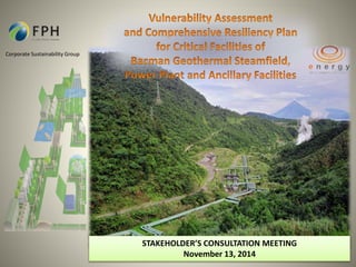
2. Corporate Sustainability Group
STAKEHOLDER’S CONSULTATION MEETING
November 13, 2014
AGENDA
Overview Of Vulnerability Assessment and
Comprehensive Resiliency Plan for Critical
Facilities of Bacman Geothermal Steamfield,
Power Plant and Ancillary Facilities
Implementation Arrangement
Ways Forward
5. La
Union
Tsunami
Bulacan
Taguig
Negros
Sorsogon
General
Santos
Davao
Typhoon
Drought
Sea Level
Rise
4th Intl. Housing Forum
Oct. 2013
http://gdis.denr.gov.ph/mgbviewer/
PHILIPPINE STATE ON CLIMATE CHANGE
6. Caloy (2006)
Frank (2008
Jolina (2009)
EDC WAS HIT BY 24 TYPHOONS THAT AFFECTED EDC SITES FROM 2006-2013
Helen (2008)
Landslides (2009)
Sendong (2011)
Canlas Flashfloods
(2006)
Crising (2013)
Jebi/Jolina (2013)
Ondoy
(2009)
Caloy (2006)
MIlenyo (2006)
Reming (2006)
Dante (2009)
Santi (2009)
Urduja (2009)
Juaning (2011)
Ambo (2012)
Glenda (2013)
Caloy (2006)
MIlenyo (2006)
Lando (2007)
Frank (2008)
Pablo (2008)
Urduja (2009)
Basyang (2010)
Ramon (2011)
Ofel (2012)
Gorio (2013)
Yolanda (2014)
6
Leyte Project (700MW)
Pantabangan (132 MW)
Negros Project (192 MW)
Bacman Project (130MW)
Mt. Apo Project (106 MW)
8. Conceptual Framework Towards Adaptive Resilient System
Critical Resource
Resiliency Planning
Identify vulnerable resource
input; restore ecosystem/natural
defences; monitor ecosystems
COMPREHENSIVE
RESILIENCY PLAN:
Ecosystem-Based Approach
Disaster Risk
Management
Identify Emergency Response,
early warning, preparedness
and preventive measures
Climate Change
Adaptation
Identify adaptation Options:
engineering measures and
natural solutions
Critical
Infrastructure
Resiliency Planning
Identify and reduce business
vulnerability
CLIMATE CHANGE & NATURAL HAZARDS
9. Critical Infrastructure Resiliency Planning
Vulnerability Assessment of
Project Facilities
Comprehensive Resiliency
Management Plan for
BacMan Geothermal
Facilities
Critical Infrastructure Resiliency
programs have been identified.
Vulnerable Facilities of Bacman
Geothermal Project has been
identified and mapped-out.
10. Critical Infrastructure Resiliency Planning
OBJECTIVES
Determine and Identify
the level of vulnerability
of EDC’s critical
infrastructures including
its immediate
environment to climate
and change and major
hazard and its effects;
Assess existing coping
mechanisms (if any) to
climate change hazards
and propose appropriate
strategies for adaptation
and/or mitigation of the
hazards; and
Enhance EDC’s technical
knowledge to better
understand and make use
of climate information,
and enhance relevant
data and access to data
for planning and decision-making.
34. BGBU HAS EMBARKED ON SEVERAL KEY PROJECTS TO
IMPROVE RELIABILITY AND TYPHOON SURVIVABILITY
34
Reliability Typhoon Survivability
• Palayan generator life extension
assessment
• Auxiliary equipment improvement
• Hot well pumps
• CW discharge valves
• Auxiliary CW pump redundancy
• Restore cooling tower N+1 capability
• Replacement of legacy and obsolete
230KV switchyard tie breakers
• Future improvements
• Cooling tower
• Installation of RTM fan stacks
• Design for 300 kph gale winds
• Restored facilities to withstand 300 kph
winds
• Install geotechnical instrumentation on
all critical slopes
• Design and implement long term
mitigation measures on critical slopes /
access road
35.
36.
37.
38.
39.
40.
41.
42.
43.
44.
45.
46.
47. BGBU HAS THREE (3) EXPANSION PROJECTS WHICH ARE IN
VARIOUS STAGES OF DEVELOPMENT
47
2015 2016 2017
1 2 3 4 1 2 3 4 1 2 3 4
2018
1 2 3 4
2019
1 2 3 4
2020
1 2 3 4
Bac-Man 4 (Botong-Rangas)
Bac-Man 5 (Tikolob)
Bac-Man 3 (Tanawon)
Bac-Man 1 and 2
MAP OF SELECT BGBU
DEVELOPMENTS
Note: *Capacities still subject to change pending drilling
and discharge tests
Source: West Bac-Man Integrated Resource Assessment
51. Vulnerability Assessment and Comprehensive Resiliency Plan
for Critical Facilities of Bacman Geothermal Steamfield, Power Plant and Ancillary Facilities
52. Scope of Work
• Stakeholder
Consultation
• Needs and
Gaps
Identification
• Review of
Secondary
Data
Inception
Phase
• Structural
Assessment
•Geotechnical
Assessment of
Project
Facilities and
Immediate
Environment
• Climate Risk
Scenario
• Estimation of
Exposure
Sensitivity &
Vulnerability
•Natural
Infrastructure
Assessment
VA
• Portfolio of
Strategies
(Structural
Engineering
Design and
Natural
Solutions
Options).
• Cost-Benefit
Analysis for
Priority
Vulnerable
Facilities
Comprehensive
Resiliency Plan
53. Vulnerability Assessment and Comprehensive Resiliency Plan
for Critical Facilities of Bacman Geothermal Steamfield, Power Plant and Ancillary Facilities
Proposed Methodologies
Comprehensive
Resiliency Plan
Portfolio of
Engineering
Design and
Natural
Solutions
Options.
Vulnerability
Assessment
Estimation of
Exposure &
Sensitivity, &
Vulnerability
Structural
Assessment
Geotechnical
Reports &
Geo-hazard
Maps
Climate Risk
Scenario
Natural
Infrastructure
Assessment
55. Vulnerability Curve
Building
Type
Estimation of
Exposure and
Sensitivity, and
Vulnerability
Building Description Number of Stories
W1
Wood Frame with Area ≤
500 sq. m
Low rise (1-2 stories)
W3 Bamboo Low rise (1-2 stories)
N Makeshift Low rise (1-2 stories)
MWS
Half-masonry and half-wood/
steel
Low rise (2 stories)
CHB Concrete Hollow Blocks Low rise (1-2 stories)
CWS
Half-concrete and half-wood/
steel
Low rise (2 stories)
C1
Reinforced Concrete
Moment Frame
Low rise (1-2 stories)
Mid rise (3-7)
S1 Steel Moment Frame
Low rise (1-2 stories)
Mid rise (3-7)
S3 Light Metal Low rise (1-2 stories)
BB Billboards -
PT Power Transmission Towers -
56. Tree Architecture
Assessment
Landscape Function Analysis
W
Landscape Windbreaks
Natural
Infrastructure
Assessment VEGETATION AND LANDSCAPE ANALYSIS
57. INTERVENTIONS SHALL BE DEVELOPED LIKE SHELTER
BELTS FOR WIND LOADS FROM TROPICAL CYCLONES
Design Factors
• Design factors (tree height,
density, orientation, width,
cross sectional shape and continuity)
• Nature of tree species
(wood hardness, leaf arrangement,
root systems)
• Regional and local severe
wind conditions and
multipliers (topography,
shielding and terrain
roughness)
Team: Forester, Engineers,
Meteorologist
Portfolio of
Engineering
Design and
Natural
Solutions
Options.
58. Portfolio of
Engineering
Design and
Natural
Solutions
Options.
Landscape Windbreaks and Other Natural
Infrastructure
59. PROPOSED TIMELINE
PROGRAM OF ACTIVITIES
TIME FRAME
2014 2015
November December January February March April May
I. Finalization of Terms of Reference
1.1 Stakeholder Consultation
II. Pre-Bid Consultation
III. Procurement of Services
IV. Project Mobilization
4.1. Project Inception
4.2. Submission of Inception Report
4.3. Submission of 1st Interim Report
4.4 Submission of 2nd Interim Report
4.3. Submission of Draft Final Report
V. Turn-Over of Final Report
60. WHERE ARE WE AT?
Drafted Project Terms of Reference (subject for review)
Consultation Meeting with BGBU on October 24, 2014
Conducted consultation meeting with Experts:
Dr. F.R. Estuar for Terms of Reference last September 30, 2014
Ms. Thelma Cinco of PAG-ASA for Briefing on Climate Risk
Scenario last November 3, 2014
64. NEXT STEPS
Finalized the Project Terms of Reference (subject for review)
Engage contractors for each studies
Conduct Inception Workshop (Stakeholders and Experts)
65. Corporate Sustainability Group
THANK YOU!
Plan for Sustainability
Projects should be designed so their impact continues long after the company’s involvement. Projects that focus on developing
community skills and capacity or improving community incomes yield more sustainable benefits than projects and programs that
simply distribute goods and services. Companies can plan for sustainability with communities by building community capacity to
manage projects and encouraging links with other organizations. Companies should prepare to hand over responsibility for projects
to communities, governments or other organizations once the program has become sustainable and self-sufficient. Setting a
timetable to hand over responsibility with measurable goals and benchmarks is essential to avoiding dependency.
KEY PRINCIPLES FOR COMMUNITY DEVELOPMENT PROGRAMS
IFC: A Community Development Resource Guide For Companies