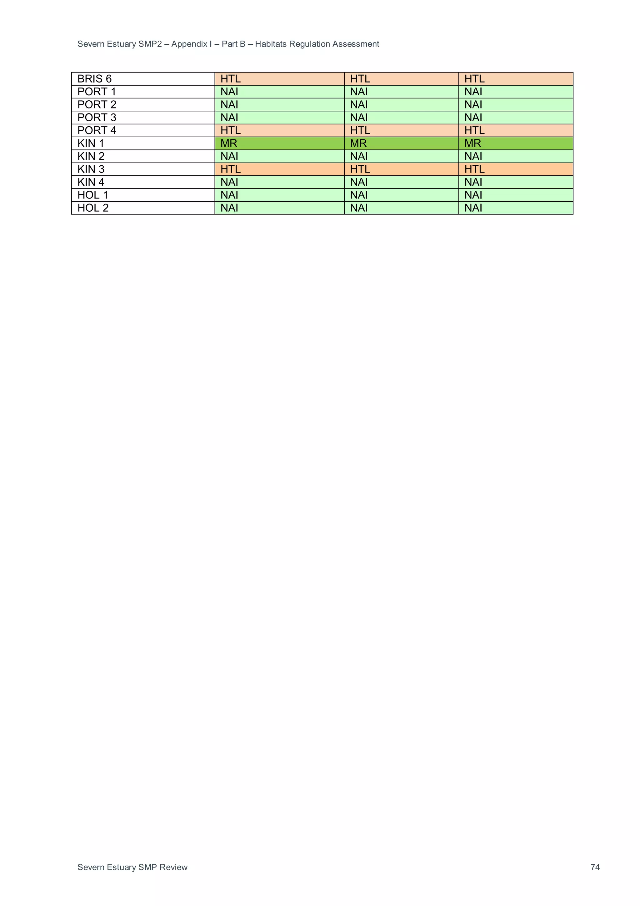
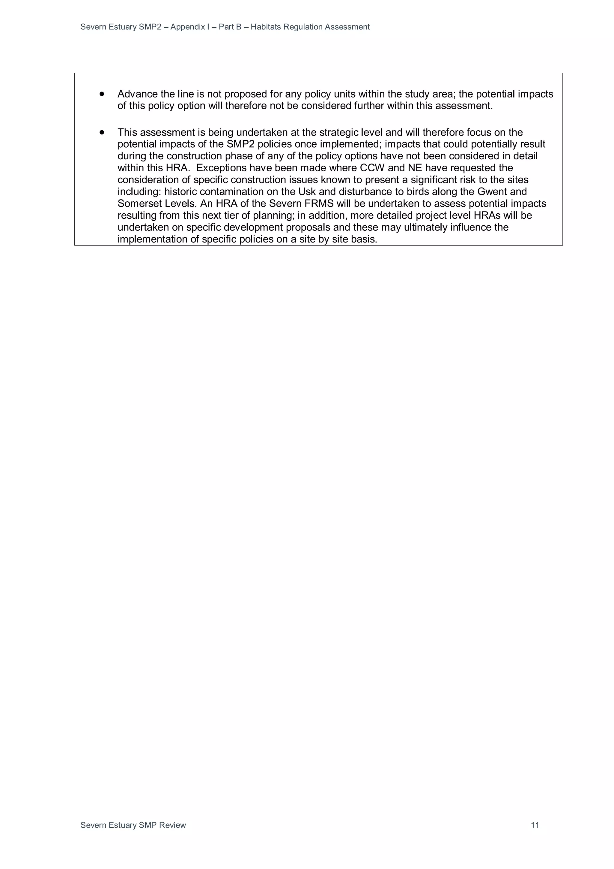
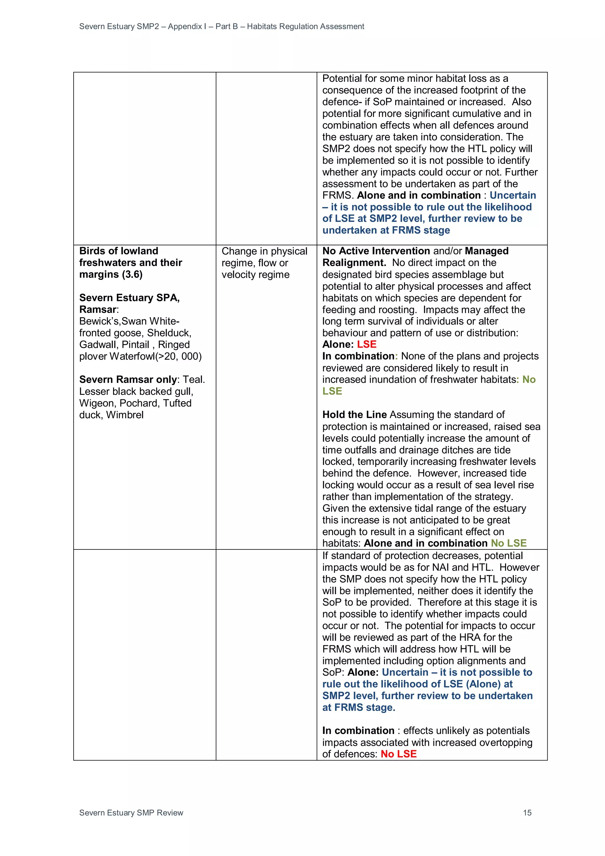
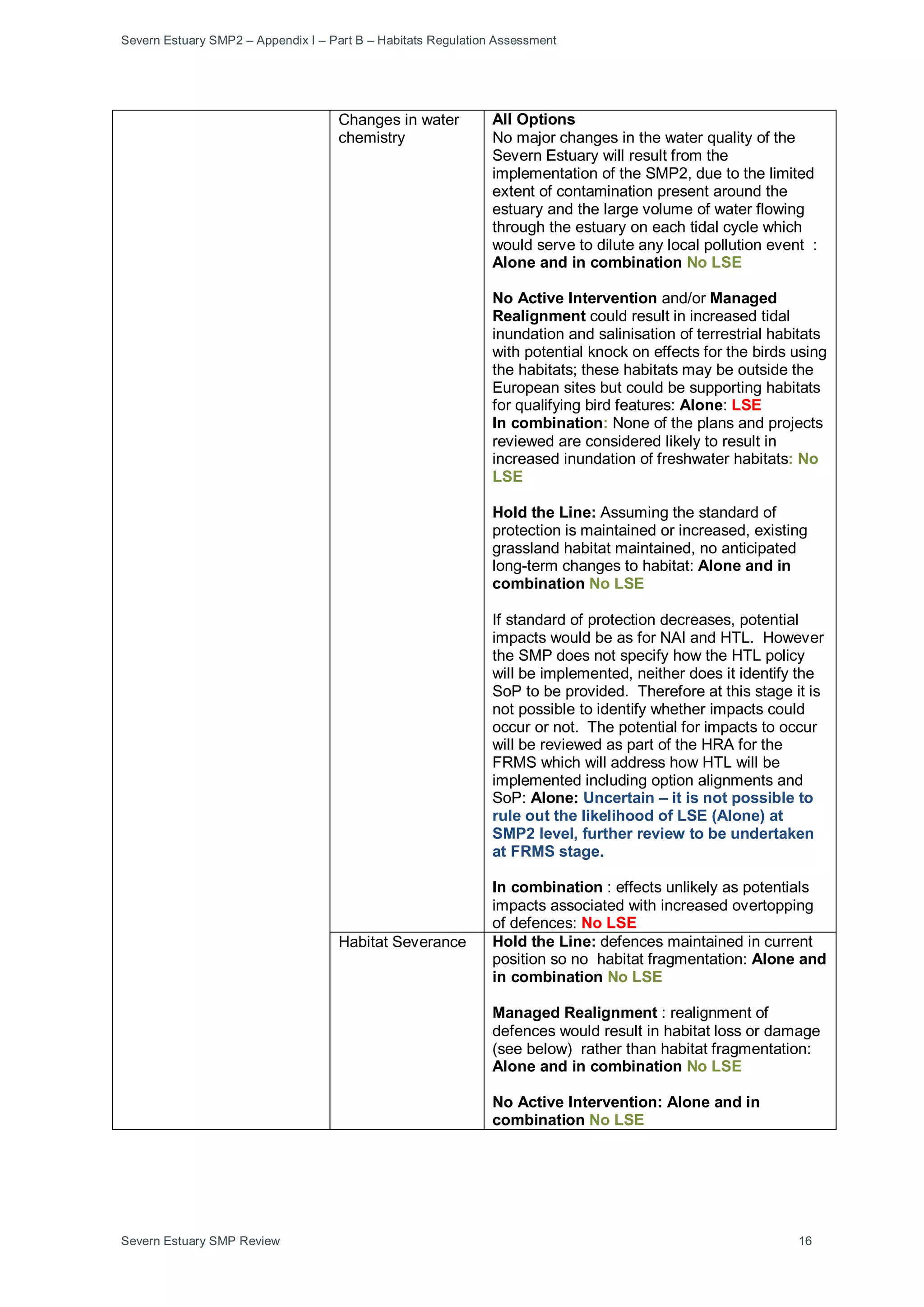
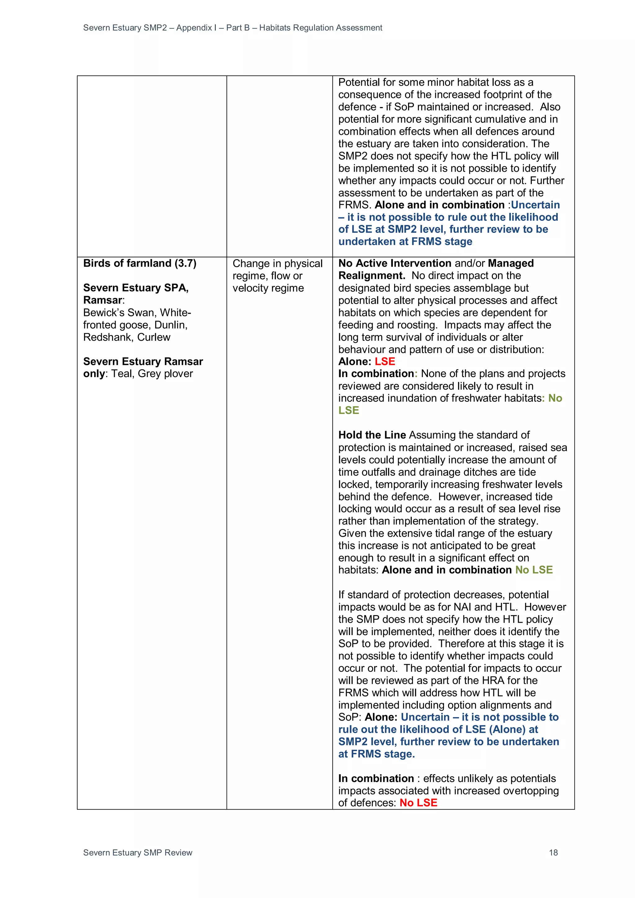
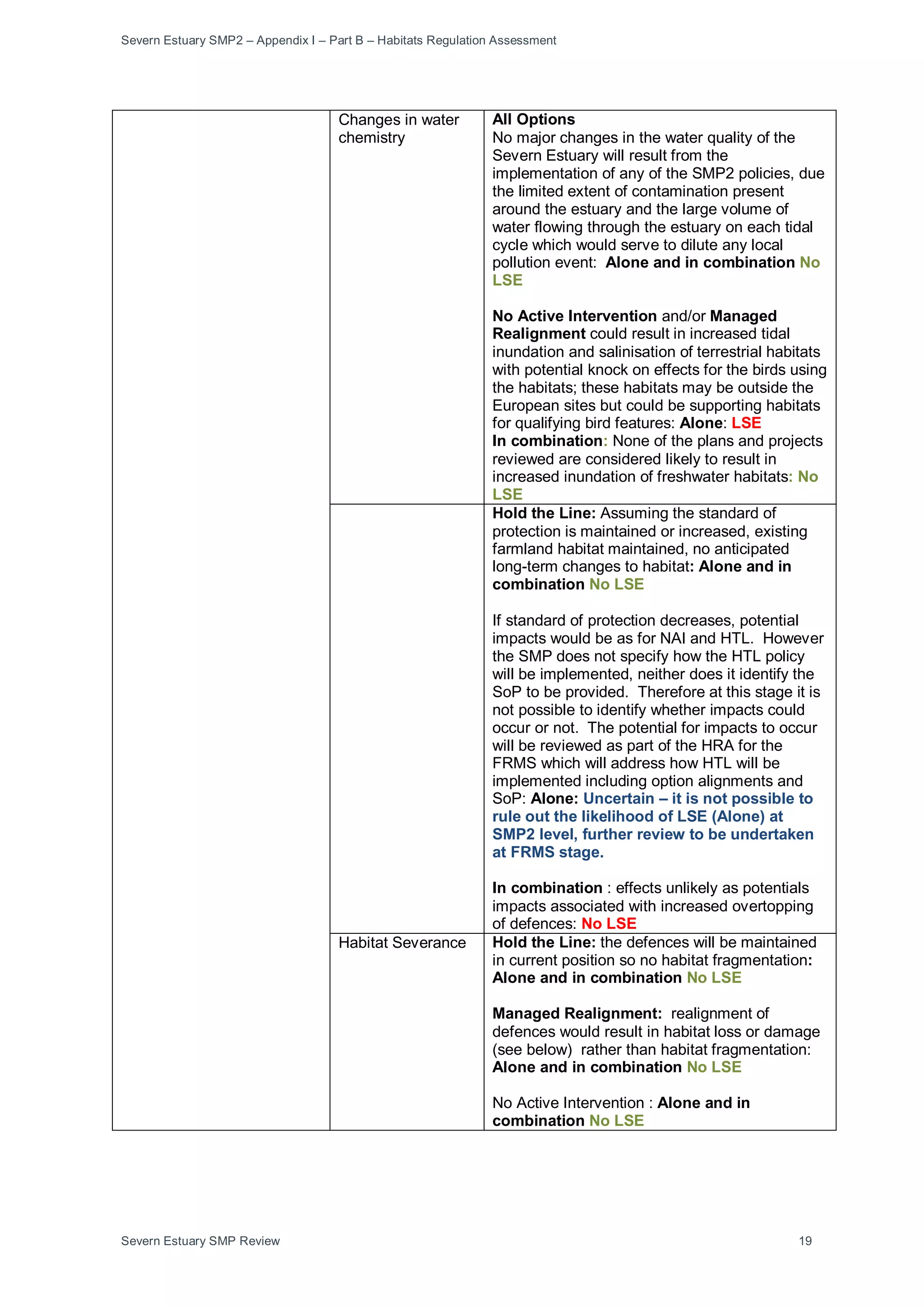
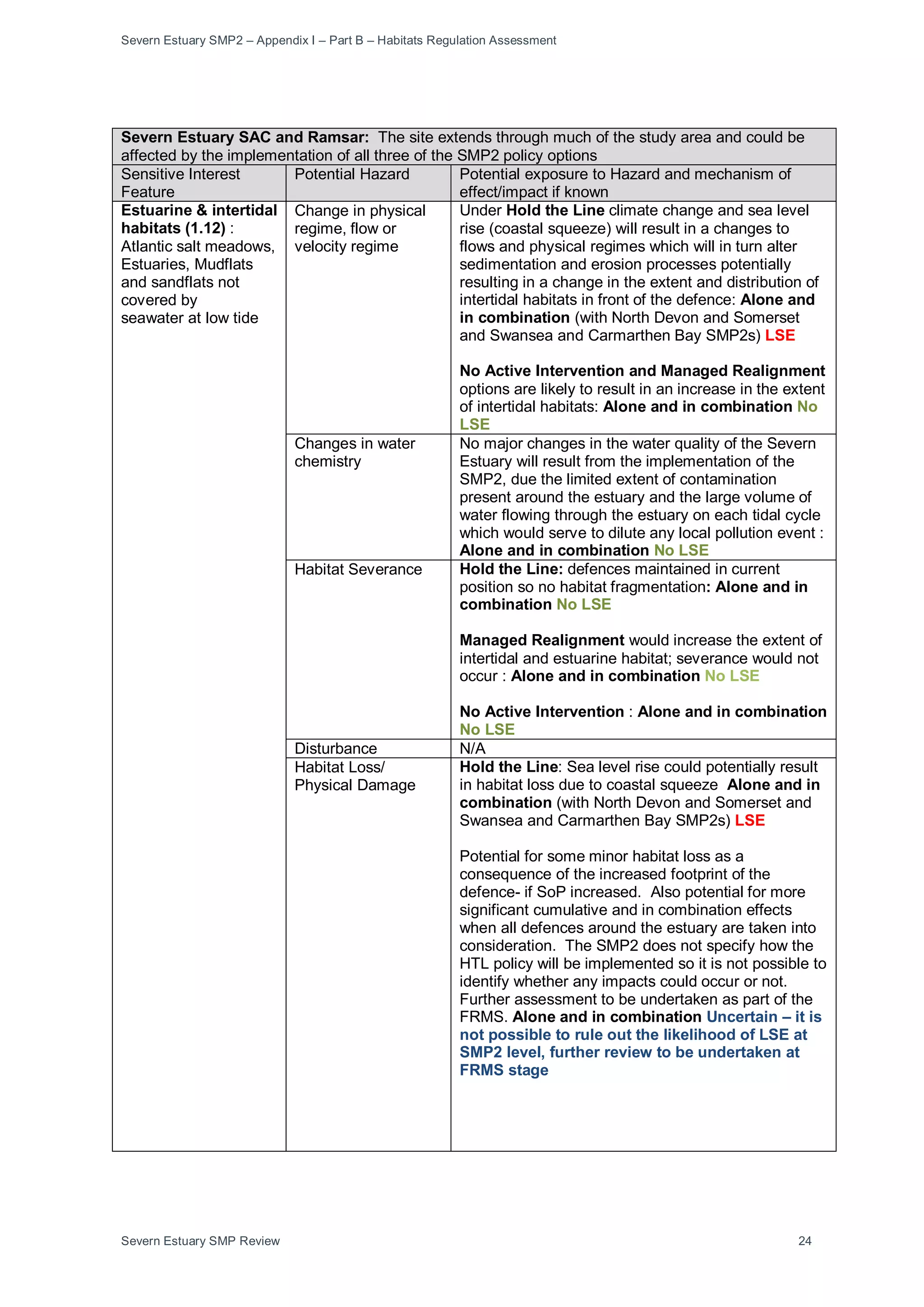
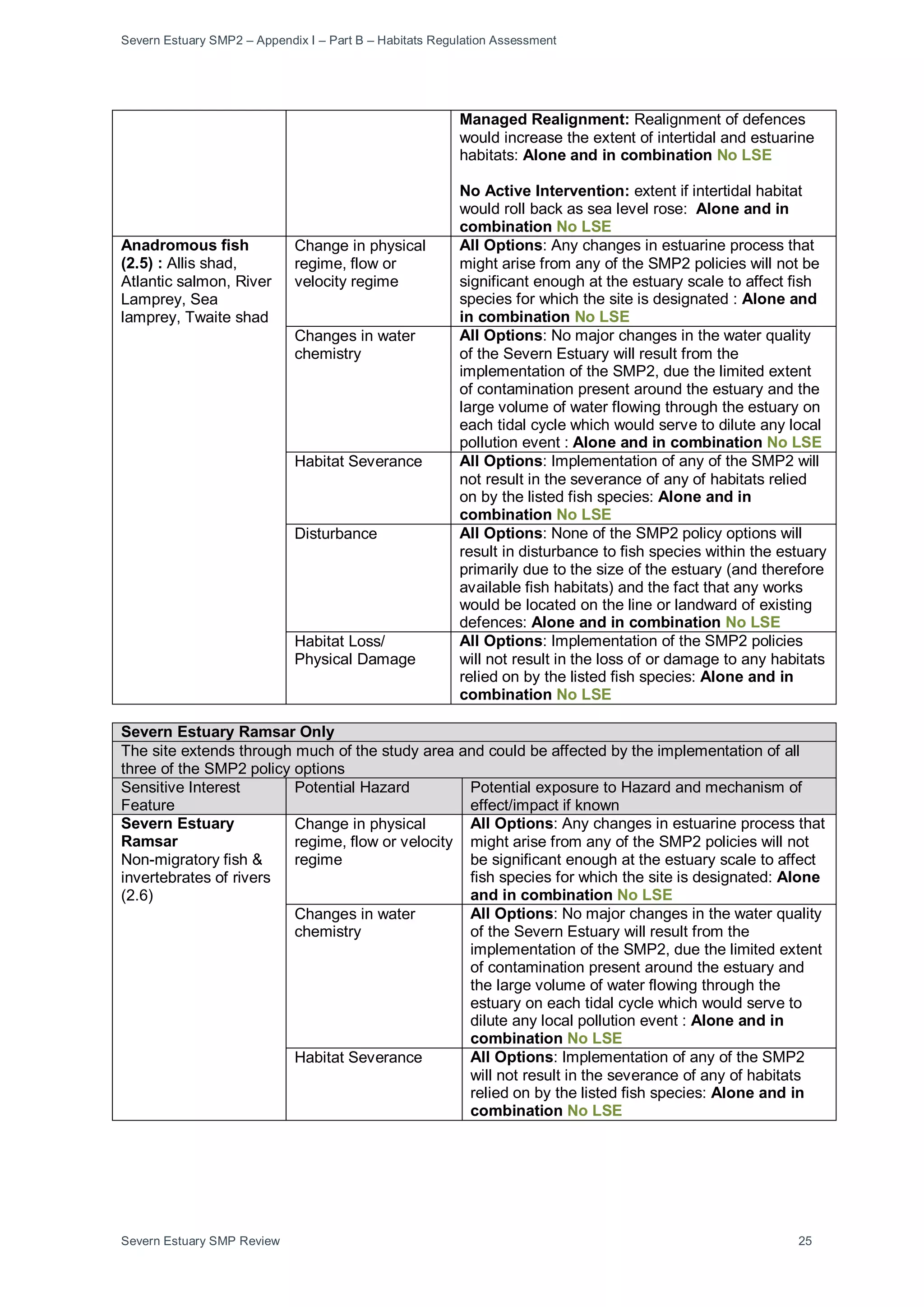
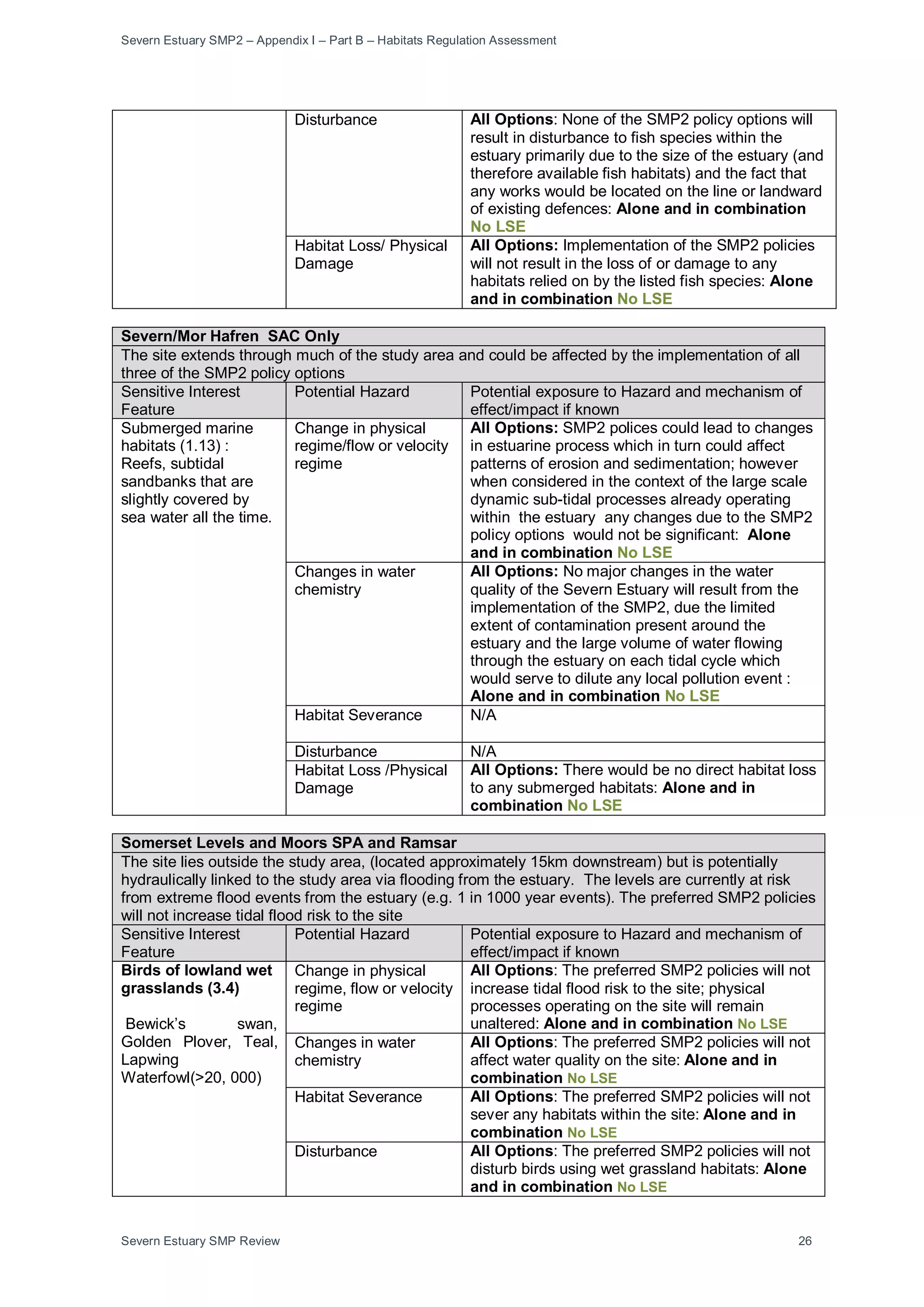
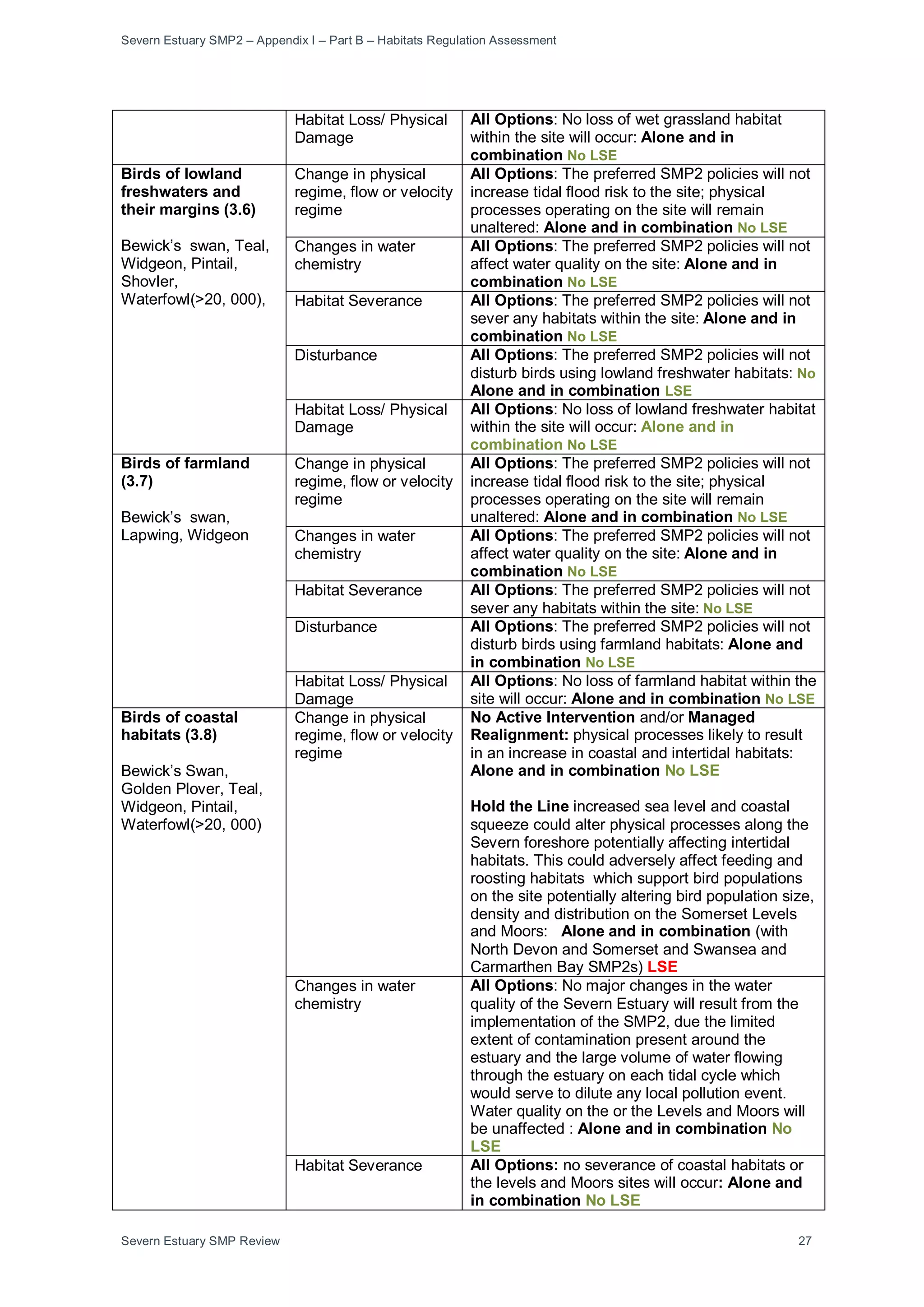
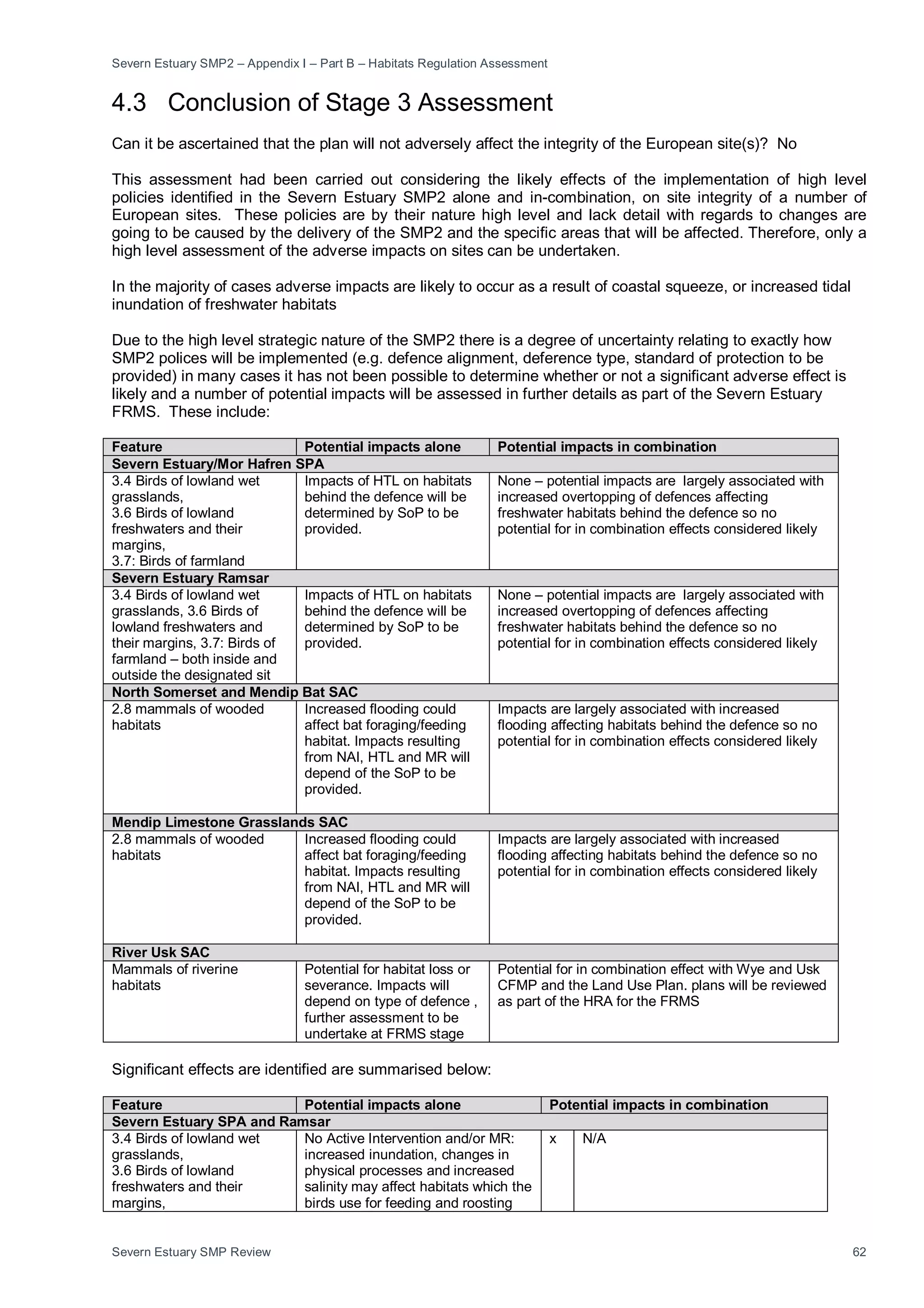
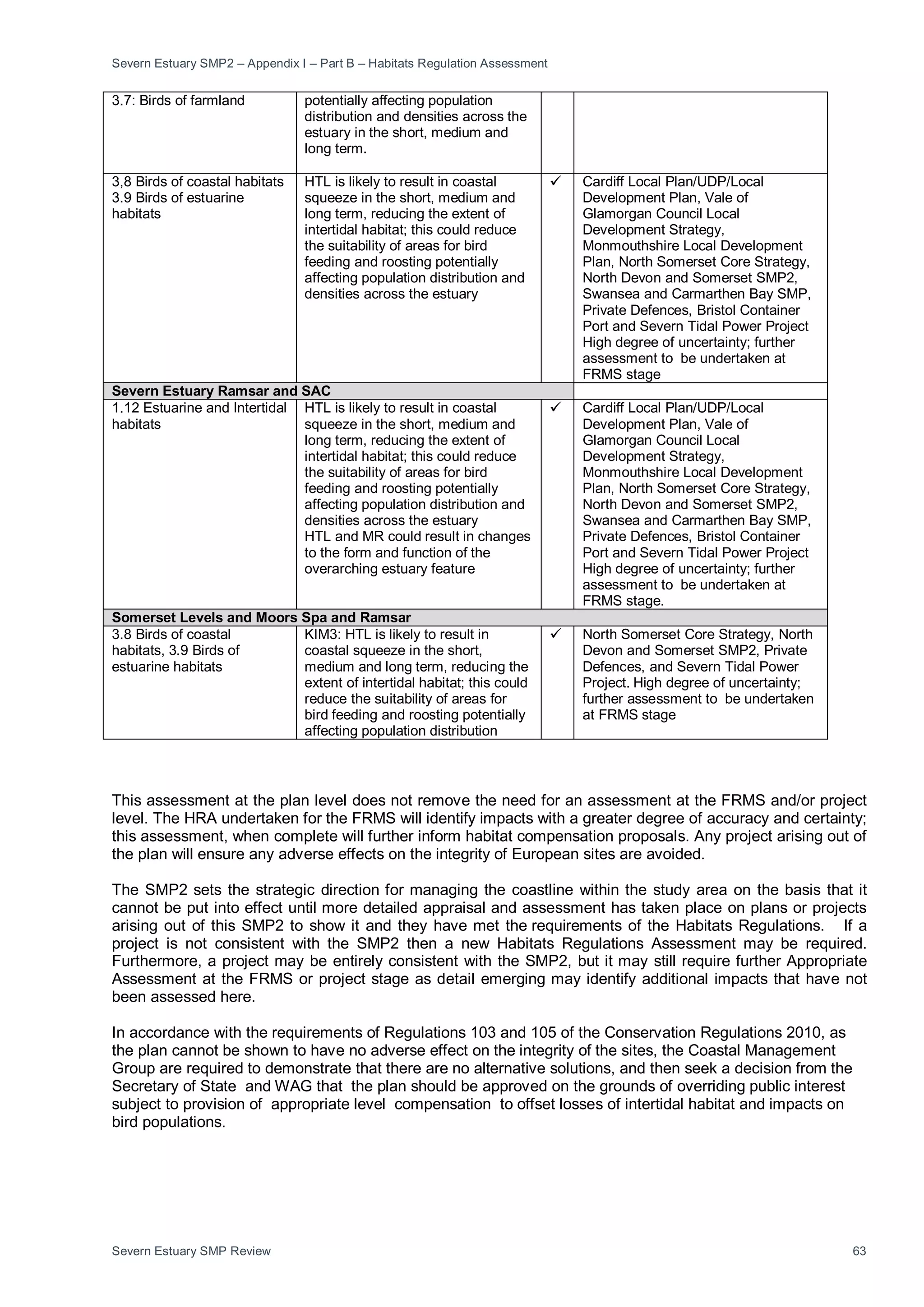
This document summarizes the Stage 1 assessment undertaken as part of the Habitats Regulations Assessment for the Severn Estuary Shoreline Management Plan Review. 30 European sites were initially considered based on their location and potential connectivity to the study area. Following an analysis of their interest features and conservation objectives, 20 sites were scoped out from further assessment because they were deemed unlikely to be affected by changes resulting from implementation of the SMP2. The remaining 10 sites were carried forward to Stage 2 assessment.


![Severn Estuary SMP2 – Appendix I – Part B – Habitats Regulation Assessment
Severn Estuary SMP Review 65
5.0 Part B: Final Appropriate Assessment Record:
Severn Estuary SMP2 (May 2010)
This is a record of the appropriate assessment required by Section 61 of the Habitats Regulations 2010,
undertaken on behalf of the Severn Estuary Coastal Group in respect of the above plan, in accordance with
the Habitats Directive (Council Directive 92/43/EEC). Having considered that the plan would be likely to have
a significant effect on the Severn Estuary SPA, SAC and Ramsar sites, Somerset Levels and Moors SPA and
Ramsar site and River Usk SAC, and that the plan was not directly connected with or necessary to the
management of the sites for nature conservation, an appropriate assessment has been undertaken of the
implications of the proposal in view of the sites’ conservation objectives.
CCW and NE were consulted under Regulation 48(3) on [date] and their representations, to which the Agency
has had regard, are attached in Annex D [not yet inserted]. The conclusions of this appropriate assessment
are / are not in accordance with the advice and recommendations of CCW/NE".
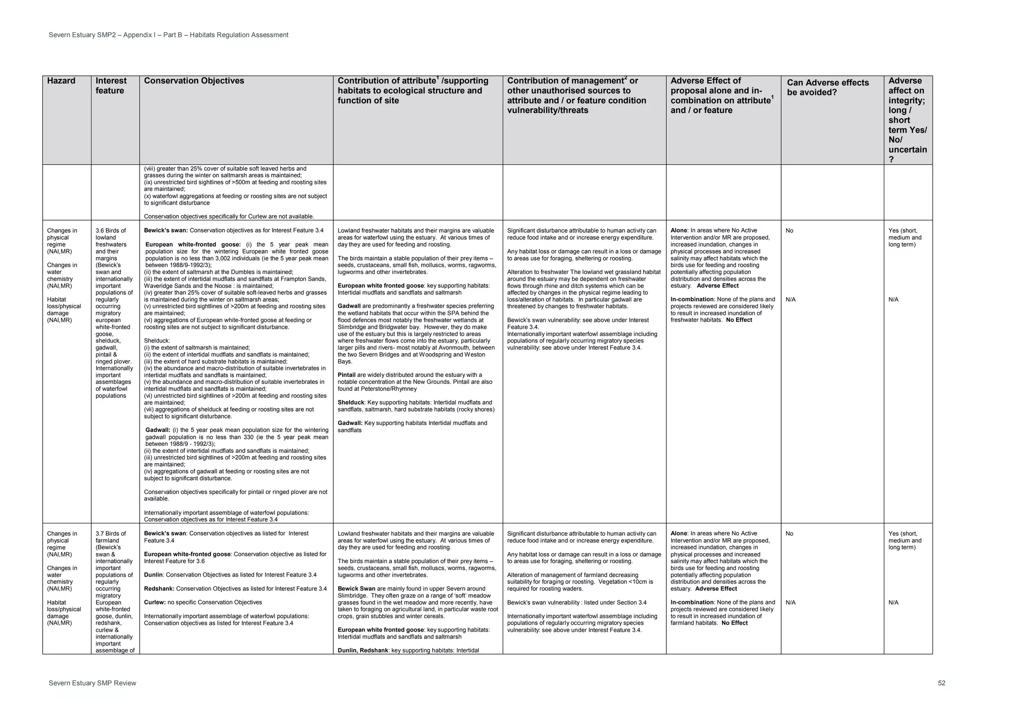
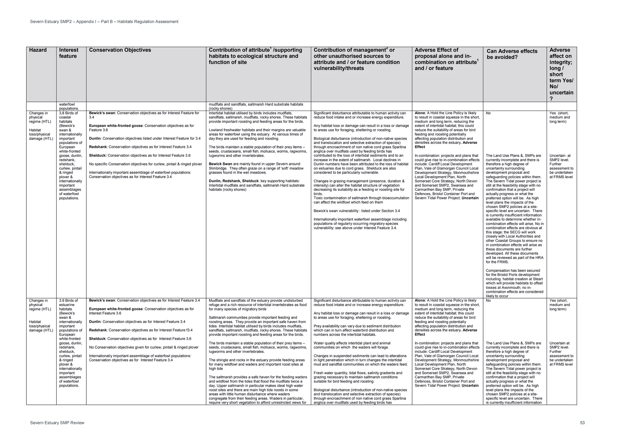
The site’s nature conservation objectives have been taken into account, including consideration of the citation
for the site and information supplied by CCW/NE. The likely effects of the SMP2 on the international nature
conservation interests for which the sites were classified or designated may be summarised as [list of effects]:
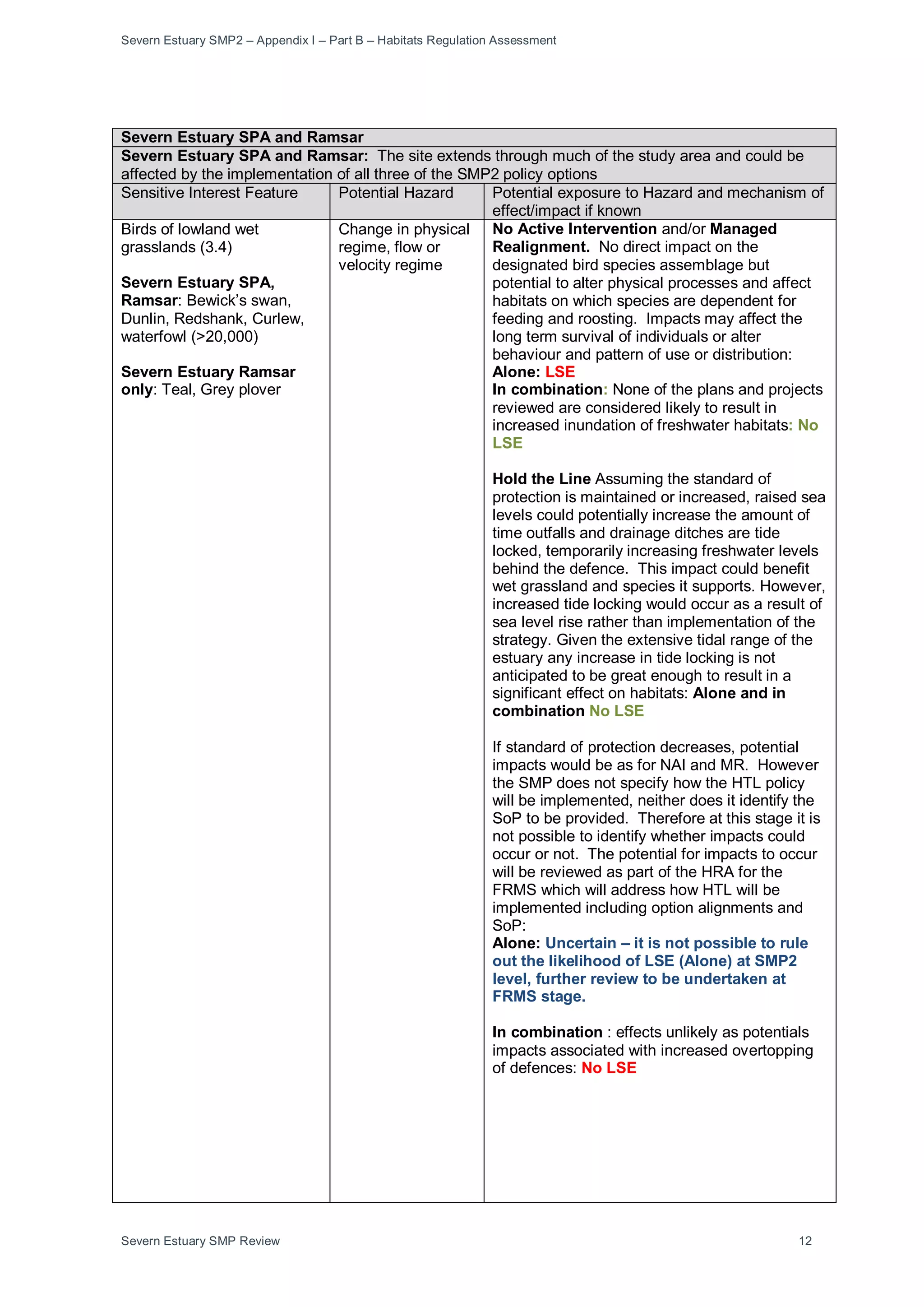
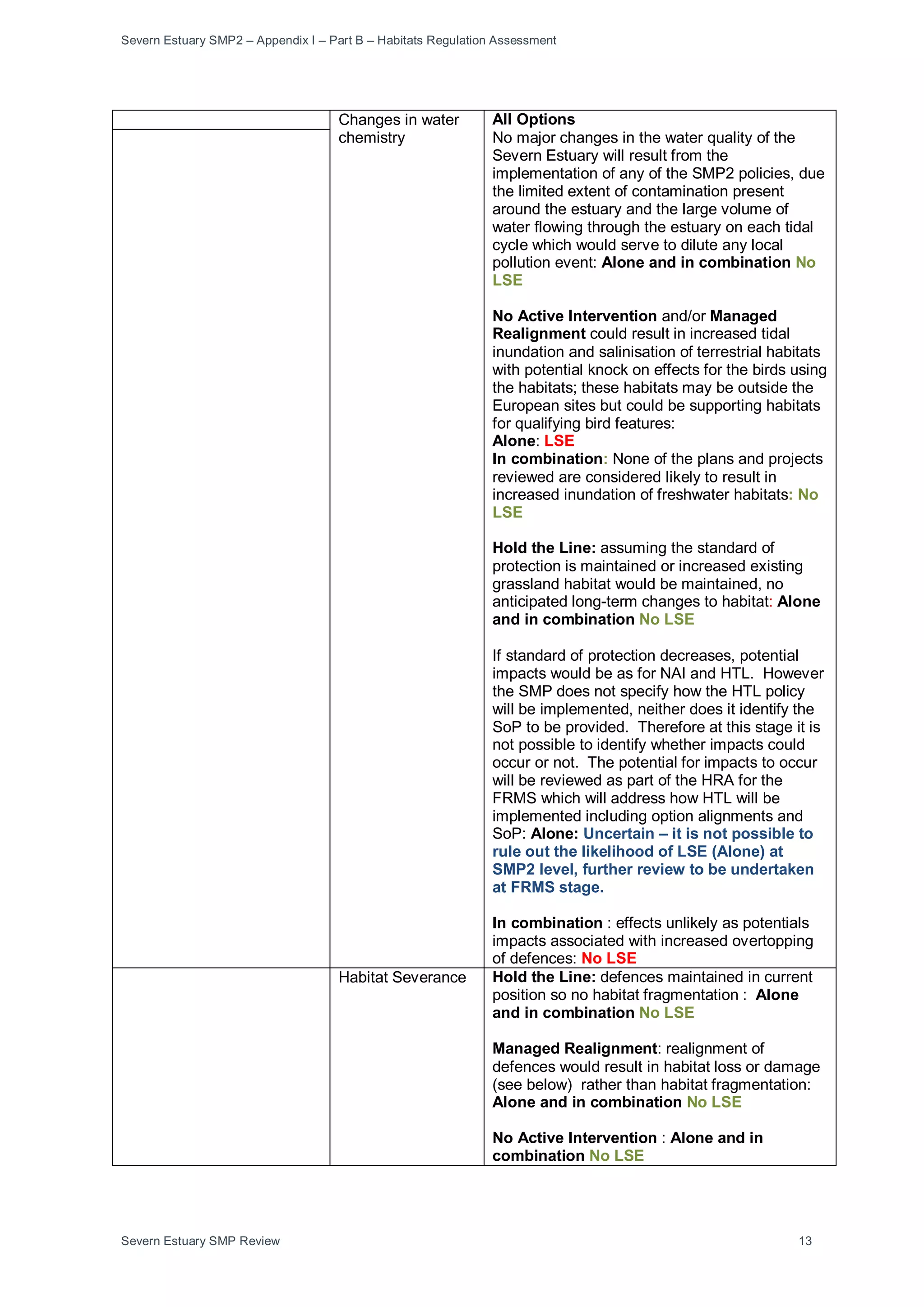
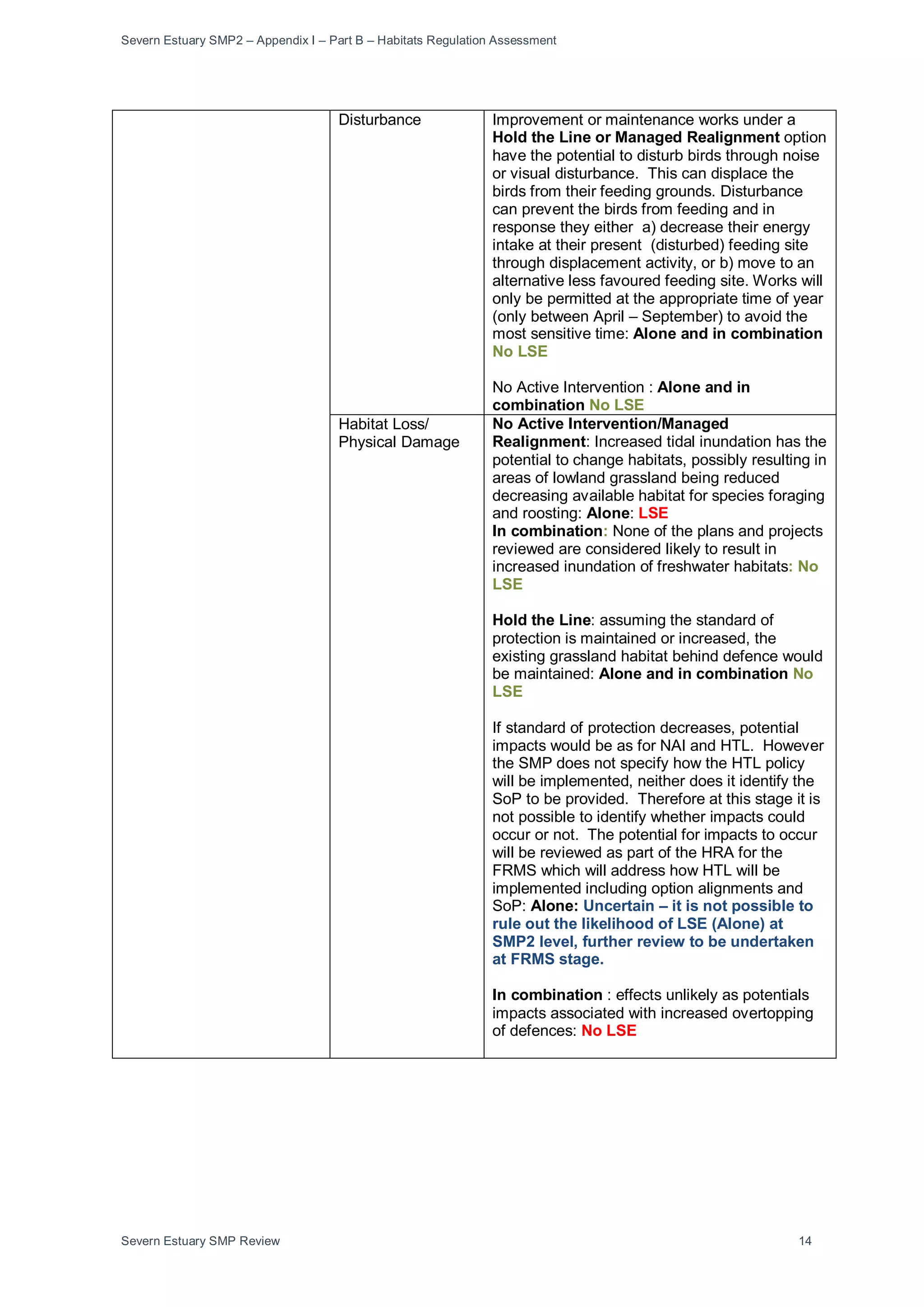
• Loss of intertidal habitat (Severn SAC/Ramsar)
• Potential impacts on bird population size, distribution and density (Severn SPA/Ramsar; Somerset
Levels and Moors SPA/Ramsar).
• Loss of intertidal habitat potentially affecting otter passage or feeding
The assessment has concluded that the plan as proposed cannot be shown to have no adverse effect on the
integrity of the site. The imposition of conditions or restrictions on the way the proposal is to be carried out
has been considered and it is ascertained that:
i conditions or restrictions cannot/may not overcome the adverse effects on the integrity of the Severn
SPA/SAC/Ramsar and Somerset Levles and Moors
ii the following conditions and/or restrictions would avoid adverse effects on the integrity of the River
Usk SAC’:
• Further assessments of impacts at the FRSM and project level will be undertaken and will allow
potential impacts to be quantified and avoidance or mitigation measures indentified.
In accordance with the requirements of Regulations 103 and 105 of the Conservation Regulations 2010, as
the plan cannot be shown to have no adverse effect on the integrity of the sites, the Coastal Management
Group are required to demonstrate that there are no alternative solutions, and then seek a decision from the
Secretary of State and WAG that the plan should be approved on the grounds of overriding public interest
subject to provision of appropriate level compensation to offset losses of intertidal habitat and impacts on
bird populations.
Signed (relevant Area Management Team member) and date.](https://image.slidesharecdn.com/appendixipartbhrafinaldec2010-160323163656/75/Appendix-i-part-b-_hra_final_dec2010-68-2048.jpg)