Download to read offline

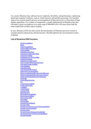


This document summarizes and compares several land use and land cover change (LUCC) modeling tools that can be used within geographic information systems (GIS). It describes tools available in common GIS software like ESRI's ArcGIS and Idrisi, as well as standalone modeling programs including CLUE, DINAMICA, SLEUTH, Land Use Scanner, Environment Explorer, and MOLAND. Many of these tools use cellular automata and statistical regression to model and predict future LUCC based on historical trends and environmental factors. The document provides links to websites with more information about these different modeling programs.


![제 23회 보아즈(BOAZ) 빅데이터 컨퍼런스 - [MBOAX] : ABSA를 활용한 소비자 반응 분석 기반 운영 효율화 대시보드 설계](https://cdn.slidesharecdn.com/ss_thumbnails/3-1boaz23rdconferencemboax-260203102709-9d519923-thumbnail.jpg?width=640&height=640&fit=bounds)


