SlideShare a Scribd company logo
1 of 6
Arab Republic Of Egypt
Ministry of Petroleum Egypt
MIDOR Co.
Petroleum Field Services’
Surveying and Geomatics Engineering Department
Presented By : Mohamed Gamal Ramadan
*Student at Shoubra faculty of Engineering ,
Surveying and Geomatics Branch of Civil Eng.
Department
Supervising : chemical Eng. / Hala Sallam
Surveying science :-
Surveying or land surveying is the technique,
profession, and science of determining the terrestrial
or three-dimensional position of points and the
distances and angles between them. A land surveying
professional is called a land surveyor. These points
are usually on the surface of the Earth, and they are
often used to establish land maps and boundaries for
ownership, locations like building corners or the
surface location of subsurface features, or other
purposes required by government or civil law, such
as property sales.
Surveyors work with elements of geometry,
trigonometry, regression analysis, physics,
engineering, metrology, programming languages and
the law. They use equipment like total stations,
robotic total stations, GPS receivers, retroreflectors,
3D scanners, radios, handheld tablets, digital levels,
drones, GIS and surveying software.
Surveying has been an element in the development of
the human environment since the beginning of
recorded history. The planning and execution of
most forms of construction require it. It is also used
in transport, communications, mapping, and the
definition of legal boundaries for land ownership.
It is an important tool for research in many other
scientific disciplines.
The Relation Between surveying and petroleum
refinery is to Determine the earth's surface altitude
and thus helps calculates the necessary depth drilled
to reach the surface of the reservoir + calculate the
size of the reservoir and help him calculates the
economic returns of the reservoir oil investor.
Levelling related to drilling of pipelines :-
The simplest method for measuring height is with an
altimeter using air pressure to find height. When
more precise measurements are needed, means like
precise levels (also known as differential leveling) are
used. When precise leveling, a series of
measurements between two points are taken using an
instrument and a measuring rod. Differences in
height between the measurements are added and
subtracted in a series to get the net difference in
elevation between the two endpoints. With the
Global Positioning System (GPS), elevation can be
measured with satellite receivers. Usually GPS is
somewhat less accurate than traditional precise
leveling, but may be similar over long distances.
Determining Position :-
The primary way of determining one's position on
the earth's surface to drill for the pipelines when no
known positions are nearby is by astronomic
observations. Observations to the sun, moon and
stars could all be made using navigational
techniques. Once the instrument's position and
bearing to a star is determined, the bearing can be
transferred to a reference point on the earth. The
point can then be used as a base for further
observations. Survey-accurate astronomic positions
were difficult to observe and calculate and so tended
to be a base off which many other measurements
were made. Since the advent of the GPS system,
astronomic observations are rare as GPS allows
adequate positions to be determined over most of the
surface of the earth.
GPS and transportationof oil Products :-
GPS rule in transportation of oil in its pipelines is to
use the coordinate systems as Many surveys do not
calculate positions on the surface of the earth, but
instead measure the relative positions of objects.
However, often the surveyed items need to be
compared to outside data, such as boundary lines or
previous surveys objects.
The oldest way of describing a position is via latitude
and longitude, and often a height above sea level. As
the surveying profession grew it created Cartesian
coordinate systems to simplify the mathematics for
surveys over small parts of the earth. The simplest
coordinate systems assume that the earth is flat and
measure from an arbitrary point, known as a
'datum' (singular form of data). The coordinate
system allows easy calculation of the distances and
direction between objects over small areas. Large
areas distort due to the earth's curvature. North is
often defined as true north at the datum.
For larger regions, it is necessary to model the shape
of the earth using an ellipsoid or a geoid. Many
countries have created coordinate-grids customized
to lessen error in their area of the earth.
An Overview :-
Petroleum Field Services only puts
experienced “boots on the ground,” using
certified, professional land surveying field crews to
dig up historical evidence on section corner
retracement. New pipeline and well pad projects
are staked in innovative ways to safeguard crops
and the natural environment.
Our CAD technicians are skilled in drafting clean,
uncluttered plats and exhibits to clearly define the
details of your project and integrate data into our
custom GIS-based Petroleum Asset Manager
(PAM) for your direct access.
Accomplished and responsible Certified Federal
Surveyors and Professional Land Surveyors are in
charge of all projects throughout the Rocky
Mountain Region, from Texas to North Dakota. Our
full team of survey professionals can complete any
upstream or midstream land survey project,
including: section breakdown, routing, pipeline
staking, boundary delineation, property descriptions,
easements, pad design and layout, grading,
topographic surveys and ALTA surveys. We pride
ourselves on providing the fastest turnaround times
in the industry, along with the highest quality results.
Our goal at PFS is to continually strive to provide
the best land surveying solutions to support our
clients in the oil and gas industry. Whether they need
to stay on track or get caught up, our clients can
always count on PFS.

More Related Content

What's hot

Techniques of Land Surveying
Techniques of Land SurveyingTechniques of Land Surveying
Techniques of Land SurveyingVijay Meena
 
Projections and coordinate system
Projections and coordinate systemProjections and coordinate system
Projections and coordinate systemMohsin Siddique
 
IGRASS2011_Target detection_zhang bo.ppt
IGRASS2011_Target detection_zhang bo.pptIGRASS2011_Target detection_zhang bo.ppt
IGRASS2011_Target detection_zhang bo.pptgrssieee
 
2018 GIS in the Rockies Workshop: Coordinate Systems and Projections
2018 GIS in the Rockies Workshop: Coordinate Systems and Projections 2018 GIS in the Rockies Workshop: Coordinate Systems and Projections
2018 GIS in the Rockies Workshop: Coordinate Systems and Projections GIS in the Rockies
 
Coordinate systems, datum & map projections
Coordinate systems, datum & map projectionsCoordinate systems, datum & map projections
Coordinate systems, datum & map projectionsKU Leuven
 
application of remote sensing in defence forces
application of remote sensing in defence forcesapplication of remote sensing in defence forces
application of remote sensing in defence forcesNEERAJSHARMA814
 
Remote sensing and it's applications
Remote sensing and it's applicationsRemote sensing and it's applications
Remote sensing and it's applicationsWaleed Liaqat
 
Presentation of survey
Presentation of surveyPresentation of survey
Presentation of surveyFaheem Khan
 
Introduction to MAPS,Coordinate System and Projection System
Introduction to MAPS,Coordinate System and Projection SystemIntroduction to MAPS,Coordinate System and Projection System
Introduction to MAPS,Coordinate System and Projection SystemNAXA-Developers
 
Surveying ( introduction )
Surveying ( introduction )Surveying ( introduction )
Surveying ( introduction )laxman singh
 
2017 PLSC Track: Fundamentals of Coordinate Systems
2017 PLSC Track: Fundamentals of Coordinate Systems2017 PLSC Track: Fundamentals of Coordinate Systems
2017 PLSC Track: Fundamentals of Coordinate SystemsGIS in the Rockies
 
identification of ground water potential zones using gis and remote sensing
identification of ground water potential zones using gis and remote sensingidentification of ground water potential zones using gis and remote sensing
identification of ground water potential zones using gis and remote sensingtp jayamohan
 
Global positioning system_Surveying, Civil Engineering
Global positioning system_Surveying, Civil EngineeringGlobal positioning system_Surveying, Civil Engineering
Global positioning system_Surveying, Civil EngineeringA Makwana
 

What's hot (20)

Techniques of Land Surveying
Techniques of Land SurveyingTechniques of Land Surveying
Techniques of Land Surveying
 
Projections and coordinate system
Projections and coordinate systemProjections and coordinate system
Projections and coordinate system
 
georeference
georeferencegeoreference
georeference
 
Gps application
Gps applicationGps application
Gps application
 
IGRASS2011_Target detection_zhang bo.ppt
IGRASS2011_Target detection_zhang bo.pptIGRASS2011_Target detection_zhang bo.ppt
IGRASS2011_Target detection_zhang bo.ppt
 
2018 GIS in the Rockies Workshop: Coordinate Systems and Projections
2018 GIS in the Rockies Workshop: Coordinate Systems and Projections 2018 GIS in the Rockies Workshop: Coordinate Systems and Projections
2018 GIS in the Rockies Workshop: Coordinate Systems and Projections
 
Coordinate systems, datum & map projections
Coordinate systems, datum & map projectionsCoordinate systems, datum & map projections
Coordinate systems, datum & map projections
 
application of remote sensing in defence forces
application of remote sensing in defence forcesapplication of remote sensing in defence forces
application of remote sensing in defence forces
 
Map_Projections
Map_ProjectionsMap_Projections
Map_Projections
 
GPS & GIS
GPS & GISGPS & GIS
GPS & GIS
 
Remote sensing and it's applications
Remote sensing and it's applicationsRemote sensing and it's applications
Remote sensing and it's applications
 
Presentation of survey
Presentation of surveyPresentation of survey
Presentation of survey
 
Introduction to MAPS,Coordinate System and Projection System
Introduction to MAPS,Coordinate System and Projection SystemIntroduction to MAPS,Coordinate System and Projection System
Introduction to MAPS,Coordinate System and Projection System
 
Land Use Surveying
Land Use Surveying Land Use Surveying
Land Use Surveying
 
General Introduction of Surveying
General Introduction of SurveyingGeneral Introduction of Surveying
General Introduction of Surveying
 
Surveying ( introduction )
Surveying ( introduction )Surveying ( introduction )
Surveying ( introduction )
 
GPS Surveying
GPS SurveyingGPS Surveying
GPS Surveying
 
2017 PLSC Track: Fundamentals of Coordinate Systems
2017 PLSC Track: Fundamentals of Coordinate Systems2017 PLSC Track: Fundamentals of Coordinate Systems
2017 PLSC Track: Fundamentals of Coordinate Systems
 
identification of ground water potential zones using gis and remote sensing
identification of ground water potential zones using gis and remote sensingidentification of ground water potential zones using gis and remote sensing
identification of ground water potential zones using gis and remote sensing
 
Global positioning system_Surveying, Civil Engineering
Global positioning system_Surveying, Civil EngineeringGlobal positioning system_Surveying, Civil Engineering
Global positioning system_Surveying, Civil Engineering
 

Similar to Midor

GIS and GPS - applications in civil engg
GIS and GPS - applications  in civil enggGIS and GPS - applications  in civil engg
GIS and GPS - applications in civil enggPundlik Rathod
 
geodesy-1 (1).pptx
geodesy-1 (1).pptxgeodesy-1 (1).pptx
geodesy-1 (1).pptxDrOmegaYT
 
Lec (remote sensing).pptx
Lec (remote sensing).pptxLec (remote sensing).pptx
Lec (remote sensing).pptxSarfrazFaiz
 
Presentation on Introduction of Surveying.
Presentation on Introduction of Surveying.Presentation on Introduction of Surveying.
Presentation on Introduction of Surveying.MaharAliHamzaHansla
 
GPS system and its application in mining
GPS system and its application in miningGPS system and its application in mining
GPS system and its application in miningSHUBHAM KUMAR
 
79338922 survey-report
79338922 survey-report79338922 survey-report
79338922 survey-reportirwandavid
 
Site location, map reading and lot plotting,
Site location, map reading and lot plotting, Site location, map reading and lot plotting,
Site location, map reading and lot plotting, Gus Agosto
 
Presentation A.K Nigam sir (2) (1).pptx
Presentation A.K Nigam sir (2)  (1).pptxPresentation A.K Nigam sir (2)  (1).pptx
Presentation A.K Nigam sir (2) (1).pptxspeedcomcyber25
 
Global positioning system (gps)
Global positioning system (gps)Global positioning system (gps)
Global positioning system (gps)aditya singh
 
Differentiation between Global and Local Datum from Different aspect
Differentiation between Global and Local Datum from Different aspect Differentiation between Global and Local Datum from Different aspect
Differentiation between Global and Local Datum from Different aspect Nzar Braim
 
MAPS GEOSYSTEM PROFILE 2015
MAPS GEOSYSTEM PROFILE 2015MAPS GEOSYSTEM PROFILE 2015
MAPS GEOSYSTEM PROFILE 2015SURAJ CHOUDHARY
 
CV MO KASIM ALI
CV MO KASIM ALICV MO KASIM ALI
CV MO KASIM ALIkasim ali
 
Commonly used ground truth equipments
Commonly used ground truth equipmentsCommonly used ground truth equipments
Commonly used ground truth equipmentsHimangshuKalita10
 

Similar to Midor (20)

GIS and GPS - applications in civil engg
GIS and GPS - applications  in civil enggGIS and GPS - applications  in civil engg
GIS and GPS - applications in civil engg
 
geodesy-1 (1).pptx
geodesy-1 (1).pptxgeodesy-1 (1).pptx
geodesy-1 (1).pptx
 
Surveying introduction
Surveying introductionSurveying introduction
Surveying introduction
 
Lec (remote sensing).pptx
Lec (remote sensing).pptxLec (remote sensing).pptx
Lec (remote sensing).pptx
 
Presentation on Introduction of Surveying.
Presentation on Introduction of Surveying.Presentation on Introduction of Surveying.
Presentation on Introduction of Surveying.
 
GPS.pptx
GPS.pptxGPS.pptx
GPS.pptx
 
Engineering survey
Engineering surveyEngineering survey
Engineering survey
 
GIS AND QGIS DESCRIOTION
GIS AND QGIS DESCRIOTIONGIS AND QGIS DESCRIOTION
GIS AND QGIS DESCRIOTION
 
Surveying (introduction)
Surveying (introduction)Surveying (introduction)
Surveying (introduction)
 
GPS system and its application in mining
GPS system and its application in miningGPS system and its application in mining
GPS system and its application in mining
 
79338922 survey-report
79338922 survey-report79338922 survey-report
79338922 survey-report
 
Site location, map reading and lot plotting,
Site location, map reading and lot plotting, Site location, map reading and lot plotting,
Site location, map reading and lot plotting,
 
Presentation A.K Nigam sir (2) (1).pptx
Presentation A.K Nigam sir (2)  (1).pptxPresentation A.K Nigam sir (2)  (1).pptx
Presentation A.K Nigam sir (2) (1).pptx
 
3A1_Lecture_1-1-.pdf
3A1_Lecture_1-1-.pdf3A1_Lecture_1-1-.pdf
3A1_Lecture_1-1-.pdf
 
Global positioning system (gps)
Global positioning system (gps)Global positioning system (gps)
Global positioning system (gps)
 
Differentiation between Global and Local Datum from Different aspect
Differentiation between Global and Local Datum from Different aspect Differentiation between Global and Local Datum from Different aspect
Differentiation between Global and Local Datum from Different aspect
 
MAPS GEOSYSTEM PROFILE 2015
MAPS GEOSYSTEM PROFILE 2015MAPS GEOSYSTEM PROFILE 2015
MAPS GEOSYSTEM PROFILE 2015
 
GIS
GISGIS
GIS
 
CV MO KASIM ALI
CV MO KASIM ALICV MO KASIM ALI
CV MO KASIM ALI
 
Commonly used ground truth equipments
Commonly used ground truth equipmentsCommonly used ground truth equipments
Commonly used ground truth equipments
 

Midor

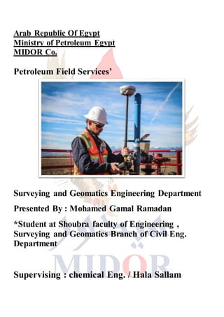
  • 1. Arab Republic Of Egypt Ministry of Petroleum Egypt MIDOR Co. Petroleum Field Services’ Surveying and Geomatics Engineering Department Presented By : Mohamed Gamal Ramadan *Student at Shoubra faculty of Engineering , Surveying and Geomatics Branch of Civil Eng. Department Supervising : chemical Eng. / Hala Sallam
  • 2. Surveying science :- Surveying or land surveying is the technique, profession, and science of determining the terrestrial or three-dimensional position of points and the distances and angles between them. A land surveying professional is called a land surveyor. These points are usually on the surface of the Earth, and they are often used to establish land maps and boundaries for ownership, locations like building corners or the surface location of subsurface features, or other purposes required by government or civil law, such as property sales. Surveyors work with elements of geometry, trigonometry, regression analysis, physics, engineering, metrology, programming languages and the law. They use equipment like total stations, robotic total stations, GPS receivers, retroreflectors, 3D scanners, radios, handheld tablets, digital levels, drones, GIS and surveying software. Surveying has been an element in the development of the human environment since the beginning of recorded history. The planning and execution of most forms of construction require it. It is also used in transport, communications, mapping, and the definition of legal boundaries for land ownership.
  • 3. It is an important tool for research in many other scientific disciplines. The Relation Between surveying and petroleum refinery is to Determine the earth's surface altitude and thus helps calculates the necessary depth drilled to reach the surface of the reservoir + calculate the size of the reservoir and help him calculates the economic returns of the reservoir oil investor. Levelling related to drilling of pipelines :- The simplest method for measuring height is with an altimeter using air pressure to find height. When more precise measurements are needed, means like precise levels (also known as differential leveling) are used. When precise leveling, a series of measurements between two points are taken using an instrument and a measuring rod. Differences in height between the measurements are added and subtracted in a series to get the net difference in elevation between the two endpoints. With the Global Positioning System (GPS), elevation can be measured with satellite receivers. Usually GPS is somewhat less accurate than traditional precise leveling, but may be similar over long distances.
  • 4. Determining Position :- The primary way of determining one's position on the earth's surface to drill for the pipelines when no known positions are nearby is by astronomic observations. Observations to the sun, moon and stars could all be made using navigational techniques. Once the instrument's position and bearing to a star is determined, the bearing can be transferred to a reference point on the earth. The point can then be used as a base for further observations. Survey-accurate astronomic positions were difficult to observe and calculate and so tended to be a base off which many other measurements were made. Since the advent of the GPS system, astronomic observations are rare as GPS allows adequate positions to be determined over most of the surface of the earth. GPS and transportationof oil Products :- GPS rule in transportation of oil in its pipelines is to use the coordinate systems as Many surveys do not calculate positions on the surface of the earth, but instead measure the relative positions of objects. However, often the surveyed items need to be compared to outside data, such as boundary lines or previous surveys objects.
  • 5. The oldest way of describing a position is via latitude and longitude, and often a height above sea level. As the surveying profession grew it created Cartesian coordinate systems to simplify the mathematics for surveys over small parts of the earth. The simplest coordinate systems assume that the earth is flat and measure from an arbitrary point, known as a 'datum' (singular form of data). The coordinate system allows easy calculation of the distances and direction between objects over small areas. Large areas distort due to the earth's curvature. North is often defined as true north at the datum. For larger regions, it is necessary to model the shape of the earth using an ellipsoid or a geoid. Many countries have created coordinate-grids customized to lessen error in their area of the earth. An Overview :- Petroleum Field Services only puts experienced “boots on the ground,” using certified, professional land surveying field crews to dig up historical evidence on section corner retracement. New pipeline and well pad projects are staked in innovative ways to safeguard crops and the natural environment. Our CAD technicians are skilled in drafting clean, uncluttered plats and exhibits to clearly define the
  • 6. details of your project and integrate data into our custom GIS-based Petroleum Asset Manager (PAM) for your direct access. Accomplished and responsible Certified Federal Surveyors and Professional Land Surveyors are in charge of all projects throughout the Rocky Mountain Region, from Texas to North Dakota. Our full team of survey professionals can complete any upstream or midstream land survey project, including: section breakdown, routing, pipeline staking, boundary delineation, property descriptions, easements, pad design and layout, grading, topographic surveys and ALTA surveys. We pride ourselves on providing the fastest turnaround times in the industry, along with the highest quality results. Our goal at PFS is to continually strive to provide the best land surveying solutions to support our clients in the oil and gas industry. Whether they need to stay on track or get caught up, our clients can always count on PFS.