
Recommended
More Related Content
Similar to Presentation A.K Nigam sir (2) (1).pptx
Similar to Presentation A.K Nigam sir (2) (1).pptx (20)
Recently uploaded
Recently uploaded (20)
Presentation A.K Nigam sir (2) (1).pptx
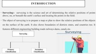
- 1. INTRODUCTION • Surveying:- surveying is the science and art of determining the relative positions of points above, on, or beneath the earth’s surface and locating the points in the field. • The object of surveying is to prepare a map or plan to show the relative positions of the objects on the surface of the earth. It also shows boundaries of districts states, and countries too. It features different engineering building roads railways dams, canals etc. Surveying Secondary Classification Primary Classification
- 2. USE OF SURVEYING • The surveying may be used for following purposes: To prepare a topographical map which shows hills, valleys, rivers, forests, villages, towns etc. To prepare a cadastral map which shows the boundaries of fields, plots, houses and other properties.. To prepare an engineering map which shows the position of engineering works such as buildings, roads, railways, dams, canals. To prepare a contour map to know the topography of the area to find out the best possible site for roads, railways, bridges, reservoirs, canals, etc. Surveying is also used to prepare military map, geological map, archaeological map etc. For setting out work and transferring details from the map on the ground.
- 3. PRIMARY CLASSIFICATION Plane survey Geodetic survey
- 4. SECONDARY SURVEYING • Secondary Types of Surveying a) Topographical Surveys b) Hydrographic Survey c) Astronomical Survey d) Engineering Survey e) Archeological Survey f) Photographic Survey g) Aerial Survey h) Reconnaissance Survey
- 5. CLASSIFICATION OF SURVEYING Classification Based on Instruments. Chain Survey: - This is the simplest type of surveying in which only linear measurements are made with a chain or a tape. Angular measurements are not taken. Compass Survey: - In Compass Survey, the angles are measured with the help of a magnetic compass. Plane Table Surveying:- It is a graphical method of surveying in which field works and plotting both are done simultaneously. Theodolite Survey: - In theodolite survey the horizontal angles are measured with the theodolite more precisely than compass and the linear measurements are made with a chain or tape. Tachometry Survey: - A special type of theodolite known as tachometer is used to determine horizontal and vertical distances indirectly.
- 7. GLOBAL POSITIONING SYSTEM (GPS) GPS, which stands for Global Positioning System, is the only system today able to show you your exact position on the Earth anytime, in any weather, anywhere. The three parts of GPS are: •Satellites •Receivers •Software
- 8. SATELLITES • There are quite a number of satellites out there in space. They are used for a wide range of purposes: satellite TV, cellular phones, military purposes and etc. Satellites can also be used by GPS receivers. The GPS Operational Constellation consists of 24 satellites that orbit the Earth in very precise orbits twice a day. GPS satellites emit continuous navigation signals.
- 9. RECEIVERS AND SATELLITES • GPS units are made to communicate with GPS satellites (which have a much better view of the Earth) to find out exactly where they are on the global scale of things. GPS SIGNALS Each GPS satellite transmits data that indicates its location and the current time. All GPS satellites synchronize operations so that these repeating signals are transmitted at the same instant. Physically the signal is just a complicated digital code, or in other words, a complicated sequence of “on” and “off” pulses.
- 10. FUTURE OF GPS • GPS III Space Vehicle 04 (GPS III SV04) satellite is scheduled to head to Space on a Space X rocket on September 29. • The GPS III is US government’s highly costly program, designed to include improved anti-jam features comprising the higher-fidelity M-Code signal for military users. • What is GPS III? • GPS III (Global Positioning System III) is a communication satellite designed and manufactured by Lockheed Martin Space Systems (LMSS) for the United States Air Force (USAF). GPS Block III (previously Block IIIA) consists of the first ten GPS III satellites, which will be used to keep the Navstar Global Positioning System operational.
- 11. • What will GPS III do? GPS III will have a 15-year design life, twice as long as some of the current GPS satellites. It will have three times better accuracy, which means the 5 to 10-meter accuracy of existing GPS technology will be slashed to 1 to 3 meters. The signal will also be more powerful, allowing it to overcome interference. The goal of GPS Block III is to provide enhanced signal reliability, accuracy and integrity. The satellites will build upon, or improve features included on the Block IIR-M and IIF satellites including: L1C signal on the 1575.42 MHz L1 frequency L2C signal on the 1227.6 MHz L2 frequency L5 “Safety of Life” signal on the 1176.45 MHz L5 frequency Military M-code
- 12. REMOTE SENSING • Remote sensing is the collection of information about an object without being direct physical contact with the object. • Remote sensing is a technology for sampling electromagnetic radiation is acquire and interpret non-immediate geo-spatial data from which to extract information's about the features, objects and classes on the Earth’s land surface , oceans and atmosphere. Elements Involve in Remote Sensing
- 13. STAGES IN REMOTE SENSING • Emission of Electromagnetic radiation EMR (sun self emission) • Transmission of the energy from the source to the surface of the Earth, as well as absorption and scattering. • Interaction of EMR with the Earth’s surface: reflection and emission. • Transmission of the energy from the surface to the remote sensors. • Sensors data output. • Data transmission, processing and analysis. There are four organizations that are involved in remote sensing activities in India besides other several central and state government bodies. ISRO (Indian Space Research organization) SAC (Space Applications centre) NNRMS (National Natural Resources Management System) NRSA ( National Remote Sensing Agency)
- 14. GIS (GLOBAL INFRASTRUCTURE SYSTEM) • GIS (Geographic Information Systems) plays a crucial role in designing multi-source information based civil infrastructure plan. • A Geographic Information System (GIS) is a computer system that analyses and displays geographically referenced information. • GIS uses data that is attached to a unique location. • Civil engineers need a vast amount of geographically referenced spatial data for their designs and decision-making process.
- 15. • What Can Be Done from Now? • To promote GIS among civil engineering students in developing countries, universities in developed countries can proactively support it. • Promote multidisciplinary education at the undergraduate level in developing countries to study GIS under civil engineering graduate programs. For this goal, university management in developing countries must adopt such multidisciplinary courses available in developed countries. • Use online education to link developed and developing countries through direct government intervention. • Seek government funds to support GIS education in developing countries to link with civil engineering undergraduate programs. • Facilitate students at universities in developing countries to study GIS courses in leading universities of developed countries through remote access. • Offer online GIS courses at an affordable price. • Invite educational officers from developing countries for GIS workshops and training programs in developed countries. • Offer incentives for the students from NESB (non-English speaking background) countries to study in developed countries.
- 16. • Early Developments in GIS Canada Geographic Information System (CGIS) • The earliest GIS, set up in mid 1960s by Roger Tomlinson and colleagues for Canadian Land Inventory. • It was developed as a measuring tool (to measure area), a producer of tabular information rather than a mapping tool. Harvard Laboratory • The Harvard laboratory for Computer Graphics and Spatial Analysis was established in 1964 by Howard Fisher at Harvard University. • The GIS packages developed were SYMAP, CALFORM, SYMVU, GRID, POLYVRT, ODYSSEY Dual Independent Map Encoding (DIME) • Developed by US Bureau of Census in 1967 to conduct the 1970 census of population. • Digital records of all US streets were created to support automatic referencing and aggregation of census records. Environmental Systems Research Institute (ESRI) • Jack Dangermond founded ESRI in 1969 to undertake GIS projects. • In 1981, ESRI launched ArcInfo (major commercial GIS software system) based on vector & relational database data model. Intergraph Corporation • Jim Meadlock and colleagues formed M&S computing in 1969 which was later renamed as Intergraph. • Global provider of engineering and geospatial software.
- 17. • Importance of GIS • GIS informs not only about the activities and the events but also where they exist. The solutions to problems often require access to several types of information that can only be linked by geography. GIS allows to store and manipulate information using geography and to analyze patterns, relationships, and trends in that information to help in making better decisions. • Objectives of GIS • Some of the major objectives of GIS are to • Maximizing the efficiency of planning and decision making • Integrating information from multiple sources • Facilitating complex querying and analysis • Eliminating redundant data and minimizing duplication