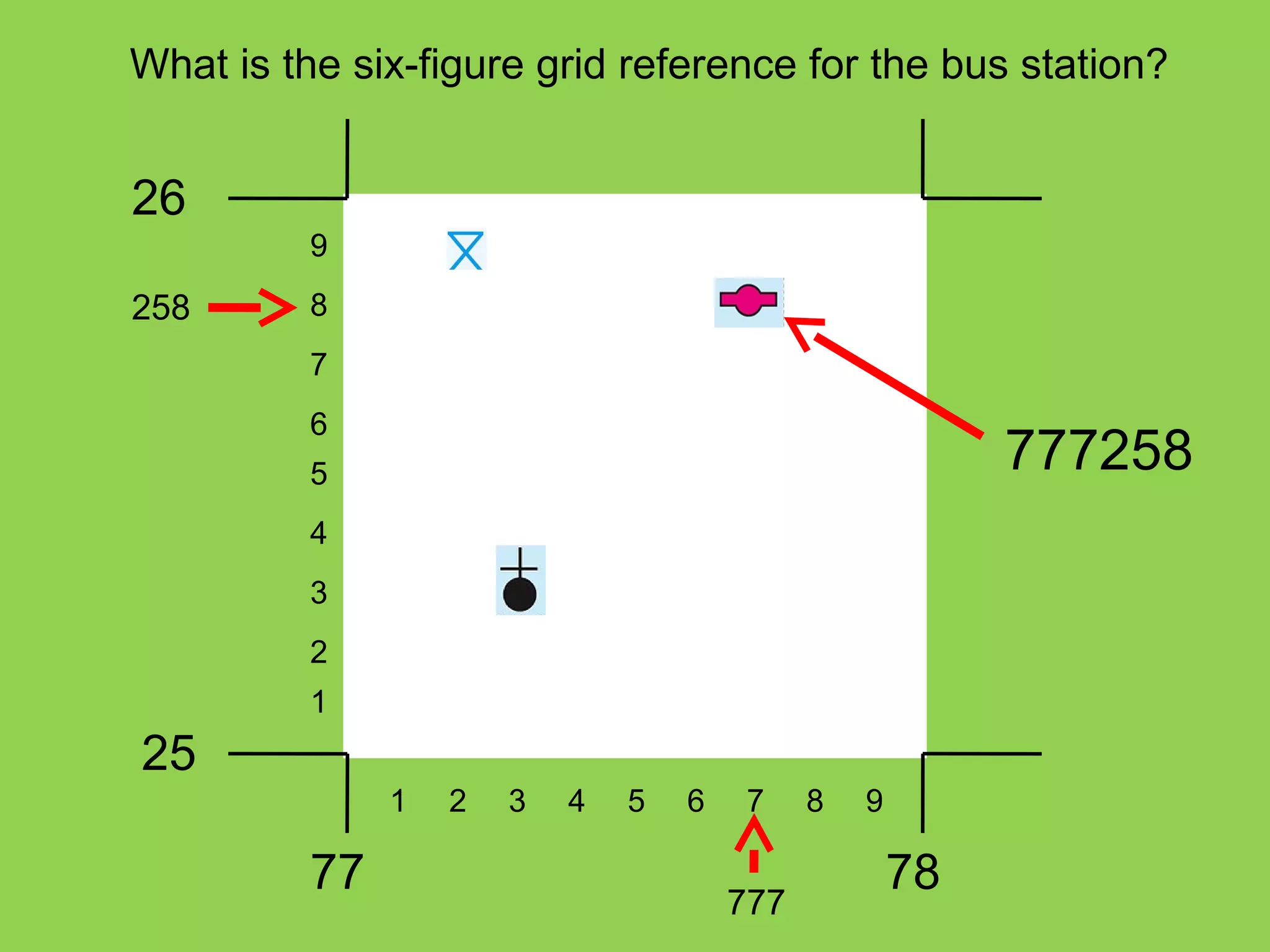
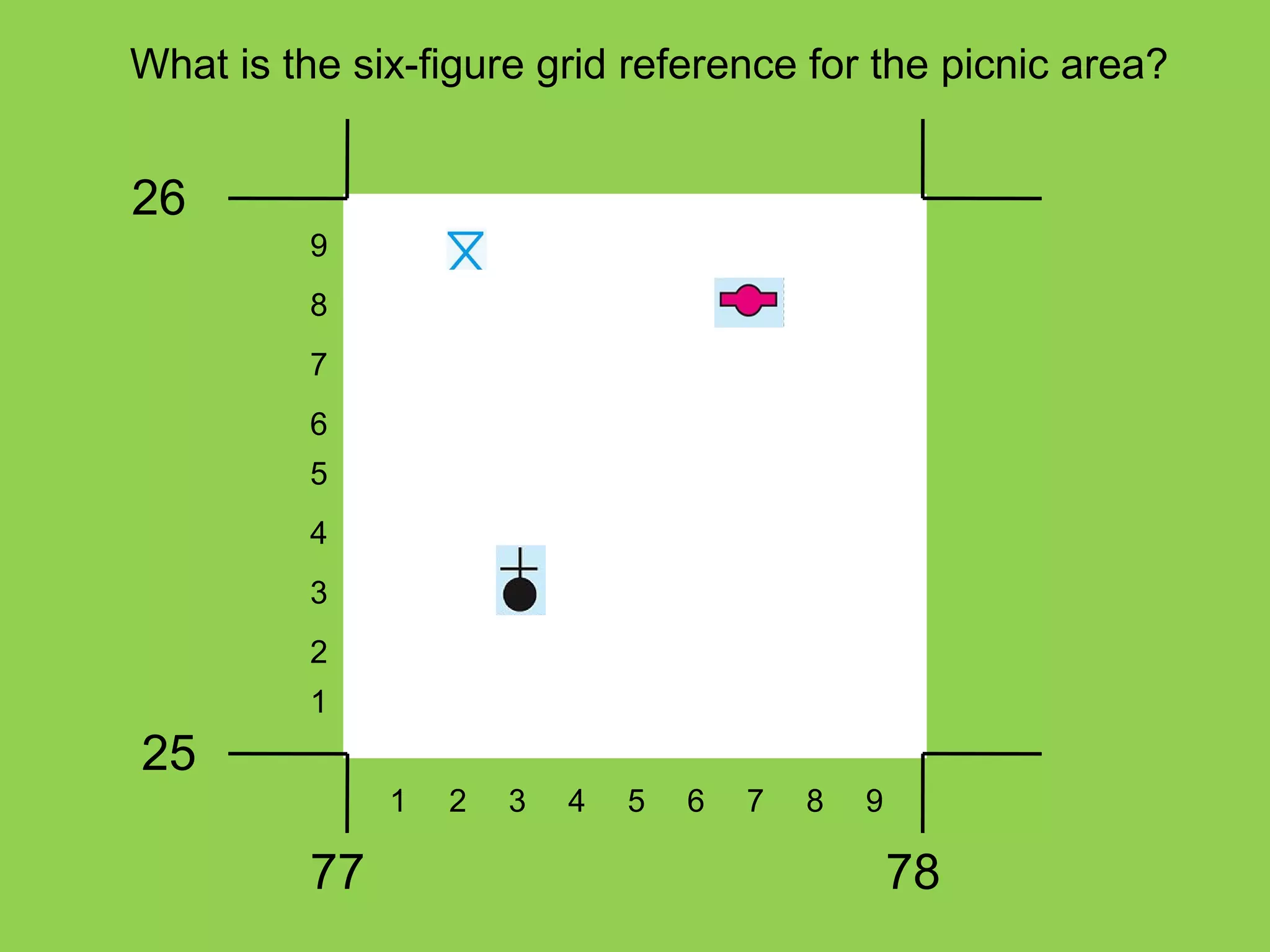
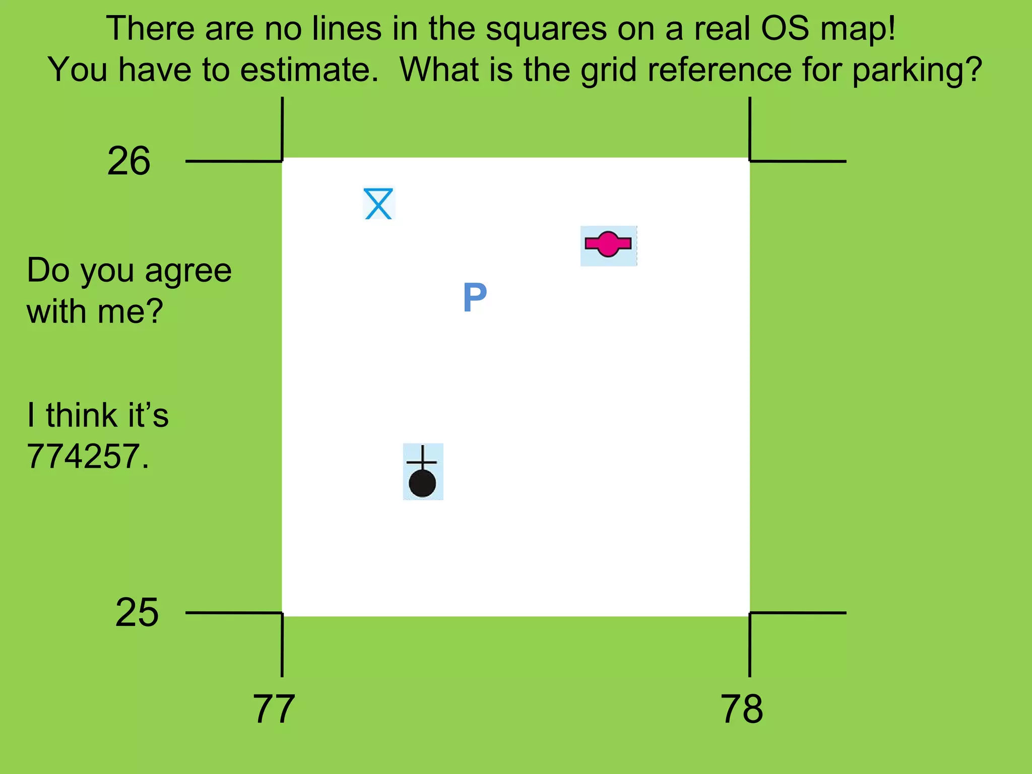
This document explains how to derive six-figure grid references from Ordnance Survey maps. It shows how to split a square into 100 smaller squares to determine the first three and last three figures of the reference. The first three figures are obtained by going along the bottom line, while the last three figures go up the side line. Examples are provided of determining the six-figure grid references for features like a church, bus station, and parking area. A mnemonic is suggested to remember the order of lines to follow.


![Water Cycle[1] Power Point](https://cdn.slidesharecdn.com/ss_thumbnails/watercycle1power-point-1216950873012568-9-thumbnail.jpg?width=640&height=640&fit=bounds)


