Download to read offline


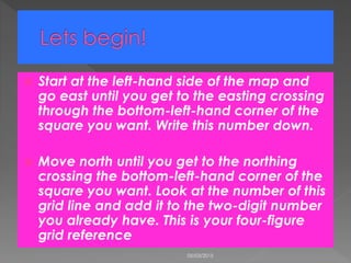
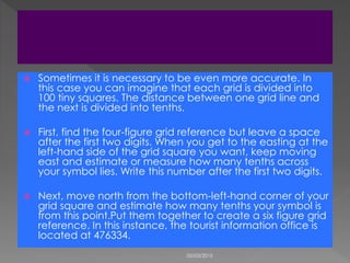


This document provides instructions on how to read and interpret grid references on an OS map, explaining the process of determining both four-figure and six-figure grid references. It describes how to find the easting and northing numbers and emphasizes precision in locating specific points by estimating tenths. An example grid reference for a tourist information office is provided as a practical application of the instructions.


