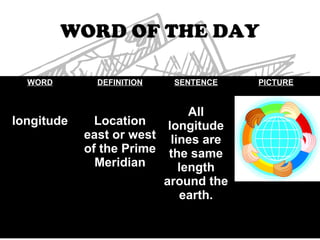
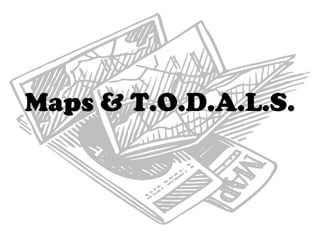
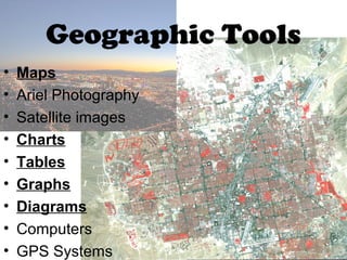
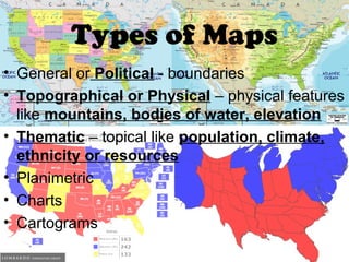
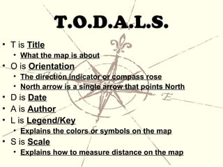
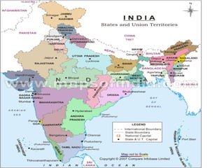
ADVISORY
• D: 9/5/12
  A: Goal Setting Sheet
  S: What are my goals for
  quarter 1?
  H: NONE
D: 9/5/12
A: Notes on Maps
S: What types of maps are
   there?
H: Family Culture Web Due 9/7
w.o.d: longitude

Warm-Up: Complete the Match
‘Em Up Worksheet
WORD OF THE DAY

  WORD        DEFINITION   SENTENCE   PICTURE


                              All
longitude     Location    longitude
            east or west lines are
            of the Prime the same
              Meridian      length
                         around the
                            earth.
Maps & T.O.D.A.L.S.
Geographic Tools
•   Maps
•   Ariel Photography
•   Satellite images
•   Charts
•   Tables
•   Graphs
•   Diagrams
•   Computers
•   GPS Systems
Types of Maps
• General or Political - boundaries
• Topographical or Physical – physical features
  like mountains, bodies of water, elevation
• Thematic – topical like population, climate,
  ethnicity or resources
• Planimetric
• Charts
• Cartograms
T.O.D.A.L.S.
• T is Title
   • What the map is about
• O is Orientation
   • The direction indicator or compass rose
   • North arrow is a single arrow that points North
• D is Date
• A is Author
• L is Legend/Key
   • Explains the colors or symbols on the map
• S is Scale
   • Explains how to measure distance on the map
Maps & TODALS
Maps & TODALS
Maps & TODALS

Maps & TODALS

  • 1.
    ADVISORY • D: 9/5/12 A: Goal Setting Sheet S: What are my goals for quarter 1? H: NONE
  • 2.
    D: 9/5/12 A: Noteson Maps S: What types of maps are there? H: Family Culture Web Due 9/7 w.o.d: longitude Warm-Up: Complete the Match ‘Em Up Worksheet
  • 3.
    WORD OF THEDAY WORD DEFINITION SENTENCE PICTURE All longitude Location longitude east or west lines are of the Prime the same Meridian length around the earth.
  • 4.
  • 5.
    Geographic Tools • Maps • Ariel Photography • Satellite images • Charts • Tables • Graphs • Diagrams • Computers • GPS Systems
  • 6.
    Types of Maps •General or Political - boundaries • Topographical or Physical – physical features like mountains, bodies of water, elevation • Thematic – topical like population, climate, ethnicity or resources • Planimetric • Charts • Cartograms
  • 7.
    T.O.D.A.L.S. • T isTitle • What the map is about • O is Orientation • The direction indicator or compass rose • North arrow is a single arrow that points North • D is Date • A is Author • L is Legend/Key • Explains the colors or symbols on the map • S is Scale • Explains how to measure distance on the map