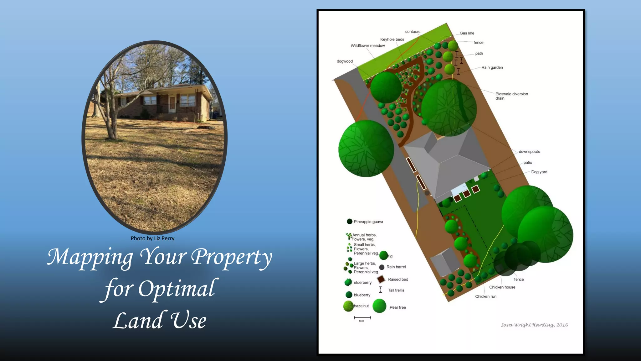
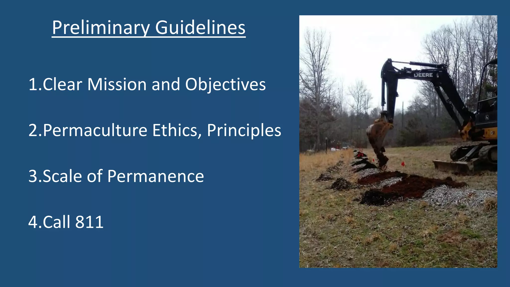
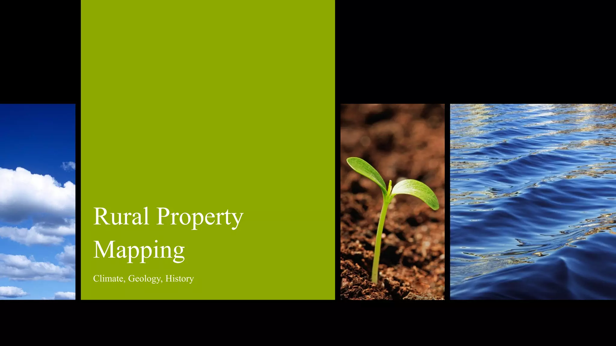
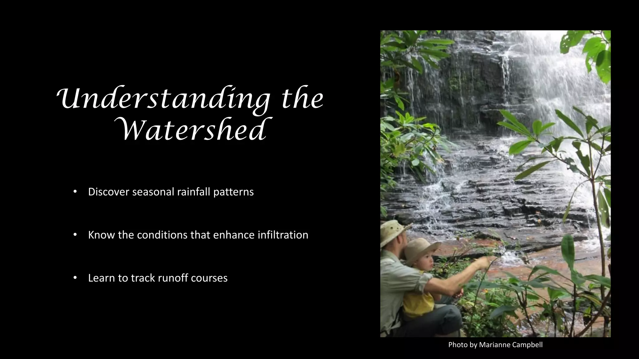
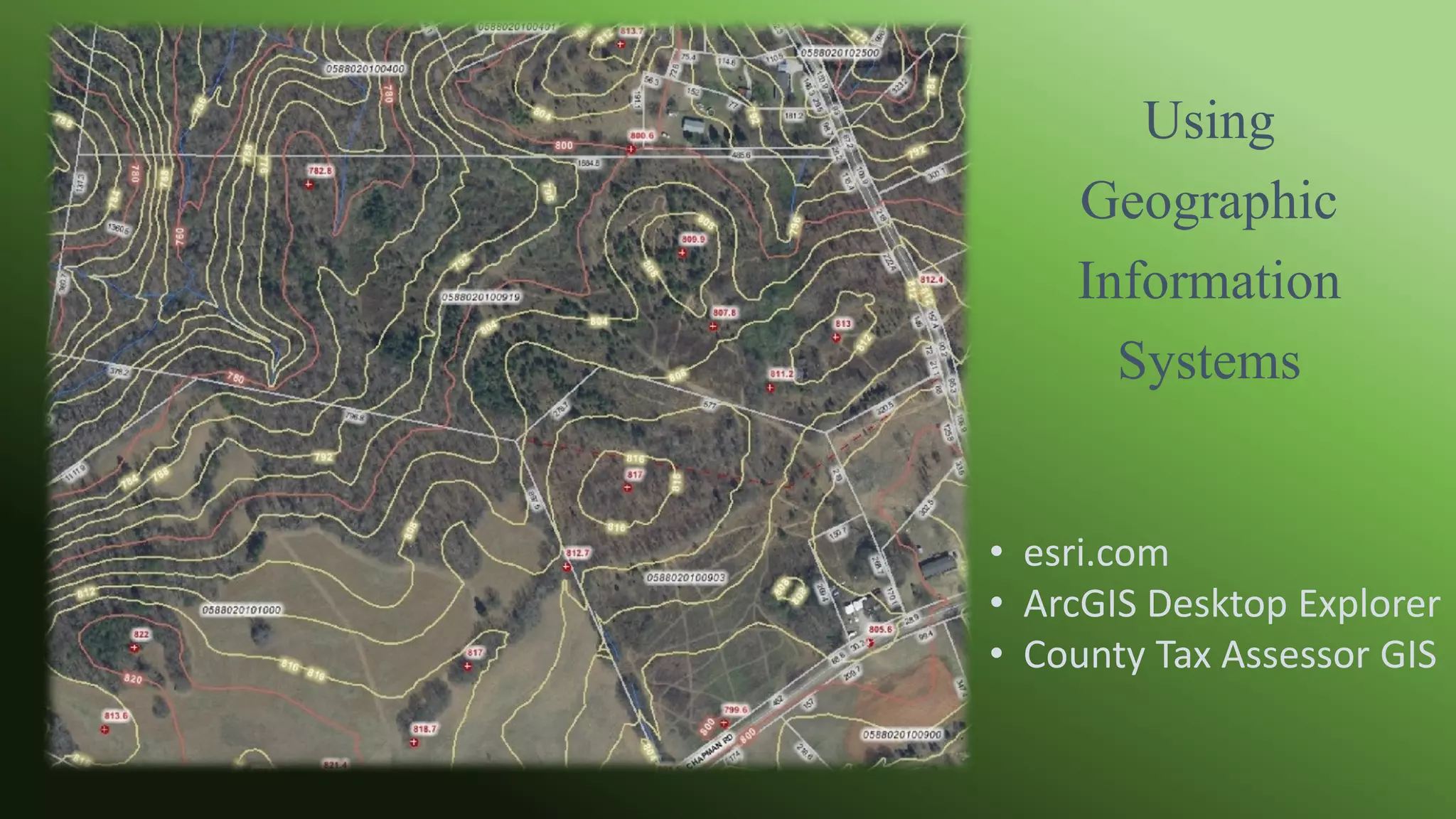
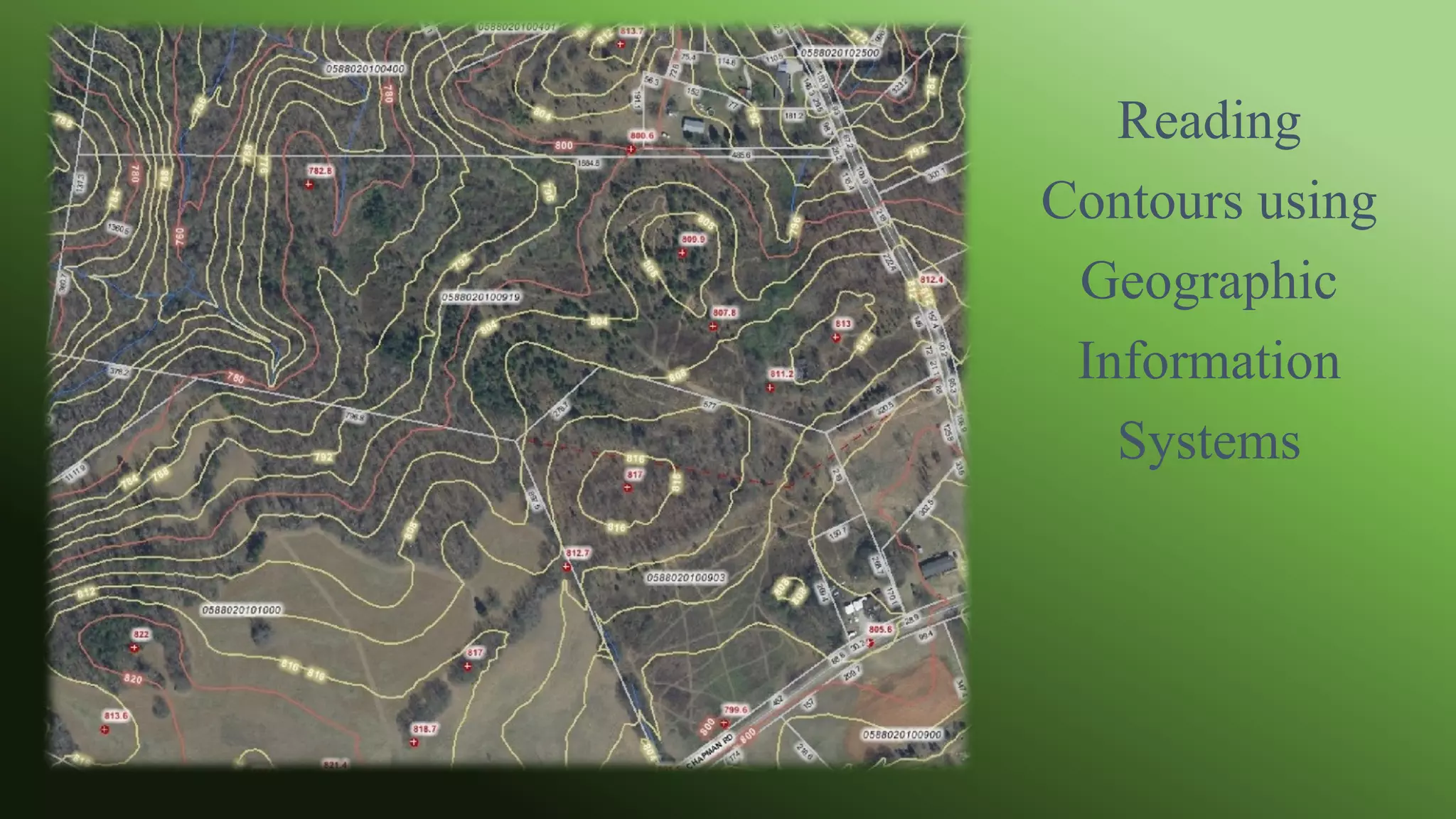
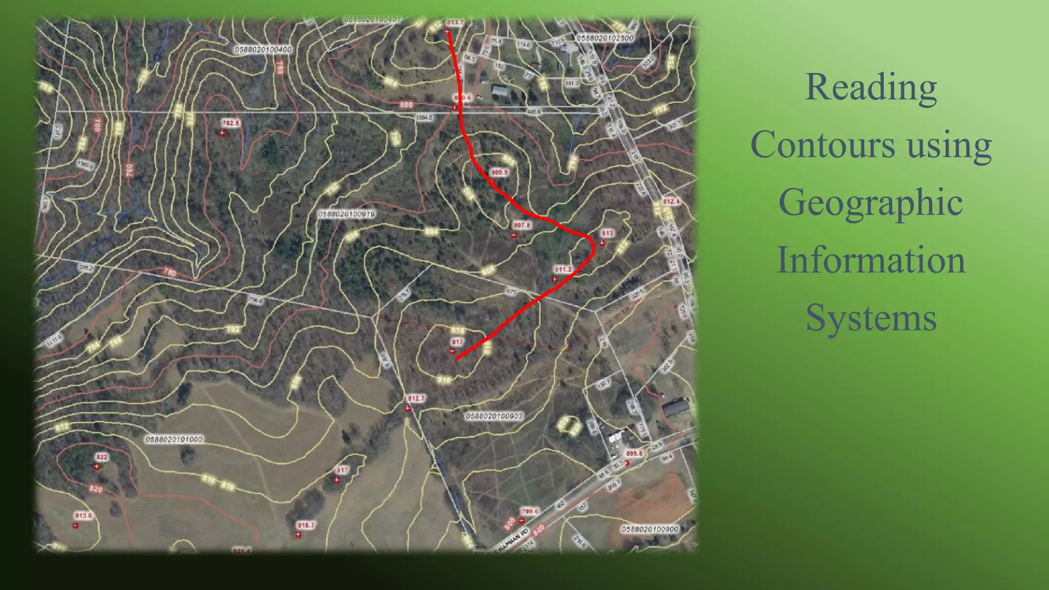
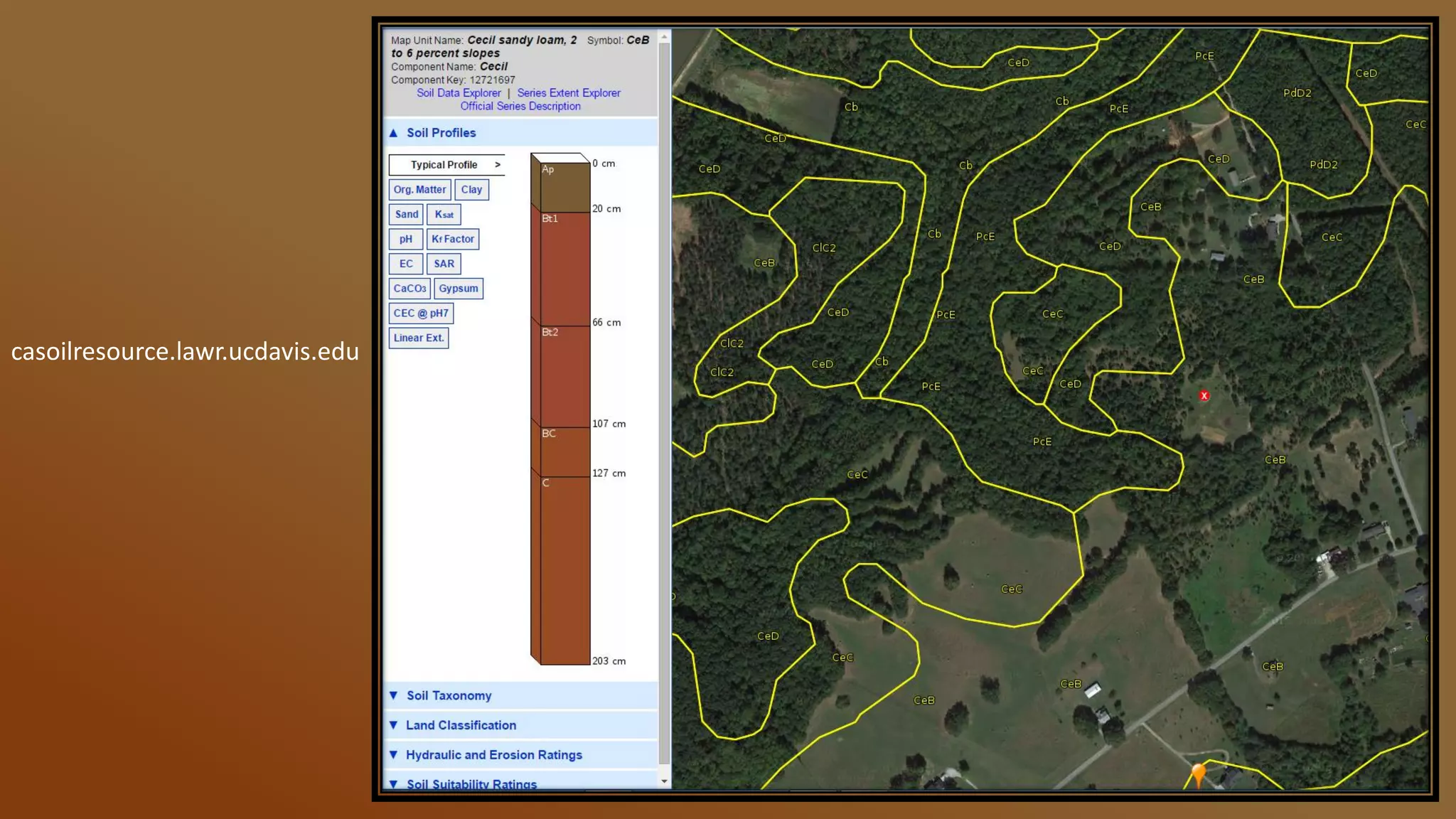
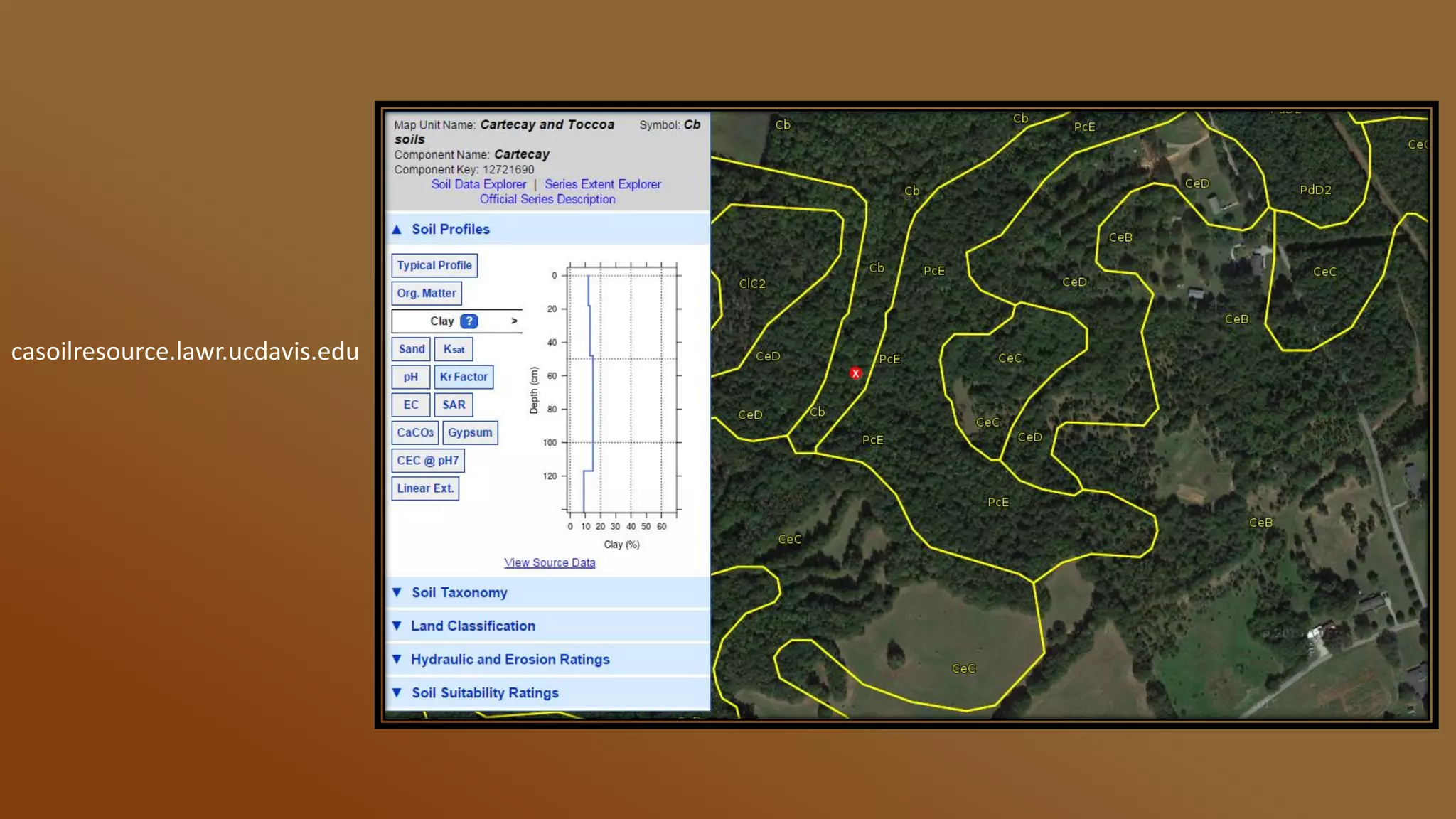
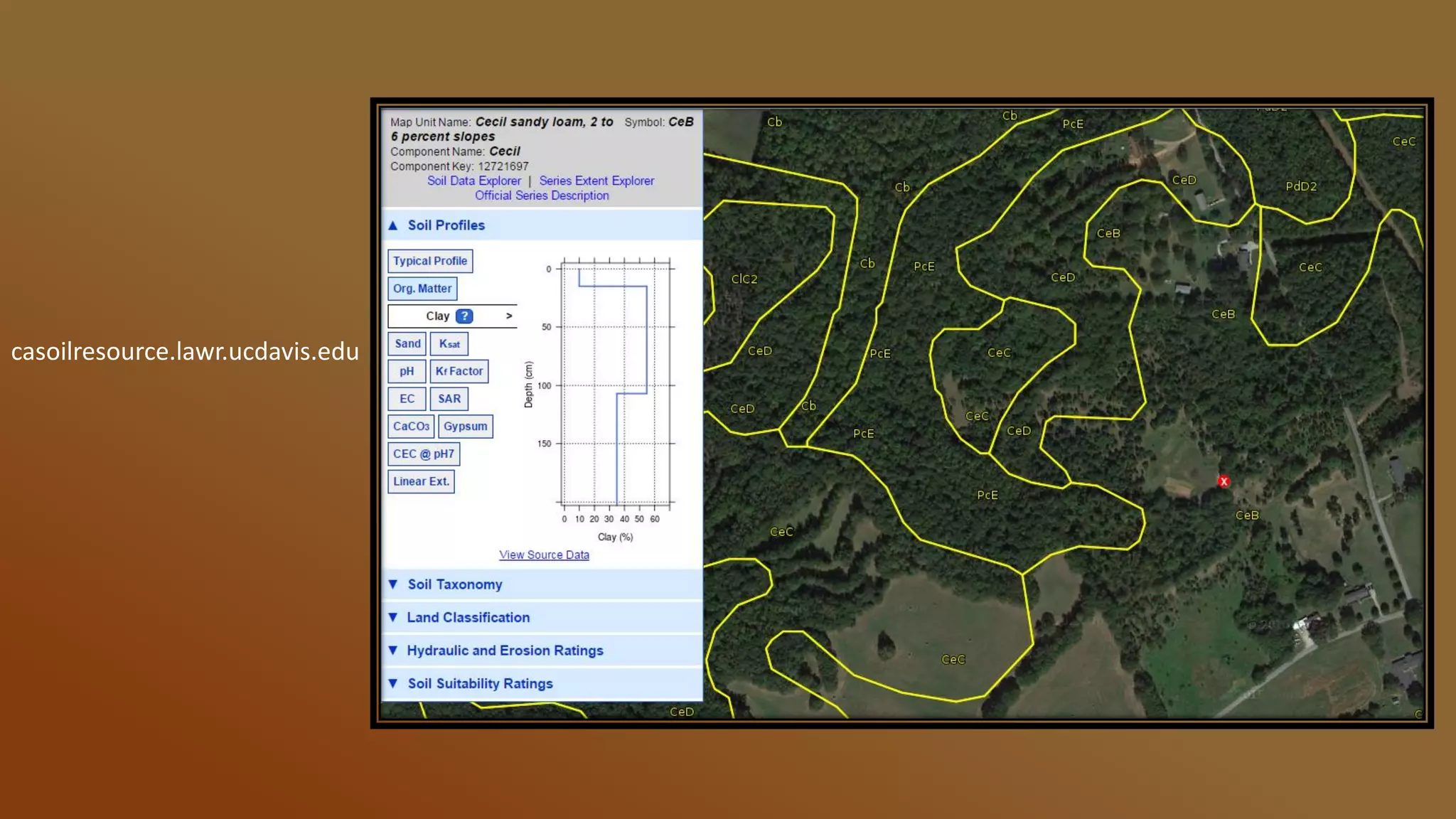
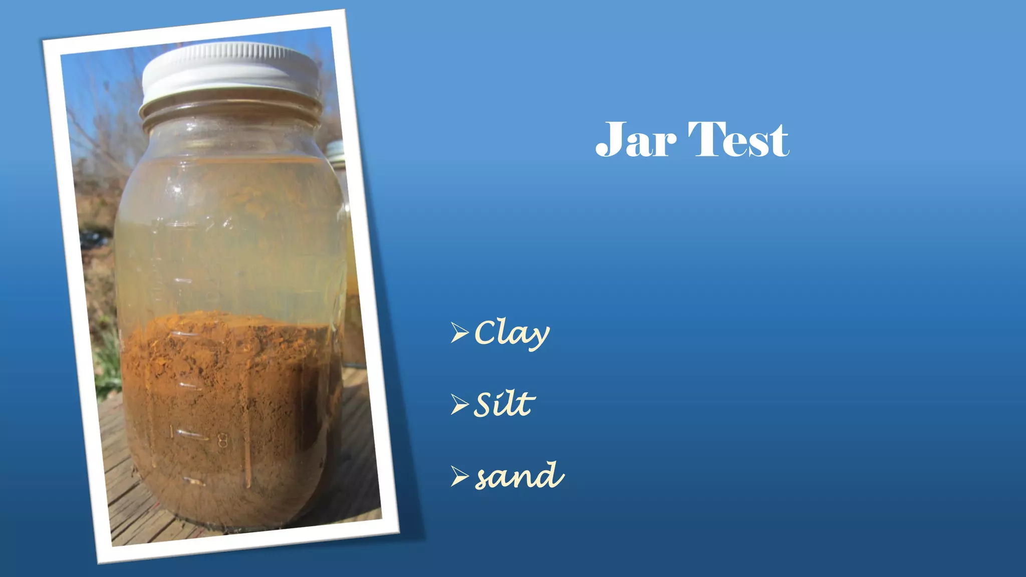
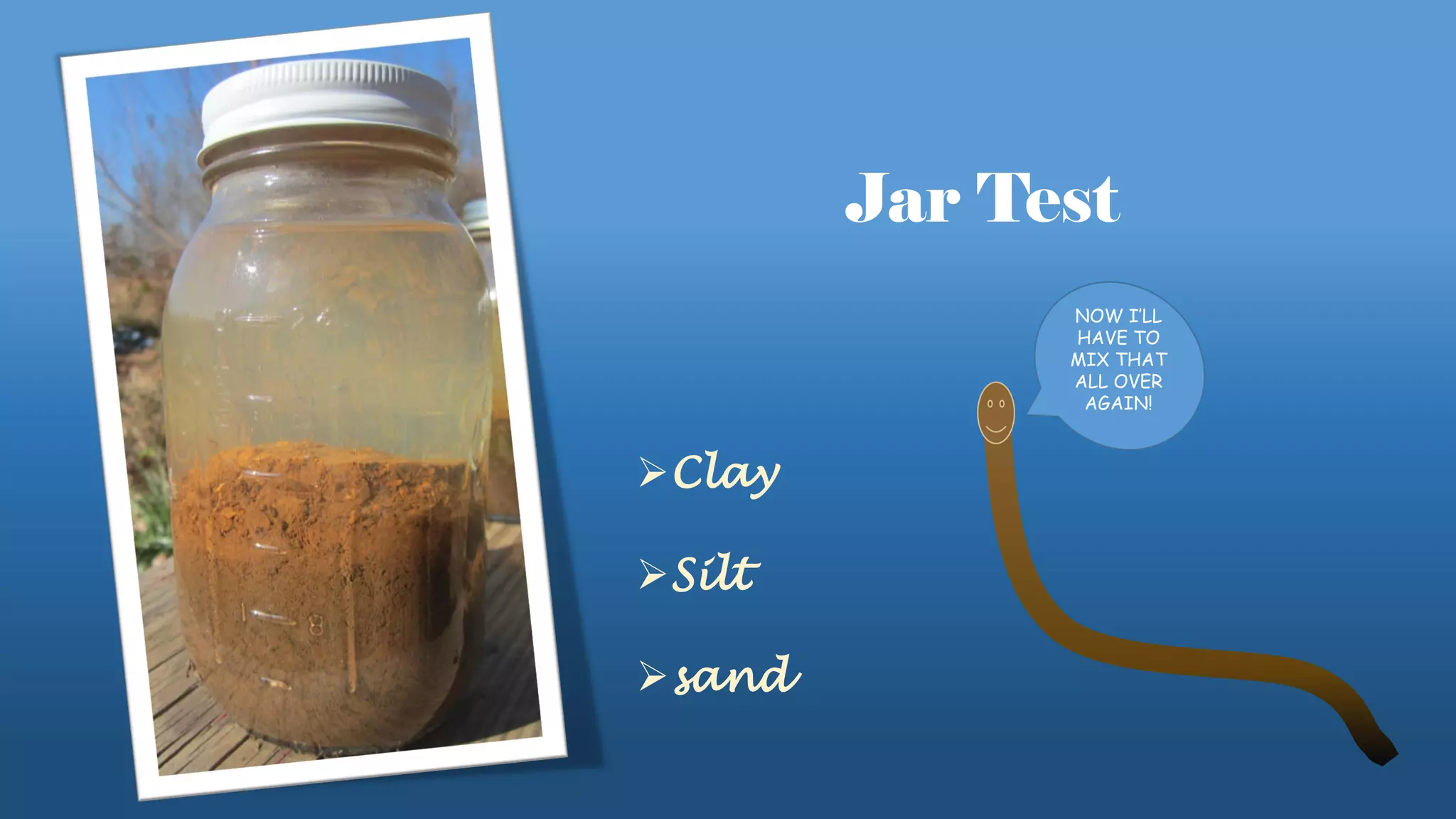
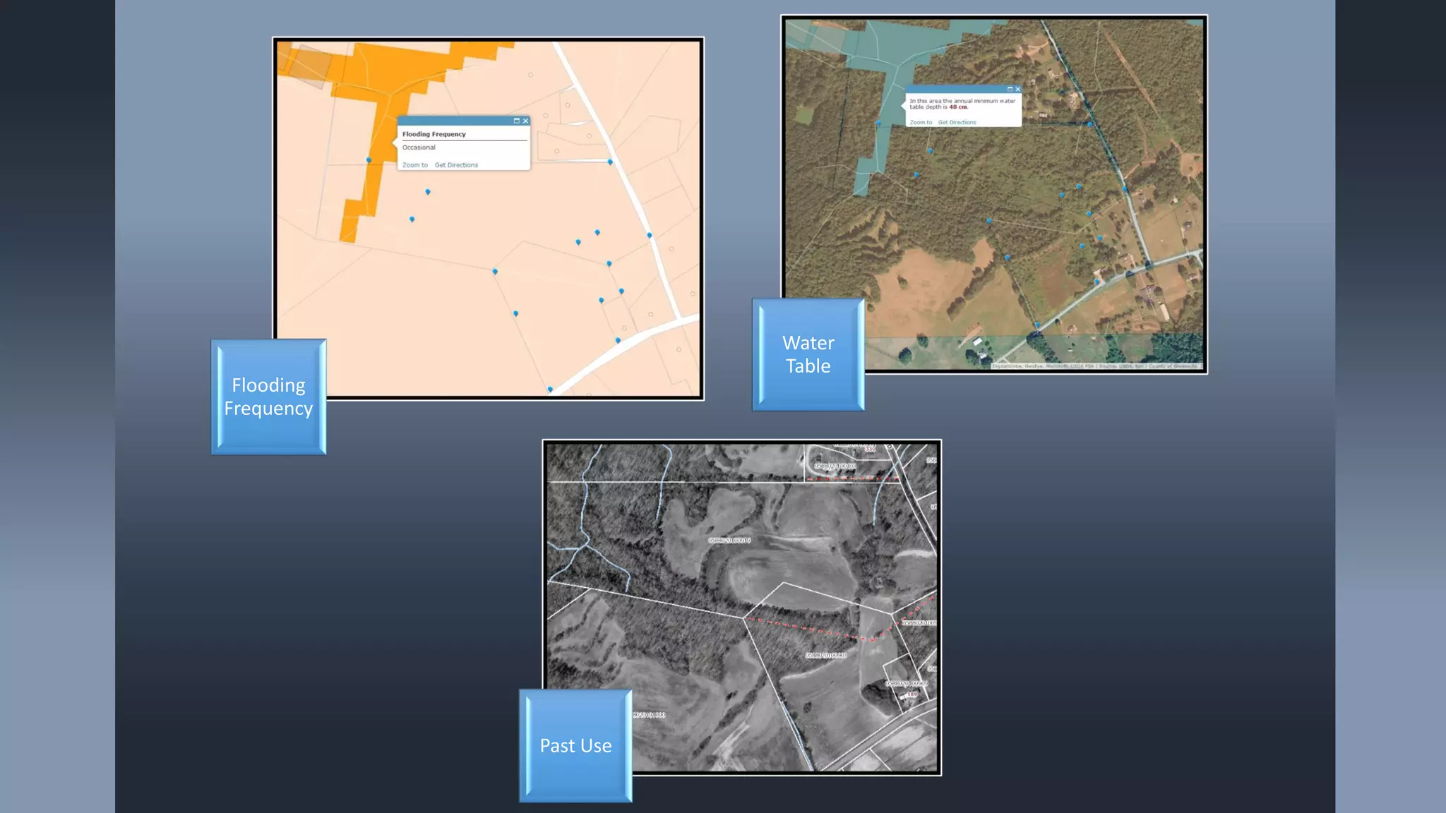
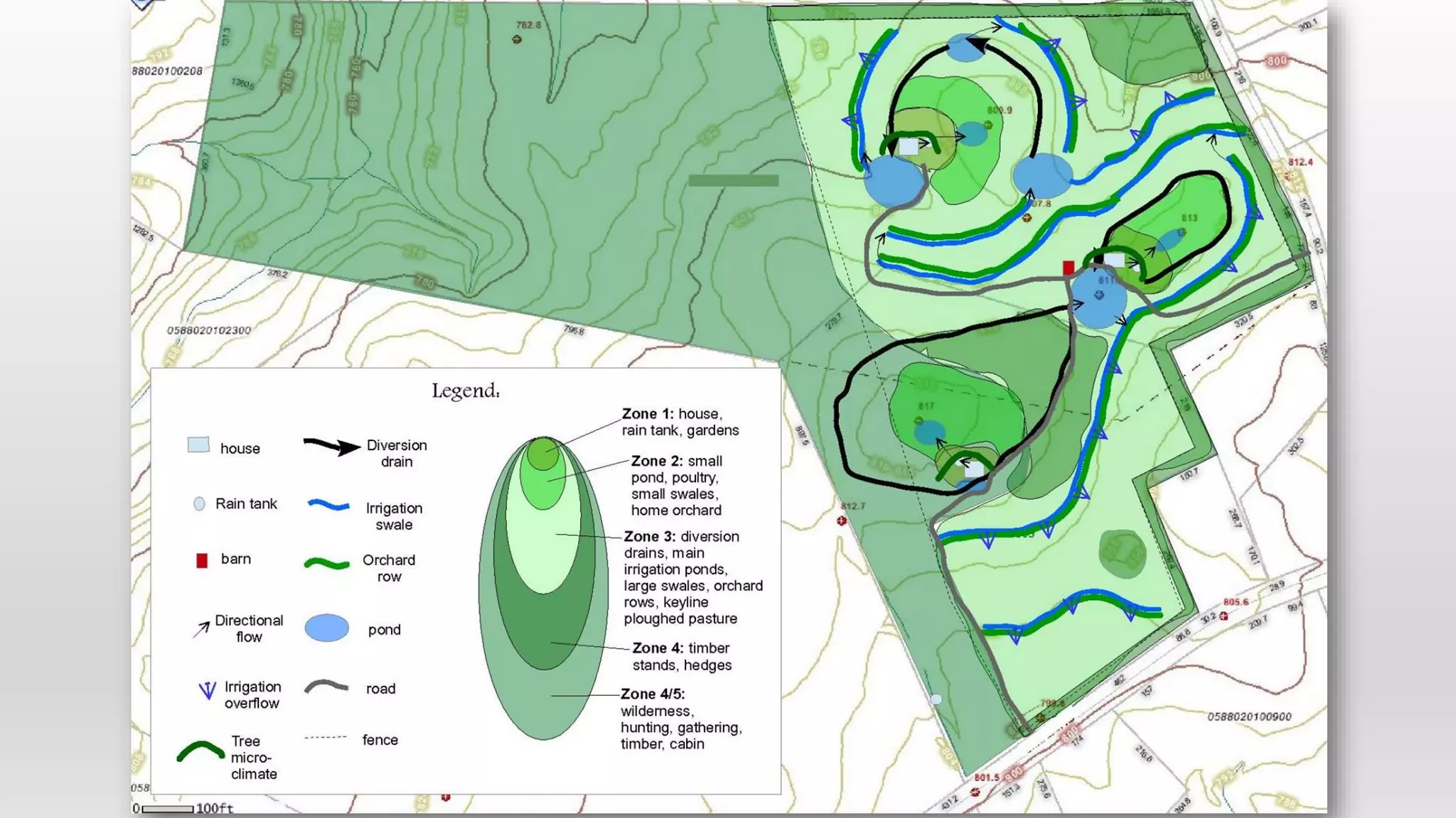
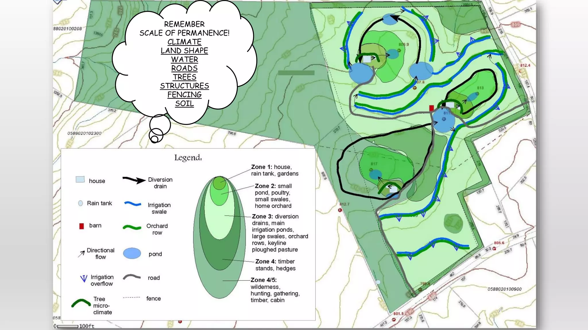
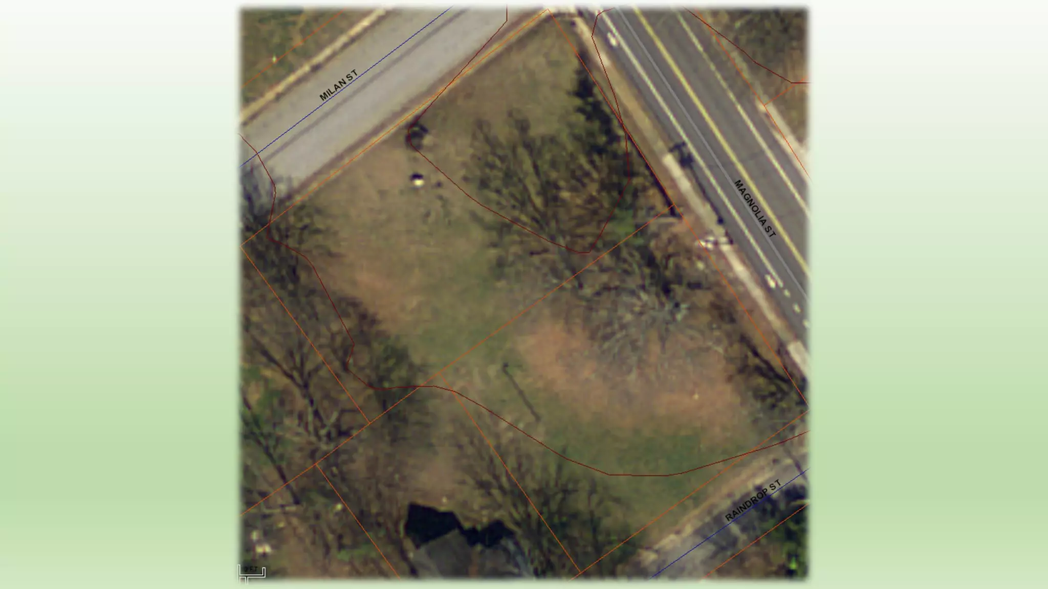
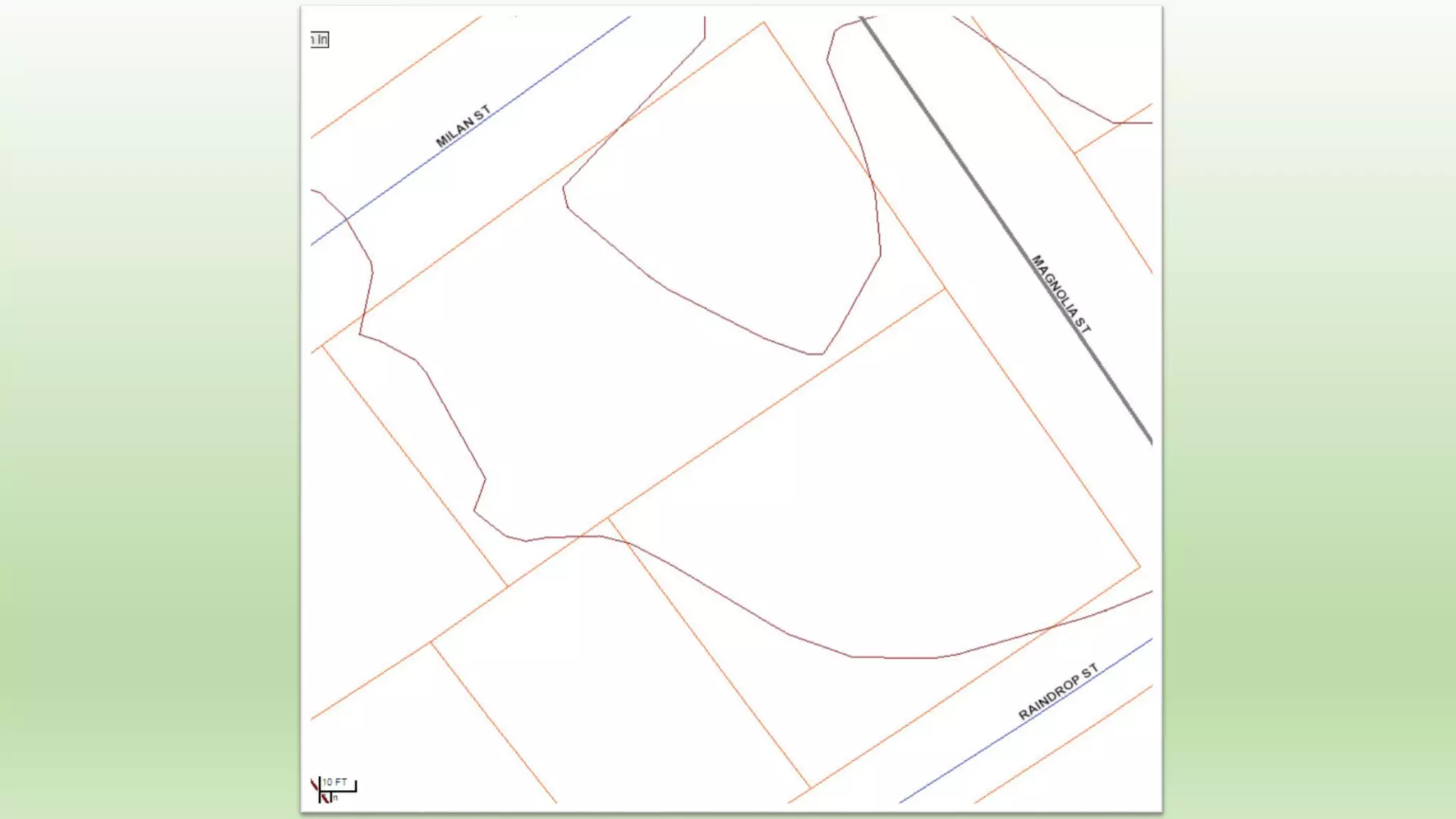
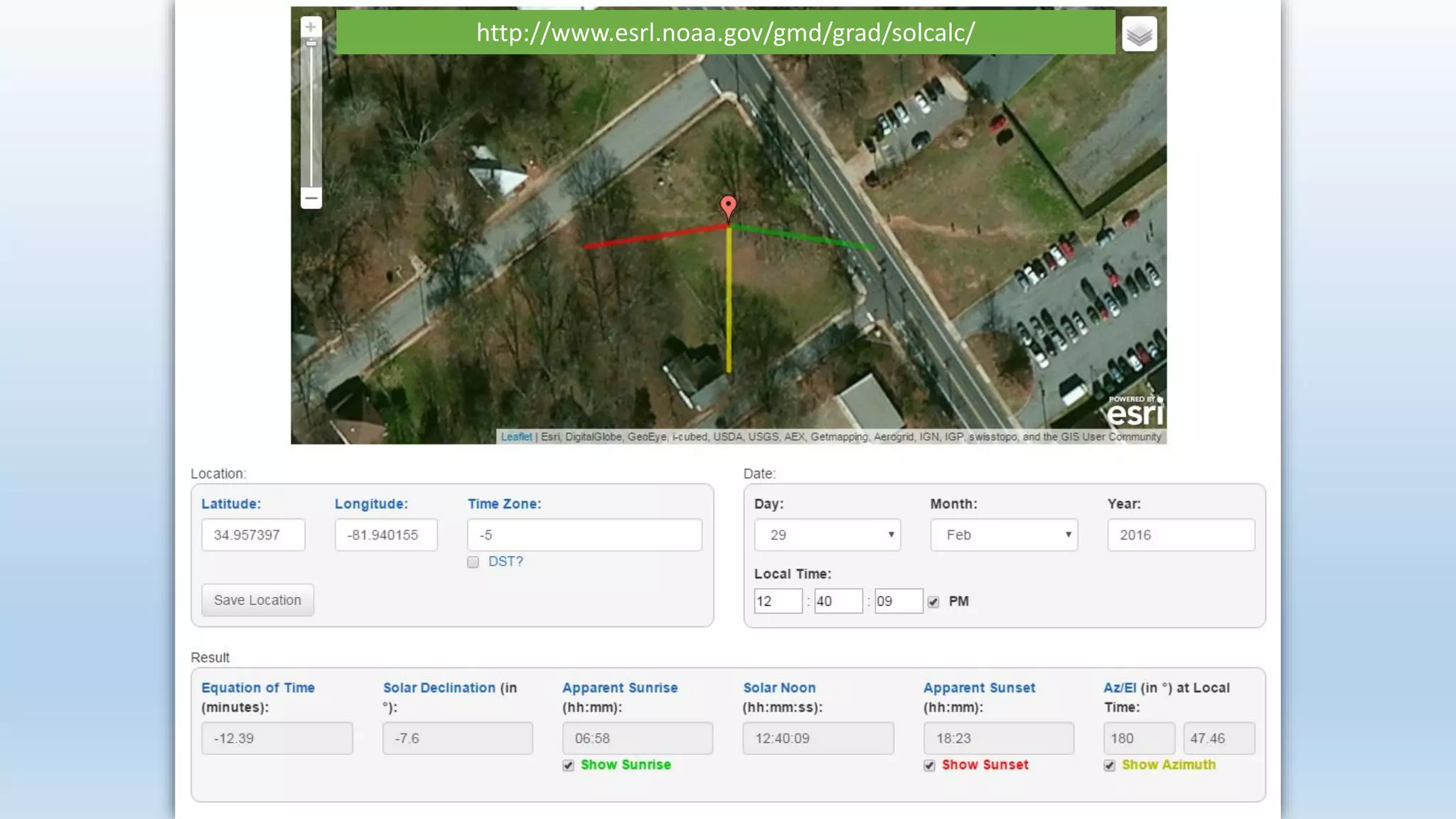
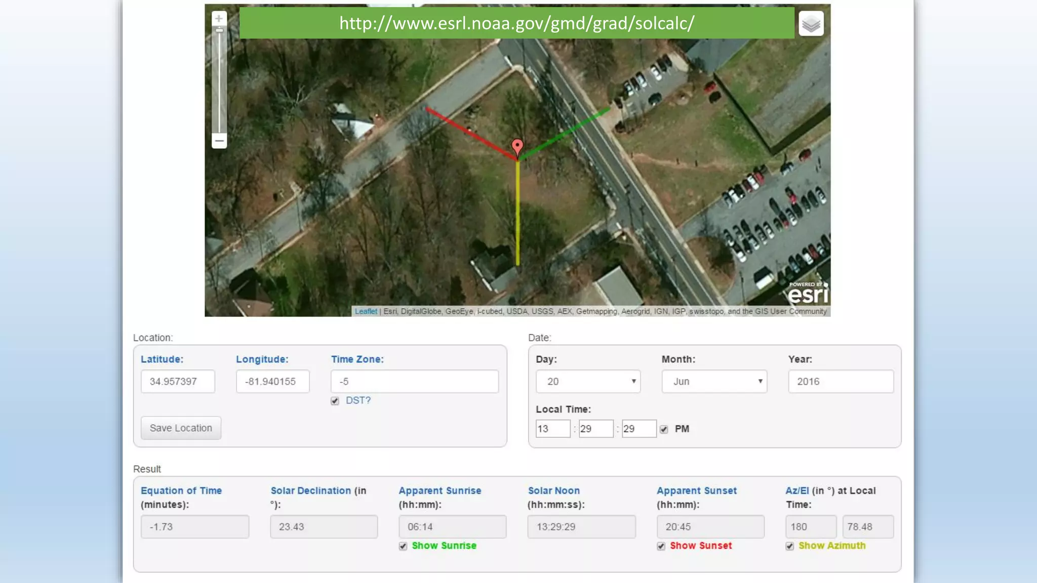
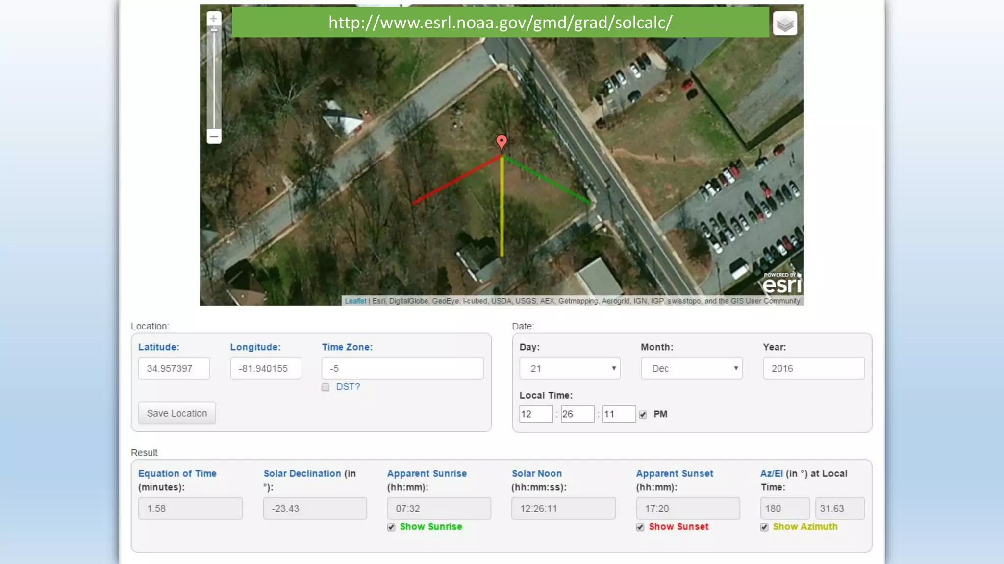
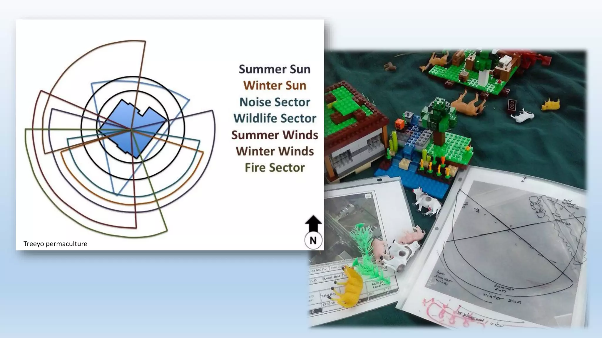
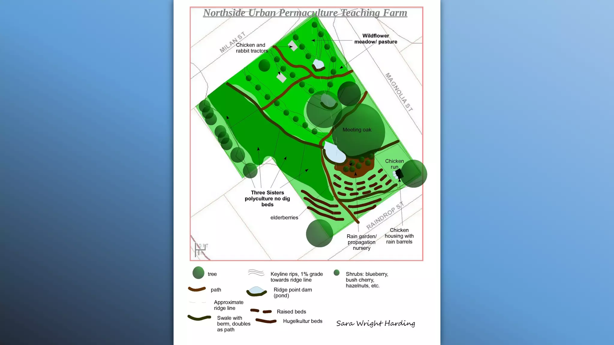
Mapping Your Property
for Optimal
Land Use
Photo by Liz Perry
1.Clear Mission and Objectives
2.Permaculture Ethics, Principles
3.Scale of Permanence
4.Call 811
Preliminary Guidelines
Rural Property
Mapping
Climate, Geology, History
Understanding the
Watershed
• Discover seasonal rainfall patterns
• Know the conditions that enhance infiltration
• Learn to track runoff courses
Photo by Marianne Campbell
Using
Geographic
Information
Systems
• esri.com
• ArcGIS Desktop Explorer
• County Tax Assessor GIS
Reading
Contours using
Geographic
Information
Systems
Reading
Contours using
Geographic
Information
Systems
casoilresource.lawr.ucdavis.edu
Jar Test
Clay
Silt
sand
Jar Test
Clay
Silt
sand
NOW I’LL
HAVE TO
MIX THAT
ALL OVER
AGAIN!
Flooding
Frequency
Water
Table
Past Use
Photo by Marianne Campbell
Plants
Plants
Animals
Plants
Animals
Points of Interest
Plants
Animals
Points of Interest
Human Activity
Plants
Animals
Points of Interest
Microclimates
Human Activity
MapPad
Google fusion tables
Import Comma
Separated Values
files (.csv) to map
or satellite image
REMEMBER
SCALE OF PERMANENCE!
CLIMATE
LAND SHAPE
WATER
ROADS
TREES
STRUCTURES
FENCING
SOIL
Urban Property Mapping
Photo by Marianne Campbell
http://www.esrl.noaa.gov/gmd/grad/solcalc/
Sun Surveyor
Treeyo permaculture
Mapping Your Property for Optimal Land Use
Introduction
A. Clear Mission:
“We wish to accomplish two basic goals:
1) to provide food for our family through increased production from our land and livestock.
2) to reclaim our land by returning the living soil to where it is naturally productive through carbon
sequestration, nitrogen fixing, minimizing a carbon footprint, and all responsible means using a
holistic design.” – Stephen A. Wright
B. Permaculture Ethics, Principles
1.Books:
Introduction to Permaculture by Bill Mollison
Permaculture: A Designer’s Manual by Bill Mollison
Gaia’s Garden by Toby Hemenway
The Permaculture City by Toby Hemenway
Permaculture Design: A Step By Step Guide by Aranya
2. Websites:
Treeyopermacultureedu.wordpress.com (chapter 2)
Permaculturenews.org
C. Scale of Permanence
Water for Every Farm by P. A. Yeomans
D. Call 811 (call811.com)
Part 1: Rural Property Mapping
A. Watershed Literacy
B. Contours (County GIS, esri.com, ArcGIS.com)
C. Geology and Soils (Water Table Map, Soil Web- http://casoilresource.lawr.ucdavis.edu/gmap/)
1. Obtaining Maps
2. Reading Soil Profile
3. Jar Tests, Ring Test
D. Climate (Flood Frequency Map)
E. History (History of Use Maps, Past Satellite Images)
F. On Site Observations
1. Plants, Animal and Human Habits, Points of Interest, Microclimates
2. Dropping Waypoints, CSV files, ( MapPad app, Google Fusion Tables)
G. Putting it all Together
1. Using Degree of Permanence to Place Main Elements
2. Zones
3. Books:
Restoration Agriculture by Mark Shepard
The Resilient Farm and Homestead by Ben Falk
Sepp Holzer’s Permaculture by Sepp Holzer
Part 2: Urban Property Mapping
A. Contours (County GIS)
B. Sun Angle (NOAA Solar Calculator-http://www.esrl.noaa.gov/gmd/grad/solcalc/, sun surveyor app)
C. Creating a Sector Map
D. Urban Challenges (Soil Toxicity, Exhaust, Regulations)
E. Putting it all Together
Websites related to audience questions:
http://www.peakprosperity.com/wsidblog/91878/how-build-earthen-pond-and-dam-wall
http://www.homestead.org/NeilShelton/Pond/AddaPondtoYourProperty.htm
http://www.motherearthnews.com/homesteading-and-livestock/build-a-pond-
zmaz06amzwar.aspx

Mapping Your Property for Optimal Land Use, Cultivate 2016