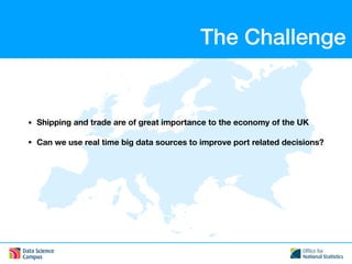
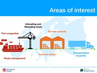
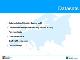
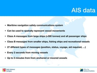
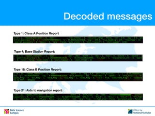
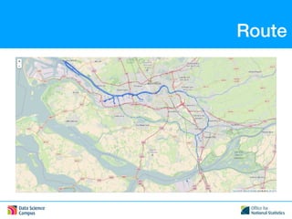
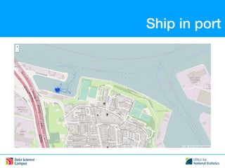
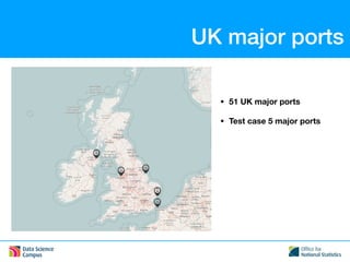
Real time position and report data
from ships for better decisions
in collaboration with
Center for Big Data Statistics (CBDS)
Dr Ioannis Tsalamanis
ioannis.tsalamanis@ons.gov.uk
The Challenge
• Shipping and trade are of great importance to the economy of the UK
• Can we use real time big data sources to improve port related decisions?
Freight Statistics
Inward Traffic Outward Traffic
Department for Transport, Statistical Release, 1 September 2017
Areas of interest
Port congestion
Unloading and
Reloading times
Storage capacity
Transportation
of goods
Route management
Customs delays
Datasets
• Automatic Identification System (AIS)
• Consolidated European Reporting System (CERS)
• Port manifests
• Customs records
• Big freight companies
• Official surveys
AIS data
• Maritime navigation safety communications system
• Can be used to spatially represent vessel movements
• Class A messages from large ships (>300 tonnes) and all passenger ships
• Class B messages from smaller ships, fishing ships and recreational vessels
• 27 different types of messages (position, status, voyage, aid required, …)
• Every 2 seconds from moving vessels
• Up to 3 minutes from from anchored or moored vessels
Encoded messages
s:ASM//Port=82//MMSI=2320734,c:1491004800*78!BSVDM,1,1,,A,E>jHCFbW7a:4@1Pa9@1:WdP0000Or:e=@6q@@10888uf:0,0*27
s:ASM//Port=26//MMSI=2320722,c:1491004800*71!BSVDM,2,1,0,A,53FsOT02?IHHD9TT000lD@4h00000000000000169H?875160>@ESkSCmE,0*56
s:ASM//Port=26//MMSI=2320722,c:1491004800*71!BSVDM,2,2,0,A,2000000000000,0*3D
Port unique ID
Base station receiver unique ID
Timestamp
NMEA type of msg
Encoded AIS message
One line encoded AIS message
Two line encoded AIS message
Lines
Type
End
Decoded messages
Type 1: Class A Position Report
Type 4: Base Station Report:
Type 18: Class B Position Report:
Type 21: Aids to navigation report:
Route
Ship in port
UK major ports
• 51 UK major ports
• Test case 5 major ports
Port traffic
Visualisations
CERS data
• Reports from ships arriving to and departing from ports
• Additional information from ships carrying dangerous or polluting goods
Thank you

Mapping mobility Ioannis Tsalamanis