Download to read offline
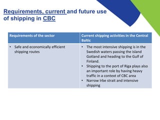
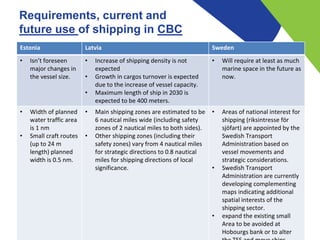
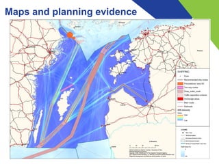
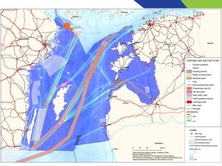
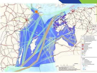
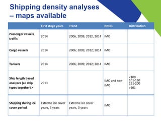
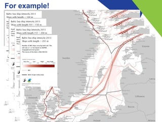

The document discusses the current and future use of shipping in the Central Baltic region, emphasizing safe and economically efficient routes, especially through Swedish waters and the port of Riga. It highlights expected growth in cargo turnover due to increased vessel capacity, outlines shipping zone dimensions, and identifies areas of national interest for shipping as designated by the Swedish Transport Administration. Additionally, it calls for socio-economic research and feasibility studies to assess risks and impacts of shipping, alongside recommendations for safety and international collaboration on shipping routes.


