Download to read offline


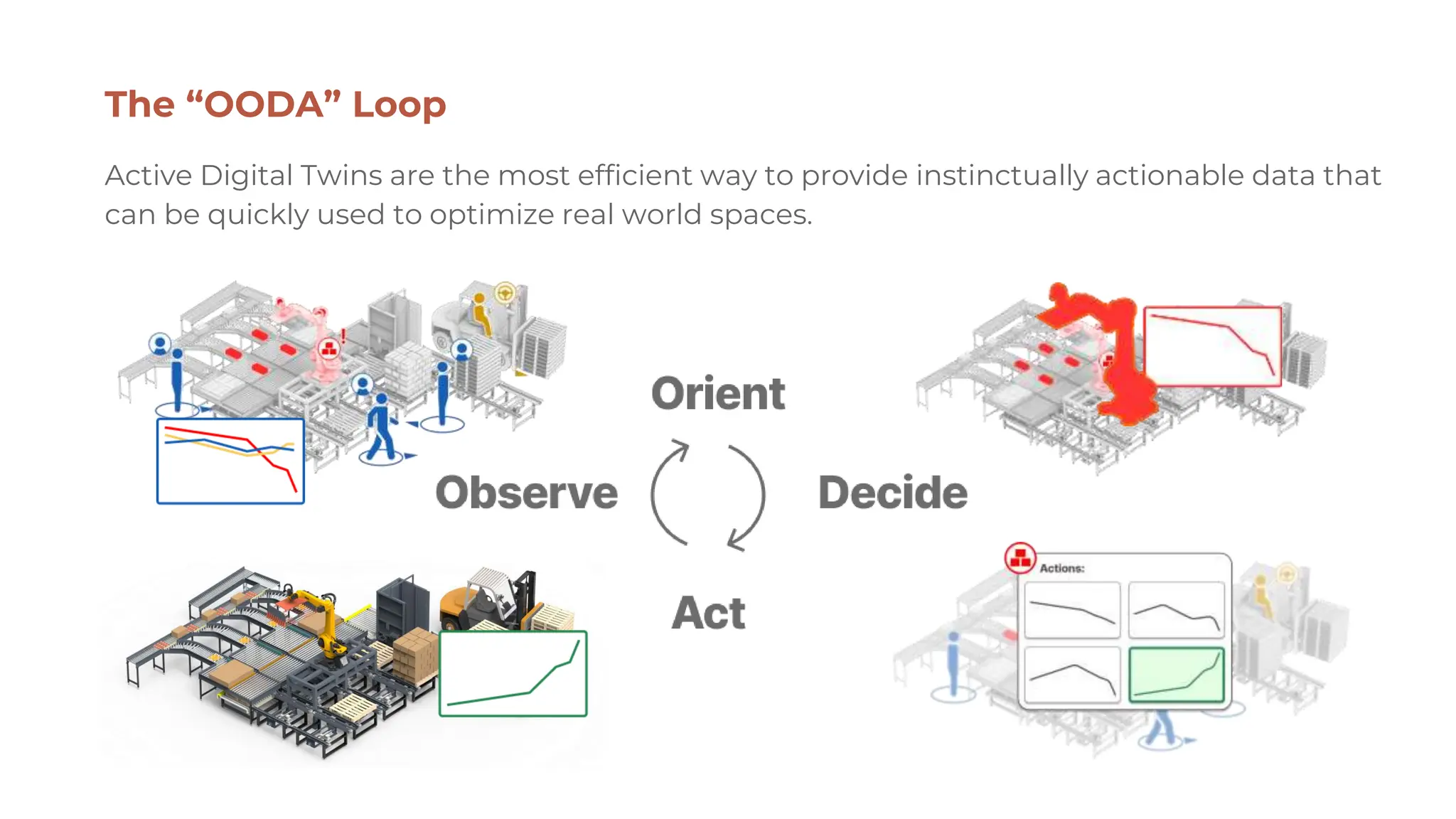


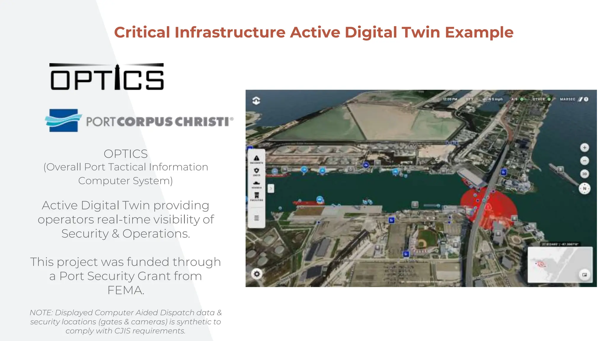


Active digital twins are real-time, actionable representations of physical entities, enabling better data processing and decision-making. They enhance context assessment, reduce cognitive load, and optimize various critical infrastructures like ports and airports by offering intuitive data visualization. Future developments include AI-driven traffic optimization, security management, and comprehensive situational awareness through merged systems.


![The Maritime Security. OSINT [EN] .pdf](https://cdn.slidesharecdn.com/ss_thumbnails/maritimesecurity-240723053511-8c070405-thumbnail.jpg?width=640&height=640&fit=bounds)


