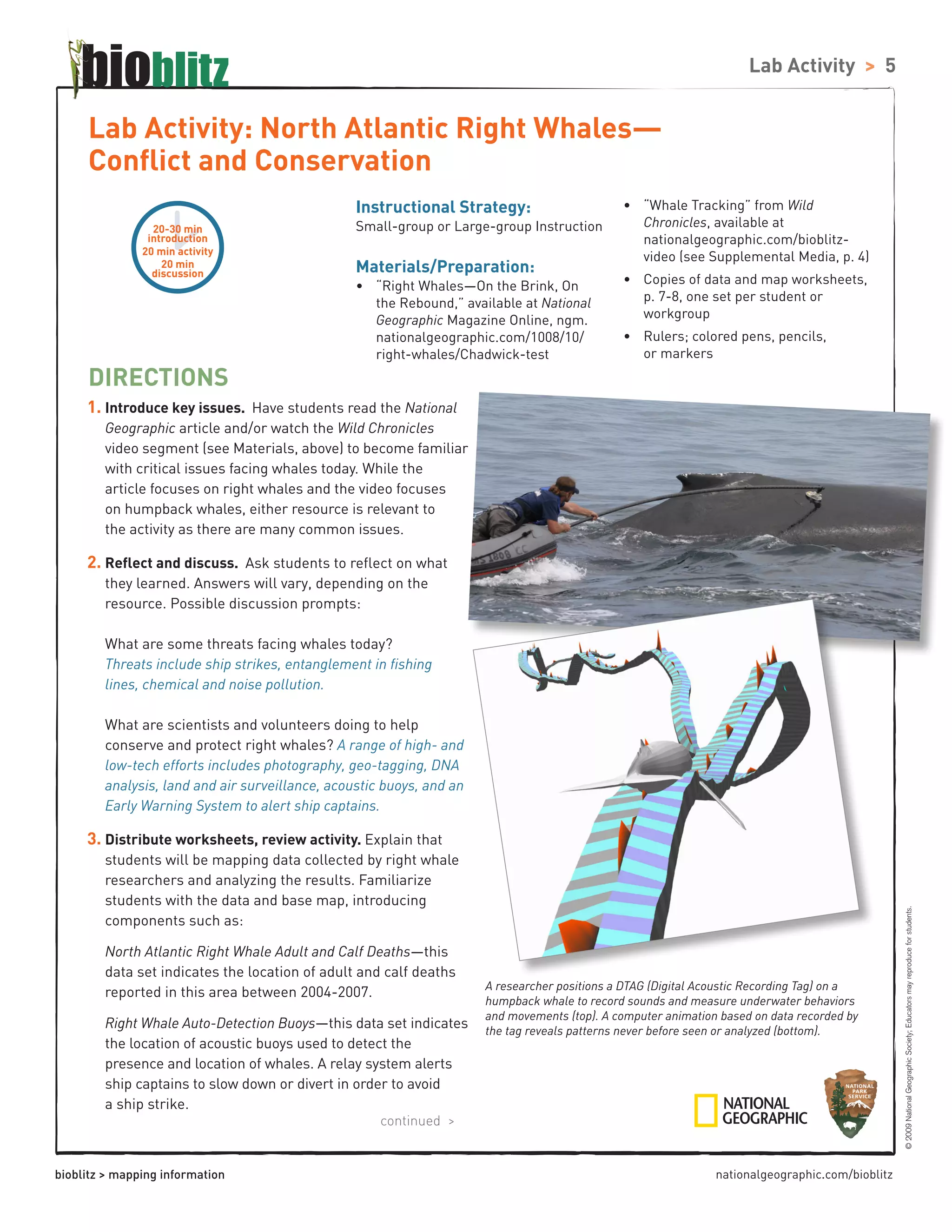
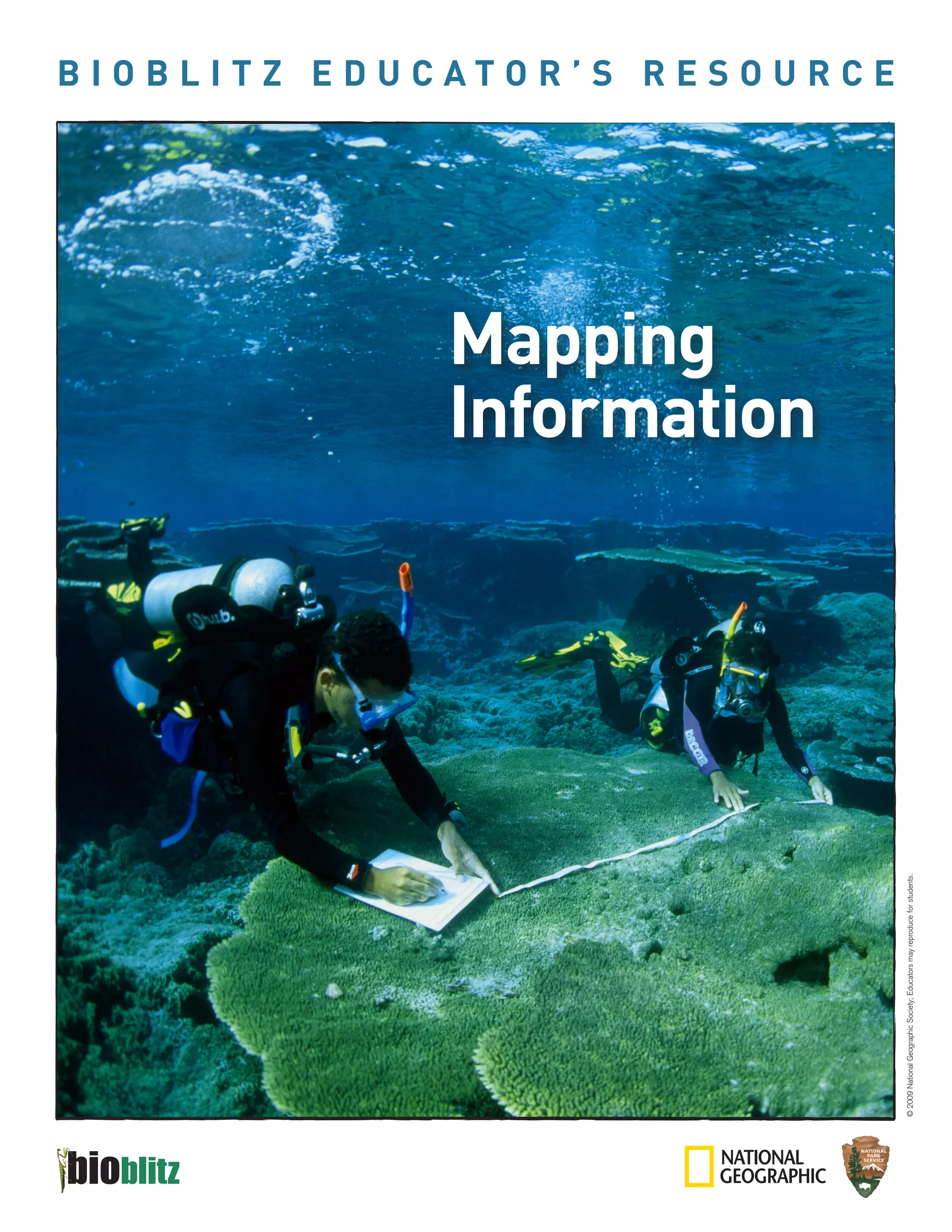
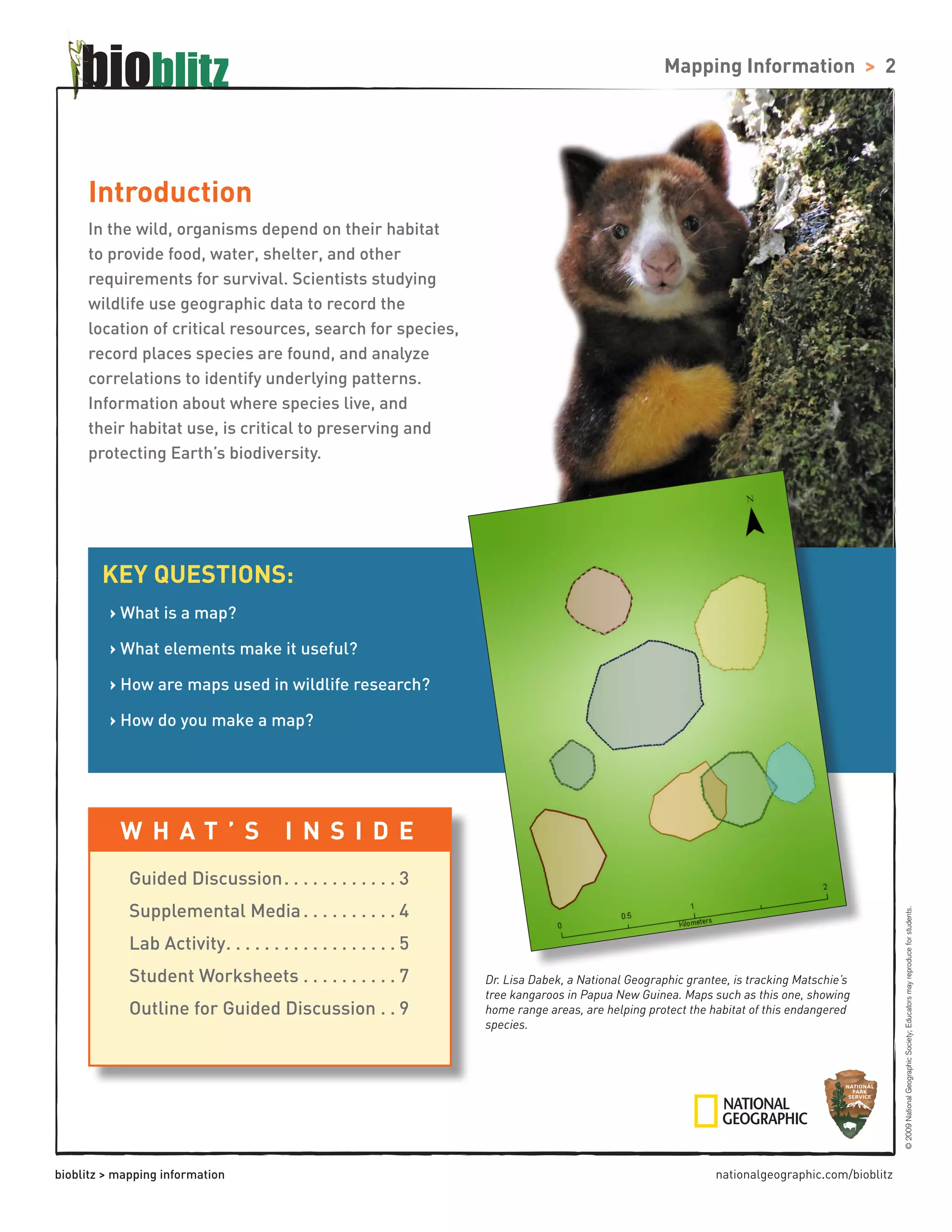
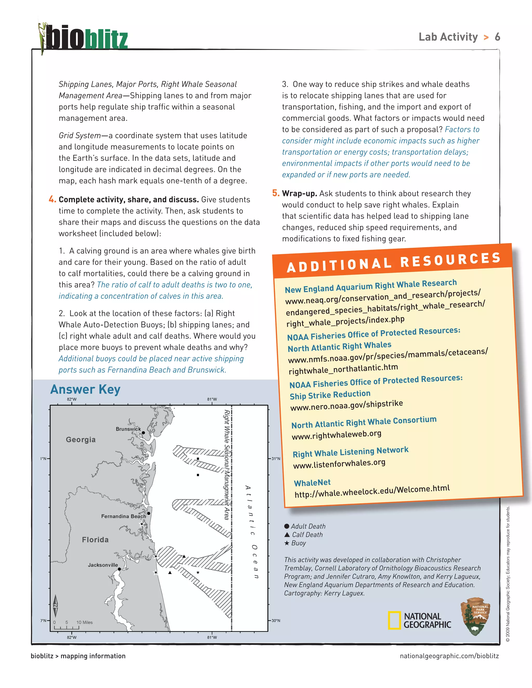
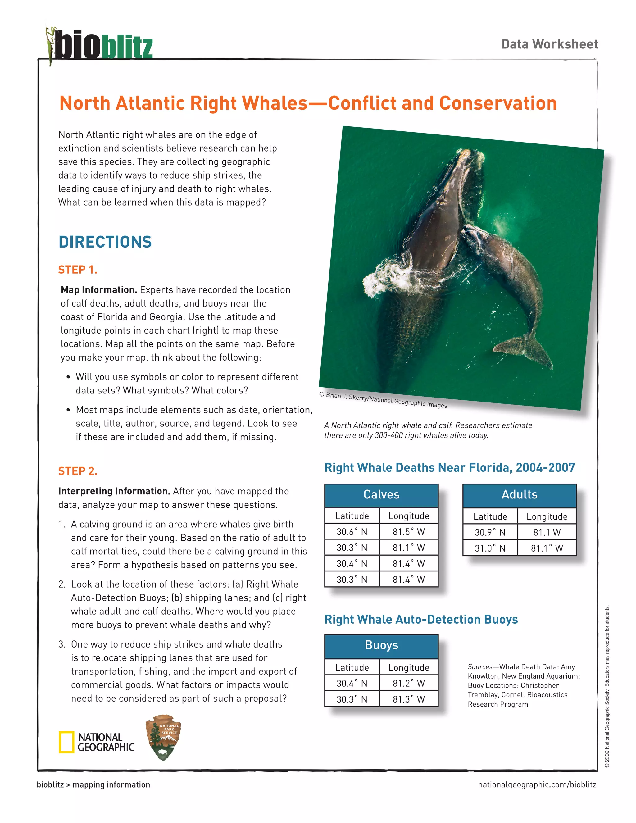
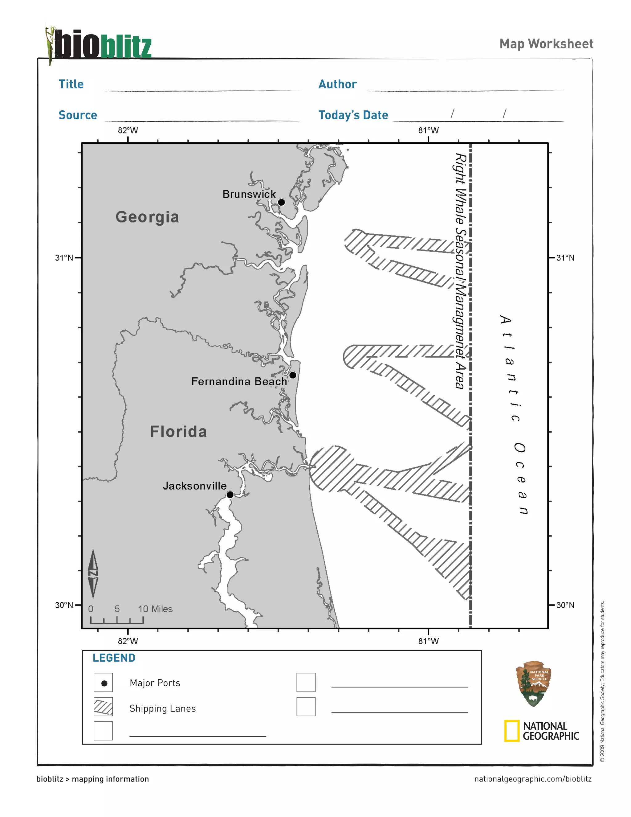
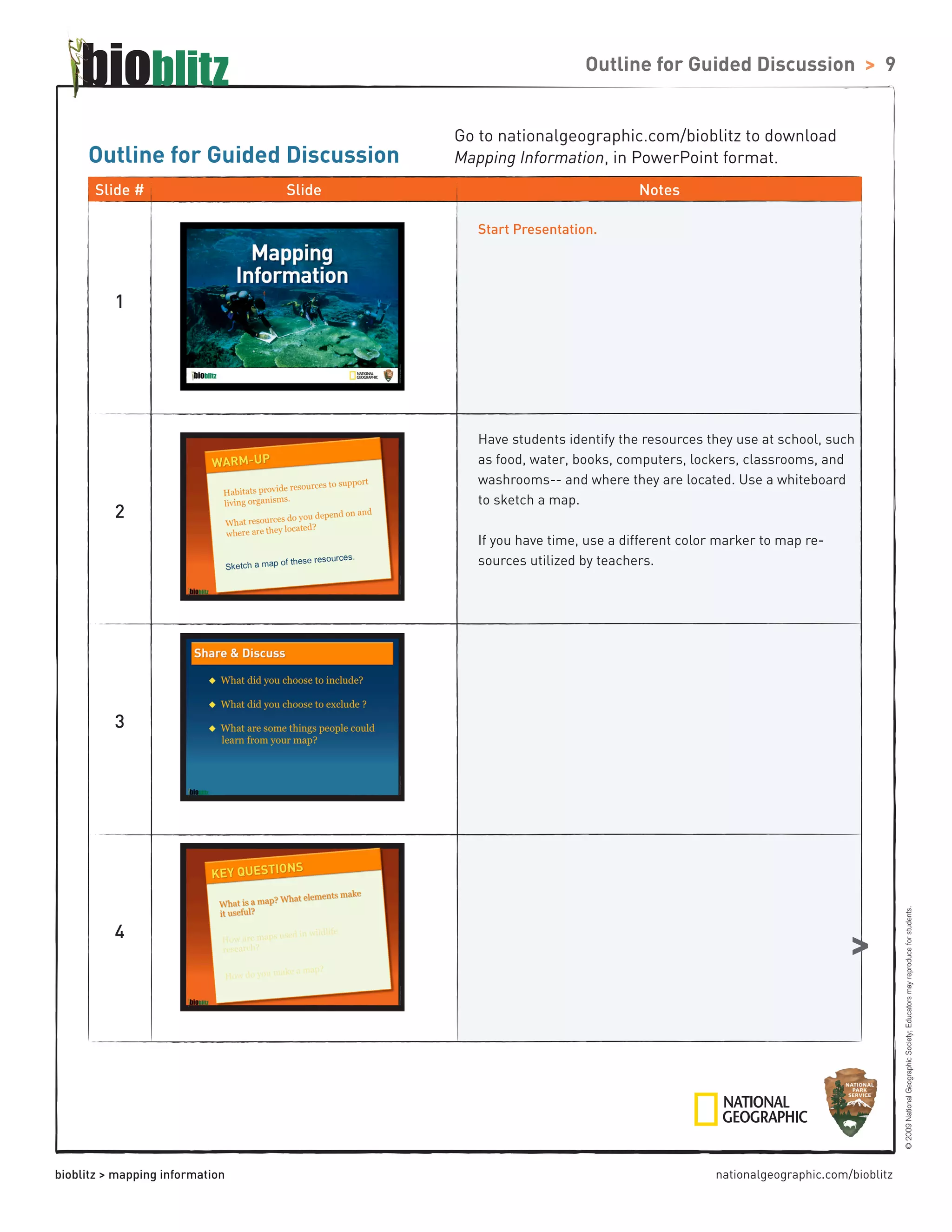
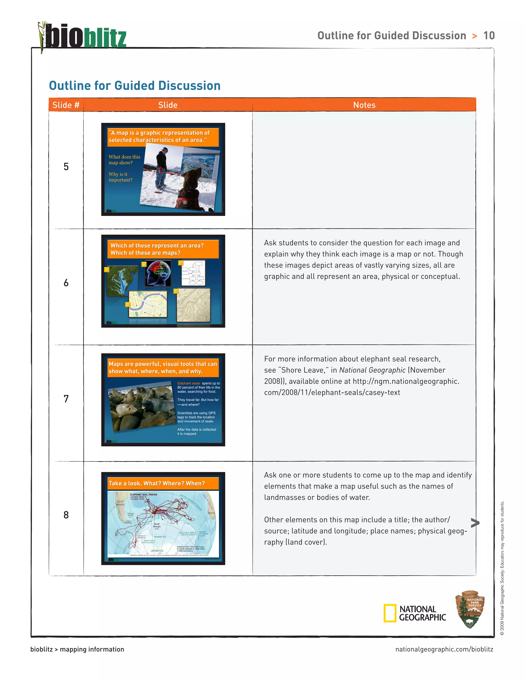
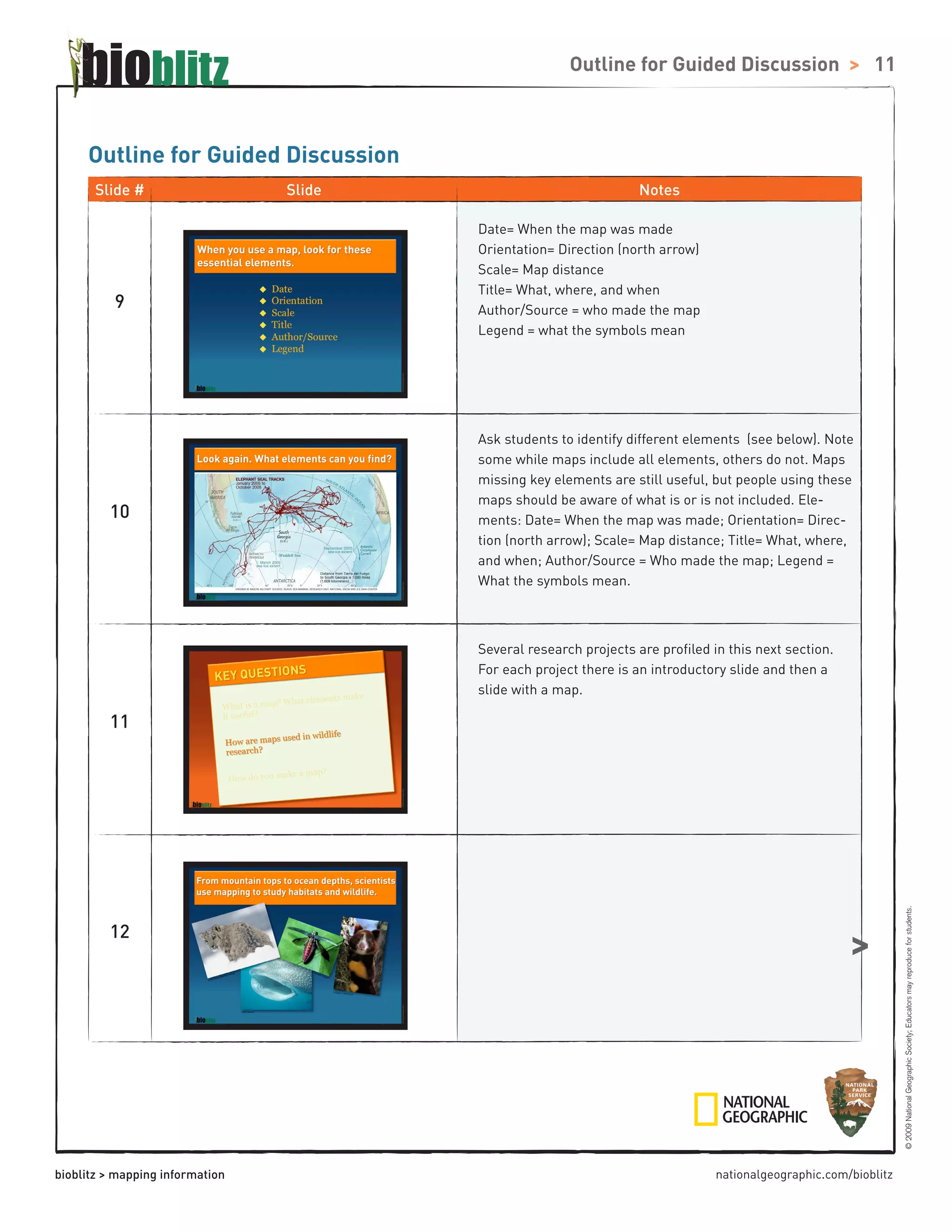
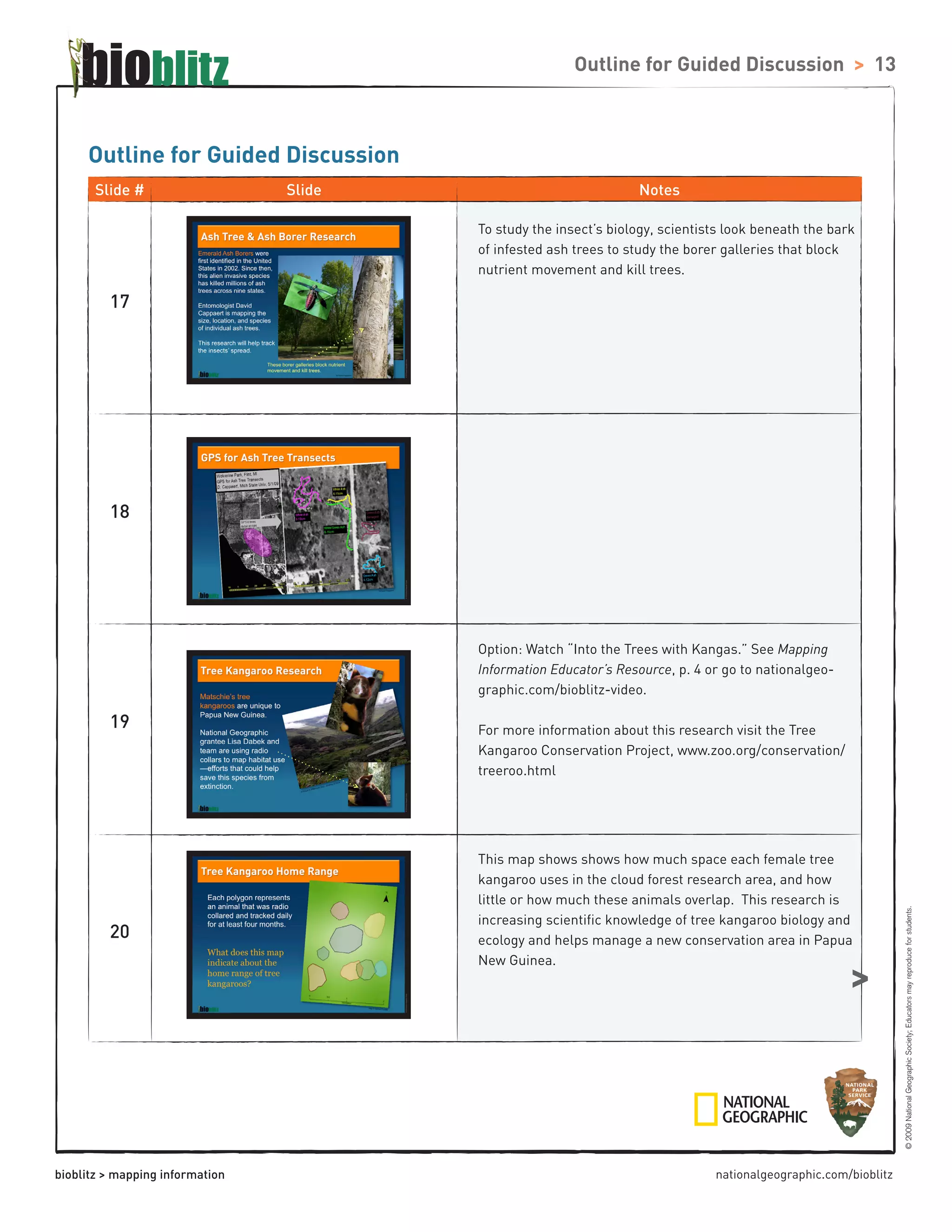
This document provides information about mapping and its uses in wildlife research. It introduces key concepts such as habitat, geographic data collection, and how maps are used to study species locations and distributions. The document outlines a guided discussion and lab activity to teach students about mapping. The lab uses real data on North Atlantic right whale deaths and acoustic buoy locations to have students create maps and analyze patterns related to threats like ship strikes.
This is a presentation I gave to education agents. It provides a snapshot of the research that has been carried out at UNMC (as at 22 Jan 2013). It is only a representative sample.
Iokiñe Rodriguez: Reframing the fire narrative in Canaima National Park, Vene...STEPS Centre
Presentation at the STEPS Conference 2010 - Pathways to Sustainability: Agendas for a new politics of environment, development and social justice
http://www.steps-centre.org/events/stepsconference2010.html
Emerald Ash Borer: First Detector Program A Volunteer Early Detection Programnacaa
Abrahamson, M.1; Cervenka, V.2; Gupta, A.3; Hahn, J.4; Herzfeld, D.5;
Holman, K.6; Johnson, G.7, Reichenbach, M.8; Wyatt, G.9;
1) EAB Coordinator, Minnesota Department of Agriculture, St. Paul, MN, 55108
2) Forest Entomologist, Minnesota Department of Natural Resources, St. Paul, MN, 55155
3) Extension Educator, University of Minnesota Extension, Rochester, MN, 55904
4) Extension Entomologist, University of Minnesota Extension, St. Paul, MN, 55108
5) Pesticide Education Coordinator, University of Minnesota Extension, St. Paul, MN, 55108
6) Community Forestry Program, Minnesota Department of Natural Resources, St. Paul, MN, 55108
7) Urban and Community Forester, University of Minnesota, St. Paul, MN, 55108
8) Extension Educator, University of Minnesota Extension, Cloquet, MN, 55720
9) Extension Educator, University of Minnesota Extension, Mankato, MN, 56001
Participatory mapping in the design process of a SDI. A case study in the Bio...Snowflake Software Ltd
In the recent years, the major production of cartographic information and the advancement of new Information Technologies (IT's) has brought with it the need to develop new storage and management tools, making access in a simpler way either alphanumeric or vector information.
Since the 60s, the processing, analysis and visualization of cartographic data has been carried out using GIS as desktop software, installed on a single computer. The advantage of this system was the possibility of combining different cartographic information thereby facilitating decision-making.
The need to share data, mainly cartographic information, between agents who are working in the same area has been the basis for the creation of Spatial Data Infrastructures (SDI) at global, national, regional ,local, or corporative level.
Several resources for managing, classifying, sharing, exchanging, combining and accessing geographic data through internet connection have been developed together with the implementation of all levels of SDI's. The resources can be classified as: software for publishing cartographic data (maps servers), publication standards, metadata, legal framework, agreements among organizations, and the possibility to create different user levels.
Therefore, the aim will be to have cartographic information updated and available for all the involved agents who are working in the same territory, which will result in sharing efforts and costs.
Nevertheless, the development of new technologies has had an effect where the cartographic data producers have less direct contact with the field, ignoring somehow the people living in it who are the ones with best knowledge of the territory.
In remote areas, where it is difficult to access such as the Rio Platano Biosphere Reserve Region (Honduras), it is indispensable to create an SDI for managing and sharing cartographic information by the involved agents in the territory.
It is important that the information offered by the indigenous communities is not left aside because they have a direct relation with the field. In the case of Rio Platano, they are scattered along the territory.
The basis of this thesis is to create the SDI for the Rio Platano region and the methodology to combine the different cartographic information published by different organisms. Also, it will be important to include in the SDI structure the information regarding the cadastral boundaries and socio environmental indicators obtained from the indigenous communities. It will require the design of participative pictograms using Participatory Mapping techniques.
Information Mapping Presentation for STC West Coast Chapter - Jan 29, 2014_finalChris MacMillan
Chris will provide an overview and answer questions about the Information Mapping® structured writing methodology. Information Mapping is a 45 year old content standard developed at Harvard and Columbia Universities and is used by companies and government around the globe to improve performance and productivity. Chris will demonstrate how the method works, talk about why companies use it, demo FS Pro — Information Mapping’s plug-in for Microsoft Word — and talk about where the method is going next in the technical communications world. Along with the overview, Chris will provide a few “Mapping” concepts and principles that you can use in your work right away.
The is the PPT for the talk that I gave on "Gamifiying your Blog" on how gamification can help increase user engagement and improve user experience on the blog at WordCamp Pune
With this article, I wish to demonstrate that when an Organization is becoming fully aware of the importance of the project management professionalism, this will lead certainly, to recognize the value and the objective benefits deriving from having in place a Project Management Office (PMO)
ZipDial’s Mobile Survey platform allows businesses, governments in India and the Caribbean to reach more mobile users than SMS-based platforms, getting actionable insights in hours, not weeks.
Exotel - Cloud telephony, Business phone system expertsExotel
Exotel is India's leading cloud telephony company that works with both Enterprises & SMEs in India. We help companies manage their customer phone calls using features like IVR, call recording etc. Customers can even devise complex call-center like call flows with simple drag and drop actions. If you're thinking of using cloud telephony for your business, this is a good place for you to start because this presentation has a few unique case studies as well as few common scenarios that companies use Exotel for.
This presentation offers a brief glimpse into the kind of solutions that Exotel offers for clients. This includes large enterprises who need more of a call-center approach to managing their phone calls and SMEs who need a business phone system to gain more insights and have control over their phone calls.
TMC 2017 Spring Far Horizon Future Truck FinalPaul Menig
Short presentation, with backup ideas, to the Technology and Maintenance Council Spring 2017 meeting. This is the Far Horizon report for the Future Truck Committee.
This guide, designed by the National Wildlife Federation for use with the film Born to be Wild 3D, will help you explore the film’s themes in an educational setting.
The activities are designed for grades 3-5, with extensions for younger and older children. These activities meet national
standards for English/Language Arts, Science, Social Studies, and Visual Arts
Find out more about the the Comprehensive Marine Biodiversity Survey of Singapore: action plan, operational set up and deliverables, in this powerpoint shared by NParks.
This is a "walk-through" of one of my most recent projects. It is an ecology game and we are pretty excited about how it is doing with teachers and students.
Biological survey. A systematic method for collecting a consistent, reproducible and reliable sample of the aquatic biological community in a waterbody. • Biological indicators. The groups of organisms used to assess the condition of an environment.
Session 06, Introduction to biodiversity sample-based data publishing at the ...Alberto González-Talaván
This presentation sets the basic principles for the publishing of biodiversity information coming from sampling efforts. It was first presented in the training event for GBIF Participant nodes part of the 22nd meeting of the GBIF Governing Board.
Slide deck developed and presented by L. Smirnova (Royal Museum for Central Africa - Belgium).
Similar to Mapping Information Educator\'s Resource (20)
Learn more about a new monitoring and evaluation (M&E) initiative, gLOCAL Evaluation Week, which is being organized by the CLEAR Initiative, and local and global partners, to raise awareness about M&E and its critical role in strengthening accountability and increasing transparency in areas of public spending and service delivery. The first gLOCAL Evaluation Week will take place between June 3 and 7, 2019.
For more information and to submit an event proposal, please visit the CLEAR Initiative (theclearinitiative.org) or follow the CLEAR Initiative (@theCLEARInitiative).
Smart TV Buyer Insights Survey 2024 by 91mobiles.pdf91mobiles
91mobiles recently conducted a Smart TV Buyer Insights Survey in which we asked over 3,000 respondents about the TV they own, aspects they look at on a new TV, and their TV buying preferences.
Neuro-symbolic is not enough, we need neuro-*semantic*Frank van Harmelen
Neuro-symbolic (NeSy) AI is on the rise. However, simply machine learning on just any symbolic structure is not sufficient to really harvest the gains of NeSy. These will only be gained when the symbolic structures have an actual semantics. I give an operational definition of semantics as “predictable inference”.
All of this illustrated with link prediction over knowledge graphs, but the argument is general.
The Art of the Pitch: WordPress Relationships and SalesLaura Byrne
Clients don’t know what they don’t know. What web solutions are right for them? How does WordPress come into the picture? How do you make sure you understand scope and timeline? What do you do if sometime changes?
All these questions and more will be explored as we talk about matching clients’ needs with what your agency offers without pulling teeth or pulling your hair out. Practical tips, and strategies for successful relationship building that leads to closing the deal.
Encryption in Microsoft 365 - ExpertsLive Netherlands 2024Albert Hoitingh
In this session I delve into the encryption technology used in Microsoft 365 and Microsoft Purview. Including the concepts of Customer Key and Double Key Encryption.
Accelerate your Kubernetes clusters with Varnish CachingThijs Feryn
A presentation about the usage and availability of Varnish on Kubernetes. This talk explores the capabilities of Varnish caching and shows how to use the Varnish Helm chart to deploy it to Kubernetes.
This presentation was delivered at K8SUG Singapore. See https://feryn.eu/presentations/accelerate-your-kubernetes-clusters-with-varnish-caching-k8sug-singapore-28-2024 for more details.
DevOps and Testing slides at DASA ConnectKari Kakkonen
My and Rik Marselis slides at 30.5.2024 DASA Connect conference. We discuss about what is testing, then what is agile testing and finally what is Testing in DevOps. Finally we had lovely workshop with the participants trying to find out different ways to think about quality and testing in different parts of the DevOps infinity loop.
State of ICS and IoT Cyber Threat Landscape Report 2024 previewPrayukth K V
The IoT and OT threat landscape report has been prepared by the Threat Research Team at Sectrio using data from Sectrio, cyber threat intelligence farming facilities spread across over 85 cities around the world. In addition, Sectrio also runs AI-based advanced threat and payload engagement facilities that serve as sinks to attract and engage sophisticated threat actors, and newer malware including new variants and latent threats that are at an earlier stage of development.
The latest edition of the OT/ICS and IoT security Threat Landscape Report 2024 also covers:
State of global ICS asset and network exposure
Sectoral targets and attacks as well as the cost of ransom
Global APT activity, AI usage, actor and tactic profiles, and implications
Rise in volumes of AI-powered cyberattacks
Major cyber events in 2024
Malware and malicious payload trends
Cyberattack types and targets
Vulnerability exploit attempts on CVEs
Attacks on counties – USA
Expansion of bot farms – how, where, and why
In-depth analysis of the cyber threat landscape across North America, South America, Europe, APAC, and the Middle East
Why are attacks on smart factories rising?
Cyber risk predictions
Axis of attacks – Europe
Systemic attacks in the Middle East
Download the full report from here:
https://sectrio.com/resources/ot-threat-landscape-reports/sectrio-releases-ot-ics-and-iot-security-threat-landscape-report-2024/
Generating a custom Ruby SDK for your web service or Rails API using Smithyg2nightmarescribd
Have you ever wanted a Ruby client API to communicate with your web service? Smithy is a protocol-agnostic language for defining services and SDKs. Smithy Ruby is an implementation of Smithy that generates a Ruby SDK using a Smithy model. In this talk, we will explore Smithy and Smithy Ruby to learn how to generate custom feature-rich SDKs that can communicate with any web service, such as a Rails JSON API.
Builder.ai Founder Sachin Dev Duggal's Strategic Approach to Create an Innova...Ramesh Iyer
In today's fast-changing business world, Companies that adapt and embrace new ideas often need help to keep up with the competition. However, fostering a culture of innovation takes much work. It takes vision, leadership and willingness to take risks in the right proportion. Sachin Dev Duggal, co-founder of Builder.ai, has perfected the art of this balance, creating a company culture where creativity and growth are nurtured at each stage.