Analysis Of Influence Of Spatial Planning On Performance Of Regional Developm...Suwandi, Dr. SE.,MSi
The various problems in regional spatial planning in Waropen District, Papua, shows that the Spatial Planning (RTRW) of Waropen District, Papua, drafted in 2010 has not had a positive contribution to the settlement of spatial planning problems. This is most likely caused by the inconsistency in the spatial planning. This study tried to observe the consistency of spatial planning as well as its relation to the regional development performance. The method used to observe the consistency of the preparation of guided Spatial Planning (RTRW) is the analysis of comparative table followed by analysis of verbal logic. In order to determine if the preparation of Spatial Planning (RTRW) has already paid attention on the synergy with the surrounding regions (Inter-Regional Context), a map overlay was conducted, followed by analysis of verbal logic. To determine the performance of the regional development, a Principal Components Analysis (PCA) was done. The analysis results showed that inconsistencies in the spatial planning had caused a variety of problems that resulted in decreased performance of the regional development. The main problems that should receive more attention are: infrastructure, development growth, economic growth, transportation aspect and new properties.
EUGEO 2021 - Integrated and Emotional Geography as a tool for analyzing urban...Bertagni Consulting srl
Wednesday, June 30, 2021
Integrated and Emotional Geography as a tool for analyzing urban and territorial systems
Directed by Marco Bertagni, Executive director at Bertagni Consulting srl and EMME’s Founder
Session 1: h 9,00 – h 10,30
9,00 - Introduction by the Chair
9,10 – Marco Bertagni: Integrated and Emotional Geography as a tool for analyzing urban and territorial systems
9,30 – Elisa Tachis (et Marco Bertagni): Geo-emotional water management
9,45 – Ana Pejdo (et Jadranka Brkić-Vejmelka): Geography Students' Competencies Self-assessment – Case Study University of Zadar Department of Geography.
10,00 – Ayumu Harada: The Placement of Religious Facilities in the City Planning of Japanese Castle Towns: Comparing the Location of Temples in the Hiroshima and Kumamoto castle town
10,15 – Anna Preti: Beyond the Green City: Critical and Emotional Geography as a tool to promote and safeguard Urban Ecologies
10,30 – Coffee break
Session 2: h 10,45 – 12,15
10,45 - Introduction by the Chair
10,50 – Salomé Vincent, Nocturnal perceptions: the weight of the gaze as a tool structuring public space.
11:05 - Lucia Brisudová (et Jonathan J. Huck, Reka Solymosi, Pavel Klapka): Rhythmicity and perception of places in an urban space: a comparison case study of Manchester (UK) and Olomouc (CZ)
11:20 - Melissa Rodriguez Martin (et Marco Bertagni): Genius Loci in Urban planning
11:35 – Riccardo Pirazzoli, PLACE-VALUES: how to transform a geographic space into an emotional space-image
11:50 – Q&A on Session 1 and session 2
12:10 – Conclusions by the Chair
Introduction to Site Planning. These slides should be able to provide urban planners a simple guide to factors and issues to consider in planning a a site. These slides were prepared for urban design class for masters students in Makerere University Kampala ( Uganda)
Regional planning concept in tourism planning.pptxLaboni16
It is a presentation on planning for tourism region
Here we explain different planning antecedents and histories, regional development hierarchy, planning approach, planning process, etc.
Although there is no consensus on the definition of the peri-urban interface, there is growing recognition among development professionals and insti-tutions that rural and urban features tend increasingly to co-exist within cities and beyond their limits. There is also recognition that the urban–rural dichotomy that is deeply ingrained in planning systems is inadequate for dealing with processes of environmental and developmental change in the peri-urban context. This paper argues that environmental planning and management of the peri-urban interface cannot simply be based on the extrapolation of planning approaches and tools applied in rural and urban areas. Instead, it needs to be based on the construc-tion of an approach that responds to the specific environment, social, economic and institutional aspects of the peri-urban interface. The paper also outlines approaches to environmental planning and management in the peri-urban interface, examin-ing its specificity in terms of both the challenges faced and possible approaches for implementation
Analysis of the Landscape Services in Çankırı, Ilgaz RegionAI Publications
The mutual relationship between man and nature brings multiple characters, functions and benefits to the landscape. Landscape services are crucial for the social and economic development and vital activities of human beings. Landscapes produce goods and services in the industry needs as well as that are directly needed by the individual in the cities and in the countryside. In this study, Çankırı, Ilgaz Region landscape services are analysed and defined in multifunctional way which are based on the basin scale. Then, qualitative and quantitative surveys were conducted to determine the priorities and significance for the Ilgaz Region and the priority services were identified.
Background to this post. Lot of people believe Eco-Tourism to be tourism activity to benefit from fresh air and good weather. However the actual concept of Eco-Tourism deals with Environmentally responsible travel and visitation to natural areas !
Slide show for ISSRM 2020 Virtual Conference. Presentation by Matt Curnock, et al. on "Design of an Aesthetics Long-Term Monitoring Program for the Great Barrier Reef"
Presented by IWMI's Liza Debevec at a Roundtable on Building Resilience to Climate Change through Community Dialogues held in Addis Ababa, Ethiopia, September 20, 2016
Similar to Manual to build a Cultural Territorial System Plan (20)
3.0 Project 2_ Developing My Brand Identity Kit.pptxtanyjahb
A personal brand exploration presentation summarizes an individual's unique qualities and goals, covering strengths, values, passions, and target audience. It helps individuals understand what makes them stand out, their desired image, and how they aim to achieve it.
Top mailing list providers in the USA.pptxJeremyPeirce1
Discover the top mailing list providers in the USA, offering targeted lists, segmentation, and analytics to optimize your marketing campaigns and drive engagement.
Buy Verified PayPal Account | Buy Google 5 Star Reviewsusawebmarket
Buy Verified PayPal Account
Looking to buy verified PayPal accounts? Discover 7 expert tips for safely purchasing a verified PayPal account in 2024. Ensure security and reliability for your transactions.
PayPal Services Features-
🟢 Email Access
🟢 Bank Added
🟢 Card Verified
🟢 Full SSN Provided
🟢 Phone Number Access
🟢 Driving License Copy
🟢 Fasted Delivery
Client Satisfaction is Our First priority. Our services is very appropriate to buy. We assume that the first-rate way to purchase our offerings is to order on the website. If you have any worry in our cooperation usually You can order us on Skype or Telegram.
24/7 Hours Reply/Please Contact
usawebmarketEmail: support@usawebmarket.com
Skype: usawebmarket
Telegram: @usawebmarket
WhatsApp: +1(218) 203-5951
USA WEB MARKET is the Best Verified PayPal, Payoneer, Cash App, Skrill, Neteller, Stripe Account and SEO, SMM Service provider.100%Satisfection granted.100% replacement Granted.
Putting the SPARK into Virtual Training.pptxCynthia Clay
This 60-minute webinar, sponsored by Adobe, was delivered for the Training Mag Network. It explored the five elements of SPARK: Storytelling, Purpose, Action, Relationships, and Kudos. Knowing how to tell a well-structured story is key to building long-term memory. Stating a clear purpose that doesn't take away from the discovery learning process is critical. Ensuring that people move from theory to practical application is imperative. Creating strong social learning is the key to commitment and engagement. Validating and affirming participants' comments is the way to create a positive learning environment.
[Note: This is a partial preview. To download this presentation, visit:
https://www.oeconsulting.com.sg/training-presentations]
Sustainability has become an increasingly critical topic as the world recognizes the need to protect our planet and its resources for future generations. Sustainability means meeting our current needs without compromising the ability of future generations to meet theirs. It involves long-term planning and consideration of the consequences of our actions. The goal is to create strategies that ensure the long-term viability of People, Planet, and Profit.
Leading companies such as Nike, Toyota, and Siemens are prioritizing sustainable innovation in their business models, setting an example for others to follow. In this Sustainability training presentation, you will learn key concepts, principles, and practices of sustainability applicable across industries. This training aims to create awareness and educate employees, senior executives, consultants, and other key stakeholders, including investors, policymakers, and supply chain partners, on the importance and implementation of sustainability.
LEARNING OBJECTIVES
1. Develop a comprehensive understanding of the fundamental principles and concepts that form the foundation of sustainability within corporate environments.
2. Explore the sustainability implementation model, focusing on effective measures and reporting strategies to track and communicate sustainability efforts.
3. Identify and define best practices and critical success factors essential for achieving sustainability goals within organizations.
CONTENTS
1. Introduction and Key Concepts of Sustainability
2. Principles and Practices of Sustainability
3. Measures and Reporting in Sustainability
4. Sustainability Implementation & Best Practices
To download the complete presentation, visit: https://www.oeconsulting.com.sg/training-presentations
B2B payments are rapidly changing. Find out the 5 key questions you need to be asking yourself to be sure you are mastering B2B payments today. Learn more at www.BlueSnap.com.
Implicitly or explicitly all competing businesses employ a strategy to select a mix
of marketing resources. Formulating such competitive strategies fundamentally
involves recognizing relationships between elements of the marketing mix (e.g.,
price and product quality), as well as assessing competitive and market conditions
(i.e., industry structure in the language of economics).
Understanding User Needs and Satisfying ThemAggregage
https://www.productmanagementtoday.com/frs/26903918/understanding-user-needs-and-satisfying-them
We know we want to create products which our customers find to be valuable. Whether we label it as customer-centric or product-led depends on how long we've been doing product management. There are three challenges we face when doing this. The obvious challenge is figuring out what our users need; the non-obvious challenges are in creating a shared understanding of those needs and in sensing if what we're doing is meeting those needs.
In this webinar, we won't focus on the research methods for discovering user-needs. We will focus on synthesis of the needs we discover, communication and alignment tools, and how we operationalize addressing those needs.
Industry expert Scott Sehlhorst will:
• Introduce a taxonomy for user goals with real world examples
• Present the Onion Diagram, a tool for contextualizing task-level goals
• Illustrate how customer journey maps capture activity-level and task-level goals
• Demonstrate the best approach to selection and prioritization of user-goals to address
• Highlight the crucial benchmarks, observable changes, in ensuring fulfillment of customer needs
Premium MEAN Stack Development Solutions for Modern BusinessesSynapseIndia
Stay ahead of the curve with our premium MEAN Stack Development Solutions. Our expert developers utilize MongoDB, Express.js, AngularJS, and Node.js to create modern and responsive web applications. Trust us for cutting-edge solutions that drive your business growth and success.
Know more: https://www.synapseindia.com/technology/mean-stack-development-company.html
LA HUG - Video Testimonials with Chynna Morgan - June 2024Lital Barkan
Have you ever heard that user-generated content or video testimonials can take your brand to the next level? We will explore how you can effectively use video testimonials to leverage and boost your sales, content strategy, and increase your CRM data.🤯
We will dig deeper into:
1. How to capture video testimonials that convert from your audience 🎥
2. How to leverage your testimonials to boost your sales 💲
3. How you can capture more CRM data to understand your audience better through video testimonials. 📊
In the Adani-Hindenburg case, what is SEBI investigating.pptxAdani case
Adani SEBI investigation revealed that the latter had sought information from five foreign jurisdictions concerning the holdings of the firm’s foreign portfolio investors (FPIs) in relation to the alleged violations of the MPS Regulations. Nevertheless, the economic interest of the twelve FPIs based in tax haven jurisdictions still needs to be determined. The Adani Group firms classed these FPIs as public shareholders. According to Hindenburg, FPIs were used to get around regulatory standards.
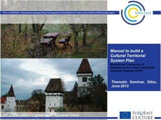
Manual to build a Cultural Territorial System Plan
1. Manual to build a
Cultural Territorial
System Plan
Manuale per il processo di
formazione di un Piano Territoriale
Culturale Integrato (CITP)
2. Manual to build a Cultural Territorial System Plan
Paolo Colarossi
Sapienza Università di Roma
Sibiu 14.06.13
3. CONVENZIONE EUROPEA DEL PAESAGGIO 2000
EUROPEAN LANDSCAPE CONVENTION 2000
Art. 1. Definizioni.
"Paesaggio” designa una determinata parte di territorio,
così come è percepita dalle popolazioni, il cui carattere
deriva dall'azione di fattori naturali e/o umani e dalle loro
interrelazioni;
"Landscape" is defined as a zone or area as perceived by
local people or visitors, whose visual features and
character are the result of the action of natural and/or
cultural (that is, human) factors. This definition reflects the
idea that landscapes evolve through time, as a result of
being acted upon by natural forces and human beings. It
also underlines that a landscape forms a whole, whose
natural and cultural components are taken together, not
separately.
4. Articolo 2 - Campo di applicazione
Fatte salve le disposizioni dell'articolo 15, la presente
Convenzione si applica a tutto il territorio delle Parti e
riguarda gli spazi naturali, rurali, urbani e periurbani. Essa
comprende i paesaggi terrestri, le acque interne e marine.
Concerne sia i paesaggi che possono essere considerati
eccezionali, sia i paesaggi della vita quotidiana sia i
paesaggi degradati.
Article 2 – Scope
Subject to the provisions contained in Article 15, this
Convention applies to the entire territory of the Parties and
covers natural, rural, urban and peri-urban areas. It includes
land, inland water and marine areas. It concerns landscapes
that might be considered outstanding as well as everyday or
degraded landscapes.
5. A Cultural Territorial System Plan (CTSP) design landscape.
A CTSP is a multiscale process of planning and design. It could be
elaborated as a stand alone project or with other projects,
An Cultural Territorial System Plan to be effective must possess seven
qualities of performance:
1. It has as its object both the physical landscape and the social
landscape (socio-economic) of a given territory, both tangible and
intangible assets and their relationships between
2. It is a structural plan organized by projects. It identifies in a sort o
fhierarchy: components of real systems, integrated components, the
primary projects of intervention, intervention priorities
3. It could be incrementally built processing parts that may each have
meaning and functional self-efficacy, while being inserted into a unitary
overall methodological framework
6. 4. It could be is implemented in time by time: you do not need immediately
a " perfect and completePlan" the various parts can be articulated, and
in-depth complessificate for subsequent additions and amendments,
5. It is flexible, that is, not just a plan "hard" and "normative", but above all
a "multiscale scenario", that’s to say a program of spatial addresses for
the area and identification of possible projects at the local scale (historic
centers or systems of scattered goods), with guidelines for developing
the projects components in a coordinated manner and in accordance
with prevailing objectives of conservation and development of
resources; however, if useful or necessary, some specific areas or
projects or parts of projects may be subject to normative planning or
design rules. A CITP is also flexible in time, as also conceived as a
process, has to be verified through monitoring on the state of
implementation of the projects and on the effects produced by the
interventions, with any necessary corrections during construction;
6. It is a strategic planning process (shared, participatory, concerted,
communicative). A CITP is a process that is trained in both the top
(institutions), and from below (associations, scholars, universities)
7. It must be managed ("accompanied" by public authorities, operators
and associations). It’s not enough to draw a beautiful plan.
7. A CTSP can be constructed by following a process that
involves the development of seven points in sequence and
with successive iterations (drafting process for future
implementations: the seven "layers):
1. Starting the process (initial knowledge base)
2. Charter of the landscape;
3. Scenario of the future physical and social set;
4. Addresses, guidelines and rules for the preservation,
enhancement and transformation projects;
5. Operational Programmes and Plans (action plans);
6. Projects;
7. The management of the CTSP.
8. 1. Starting the process (initial knowledge base)
Processed essential to be prepared for this first phase are:
Mapping and profiling of the tangible assets
Mapping and recording of intangible assets
As it has already been said about the quality of implementation that must
have a CITP, mapping and profiling can be performed initially and also
given in an incomplete or reduced form.
This phase of gathering knowledge base can be finalized and organized for
the formation of an "Atlas of cultural and natural heritage" to conceive as
a gathering place, open and implementable, news and information on
the shareholders of properties of a given territory.
In this phase can be important the contribution from the bottom of
associations and scholars in the formation of a base of a first draft
of Atlas. Operation that can fully be considered as a first step to
start the process of forming a CITP.Elaborati indispensabili da
approntare per questa prima fase sono:
15. 2. Landscape Chart
• In this second phase (or layer) of the processing of the
CITP, of course, also on the basis of basic knowledge
gathered in the first, are found the “Landscape Zones"
and defines the scale of the heritage values of the area
(the "hierarchy of values heritage ").
• The set of such content defines the "Charter of the
Landscape" physical and socio-economic (tangible and
intangible) of a given territory.
• The Charter of the landscape should be the "structure",
the axis of a CITP, the reference base (although, as
mentioned, integrated and modified over time) for the
process of elaboration of the successive phases of the
same CITP.
16. 2.1. Landscape zones
• The scope of term landscape can be defined as the optimal size and
minimum recognizable with given characteristics of perception, physical
and socio-economic unity and / or homogeneity.
• The scope of the landscape is found in relation to the opportunity or
need to identify policies and addresses structure and adapted to the
specific characteristics of the given scope.
• In general there may be difference between the area affected by the
CTSP and Scope of landscape.
• In fact, the area of the Plan (generally identified with Administrative
criterion) can also be identified as an Area of landscape unit, but in
general provide a system composed of several landscape zones.
18. Criteria for the identification of landscape zones
Possible criteria for the identification of a landscape zone, and that should be
taken into account at the same time, are:
Criterion of "visual basin" (perceptual criterion)
Criterion of "morphological boundaries" (rivers, roads, railways, built margins,
etc.).
Criterion of physical, historical, cultural and social homogeneity
Criterion of local perceptions
Criterion of existing and possible uses
Criterion of environmental relationships and interdependencies
Administrative policy
19. Criterion of visual basin
The perceptual criterion is themost immediate and comprehensible
criterion for the identification of a landscape zone (the landscape is
also what we see and how we see it :).
To deal with the perceptual criterion is necessary to consider three
types of perception of the landscape, resulting in three types of
landscape:
Distant landscape (the bottom, the scene)
Middle landscape (the landscape of everyday spaces meaningful
experiences, or memories of experiences)
Near Landscape (the living spaces, the "rooms" of the landscape)
You can find yourself in situations of contemporary perception of the
three types of landscapes.
But in the context of perceptual criterion must be considered not only
visual perceptions, but also the perceptions that the inhabitants of its
territory could have.
37. The hierarchy of heritage values
Landscape values survey in a specific field: the criteria to
define the scale of the values of present cultural and
natural heritage :
• consistency,
• numerically,
• significance,
• rarity,
• usability
• perception of the inhabitants
For the definition of hierarchies can be used multiple criteria.
38. Definition of factors to investigate the landscape values of a
field:
environmental (mountain system, hydrological, geological,
botanical, agricultural, wildlife, fish, ...),
aesthetic (values of image, perception and identification of the
values of beauty and related areas - scale scope - territory -
and its places - a local scale - both on the part of expert
knowledge than local knowledge)
functional and social (traditions, know-how, local identity,
actual or potential use, generally immaterial aspects of
culture that need to be considered full-fledged part of the
qualities of a landscape).
39. 3. Scenario of 'physical structure and social
•"Charter of the current cultural structure of the territory":
•Framework of opportunities, critics (description of strengths
and weaknesses) and objectives for the heritage conservation
and enhancement.
•"Scenario of the future physical and social set "
•As the proposed structure which includes both physical and
social arrangements, the scenario consists of communication
design and a text of "guidelines" that have no normative value,
but only indicative .. A sort of "guide" to the future scenario.
•To be effective, the scenario must be formalized as a program
to be adopted by the local administrative level (associations of
municipalities and / or Province and / Region) which includes
the part of the territory affected by the scenario itself (ie the area
of the ICTP).
40. • The scenario is not a plan or a project, but the representation of a vision
(shared) of the future where the territory should tend, such as physical structure
(the drawing itself) and the social and economic structure (patterns of
relationships and configurations of social and economic) could become.
• The contents of the Scenario are basically of two types: rules for the
conservation of relevant quality in the area (identification of areas not
convertible, convertible and levels of transformation) and a list of projects for
the implementation of Scenario (Scenario for projects ). Scenario, in short,
contains the objectives, actions and things to do ie the list of actions related to
tangible and intangible assets and tangible and intangible assets.
• Actions, projects and addresses are identified (by location and type), and
defined in objectives and content of the maximum contribution of the
inhabitants, associations and local authorities.
• The identification of the scenario and related projects can be reached by
processing multiple (two or three) alternative scenarios to be put under
discussion between experts and local people, to get to the identification of a
scenario to be adopted, even as a composition of parts of the scenarios
discussed.
42. 4. Guide Lines, transformation rules
•Implementation and integration with the guidelines previously
as part of the scenario.
•Processing, and claims processing, regulations, manuals,
project type, procedures and tools to control the quality of
interventions, etc.., Such as:
•Regulations for planting trees
•Manuals for building restoration
•Intervention Manual of bioengineering
•In the implementation phase, this phase can be processed
even later stages 5 and 6.
43. 5. Plans-Operational Programmes (action plans)
This phase is the strategic part of the ICTP.
Based on the scenario, action plans are identified through participatory
processes-consultation (every three years, every five years, or with
continuity over time), interventions identified in the setting of physical and
social structure, which are considered a priority and that should be
promoted, or those that mature in terms of political and administrative will, of
available operators, used resources and for which projects can be
processed. In any case, the criteria for inclusion of a project in the
operational program are those of the congruence with the scenario and the
degree of feasibility.
Action Plans may affect operations of historic centers and/or systems of
scattered goods planning-designing.
44. • Action Plan to rebuild a landscape system or historic centre.
• Defining the scope.
• Urban, territorial, social and economic diagnosis, which answers to the
problems identified in the analysis phase.
• Objectives and strategies
• Determination of actions, projects to be undertaken in a comprehensive.
• Management Model to perform. Public-Private relationships.
• Participation of actors, agents, companies, associations. Citizen
participation.
• Financing systems.
• Administrations Commitment acting. Alliances and agreements
45. Analysis for Action Plans in the areas of the old town.
•Uses of the building.
•Buildability level and building heights.
•Protection level for the equity. Making a catalog of protected buildings.
•Public facilities.
•Public Spaces.
46. 6. The projects
The actions and related projects may be targeted to only a part of a larger
idea identified by the physical structure and social scenario, or even a
single element of the assets as part of a project.
This is also why there needs to be coordination dependence of
relationships between project preparation and its contents and scenario
planning, with particular attention to the conditions and characteristics of
the system in which it is inserted every single item of tangible or intangible
heritage.
The preparation of the projects is based on the rules of conservation and
transformation of points 3 and 4;
The control of the quality of the projects is based on the same guidelines
and rules and in accordance with procedures defined within the guidelines
of the Scenario.
47. Project types in historic centre
•External treatment of materials, construction systems (roofs, walls,
woodwork, color chart, etc..)
•Furniture
•Accessibility and mobility. Systems connected to public transport.
Pedestrian areas.
•Activities permitted to regenerate the city, sightseeing, shopping ...
•Signaling systems, creating tours of historic interest.
•Urban regeneration strategies. Connecting to pray parts of the city and /
or territory.
•Specific actions in degraded areas citywide.
53. 7. The accompaniment of the CTSP
•Key factor for success (the effectiveness and usefulness) of an
ICTP is its management.
•The government management skills ("accompanying" the
CITP) the levels of involvement or expertise, but also by the
point of view of operators and associations concerned.
•"Handbook to manage ICTP" is one of the entries in an ICTP
also be implemented over time, in parallel, and therefore the
implementation of the previous six operating points.