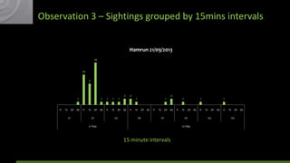
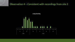
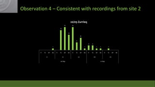
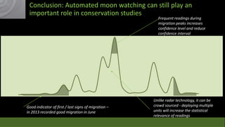
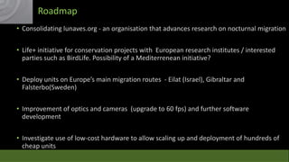
Download to read offline

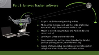
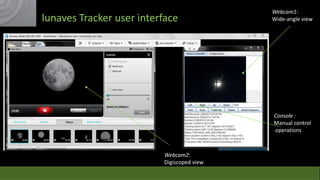
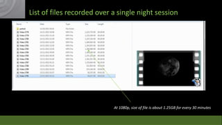
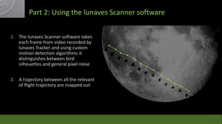
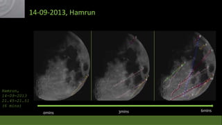

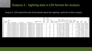
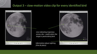
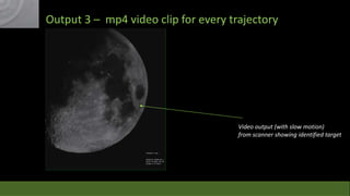


The Lunaves project examines the effectiveness of moon watching as a method for studying bird migration, highlighting its limitations and the necessity for dedicated volunteers. The initiative utilizes a sophisticated tracking system combining video recording and motion detection algorithms to map bird migration trajectories, yielding significant data and insights. Future steps include improvements in technology and expanding deployment across European migration routes to enhance research and conservation efforts.