This document presents a project report on the design of a wireless low bridge avoidance system. The system aims to prevent accidents caused by large vehicles colliding with bridges that are too low for them to pass under safely. It involves using a smartphone connected to an Arduino Uno microcontroller via Bluetooth to compare the vehicle's height, obtained from the driver, to the bridge's height at the vehicle's GPS coordinates, and warn the driver if there is insufficient clearance to pass under the bridge safely. The report describes the objectives, scope, importance and organization of the project, as well as standards, earlier work, methodology used and preliminary results obtained.
Short Term Car Lease in Europe - Espace Driver's HandBookAdrian Bert
Discounted Car rental rates , Car Lease in Paris, Nice, France, Italy, Spain, Great Britain, Germany, Switzerland, Scandinavia, Eastern Europe, Baltic Countries, One way car rental, Save Money on Car Rental, Long Term Discount on Car Rental, car rentals in Europe from one day to one year.
Rapport Stage PFE Bureau D'étude Electricité : ÉTUDE DE L’INSTALLATION ÉLECTR...SadokZgolli
Étude et dimensionnement de l’installation électrique de la cité scolaire de Saint George de l’Oyapock composé de 25 bâtiments, élaboration des plans d’exécutions, schémas unifilaires, encombrement des armoires, maquettages des locaux techniques, dimensionnement et liaison des transformateurs, et la modélisation maquettes BIM.
Contact :
https://www.linkedin.com/in/sadok-zgolli/
zgollisadok@yahoo.com
Lesotho PHC Revitalization: Services Availability and Readiness Assessment In...HFG Project
A year and half in office, with a visibly ailing health system, the new leadership of the MOH took a decision to revisit the role of primary health care (PHC) as an approach to revitalize and improve provision of health services. The decision on what aspects of PHC the MOH would address required empirical evidence on the current status of the health system. To inform this process, the MOH determined to undertake a health services assessment across different sections of the primary health care system in Lesotho. The Assessment would build on previous work including the Lesotho Health Systems Assessment HSA (2010); but with a distinct focus on exploring service availability and readiness at the local health facility/centre levels. The goal was to understand the contributions and constraints within the primary health care system as a whole.
The assessment approach and methodology were developed and agreed upon based on the understanding of the multiple dimensions of a health system. This assessment focused on exploring issues required to improve service availability and readiness at the primary health care level. As such the main findings of this assessment are presented with a focus on the service availability; resources and infrastructure that support quality services delivery. The report presents key findings, general observations and makes recommendations for consideration by the MOH.
Phase angle controlled converter using back to back Thyristors or Triacs are being adopted to controlled the speed of voltage controlled single phase Induction Motor used for domestic Fan / Blower loads.
This method suffers from the disadvantages of low input power factor at lowers speeds due to low power factor. The fan draws more current than the required one. This leads to higher I2R Cu losses occurring in the stator of the single phase motor. The proposed techniques of i) Symmetrical Angle Controlled ii) High Frequency PWM Controlled are proposed with this techniques. This motor is
expected to draw lesser current at higher input power factor as compared to existing firing angle controlled speed controlled techniques. In this way, the motor would operate at higher efficiency, low Cu loss, high input power factor and reduced low order harmonics.
This paper focuses on the design of pin for the purpose design join pin for tractor. One of the major components in heavy machinery connector is the pin joint.
GSM Automated System For Monitoring And Controlling meerkhan627
Final year project report OF GSM Automated System for Monitoring And Controlling Micro-Grid
included Code
By
Meer Zaman Khan
Abdullah Anjum Daar
M. Awais Kamran
UMT Lahore Pakistan
By
Industrial Training Report, UmaOya Downstream Development ProjectMohamed Juzaafi
This report describes my training experiences as a civil engineering trainee for 12 weeks of industrial training in an irrigation development project. Also this report explains the important civil engineering practices at the irrigation project as well.
Cosmetic shop management system project report.pdfKamal Acharya
Buying new cosmetic products is difficult. It can even be scary for those who have sensitive skin and are prone to skin trouble. The information needed to alleviate this problem is on the back of each product, but it's thought to interpret those ingredient lists unless you have a background in chemistry.
Instead of buying and hoping for the best, we can use data science to help us predict which products may be good fits for us. It includes various function programs to do the above mentioned tasks.
Data file handling has been effectively used in the program.
The automated cosmetic shop management system should deal with the automation of general workflow and administration process of the shop. The main processes of the system focus on customer's request where the system is able to search the most appropriate products and deliver it to the customers. It should help the employees to quickly identify the list of cosmetic product that have reached the minimum quantity and also keep a track of expired date for each cosmetic product. It should help the employees to find the rack number in which the product is placed.It is also Faster and more efficient way.
Courier management system project report.pdfKamal Acharya
It is now-a-days very important for the people to send or receive articles like imported furniture, electronic items, gifts, business goods and the like. People depend vastly on different transport systems which mostly use the manual way of receiving and delivering the articles. There is no way to track the articles till they are received and there is no way to let the customer know what happened in transit, once he booked some articles. In such a situation, we need a system which completely computerizes the cargo activities including time to time tracking of the articles sent. This need is fulfilled by Courier Management System software which is online software for the cargo management people that enables them to receive the goods from a source and send them to a required destination and track their status from time to time.
Sachpazis:Terzaghi Bearing Capacity Estimation in simple terms with Calculati...Dr.Costas Sachpazis
Terzaghi's soil bearing capacity theory, developed by Karl Terzaghi, is a fundamental principle in geotechnical engineering used to determine the bearing capacity of shallow foundations. This theory provides a method to calculate the ultimate bearing capacity of soil, which is the maximum load per unit area that the soil can support without undergoing shear failure. The Calculation HTML Code included.
Automobile Management System Project Report.pdfKamal Acharya
The proposed project is developed to manage the automobile in the automobile dealer company. The main module in this project is login, automobile management, customer management, sales, complaints and reports. The first module is the login. The automobile showroom owner should login to the project for usage. The username and password are verified and if it is correct, next form opens. If the username and password are not correct, it shows the error message.
When a customer search for a automobile, if the automobile is available, they will be taken to a page that shows the details of the automobile including automobile name, automobile ID, quantity, price etc. “Automobile Management System” is useful for maintaining automobiles, customers effectively and hence helps for establishing good relation between customer and automobile organization. It contains various customized modules for effectively maintaining automobiles and stock information accurately and safely.
When the automobile is sold to the customer, stock will be reduced automatically. When a new purchase is made, stock will be increased automatically. While selecting automobiles for sale, the proposed software will automatically check for total number of available stock of that particular item, if the total stock of that particular item is less than 5, software will notify the user to purchase the particular item.
Also when the user tries to sale items which are not in stock, the system will prompt the user that the stock is not enough. Customers of this system can search for a automobile; can purchase a automobile easily by selecting fast. On the other hand the stock of automobiles can be maintained perfectly by the automobile shop manager overcoming the drawbacks of existing system.
Water scarcity is the lack of fresh water resources to meet the standard water demand. There are two type of water scarcity. One is physical. The other is economic water scarcity.
Final project report on grocery store management system..pdfKamal Acharya
In today’s fast-changing business environment, it’s extremely important to be able to respond to client needs in the most effective and timely manner. If your customers wish to see your business online and have instant access to your products or services.
Online Grocery Store is an e-commerce website, which retails various grocery products. This project allows viewing various products available enables registered users to purchase desired products instantly using Paytm, UPI payment processor (Instant Pay) and also can place order by using Cash on Delivery (Pay Later) option. This project provides an easy access to Administrators and Managers to view orders placed using Pay Later and Instant Pay options.
In order to develop an e-commerce website, a number of Technologies must be studied and understood. These include multi-tiered architecture, server and client-side scripting techniques, implementation technologies, programming language (such as PHP, HTML, CSS, JavaScript) and MySQL relational databases. This is a project with the objective to develop a basic website where a consumer is provided with a shopping cart website and also to know about the technologies used to develop such a website.
This document will discuss each of the underlying technologies to create and implement an e- commerce website.
NO1 Uk best vashikaran specialist in delhi vashikaran baba near me online vas...Amil Baba Dawood bangali
Contact with Dawood Bhai Just call on +92322-6382012 and we'll help you. We'll solve all your problems within 12 to 24 hours and with 101% guarantee and with astrology systematic. If you want to take any personal or professional advice then also you can call us on +92322-6382012 , ONLINE LOVE PROBLEM & Other all types of Daily Life Problem's.Then CALL or WHATSAPP us on +92322-6382012 and Get all these problems solutions here by Amil Baba DAWOOD BANGALI
#vashikaranspecialist #astrologer #palmistry #amliyaat #taweez #manpasandshadi #horoscope #spiritual #lovelife #lovespell #marriagespell#aamilbabainpakistan #amilbabainkarachi #powerfullblackmagicspell #kalajadumantarspecialist #realamilbaba #AmilbabainPakistan #astrologerincanada #astrologerindubai #lovespellsmaster #kalajaduspecialist #lovespellsthatwork #aamilbabainlahore#blackmagicformarriage #aamilbaba #kalajadu #kalailam #taweez #wazifaexpert #jadumantar #vashikaranspecialist #astrologer #palmistry #amliyaat #taweez #manpasandshadi #horoscope #spiritual #lovelife #lovespell #marriagespell#aamilbabainpakistan #amilbabainkarachi #powerfullblackmagicspell #kalajadumantarspecialist #realamilbaba #AmilbabainPakistan #astrologerincanada #astrologerindubai #lovespellsmaster #kalajaduspecialist #lovespellsthatwork #aamilbabainlahore #blackmagicforlove #blackmagicformarriage #aamilbaba #kalajadu #kalailam #taweez #wazifaexpert #jadumantar #vashikaranspecialist #astrologer #palmistry #amliyaat #taweez #manpasandshadi #horoscope #spiritual #lovelife #lovespell #marriagespell#aamilbabainpakistan #amilbabainkarachi #powerfullblackmagicspell #kalajadumantarspecialist #realamilbaba #AmilbabainPakistan #astrologerincanada #astrologerindubai #lovespellsmaster #kalajaduspecialist #lovespellsthatwork #aamilbabainlahore #Amilbabainuk #amilbabainspain #amilbabaindubai #Amilbabainnorway #amilbabainkrachi #amilbabainlahore #amilbabaingujranwalan #amilbabainislamabad
Industrial Training at Shahjalal Fertilizer Company Limited (SFCL)MdTanvirMahtab2
This presentation is about the working procedure of Shahjalal Fertilizer Company Limited (SFCL). A Govt. owned Company of Bangladesh Chemical Industries Corporation under Ministry of Industries.
Welcome to WIPAC Monthly the magazine brought to you by the LinkedIn Group Water Industry Process Automation & Control.
In this month's edition, along with this month's industry news to celebrate the 13 years since the group was created we have articles including
A case study of the used of Advanced Process Control at the Wastewater Treatment works at Lleida in Spain
A look back on an article on smart wastewater networks in order to see how the industry has measured up in the interim around the adoption of Digital Transformation in the Water Industry.
Student information management system project report ii.pdfKamal Acharya
Our project explains about the student management. This project mainly explains the various actions related to student details. This project shows some ease in adding, editing and deleting the student details. It also provides a less time consuming process for viewing, adding, editing and deleting the marks of the students.
Quality defects in TMT Bars, Possible causes and Potential Solutions.PrashantGoswami42
Maintaining high-quality standards in the production of TMT bars is crucial for ensuring structural integrity in construction. Addressing common defects through careful monitoring, standardized processes, and advanced technology can significantly improve the quality of TMT bars. Continuous training and adherence to quality control measures will also play a pivotal role in minimizing these defects.
Democratizing Fuzzing at Scale by Abhishek Aryaabh.arya
Presented at NUS: Fuzzing and Software Security Summer School 2024
This keynote talks about the democratization of fuzzing at scale, highlighting the collaboration between open source communities, academia, and industry to advance the field of fuzzing. It delves into the history of fuzzing, the development of scalable fuzzing platforms, and the empowerment of community-driven research. The talk will further discuss recent advancements leveraging AI/ML and offer insights into the future evolution of the fuzzing landscape.
CFD Simulation of By-pass Flow in a HRSG module by R&R Consult.pptxR&R Consult
CFD analysis is incredibly effective at solving mysteries and improving the performance of complex systems!
Here's a great example: At a large natural gas-fired power plant, where they use waste heat to generate steam and energy, they were puzzled that their boiler wasn't producing as much steam as expected.
R&R and Tetra Engineering Group Inc. were asked to solve the issue with reduced steam production.
An inspection had shown that a significant amount of hot flue gas was bypassing the boiler tubes, where the heat was supposed to be transferred.
R&R Consult conducted a CFD analysis, which revealed that 6.3% of the flue gas was bypassing the boiler tubes without transferring heat. The analysis also showed that the flue gas was instead being directed along the sides of the boiler and between the modules that were supposed to capture the heat. This was the cause of the reduced performance.
Based on our results, Tetra Engineering installed covering plates to reduce the bypass flow. This improved the boiler's performance and increased electricity production.
It is always satisfying when we can help solve complex challenges like this. Do your systems also need a check-up or optimization? Give us a call!
Work done in cooperation with James Malloy and David Moelling from Tetra Engineering.
More examples of our work https://www.r-r-consult.dk/en/cases-en/
CFD Simulation of By-pass Flow in a HRSG module by R&R Consult.pptx
Low bridge avoidance system
1. I | P a g e
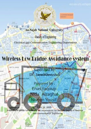
An-Najah National University
FacultyofEngineering
Electrical and Communication Engineering Departments
Supervised by:
Dr. JamalKhroushah
April 29, 2015
Presented in partial fulfillment of the requirements for Bachelor degree in Electrical
and Communication Engineering
3. II | P a g e
Acknowledgment
We are heartily thankful to our supervisor Dr. Jamal Kharousheh for his
guidance and support from the initial to the final level which enabled us to
complete this project.
Also we give all our regards and wishes to all the academic supervisors and the
employees at An-Najah National University whom encouraged and supported
us throughout our study, especially Eng. MohanadMayalehfrom surveying lab
in the civil engineering department in An-Najah University.
4. III| P a g e
Table of Contents
List of Figures..............................................................................................................................IV
List of tables………………………………………………………………………………………………………………………………………V
Abstract……………………………………………………………………………………………………………………………………………VI
Chapter one :Introduction............................................................................................................ 1
1.1 Objectives........................................................................................................................... 1
1.2 Scope of the work........................................................................................................................1
1.3 Importance of the work………………………………………………………………………………………………………….1
1.4 ReportOrganization....................................................................................................................3
ChapterTwo: Constrains,Standards/CodesandEarlierwork………………………………………………………….3
2.1 Standards/Codes……………………………………………………………………………………………………………………3
2.1 EarlierCoursework…………………………………………………………………………………………………………………4
ChapterThree:Literature Review………………………………………………………………………………….………………...4
ChapterFour:Methodology………………………………………………………………………………………….………………….7
4.1 BlockDiagram……………………………………………………………………………………………………………………….7
4.2 Circuits………………………………………………………………………………………………………………………………….8
4.3 FlowChartsand ProjectDescription…………………………………………………………………………………….9
4.4 The usedTechnology…………………………………………………………………………………………………….……12
4.1.1 GPS……………………………………………………………………………………………………………………………12
4.5 ProjectComponents…………………………………………………………………………………………………………..17
4.5.1 ArduinoUno…………………………………………………………………………………………………………….17
4.5.2 GenericWirelessSerial 4PinBluetoothRFTransceiverModule HC-06RS232 for
Arduino…………………………………………….………………………………………………………………………………18
4.5.3 Basic 16*2 characters LCD-Blackon Green5v……………………………………………………..……19
Chapterfive:ResultsandAnalysis………………………………………………………………………………………………...20
Chaptersix:Conclusion………………………………………………………………………………………………………………….23
6.1 Conclusion……………………………………………………………………………………………………………………….23
6.2 Economical feasibility………………………………………………………………………………………………………23
References…………………………………………………………………………………………………………………………………….24
Appendix A…………………………………………………………………………………………………………………………………….25
Appendix B…………………………………………………………………………………………………………………………………….26
Appendix C…………………………………………………………………………………………………………………………………….27
5. IV | P a g e
List of Figures:
Figure 1 Number of Recorded Bridges Hits by Year (New Yourk State)..........................................2
Figure 2 Concept for over height vehicle detection system.............................................................. 5
Figure 3 Block Diagram............................................................................................................... 7
Figure 4 LCD - Arduino Connection ............................................................................................. 8
Figure 5 Push buttons - Arduino Connection ................................................................................. 8
Figure 6 Bluetooth (HC-06) - Arduino Connection.........................................................................9
Figure 7 Android flowchart........................................................................................................ 10
Figure 8 Arduino flowchart........................................................................................................ 11
Figure 9 GPS Technology .......................................................................................................... 12
Figure 10 Signals from multiple satellites are required to calculate a position. ................................ 14
Figure 11 Sources of GPS signal error.......................................................................................... 15
Figure 12 Arduino Uno R3......................................................................................................... 17
Figure 13 HC-06 Bluetooth ........................................................................................................ 18
Figure 14 Basic 16*2 Characters LCD ........................................................................................ 19
Figure 15 Aerial photo of the test location.................................................................................... 20
Figure 16 Android Application Blocks ......................................................................................... 20
Figure 17 Android Application Blocks ......................................................................................... 21
Figure 18 Android Application .................................................................................................... 21
Figure 19 Hardware circuit.......................................................................................................... 22
Figure 20 Hardware circuit.......................................................................................................... 22
6. V | P a g e
List of Tables:
Table 1 Arduino Uno R3 summery. ............................................................................................... 3
Table 2 HC-06 Bluetooth summary................................................................................................ 4
Table 3 Interface pin description of LCD...................................................................................... 19
7. VI| P a g e
Abstract:
Since human life is precious, low bridge collision accident must be avoided, in
this project titled " Wireless Low Bridge Avoidance System" it will be trying to
achieve this goal by create a system to prevent the numerous accidents which
occur every year when trucks and other high vehicles drive underneath
structures such as bridges, buildings and tunnels for which they lack the
necessary clearance.
The high of the vehicle is entered by the driver, and by taking the street
coordinates from the GPS sensor in the Smartphone and the high of the existing
bridge from the stored data, the microcontroller will make a decision if there is
an acceptable clearance for the vehicle to safely pass under the bridge. This
device will remedy the situation by warning the drivers of these vehicles about a
possible collision with a low hanging underpass. This design will be cheap and
easy to install, this will ensure the marketability of the device as it will cost less
than the potential repair of the truck.
In this report, it intends to discuss the design and each individual component;
building and testing the device are done and this report contains the results.
8. 1 | P a g e
Chapter One: Introduction
Statement of the problem:
Each year there are hundreds of accidents in which vehicles are struck low
bridges. This project is to design a special system that makes large vehicles
drivers avoid the low bridges.
1.1 Objectives.
In this project we hope to design a device using the smart phone and the
Arduino Uno that can provide the truck the required clearance to safely pass
under the bridge and that will be done according to the high of the truck and the
bridge. The purpose is to fill a gap in the safety market for large vehicles.
1.2 Scope of the work.
Our project mainly focuses on comparing between the high of the vehicle and
the bridge. If the vehicle cannot safely pass under the bridge the GPS should
plan an alternate trip route. The device can be used for many places like bridges,
tunnels, parking garages, and other dangerous obstacles.
1.3 Importance ofthe work.
Bridge strikes have been a dangerous problem. While some of these strikes have
been seen to cause serious damage to bridges, a majority of bridge strikes create
significant threat to public safety and cause severe congestions because of the
truck being stuck under the bridge littering over the roadway. Unfortunately for
the drivers, most insurance plans involving trucks specifically exclude overhead
damage from coverage.
Even though there are numerous warning lights and signs, trucks still slam into
the bridges an unbelievable amount .There are many reasons for these accidents,
for example: driver not knowing the vehicle high, inadequate signing, and
driver not believing or understanding signs. But according to reporting from
The New York Times, “Eighty percent of all the trucks that get stuck under
bridges are a result of using the wrong GPS" [1], because current GPS systems
used do not take into account the size of the vehicle. It simply gives the drivers
the most direct routes.
Recent research conducted by the University Transportation Research Center at
the City College of New York, shows that bridges in New York State has been
experiencing approximately 200 strikes annually by over-height trucks. [2]
9. 2 | P a g e
Major repairs on the Long Island Expressway connected to these types of
accidents have cost taxpayers $4.1million in recent years. [3]
Figure 1 shows a histogram that details the number of reported bridge hits in
New York between 1993 and 2011. It is observed from the figure that the
number of reported annual bridge hits increased from 69 to 219 during 2001 to
2005, and was steady during 2005 to 2008.The number has declined
significantly after 2009 (data shown for 2011 is only partial).
However, the number of total annual hits has been varying. The increase in
bridge hits during2001 to 2007 may be linked to the increased construction
activity because of the real estate boom during this period. Increase in bridge
hits data may also be attributed to better record keeping practice that
NYSDOT(New Yourk State Department of Transportation) started
implementing after 2001. [2]
Figure 1Number of Recorded Bridges Hits by Year (New Yourk State ).
[2]
We have chosen to make our design cheap and easy to install. This will
ensure the marketability of the device as it will cost less than the potential
repair of the truck.
This product will save government money by preventing the damaged of
the infrastructures.
Getting accurate directions saves time, fuel and money.
10. 3 | P a g e
1.4 Report Organization.
This report is started with the introduction as the first chapter to talk about the
project briefly. Then, for the second chapter constrains and code/standards
related to the project are added. After that the third chapter is consist of the
literature review which talk about some steps and research that done about this
problem. Then the fourth chapter was the methodology which it talked about the
project in details and showed the components that will use for this project. Then
all the collected data was summarized in the fifth chapter under the results and
analysis subject. Then the sixth chapter is a discussion. Finally, chapter seven
was the conclusion and recommendation.
Chapter Two: Constrains,Standards/Codes andEarlier Course work
2.1 Standards/Codes.
1- The Arduino Un R3:
Microcontroller ATmega328
Operating Voltage 5V
Input Voltage (recommended) 7-12V
Input Voltage (limits) 6-20V
Digital I/O Pins 14 (of which 6 provide PWM output)
Analog Input Pins 6
DC Current per I/O Pin 40 mA
DC Current for 3.3V Pin 50 mA
Flash Memory 32 KB (ATmega328) of which 0.5 KB used by boot loader
SRAM 2 KB (ATmega328)
EEPROM 1 KB (ATmega328)
Clock Speed 16 MHz
Table 1 Arduino Uno R3 summery.
2- HC-06 Bluetooth :
HC serial Bluetooth products consist of Bluetooth serial interface module
and Bluetooth adapter. The package size is 28mm * 15mm * 2.35mm.
11. 4 | P a g e
PIN Num. PIN name Description
1 UART_Tx UART data output
2 UART_Rx UART data input
3 VCC 5 volt
4 GND Ground point
Table 2 HC-06 Bluetooth summary
2.2 Earlier coursework.
Many courses were taken that are related to this project, such as analysis
systems and signals, Electrical circuits, Electronic circuit, Measurements and
sensors, Micro processors and micro controllers, and digital communication.
Chapter Three: Literature Review.
Although bridge collisions have been a common problem, few studies and steps
have focused on solving this problem.
One of these steps was taken by the Federal Motor Carrier Safety
Administration (FMCSA) which has set new recommendations for GPS systems
approved for used in commercial trucks. It will take into consideration the
vehicle’s height, weight and contents to direct it to the appropriate roads. These
new standards have only been set for the GPS systems used for commercial
trucks, and not for consumer vehicles. U.S. Department of Transportation
Federal Motor Carrier Safety Administration (FMCSA), held two press
conferences in the New York City area on March 11 to alert commercial vehicle
drivers to the importance of using updated, professional-quality GPS devices to
prevent routes that include height-restricted overpasses and bridges.(GPS World
Staff, 2013) [3]
Under the recommendations, commercial drivers will be trained, and reminded,
to only use GPS systems designed specifically for the industry. These
specialized units take into account the specifics of the truck they’re including
the height, weight and contents and will then route the trucks onto appropriate
roads.
Another step was taken by the Public Works Authority ‘Ashghal’ in Qatar
which installed Over-Height Vehicle Detection System at Duhail Interchanges a
first step ,and then this system will generalized on a number of entrances,
12. 5 | P a g e
tunnels and bridges in order to protect the bridges and tunnels of truck
accidents.(Al-Raya newspaper, 2014)[4]
The OVDS detects the vehicles that violate the maximum legal height of 5.5m
before entering tunnels, or passing under bridges. Any violation turns on the
warning sirens to avoid the risk of colliding tunnels’ roofs, putting the security
and safety of road users at risk and bringing damages to the structure of the
bridges. The sophisticated OVDS system will be operated and controlled by the
operators at the Traffic Signal Control Room (TSCR) at Ashghal.
The OVDS system consists of a sensor or height detector, electronic board, and
Closed-Circuit Television (CCTV). All components of the system will work
together in order to detect trucks that violate the legal height. The system
operates in such a way that in the event of any over-height vehicle trying to
enter the interchange, the system will directly alert the vehicle through a siren
audible at the site, followed by a multi-lingual text message that appear on the
electronic board installed at the site. At the same time, the traffic signal at the
approach shall turn red through TSCR in order to prevent the vehicle entering
the interchange. If the vehicle is not following the warning orders, the operator
at TSCR will immediately contact the Traffic Department of Ministry of the
Interior (MOI) in order to take steps to prevent the vehicle from entering the
interchange.
Figure 2Concept for over height vehicle detection system.
13. 6 | P a g e
Max Holthaus and Tomasz Gromko in May (2014) were designed device to
avoided low bridges accidents. The device was consist of two components: a
wireless RF transmitter mounted to the bridge which will constantly broadcast
bridge or structure clearance height, and truck-mounted micro-controller, to
which was wired an RF receiver module, ultrasonic ride height sensors , and a
speaker with a few lights. The micro-controller will receive bridge information
from a few hundred feet maximum, take an active measurement of truck height;
based on sensors and pre-programmed data specific to each vehicle; and
determine clearance. If clearance is within tolerance, a particular tone or light
will be activated. Otherwise, an audible alert will be heard in the cabin.
In Durham, North Carolina in United States of America11-feet, 8-inches high
rail bridge has been rammed about once a month. The bridge is over 100 years
old, meaning that it was built at a time when there were no requirements for
minimum clearance because there were no large trucks driving underneath. As
both raising the bridge and lowering the road are out of the question due to the
scale of the project and the amount that it would cost, the railroad company had
to specifically install a crash beam made out of reinforced steel simply to stop
the trucks from being damaged so much, and the crash beam need to be
replaced. The crash bar has gone a long ways in preventing damage to the
railroad bridge, but the damage to the trucks can be pretty bad. [5]
14. 7 | P a g e
Chapter Four: Methodology
4.1 BlockDiagram:
Figure 3 is a block diagram describing the main sections of the device.
Figure 3Block Diagram
Block Descriptions:
Data processing unit: it is an Arduino Uno microcontroller which takes
input from Bluetooth andthe push buttons. This data is used to make a
decision then transmitted a signal to the alarm unit (LCD).
Bluetooth:to receive the coordination of street from the smart phone and
transmitting it to microcontroller.
2 push buttons: to allow the driver to enter the high of his truck.
LCD:it used to enter the high of the vehicle and to show the messages to
the driver.
Power Supply: batteries (2 batteries - 9 Volt) that feed the component
with power.
Power Supply
Bluetooth
HC-
Data processing
Unit
LCD
power
data
data
P.B -
P.B +
15. 8 | P a g e
4.2 Circuits:
Figure 4LCD-Arduino Connection
Figure 5Push buttons-Arduino Connection
16. 9 | P a g e
Figure 6Bluetooth(HC-06) - Arduino Connection
4.3 Flow Charts and Project Description:
Figure 4represents the Android application flowchart, starting with turn on the
GPS sensor in the smart phone, then connecting to the Bluetooth choose "HC-
06", then check if the location is change the latitude and longitude variable will
change, and then the program will check, if the new variable is located in a
specific range (the start of the street) the application will light green and send
the letter "O" to the Arduino as a sign to start, if not the application will
continue light red.
Figure 5 represents the Arduino flowchart,starting with configuration the LCD,
the first push button is used to decrease the entered high of the vehicle and the
second on is used to increase it, and then the Arduino will check, if "O" is
received from the HC-06 Bluetooth it will start compare the high of the vehicle
with the stored high of the bridge.
If (H vehicle< H bridge) the Arduino write "OK" on the LCD, if not the message
will be "choose the alternative root".
17. 10 | P a g e
turn on gps
connect to bluetooth
"choose HC- "
If location
sensor change?
NoYes
update latitude and
longitude
If
(lat > ) &&
(lat < )
No
Go redYes
Go green
send "O" to
Arduino
Figure 7 Android flowchart
18. 11 | P a g e
Figure 8Arduino flowchart
Configuration for LCD
If P.B
Pushed
Decrease the vehicle
high
Yes
If P.B
Pushed
No
Increase the vehicle
high
Yes No
If "O" is
receivedfrom
the HC-
NoYes
If
( vehicle high<
. )
Yes
write LCD
"OK"
No
"choose the
alternative
root"
19. 12 | P a g e
4.4 The UsedTechnology:
4.4.1 GPS:
The Global Positioning System (GPS) is a space-based satellite
navigation system that provides location and time information in all weather
conditions, anywhere on or near the Earth where there is an unobstructed line of
sight to four or more GPS satellites. The system provides critical capabilities to
military, civil and commercial users around the world. It is maintained by the
United States government and is freely accessible to anyone with a GPS
receiver.
The GPS project was developed in 1973 to overcome the limitations of previous
navigation systems, integrating ideas from several predecessors, including a
number of classified engineering design studies from the 1960s. GPS was
created and realized by the U.S. Department of Defense (DOD) and was
originally run with 24 satellites. It became fully operational in 1995.
How it work:
GPS satellites circle the earth twice a day in a very precise orbit and transmit
signal information to earth. GPS receivers take this information and use
triangulation to calculate the user's exact location. Essentially, the GPS receiver
compares the time a signal was transmitted by a satellite with the time it was
received. The time difference tells the GPS receiver how far away the satellite
is. Now, with distance measurements from a few more satellites, the receiver
can determine the user's position and display it on the unit's electronic map.
Figure 9 GPS Technology
[6]
20. 13 | P a g e
A GPS receiver must be locked on to the signal of at least three satellites to
calculate a 2D position (latitude and longitude) and track movement. With four
or more satellites in view, the receiver can determine the user's 3D position
(latitude, longitude and altitude). Once the user's position has been determined,
the GPS unit can calculate other information, such as speed, bearing, track, trip
distance, distance to destination, sunrise and sunset time and more.
The Satellite Network:
The GPS satellites transmit signals to a GPS receiver. These receivers passively
receive satellite signals; they do not transmit and require an unobstructed view
of the sky, so they can only be used effectively outdoors. Early receivers did not
perform well within forested areas or near tall buildings but later receiver
designs such as SiRFStarIII have overcome this and improved performance and
sensitivity markedly. GPS operations depend on a very accurate time reference,
which is provided by atomic clocks on board the satellites.
Each GPS satellite transmits data that indicates its location and the current time.
All GPS satellites synchronize operations so that these repeating signals are
transmitted at the same instant. The signals, moving at the speed of light, arrive
at a GPS receiver at slightly different times because some satellites are further
away than others. The distance to the GPS satellites can be determined by
estimating the amount of time it takes for their signals to reach the receiver.
When the receiver estimates the distance to at least four GPS satellites, it can
calculate its position in three dimensions.
There are at least 24 operational GPS satellites at all times plus a number of
spares. The satellites, operated by the US DOD, orbit with a period of 12 hours
(two orbits per day) at a height of about 11,500 miles traveling at 9,000mph
(3.9km/s or 14,000kph). Ground stations are used to precisely track each
satellite's orbit.
Here is an interesting comparison. The GPS signals are transmitted at a power
equivalent to a 50 watt domestic light bulb. Those signals have to pass through
space and our atmosphere before reaching your satnav after a journey of 11,500
miles. Compare that with a TV signal, transmitted from a large tower 10 - 20
miles away at most, at a power level of 5-10,000 watts. And compare the size of
your TV's roof mounted antenna with that of your GPS, often hidden inside the
case itself. A wonder then that it works as well as it does and when the
occasional hiccup occurs you will at least understand the reasons why.
21. 14 | P a g e
How Position is Determined:
A GPS receiver "knows" the location of the satellites because that information
is included in the transmitted Ephemeris data. By estimating how far away a
satellite is, the receiver also "knows" it is located somewhere on the surface of
an imaginary sphere centered at the satellite. It then determines the sizes of
several spheres, one for each satellite and therefore knows the receiver is located
where these spheres intersect.
Figure 10 Signals from multiple satellites are required to calculate a position.
GPS Accuracy:
The accuracy of a position determined with GPS depends on the type of
receiver. Most consumer GPS units have an accuracy of about +/-10m. Other
types of receivers use a method called Differential GPS (DGPS) to obtain much
higher accuracy. DGPS requires an additional receiver fixed at a known location
nearby. Observations made by the stationary receiver are used to correct
positions recorded by the roving units, producing an accuracy greater than 1
meter. [7]
About GPS Signal:
GPS satellites transmit two low power radio signals, designated L1 and L2.
Civilian GPS uses the L1 frequency of 1575.42 MHz in the UHF band. The
signals travel by line of sight, meaning they will pass through clouds, glass and
22. 15 | P a g e
plastic but will not go through most solid objects such as buildings and
mountains.
A GPS signal contains three different bits of information - a pseudorandom
code, ephemeris data and almanac data. The pseudorandom code is simply an
I.D. code that identifies which satellite is transmitting information. You can
view this number on your Garmin GPS unit's satellite page, as it identifies
which satellites it's receiving.
Ephemeris data, which is constantly transmitted by each satellite, contains
important information about the status of the satellite (healthy or unhealthy),
current date and time. This part of the signal is essential for determining a
position.
The almanac data tells the GPS receiver where each GPS satellite should be at
any time throughout the day. Each satellite transmits almanac data showing the
orbital information for that satellite and for every other satellite in the system.
[8]
Sources of GPS signal error:
Factors that can degrade the GPS signal and thus affect accuracy include the
following:
Figure 11 Sources of GPS signal error
.
There are many causes for position errors or low signal: [7]
Ionosphere and troposphere delays — the satellite signal slows as it
passes through the atmosphere. The GPS system uses a built-in model
that calculates an average amount of delay to partially correct for this
type of error.
23. 16 | P a g e
Signal multi path — this occurs when the GPS signal is reflected off
objects such as tall buildings or large rock surfaces before it reaches the
receiver. This increases the travel time of the signal, thereby causing
errors.
Receiver clock errors — a receiver's built-in clock is not as accurate as
the atomic clocks onboard the GPS satellites. Therefore, it may have very
slight timing errors.
Orbital errors — also known as ephemeris errors, these are inaccuracies
of the satellite's reported location.
Number of satellites visible — the more satellites a GPS receiver can
"see," the better the accuracy.
Buildings, terrain, electronic interference, or sometimes even dense
foliage can block signal reception, causing position errors or possibly no
position reading at all. GPS units typically will not work indoors,
underwater or underground.
Satellite geometry/shading — this refers to the relative position of the
satellites at any given time.
Ideal satellite geometry exits when the satellites are located at wide
angles relative to each other.
Poor geometry results when the satellites are located in a line or in a tight
grouping.
Intentional degradation of the satellite signal — Selective Availability
(SA) is an intentional degradation of the signal once imposed by the U.S.
DoD. SA was intended to prevent military adversaries from using the
highly accurate GPS signals. The government turned off SA in May
2000, which significantly improved the accuracy of civilian GPS
receivers.
24. 17 | P a g e
4.5 Project Components:
4.5.1 Arduino Uno:
The Arduino Uno is an open source microcontroller board. It isa small
electronic circuit controls the programming of Atmega328 microcontroller, this
circuit provides pins to connect electronic components directly to the
microcontroller using 14 digital input/output pins (of which 6 can be used as
PWM outputs), and also it consists of Crystal Oscillator 16 MHz and USB to
connect with the computer. It contains everything needed to support the
microcontroller; simply connect it to a computer with a USB or use a battery to
get started.
Figure 12 Arduino Uno R3
Features:[9]
ATmega328 microcontroller
Input voltage - 7-12V
14 Digital I/O Pins (6 PWM outputs)
6 Analog Inputs
32k Flash Memory
16Mhz Clock Speed
25. 18 | P a g e
4.5.2 Generic WirelessSerial4 Pin Bluetooth RF TransceiverModule HC-
06 RS232 forArduino:
Figure 13HC-06 Bluetooth
[9]
HC serial Bluetooth products consist of Bluetooth serial interface module and
Bluetooth adapter. The package size is 28mm * 15mm * 2.35mm.
PIN Num. PIN name Description
1 UART_Tx UART data output
2 UART_Rx UART data input
3 VCC 5 volt
4 GND Ground point
HC-06 Arduino Wireless Serial 4 Pin Bluetooth RF Transceiver Module
RS232.
Free Economy Shipping: free shipping provides an internal tracking
number for delivery confirmation but will not allow you to access real
time tracking information.
Allows your device to both send and receive the TTLdata via Bluetooth
technology without connecting a serial cable to your computer. Just
power, ground, Rx, Tx and we can send data to/from Arduino.
Works with any USB Bluetooth adapters.
26. 19 | P a g e
4.5.3 Basic 16 x2 Characters LCD – Black on Green5V:
Figure 14 Basic 16*2 Characters LCD
[9]
This is a basic 16 character by 2 line display. Black text on Green background,
utilizes the extremely common HD44780 parallel interface chipset. Interface
code is freely available. You will need ~11 general I/O pins to interface to this
LCD screen. Includes LED backlight.
Dimensions: 3.15" x 1.425"
Table 3 Interface pin description of LCD
27. 20 | P a g e
Chapter Five: Results and Analysis:
These photos show the circuits after we connect the components and test the
project in the location that we mentioned before.
1) This is the Aerial photo of the test location (Appendix B is shown the X,
Y coordinates):
Figure 15 Aerial photo of the test location
2) These are the photos of the blocks of the android application, we use the
(appinventor.mit.edu) website to design these blocks:
Figure 16 Android Application Blocks
28. 21 | P a g e
Figure 17 Android Application Blocks
3) This is the photo of the application in smart phone, and you can see the
coordination (Lat,Long) in the location (Appendix C is shown the (Lat,
Long) coordination’s that we take from the smart phone:
Figure 18 Android Application
29. 22 | P a g e
4) Then we connect the hardware components which are (Arduino,
Bluetooth, LCD & 2 Push Buttons) as we can see in this pictures:
Figure 19 Hardware circuit
Figure 20 Hardware circuit
5) The final shape it will be with wooden design we will see it in the final
presentation, with GOD willing.
30. 23 | P a g e
Chapter Six: Conclusions:
6.1 Conclusion:
Clearance can be a real challenge for a truck driver. Especially inexperienced
drivers of trucks seem to be quite oblivious to the warning signs and flashing
over height warning lights. So we designed a GPS based wireless controlling
model in order to increase the chance for applying this model in many areas
around the world. The proposed model hope to be able to achieve what is meant
for, reducing road traffics, leading to cutting in crashes expenses, decreasing the
number of resulting casualties, all this in favor of road safety.
6.2 Economicalfeasibility:
In this section we will analyze the economical part of our project. These
prices are according to the local market.
Model total cost: 315 NIS.
Arduino Uno R3: 170 NIS.
HC-06 Bluetooth: 60 NIS.
LCD: 50 NIS.
Batteries: 20 NIS.
Resistors:5 NIS.
Push Buttons: 10 NIS
31. 24 | P a g e
References:
[1] Luke, H. (2013). To Prevent Overpass Hits, New Rules for Truckers. Retrieved
October 3, 2014 from http://cityroom.blogs.nytimes.com/.
[2] Agrawal, A.K. (2011). Bridge vehicle impact assessment. Retrieved October 5, 2014
fromhttps://www.dot.ny.gov/divisions/engineering/structures/repository/manuals/Brid
ge_Hits_Task3_Final_02-03-10.pdf.
[3] GPS World staff. (2013). Federal Steps Taken to Reduce GPS-Caused Bridge Strikes
by Oversized Trucks. Retrieved October 5, 2014 from http://gpsworld.com/
[4] AbdAlmajed, H. (2014). Public Works Authority ‘Ashghal’ in Qatar which installed
Over-Height Vehicle Detection System. Retrieved October 6, 2014 from
www.raya.com.
[5] Low Bridge Causes Big Problems For Trucks. (n.d.). Retrieved October 6, 2014 from
http://autos.aol.com/article/low-bridge-truck-crash-video/
[6] Retrieved November 3, 2014 from
http://stech1.firstpost.com/tech2images/640x359/proportional/jpeg/images/2010/mar/i
mg_210112_agps.jpg.
[7] Darren, G. (2011). How does the Global Positioning System work?. Retrieved
October 5, 2014 from http://www.pocketgpsworld.com/howgpsworks.php
[8] What is GPS?.(n.d.). Retrieved October 6, 2014
fromhttp://www8.garmin.com/aboutGPS/
[9] Retrieved November 7, 2014 fromhttps://www.sparkfun.com/products/255
32. 25 | P a g e
Appendix A:
DISCLAIMER
This report was written by students at the (Electrical and Communication)
Engineering Departments, Faculty of Engineering, an –Najah National
University. It has not been altered or corrected, other than editorial correction,
as a result of assessment and it may contain language as well as content errors.
The views expressed in it together with any outcomes and recommendations are
solely those of the students. An- Najah National University accepts no
responsibility or liability for the consequences of this report being used for a
purpose other than the purpose for which it was commissioned.
33. 26 | P a g e
Appendix B:
FID Shape * Easting Northing
0 Point 170920.88 181682.52
1 Point 170916.91 181673.79
2 Point 170913.74 181665.46
3 Point 170914.13 181657.92
4 Point 170915.72 181651.17
5 Point 170926.44 181646.01
6 Point 170955.01 181635.29
7 Point 170982.79 181625.37
8 Point 171009.78 181614.66
9 Point 171021.69 181609.5
10 Point 171026.85 181602.35
11 Point 171027.24 181592.83
12 Point 171035.97 181588.07
13 Point 171053.83 181583.7
14 Point 171190.76 181546.79
15 Point 171198.69 181543.62
16 Point 171199.88 181534.09
17 Point 171200.68 181528.93
18 Point 171209.81 181524.96
19 Point 171222.9 181519.41
20 Point 171025.26 181582.11
21 Point 171024.07 181565.05
22 Point 171023.27 181550.76
23 Point 171022.08 181537.27
34. 27 | P a g e
Appendix C:
FID Shape * Latitude Longitude
0 Point 32.2275 35.22107
1 Point 32.22745 35.22105
2 Point 32.22761 35.22086
3 Point 32.22751 35.22092
4 Point 32.22759 35.22102
5 Point 32.22769 35.22105
6 Point 32.22779 35.2208
7 Point 32.22786 35.22109
8 Point 32.22792 35.22073
9 Point 32.22796 35.22102
10 Point 32.22789 35.22098