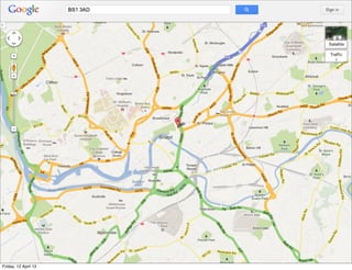
Location
                                  Location
                                  Location

                      Gavin Heavyside - ACCU 2013 - 12 April 2012
                        gavin@heavyside.co.uk @gavinheavyside
Friday, 12 April 13
Friday, 12 April 13
GPS, Location, GIS, and
                       Spatial Relationships
                      • GPS Technology
                      • GIS and Mapping Concepts
                      • Spatial DBs and SQL
                      • Practical Example

Friday, 12 April 13
Friday, 12 April 13
• www.mydrivesolutions.com
                      • Insurance telematics
                      • Linux,Ruby, Rails, Postgres, PostGIS,
                        NoSQL, Chef, AWS, C++


Friday, 12 April 13
Friday, 12 April 13
• I have no idea what I’m doing


Friday, 12 April 13
GPS


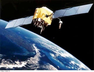
                      • Currently 32 satellites


Friday, 12 April 13
GPS


Friday, 12 April 13
Basic GPS Concepts
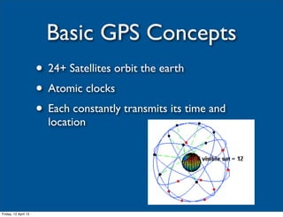
                      • 24+ Satellites orbit the earth
                      • Atomic clocks
                      • Each constantly transmits its time and
                        location


Friday, 12 April 13
Basic GPS Concepts

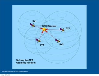
                      • Normally 4 or more sats used by receiver
                      • Distance to each satellite calculated using
                        speed of light
                      • Triangulate position
                      • Derived attributes - speed, bearing

Friday, 12 April 13
http://www.ausairpower.net/TE-GPS-Guided-Weps.html


Friday, 12 April 13
Almanac and Ephemeris

                      • Almanac: GPS constellation info, orbits
                      • Ephemeris: orbital and clock correction
                      • With both in memory, lock is faster
                      • A-GPS gets ephemeris from internet

Friday, 12 April 13
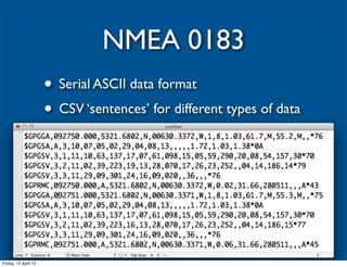
NMEA 0183
                      • Serial ASCII data format
                      • CSV ‘sentences’ for different types of data


Friday, 12 April 13
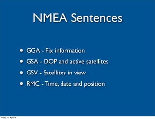
NMEA Sentences

                      • GGA - Fix information
                      • GSA - DOP and active satellites
                      • GSV - Satellites in view
                      • RMC - Time, date and position

Friday, 12 April 13
Friday, 12 April 13
Problems with GPS

                      • Noise
                      • Urban Canyons
                      • Multipath signals
                      • Solar flares and atmospherics
                      • Mounting of receiver

Friday, 12 April 13
Others

                      • GLONASS
                      • BEIDOU/COMPASS
                      • GALILEO
                      • IRNSS

Friday, 12 April 13
Smartphone Support

                      • All major smartphones have GPS sensors
                      • Balance accuracy, frequency, battery life
                      • Usually subscribe to service and get called
                        back with location updates
                      • Alerts: Geofencing, Significant Change

Friday, 12 April 13
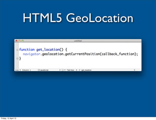
HTML5 GeoLocation


Friday, 12 April 13
Friday, 12 April 13
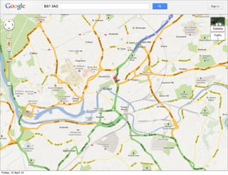
Digital Maps
                      • Commercial
                       • NAVTEQ, Tele Atlas
                      • Free
                       • OSM
                      • Online
                       • Google, Bing, etc
Friday, 12 April 13
Display
                      • Usually map tiles at different zoom levels
                      • Server will return tiled images for a
                        bounding box
                      • Plenty of libraries commercial or free to
                        embed in apps or web pages
                      • Add your own overlay markers and layers

Friday, 12 April 13
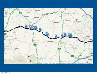
Leaflet
                      • JS plugin
                      • Uses OSM or other tile servers
                      • HW accelerated, touch-compatible
                      • Markers, Polygons, Layers, GeoJSON
                      • http://leafletjs.com


Friday, 12 April 13
Friday, 12 April 13
Digital maps for GIS

                      • Vector representation of your map
                      • Commercial or OSM
                      • Use the road or feature geometry, in
                        conjunction with attributes of the features


Friday, 12 April 13
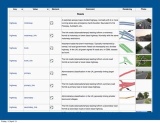
OpenStreetMap
                      • http://www.openstreetmap.org/
                      • Community generated and curated
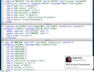
                      • XML geometry and metadata composed of
                        nodes, ways, and relations
                      • Can be downloaded in regions, updated
                        incrementally


Friday, 12 April 13
Friday, 12 April 13
Friday, 12 April 13
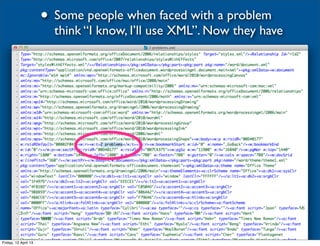
• Some people when faced with a problem
                        think “I know, I’ll use XML”. Now they have


Friday, 12 April 13
Data Formats


Friday, 12 April 13
Geometry Types

                      • Points
                      • Linestrings
                      • Polygons
                      • Compound: MultiPoint etc
                      • 3D: all above with elevation, Polyhedrals

Friday, 12 April 13
Well-Known Text
                               (WKT)
                      • markup language for vector geometry
                      • ISO standard, originally by OGC
                      • Always uses X Y, so watch out when using
                        lat and lon: needs to be (lon lat)
                      • Also an equivalent Well Known Binary used
                        by databases to store spatial data
                      • Can embed SRID (see later)
Friday, 12 April 13
WKT Examples
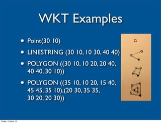
                      • Point(30 10)
                      • LINESTRING (30 10, 10 30, 40 40)
                      • POLYGON ((30 10, 10 20, 20 40,
                        40 40, 30 10))
                      • POLYGON ((35 10, 10 20, 15 40,
                        45 45, 35 10),(20 30, 35 35,
                        30 20, 20 30))


Friday, 12 April 13
KML

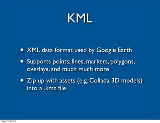
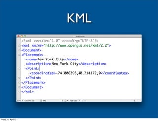
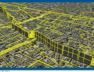
                      • XML data format used by Google Earth
                      • Supports points, lines, markers, polygons,
                        overlays, and much much more
                      • Zip up with assets (e.g. Collada 3D models)
                        into a .kmz file


Friday, 12 April 13
KML


Friday, 12 April 13
Friday, 12 April 13
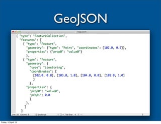
GeoJSON


Friday, 12 April 13
ShapeFiles
                      • Created by ESRI
                      • Widely used and understood
                      • Points, Lines, Polygons
                      • Collection of files: .shp, .shx, .dbf, others
                      • Can be imported straight into PostGIS with
                        shp2pgsql


Friday, 12 April 13
Friday, 12 April 13
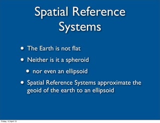
Spatial Reference
                                Systems
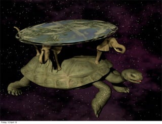
                      • The Earth is not flat
                      • Neither is it a spheroid
                       • nor even an ellipsoid
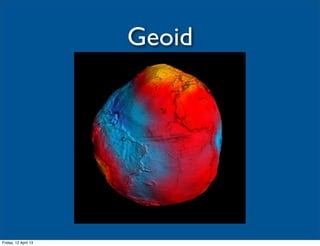
                      • Spatial Reference Systems approximate the
                        geoid of the earth to an ellipsoid


Friday, 12 April 13
Geoid


Friday, 12 April 13
WGS84

                      • The most common (and most useful)
                        spatial reference system
                      • best fitting ellipsoid model to the reference
                        points on the 1996 Earth Gravitational
                        Model geoid
                      • Used by GPS

Friday, 12 April 13
Friday, 12 April 13
Projections

                      • Projections    • Orientation
                       • Cylindrical    • Oblique
                       • Conic          • Equatorial
                       • Azimuthal      • Transverse

Friday, 12 April 13
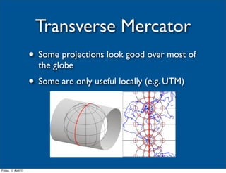
Transverse Mercator
                      • Some projections look good over most of
                        the globe
                      • Some are only useful locally (e.g. UTM)


Friday, 12 April 13
Geospatial Databases

                      • Ordinary RDBs with support for spatial
                        data types
                      • NoSQL DBs
                       • MongoDB
                       • https://github.com/neo4j/spatial

Friday, 12 April 13
PostGIS

                      • http://postgis.org/
                      • Geospatial Extensions for PostgreSQL
                      • Excellent support for spatial data,
                        operations, indexes
                      • Actively developed

Friday, 12 April 13
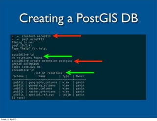
Creating a PostGIS DB


Friday, 12 April 13
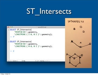
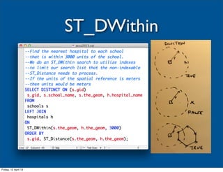
Spatial Relationships
                      • Many ways to compare geometries
                      • Some can compare different types
                      • Some only valid for same type
                      • CONTAINS, CROSSES, DISJOINT,
                        DISTANCE, DWITHIN, EQUALS,
                        INTERSECTS, OVERLAPS, TOUCHES,
                        WITHIN


Friday, 12 April 13
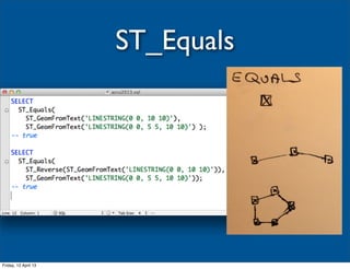
ST_Equals


Friday, 12 April 13
ST_Intersects


Friday, 12 April 13
ST_DWithin


Friday, 12 April 13
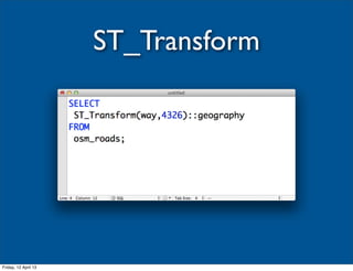
ST_Transform


Friday, 12 April 13
Geography Data Type

                      • Usually measurements are in the units of
                        the spatial reference system
                      • Radians for SRID 4326 (WGS84)
                      • The geography data type can help


Friday, 12 April 13
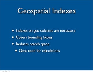
Geospatial Indexes

                      • Indexes on geo columns are necessary
                      • Covers bounding boxes
                      • Reduces search space
                       • Geos used for calculations

Friday, 12 April 13
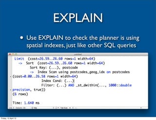
EXPLAIN
                      • Use EXPLAIN to check the planner is using
                        spatial indexes, just like other SQL queries


Friday, 12 April 13
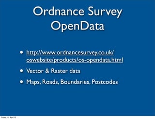
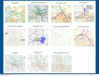
Ordnance Survey
                            OpenData

                      • http://www.ordnancesurvey.co.uk/
                        oswebsite/products/os-opendata.html
                      • Vector & Raster data
                      • Maps, Roads, Boundaries, Postcodes


Friday, 12 April 13
Friday, 12 April 13
Code-Point Open

                      • CSV "Database" of UK postcode
                      • (Not Northern Ireland)
                      • 1.6m+ postcodes
                      • Eastings and Northings for each entry
                      • Also county/district & NHS info

Friday, 12 April 13
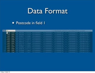
Data Format
                      • Postcode in field 1


Friday, 12 April 13
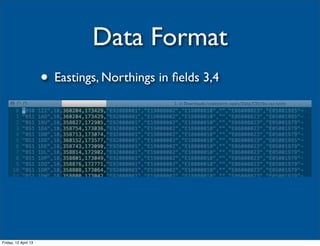
Data Format
                      • Eastings, Northings in fields 3,4


Friday, 12 April 13
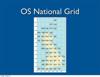
OS National Grid


Friday, 12 April 13
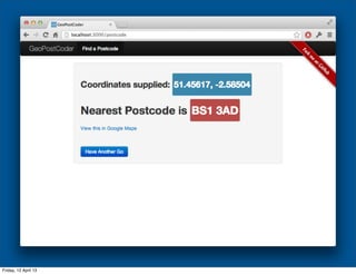
Geocoding

                      • Find the geographic location of a feature,
                        e.g. address, business, POI
                      • Reverse: Find a feature from a geographic
                        location (e.g. lat/lng)


Friday, 12 April 13
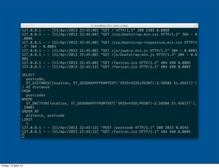
Example App

                      • Put it all together:
                       • Open Data
                       • PostGIS
                       • CRS transformations
                       • Geospatial DB queries

Friday, 12 April 13
Friday, 12 April 13
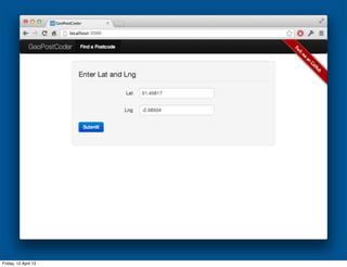
GeoPostCoder

                      • https://github.com/gavinheavyside/
                        geopostcoder
                      • Bash and SQL to load postcode geo data
                      • Simple Ruby web app to query DB


Friday, 12 April 13
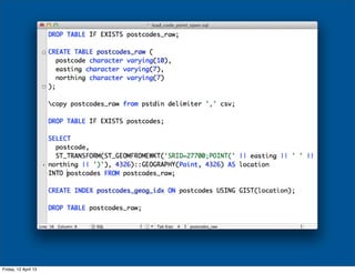
Loading Data

                      • Filter Code-Point Open just to the columns
                        we want
                      • Load into a temporary table
                      • Transform National Grid coordinates to
                        WGS Geography data type


Friday, 12 April 13
Friday, 12 April 13
Friday, 12 April 13
Friday, 12 April 13
Friday, 12 April 13
Friday, 12 April 13
Recap
                      • Lots of sources of location data
                      • You probably have a GPS receiver with you
                      • Lots of data available for free
                      • Plenty of free and open-source tools
                        querying and manipulating spatial data
                      • Go do something interesting with it :)
Friday, 12 April 13
@gavinheavyside
   gavin@heavyside.co.uk

Friday, 12 April 13