Download to read offline


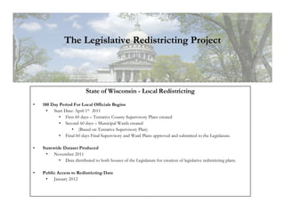


The document summarizes Wisconsin's legislative redistricting process following the decennial Census. It discusses: 1) The 5 phases of the U.S. Census Bureau's Redistricting Data Program including submitting current districts, receiving Census data, and collecting new district plans. 2) Wisconsin's 180 day period for local redistricting where counties create tentative and final supervisory district plans and municipalities create ward plans. 3) The WISE-LR online application that will allow counties and municipalities to create electronic ward maps and submit final redistricting plans to the state legislature.


